- National Register of Historic Places listings in Sandusky, Ohio
-
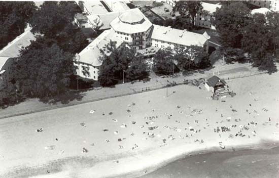
 Sandusky and its surrounding area
This is a list of the National Register of Historic Places listings in Sandusky, Ohio.
This is intended to be a complete list of the properties and districts on the National Register of Historic Places in Sandusky, Ohio, United States. Latitude and longitude coordinates are provided for many National Register properties and districts; these locations may be seen together in a Google map.[1]
There are 177 properties and districts listed on the National Register in Erie County, including 2 National Historic Landmarks. The city of Sandusky is the location of 114 of these properties and districts; they are listed here, while the remaining 63 sites, including both National Historic Landmarks, are listed separately. Another 3 properties were once listed but have been removed.
-
- This National Park Service list is complete through NPS recent listings posted November 10, 2011.[2]
Current listings
[3] Landmark name[4] Image Date listed Location Summary 1 Adams Street Double House October 10, 1975 106-108 E. Adams St.
41°27′13″N 82°42′36″W / 41.45361°N 82.71°W2 Barker School October 20, 1982 1925 Barker St.
41°26′43″N 82°43′38″W / 41.44528°N 82.72722°W3 Freeland T. Barney House October 20, 1982 215-213 Fulton St.
41°27′14″N 82°42′58″W / 41.45389°N 82.71611°W4 Bates-Cockrem House October 20, 1982 325 Lawrence St.
41°27′6″N 82°43′1″W / 41.45167°N 82.71694°W5 Bavarian Brewery October 20, 1982 1816-1820 W. Jefferson St.
41°26′57″N 82°43′31″W / 41.44917°N 82.72528°W6 Lucas Beecher House May 7, 1979 215 W. Washington Row
41°27′18″N 82°42′46″W / 41.455°N 82.71278°W7 Bing's Hotel October 20, 1982 302 E. Water St.
41°27′29″N 82°42′32″W / 41.45806°N 82.70889°W8 John Boalt House October 20, 1982 631 Wayne St.
41°26′57″N 82°42′24″W / 41.44917°N 82.70667°W9 Boeckling Building October 20, 1982 103-105 W. Shoreline Dr.
41°27′27″N 82°42′46″W / 41.4575°N 82.71278°W10 G. A. Boeckling House January 20, 1983 614 Columbus Ave.
41°27′3″N 82°42′30″W / 41.45083°N 82.70833°W11 Boy with the Boot Fountain 
October 20, 1982 W. Washington St. Park
41°27′16″N 82°42′46″W / 41.45444°N 82.71278°W13 Cable Park Historic District January 21, 1988 1103-1234 Wayne St.
41°26′50″N 82°42′13″W / 41.447134°N 82.703576°W14 Frank Cable House October 20, 1982 809 W. Washington St.
41°27′11″N 82°43′1″W / 41.45306°N 82.71694°W15 Laurence Cable House October 20, 1982 910 W. Monroe St.
41°26′51″N 82°42′53″W / 41.4475°N 82.71472°W16 Campbell School October 20, 1982 1215 Campbell St.
41°26′43″N 82°42′27″W / 41.44528°N 82.7075°W17 Carnegie Library November 12, 1975 Adams and Columbus Ave.
41°27′11″N 82°42′37″W / 41.45306°N 82.71028°W18 Cedar Point Light 
July 19, 1984 Cedar Point
41°29′17″N 82°41′37″W / 41.48806°N 82.69361°W19 Coliseum October 20, 1982 Midway at Cedar Point
41°28′53″N 82°40′54″W / 41.48139°N 82.68167°W20 Columbus Avenue Historic District January 20, 1983 102-162 Columbus Ave.
41°27′28″N 82°42′43″W / 41.457861°N 82.711945°W21 Commercial Banking & Trust Co. October 20, 1982 115 E. Washington Row
41°27′19″N 82°42′40″W / 41.45528°N 82.71111°W22 Converse-Mertz Apartments October 20, 1982 301-303 E. Washington St.
41°27′22″N 82°42′27″W / 41.45611°N 82.7075°W23 Eleutheros Cooke House October 20, 1982 410 Columbus Ave.
41°27′12″N 82°42′36″W / 41.45333°N 82.71°W24 Eleutheros Cooke House October 20, 1982 1415 Columbus Ave.
41°26′38″N 82°42′18″W / 41.44389°N 82.705°W25 Cooke-Robertson House October 20, 1982 412 Columbus Ave.
41°27′11″N 82°42′36″W / 41.45306°N 82.71°W26 William D. Curtis House October 20, 1982 1411 Hayes Ave.
41°26′36″N 82°42′38″W / 41.44333°N 82.71056°W27 William H. Dentzel 1921 Carousel November 8, 1990 Frontiertown, Cedar Point Amusement Park
41°29′7″N 82°41′36″W / 41.48528°N 82.69333°W28 William H. Dentzel 1924 Carousel November 8, 1990 Kiddieland, Cedar Point Amusement Park
41°28′50″N 82°40′52″W / 41.48056°N 82.68111°W29 George J. Doerzbach House April 23, 1987 1208-1210 Central Ave.
41°26′43″N 82°42′51″W / 41.44528°N 82.71417°W30 Emmanuel Church October 20, 1982 334 Columbus Ave.
41°27′14″N 82°42′37″W / 41.45389°N 82.71028°W31 Engels And Krudwig Wine Company Buildings July 30, 1976 220 E. Water St.
41°27′28″N 82°42′35″W / 41.45778°N 82.70972°W32 Herman Engels House October 20, 1982 117 Hancock St.
41°27′27″N 82°42′32″W / 41.4575°N 82.70889°W33 Engine House No. 1 October 20, 1982 901 W. Market St.
41°27′14″N 82°43′10″W / 41.45389°N 82.71944°W34 Engine House No. 3 April 1, 1975 Meigs St. and Sycamore Line
41°27′9″N 82°41′53″W / 41.4525°N 82.69806°W35 Erie County Jail October 20, 1982 204 W. Adams St.
41°27′12″N 82°42′39″W / 41.45333°N 82.71083°W36 Erie County Office Building November 20, 1974 1202 Sycamore Line
41°26′51″N 82°41′50″W / 41.4475°N 82.69722°W37 Erie County Oil Products Co. October 20, 1982 649 Tiffin Ave.
41°26′47″N 82°45′3″W / 41.44639°N 82.75083°W38 Exchange Hotel October 29, 1985 202-204 E. Water St.
41°27′27″N 82°42′37″W / 41.4575°N 82.71028°W39 Facer's Store October 20, 1982 279 E. Market St.
41°27′26″N 82°42′31″W / 41.45722°N 82.70861°W40 Feick Building October 22, 2009 158-160 E. Market St.
41°27′22.48″N 82°42′37.82″W / 41.4562444°N 82.7105056°W41 First Church of Christ Scientist October 20, 1982 128 E. Adams St.
41°27′14″N 82°42′33″W / 41.45389°N 82.70917°W42 First Congregational Church October 20, 1982 431 Columbus Ave.
41°27′9″N 82°42′36″W / 41.4525°N 82.71°W43 Follett-Moss-Moss Residences December 31, 1974 404, 414, 428 Wayne St.
41°27′13″N 82°42′28″W / 41.45361°N 82.70778°W44 Fox's Brewery-Diamond Wine Co. October 20, 1982 334 Harrison St.
41°27′4″N 82°43′28″W / 41.45111°N 82.72444°W45 Godfrey-Johnson House October 20, 1982 417 Columbus Ave.
41°27′10″N 82°42′36″W / 41.45278°N 82.71°W46 Grace Episcopal Church October 20, 1982 315 Wayne St.
41°27′17″N 82°42′34″W / 41.45472°N 82.70944°W47 Henry Graefe House October 20, 1982 1429 Columbus Ave.
41°26′37″N 82°42′17″W / 41.44361°N 82.70472°WWilliam Warren Sabin architect 48 Great American Racing Derby November 8, 1990 Midway, Cedar Point Amusement Park
41°28′50″N 82°40′57″W / 41.48056°N 82.6825°W49 Rice Harper House October 20, 1982 403 E. Washington St.
41°27′24″N 82°42′21″W / 41.45667°N 82.70583°W50 Hemminger Saloon October 20, 1982 333 W. Market St.
41°27′19″N 82°42′50″W / 41.45528°N 82.71389°W51 Hinde & Dauch Paper Co. October 20, 1982 407 Decatur St.
41°27′8″N 82°42′48″W / 41.45222°N 82.71333°W52 Hinde & Dauch Paper Co. October 20, 1982 401 W. Shoreline Dr.
41°27′28″N 82°42′55″W / 41.45778°N 82.71528°W53 Hinde & Dauch Paper Co. October 20, 1982 409 W. Water St.
41°27′22″N 82°42′55″W / 41.45611°N 82.71528°W54 James J. Hinde House October 20, 1982 317 Fulton St.
41°27′8″N 82°42′55″W / 41.45222°N 82.71528°W55 Holy Angels Church October 20, 1982 W. Jefferson St. at Tiffin Ave. and Clinton St.
41°26′57″N 82°43′23″W / 41.44917°N 82.72306°W56 Hotel Rieger June 10, 2005 232 Jackson St.
41°27′19″N 82°42′47″W / 41.45528°N 82.71306°W57 Lester Hubbard House October 20, 1982 134 E. Adams St.
41°27′14″N 82°42′31″W / 41.45389°N 82.70861°W58 S. B. Hubbard House October 20, 1982 1205 Columbus Ave.
41°26′45″N 82°42′21″W / 41.44583°N 82.70583°W59 Independent Order of Odd Fellows Temple May 1, 2003 231 W. Washington Row
41°27′18″N 82°42′46″W / 41.455°N 82.71278°W60 Jackson Jr. High School October 20, 1982 414 W. Madison St.
41°27′0″N 82°42′34″W / 41.45°N 82.70944°W61 Kerber's Marine Grocery October 20, 1982 1006 Tiffin Ave.
41°26′46″N 82°43′36″W / 41.44611°N 82.72667°W62 August Kuebeler House October 20, 1982 1319 Tiffin Ave.
41°26′39″N 82°43′46″W / 41.44417°N 82.72944°W63 Kuebeler-Stang Block October 20, 1982 634 Hancock St.
41°27′5″N 82°42′17″W / 41.45139°N 82.70472°W64 Lake Shore And Michigan Southern Railroad Depot July 17, 1975 N. Depot at Carr St.
41°26′26″N 82°43′7″W / 41.44056°N 82.71861°W65 Ebenezer Lane House October 20, 1982 318 Huron Ave.
41°27′18″N 82°42′31″W / 41.455°N 82.70861°W66 Lea Block October 20, 1982 174-186 E. Market St.
41°27′23″N 82°42′36″W / 41.45639°N 82.71°W67 Henry Lotz Store October 20, 1982 1119 W. Washington St.
41°27′6″N 82°43′13″W / 41.45167°N 82.72028°W68 Mad River Block October 16, 1974 1002-1018 W. Adams St.
41°27′2″N 82°43′6″W / 41.45056°N 82.71833°W69 Ogden Mallory House October 20, 1982 410 Warren St.
41°27′19″N 82°42′13″W / 41.45528°N 82.70361°W70 George March House October 20, 1982 532 Wayne St.
41°27′7″N 82°42′25″W / 41.45194°N 82.70694°W71 James E. Marshall House October 20, 1982 514 Wayne St.
41°27′8″N 82°42′26″W / 41.45222°N 82.70722°W72 McKenster-Groff House October 20, 1982 334 E. Washington St.
41°27′22″N 82°42′23″W / 41.45611°N 82.70639°W73 William Gordon Melville-Milne House March 28, 1979 319 Lawrence St.
41°27′7″N 82°43′2″W / 41.45194°N 82.71722°W74 John Mertz House August 21, 1992 610 W. Washington St.
41°27′12″N 82°43′1″W / 41.45333°N 82.71694°W75 Monroe School October 20, 1982 328 E. Monroe St.
41°27′5″N 82°42′13″W / 41.45139°N 82.70361°W76 Moss-Foster House October 20, 1982 621 Wayne St.
41°27′3″N 82°42′25″W / 41.45083°N 82.70694°W77 Daniel C. Muller Carousel October 20, 1982 Midway at Cedar Point
41°28′50″N 82°40′57″W / 41.48056°N 82.6825°W78 Murschel House October 20, 1982 1221 N. Depot St.
41°26′26″N 82°43′5″W / 41.44056°N 82.71806°W79 No. 5 Fire Station October 20, 1982 W. Madison and Tiffin Ave.
41°26′42″N 82°43′42″W / 41.445°N 82.72833°W80 Old First Church October 20, 1982 265 Jackson St.
41°27′15″N 82°42′46″W / 41.45417°N 82.71278°W81 Osborne School October 20, 1982 922 W. Osborne St.
41°26′30″N 82°42′55″W / 41.44167°N 82.71528°W82 Red Popcorn Wagon October 20, 1982 102 W. Washington Row
41°27′18″N 82°42′40″W / 41.455°N 82.71111°W83 Joseph Root House October 20, 1982 231 E. Adams St.
41°27′18″N 82°42′28″W / 41.455°N 82.70778°W84 Ross Hardware October 20, 1982 708 Hancock St.
41°27′3″N 82°42′17″W / 41.45083°N 82.70472°W85 St. Mary's Catholic Church October 10, 1975 429 Central Ave.
41°27′5″N 82°42′50″W / 41.45139°N 82.71389°W86 St. Mary's Girls Grade School October 20, 1982 514 Decatur St.
41°27′3″N 82°43′26″W / 41.45083°N 82.72389°W87 St. Mary's Rectory October 20, 1982 429 Central Ave.
41°27′6″N 82°42′49″W / 41.45167°N 82.71361°W88 St. Mary's School October 20, 1982 410 W. Jefferson St.
41°27′5″N 82°43′25″W / 41.45139°N 82.72361°W89 Sts. Peter & Paul Church and Rectory January 20, 1983 Columbus Ave. at E. Jefferson St.
41°27′8″N 82°42′32″W / 41.45222°N 82.70889°W90 St. Stephen's AME Church October 20, 1982 312 Neil St.
41°27′28″N 82°42′12″W / 41.45778°N 82.70333°W91 Schine State Theatre October 20, 1982 101-109 Columbus Ave.
41°27′25″N 82°42′44″W / 41.45694°N 82.71222°W92 Second Baptist Church May 14, 2002 315 Decatur St.
41°27′12″N 82°42′51″W / 41.45333°N 82.71417°W93 Walter Simpson House October 20, 1982 521 Hancock St.
41°27′10″N 82°42′22″W / 41.45278°N 82.70611°W94 William A. Simpson House October 20, 1982 230 E. Washington St.
41°27′21″N 82°42′29″W / 41.45583°N 82.70806°W95 Rush R. Sloane House February 24, 1975 403 E. Adams St.
41°27′20″N 82°42′20″W / 41.45556°N 82.70556°W96 John Stang House October 20, 1982 629 Columbus Ave.
41°27′0″N 82°42′31″W / 41.45°N 82.70861°W97 Henry Stoffel Blacksmith Shop October 20, 1982 321 E. Market St. (rear)
41°27′28″N 82°42′27″W / 41.45778°N 82.7075°W98 Adam J. Stoll House October 20, 1982 531 Wayne St.
41°27′7″N 82°42′27″W / 41.45194°N 82.7075°W99 Stone's Block October 20, 1982 202 Columbus Ave.
41°27′21″N 82°42′41″W / 41.45583°N 82.71139°W100 Sycamore School November 19, 1974 3rd and Sycamore Sts.
41°27′3″N 82°41′51″W / 41.45083°N 82.6975°W101 Taylor-Frohman House October 20, 1982 1315 Columbus Ave.
41°26′40″N 82°42′18″W / 41.44444°N 82.705°W102 Third National Bank October 20, 1982 220 W. Market St.
41°27′20″N 82°42′46″W / 41.45556°N 82.71278°W103 William T. Townsend House October 20, 1982 515 W. Washington St.
41°27′13″N 82°42′53″W / 41.45361°N 82.71472°W104 U.S. Coast Guard Building October 20, 1982 Cedar Point, off Perimeter Rd.
41°29′17″N 82°41′38″W / 41.48806°N 82.69389°W105 U.S. Post Office October 20, 1982 W. Washington and Jackson Sts.
41°27′14″N 82°42′46″W / 41.45389°N 82.71278°W106 Ernst Von Schulenburg House October 20, 1982 922 W. Adams St.
41°27′4″N 82°43′2″W / 41.45111°N 82.71722°W107 James Wadsworth House October 20, 1982 519 Huron Ave.
41°27′12″N 82°42′17″W / 41.45333°N 82.70472°W108 Wagner Palace October 20, 1982 804-806 Hayes Ave.
41°26′54″N 82°42′26″W / 41.44833°N 82.70722°W109 Water Street Commercial Buildings March 18, 1975 101-165 E. Water St. and 101-231 W. Water St.
41°27′26″N 82°42′45″W / 41.45722°N 82.7125°W110 West Market School October 20, 1982 211 Fulton St.
41°27′14″N 82°42′59″W / 41.45389°N 82.71639°W111 Samuel M. White House June 16, 1976 304 E. Adams St.
41°27′17″N 82°42′24″W / 41.45472°N 82.70667°W112 Wichman's Grocery October 20, 1982 1118 W. Washington St.
41°27′6″N 82°43′14″W / 41.45167°N 82.72056°W113 Willdred Flats March 11, 1993 1116 Columbus Ave.
41°26′46″N 82°42′19″W / 41.44611°N 82.70528°W114 Zion Lutheran Church October 20, 1982 501-503 Columbus Ave.
41°27′7″N 82°42′35″W / 41.45194°N 82.70972°WFormer listings
Landmark name Image Date delisted Location Summary 1 Baltimore and Ohio Railroad Company Depot December 24, 1990 Washington and Warren Sts.
41°27′25.3″N 82°42′18″W / 41.457028°N 82.705°W2 Hotel Breakers 
December 24, 1990 Cedar Point 3 Ohio Theatre December 24, 1990 205-211 W. Market St.
41°27′21.6″N 82°42′45″W / 41.456°N 82.7125°WSee also
References
- ^ The latitude and longitude information provided in this table was derived originally from the National Register Information System, which has been found to be fairly accurate for about 99% of listings. For about 1% of NRIS original coordinates, experience has shown that one or both coordinates are typos or otherwise extremely far off; some corrections may have been made. A more subtle problem causes many locations to be off by up to 150 yards, depending on location in the country: most NRIS coordinates were derived from tracing out latitude and longitudes off of USGS topographical quadrant maps created under North American Datum of 1927, which differs from the current, highly accurate GPS system used by Google maps. Chicago is about right, but NRIS longitudes in Washington are higher by about 4.5 seconds, and are lower by about 2.0 seconds in Maine. Latitudes differ by about 1.0 second in Florida. Some locations in this table may have been corrected to current GPS standards.
- ^ "National Register of Historic Places: Weekly List Actions". National Park Service, United States Department of the Interior. Retrieved on November 10, 2011.
- ^ Numbers represent an ordering by significant words. Various colorings, defined here, differentiate National Historic Landmark sites and National Register of Historic Places Districts from other NRHP buildings, structures, sites or objects.
- ^ "National Register Information System". National Register of Historic Places. National Park Service. 2008-04-24. http://nrhp.focus.nps.gov/natreg/docs/All_Data.html.
Categories:- National Register of Historic Places in Ohio
- Sandusky, Ohio
-


Wikimedia Foundation. 2010.