- National Register of Historic Places listings in Washington County, Ohio
-
 Location of Washington County in Ohio
This is a list of the National Register of Historic Places listings in Washington County, Ohio.
This is intended to be a complete list of the properties and districts on the National Register of Historic Places in Washington County, Ohio, United States. The locations of National Register properties and districts for which the latitude and longitude coordinates are included below, may be seen in a Google map.[1]
There are 35 properties and districts listed on the National Register in the county, including 1 National Historic Landmark. Another property, although listed in the county, has been moved to another location.
-
- This National Park Service list is complete through NPS recent listings posted November 10, 2011.[2]
Current listings
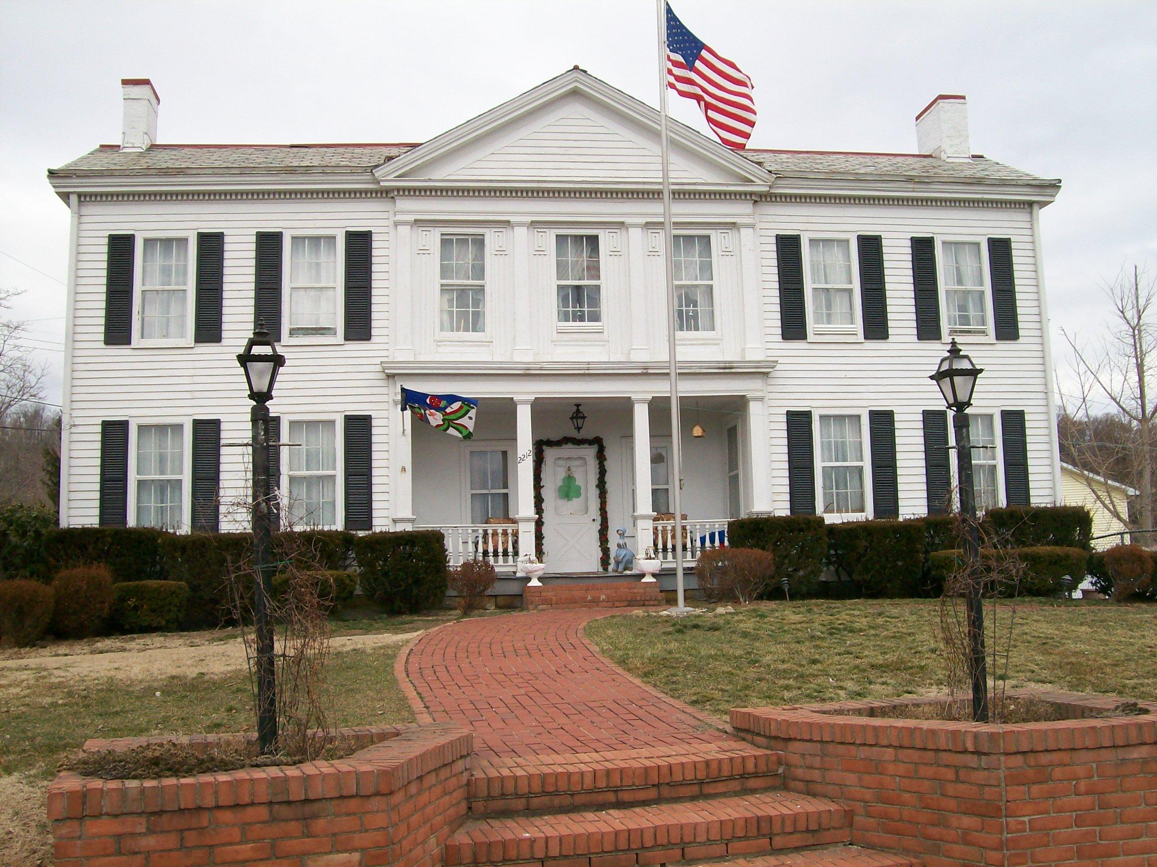
[3] Landmark name[4] Image Date listed Location City or Town Summary 1 Charles Rice Ames House 
February 14, 1978 2212 Miller Ave.
39°16′59″N 81°36′21″W / 39.28306°N 81.60583°WBelpre 2 Col. Joseph Barker House 
June 23, 1978 North of Marietta on Masonic Park Rd.
39°29′11″N 81°29′19″W / 39.48639°N 81.48861°WMuskingum Township 3 Judge Joseph Barker, Jr., House 
July 26, 1979 Southwest of Newport on State Route 7
39°21′29″N 81°19′45″W / 39.35806°N 81.32917°WNewport Township 4 Becker Lumber and Manufacturing Company 
June 18, 1987 121 Pike St.
39°24′55.38″N 81°26′28.36″W / 39.4153833°N 81.4412111°WMarietta 5 Cisler Terrace 
January 19, 1983 7th and Ephraim Cutler Sts.
39°25′17.97″N 81°26′57.98″W / 39.4216583°N 81.4494389°WMarietta 6 Coal Run Historic District 
February 22, 1996 Roughly along Main, Maple, and Hill Sts. in Coal Run
39°34′1″N 81°35′15″W / 39.56694°N 81.5875°WWaterford Township 7 Walter Curtis House 
October 3, 1980 South of Little Hocking
39°13′17″N 81°42′39″W / 39.22139°N 81.71083°WBelpre Township 8 Col. Simeon Deming House 
March 24, 1980 Northeast of Watertown on Willis Rd.
39°29′21″N 81°36′35″W / 39.48917°N 81.60972°WWatertown Township 9 Erwin Hall, Marietta College 
April 23, 1973 5th St. on Marietta College campus
39°25′1″N 81°27′2″W / 39.41694°N 81.45056°WMarietta 10 First Unitarian Church Of Marietta 
October 3, 1973 232 3rd St.
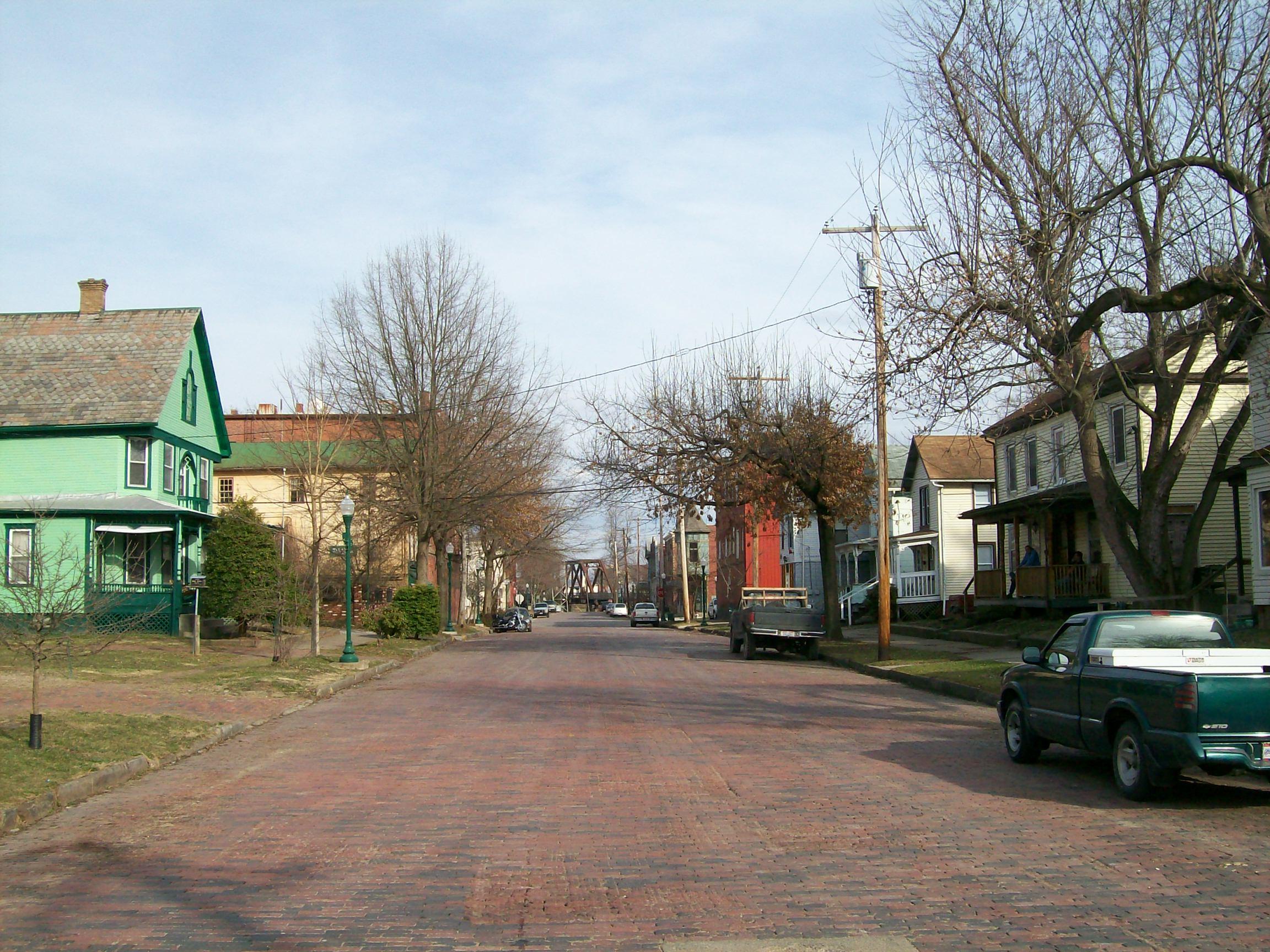
39°24′58″N 81°27′11″W / 39.41611°N 81.45306°WMarietta 11 Harmar Historic District 
December 19, 1974 Roughly bounded by the Ohio and Muskingum Rivers and the rear property line of Lancaster, George, and Franklin Sts.; also roughly bounded by Lancaster, Harmar, Putnam, and Franklin Sts. and the Ohio River, Fort Harmar Dr., and the Muskingum River
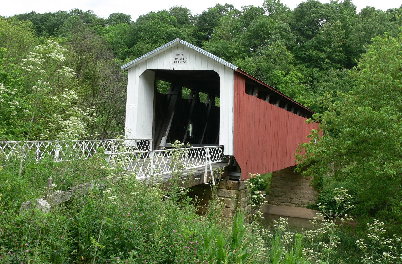
39°24′35″N 81°27′46″W / 39.40972°N 81.46278°WMarietta Second set of boundaries represents a boundary increase 12 Harra Covered Bridge 
October 8, 1976 2 mi (3.2 km) northwest of Watertown on State Route 172
39°29′16″N 81°38′53″W / 39.48778°N 81.64806°WWatertown Township 13 Hildreth Covered Bridge 
February 8, 1978 5 mi (8.0 km) east of Marietta off State Route 26
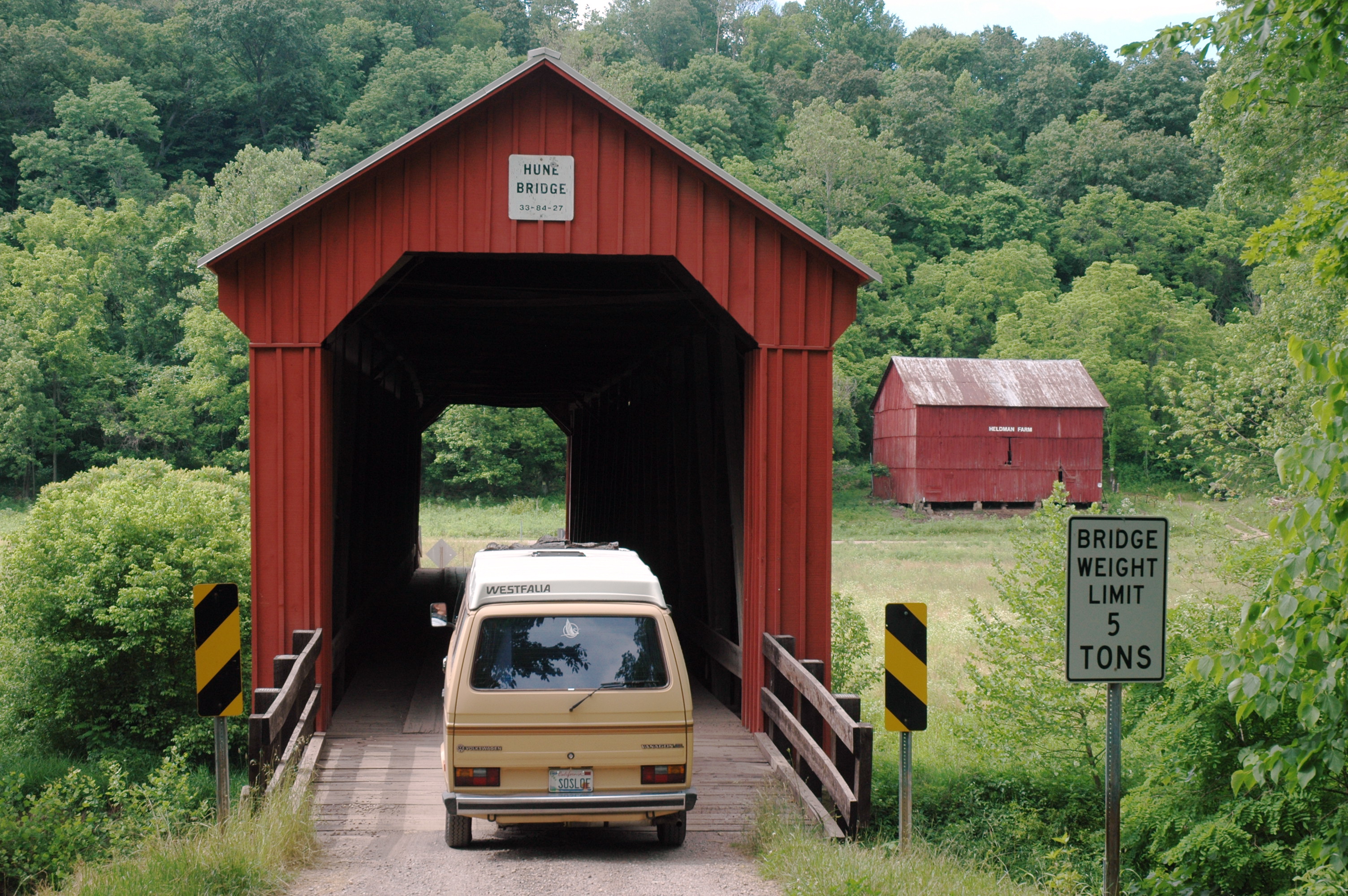
39°25′38″N 81°21′42″W / 39.42722°N 81.36167°WNewport Township 14 Hune Covered Bridge 
October 8, 1976 2.5 mi (4.0 km) north of Dart on State Route 26
39°30′38″N 81°15′2″W / 39.51056°N 81.25056°WLawrence Township 15 William Hune Farm March 28, 1991 State Route 26 north of Dart
39°30′50″N 81°15′20″W / 39.51389°N 81.25556°WLawrence Township 16 John Kaiser House 
December 10, 1993 300 Bellevue St.
39°24′56″N 81°27′59″W / 39.41556°N 81.46639°WMarietta 17 Marietta Historic District 
December 19, 1974 Roughly bounded by the Muskingum and Ohio Rivers and Warren, 3rd, 5th, and 6th Sts.; also roughly bounded by Marion, Montgomery, Ohio, Greene, Butler, 2nd through 9th Sts., and the Ohio and Muskingum Rivers
39°25′4″N 81°27′19″W / 39.41778°N 81.45528°WMarietta Second set of boundaries represents a boundary increase 18 Mason House November 29, 1979 Township Road 393
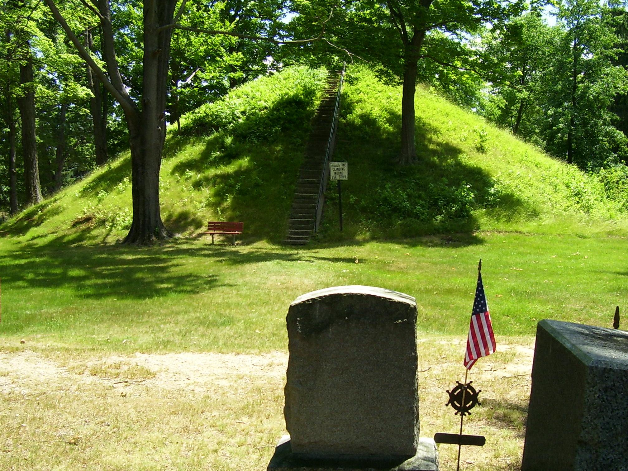
39°33′50″N 81°35′5″W / 39.56389°N 81.58472°WWaterford Township 19 Mound Cemetery Mound 
February 23, 1973 5th and Scammel Sts.
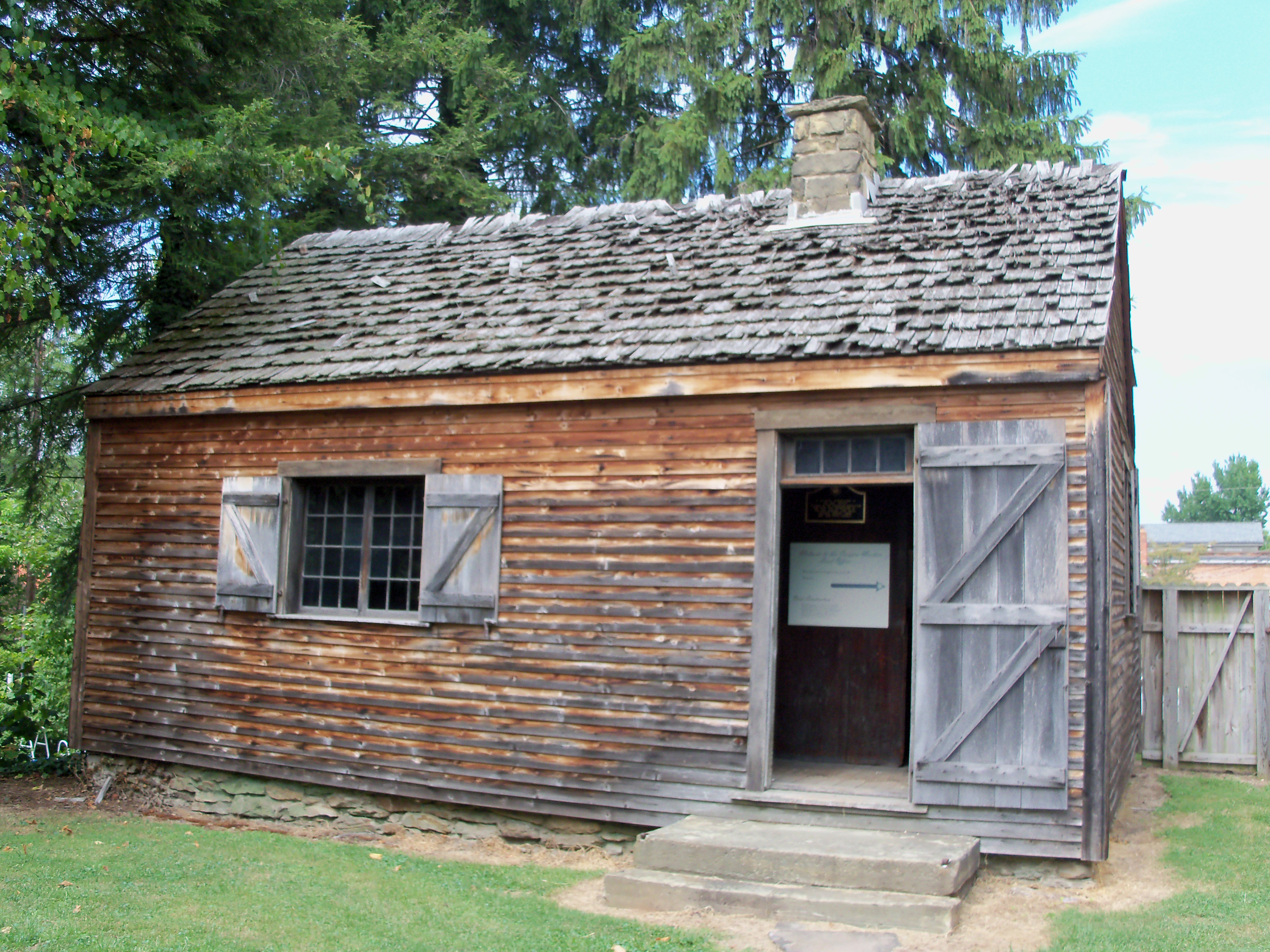
39°25′12.96″N 81°27′6.3″W / 39.4202667°N 81.45175°WMarietta Mound Cemetery, home to the Mound Cemetery Mound (aka Conus or Great Mound) and reportedly home to the largest number of American Revolutionary War officers buried in one location 20 Ohio Company Land Office 
November 10, 1970 Washington and 2nd Sts., Campus Martius Museum
39°25′16″N 81°27′42″W / 39.42111°N 81.46167°WMarietta 21 Old St. Mary's School 
October 3, 1989 132 S. 4th St.
39°24′52″N 81°26′49″W / 39.41444°N 81.44694°WMarietta Destroyed 22 Rufus Putnam House 
November 10, 1970 Campus Martius Museum, corner of 2nd and Washington Sts.
39°25′17″N 81°27′41″W / 39.42139°N 81.46139°WMarietta 23 Rinard Covered Bridge October 8, 1976 Northeast of Wingett Run on State Route 406
39°32′12″N 81°13′23″W / 39.53667°N 81.22306°WLudlow Township 24 Root Covered Bridge 
March 27, 1975 0.5 mi (0.80 km) north of Decaturville on State Route 6
39°20′33″N 81°45′16″W / 39.3425°N 81.75444°WDecatur Township 25 Sawyer-Curtis House 
October 18, 1984 Off U.S. Route 50 in Little Hocking
39°15′39″N 81°41′47″W / 39.26083°N 81.69639°WBelpre Township 26 Shinn Covered Bridge 
October 8, 1976 Northeast of Bartlett off State Route 555
39°27′46″N 81°45′40″W / 39.46278°N 81.76111°WPalmer Township 27 Sixth Street Railroad Bridge 
December 10, 1982 East of the 5th Street Bridge
39°16′14.844″N 81°33′54.108″W / 39.27079°N 81.56503°WBelpre Extends into Wood County, West Virginia 28 Spencer's Landing 
August 18, 1992 4 E. 5th St.
39°16′36.91″N 81°33′58.94″W / 39.2769194°N 81.5663722°WBelpre 29 Jonathan Sprague House 
January 11, 1983 West of Lowell off State Route 60
39°33′34″N 81°34′13″W / 39.55944°N 81.57028°WAdams Township 30 Capt. Jonathan Stone House 
February 7, 1978 612 Blennerhassett Ave.
39°16′16″N 81°34′37″W / 39.27111°N 81.57694°WBelpre 31 Vaughn-Stacy-Evans Farm Historic District 
September 6, 2006 7700 State Route 60, southeast of Lowell
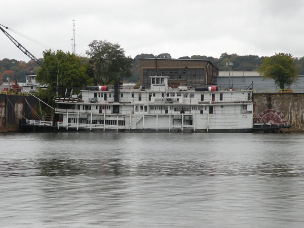
39°30′22″N 81°27′39″W / 39.50611°N 81.46083°WMuskingum Township 32 W.P. SNYDER, JR. (steamboat) 
November 10, 1970 On the Muskingum River at Sacra Via
39°25′13″N 81°27′48″W / 39.42028°N 81.46333°WMarietta In November 2009, W.P. Snyder, Jr. was towed to South Point, Ohio for a hull replacement. 33 Waernicke-Hille House and Store November 29, 1979 Township Road 36 in Archers Fork
39°29′3″N 81°12′20″W / 39.48417°N 81.20556°WIndependence Township 34 Watertown Historic District 
April 10, 1986 East of State Route 339 and north of State Route 676
39°27′59″N 81°37′57″W / 39.46639°N 81.6325°WWatertown Township 35 Wilcox-Mills House 
April 13, 1973 301 5th St.
39°25′4″N 81°27′5″W / 39.41778°N 81.45139°WMarietta Former listing
[3] Landmark name[4] Image Date listed Location City or Town Summary 1 MISSISSIPPI III 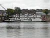
September 21, 1983 237 Front St.
39°24′45.2154″N 81°27′21.96″W / 39.412559833°N 81.4561°WMarietta The last of the Texas-deck sternwheelers, Showboat Becky Thatcher relocated to Neville Island, Pennsylvania, in October 2009.[5] On the night of February 19, 2010, the Becky Thatcher sank at its mooring on Neville Island in the Ohio River.[6] Demolition of the boat began on Monday, March 8, 2010.[7] See also
References
- ^ The latitude and longitude information provided in this table was derived originally from the National Register Information System, which has been found to be fairly accurate for about 99% of listings. For about 1% of NRIS original coordinates, experience has shown that one or both coordinates are typos or otherwise extremely far off; some corrections may have been made. A more subtle problem causes many locations to be off by up to 150 yards, depending on location in the country: most NRIS coordinates were derived from tracing out latitude and longitudes off of USGS topographical quadrant maps created under the North American Datum of 1927, which differs from the current, highly accurate WGS84 GPS system used by Google maps. Chicago is about right, but NRIS longitudes in Washington are higher by about 4.5 seconds, and are lower by about 2.0 seconds in Maine. Latitudes differ by about 1.0 second in Florida. Some locations in this table may have been corrected to current GPS standards.
- ^ "National Register of Historic Places: Weekly List Actions". National Park Service, United States Department of the Interior. Retrieved on November 10, 2011.
- ^ a b Numbers represent an ordering by significant words. Various colorings, defined here, differentiate National Historic Landmark sites and National Register of Historic Places Districts from other NRHP buildings, structures, sites or objects.
- ^ a b "National Register Information System". National Register of Historic Places. National Park Service. 2008-04-24. http://nrhp.focus.nps.gov/natreg/docs/All_Data.html.
- ^ Majors, Dan (October 14, 2009). "Riverboat owner to float restaurant idea on river here". Pittsburgh, Pennsylvania: Pittsburgh Post-Gazette. http://www.post-gazette.com/pg/09287/1005260-455.stm. Retrieved October 20, 2009.
- ^ "Sunk!: Reason Becky Thatcher took on water not known". Parkersburg News and Sentinel 2010-02-22. http://www.newsandsentinel.com/page/content.detail/id/526900.html?nav=5061.
- ^ Dennis B. Roddy, "Crews begin demolishing historic ship on Ohio River", Pittsburgh Post-Gazette, Tuesday, March 09, 2010.
National Register of Historic Places in Ohio Lists by county Adams • Allen • Ashland • Ashtabula • Athens • Auglaize • Belmont • Brown • Butler • Carroll • Champaign • Clark • Clermont • Clinton • Columbiana • Coshocton • Crawford • Cuyahoga • Darke • Defiance • Delaware • Erie • Fairfield • Fayette • Franklin • Fulton • Gallia • Geauga • Greene • Guernsey • Hamilton • Hancock • Hardin • Harrison • Henry • Highland • Hocking • Holmes • Huron • Jackson • Jefferson • Knox • Lake • Lawrence • Licking • Logan • Lorain • Lucas • Madison • Mahoning • Marion • Medina • Meigs • Mercer • Miami • Monroe • Montgomery • Morgan • Morrow • Muskingum • Noble • Ottawa • Paulding • Perry • Pickaway • Pike • Portage • Preble • Putnam • Richland • Ross • Sandusky • Scioto • Seneca • Shelby • Stark • Summit • Trumbull • Tuscarawas • Union • Van Wert • Vinton • Warren • Washington • Wayne • Williams • Wood • Wyandot

Lists by city Other lists Municipalities and communities of Washington County, Ohio Cities 
Villages Beverly | Lowell | Lower Salem | Macksburg | Matamoras
Townships CDP Unincorporated
communitiesBarlow | Bartlett | Coal Run | Cutler | Fleming | Germantown | Little Hocking | Newport | Reno | Vincent | Waterford | Watertown | Whipple | Wingett Run
Categories:- National Register of Historic Places in Ohio by county
- Washington County, Ohio
-


Wikimedia Foundation. 2010.