- National Register of Historic Places listings in Trumbull County, Ohio
-
 Location of Trumbull County in Ohio
This is a list of the National Register of Historic Places listings in Trumbull County, Ohio.
This is intended to be a complete list of the properties and districts on the National Register of Historic Places in Trumbull County, Ohio, United States. The locations of National Register properties and districts for which the latitude and longitude coordinates are included below, may be seen in a Google map.[1]
There are 34 properties and districts listed on the National Register in the county, including 1 National Historic Landmark.
-
- This National Park Service list is complete through NPS recent listings posted November 10, 2011.[2]
Current listings
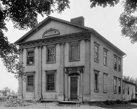
[3] Landmark name [4] Image Date listed Location City or town Summary 1 Dr. Peter Allen House 
September 3, 1971 W. Williamsfield State Rd., north of its intersection with State Route 87, in Kinsman
41°27′17″N 80°35′41″W / 41.454722°N 80.594722°WKinsman Township 2 Henry Barnhisel, II House December 19, 1982 1011 N. State St.
41°09′52″N 80°42′20″W / 41.164444°N 80.705556°WGirard 3 Brookfield Center Historic District October 10, 1985 Roughly the western side of State Route 7 from Sharon-Warren Rd. to N. Wood St. and Brookfield Village Green
41°13′59″N 80°34′06″W / 41.233056°N 80.568333°WBrookfield Township 4 Charles Brown Gothic Cottage May 28, 1975 State Route 45, S. in North Bloomfield
41°27′36″N 80°52′10″W / 41.46°N 80.869444°WBloomfield Township 5 Brown-Wing House June 20, 1975 Park West Rd. in North Bloomfield
41°27′50″N 80°52′30″W / 41.463889°N 80.875°WBloomfield Township 6 Brownwood 
September 3, 1971 State Route 45 in North Bloomfield
41°27′39″N 80°51′21″W / 41.460833°N 80.855833°WBloomfield Township 7 Chalker High School February 4, 2011 4432 State Route 305
41°18′30″N 80°57′27″W / 41.308333°N 80.9575°WSouthington Township 8 Congregational-Presbyterian Church 
September 3, 1971 Near State Routes 5 and 7 in Kinsman
41°26′56″N 80°35′21″W / 41.448889°N 80.589167°WKinsman Township 9 Clarence Darrow Octagon House September 10, 1971 State Routes 5 and 7 in Kinsman
41°26′59″N 80°35′05″W / 41.449722°N 80.584722°WKinsman Township 10 John Stark Edwards House July 17, 1978 309 South St., SE.
41°14′03″N 80°49′00″W / 41.234167°N 80.816667°WWarren 11 Fowler Center Historic District October 10, 1985 Roughly the area around the Fowler Township Village Green at the junction of State Routes 193 and 305, in Fowler
41°18′39″N 80°39′22″W / 41.310833°N 80.656111°WFowler Township 12 Richard Garlick House October 10, 1990 1025 Ravine Dr., north of Youngstown
41°08′42″N 80°38′34″W / 41.145°N 80.642778°WLiberty Township 13 Greene Township Center March 8, 1978 East of North Bloomfield on State Route 87 at Greene Center
41°27′41″N 80°45′44″W / 41.461389°N 80.762222°WGreene Township 14 Gustavus Center Historic District August 6, 1975 Town of Gustavus situated at the junction of State Routes 87 and 193
41°27′42″N 80°39′56″W / 41.461667°N 80.665556°WGustavus Township 15 Charles Harshman House July 7, 1983 3932 Painesville-Warren State Rd., NW.
41°19′36″N 80°56′40″W / 41.326667°N 80.944444°WSouthington Township 16 Elam Jones Public House January 8, 2003 3365 State Route 7 in Hartford
41°18′43″N 80°34′06″W / 41.311944°N 80.568333°WHartford Township 17 Mahoning Avenue Historic District 
October 26, 1971 241-391 Mahoning Ave., NW.; also Mahoning Ave. between Perkins Dr. and High St.
41°14′19″N 80°49′22″W / 41.238611°N 80.822778°WWarren Second set of boundaries represents a boundary increase 18 John Wesley Mason Gothic Cottage November 12, 1975 Northwest of Braceville on State Route 534
41°14′46″N 80°58′34″W / 41.246111°N 80.976111°WBraceville Township 19 Almon G. McCorkle House March 10, 1982 1180 Saltsprings Rd.
41°09′58″N 80°50′40″W / 41.166111°N 80.844444°WLordstown 20 McKinley Memorial 
October 31, 1975 40 N. Main St.
41°10′51″N 80°45′58″W / 41.180833°N 80.766111°WNiles Beaux-Arts memorial to President McKinley designed by McKim, Mead & White. 21 McLain-Gillmer House June 15, 1978 720 Mahoning Ave., NW.
41°14′30″N 80°49′29″W / 41.241667°N 80.824722°WWarren 22 Mesopotamia Village District December 24, 1974 State Routes 87 and 534 at Mesopotamia
41°27′37″N 80°57′16″W / 41.460278°N 80.954444°WMesopotamia Township 23 Newton Falls Covered Bridge 
October 16, 1974 Off State Route 534
41°11′17″N 80°58′17″W / 41.188056°N 80.971389°WNewton Falls 24 Niles Masonic Temple April 12, 2006 22 W. Church St.
41°10′55″N 80°45′59″W / 41.181944°N 80.766389°WNiles 25 James Ward Packard House October 31, 1985 319 Oak Knoll Ave., NE.
41°14′21″N 80°47′39″W / 41.239167°N 80.794167°WWarren 26 Liberty G. Raymond Tavern and Barn June 20, 1975 State Route 87 and Dennison-Ashtabula Rd. in Kenilworth
41°27′44″N 80°44′18″W / 41.462222°N 80.738333°WGreene Township 27 Dr. John W. Seely House April 14, 1972 2245 Niles-Cortland Rd., south of Howland Corners
41°12′45″N 80°44′24″W / 41.2125°N 80.74°WHowland Township 28 Trumbull County Courthouse 
December 31, 1974 160 High St., NW.
41°14′13″N 80°49′09″W / 41.236944°N 80.819167°WWarren 29 Harriet Taylor Upton House 
October 5, 1992 380 Mahoning Ave., NW.
41°14′22″N 80°49′21″W / 41.239444°N 80.8225°WWarren 30 Ward-Thomas House February 9, 1984 503 Brown St.
41°10′26″N 80°45′54″W / 41.173889°N 80.765°WNiles 31 Warren Commercial Historic District June 16, 1983 Roughly bounded by Mahoning, Monroe, Franklin, and Pine Sts.
41°14′17″N 80°49′13″W / 41.238056°N 80.820278°WWarren 32 Warren Public Library March 20, 1973 120 High St., NW.
41°14′15″N 80°49′06″W / 41.2375°N 80.818333°WWarren 33 Wells-Clark-Strouss House September 10, 1993 50 Warner Rd. at Logan Rd., east of Churchill
41°10′19″N 80°37′55″W / 41.171944°N 80.631944°WLiberty Township 34 William Woodrow House July 15, 1982 138 Champion St., E., in Champion Heights
41°17′28″N 80°50′45″W / 41.291111°N 80.845833°WChampion Township See also
References
- ^ The latitude and longitude information provided in this table was derived originally from the National Register Information System, which has been found to be fairly accurate for about 99% of listings. For about 1% of NRIS original coordinates, experience has shown that one or both coordinates are typos or otherwise extremely far off; some corrections may have been made. A more subtle problem causes many locations to be off by up to 150 yards, depending on location in the country: most NRIS coordinates were derived from tracing out latitude and longitudes off of USGS topographical quadrant maps created under North American Datum of 1927, which differs from the current, highly accurate GPS system used by Google maps. Chicago is about right, but NRIS longitudes in Washington are higher by about 4.5 seconds, and are lower by about 2.0 seconds in Maine. Latitudes differ by about 1.0 second in Florida. Some locations in this table may have been corrected to current GPS standards.
- ^ "National Register of Historic Places: Weekly List Actions". National Park Service, United States Department of the Interior. Retrieved on November 10, 2011.
- ^ Numbers represent an ordering by significant words. Various colorings, defined here, differentiate National Historic Landmark sites and National Register of Historic Places Districts from other NRHP buildings, structures, sites or objects.
- ^ "National Register Information System". National Register of Historic Places. National Park Service. . http://nrhp.focus.nps.gov/natreg/docs/All_Data.html.
Municipalities and communities of Trumbull County, Ohio County seat: Warren Cities Cortland | Girard | Hubbard | Newton Falls | Niles | Warren | Youngstown‡

Villages Townships Bazetta | Bloomfield | Braceville | Bristol | Brookfield | Champion | Farmington | Fowler | Greene | Gustavus | Hartford | Howland | Hubbard | Johnston | Kinsman | Liberty | Newton Falls | Mecca | Mesopotamia | Newton | Southington | Vernon | Vienna | Warren | Weathersfield
CDPs Unincorporated
communitiesBristolville | Burghill | Center of the World | Farmdale | Fowler | Hartford | Kinsman | North Bloomfield | Southington
Footnotes ‡This populated place also has portions in an adjacent county or counties
Categories:- National Register of Historic Places in Ohio by county
- Trumbull County, Ohio
-


Wikimedia Foundation. 2010.