- National Register of Historic Places listings in Montgomery County, Ohio
-
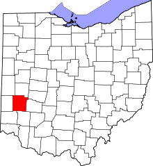 Location of Montgomery County in Ohio
This is a list of the National Register of Historic Places listings in Montgomery County, Ohio.
This is intended to be a complete list of the properties and districts on the National Register of Historic Places in Montgomery County, Ohio, United States. The locations of National Register properties and districts for which the latitude and longitude coordinates are included below, may be seen in a Google map.[1]
There are 140 properties and districts listed on the National Register in the county, including 6 National Historic Landmarks. The city of Dayton is the location of 99 of these properties and districts, including 4 National Historic Landmarks; they are listed separately, while the remaining properties and districts are listed here. Another property was once listed but has been removed.
-
- This National Park Service list is complete through NPS recent listings posted November 10, 2011.[2]
Current listings
Dayton
Outside of Dayton
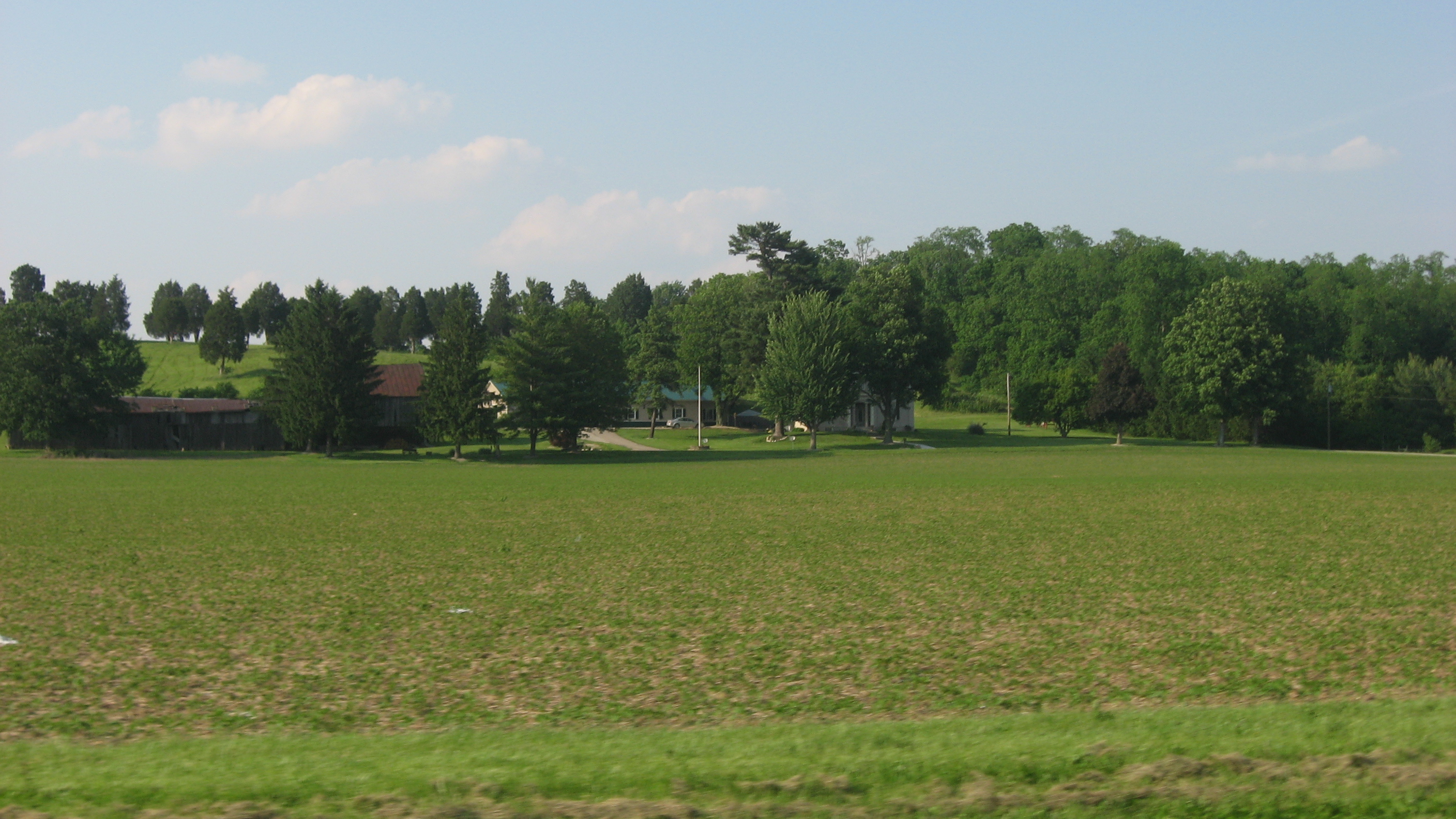
[3] Landmark name [4] Image Date listed Location City or town Summary 1 Arnold Homestead November 7, 1977 North of Dayton on State Route 201
39°52′20″N 84°05′46″W / 39.872222°N 84.096111°WHuber Heights 2 Aullwood House and Garden February 5, 1999 900 Aullwood Rd., northwest of Dayton
39°52′05″N 84°16′32″W / 39.868056°N 84.275556°WButler Township 3 Ausenbaugh-McElhenny House July 18, 1975 7373 Taylorsville Rd.
39°51′39″N 84°06′09″W / 39.860833°N 84.1025°WHuber Heights 4 George Bixler Farm August 22, 2002 13213 Providence Pike, south of Brookville
39°48′19″N 84°25′45″W / 39.805278°N 84.429167°WPerry Township 5 Robert Bradford House March 21, 1979 South of Centerville on Social Row Rd.
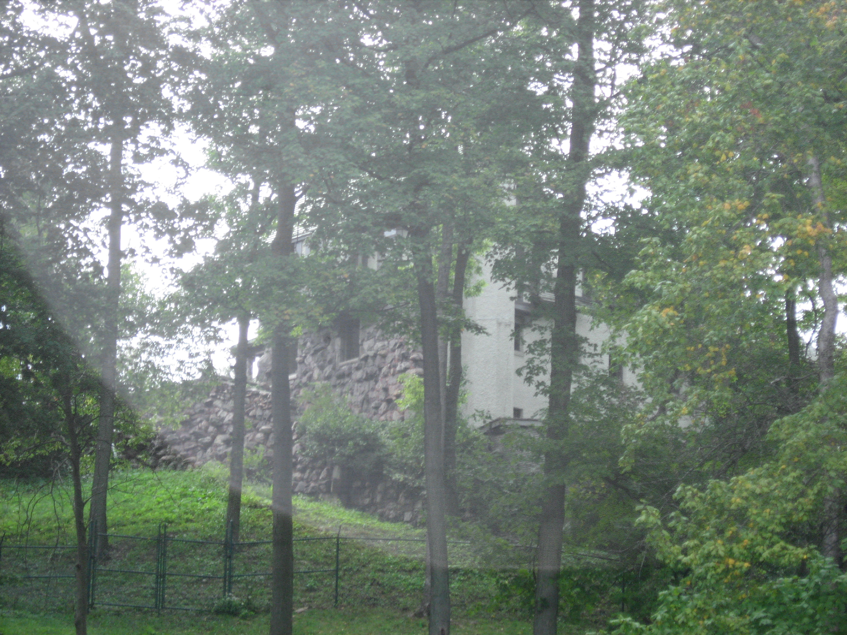
39°35′08″N 84°08′26″W / 39.585556°N 84.140556°WWashington Township 6 Carlisle Fort 
February 15, 1974 Western bank of Twin Creek, south of Germantown
39°35′26″N 84°21′15.4″W / 39.59056°N 84.354278°W[5]German Township 7 Centerville Historic District December 17, 1974 Irregular pattern at Franklin and Main Sts.
39°37′42″N 84°09′38″W / 39.628333°N 84.160556°WCenterville 8 Deeds' Barn December 4, 1979 35 Moraine Circle South
39°41′49″N 84°12′52″W / 39.696944°N 84.214444°WKettering 9 Deerwood Farm November 12, 1975 North of Dayton at 7200 Peters Pike
39°51′07″N 84°13′37″W / 39.851944°N 84.226944°WButler Township 10 Emmanuel's Evangelical Lutheran Church September 6, 1990 30 W. Warren St.
39°37′40″N 84°22′18″W / 39.627778°N 84.371667°WGermantown 11 Joseph Flory House March 29, 1978 Northwest of Clayton on Diamond Mill Rd.
39°51′58″N 84°22′07″W / 39.866111°N 84.368611°WClay Township 12 Fox Hollow June 9, 2006 6320 Mad River Rd.
39°39′23″N 84°11′30″W / 39.656422°N 84.191603°WWashington Township 13 Gunckel's Town Plan Historic District May 13, 1976 Roughly bounded by Mulberry and Walnut Sts. and Warren and Market Sts.
39°37′32″N 84°22′14″W / 39.625556°N 84.370556°WGermantown 14 Hawthorn Hill 
October 18, 1974 Harman and Park Aves.
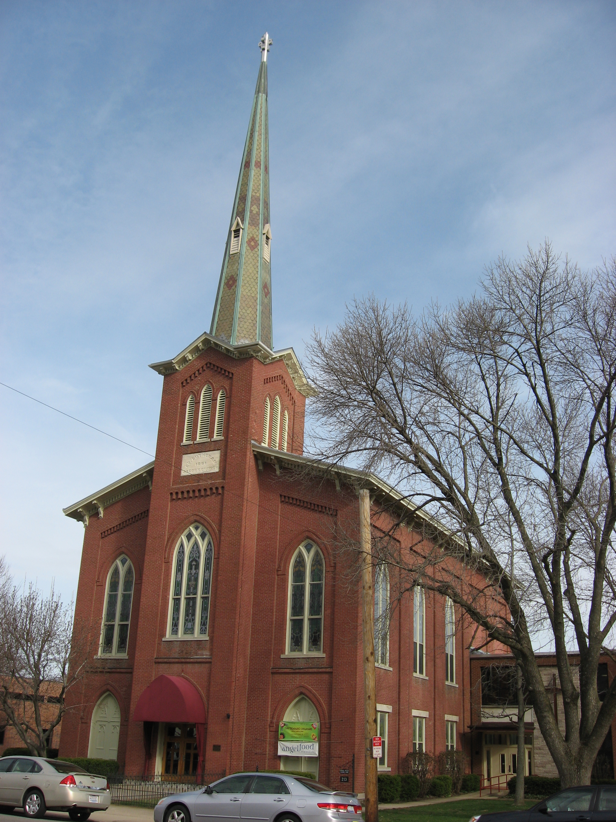
39°43′20″N 84°10′34″W / 39.722222°N 84.176111°WOakwood 15 Jacob's Church 
September 6, 1990 213 E. Central Ave.
39°38′31″N 84°17′11″W / 39.641944°N 84.286389°WMiamisburg 16 Ethol Kellog House June 18, 1976 West of Centerville off State Route 755 on Yankee St.
39°37′47″N 84°12′02″W / 39.629722°N 84.200556°WWashington Township 17 Charles F. Kettering House 
December 22, 1977 3965 Southern Boulevard
39°41′37″N 84°11′38″W / 39.693611°N 84.193889°WKettering 18 Koehne-Poast Farm 
April 11, 1977 West of Germantown off State Route 725
39°37′29″N 84°23′08″W / 39.624722°N 84.385556°WGerman Township and Germantown 19 Krug House August 12, 1992 3473 Sweet Potato Ridge Rd.
39°53′30″N 84°19′10″W / 39.891667°N 84.319444°WUnion 20 Long-Mueller House April 23, 1987 986 Laurelwood Rd.
39°42′02″N 84°11′16″W / 39.700556°N 84.187778°WKettering 21 Long-Romspert House December 21, 1987 1947 Far Hills Ave.
39°42′50″N 84°10′20″W / 39.713889°N 84.172222°WOakwood 22 Market Square 
November 10, 1975 Both sides of Main St. including junctions at Central and Linden Aves.
39°38′27″N 84°17′22″W / 39.640833°N 84.289333°WMiamisburg 23 Samuel Martindale House May 22, 1978 Northeast of Englewood off U.S. Route 40
39°53′43″N 84°17′10″W / 39.895278°N 84.286111°WButler Township 24 Miami-Erie Canal Lock No. 70 December 20, 1982 Fishburg and Endicott Rds.
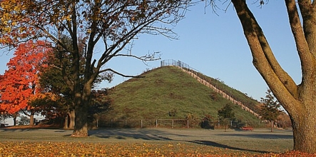
39°50′28″N 84°09′32″W / 39.841111°N 84.158889°WHuber Heights 25 Miamisburg Mound 
November 10, 1970 Southeast of Miamisburg on State Route 725
39°37′38″N 84°16′51″W / 39.627222°N 84.280833°WMiamisburg 26 Normandy Farms November 25, 1983 450 W. Alex-Bell Rd., northwest of Centerville
39°38′43″N 84°10′08″W / 39.645278°N 84.168889°WWashington Township 27 Pease Homestead August 11, 1980 2123 Alexander-Bellbrook Rd., northwest of Centerville
39°40′17″N 84°12′23″W / 39.671389°N 84.206389°WMiami Township 28 David Rohr Mansion and Carriage House May 22, 1978 Astoria Rd. and State Route 725
39°37′20″N 84°23′06″W / 39.622222°N 84.385°WGermantown 29 Salem Bear Creek Church, Salem Evangelical Lutheran Church September 6, 1990 Roughly bounded by Union Rd., Dayton Germantown Pike, and Bear Creek
39°40′48″N 84°18′34″W / 39.68°N 84.309444°WMoraine 30 Schantz Park Historic District October 16, 1992 Roughly bounded by Far Hills, Irving, Mahart and Schenck Aves.
39°43′54″N 84°10′37″W / 39.731667°N 84.176944°WOakwood 31 Adam Schantz, Sr., House 
March 7, 1980 314-316 Schantz Ave.
39°43′54″N 84°10′35″W / 39.731667°N 84.176389°WOakwood 32 Schuter Carpenter Shop and House September 27, 1980 3224 W. Alexandersville-Bellbrook Rd., east of West Carrollton
39°40′24″N 84°13′37″W / 39.673333°N 84.226944°WMiami Township 33 Shuey's Mill September 5, 1975 Main St.
39°37′15″N 84°22′13″W / 39.620833°N 84.370278°WGermantown 34 Skywood Farms February 22, 1996 732 W. Alex-Bell Rd., northwest of Centerville
39°38′57″N 84°10′46″W / 39.649167°N 84.179444°WWashington Township 35 Samuel Spitler House 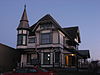
September 28, 1973 14 Market St.
39°50′08″N 84°24′50″W / 39.835556°N 84.413889°WBrookville Designed by architect George Franklin Barber 36 John Stump House and Mill July 7, 1975 Southwest of Germantown at the junction of Signal and Oxford Rds.
39°37′02″N 84°23′27″W / 39.617222°N 84.390833°WGerman Township 37 Taylorsville Canal Inn November 16, 1977 4240 Taylorsville Rd.
39°51′48″N 84°09′54″W / 39.863333°N 84.165°WHuber Heights 38 Trailsend May 22, 1979 3500 Governors Trail
39°42′04″N 84°11′57″W / 39.701111°N 84.199167°WKettering 39 Trotwood Railroad Station and Depot January 26, 1981 2 W. Main St.
39°47′50″N 84°18′39″W / 39.797222°N 84.310833°WTrotwood 40 Watkins House December 24, 1974 9950 Lebanon Pike, south of Centerville
39°35′56″N 84°09′41″W / 39.598889°N 84.161389°WWashington Township 41 Wolf Creek Mound June 4, 1973 Along Wolf Creek, west of Trotwood
39°48′0″N 84°22′12″W / 39.8°N 84.37°W[5]Perry Township Former listing
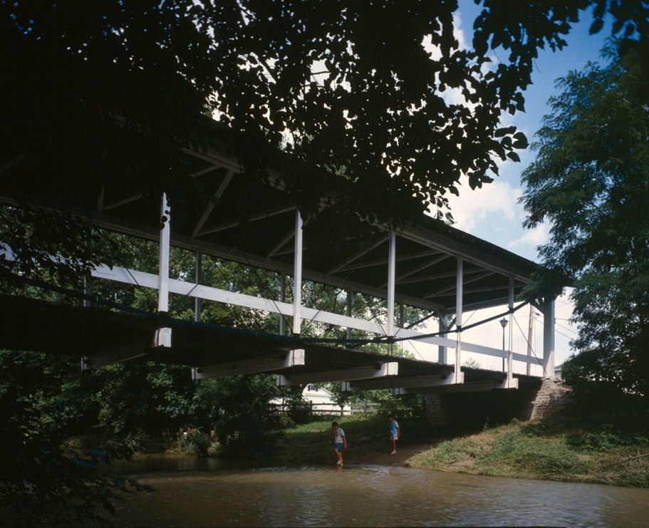
[3] Landmark name Image Date listed Location City or town Summary 1 Germantown Covered Bridge 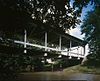
January 1, 1999 Center St., over Little Twin Creek Germantown Listed in 1971 See also
References
- ^ The latitude and longitude information provided in this table was derived originally from the National Register Information System, which has been found to be fairly accurate for about 99% of listings. For about 1% of NRIS original coordinates, experience has shown that one or both coordinates are typos or otherwise extremely far off; some corrections may have been made. A more subtle problem causes many locations to be off by up to 150 yards, depending on location in the country: most NRIS coordinates were derived from tracing out latitude and longitudes off of USGS topographical quadrant maps created under the North American Datum of 1927, which differs from the current, highly accurate WGS84 GPS system used by Google maps. Chicago is about right, but NRIS longitudes in Washington are higher by about 4.5 seconds, and are lower by about 2.0 seconds in Maine. Latitudes differ by about 1.0 second in Florida. Some locations in this table may have been corrected to current GPS standards.
- ^ "National Register of Historic Places: Weekly List Actions". National Park Service, United States Department of the Interior. Retrieved on November 10, 2011.
- ^ a b Numbers represent an ordering by significant words. Various colorings, defined here, differentiate National Historic Landmark sites and National Register of Historic Places Districts from other NRHP buildings, structures, sites or objects.
- ^ "National Register Information System". National Register of Historic Places. National Park Service. . http://nrhp.focus.nps.gov/natreg/docs/All_Data.html.
- ^ a b Location derived from Mills, William C. Archeological Atlas of Ohio. Columbus: Ohio State Archeological and Historical Society, 1914, page 57 and plate 57. The NRIS lists the site as "Address Restricted".
National Register of Historic Places in Ohio Lists by county Adams • Allen • Ashland • Ashtabula • Athens • Auglaize • Belmont • Brown • Butler • Carroll • Champaign • Clark • Clermont • Clinton • Columbiana • Coshocton • Crawford • Cuyahoga • Darke • Defiance • Delaware • Erie • Fairfield • Fayette • Franklin • Fulton • Gallia • Geauga • Greene • Guernsey • Hamilton • Hancock • Hardin • Harrison • Henry • Highland • Hocking • Holmes • Huron • Jackson • Jefferson • Knox • Lake • Lawrence • Licking • Logan • Lorain • Lucas • Madison • Mahoning • Marion • Medina • Meigs • Mercer • Miami • Monroe • Montgomery • Morgan • Morrow • Muskingum • Noble • Ottawa • Paulding • Perry • Pickaway • Pike • Portage • Preble • Putnam • Richland • Ross • Sandusky • Scioto • Seneca • Shelby • Stark • Summit • Trumbull • Tuscarawas • Union • Van Wert • Vinton • Warren • Washington • Wayne • Williams • Wood • Wyandot

Lists by city Other lists Municipalities and communities of Montgomery County, Ohio Cities Brookville | Centerville‡ | Clayton | Dayton | Englewood | Germantown | Huber Heights‡ | Kettering‡ | Miamisburg | Moraine | Oakwood | Riverside | Springboro‡ | Trotwood | Union‡ | Vandalia | West Carrollton

Villages Carlisle‡ | Farmersville | New Lebanon | Phillipsburg | Verona‡
Townships CDPs Unincorporated
communitiesGhost town Footnotes ‡This populated place also has portions in an adjacent county or counties
Categories:- National Register of Historic Places in Ohio by county
- Montgomery County, Ohio
-


Wikimedia Foundation. 2010.