- National Register of Historic Places listings in Akron, Ohio
-
This is a list of the National Register of Historic Places listings in Akron, Ohio.
This is intended to be a complete list of the properties and districts on the National Register of Historic Places in Akron, Ohio, United States. Latitude and longitude coordinates are provided for many National Register properties and districts; these locations may be seen together in a Google map.[1]
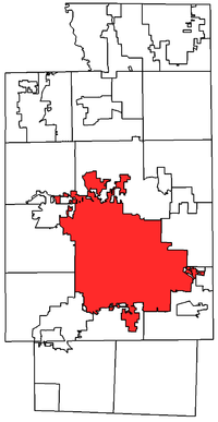
There are 160 properties and districts listed on the National Register in Summit County, including 1 National Historic Landmark. The city of Akron is the location of 50 of these properties and districts, including the National Historic Landmark; they are listed here, while the 111 sites located elsewhere in Summit County are listed separately. One district, the Valley Railway Historic District, is split between Akron and other parts of the county, and is thus included on both lists.
-
- This National Park Service list is complete through NPS recent listings posted November 10, 2011.[2]
Current listings
[3] Landmark name[4] Image Date listed Location Summary 1 Akron Jewish Center July 24, 1986 220 S. Balch St.
41°5′11″N 81°32′4″W / 41.08639°N 81.53444°W2 Akron Post Office and Federal Building May 26, 1983 168 E. Market St.
41°5′0″N 81°30′49″W / 41.083333°N 81.51361°W3 Akron Public Library January 19, 1983 69 E. Market St.
41°5′6″N 81°30′52″W / 41.085°N 81.51444°W4 Akron Rural Cemetery Buildings September 27, 1980 150 Glendale Ave.
41°5′5″N 81°31′32″W / 41.08472°N 81.52556°W5 Akron Y.M.C.A. Building October 31, 1980 80 W. Center St.
41°4′49″N 81°31′24″W / 41.08028°N 81.52333°W6 Akron-Fulton International Airport Administration Building December 21, 2001 1800 Triplett Boulevard
41°2′31″N 81°27′47″W / 41.04194°N 81.46306°W7 Byron R. Barder House September 17, 1987 1041 W. Market St.
41°5′29″N 81°33′1″W / 41.09139°N 81.55028°W8 Barker Village Site April 19, 1978 North of central Akron[5] 9 Stacy G. Carkhuff House August 30, 1984 1225 W. Market St.
41°5′40″N 81°33′15″W / 41.09444°N 81.55417°W10 Cascade Locks Historic District December 10, 1992 Roughly bounded by North, Howard, Innerbelt Rt. 59 and the canal from Locks 10 to 16, including discontiguous parts north
41°5′35″N 81°31′16″W / 41.09306°N 81.52111°W11 Cole Avenue Housing Project Historic District October 17, 2007 744 Colette Dr.
41°3′5.28″N 81°30′6.94″W / 41.0514667°N 81.5019278°W12 Eagles Temple June 1, 1982 131-137 E. Market St.
41°5′3″N 81°30′47″W / 41.08417°N 81.51306°W13 East Market Street Church of Christ February 7, 1989 864 E. Market St.
41°4′22″N 81°29′31″W / 41.07278°N 81.49194°W14 First Congregational Church February 20, 2004 292 E. Market St.
41°4′53″N 81°30′31″W / 41.08139°N 81.50861°W15 First National Bank Tower June 27, 2007 106 S. Main St.
41°4′56″N 81°31′8″W / 41.08222°N 81.51889°W16 Jacob M. Gayer House October 18, 1984 406 Sumner St.
41°4′21″N 81°30′52″W / 41.0725°N 81.51444°W17 Glendale Cemetery September 28, 2001 150 Glendale Ave.
41°5′2″N 81°31′44″W / 41.08389°N 81.52889°W18 Goodyear Airdock 
April 11, 1973 Southern side of the Akron Airport
41°1′55″N 81°28′15″W / 41.03194°N 81.47083°W19 The Gothic Building May 21, 2010 102 S. High St. & 52-58 E. Mill St.
41°4′55.95″N 81°31′0.37″W / 41.0822083°N 81.5167694°W20 Grace Reformed Church July 19, 1984 172 W. Bowery St.
41°4′48″N 81°31′28″W / 41.08°N 81.52444°W21 Hall Park Allotment Historic District October 31, 2002 Roughly along Oakland Ave., from Crestwood Ave. and Crosby St.
41°5′20″N 81°32′0″W / 41.08889°N 81.533333°W22 Hower Mansion April 11, 1973 60 Fir Hill
41°4′47″N 81°30′28″W / 41.07972°N 81.50778°W23 Andrew Jackson House February 13, 1975 277 E. Mill St.
41°4′48″N 81°30′33″W / 41.08°N 81.50917°W24 Loew's Theatre July 16, 1973 182 S. Main St.
41°4′51″N 81°31′13″W / 41.08083°N 81.52028°W25 Main Exchange Historic District November 12, 2009 1 W. Exchange St., 323-337 S. Main St., 12 E. Exchange St., 380-348 S. Main St., and 328-326 S. Main St.
41°4′35.54″N 81°31′19.6″W / 41.0765389°N 81.522111°W26 Main-Market Historic District August 1, 2003 15-47 N. Main St., 1-39 S. Main St., 39-168 E. Market St., 18-42 N. High St., and 70 Broadway St.
41°5′6.17″N 81°30′58.86″W / 41.0850472°N 81.51635°W27 Wells E. Merriman House September 29, 1983 641 W. Market St.
41°5′39″N 81°32′16″W / 41.09417°N 81.53778°W28 Lewis Miller House January 30, 1976 142 King Dr.
41°5′4″N 81°31′23″W / 41.08444°N 81.52306°W29 O'Neil's Department Store 
November 28, 1990 226-250 S. Main St.
41°4′46″N 81°31′24″W / 41.07944°N 81.52333°W30 Old Akron Post Office June 19, 1972 70 E. Market St.
41°5′4″N 81°30′55″W / 41.08444°N 81.51528°W31 Col. Simon Perkins Mansion 
August 13, 1974 550 Copley Rd.
41°5′6″N 81°32′30″W / 41.085°N 81.54167°W32 Portage Hotel October 17, 1988 10 N. Main St.
41°5′7″N 81°30′57″W / 41.08528°N 81.51583°W33 Quaker Oats Cereal Factory 
December 8, 1978 120 E. Mill St.
41°4′52″N 81°30′54″W / 41.08111°N 81.515°W34 The Rhodes and Watters Apartment Buildings December 20, 2007 614, 608, 610, and 612 W. Market St., and 16 Rhodes Ave.
41°5′37″N 81°32′15″W / 41.09361°N 81.5375°W35 Byron W. Robinson House September 20, 1991 715 E. Buchtel Ave.
41°4′37″N 81°29′44″W / 41.07694°N 81.49556°W36 Charles Willard Seiberling House May 6, 1993 1075 W. Market St.
41°6′6″N 81°33′4″W / 41.10167°N 81.55111°W37 Selle Gear Company November 9, 2005 451 S. High St.
41°4′25″N 81°31′20″W / 41.07361°N 81.52222°W38 Dr. Robert Smith House October 31, 1985 855 Ardmore Ave.
41°5′45″N 81°32′56″W / 41.09583°N 81.54889°W39 South Main Street Historic District July 2, 2008 156-222 S. Main St., 153-279 S. Main St.
41°4′45.77″N 81°31′12.49″W / 41.0793806°N 81.5201361°W40 St. Bernard's Church March 9, 1989 240 S. Broadway St.
41°4′41″N 81°31′7″W / 41.07806°N 81.51861°W41 St. Paul's Sunday School and Parish House November 7, 1976 E. Market and Forge Sts.
41°4′51″N 81°30′25″W / 41.08083°N 81.50694°W42 Stan Hywet Hall-Frank A. Seiberling House January 17, 1975 714 N. Portage Path
41°7′7″N 81°33′5″W / 41.11861°N 81.55139°W43 Summit County Courthouse and Annex 
October 15, 1974 209 S. High St.
41°4′49″N 81°31′1″W / 41.08028°N 81.51694°W44 Valley Railway Historic District May 17, 1985 Cuyahoga Valley between Rockside Rd. in the Cuyahoga Valley National Park and Howard St. at Little Cuyahoga Valley
41°13′38″N 81°34′13″W / 41.22722°N 81.57028°WExtends into other parts of Summit County and into Cuyahoga County 45 Viall Lodge March 17, 1994 1135 E. Market St.
41°4′5″N 81°29′5″W / 41.06806°N 81.48472°W46 Werner Company Building December 12, 1976 109 N. Union
41°5′3″N 81°30′21″W / 41.08417°N 81.50583°W47 Edward P. Werner House October 4, 2005 258 W. Market St.
41°5′20″N 81°31′34″W / 41.08889°N 81.52611°W48 Wesley Temple AME Church March 17, 1994 104 N. Prospect St.
41°5′10″N 81°30′38″W / 41.08611°N 81.51056°W49 Westmont Building May 31, 1984 22 Rhodes Ave.
41°5′35″N 81°32′16″W / 41.09306°N 81.53778°W50 Young Women's Christian Association 
November 4, 1982 146 S. High St.
41°4′52″N 81°31′3″W / 41.08111°N 81.5175°WSee also
References
- ^ The latitude and longitude information provided in this table was derived originally from the National Register Information System, which has been found to be fairly accurate for about 99% of listings. For about 1% of NRIS original coordinates, experience has shown that one or both coordinates are typos or otherwise extremely far off; some corrections may have been made. A more subtle problem causes many locations to be off by up to 150 yards, depending on location in the country: most NRIS coordinates were derived from tracing out latitude and longitudes off of USGS topographical quadrant maps created under the North American Datum of 1927, which differs from the current, highly accurate WGS84 GPS system used by Google maps. Chicago is about right, but NRIS longitudes in Washington are higher by about 4.5 seconds, and are lower by about 2.0 seconds in Maine. Latitudes differ by about 1.0 second in Florida. Some locations in this table may have been corrected to current GPS standards.
- ^ "National Register of Historic Places: Weekly List Actions". National Park Service, United States Department of the Interior. Retrieved on November 10, 2011.
- ^ Numbers represent an ordering by significant words. Various colorings, defined here, differentiate National Historic Landmark sites and National Register of Historic Places Districts from other NRHP buildings, structures, sites or objects.
- ^ "National Register Information System". National Register of Historic Places. National Park Service. 2008-04-24. http://nrhp.focus.nps.gov/natreg/docs/All_Data.html.
- ^ Location derived from its Federal Register notice; the NRIS lists the site as "Address Restricted"
National Register of Historic Places in Ohio Lists by county Adams • Allen • Ashland • Ashtabula • Athens • Auglaize • Belmont • Brown • Butler • Carroll • Champaign • Clark • Clermont • Clinton • Columbiana • Coshocton • Crawford • Cuyahoga • Darke • Defiance • Delaware • Erie • Fairfield • Fayette • Franklin • Fulton • Gallia • Geauga • Greene • Guernsey • Hamilton • Hancock • Hardin • Harrison • Henry • Highland • Hocking • Holmes • Huron • Jackson • Jefferson • Knox • Lake • Lawrence • Licking • Logan • Lorain • Lucas • Madison • Mahoning • Marion • Medina • Meigs • Mercer • Miami • Monroe • Montgomery • Morgan • Morrow • Muskingum • Noble • Ottawa • Paulding • Perry • Pickaway • Pike • Portage • Preble • Putnam • Richland • Ross • Sandusky • Scioto • Seneca • Shelby • Stark • Summit • Trumbull • Tuscarawas • Union • Van Wert • Vinton • Warren • Washington • Wayne • Williams • Wood • Wyandot

Lists by city Other lists Categories:- National Register of Historic Places in Ohio
- History of Akron, Ohio
-
Wikimedia Foundation. 2010.


