- National Register of Historic Places listings in Logan County, Ohio
-
 Location of Logan County in Ohio
This is a list of the National Register of Historic Places listings in Logan County, Ohio.
This is intended to be a complete list of the properties and districts on the National Register of Historic Places in Logan County, Ohio, United States. The locations of National Register properties and districts for which the latitude and longitude coordinates are included below, may be seen in a Google map.[1]
There are 9 properties and districts listed on the National Register in the county.
-
- This National Park Service list is complete through NPS recent listings posted November 10, 2011.[2]
Current listings
[3] Landmark name [4] Image Date listed Location City or town Summary 1 Dunns Pond Mound 
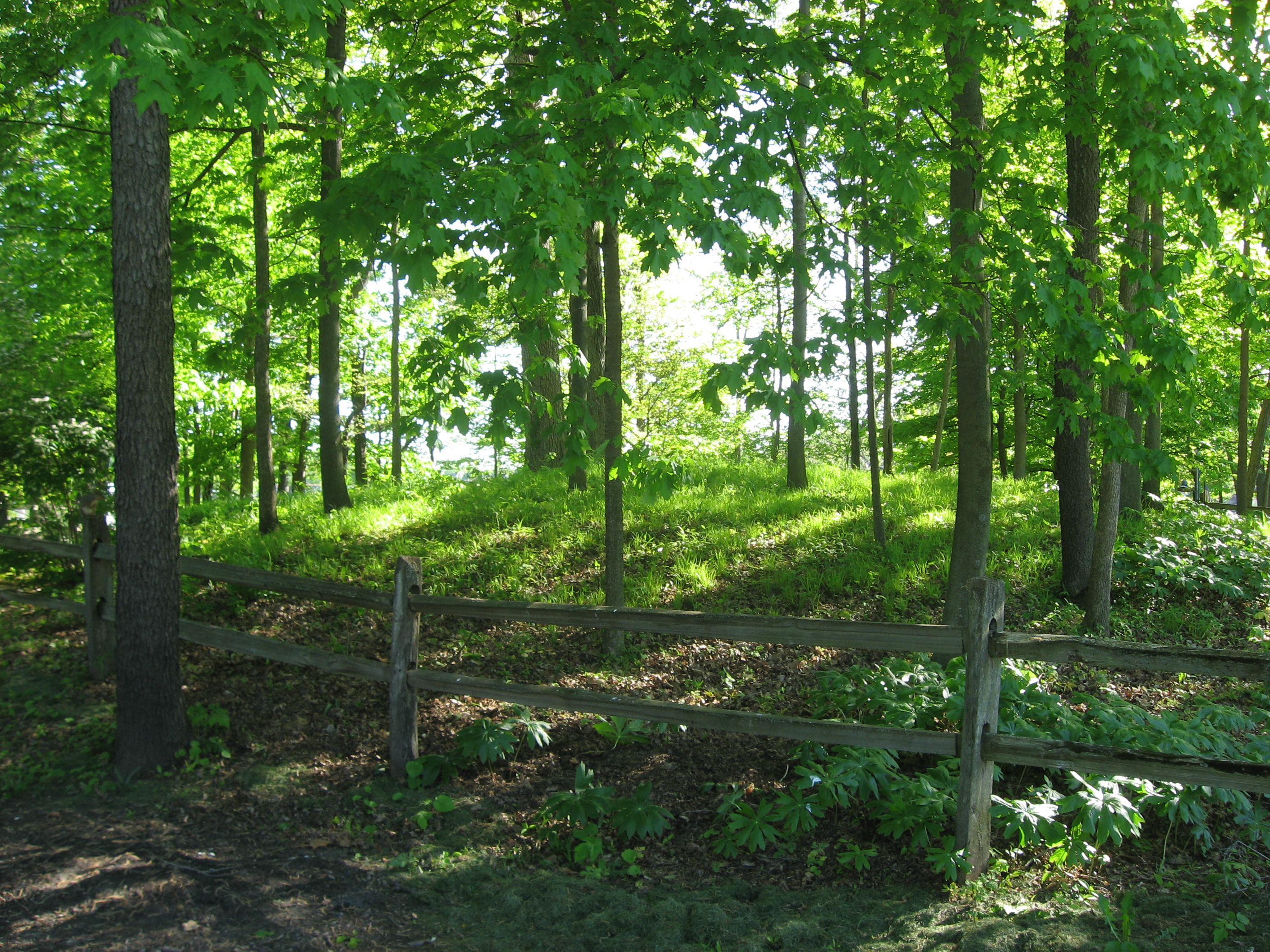
July 30, 1974 Junction of Mohawk and Mound Aves., northeast of Dunns Pond
40°28′32.448″N 83°51′46.404″W / 40.47568°N 83.86289°W[5][6]Washington Township A Hopewell burial mound 2 First Concrete Street in U.S. 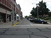
February 25, 1974 Court Avenue
40°21′37″N 83°45′33″W / 40.360389°N 83.759167°WBellefontaine Only remaining portion of the first concrete pavement in the United States, built in 1891 3 Lake Ridge Island Mounds 
October 16, 1974 Western side of State Route 368 on Lake Ridge Island
40°29′24.5″N 83°51′36.2″W / 40.490139°N 83.860056°W[6][7]Stokes Township Group of small hills thought to be Native American mounds 4 William Lawrence House 
August 24, 1979 325 N. Main St.
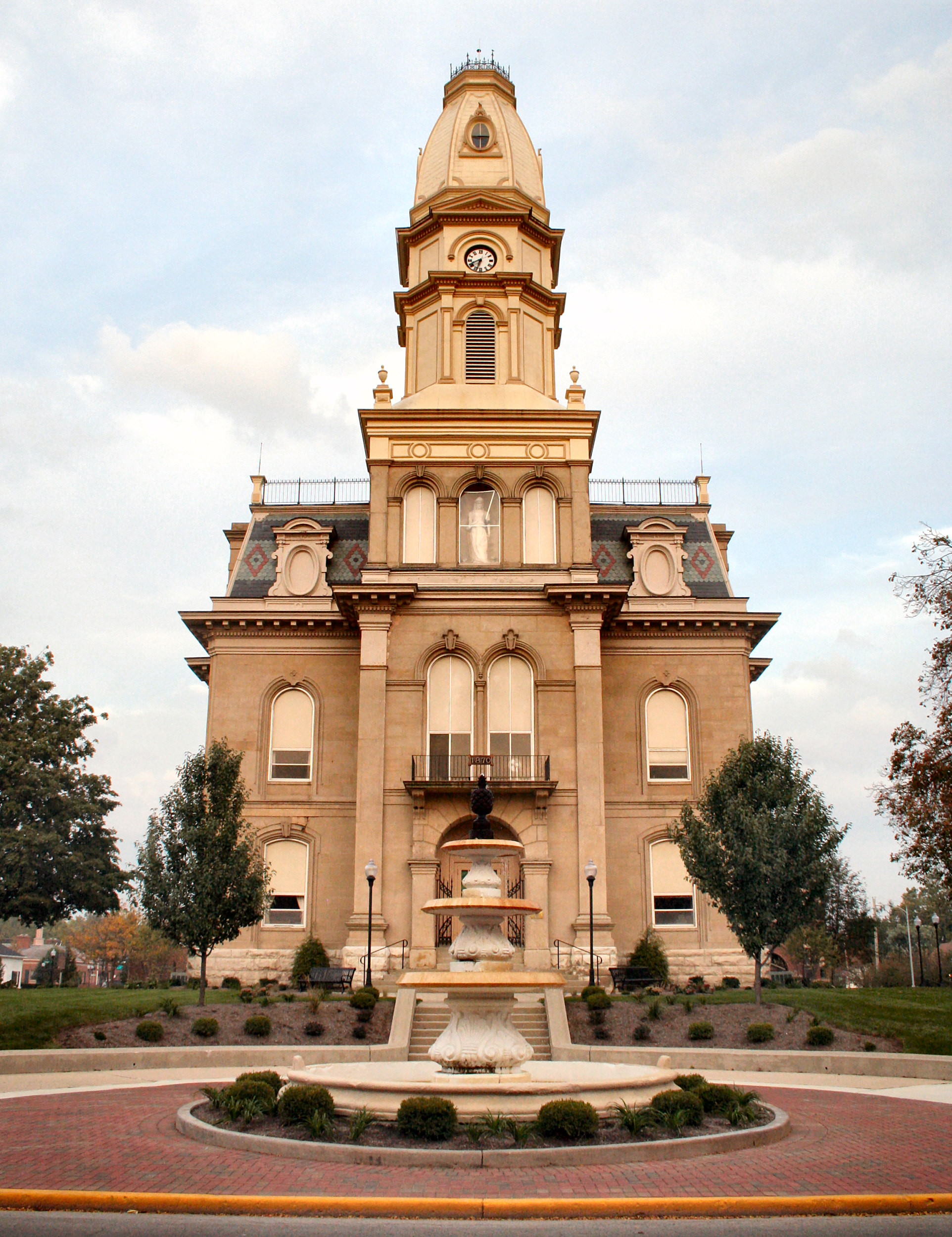
40°21′55″N 83°45′35″W / 40.365278°N 83.759722°WBellefontaine Home of prominent politician William Lawrence 5 Logan County Courthouse 
June 4, 1973 101 S. Main St.
40°21′38.6″N 83°45′32.75″W / 40.360722°N 83.7590972°W[8]Bellefontaine Second Empire sandstone courthouse 6 Martin Marmon House 
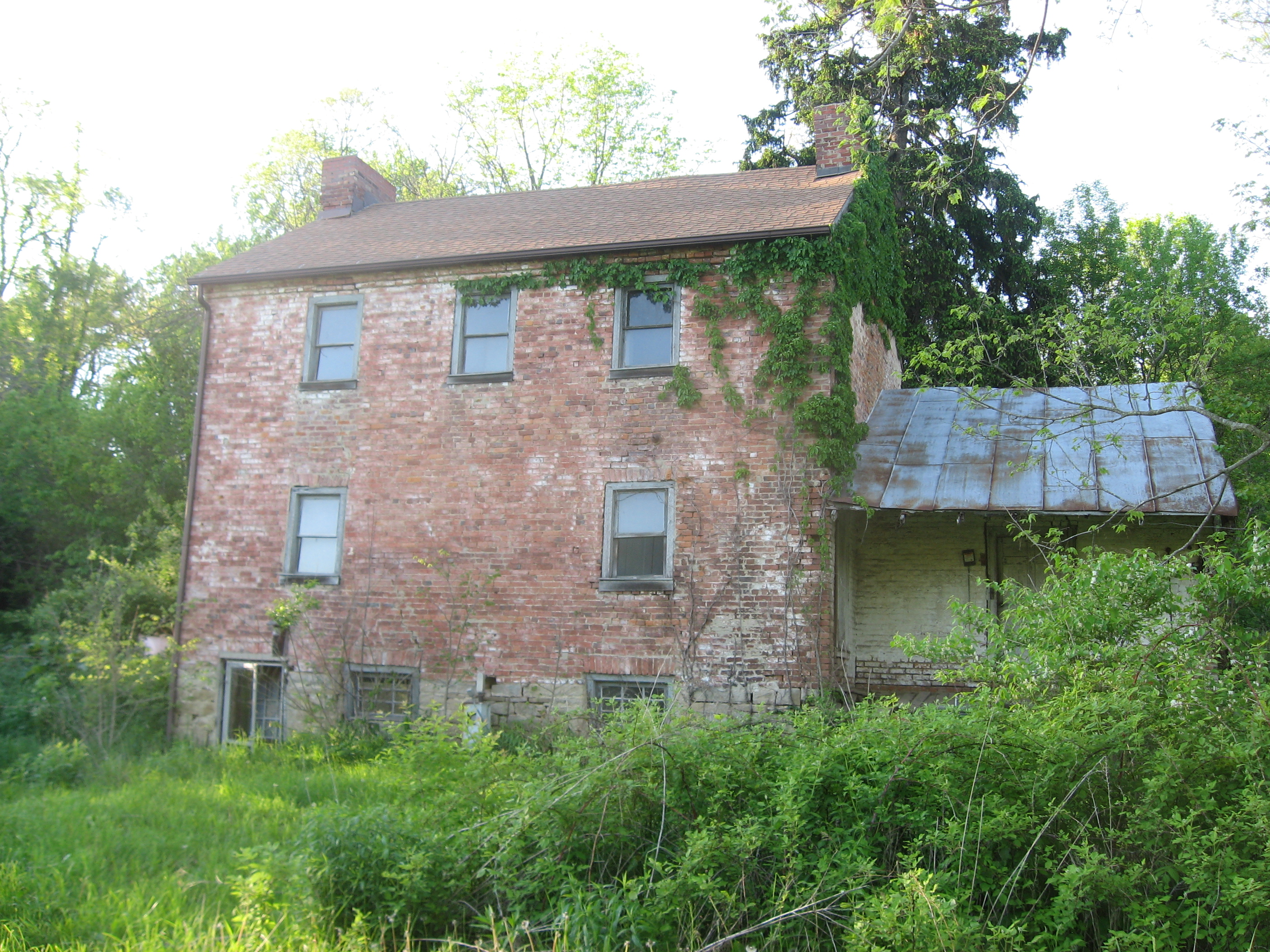
February 20, 1986 County Road 153 near Zanesfield
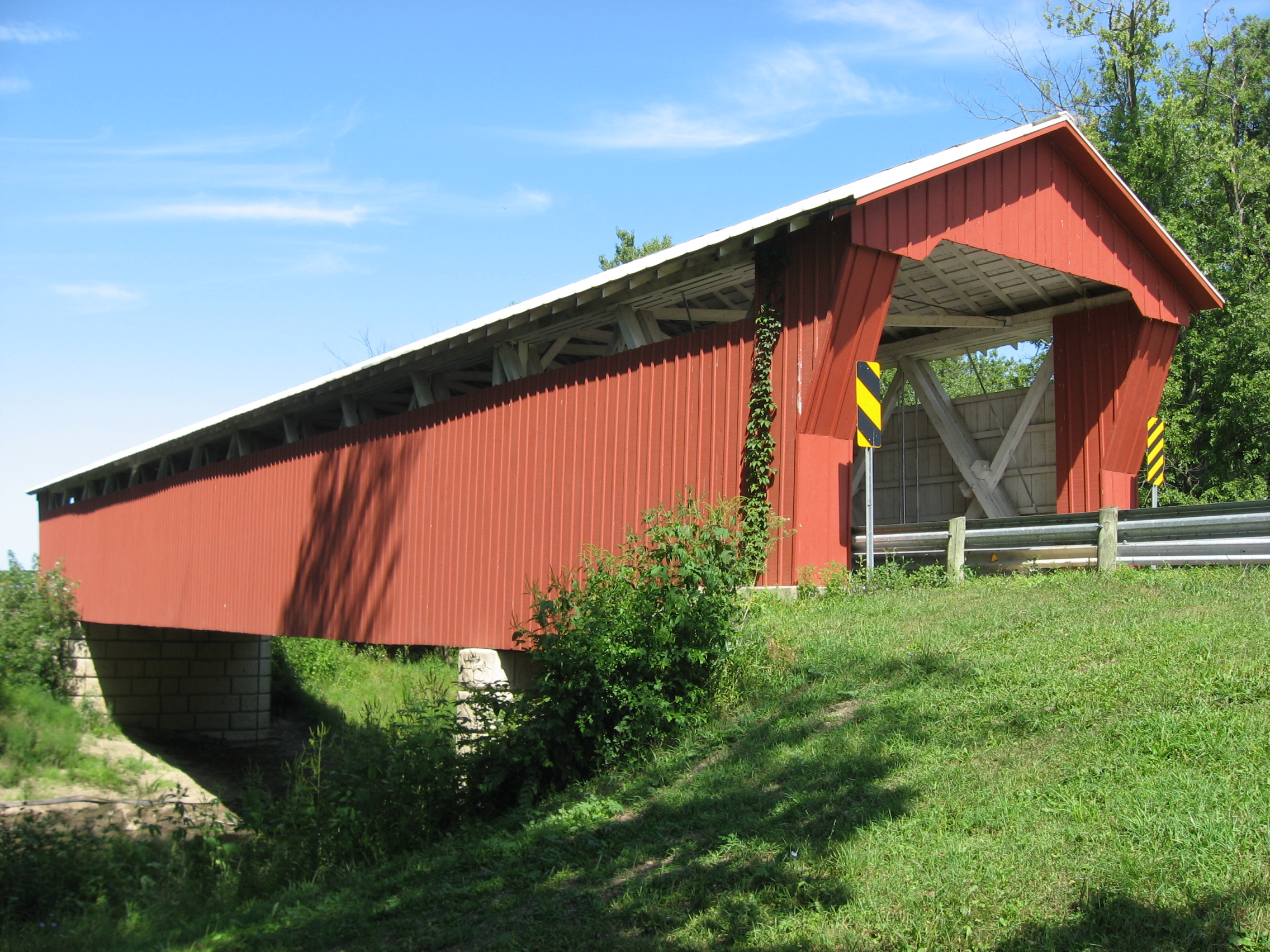
40°19′40″N 83°40′00″W / 40.327778°N 83.666667°WJefferson Township 1820 home of prominent Quaker pioneer 7 McColly Covered Bridge 
May 28, 1975 2 miles southeast of Bloom Center on County Road 13
40°24′03″N 83°55′27″W / 40.400833°N 83.924167°WWashington Township One of two remaining covered bridges in Logan County 8 Abram S. Piatt House and Donn S. Piatt House 
May 3, 1982 Township Road 47 and State Route 245 (Mac-a-Cheek);
40°15′3.24″N 83°43′36.192″W / 40.2509°N 83.72672°W
County Road 1 and State Route 287 (Mac-o-Chee)
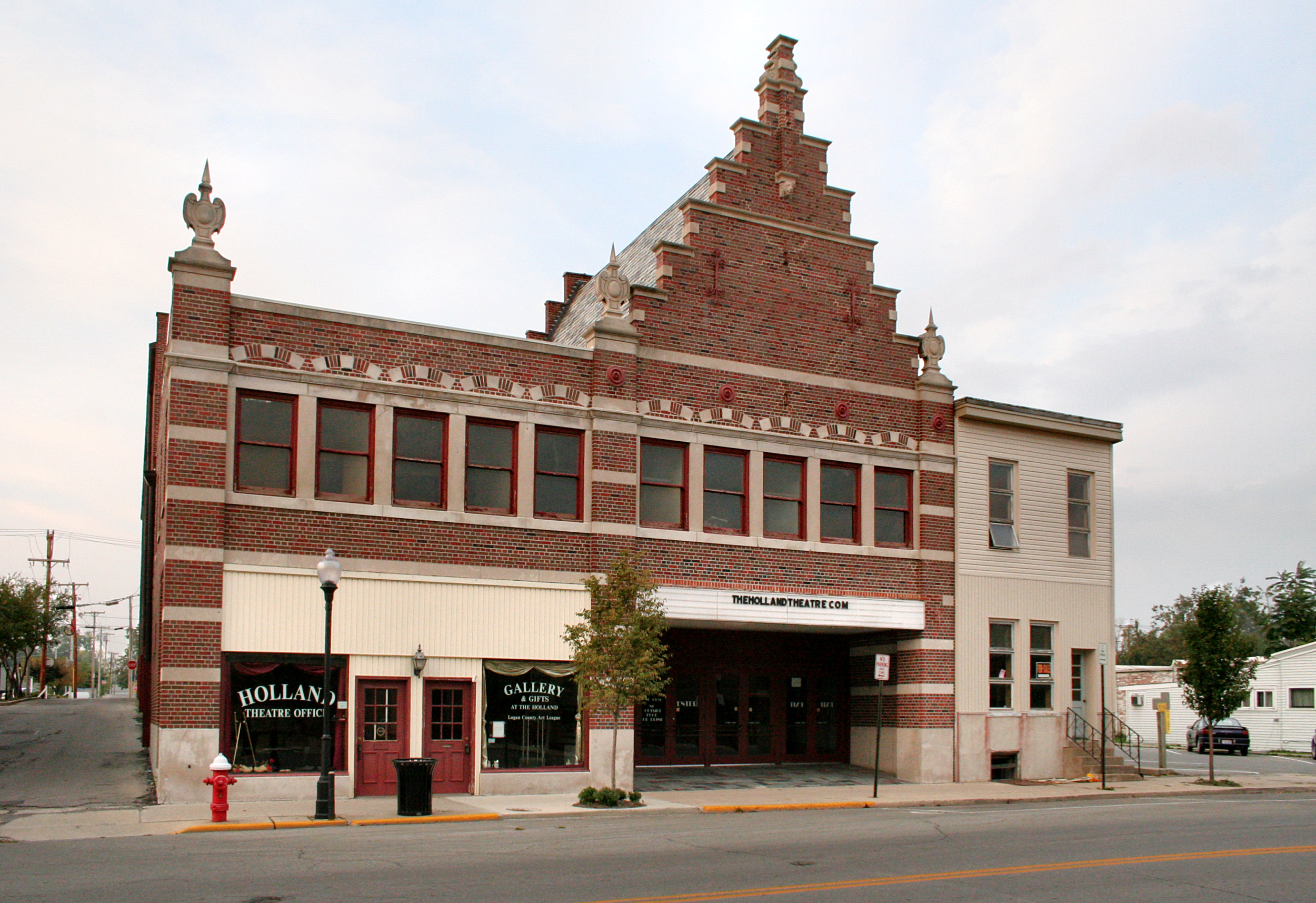
40°15′30″N 83°43′00″W / 40.25834°N 83.71664°WMonroe Township Gothic chateaux built by two brothers; commonly known as the Piatt Castles 9 Schine's Holland Theatre 
May 25, 2001 125 E. Columbus St.
40°21′40″N 83°45′32″W / 40.361111°N 83.758889°WBellefontaine Dutch Revival theater See also
References
- ^ The latitude and longitude information provided in this table was derived originally from the National Register Information System, which has been found to be fairly accurate for about 99% of listings. For about 1% of NRIS original coordinates, experience has shown that one or both coordinates are typos or otherwise extremely far off; some corrections may have been made. A more subtle problem causes many locations to be off by up to 150 yards, depending on location in the country: most NRIS coordinates were derived from tracing out latitude and longitudes off of USGS topographical quadrant maps created under the North American Datum of 1927, which differs from the current, highly accurate WGS84 GPS system used by Google maps. Chicago is about right, but NRIS longitudes in Washington are higher by about 4.5 seconds, and are lower by about 2.0 seconds in Maine. Latitudes differ by about 1.0 second in Florida. Some locations in this table may have been corrected to current GPS standards.
- ^ "National Register of Historic Places: Weekly List Actions". National Park Service, United States Department of the Interior. Retrieved on November 10, 2011.
- ^ Numbers represent an ordering by significant words. Various colorings, defined here, differentiate National Historic Landmark sites and National Register of Historic Places Districts from other NRHP buildings, structures, sites or objects.
- ^ "National Register Information System". National Register of Historic Places. National Park Service. . http://nrhp.focus.nps.gov/natreg/docs/All_Data.html.
- ^ Drennen, Bert C., III. National Register of Historic Places Inventory/Nomination: Dunns Pond Mound. National Park Service, 1974-01-22.
- ^ a b Location derived from descriptions in nomination form and from USGS topographical maps; the specific address is restricted.
- ^ Drennen, Bert C., III. National Register of Historic Places Inventory/Nomination: Lake Ridge Island Mounds. National Park Service, 1974-01-22.
- ^ Address derived from this county website; the NRIS lists it as "Public Sq."
National Register of Historic Places in Ohio Lists by county Adams • Allen • Ashland • Ashtabula • Athens • Auglaize • Belmont • Brown • Butler • Carroll • Champaign • Clark • Clermont • Clinton • Columbiana • Coshocton • Crawford • Cuyahoga • Darke • Defiance • Delaware • Erie • Fairfield • Fayette • Franklin • Fulton • Gallia • Geauga • Greene • Guernsey • Hamilton • Hancock • Hardin • Harrison • Henry • Highland • Hocking • Holmes • Huron • Jackson • Jefferson • Knox • Lake • Lawrence • Licking • Logan • Lorain • Lucas • Madison • Mahoning • Marion • Medina • Meigs • Mercer • Miami • Monroe • Montgomery • Morgan • Morrow • Muskingum • Noble • Ottawa • Paulding • Perry • Pickaway • Pike • Portage • Preble • Putnam • Richland • Ross • Sandusky • Scioto • Seneca • Shelby • Stark • Summit • Trumbull • Tuscarawas • Union • Van Wert • Vinton • Warren • Washington • Wayne • Williams • Wood • Wyandot

Lists by city Other lists Municipalities and communities of Logan County, Ohio City 
Villages Belle Center | De Graff | Huntsville | Lakeview | Quincy | Ridgeway‡ | Rushsylvania | Russells Point | Valley Hi | West Liberty | West Mansfield | Zanesfield
Townships CDPs Unincorporated
communitiesFootnotes ‡This populated place also has portions in an adjacent county or counties
Categories:- National Register of Historic Places in Ohio by county
- Logan County, Ohio
-


Wikimedia Foundation. 2010.