- National Register of Historic Places listings in Franklin County, Ohio
-
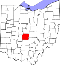 Location of Franklin County in Ohio
This is a list of the National Register of Historic Places listings in Franklin County, Ohio.
This is intended to be a complete list of the properties and districts on the National Register of Historic Places in Franklin County, Ohio, United States. Latitude and longitude coordinates are provided for many National Register properties and districts; these locations may be seen together in a Google map.[1]
There are 308 properties and districts listed on the National Register in the county, including 3 National Historic Landmarks. The city of Columbus is the location of 142 of these properties and districts, including all of the National Historic Landmarks; they are listed separately, while the remaining 166 properties and districts are listed here.
-
- This National Park Service list is complete through NPS recent listings posted November 10, 2011.[2]
Current listings
Columbus
Exclusive of Columbus
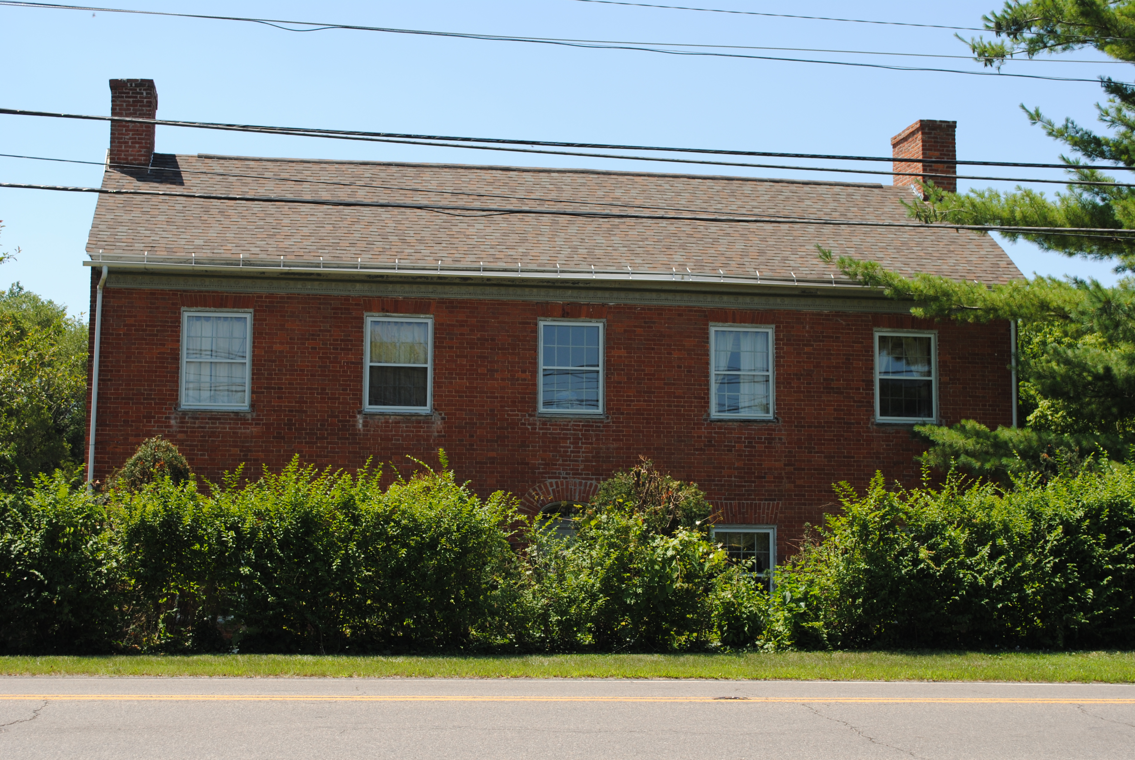
[3] Landmark name [4] Image Date listed Location City or town Summary 1 Demas Adams House 
April 17, 1980 721 High St.
40°05′19″N 83°01′08″W / 40.088611°N 83.018889°WWorthington 2 Agler-La Follette House 
December 14, 1978 2621 Sunbury Rd.
40°01′29″N 82°56′04″W / 40.024722°N 82.934444°WMifflin Township 3 Alkire House 
March 30, 1978 259 N. State St.
40°07′58″N 82°56′00″W / 40.132778°N 82.933333°WWesterville 4 Arendt-Seymour House August 15, 1989 53 W. Columbus St.
39°50′29″N 82°48′28″W / 39.841347°N 82.807806°WCanal Winchester 5 Artz House 
April 11, 1979 56 N. High St.
40°06′03″N 83°06′48″W / 40.100833°N 83.113333°WDublin 6 Bank Block Building September 15, 1997 1255-1293 Grandview Ave.
39°58′58″N 83°02′44″W / 39.982778°N 83.045556°WGrandview Heights 7 Barnhardt-Bolenbaugh House August 15, 1989 113 E. Waterloo St.
39°50′28″N 82°48′07″W / 39.841111°N 82.801944°WCanal Winchester 8 Dr. L.W. Beery House August 15, 1989 68 Washington St.
39°50′32″N 82°48′33″W / 39.842222°N 82.809167°WCanal Winchester 9 Bergstresser Covered Bridge May 3, 1974 West of State Route 674 over Walnut Creek
39°49′48″N 82°49′00″W / 39.83°N 82.816667°WCanal Winchester 10 E. Boles Cottage April 11, 1979 5350 Hayden Run Rd.
40°03′35″N 83°08′49″W / 40.059722°N 83.146944°WHilliard 11 Asher Brand Residence April 11, 1979 5381 Brand Rd.
40°07′06″N 83°07′57″W / 40.118333°N 83.1325°WDublin 12 Brelsford-Seese House 
April 11, 1979 129 Riverview St.
40°05′49″N 83°06′44″W / 40.096944°N 83.112222°WDublin 13 Bruns-Wynkoop House August 15, 1989 129 Washington St.
39°50′25″N 82°48′32″W / 39.840278°N 82.808889°WCanal Winchester 14 J.G. Butler House 
April 11, 1979 35 S. High St.
40°05′56″N 83°06′50″W / 40.098806°N 83.113889°WDublin 15 Aurora Buttles House 
April 17, 1980 12 E. Strafford Ave.
40°05′28″N 83°01′03″W / 40.091111°N 83.0175°WWorthington 16 Buttles-Johnson House 
April 3, 1973 956 High St.
40°05′37″N 83°01′02″W / 40.093611°N 83.017222°WWorthington 17 Canal Winchester Methodist Church March 15, 1982 S. Columbus and High St.
39°50′27″N 82°48′22″W / 39.840833°N 82.806111°WCanal Winchester 18 Canal Winchester School February 9, 2007 100 South Washington St.
39°50′27″N 82°48′34″W / 39.840833°N 82.809444°WCanal Winchester 19 Tom Cannon Mound May 2, 1974 On a bluff over the confluence of the Big and Little Darby Creeks
39°53′37.75″N 83°13′5″W / 39.8938194°N 83.21806°W[5]Pleasant Township 20 Capital University Historic District December 17, 1982 E. Main St. at College Ave.
39°57′21″N 82°56′19″W / 39.955833°N 82.938611°WBexley 21 J. Carty-R.J. Tussing House August 15, 1989 48 Elm St.
39°50′42″N 82°48′28″W / 39.845°N 82.807778°WCanal Winchester 22 Central College Presbyterian Church 
November 24, 1980 6891 Sunbury Rd.
40°05′59″N 82°53′23″W / 40.099722°N 82.889722°WWesterville 23 O.P. Chaney Grain Elevator January 28, 1988 W. Oak and N. High Sts.
39°50′40″N 82°48′23″W / 39.844444°N 82.806389°WCanal Winchester 24 Chapman-Hutchinson House 
April 11, 1979 37 S. Riverview St.
40°05′56″N 83°06′45″W / 40.098889°N 83.1125°WDublin 25 Fletcher Coffman House 
April 11, 1979 6659 Coffman Rd.
40°06′15″N 83°08′02″W / 40.104167°N 83.133889°WDublin 26 Columbus Street Historic District May 5, 1988 8-129 E. Columbus St. and 57 S. High St.
39°50′26″N 82°48′13″W / 39.840556°N 82.803611°WCanal Winchester 27 Columbus, Hocking Valley and Toledo Railway Depot January 28, 1988 100 N. High St.
39°50′40″N 82°48′21″W / 39.844444°N 82.805833°WCanal Winchester 28 Walter Datz House April 11, 1979 5040 Tuttle Rd.
40°04′40″N 83°07′41″W / 40.077778°N 83.128056°WDublin 29 David's Reformed Church August 15, 1989 80 W. Columbus St.
39°50′30″N 82°48′31″W / 39.841667°N 82.808611°WCanal Winchester 30 Alexander Davis Cabin April 11, 1979 5436 Dublin Rd. (rear house)
40°04′41″N 83°06′46″W / 40.078056°N 83.112778°WDublin 31 Alexander Davis House April 11, 1979 5436 Dublin Rd. (front house)
40°04′41″N 83°06′48″W / 40.078056°N 83.113333°WDublin 32 James Davis Barn April 11, 1979 5707 Dublin Rd.
40°04′58″N 83°06′55″W / 40.082778°N 83.115278°WDublin 33 James Davis Farm April 11, 1979 5707 Dublin Rd.
40°05′00″N 83°06′55″W / 40.083333°N 83.115278°WDublin 34 Samuel Henry Davis House April 11, 1979 5083 Rings Rd.
40°05′03″N 83°07′40″W / 40.084197°N 83.127911°WDublin 35 Samuel Davis House February 15, 1974 4264 Dublin Rd.
40°02′44″N 83°06′13″W / 40.045556°N 83.103611°WMifflin Township 36 Elias Decker Farmhouse August 15, 1989 6170 Lithopolis Rd.
39°49′36″N 82°50′16″W / 39.826667°N 82.837778°WCanal Winchester 37 Samuel Deitz Farmhouse August 15, 1989 280 Ashbrook Rd.
39°49′59″N 82°48′56″W / 39.833056°N 82.815556°WCanal Winchester 38 Dublin Cemetery Vaults 
April 11, 1979 State Route 161, ¼ mile west of its intersection with Dublin River Rd.
40°05′51″N 83°07′01″W / 40.0975°N 83.116944°WDublin 39 Dublin Christian Church 
April 11, 1979 81 W. Bridge St. (State Route 161)
40°05′56″N 83°06′58″W / 40.098889°N 83.116111°WDublin 40 Dublin Christian Church 
April 11, 1979 53 N. High St.
40°06′00″N 83°06′50″W / 40.1°N 83.113889°WDublin 41 Dublin High Street Historic District 
April 11, 1979 6-126 High St. (both sides of street)
40°05′58″N 83°06′49″W / 40.099444°N 83.113611°WDublin 42 Dublin Veterinary Clinic 
April 11, 1979 32 W. Bridge St.
40°05′59″N 83°06′53″W / 40.099722°N 83.114722°WDublin 43 John Dun Homestead April 11, 1979 8055 Dublin-Bellpoint Rd. (at intersection of Ashford Rd.)
40°08′18″N 83°07′37″W / 40.138333°N 83.126944°WDublin 44 George and Christina Ealy House 
July 2, 2008 6359 Dublin-Granville Rd.
40°04′57″N 82°49′10″W / 40.082603°N 82.819528°WNew Albany 45 Henry J. Epley House August 15, 1989 55 Franklin St.
39°50′26″N 82°48′29″W / 39.840556°N 82.808056°WCanal Winchester 46 Richard W. Evans House 
April 17, 1980 92 E. Granville Rd.
40°05′20″N 83°00′55″W / 40.088889°N 83.015278°WWorthington 47 John W. Everal Farm Buildings September 18, 1975 7610 Cleveland Ave.
40°07′35″N 82°56′52″W / 40.126389°N 82.947778°WWesterville 48 Foor-Alspach House August 15, 1989 92 E. Waterloo St.
39°50′30″N 82°48′10″W / 39.841667°N 82.802778°WCanal Winchester 49 Frantz House April 11, 1979 6152 Frantz Rd.
40°05′43″N 83°07′28″W / 40.095278°N 83.124444°WDublin 50 John Galbreath Mound 
July 15, 1974 Eastern bank of Big Darby Creek, west of Galloway
39°54′43″N 83°13′16.3″W / 39.91194°N 83.221194°W[6]Pleasant Township 51 Gantz Homestead 
June 20, 1979 2233 Gantz Rd.
39°53′52″N 83°03′46″W / 39.897778°N 83.062778°WGrove City 52 Gardner House 
April 17, 1980 80 W. Granville Rd.
40°05′28″N 83°01′13″W / 40.091111°N 83.020278°WWorthington 53 Christian Gayman House August 15, 1989 110 E. Waterloo St.
39°50′30″N 82°48′08″W / 39.841667°N 82.802222°WCanal Winchester 54 Eleanor A. Gelpi House 
March 19, 2001 7125 Riverside Dr.
40°06′45″N 83°05′56″W / 40.1125°N 83.098889°WDublin 55 Gilbert House 
April 17, 1980 72 E. Granville Rd.
40°05′19″N 83°00′56″W / 40.088611°N 83.015556°WWorthington 56 Gilbert-Wilcox House 
April 17, 1980 196 E. Granville Rd.
40°05′19″N 83°00′41″W / 40.088611°N 83.011389°WWorthington 57 A.G. Grant Homestead 
June 3, 1998 4124 Haughn Rd.
39°52′48″N 83°05′07″W / 39.88°N 83.085278°WGrove City 58 Green Lawn Abbey 
June 27, 2007 700 Greenlawn Ave.
39°56′26″N 83°00′58″W / 39.940556°N 83.016111°WFranklin Township 59 James Griffith House August 15, 1989 172 Washington St.
39°50′21″N 82°48′34″W / 39.839167°N 82.809444°WCanal Winchester 60 Groveport Log Houses May 6, 1976 Wirt Rd.
39°50′58″N 82°53′07″W / 39.849444°N 82.885278°WGroveport 61 Groveport School July 24, 2009 715 E. Main St.
39°51′03″N 82°52′52″W / 39.850703°N 82.881117°WGroveport 62 Groveport Town Hall Historic Group July 31, 1978 628, 632 Main and Main and Front Sts.
39°51′05″N 82°52′57″W / 39.851389°N 82.8825°WGroveport 63 Groveport United Methodist Church April 20, 1995 512 Main St.
39°51′07″N 82°53′09″W / 39.851944°N 82.885833°WGroveport 64 Parley Haffey Farm Complex August 15, 1989 525 Gender Rd.
39°49′55″N 82°49′52″W / 39.831944°N 82.831111°WCanal Winchester 65 J.L. Hamilton Residence April 11, 1979 6273 Cosgray Rd.
40°05′53″N 83°11′21″W / 40.098056°N 83.189167°WWashington Township 66 Benjamin Hanby House 
November 10, 1970 160 W. Main St.
40°07′36″N 82°56′19″W / 40.126667°N 82.938611°WWesterville 67 Gideon Hart House August 14, 1973 7328 Hempstead Rd.
40°06′32″N 82°53′52″W / 40.108889°N 82.897778°WWesterville 68 Lucy Hart House 
April 17, 1980 64 W. Granville Rd.
40°05′29″N 83°01′11″W / 40.091389°N 83.019722°WWorthington 69 Helpman-Chaney House August 15, 1989 132 W. Columbus St.
39°50′30″N 82°48′38″W / 39.841667°N 82.810556°WCanal Winchester 70 Christian S. Herr House March 5, 1982 North of Lockbourne at 1451 Rathmell Rd.
39°51′40″N 82°57′34″W / 39.861111°N 82.959444°WHamilton Township 71 Hilliard Methodist Episcopal Church 
August 4, 1988 4066 Main St.
40°02′05″N 83°09′30″W / 40.034722°N 83.158333°WHilliard 72 Holder-Wright Works 
February 15, 1974 Off Bright Rd., east of the Scioto River
40°6′46.78″N 83°6′22.78″W / 40.1129944°N 83.1063278°W[7]Dublin 73 Home for the Aged Deaf 
November 25, 1980 6971 Sunbury Rd.
40°06′04″N 82°53′22″W / 40.101111°N 82.889444°WWesterville 74 Hotel Central 
April 17, 1980 New England and High Sts.
40°05′13″N 83°01′06″W / 40.086944°N 83.018333°WWorthington 75 Franz Huntington House May 29, 1980 81 N. Drexel Ave.
39°57′45″N 82°56′15″W / 39.9625°N 82.9375°WBexley 76 Indian Run Cemetery Stone Walls 
April 11, 1979 North High St.
40°06′07″N 83°06′55″W / 40.101944°N 83.115278°WDublin 77 Jackson Fort December 16, 1974 Surrounding a house at 3845 Westerville Rd.
40°2′55.4″N 82°56′43.5″W / 40.048722°N 82.945417°W[8]Blendon Township 78 H.P. Jeffers Mound 
May 2, 1974 Above the junction of Olentangy River Rd. and Plesenton Dr., west of downtown Worthington
40°5′33″N 83°2′22″W / 40.0925°N 83.03944°W[9]Worthington 79 Malcolm Jeffrey House 
May 6, 1983 358 N. Parkview
39°58′35″N 82°56′25″W / 39.976389°N 82.940278°WBexley 80 The Kahiki December 8, 1997 3583 E. Broad St.
39°58′21″N 82°54′16″W / 39.9725°N 82.9045°WWhitehall 81 Karrer Barn April 11, 1979 6199 Dublin Rd.
40°05′42″N 83°06′49″W / 40.095°N 83.113611°WDublin 82 Henry Karrer House 
April 11, 1979 19 S. Riverview
40°05′58″N 83°06′44″W / 40.099444°N 83.112222°WDublin 83 Kilbourn Commercial Building 
April 17, 1980 679-681 High St.
40°05′16″N 83°01′06″W / 40.087778°N 83.018333°WWorthington 84 William Kilbourn House 
April 11, 1979 63 S. Riverview St.
40°05′54″N 83°06′44″W / 40.098333°N 83.112222°WDublin 85 William King House August 15, 1989 80 E. Waterloo St.
39°50′31″N 82°48′11″W / 39.841944°N 82.803056°WCanal Winchester 86 Abraham Lehman Farmhouse August 15, 1989 40 Lehman Dr.
39°50′58″N 82°48′47″W / 39.849444°N 82.813056°WCanal Winchester 87 C. Leppert Barn April 11, 1979 5280 Pinney Rd.
40°05′28″N 83°07′44″W / 40.091111°N 83.128889°WDublin 88 C. Leppert Cabin April 11, 1979 5280 Pinney Rd.
40°05′27″N 83°07′42″W / 40.090833°N 83.128333°WDublin 89 C. Leppert Farm April 11, 1979 5280 Pinney Rd.
40°05′27″N 83°07′42″W / 40.090833°N 83.128333°WDublin 90 Alexander W. Livingston House June 17, 1994 1792 Graham Rd.
39°56′52″N 82°47′46″W / 39.947778°N 82.796111°WReynoldsburg 91 Doctor Longenecker Office Building 
March 9, 1990 633-5 High St.
40°05′11″N 83°01′06″W / 40.086389°N 83.018333°WWorthington 92 David Marshall House April 11, 1979 7455 Cosgray Rd.
40°06′26″N 83°11′28″W / 40.107333°N 83.191111°WDublin 93 Mattoon-Woodrow House 
April 17, 1980 72 E. North St.
40°05′34″N 83°00′56″W / 40.092778°N 83.015556°WWorthington 94 McCracken-Sells House November 29, 1984 3983 Dublin Rd.
40°02′08″N 83°06′12″W / 40.035556°N 83.103333°WMifflin Township 95 Austin McDowell House April 11, 1979 6189 Dublin Rd.
40°05′11″N 83°06′56″W / 40.086389°N 83.115556°WDublin 96 Dr. McKitrick House 
April 11, 1979 16 N. High St.
40°05′59″N 83°06′50″W / 40.099722°N 83.113889°WDublin 97 Dr. McKitrick Office 
April 11, 1979 22 N. High St.
40°06′00″N 83°06′48″W / 40.1°N 83.113333°WDublin 98 Dr. James Merryman House 
May 26, 1988 5232 Norwich St.
40°02′00″N 83°09′24″W / 40.033333°N 83.156667°WHilliard 99 Methodist Church Parsonage August 15, 1989 59 W. Columbus St.
39°50′29″N 82°48′29″W / 39.841389°N 82.808056°WCanal Winchester 100 J.F. Miller House 
May 31, 1984 1600 Roxbury Rd.
39°58′45″N 83°03′40″W / 39.979167°N 83.061111°WMarble Cliff 101 Charles Mitchell House April 11, 1979 6992 Dublin-Bellpoint
40°06′33″N 83°06′51″W / 40.109167°N 83.114167°WWashington Township 102 Myer House April 11, 1979 5827 Rings Rd.
40°04′48″N 83°09′21″W / 40.08°N 83.155833°WDublin 103 Nafzger-Miller House 
January 21, 1999 110 Mill St.
40°01′13″N 82°52′46″W / 40.020278°N 82.879444°WGahanna 104 New England Lodge 
March 20, 1973 634 N. High St.
40°05′10″N 83°01′04″W / 40.086111°N 83.017778°WWorthington 105 Niles Car & Manufacturing Company Electric Railway Interurban Combine No. 21 June 19, 1987 990 Proprietor's Rd.
40°05′24″N 83°00′07″W / 40.09°N 83.001944°WWorthington 106 Lewis Noble House 
April 17, 1980 48 W. South St.
40°05′04″N 83°01′09″W / 40.084444°N 83.019167°WWorthington 107 North High Street Historic District August 15, 1989 Roughly N. High St. and E. and W. Mound St.
39°50′39″N 82°48′19″W / 39.844167°N 82.805278°WCanal Winchester 108 Odd Fellows Hall 
May 26, 1988 4065 Main St.
40°02′05″N 83°09′32″W / 40.034722°N 83.158889°WHilliard 109 Old Peace Lutheran Church 
April 23, 1987 78-82 N. High St.
40°01′11″N 82°52′42″W / 40.019686°N 82.878261°WGahanna 110 Charles S. Osborn House March 28, 1977 5785 Cooper Rd., south of Westerville
40°05′17″N 82°55′55″W / 40.088056°N 82.931944°WBlendon Township 111 Otterbein Mausoleum 
November 29, 1979 W. Walnut St.
40°07′13″N 82°56′11″W / 40.120278°N 82.936389°WWesterville 112 Jonathan Park House 
April 17, 1980 91 E. Granville Rd.
40°05′18″N 83°00′55″W / 40.088333°N 83.015278°WWorthington 113 Peoples Bank Company Building August 15, 1989 10 N. High St.
39°50′35″N 82°48′22″W / 39.843056°N 82.806111°WCanal Winchester 114 Pinney Road Log Cabin April 11, 1979 Pinney Rd.
40°05′52″N 83°07′01″W / 40.097778°N 83.116944°WDublin 115 Dr. Eli Pinney House 
April 11, 1979 109 S. Riverview St.
40°05′50″N 83°06′44″W / 40.097222°N 83.112222°WDublin 116 Presbyterian Parsonage November 25, 1980 6972 Sunbury Rd.
40°06′03″N 82°53′18″W / 40.100833°N 82.888333°WWesterville 117 Principal's Cottage 
April 17, 1980 38 Short St.
40°05′09″N 83°01′09″W / 40.085833°N 83.019167°WWorthington 118 John Rager Farmhouse October 1, 1990 8020 Groveport Rd., west of Canal Winchester
39°51′04″N 82°50′59″W / 39.851111°N 82.849722°WMadison Township 119 F. Riley House 
April 11, 1979 182 S. High St.
40°05′45″N 83°06′46″W / 40.095833°N 83.112778°WDublin 120 Louis Rings Barn No. 1 
April 11, 1979 6665 Shiers-Rings Rd.
40°05′37″N 83°10′15″W / 40.093611°N 83.170833°WDublin 121 Louis Rings Barn No. 2 
April 11, 1979 6665 Shiers-Rings Rd.
40°05′37″N 83°10′15″W / 40.093611°N 83.170836°WDublin 122 Louis Rings Residence 
April 11, 1979 6665 Shiers-Rings Rd.
40°05′38″N 83°10′12″W / 40.093889°N 83.17°WDublin 123 Ripley House 
April 17, 1980 623 High St.
40°05′09″N 83°01′06″W / 40.085833°N 83.018333°WWorthington 124 Rush Creek Village Historic District 
August 14, 2003 Residential subdivision centered along E. South St., east of Morning St.
40°05′10″N 83°00′33″W / 40.086111°N 83.009167°WWorthington 125 Mark Russell House December 12, 1976 5751 N. High St.
40°04′48″N 83°01′09″W / 40.08°N 83.019167°WRiverlea 126 David Sells Barn April 11, 1979 4586 Hayden Run Rd.
40°04′05″N 83°06′56″W / 40.068056°N 83.115556°WDublin 127 Eliud Sells House 
April 11, 1979 83 S. Riverview St.
40°05′53″N 83°06′03″W / 40.098056°N 83.100833°WDublin 128 William Henry Sells House April 11, 1979 6028 Dublin Rd.
40°05′04″N 83°06′51″W / 40.084444°N 83.114167°WDublin 129 Sessions Village February 20, 1975 Both sides of Sessions Dr.
39°58′10″N 82°56′40″W / 39.969444°N 82.944444°WBexley 130 Sharon Township Town Hall 
April 17, 1980 Granville Rd. and Hartford St.
40°05′19″N 83°00′58″W / 40.088611°N 83.016111°WWorthington 131 Shepard Street School 
November 29, 1979 106 Short St.
40°01′13″N 82°52′37″W / 40.020278°N 82.876944°WGahanna 132 Carl H. Shier Barn 
April 11, 1979 7026 Shier-Rings Rd.
40°05′38″N 83°11′00″W / 40.093889°N 83.183333°WWashington Township 133 Carl H. Shier Chicken House 
April 11, 1979 7026 Shier-Rings Rd.
40°05′38″N 83°11′00″W / 40.093889°N 83.183333°WWashington Township 134 Carl H. Shier House 
April 11, 1979 7026 Shier-Rings Rd.
40°05′38″N 83°11′00″W / 40.093889°N 83.183333°WWashington Township 135 Capt. J.S. Skeele House 
April 17, 1980 700 Hartford St.
40°05′18″N 83°00′57″W / 40.088333°N 83.015833°WWorthington 136 John Snow House 
July 26, 1973 41 W. New England Ave.
40°05′12″N 83°01′09″W / 40.086667°N 83.019167°WWorthington 137 Squire's Glen Farm August 13, 1974 6770 Sunbury Rd.
40°05′52″N 82°53′22″W / 40.097667°N 82.889306°WWesterville 138 St. John's Episcopal Church 
April 17, 1980 700 High St.
40°05′19″N 83°01′02″W / 40.088611°N 83.017222°WWorthington 139 St. John's Lutheran Church 
April 11, 1979 6135 Rings Rd.
40°04′48″N 83°09′24″W / 40.08°N 83.156667°WDublin 140 Joshua Stevenson House June 21, 2007 5105 Bowen Rd., north of Canal Winchester
39°52′43″N 82°48′06″W / 39.878611°N 82.801667°WMadison Township 141 Temperance Row Historic District October 16, 2008 Park, Grove, Walnut, and University Sts.
40°07′24″N 82°56′11″W / 40.123333°N 82.936389°WWesterville 142 Thompson-Builder House April 11, 1979 5051 Brand Rd.
40°07′00″N 83°07′39″W / 40.116667°N 83.1275°WDublin 143 Morgan Thrush Farm Complex August 15, 1989 375 Gender Rd.
39°50′25″N 82°49′47″W / 39.840278°N 82.829722°WCanal Winchester 144 Times Building-Lodge Hall August 15, 1989 19 E. Waterloo St.
39°50′32″N 82°48′19″W / 39.842222°N 82.805278°WCanal Winchester 145 Towers Hall, Otterbein College 
March 4, 1971 Main and Grove Sts. on the Otterbein College campus
40°07′31″N 82°56′11″W / 40.125333°N 82.936389°WWesterville 146 Upper Arlington Historic District 
September 30, 1985 Roughly bounded by Lane Ave., Andover Rd., 5th Ave., Cambridge Boulevard, and Riverside Dr.
39°59′59″N 83°03′54″W / 39.999722°N 83.065°WUpper Arlington 147 Rev. Ebenezer Washburn House 
November 25, 1980 7121 Sunbury Rd.
40°06′15″N 82°53′18″W / 40.104167°N 82.888333°WWesterville 148 Washington Township School April 11, 1979 4915 Brand Rd.
40°07′02″N 83°07′33″W / 40.117222°N 83.125833°WDublin 149 Washington Township Voting Hall April 11, 1979 Rings Rd., fourth building east of the railroad tracks
40°05′30″N 83°11′13″W / 40.091667°N 83.186944°WWashington Township 150 Wesley Chapel 
February 27, 1979 Southeast of Hilliard at 3299 Dublin Rd.
40°01′02″N 83°06′00″W / 40.017222°N 83.1°WNorwich Township 151 West Mound Street Historic District February 11, 1988 10-54 West Mound St., 23 Elm St.
39°50′39″N 82°48′25″W / 39.844167°N 82.806944°WCanal Winchester 152 Westerville High School-Vine Street School May 29, 1975 44 N. Vine St.
40°07′37″N 82°55′43″W / 40.126944°N 82.928611°WWesterville 153 Frieda Whitmer House April 11, 1979 5530 Houchard Rd.
40°04′45″N 83°11′51″W / 40.079167°N 83.1975°WWashington Township 154 Jacob Wilcox Farm April 11, 1979 7495 Rings Rd.
40°04′29″N 83°11′42″W / 40.074722°N 83.195°WWashington Township 155 James Wilcox House April 11, 1979 7590 Rings Rd.
40°04′30″N 83°11′51″W / 40.075°N 83.1975°WWashington Township 156 Winterringer Building and House 
June 9, 1988 5344 Center St.
40°02′02″N 83°09′35″W / 40.033889°N 83.159722°WHilliard 157 Worthington Historic District 
April 13, 2010 Roughly bounded by North, South, Morning, and Evening Sts.
40°05′20″N 83°01′05″W / 40.088867°N 83.018067°WWorthington 158 Worthington Historical Society Museum 
April 17, 1980 50 W. New England Ave.
40°05′13″N 83°01′12″W / 40.086944°N 83.02°WWorthington 159 Worthington Manufacturing Company Boardinghouse June 19, 1973 25 Fox Lane
40°05′05″N 83°01′46″W / 40.084722°N 83.029444°WWorthington 160 Worthington Public Square 
April 17, 1980 Village Green
40°05′19″N 83°01′05″W / 40.088611°N 83.018056°WWorthington 161 Worthington United Presbyterian Church 
April 17, 1980 High St. and W. Granville Rd.
40°05′22″N 83°01′08″W / 40.089444°N 83.018889°WWorthington 162 Horace Wright House 
April 17, 1980 137 E. Granville Rd.
40°05′17″N 83°00′49″W / 40.088056°N 83.013611°WWorthington 163 J.E. Wright Farm 
April 11, 1979 167 S. High St.
40°05′40″N 83°06′48″W / 40.094444°N 83.113333°WDublin 164 Potter Wright House 
April 17, 1980 174 E. New England Ave.
40°05′12″N 83°00′45″W / 40.086667°N 83.0125°WWorthington 165 Zellers-Langel House August 15, 1989 163 W. Waterloo St.
39°50′43″N 82°48′38″W / 39.845278°N 82.810556°WCanal Winchester 166 Zion's Evangelical Lutheran Church June 16, 2004 4501 Groveport Rd.
39°52′34″N 82°56′52″W / 39.876111°N 82.947778°WObetz See also
References
- ^ The latitude and longitude information provided in this table was derived originally from the National Register Information System, which has been found to be fairly accurate for about 99% of listings. For about 1% of NRIS original coordinates, experience has shown that one or both coordinates are typos or otherwise extremely far off; some corrections may have been made. A more subtle problem causes many locations to be off by up to 150 yards, depending on location in the country: most NRIS coordinates were derived from tracing out latitude and longitudes off of USGS topographical quadrant maps created under the North American Datum of 1927, which differs from the current, highly accurate WGS84 GPS system used by Google maps. Chicago is about right, but NRIS longitudes in Washington are higher by about 4.5 seconds, and are lower by about 2.0 seconds in Maine. Latitudes differ by about 1.0 second in Florida. Some locations in this table may have been corrected to current GPS standards.
- ^ "National Register of Historic Places: Weekly List Actions". National Park Service, United States Department of the Interior. Retrieved on November 10, 2011.
- ^ Numbers represent an ordering by significant words. Various colorings, defined here, differentiate National Historic Landmark sites and National Register of Historic Places Districts from other NRHP buildings, structures, sites or objects.
- ^ "National Register Information System". National Register of Historic Places. National Park Service. . http://nrhp.focus.nps.gov/natreg/docs/All_Data.html.
- ^ Location derived from this Franklin County document; the NRIS lists the site as "Address Restricted"
- ^ Location derived from Aument, Bruce Warren. Mortuary Variability in the Middle Big Darby Drainage of Central Ohio Between 300 B.C. and 300 A.D. Diss. Ohio State University. Columbus: Ohio State U, 1990, 85 and 117. Accessed 2009-11-10. The NRIS lists the site as "Address Restricted".
- ^ Location derived from Sauer, Erin. "Analysis of Stone Tools from Holder-Wright Mound Complex, Dublin, Ohio". Columbus: Ohio State U, 2006, 6. Accessed 2009-11-10. The NRIS lists the site as "Address Restricted".
- ^ Location derived from main and location pages for the property owner's website; the NRIS lists the site as "Address Restricted".
- ^ Location derived from this Worthington city webpage; the NRIS lists the site as "Address Restricted"
National Register of Historic Places in Ohio Lists by county Adams • Allen • Ashland • Ashtabula • Athens • Auglaize • Belmont • Brown • Butler • Carroll • Champaign • Clark • Clermont • Clinton • Columbiana • Coshocton • Crawford • Cuyahoga • Darke • Defiance • Delaware • Erie • Fairfield • Fayette • Franklin • Fulton • Gallia • Geauga • Greene • Guernsey • Hamilton • Hancock • Hardin • Harrison • Henry • Highland • Hocking • Holmes • Huron • Jackson • Jefferson • Knox • Lake • Lawrence • Licking • Logan • Lorain • Lucas • Madison • Mahoning • Marion • Medina • Meigs • Mercer • Miami • Monroe • Montgomery • Morgan • Morrow • Muskingum • Noble • Ottawa • Paulding • Perry • Pickaway • Pike • Portage • Preble • Putnam • Richland • Ross • Sandusky • Scioto • Seneca • Shelby • Stark • Summit • Trumbull • Tuscarawas • Union • Van Wert • Vinton • Warren • Washington • Wayne • Williams • Wood • Wyandot

Lists by city Other lists Municipalities and communities of Franklin County, Ohio Cities Bexley | Canal Winchester‡ | Columbus‡ | Dublin‡ | Gahanna | Grandview Heights | Grove City | Groveport | Hilliard | New Albany‡ | Pickerington‡ | Reynoldsburg‡ | Upper Arlington | Westerville‡ | Whitehall | Worthington

Villages Brice | Harrisburg‡ | Lithopolis‡ | Lockbourne | Marble Cliff | Minerva Park | Obetz | Riverlea | Urbancrest | Valleyview
Townships CDPs Unincorporated
communitiesFootnotes ‡This populated place also has portions in an adjacent county or counties
Categories:- National Register of Historic Places in Ohio by county
- Franklin County, Ohio
-


Wikimedia Foundation. 2010.