- Ohio State Route 161
-
State Route 161 Route information Maintained by ODOT Length: 57.46 mi[1] (92.47 km) Existed: 1924 – present Major junctions West end:  SR 29 in Mutual
East end:  SR 37 near Alexandria
Location Counties: Champaign, Union, Madison, Franklin, Licking Highway system Ohio highways
Interstates • U.S. Routes • State Routes←  SR 160
SR 162  →
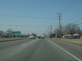
→State Route 161 is an east–west state highway in the state of Ohio. Its western terminus is in Mutual at State Route 29 and its eastern terminus is near Alexandria at State Route 37.
On its path through Department of Transportation regional development districts 5, 6, and 7, State Route 161 passes through Columbus, Ohio's Capital, and a variety of towns including Plain City, Dublin (the home of Wendy's International headquarters), and New Albany (the home of Tween Brands and Abercrombie & Fitch).
Contents
History
1924 – Original route established;[2] Originally ran from Plain City to a junction with State Route 21 5 miles (8.0 km) west of Dublin to serve as a more direct connection between Plain City and Dublin.[3]
- 1931 - Expanded west to include a previously unnumbered section from Mutual to Plain City, and east from 5 miles (8.0 km) west of Dublin to Granville, significantly increasing the length of the route and expanded the number of counties served from 3 to 5.[3]
- 1931 - A large grade separation project allowed 161 to pass underneath the New York Central, Pennsylvania Railroad and Columbus, Delaware and Marion tracks in Worthington (Photos)
- 1938 - Dual designation of cosigned section from 5 miles (8.0 km) west of Dublin to Dublin changed from State Route 31 to U.S. Route 33.[3]
- 1969 - Five-mile section from Dublin west upgraded to freeway.[3]
- 1976 - Section from Interstate 71 to Gould Park upgraded to divided highway.[3]
- 1997-2000 - Bypass around New Albany constructed as freeway from Interstate 270 to a point 2 miles (3.2 km) east of New Albany.[3]
- 2004-2007 - NExT Project begins, modernizing the road from just east of SR-3 to Little Turtle Way. Completion set for end of 2007.[4]
- 2007-2011 - Freeway completed from 2 miles (3.2 km) east of New Albany to State Route 37
Junction list
County Location Mile Destinations Notes Champaign Mutual 0.0  SR 29
SR 29Goshen Township 5.4  SR 559
7.1  SR 4
SR 4Union Irwin 8.5  SR 4
SR 4Chuckery 14.0  SR 38
SR 3814.2  SR 38
SR 38Plain City 20.5  US 42
US 42Madison 21.0  US 42
US 42Union Dublin 26.0  US 33
US 33SR 161 enters (EB) / exits from (WB) US 33 freeway; old US 33 / SR 161 on Post Rd east of this interchange Franklin 27.5 Avery-Muirfield Dr Actually Avery Rd (south) and Muirfield Dr (north) 28.7  I-270
I-270I-270 Exit 17A-B; US 33 / SR 161 is freeway west of here 29.4 Post Road Former routing of SR 161 29.8  SR 745
SR 745's southern terminus; center of "Olde Dublin" 30.0  US 33
US 33  SR 257
SR 257's southern terminus Worthington 34.0  SR 315
35.0  US 23
US 23Columbus 36.3  SR 710
SR 710's western terminus 36.6  I-71
I-71I-71 Exit 117 Minerva Park 39.8  SR 3
SR 3Access via folded diamond / service roads. Columbus 40.9  I-270
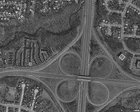
I-270I-270 Exit 30; SR 161 is freeway east of here 41.5 Sunbury Rd Spui and half cloverleaf combined 42.5 Little Turtle Way old SR 161 follows Dublin-Granville Rd east of this interchange 43.8 Hamilton Rd 45.5 New Albany Rd New Albany 46.9  US 62
US 62Licking Beech Rd St. Albans Township 54.2  SR 310
57.5  SR 37
SR 371.000 mi = 1.609 km; 1.000 km = 0.621 mi See also
References
- ^ Ohio Department of Transportation. "Technical Services Straight Line Diagrams". http://www.odotonline.org/techservapps/SLD/default.htm. Retrieved April 30, 2010.
- ^ Explanation of the Ohio State Highway System (The Unofficial Ohio State Highways Web Site) by John Simpson
- ^ a b c d e f Route 161 (The Unofficial Ohio State Highways Web Site) by John Simpson
- ^ Northeast EXpressway Transformation Official Project Site
Categories:- State highways in Ohio
- Transportation in Champaign County, Ohio
- Transportation in Franklin County, Ohio
- Transportation in Licking County, Ohio
- Transportation in Madison County, Ohio
- Transportation in Union County, Ohio
Wikimedia Foundation. 2010.


