- Delaware County, Ohio
-
Delaware County, Ohio 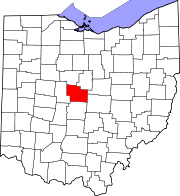
Location in the state of Ohio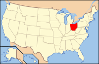
Ohio's location in the U.S.Founded February 10, 1808[1] Named for the Leanape (Delaware) Seat Delaware Largest city Delaware* Area
- Total
- Land
- Water
456 sq mi (1,181 km²)
442 sq mi (1,146 km²)
14 sq mi (35 km²), 2.97%Population
- (2000)
- Density
110,106
249/sq mi (96/km²)Time zone Eastern: UTC-5/-4 Website www.co.delaware.oh.us Footnotes: *Based on population just within the county.[2] Delaware County is a fast-growing suburban county in the state of Ohio, United States, within the Columbus, Ohio Metropolitan Statistical Area. According to the United States Census Bureau's 2004 population estimates, Delaware County's population of 142,503 made it the fastest growing county in Ohio, and the 11th fastest growing in the United States from 2000 to 2004. The Census Bureau published its 2010 population to be 174,214, for a 58.4% increase over the population in 2000 and the fastest growing county in Ohio. Its county seat is the City of Delaware[3], and both are named after the Delaware (Lenape) tribe.[4] The county is expected to see explosive growth in the years to come, as young people that want to escape from the city move to the suburbs of southern Delaware County.[citation needed]
According to Forbes Magazine, Delaware County is the fifth best place in the United States to raise a family and the best place in the state of Ohio to reside. It was home to former U.S. President Rutherford B. Hayes.
Contents
Government
Geography
According to the U.S. Census Bureau, the county has a total area of 456 square miles (1,181.0 km2). 442 square miles (1,144.8 km2) is land and 14 square miles (36.3 km2) is water. The total area is 2.97% water.
Adjacent counties
- Morrow County (north)
- Knox County (northeast)
- Licking County (east)
- Franklin County (south)
- Union County (west)
- Marion County (northwest)
Lakes and rivers
The major rivers of the county are the Scioto River, Olentangy River, Alum Creek, and the Big Walnut Creek. These waterways run from north to south across the county. The Alum Creek Lake[5] and the Delaware Lake[6] are reservoirs created on Alum Creek and the Olentangy River, respectively.
Demographics
Historical populations Census Pop. %± 1810 2,000 — 1820 7,639 282.0% 1830 11,504 50.6% 1840 22,060 91.8% 1850 21,817 −1.1% 1860 23,902 9.6% 1870 25,175 5.3% 1880 27,381 8.8% 1890 27,189 −0.7% 1900 26,401 −2.9% 1910 27,182 3.0% 1920 26,013 −4.3% 1930 26,016 0% 1940 26,780 2.9% 1950 30,278 13.1% 1960 36,107 19.3% 1970 42,908 18.8% 1980 53,840 25.5% 1990 66,929 24.3% 2000 109,989 64.3% 2010 174,214 58.4% Population 1810-2010.[1][7] As of the census[8] of 2000, there were 109,989 people, 39,674 households, and 30,668 families residing in the county. The population density is 249 people per square mile (96/km²). There were 42,374 housing units at an average density of 96 per square mile (37/km²). The racial makeup of the county was 94.25% White, 2.52% Black or African American, 0.14% Native American, 1.54% Asian, 0.03% Pacific Islander, 0.38% from other races, and 1.14% from two or more races. Hispanic or Latino of any race were 1.01% of the population. 26.8% were of German, 11.7% Irish, 11.3% English, 10.7% American and 6.9% Italian ancestry according to Census 2000.
There were 39,674 households out of which 40.10% had children under the age of 18 living with them, 67.70% were married couples living together, 6.70% had a female householder with no husband present, and 22.70% were non-families. 18.10% of all households were made up of individuals and 5.30% had someone living alone who was 65 years of age or older. The average household size was 2.70 and the average family size was 3.09.
In the county the population was spread out with 28.20% under the age of 18, 7.60% from 18 to 24, 32.60% from 25 to 44, 23.30% from 45 to 64, and 8.20% who were 65 years of age or older. The median age was 35 years. For every 100 females there were 98.00 males. For every 100 females age 18 and over, there were 94.90 males.
The median income for a household in the county was $67,258, and the median income for a family was $76,453. Males had a median income of $51,428 versus $33,041 for females. The per capita income for the county was $31,600. About 2.90% of families and 3.80% of the population were below the poverty line, including 4.40% of those under the age of 18 and 4.80% of those 65 and older.
By 2007, the median income for a household and for a family had risen to $80,526 and $94,099 respectively.[9]
According to the United States Census Bureau, Delaware County is the 21st fastest growing county in the United States. Its populated on July 1, 2008 was estimated at 165,026.[7]
Localities
Municipalities
- 1 Mainly in Franklin County, but parts of Columbus extend into both Delaware County and Fairfield County.
- 2 Mainly in Franklin County, but parts of Dublin extend into both Delaware County and Union County.
- 3 Mainly in Franklin County, but a part of Westerville extends into Delaware County.
Other places
 Map of Delaware County, Ohio With Municipal and Township Labels
Townships
School districts
- Northridge Local SD5
- North Union Local SD6
- Olentangy Local School District
- 1 Mainly in Knox County, with portions in Delaware County
- 2 Mainly in Franklin County, with portions in Delaware County and Union County
- 3 Mainly in Marion County, with portions in Delaware County
- 4 Mainly in Morrow County, with portions in Delaware County
- 5 Mainly in Licking County, with portions in Delaware County
- 6 Mainly in Union County, with portions in Delaware County
- 7 Mainly in Franklin County, with portions in Delaware County
Transportation
Highways
Interstate 71 and U.S. Highway 23 pass through the county. Interstate 71 crosses over Alum Creek immediately south of the Alum Creek Lake recreation area.
Airports
The area is served by the Delaware Municipal Airport,[10] which is strategically located to serve the rapidly developing southern Delaware County area and the north portion of the Franklin County and Columbus, Ohio, areas. The airport contains a 5,000 foot runway, flight terminal, lounges, and weather briefing areas. It is home to approximately 80 aircraft and an estimated 40,000 operations take place per year. Several smaller airports are located in the county.
Media
The Delaware Gazette, a morning daily founded in 1885, is the dominant local newspaper in Delaware County, while the Sunbury News, a weekly community newspaper, serves eastern Delaware County and residents of the Big Walnut Local School District. Both publications are owned by Brown Publishing Company.
Additional local print publications include the Delaware News, which is owned by Columbus-based Suburban News Publications, ThisWeek in Delaware, which is owned by the Columbus Dispatch, and the Transcript, the student paper at Ohio Wesleyan University. Local residents often subscribe to out-of-town papers as well; the Columbus Dispatch is popular among many.
Points and activities of Interest
The Ohio Wesleyan University, located in Delaware, Ohio, is one of the top liberal arts colleges in the United States and one of the Five Colleges of Ohio.
Delaware, Ohio is famous for The Little Brown Jug, an internationally famous harness race which is part of the Triple Crown of harness racing.
The Methodist Theological School in Ohio is the Methodist graduate school seminary located between Delaware and Columbus, Ohio. It is often referred to as METHESCO.
Additional notable places include:
- Delaware Municipal Airport [10] Annual Air Fair
- The Germain Amphitheater, formerly the Polaris Amphitheater, closed at the end of 2007[11]
- Alum Creek State Park[5] and the Delaware State Park[6] bring millions of local, national, and international visitors to the area each year.[citation needed]
- The site of the first Ohio State University football game[12]
- The Hamburger Inn at 16 N. Sandusky [13]
- Historical Marker of Rutherford B. Hayes' home on E. William St.[14]
- The Strand Theater.[15]
Notable natives and residents
Notable natives include Rutherford B. Hayes, who was the 19th President of the United States (1877–1881). His wife, Lucy Webb Hayes, was one of the most popular of first ladies. She strongly supported the Temperance, and no alcohol was served in the White House during the Hayes administration. This prompting the press to call her "Lemonade Lucy." She also introduced the Children's Easter egg roll, Egg rolling, on the White House lawn.
Among the famous who have inhabited or been associated with the county are:
- John Purdue [16] founding benefactor of Purdue University
- Norman Vincent Peale
- Horace Newton Allen
- Amos Dolbear
- Clint Evans, childhood TV star
- Charles W. Fairbanks, the 26th Vice President of the United States
- Arthur Flemming
- Reuben James
- Clare Kramer Actress
- Branch Rickey
- Buck Rodgers, professional baseball player
- F.F. Schnitzer, a famous architect who built the Delaware City Hall and other historic structures
- Frank Sherwood Rowland, a Chemistry Nobel laureate
- Ezra Vogel
- Ben Curtis, professional golfer, British Open Champion
See also
References
- ^ a b "Ohio County Profiles: Delaware County" (PDF). Ohio Department of Development. http://www.odod.state.oh.us/research/FILES/S0/Delaware.pdf. Retrieved 2007-04-28.
- ^ "Delaware County data (population)". Ohio State University Extension Data Center. http://www.osuedc.org/profiles/population/places.php?sid=41&fips=39041. Retrieved 2007-05-10.
- ^ "Find a County". National Association of Counties. http://www.naco.org/Counties/Pages/FindACounty.aspx. Retrieved 2011-06-07.
- ^ "Delaware County data". Ohio State University Extension Data Center. http://www.osuedc.org/profiles/profile_entrance.php?fips=39041&sid=0. Retrieved 2007-04-28.[dead link]
- ^ a b "Alum Creek State Park". Archived from the original on 2007-08-23. http://web.archive.org/web/20070823121933/http://www.dnr.state.oh.us/parks/parks/alum.htm. Retrieved 2007-09-12.
- ^ a b "Delaware State Park". http://www.dnr.state.oh.us/PARKS/parks/delaware.htm. Retrieved 2007-09-12.[dead link]
- ^ a b "Population Estimates - County". Census.gov. http://www.census.gov/popest/counties/CO-EST2008-08.html. Retrieved 2010-07-22.
- ^ "American FactFinder". United States Census Bureau. http://factfinder.census.gov. Retrieved 2008-01-31.
- ^ "Delaware County, Ohio - Fact Sheet - American FactFinder". Factfinder.census.gov. http://factfinder.census.gov/servlet/ACSSAFFFacts?_event=Search&geo_id=05000US18057&_geoContext=01000US%7C04000US18%7C05000US18057&_street=&_county=delaware+county&_cityTown=delaware+county&_state=04000US39&_zip=&_lang=en&_sse=on&ActiveGeoDiv=geoSelect&_useEV=&pctxt=fph&pgsl=050&_submenuId=factsheet_1&ds_name=ACS_2007_3YR_SAFF&_ci_nbr=null&qr_name=null®=null%3Anull&_keyword=&_industry=. Retrieved 2010-07-22.
- ^ a b "Delaware Airport". Archived from the original on 2007-08-26. http://web.archive.org/web/20070826155611/http://www.delawareohio.net/departments/airport. Retrieved 2007-09-12.
- ^ "End of the Road for Germain Amphitheater?". http://www.dispatch.com/live/content/local_news/stories/2007/09/16/1_GERMAIN_KEITH.ART_ART_09-16-07_A1_0P7TPJ2.html. Retrieved 2008-05-19.
- ^ http://news.owu.edu/owuOsu.html
- ^ http://www.delawareohrealestate.com/2010/09/05/delaware-ohio-landmark-adds-hours/
- ^ http://drc.owu.edu/handle/2374.OWES/759
- ^ http://www.thestrandtheatre.net/
- ^ "Library of Congress Online Catalog". http://catalog.loc.gov/cgi-bin/Pwebrecon.cgi?v3=1&DB=local&CMD=010a+2007001849&CNT=10+records+per+page. Retrieved 2007-09-12.
Further reading
- Buckingham, Ray, E. Delaware County Then and Now, History Book, Inc., 1976
- History of Delaware County and Ohio. Chicago: O. L. Baskin & Co., 1880
- Lytle, A. R., History of Delaware County Ohio, Delaware, 1908
- Memorial Record of the Counties of Delaware, union and Morrow, Ohio, Chicago, The Lewis Publishing Company, 1895
External links

Marion County Morrow County Knox County Union County 
Licking County  Delaware County, Ohio

Franklin County Municipalities and communities of Delaware County, Ohio Cities Columbus‡ | Delaware | Dublin‡ | Powell | Westerville‡

Villages Ashley | Galena | Ostrander | Shawnee Hills | Sunbury
Townships Unincorporated
communitiesAfrica | Kilbourne | Lewis Center | Radnor
Ghost town Carpenter's Mill
Footnotes ‡This populated place also has portions in an adjacent county or counties
Categories:- Ohio counties
- Delaware County, Ohio
- 1808 establishments in the United States
- Populated places established in 1808
- Columbus, Ohio metropolitan area


Wikimedia Foundation. 2010.