- Olentangy River
-
Olentangy River 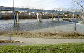
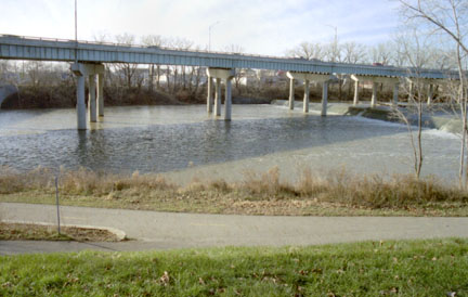
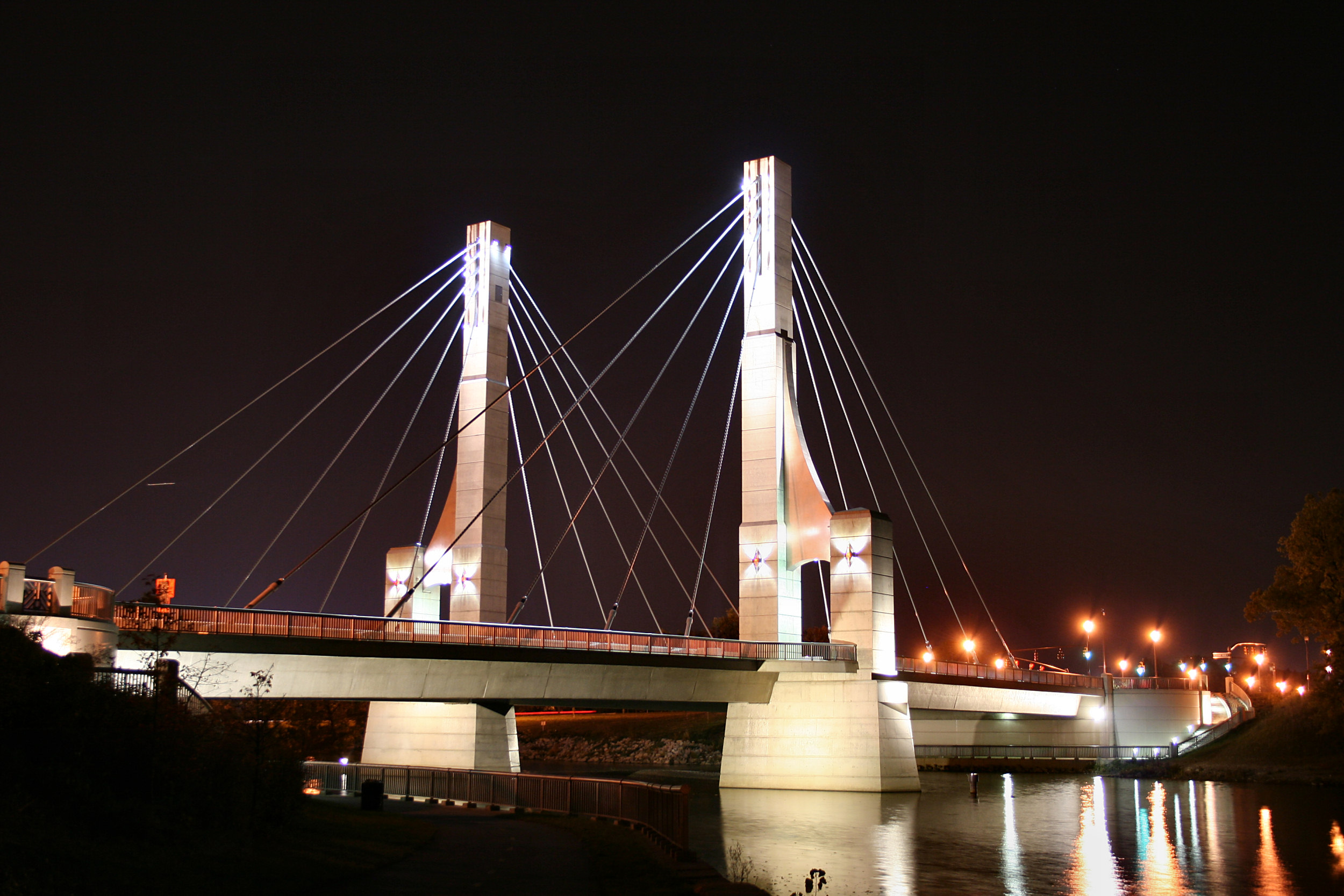
State Route 315 passing over the Olentangy in Columbus in 2002Origin ~ 2 mi (3.2 km) NorthEast of Galion Mouth Scioto River at Columbus Source elevation ~ 1,190 ft (363 m) [1] Mouth elevation ~ 710 ft (216 m) [2] Basin area 543 mi² (1,046 km²) [3] 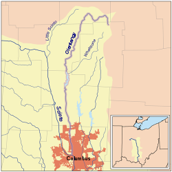 Map of Olentangy River highlighted within the Scioto River watershed.
The Olentangy River (
 /oʊlənˈtændʒi/) is a 97-mile-long (156 km)[4] tributary of the Scioto River in Ohio.
It was originally called keenhongsheconsepung, a Delaware word literally translated as "stone for your knife stream", based on the shale found along its shores. Early settlers to the region translated this into "Whetstone River". In 1833, the Ohio General Assembly passed legislation intending to restore the original Native American names to some Ohio waterways, but mistakenly gave Whetstone River the name "Olentangy"—Delaware for "river of the red face paint"—which had actually belonged to what is now known as Big Darby Creek.
The Olentangy River rises in Crawford County approximately 2 mi (3.2 km) northeast of Galion, flowing through Galion and northwest towards Bucyrus, where it then turns south and flows through the communities of Delaware, Powell, Worthington, and the campus of the Ohio State University, before joining with the Scioto River in downtown Columbus.
The Delaware State Park Reservoir, also known as Delaware Lake, was constructed along the Olentangy River in 1951. The reservoir is located 5 miles north of the city of Delaware, and was built by the U.S. Army Corps of Engineers for flood control purposes. On January 13, 2005, Delaware Dam was nearly overtopped. The water level came within less than 1 foot of requiring the main spill gates to be opened before it began dropping.[5]
The Olentangy River is the primary source of drinking water for much of Delaware County. Both the City of Delaware and Del-Co water company, the supplier of drinking water to most of rural Delaware County, draw the majority of their water supplies from the Olentangy system.
Twenty-two miles of the Olentangy have been designated a State Scenic River by the Ohio Department of Natural Resources, Division of Natural Areas & Preserves.[6]
Variant names
According to the Geographic Names Information System, the Olentangy River has also been known as: [7]
- Keenhongsheconsepung
- Oleutangy
- Whetstone Creek
- Whetstone River
- Whitestone Creek
References
- ^ U.S. Geological Survey. Blooming Grove quadrangle, Ohio. 1:24,000. 7.5 Minute Series. Washington D.C.: USGS, 1988.
- ^ U.S. Geological Survey. Southwest Columbus quadrangle, Ohio. 1:24,000. 7.5 Minute Series. Washington D.C.: USGS, 1995.
- ^ "Map of Ohio watersheds". http://www.dnr.state.oh.us/water/watersheds/Basins72PDI_40x40_OnScreen.gif.
- ^ "The National Map". U.S. Geological Survey. http://viewer.nationalmap.gov/viewer/. Retrieved Feb. 14, 2011.
- ^ "Delaware Dam nearly overtopped on January 13, 2005". http://www.tallgeorge.com/Ohio%20Flood%202005.htm#Delaware%20Dam%20Pictures.
- ^ "Olentangy State Scenic River". http://www.dnr.state.oh.us/dnap/sr/olentang.htm.
- ^ U.S. Geological Survey Geographic Names Information System: Olentangy River
External links
- Friends of the Lower Olentangy Watershed
- Delaware Dam level and outflow graph
- Olentangy River Level Gauge at Worthington, OH
Protected areas of Ohio Federal National parksCedar Point • Ottawa • West Sister IslandState Adams Lake • Alum Creek • A. W. Marion • Barkcamp • Beaver Creek • Blue Rock • Buck Creek • Buckeye Lake • Burr Oak • Caesar Creek • Catawba Island • Cleveland Lakefront • Cowan Lake • Deer Creek • Delaware • Dillon • East Fork • East Harbor • Findley • Forked Run • Geneva • Grand Lake St. Marys • Great Seal • Guilford Lake • Harrison Lake • Headlands Beach • Hocking Hills • Hueston Woods • Independence Dam • Indian Lake • Jackson Lake • Jefferson Lake • John Bryan • Kelleys Island • Kiser Lake • Lake Alma • Lake Hope • Lake Logan • Lake Loramie • Lake Milton • Lake White • Little Miami • Madison Lake • Malabar Farm • Marblehead Lighthouse • Mary Jane Thurston • Middle Bass Island • Maumee Bay • Mohican • Mosquito Lake • Mt. Gilead • Muskingum River • Nelson Kennedy Ledges • Paint Creek • Pike Lake • Portage Lakes • Punderson • Pymatuning • Quail Hollow • Rocky Fork • Salt Fork • Scioto Trail • Shawnee • South Bass Island • Stonelick • Strouds Run • Sycamore • Tar Hollow • Tinkers Creek • Van Buren • West Branch • Wingfoot Lake • Wolf Run
Beaver Creek • Blue Rock • Brush Creek • Dean • Fernwood • Gifford • Harrison • Hocking • Maumee • Mohican-Memorial • Perry • Pike • Richland Furnace • Scioto Trail • Shade River • Shawnee • Sunfish Creek • Tar Hollow • Yellow Creek • Zaleski
State nature
preservesAcadia Cliffs • Adams Lake Prairie • Audubon Islands • Augusta-Anne Olsen • Aurora Sanctuary • Baker Woods • Evans Beck Memorial • Betsch Fen • Bigelow Cemetery • Blackhand Gorge • Bonnet Pond • Boord • Brown's Lake Bog • Burton Wetlands • Caesar Creek Gorge • Lou Campbell • Carmean Woods • Cedar Bog • Chaparral Prairie • Christmas Rocks • Clear Creek • Clear Fork Gorge • Clifton Gorge • Howard Collier • Compass Plant Prairie • Conkle's Hollow • Copperrider-Kent Bog • Crabill Fen • Cranberry Bog • Crane Hollow • Crooked Run • Culberson Woods • Davey Woods • Davis Memorial • Marie J. Desonier • Drew Woods • Dupont Marsh • Eagle Creek • Emerald Hills • Erie Sand Barrens • Etawah Woods • Flatiron Lake Bog • Fowler Woods • Frame Lake Fen • Gahanna Woods • Gallagher/Springfield Fen • Goll Woods • Goode Prairie • Gott Fen • Greenbelt • Greenville Falls • Gross Memorial Woods • Hatch-Otis • Halls Creek • Headlands Dunes • Hueston Woods • Hutchins (Highland) • Irwin Prairie • Jackson Bog • Johnson Ridge • Johnson Woods • Karlo Fen • Kendrick Woods • Kessler Swamp • Kiser Lake Wetlands • Kitty Todd • Knox Woods • Kyle Woods • Ladd Natural Bridge • Lake Katharine • Lakeside Daisy • Lawrence Woods • Little Rocky Hollow • Mantua Bog • Marsh Wetlands • McCracken Fen • Mentor Marsh • Milford Center Railroad Prairie • Miller • Morris Woods • Mud Lake Bog • Myersville • Newberry • North Pond • North Shore Alvar • Novak Sanctuary • Old Woman Creek • Owens/Liberty Fen • Pallister • Pickerington Ponds • Portage Lakes Wetland • Prairie Road Fen • William C. McCoy • Raven Rock • Rhododendeon Cove • Rockbridge • Rome • Rothenbuhler Woods • Saltpetre Cave • Sears Woods • Seymour Woods • Shallenberger • Sharon Woods Gorge • Sheepskin Hollow • Sheick Hollow • Sheldon Marsh • Shoemaker • Siegenthaler-Kaestner Esker • Smith Cemetery • Spring Beauty Dell • Spring Brook Sanctuary • Springville Marsh • Stage's Pond • Strait Creek Prairie • Stratford Woods • Swamp Cottonwood • Edward Thomas • Tinker's Creek • Travertine Fen • Triangle Lake Bog • Trillium Trails • Walter Tucker • Tummonds • Warder-Perkins • Whipple • White Pine Bog Forest • Zimmermand Prairie
State
scenic riversBig Darby Creek • Chagrin River • Conneaut Creek • Cuyahoga River • Grand River • Greenville Creek • Kokosing River • Little Beaver Creek • Little Darby Creek • Little Miami River • Maumee River • Mohican River • Olentangy River • Sandusky River • Stillwater River
Regional Ashtabula County Metroparks • Cleveland Metroparks • Columbus Metro Parks • Erie MetroParks • Five Rivers MetroParks • Geauga Park District • Hamilton County Park District • Johnny Appleseed Metro Parks • Lake Metroparks • Lorain County Metro Parks • Metroparks of Butler County • Metro Parks, Serving Summit County • Metroparks of the Toledo Area • Mill Creek MetroParks • Trumbull County MetroParks •
Categories:- Geography of Columbus, Ohio
- Rivers of Ohio
- Geography of Delaware County, Ohio
- Geography of Crawford County, Ohio
- Geography of Franklin County, Ohio

Wikimedia Foundation. 2010.