- Chagrin River
-
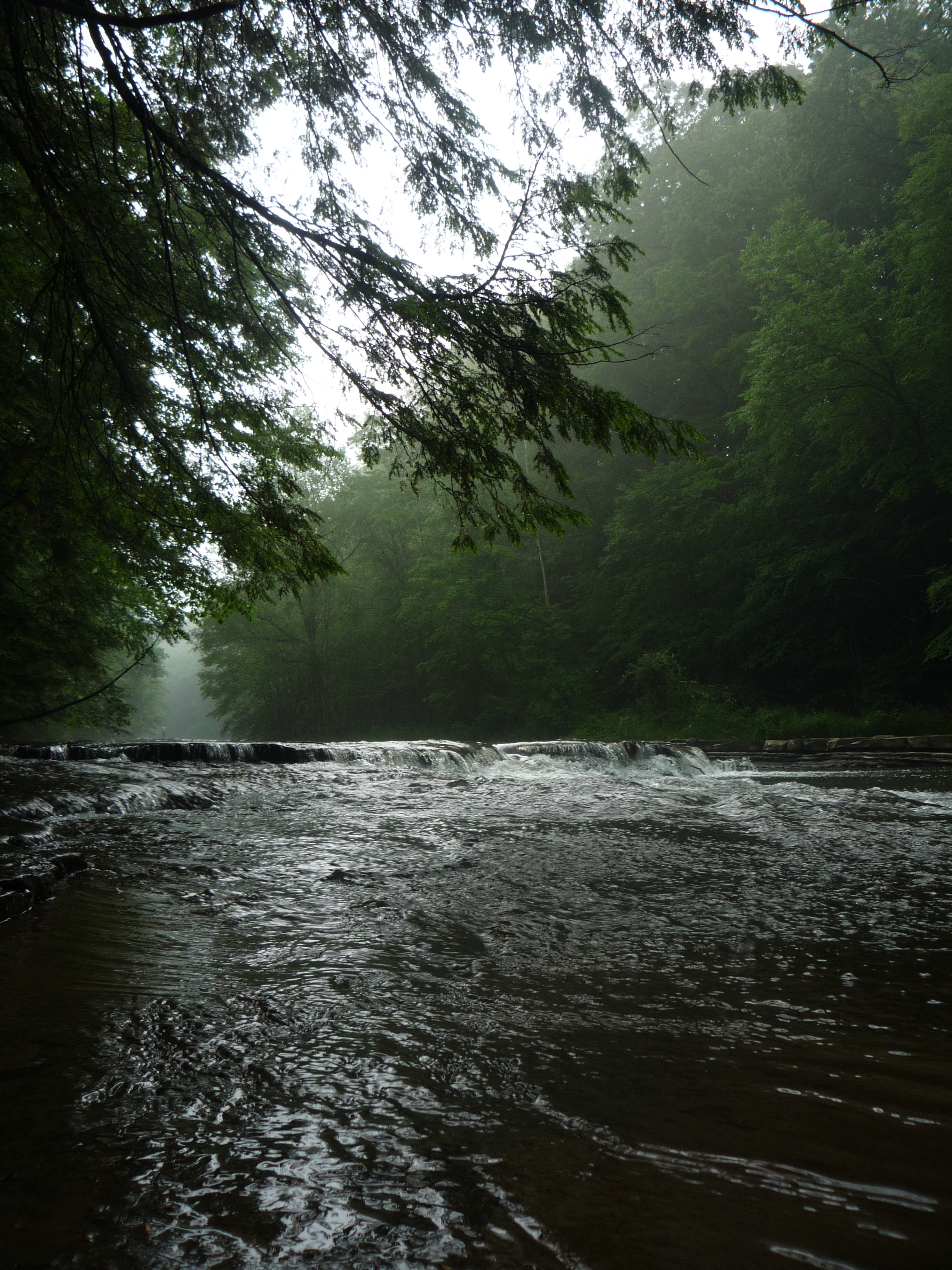
Chagrin River (Shagarin or "clear water") River 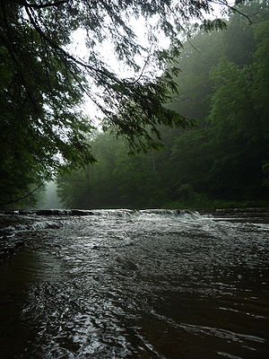 Chagrin River from South Chagrin Reservation
Country United States State Ohio Source Bass Lake, Ohio - location Munson Township, Northeast Ohio Mouth Chagrin Harbor - location Eastlake, Lake County, OH The Chagrin River is located in Northeast Ohio.[1] The river has two branches, the Aurora Branch and East Branch. Its name is believed to stem from what the local Erie Indians used to call it, the "Sha-ga-rin", or "Clear Water".[2] Given the clear flowing nature of especially the East Branch of the river, this name is appropriate. Another hypothesis attributes the name of the river to a corruption and anglicization of the name of a French trader, Sieur de Saguin.[3][4] The Chagrin River runs through suburban areas of Greater Cleveland in Cuyahoga, Geauga, and Portage counties, transects two Cleveland Metroparks reservations, and then meanders into nearby Lake County before emptying into Lake Erie.
The East Branch[5] begins in Geauga County, flows north then west through Lake County, largely in Kirtland, and Kirtland Hills, In these communities the East Branch transects the Holden Arboretum, before intersecting the main in Willoughby.
The Aurora Branch[6] begins in northwest Portage County, flowing northwest through Aurora and portions of Geauga and Cuyahoga Counties, intersecting the main branch west of Chagrin Falls.
The Chagrin River was designated as a State Scenic River in 1979.
Contents
Natural history
Along its banks and tributaries Berea sandstone, Bedford shale, Cleveland shale, and Chagrin shale bedrock, are exposed in layers. The river itself was cut through the Allegheny Plateau as glaciers receded in the area at the end of the Wisconsin glaciation.
The lowest visible bedrock is Chagrin shale. Named for the river itself and easily found in the river valley. Chagrin shale, is blue gray in color, an offshore alluvial, silt shale of the Devonian period. This layer is found below about 800 feet (240 m) msl.
The next layer is Cleveland shale. This is a black shale that is an important source of local fossils. Cleveland Shale is found in the Chagrin River valley between 800 and 900 feet (270 m) msl.
Bedford Shale is found above the Cleveland Shale layer. This material marks the uncertain transition between the Devonian and Pennsylvanian periods in the region and is also an important source of local fossils. This layer is found in the ravines that carry tributaries of the Chagrin River . Bedford shale is a sand shale and is characterized by its roughly 90° cleavage pattern. Pieces of Bedford shale can look as if they were cut by human hands and are found up to about 950 feet (290 m) msl.
Berea sandstone is found from around 950 feet (290 m) msl to roughly 1,070 feet (330 m) msl. Berea sandstone, is an important local building material. In the nineteenth century it was quarried from the base of Gildersleeve Mountain (in the East Branch watershed). This material was used to build Kirtland Temple and other local structures. Berea sandstone is still used as a local building material
According to the Ohio Department of National Resources, more than 49 species of fish and 90 bird species live in the Chagrin River watershed, including the American brook lamprey, which is relatively rare in Ohio.
Sporting
The Aurora branch of the Chagrin River is a class III-IV of whitewater, according to the American Whitewater Association. On the other hand, the Daniels Park section is rated a class I.
ESPN Outdoors recommends the Chagrin River for fishing,[7] especially for finding steelhead fish. The Daniels Park Dam, a small lowhead dam, was their favorite spot. On December 31, 2004, the Daniels Park Dam failed due to excess pressure from ice and water.[8]
Channelization
In 2007, in violation of both state law and Federal Regulations, the 8,700 feet (2,700 m) of the East Branch of the river was channelized and diked to prevent flooding on agricultural land owned by the Village of Kirtland Hills. This activity was conducted by local developer Jerome Osborne who leases the land from the village. Both the village and Osborne have been cited for this illegal activity.[9] This activity both threatened the riparian floodplain in the area of disruption, and increases the likelihood and severity of flooding in downstream the communities of Willoughby and Eastlake. As of September 2007, a plan was being developed to restore the East Branch to its original condition, and further action against the cited parties is being considered.[9]
See also
- List of Ohio rivers
References
- ^ U.S. Geological Survey Geographic Names Information System: Chagrin River
- ^ Chagrin State Scenic River, Ohio Department of Natural Resources. Accessed 2007-09-08.
- ^ "Chagrin River." The Encyclopedia of Cleveland History. July 10, 1997. Accessed February 9, 2007.
- ^ "Chagrin Falls, an Ohio Village History", ISBN 0975305107, pub. 2005 by The Chagrin Falls Historical Society
- ^ U.S. Geological Survey Geographic Names Information System: East Branch Chagrin River
- ^ U.S. Geological Survey Geographic Names Information System: Aurora Branch
- ^ Landahl, Dave. Chagrin River's dams are best for metalheads, Fishing and Hunting News, 2003
- ^ Frischkorn, Jeffrey L. (2005-01-03). "Dam Breaks". The News-Herald. http://www.news-herald.com/articles/2005/01/03/top%20stories/13667864.txt. Retrieved 2009-02-03.
- ^ a b O'Donnell, Patrick (2007-09-01). "Osborne cited for dredging river". The Plain Dealer. http://www.cleveland.com/whateverhappened/plaindealer/index.ssf?/whateverhappened/more/osborne2.html. Retrieved 2009-02-03.
External links
Protected areas of Ohio Federal National parksCedar Point • Ottawa • West Sister IslandState Adams Lake • Alum Creek • A. W. Marion • Barkcamp • Beaver Creek • Blue Rock • Buck Creek • Buckeye Lake • Burr Oak • Caesar Creek • Catawba Island • Cleveland Lakefront • Cowan Lake • Deer Creek • Delaware • Dillon • East Fork • East Harbor • Findley • Forked Run • Geneva • Grand Lake St. Marys • Great Seal • Guilford Lake • Harrison Lake • Headlands Beach • Hocking Hills • Hueston Woods • Independence Dam • Indian Lake • Jackson Lake • Jefferson Lake • John Bryan • Kelleys Island • Kiser Lake • Lake Alma • Lake Hope • Lake Logan • Lake Loramie • Lake Milton • Lake White • Little Miami • Madison Lake • Malabar Farm • Marblehead Lighthouse • Mary Jane Thurston • Middle Bass Island • Maumee Bay • Mohican • Mosquito Lake • Mt. Gilead • Muskingum River • Nelson Kennedy Ledges • Paint Creek • Pike Lake • Portage Lakes • Punderson • Pymatuning • Quail Hollow • Rocky Fork • Salt Fork • Scioto Trail • Shawnee • South Bass Island • Stonelick • Strouds Run • Sycamore • Tar Hollow • Tinkers Creek • Van Buren • West Branch • Wingfoot Lake • Wolf Run
Beaver Creek • Blue Rock • Brush Creek • Dean • Fernwood • Gifford • Harrison • Hocking • Maumee • Mohican-Memorial • Perry • Pike • Richland Furnace • Scioto Trail • Shade River • Shawnee • Sunfish Creek • Tar Hollow • Yellow Creek • Zaleski
State nature
preservesAcadia Cliffs • Adams Lake Prairie • Audubon Islands • Augusta-Anne Olsen • Aurora Sanctuary • Baker Woods • Evans Beck Memorial • Betsch Fen • Bigelow Cemetery • Blackhand Gorge • Bonnet Pond • Boord • Brown's Lake Bog • Burton Wetlands • Caesar Creek Gorge • Lou Campbell • Carmean Woods • Cedar Bog • Chaparral Prairie • Christmas Rocks • Clear Creek • Clear Fork Gorge • Clifton Gorge • Howard Collier • Compass Plant Prairie • Conkle's Hollow • Copperrider-Kent Bog • Crabill Fen • Cranberry Bog • Crane Hollow • Crooked Run • Culberson Woods • Davey Woods • Davis Memorial • Marie J. Desonier • Drew Woods • Dupont Marsh • Eagle Creek • Emerald Hills • Erie Sand Barrens • Etawah Woods • Flatiron Lake Bog • Fowler Woods • Frame Lake Fen • Gahanna Woods • Gallagher/Springfield Fen • Goll Woods • Goode Prairie • Gott Fen • Greenbelt • Greenville Falls • Gross Memorial Woods • Hatch-Otis • Halls Creek • Headlands Dunes • Hueston Woods • Hutchins (Highland) • Irwin Prairie • Jackson Bog • Johnson Ridge • Johnson Woods • Karlo Fen • Kendrick Woods • Kessler Swamp • Kiser Lake Wetlands • Kitty Todd • Knox Woods • Kyle Woods • Ladd Natural Bridge • Lake Katharine • Lakeside Daisy • Lawrence Woods • Little Rocky Hollow • Mantua Bog • Marsh Wetlands • McCracken Fen • Mentor Marsh • Milford Center Railroad Prairie • Miller • Morris Woods • Mud Lake Bog • Myersville • Newberry • North Pond • North Shore Alvar • Novak Sanctuary • Old Woman Creek • Owens/Liberty Fen • Pallister • Pickerington Ponds • Portage Lakes Wetland • Prairie Road Fen • William C. McCoy • Raven Rock • Rhododendeon Cove • Rockbridge • Rome • Rothenbuhler Woods • Saltpetre Cave • Sears Woods • Seymour Woods • Shallenberger • Sharon Woods Gorge • Sheepskin Hollow • Sheick Hollow • Sheldon Marsh • Shoemaker • Siegenthaler-Kaestner Esker • Smith Cemetery • Spring Beauty Dell • Spring Brook Sanctuary • Springville Marsh • Stage's Pond • Strait Creek Prairie • Stratford Woods • Swamp Cottonwood • Edward Thomas • Tinker's Creek • Travertine Fen • Triangle Lake Bog • Trillium Trails • Walter Tucker • Tummonds • Warder-Perkins • Whipple • White Pine Bog Forest • Zimmermand Prairie
State
scenic riversBig Darby Creek • Chagrin River • Conneaut Creek • Cuyahoga River • Grand River • Greenville Creek • Kokosing River • Little Beaver Creek • Little Darby Creek • Little Miami River • Maumee River • Mohican River • Olentangy River • Sandusky River • Stillwater River
Regional Ashtabula County Metroparks • Cleveland Metroparks • Columbus Metro Parks • Erie MetroParks • Five Rivers MetroParks • Geauga Park District • Hamilton County Park District • Johnny Appleseed Metro Parks • Lake Metroparks • Lorain County Metro Parks • Metroparks of Butler County • Metro Parks, Serving Summit County • Metroparks of the Toledo Area • Mill Creek MetroParks • Trumbull County MetroParks •
Ohio Department of Natural Resources (web) Categories:- Rivers of Ohio
- Greater Cleveland
- Tributaries of Lake Erie
- Geography of Cuyahoga County, Ohio
- Geography of Geauga County, Ohio
- Geography of Lake County, Ohio
- Geography of Portage County, Ohio
Wikimedia Foundation. 2010.