- Cowan Lake State Park
-
For the Pennsylvania State Park, see Cowans Gap State Park.
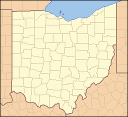
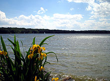
Cowan Lake State Park Ohio State Park Natural Monument (IUCN III) Sunset on Cowan LakeNamed for: Cowan Lake Country United States State Ohio County Clinton Location [1] - coordinates 39°23′20″N 83°54′18″W / 39.38889°N 83.905°WCoordinates: 39°23′20″N 83°54′18″W / 39.38889°N 83.905°W - elevation 971 ft (296 m) [1] Area 1,775 acres (718 ha) Founded 1968 Managed by Ohio Department of Natural Resources Division of Parks and Recreation Website : Cowan Lake State Park Cowan Lake State Park is a 1,775-acre (718 ha) Ohio state park in Clinton County, Ohio, in the United States. It is operated by the Ohio Department of Natural Resources.[2] Cowan Lake State Park is open for year-round recreation and is known for a variety of birds that attract birdwatching enthuiasts to the park in southwestern Ohio.
Contents
History
Native Americans
What is now Cowan Lake State Park was once home to the Miami and Shawnee Indians. The Battle of Fallen Timbers in 1794 resulted in the opening of the land to settlement by Anglo-Americans.
Early settlers
The first settler in the area was William Smalley. Smalley had previously been held captive by the Lenape. His language skills and knowledge of the land, left him ideally suited to be among the pioneers in settling what became Clinton County.[2]
William Smalley was born in 1759 or 1760 in New Jersey. The Smalley family moved to Western Pennsylvania in 1764 near Pittsburgh. At the age of 16 Smalley was abducted by a band of Lenape Indians while he was standing guard over the pioneer farmer's fields near Fort Pitt.[3]
While held prisoner witnessed the death of his father and many other settlers at the hands of the Lenape. Smalley was taken to an Indian village along the Maumee River. He lived with the Lenape in for five years and became accustomed to the ways of the Lenape, learning both their language and how to survive in the forests of Ohio. He later served an envoy for the Lenape with French and English fur traders. Following a successful negotiations with a group of traders, Smalley was released from the custody of the Lenape in about 1781.[3]
Soon after his release Smalley got married and settled near Cincinnati. He served as a scout and guide for various U.S. Army generals in the Ohio Territory. While serving in this capacity he was once again captured by the Lenape. Smalley was able to escape after a year and seven months. He returned to his family for a short time before being hired by General Anthony Wayne to serve as a guide and interpreter. Smalley remained in the Army with General Wayne until after the Treaty of Greenville when he was discharged.[3]
Smalley settled in the area of what is now Cowan Lake State Park in 1797. He and his brother were the first white settlers in the area and cleared many acres of land for a farm.[2] They built a sawmill, a grist mill and a small distillery. Smalley lived in the area with his family until he died in 1840.[3]
Cowan Lake and Cowan Lake State Park
Cowan Creek named for a pioneer surveyor, John Cowan was dammed in 1950. The creation of Cowan Lake lead to the establishment of Cown Lake State Park in 1968.[2] Its surface area is 692 acres (2.80 km2)[4]
Geology and ecology
Cowan Lake State Park lies atop limestone that is laden with fossils. The fossilized plants and animals attract attention from both professional and amateur paleontologists. Much of what is now Ohio was covered by massive inland seas and lakes such as Lake Maumee. As the Appalachian Mountains were formed, the limestone that was once the sea floor was pushed to the surface.[2]
Cowan Lake is surrounded by a deciduous forest of beech and maple trees.[2] The combination of lake and forest makes the park a destination for birders, who can observe Mallards, American Wigeons, mergansers, Great Blue and Green-backed herons, Killdeer, Eastern Bluebirds, catbirds, and many other species of bird.[2][5] The most common mammals at the park are groundhogs, skunks, raccoons, and oppossums.[2]
Other plant life found at the park include bloodroot, wild ginger, and American Lotus. The lotus is a water lily that thrives in the shallow waters of Cowan Lake. The leaves of the plant are quite large with yellow flowers.[2]
Recreation
Cowan Lake State Park is open for year round recreation. There are six picnic areas and two pavilions. Cowan Lake State Park features six hiking trails and one trail that is open to mountain bikes. [2]
There are 27 cottages that are heated and have air-conditioning. The cottages are fully furnished and linens are provided. There are 237 electric camp-sites and 17 sites without electricity. A centrally located bathhouse was showers, flush toilets and a sanitary dump station for RVs.[2]
Cowan Lake is open for boating, swimming and fishing. Motorboats have a 10 horsepower limit. A marina on the southern shore of the lake provides rental boats, canoes and motors, with four launch ramps, fuel and dock rentals. Common game fish in Cowan Lake are muskellunge, crappie, largemouth bass and bluegill. There is a handicapped accessible fishing pier at the Pine Tree picnic area. A public swimming beach is on the southern shore of the lake. The 1,000 foot beach is located near the campers bathhouse and also has a snack bar.[2]
References
- ^ a b "Cowan Lake State Park". Geographic Names Information System. United States Geological Survey. 1979-7-12. http://geonames.usgs.gov/pls/gnispublic/f?p=gnispq:3:::NO::P3_FID:1061002. Retrieved 2009-07-11.
- ^ a b c d e f g h i j k l "Cowan Lake State Park". Ohio Department of Natural Resources. http://www.dnr.state.oh.us/parks/tabid/722/Default.aspx. Retrieved 2009-07-22.
- ^ a b c d "Sketch of William Smalley". W.H. Beers & Co.. 1882. http://home.earthlink.net/~wrj2/data/pg9.html. Retrieved 2009-07-24.
- ^ Cowan Lake Fishing Map with area description
- ^ Tom Thomson (1994). Birding in Ohio. Indiana University Press. pp. 169–170. ISBN 0253208742. http://books.google.com/books?id=JQL2vfUOnFsC.
External links
Protected areas of Ohio Federal National parksCedar Point • Ottawa • West Sister IslandState Adams Lake • Alum Creek • A. W. Marion • Barkcamp • Beaver Creek • Blue Rock • Buck Creek • Buckeye Lake • Burr Oak • Caesar Creek • Catawba Island • Cleveland Lakefront • Cowan Lake • Deer Creek • Delaware • Dillon • East Fork • East Harbor • Findley • Forked Run • Geneva • Grand Lake St. Marys • Great Seal • Guilford Lake • Harrison Lake • Headlands Beach • Hocking Hills • Hueston Woods • Independence Dam • Indian Lake • Jackson Lake • Jefferson Lake • John Bryan • Kelleys Island • Kiser Lake • Lake Alma • Lake Hope • Lake Logan • Lake Loramie • Lake Milton • Lake White • Little Miami • Madison Lake • Malabar Farm • Marblehead Lighthouse • Mary Jane Thurston • Middle Bass Island • Maumee Bay • Mohican • Mosquito Lake • Mt. Gilead • Muskingum River • Nelson Kennedy Ledges • Paint Creek • Pike Lake • Portage Lakes • Punderson • Pymatuning • Quail Hollow • Rocky Fork • Salt Fork • Scioto Trail • Shawnee • South Bass Island • Stonelick • Strouds Run • Sycamore • Tar Hollow • Tinkers Creek • Van Buren • West Branch • Wingfoot Lake • Wolf Run
Beaver Creek • Blue Rock • Brush Creek • Dean • Fernwood • Gifford • Harrison • Hocking • Maumee • Mohican-Memorial • Perry • Pike • Richland Furnace • Scioto Trail • Shade River • Shawnee • Sunfish Creek • Tar Hollow • Yellow Creek • Zaleski
State nature
preservesAcadia Cliffs • Adams Lake Prairie • Audubon Islands • Augusta-Anne Olsen • Aurora Sanctuary • Baker Woods • Evans Beck Memorial • Betsch Fen • Bigelow Cemetery • Blackhand Gorge • Bonnet Pond • Boord • Brown's Lake Bog • Burton Wetlands • Caesar Creek Gorge • Lou Campbell • Carmean Woods • Cedar Bog • Chaparral Prairie • Christmas Rocks • Clear Creek • Clear Fork Gorge • Clifton Gorge • Howard Collier • Compass Plant Prairie • Conkle's Hollow • Copperrider-Kent Bog • Crabill Fen • Cranberry Bog • Crane Hollow • Crooked Run • Culberson Woods • Davey Woods • Davis Memorial • Marie J. Desonier • Drew Woods • Dupont Marsh • Eagle Creek • Emerald Hills • Erie Sand Barrens • Etawah Woods • Flatiron Lake Bog • Fowler Woods • Frame Lake Fen • Gahanna Woods • Gallagher/Springfield Fen • Goll Woods • Goode Prairie • Gott Fen • Greenbelt • Greenville Falls • Gross Memorial Woods • Hatch-Otis • Halls Creek • Headlands Dunes • Hueston Woods • Hutchins (Highland) • Irwin Prairie • Jackson Bog • Johnson Ridge • Johnson Woods • Karlo Fen • Kendrick Woods • Kessler Swamp • Kiser Lake Wetlands • Kitty Todd • Knox Woods • Kyle Woods • Ladd Natural Bridge • Lake Katharine • Lakeside Daisy • Lawrence Woods • Little Rocky Hollow • Mantua Bog • Marsh Wetlands • McCracken Fen • Mentor Marsh • Milford Center Railroad Prairie • Miller • Morris Woods • Mud Lake Bog • Myersville • Newberry • North Pond • North Shore Alvar • Novak Sanctuary • Old Woman Creek • Owens/Liberty Fen • Pallister • Pickerington Ponds • Portage Lakes Wetland • Prairie Road Fen • William C. McCoy • Raven Rock • Rhododendeon Cove • Rockbridge • Rome • Rothenbuhler Woods • Saltpetre Cave • Sears Woods • Seymour Woods • Shallenberger • Sharon Woods Gorge • Sheepskin Hollow • Sheick Hollow • Sheldon Marsh • Shoemaker • Siegenthaler-Kaestner Esker • Smith Cemetery • Spring Beauty Dell • Spring Brook Sanctuary • Springville Marsh • Stage's Pond • Strait Creek Prairie • Stratford Woods • Swamp Cottonwood • Edward Thomas • Tinker's Creek • Travertine Fen • Triangle Lake Bog • Trillium Trails • Walter Tucker • Tummonds • Warder-Perkins • Whipple • White Pine Bog Forest • Zimmermand Prairie
State
scenic riversBig Darby Creek • Chagrin River • Conneaut Creek • Cuyahoga River • Grand River • Greenville Creek • Kokosing River • Little Beaver Creek • Little Darby Creek • Little Miami River • Maumee River • Mohican River • Olentangy River • Sandusky River • Stillwater River
Regional Ashtabula County Metroparks • Cleveland Metroparks • Columbus Metro Parks • Erie MetroParks • Five Rivers MetroParks • Geauga Park District • Hamilton County Park District • Johnny Appleseed Metro Parks • Lake Metroparks • Lorain County Metro Parks • Metroparks of Butler County • Metro Parks, Serving Summit County • Metroparks of the Toledo Area • Mill Creek MetroParks • Trumbull County MetroParks •
Categories:- Protected areas of Clinton County, Ohio
- Lakes of Ohio
- Ohio state parks
- Protected areas established in 1968
Wikimedia Foundation. 2010.


