- Hocking Hills State Park
Infobox_protected_area | name = Hocking Hills State Park
iucn_category = V
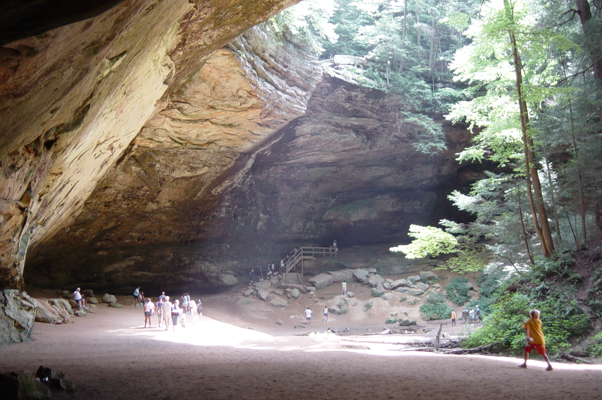
caption = The Ash Cave complex in Hocking Hills State Park nearLogan, Ohio .
locator_x =
locator_y =
location =Hocking County, Ohio , USA
nearest_city =Logan, Ohio
lat_degrees = 39
lat_minutes = 25
lat_seconds = 50
lat_direction = N
long_degrees = 82
long_minutes = 32
long_seconds = 20
long_direction = W
area = Land: 2,356 acres
Water: 17 acres
established = 1924
visitation_num =
visitation_year = 2004
governing_body =Ohio Department of Natural Resources Hocking Hills State Park is a non-contiguous
state park located in theHocking Hills region of theU.S. state ofOhio , in Hocking County, and embedded within theHocking State Forest . Within the park are several spectacular features based around rock formations, including Old Man's Cave, a narrow, deepgorge featuringwaterfall s; Rockhouse, a cliffed area with arock shelter ; Cantwell Cliffs, a broad gorge at the head of a hollow with a unique stone stairway; and Ash Cave and Cedar Falls, largerock shelter s withwaterfall s.There are around 200 campsites in the park with most being equipped with electric. The campground is very close to all of the hiking trails available in the area, and in the campground there are flush toilets and shower houses with hot water. There is also vending machines as well as a camp store, pool and other amenities. There are also many cabins and hotels in this area available to stay in. There is also a guest lodge that does not have lodging yet it does have a restaurant, snack bar, pool, and a game room.
The park is in four separate sections. The largest includes Old Man's Cave and Cedar Falls. Ash Cave, Cantwell Cliffs, and Rockhouse are each separate sections.
Nearby are also other attractions of the Hocking Hills, including
Hocking Hills State Forest ,Conkles Hollow State Nature Preserve ,Lake Logan State Park , andRockbridge State Nature Preserve . TheNorth Country Trail passes through the complex, where it is coincident with theBuckeye Trail and theAmerican Discovery Trail . The most important segment of this trail in the Hocking Hills is known as the Grandma Gatewood Trail.The deep gorges and high cliffs result from the erosion-resistant Blackhand
Sandstone , which extends well to the northeast of the Hocking Hills. A number of uncommon and even rare plants are known from this area, including plants that are outside their normal range.Canadian yew ,bigleaf magnolia and many others may be found here.External links
* [http://www.dnr.state.oh.us/parks/parks/hocking.htm Hocking Hills State Park official website]
Gallery
Wikimedia Foundation. 2010.