- Delaware State Park
-
- This is about the Ohio State park. For state parks in Delaware, see List of Delaware state parks.
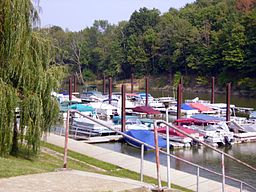
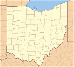
Delaware State Park Ohio State Park Natural Monument (IUCN III) The marina at Delaware State ParkNamed for: Lenape nation Country United States State Ohio County Delaware County Location [1] - coordinates 40°21′31″N 83°04′09″W / 40.35861°N 83.06917°WCoordinates: 40°21′31″N 83°04′09″W / 40.35861°N 83.06917°W - elevation 899 ft (274 m) [1] Area 2,016 acres (816 ha) Founded 1952 Managed by Ohio Department of Natural Resources Division of Parks and Recreation Website : Delaware State Park Delaware State Park is a 2,016-acre (816 ha) Ohio state park in Delaware County, Ohio in the United States. The park, town and county are named for the Delaware nation (also known as the Lenape), a Native American tribe that originally lived along the Delaware River in Pennsylvania, Delaware, New York, Maryland, Connecticut and New Jersey. The Lenape were forced west by colonial settlers and were eventually forced further west by settlers of the Northwest Territory from which Ohio was established in 1803. Delaware State Park is on U.S. Route 23 near the city of Delaware, Ohio. It is open for year-round recreation including camping, hiking, boating, hunting, fishing, and picnicking.[2]
Contents
History
The Lenape (later named Delaware Indians by Europeans) are organized bands of Native American peoples with shared cultural and linguistic characteristics. Delaware State Park is named for them. It is just one of many places in the United States bearing the name "Delaware".[3]
They lived in what is now New Jersey and along the Delaware River in Pennsylvania, the northern shore of Delaware, in the northeastern corner of Maryland, the panhandle of Connecticut and the lower Hudson Valley and New York Harbor in New York, at the time of the arrival of the Europeans in the 16th and 17th centuries.[3]
The Treaty of Easton, signed between the Lenape and the English in 1766, removed them westward, out of present-day New York and New Jersey and into Western Pennsylvania and Ohio and beyond. The Lenape continually were crowded out by European settlers and pressed to move in several stages over a period of 176 years, with the main body arriving in the northeast region of Oklahoma in the 1860s. Along the way many smaller groups left, or were told to stay where they were, but not in Ohio. Consequently today, the Lenape are spread from New Jersey to Wisconsin to southwest Oklahoma.[3]
The Delaware did not leave Ohio without a fight. They joined a confederation of tribes led by Chief Pontiac and participated in what became known as Pontiac's Rebellion. They also joined Blue Jacket's confederation in the Northwest Indian War.[4]
Anglo-American settlers moved into the area of Delaware State Park in the early 19th century. A wagon trail near what is now U.S. Route 23 brought settlers to the area. A tavern was constructed along the trail in 1810 on a small hill that is now part of the park. A palisade was built around the tavern in anticipation of the War of 1812. The tavern and palisade came to be known as Fort Morrow. The fort was never attacked but it did provide a sense of security for the settlers of the area.[2] Today, the fort is an archaeological site; it is one of two such sites near the park that are listed on the National Register of Historic Places. The other site is the Ufferman Site,[5] which was inhabited during the Late Woodland period of North American prehistory.[6]
Delaware State Park was established in 1952 following the completion of Delaware Lake by the U.S. Army Corps of Engineers in 1951.[2] The lake was built as part of the Flood Control Act of 1938. The dam on the Olentangy River is part of the Corps' Huntingdon district and helps control flooding along the Olentangy, Scioto and Ohio Rivers. It was built between 1947 and 1951 at a cost of $4,307,000.[7]
Ecology
Delaware State Park is surrounded by farm land. Before the land was cleared for farming it was an old-growth forest of beech and maple. The old forest was cut long ago, but a thriving second growth forest can be found in and around Delaware State Park. The woods provide habitat for White-tailed deer, Fox Squirrels, Groundhogs, and Pheasant.[2]
Recreation
Delaware State Park is open for year-round recreation. Boats with unlimited horsepower are permitted on Delaware Lake which is also open to fishing and swimming in the designated swimming area. There is a marina that sells fuel as well as fishing and boating supplies. The lake is home to a variety of game fish including largemouth and smallmouth bass, crappie, and muskellunge. Waterfowl hunting is permitted along the lake. Numerous duck blinds are awarded through a lottery system. Hunting for other game animals is permitted on the wildlife area. There are many picnic area on the shore of the lake with table available on a first come, first served basis.[2]
References
- ^ a b "Delaware Lake". Geographic Names Information System. United States Geological Survey. July 12, 1979. http://geonames.usgs.gov/pls/gnispublic/f?p=gnispq:3:::NO::P3_FID:1039659. Retrieved 2009-01-06.
- ^ a b c d e "Delaware State Park". Ohio Department of Natural Resources Division of Parks and Recreation. http://www.dnr.state.oh.us/parks/tabid/729/Default.aspx. Retrieved 2009-01-09.
- ^ a b c Adams, Richard Calmit (1909). The Delaware Indians, a brief history. Washington, DC 1909: Government Printing Office.
- ^ Dowd, Gregory Evans (1992). A Spirited Resistance: The North American Indian Struggle for Unity, 1745-1815. Baltimore, Maryland: Johns Hopkins University.
- ^ Delaware State Park Natural Resource Management Plan 2009-2014, Delaware State Park, 11, 12. Accessed 2010-05-19.
- ^ Owen, Lorrie K., ed. Dictionary of Ohio Historic Places. Vol. 1. St. Clair Shores: Somerset, 1999, 328.
- ^ "Delaware Lake". U.S. Army Corps of Engineers. http://www.lrh.usace.army.mil/_kd/go.cfm?destination=Page&Pge_ID=1214. Retrieved 2009-01-10.
Protected areas of Ohio Federal National parksCedar Point • Ottawa • West Sister IslandState Adams Lake • Alum Creek • A. W. Marion • Barkcamp • Beaver Creek • Blue Rock • Buck Creek • Buckeye Lake • Burr Oak • Caesar Creek • Catawba Island • Cleveland Lakefront • Cowan Lake • Deer Creek • Delaware • Dillon • East Fork • East Harbor • Findley • Forked Run • Geneva • Grand Lake St. Marys • Great Seal • Guilford Lake • Harrison Lake • Headlands Beach • Hocking Hills • Hueston Woods • Independence Dam • Indian Lake • Jackson Lake • Jefferson Lake • John Bryan • Kelleys Island • Kiser Lake • Lake Alma • Lake Hope • Lake Logan • Lake Loramie • Lake Milton • Lake White • Little Miami • Madison Lake • Malabar Farm • Marblehead Lighthouse • Mary Jane Thurston • Middle Bass Island • Maumee Bay • Mohican • Mosquito Lake • Mt. Gilead • Muskingum River • Nelson Kennedy Ledges • Paint Creek • Pike Lake • Portage Lakes • Punderson • Pymatuning • Quail Hollow • Rocky Fork • Salt Fork • Scioto Trail • Shawnee • South Bass Island • Stonelick • Strouds Run • Sycamore • Tar Hollow • Tinkers Creek • Van Buren • West Branch • Wingfoot Lake • Wolf Run
Beaver Creek • Blue Rock • Brush Creek • Dean • Fernwood • Gifford • Harrison • Hocking • Maumee • Mohican-Memorial • Perry • Pike • Richland Furnace • Scioto Trail • Shade River • Shawnee • Sunfish Creek • Tar Hollow • Yellow Creek • Zaleski
State nature
preservesAcadia Cliffs • Adams Lake Prairie • Audubon Islands • Augusta-Anne Olsen • Aurora Sanctuary • Baker Woods • Evans Beck Memorial • Betsch Fen • Bigelow Cemetery • Blackhand Gorge • Bonnet Pond • Boord • Brown's Lake Bog • Burton Wetlands • Caesar Creek Gorge • Lou Campbell • Carmean Woods • Cedar Bog • Chaparral Prairie • Christmas Rocks • Clear Creek • Clear Fork Gorge • Clifton Gorge • Howard Collier • Compass Plant Prairie • Conkle's Hollow • Copperrider-Kent Bog • Crabill Fen • Cranberry Bog • Crane Hollow • Crooked Run • Culberson Woods • Davey Woods • Davis Memorial • Marie J. Desonier • Drew Woods • Dupont Marsh • Eagle Creek • Emerald Hills • Erie Sand Barrens • Etawah Woods • Flatiron Lake Bog • Fowler Woods • Frame Lake Fen • Gahanna Woods • Gallagher/Springfield Fen • Goll Woods • Goode Prairie • Gott Fen • Greenbelt • Greenville Falls • Gross Memorial Woods • Hatch-Otis • Halls Creek • Headlands Dunes • Hueston Woods • Hutchins (Highland) • Irwin Prairie • Jackson Bog • Johnson Ridge • Johnson Woods • Karlo Fen • Kendrick Woods • Kessler Swamp • Kiser Lake Wetlands • Kitty Todd • Knox Woods • Kyle Woods • Ladd Natural Bridge • Lake Katharine • Lakeside Daisy • Lawrence Woods • Little Rocky Hollow • Mantua Bog • Marsh Wetlands • McCracken Fen • Mentor Marsh • Milford Center Railroad Prairie • Miller • Morris Woods • Mud Lake Bog • Myersville • Newberry • North Pond • North Shore Alvar • Novak Sanctuary • Old Woman Creek • Owens/Liberty Fen • Pallister • Pickerington Ponds • Portage Lakes Wetland • Prairie Road Fen • William C. McCoy • Raven Rock • Rhododendeon Cove • Rockbridge • Rome • Rothenbuhler Woods • Saltpetre Cave • Sears Woods • Seymour Woods • Shallenberger • Sharon Woods Gorge • Sheepskin Hollow • Sheick Hollow • Sheldon Marsh • Shoemaker • Siegenthaler-Kaestner Esker • Smith Cemetery • Spring Beauty Dell • Spring Brook Sanctuary • Springville Marsh • Stage's Pond • Strait Creek Prairie • Stratford Woods • Swamp Cottonwood • Edward Thomas • Tinker's Creek • Travertine Fen • Triangle Lake Bog • Trillium Trails • Walter Tucker • Tummonds • Warder-Perkins • Whipple • White Pine Bog Forest • Zimmermand Prairie
State
scenic riversBig Darby Creek • Chagrin River • Conneaut Creek • Cuyahoga River • Grand River • Greenville Creek • Kokosing River • Little Beaver Creek • Little Darby Creek • Little Miami River • Maumee River • Mohican River • Olentangy River • Sandusky River • Stillwater River
Regional Ashtabula County Metroparks • Cleveland Metroparks • Columbus Metro Parks • Erie MetroParks • Five Rivers MetroParks • Geauga Park District • Hamilton County Park District • Johnny Appleseed Metro Parks • Lake Metroparks • Lorain County Metro Parks • Metroparks of Butler County • Metro Parks, Serving Summit County • Metroparks of the Toledo Area • Mill Creek MetroParks • Trumbull County MetroParks •
Categories:- Ohio state parks
- Protected areas of Delaware County, Ohio
- Protected areas established in 1952
Wikimedia Foundation. 2010.


