- Scioto River
Infobox River
river_name = Scioto River
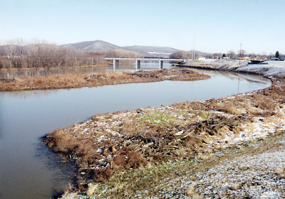
caption = The Scioto River at Chillicothe
origin = NearNew Hampshire, Ohio
mouth =Ohio River near Portsmouth
basin_countries =
length = 231 miles (372 km)
elevation =
mouth_elevation = 485 ft (148 m)
discharge = 6,674 ft³/s (189 m³/s) "Arthur Benke & Colbert Cushing, "Rivers of North America". Elsevier Academic Press, 2005 ISBN 0-12-088253-1]
watershed = 6,517 mi² (16,879 km²) [cite web| title = Map of Ohio watersheds | url = http://www.dnr.state.oh.us/water/watersheds/Basins72PDI_40x40_OnScreen.gif]The Scioto River (pronEng|saɪˈoʊtoʊ "sigh-OH-toe" or IPA|/saɪˈoʊtə/ "sigh-OH-tuh") is a river in central and southern
Ohio more than 231 miles (372 km) in length [cite web| title = Scioto River Valley Federation | url = http://www.sciotoriver.org/] . It rises inAuglaize County in west central Ohio, flows through Columbus, where it collects its largesttributary , theOlentangy River , and meets theOhio River at Portsmouth. Too small for modern commercialshipping , its primary economic importance is forrecreation anddrinking water .Geography and geology
The lower Scioto River valley is very large compared to the width of the river itself and is extensively farmed. Meltwaters from retreating Ice Age glaciers carved the valley exceptionally wide. Valley bottoms are smooth and flood deposits created during and since the most recent Ice Age cause floodplain soils to be very productive. As a result, farms line much of the lower Scioto where it flows through low, rolling hills covered in hardwood trees.
The geologic history of the Scioto River is tied to the destruction of the
Teays River network during the Ice Ages and consequent creation of theOhio River . The north flowingTeays River was dammed by glaciers and damming of other rivers led to a series of floods as lakes overflowed into adjacent valleys.Glacial Lake Tight is estimated to have been two-thirds the size of modern Lake Erie. Valleys beyond the reach of glaciers were reorganized to create theOhio River and the Scioto River replaced theTeays River . The Scioto River flows through segments of the Teays River valley, but opposite the direction theTeays River flowed. Satellite images show the relationship between the Scioto and Teays river valleys very clearly and are available in theTeays River article. In the cities of Columbus and Dublin, the river has cut a gorge in fossil-bearingDevonian limestone, and many tributary streams have waterfalls, such as Hayden Falls.The Scioto in early American history
The Scioto River valley was home to many Native American cultures. The best known group is the Mound Builders of the
Hopewell culture , and today a large number of theirburial mounds can be seen near Chillicothe at theHopewell Culture National Historic Park . The former strength of these cultures is demonstrated in settler accounts from as far east asVirginia . A book, Trans-Allegheny Pioneers, is a compilation of historical events surrounding the move west across theAllegheny Mountains . Settlers reaching theVirginia -West Virginia border region in the late 17th century had many exciting encounters with Native American parties from their seat of power, the Scioto River valley.Pollution
Threats facing the river include agricultural pollutants from upstream, and urban-generated pollutants such as contaminated street runoff and waterborne litter. Rapid residential and commercial development in the watershed is increasing stormwater runoff spikes.
Dams and reservoirs
There are two major dams on the river. Griggs Dam in Columbus was built in 1904 - 1908 to impound a water supply for the city. Farther upstream, at Shawnee Hills, the O'Shaughnessy Dam was built in 1922 - 1925 creating a larger reservoir which was billed at the time as "the finest inland waterway in the United States." Both dams are operated by the City of Columbus.
Cities and towns along the Scioto River
These towns and cities are along the Scioto River.
*Chillicothe
*Circleville
*Columbus
*Dublin
*Green Camp
*Hilliard
*Kenton
*LaRue
*Marble Cliff
*Piketon
*Portsmouth
*Prospect
*Shawnee Hills
*Upper Arlington
*WaverlyVariant names
According to the
Geographic Names Information System , the Scioto River has also been known as:
*Big Sciota River
*Big Scioto River
*Chianotho River
*Great Siota River
*Menkwi Siipunk
*Riviere Chianouske
*Sci-ou-to
*Sciodoe Creek
*Sciota River
*Seeyotah River
*Sinhioto River
*Siothai River
*Sioto Riveree also
*
List of Ohio rivers
*Little Scioto River External links
* [http://www.nps.gov/hocu/ Hopewell Culture National Historic Park]
* [http://www.friendsofthesciotoriver.org/index.html Friends of the Scioto River]References
Wikimedia Foundation. 2010.