- O'Shaughnessy Dam (Ohio)
-
This article is about the dam near Columbus, Ohio. For the one in the Sierra Nevada mountains, see O'Shaughnessy Dam.O'Shaughnessy Dam and Bridge
 View below the dam
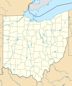

Location: Concord Township / Liberty Township, Delaware County, Ohio, USA Nearest city: Shawnee Hills, Ohio Coordinates: 40°09′14″N 83°07′33″W / 40.15389°N 83.12583°WCoordinates: 40°09′14″N 83°07′33″W / 40.15389°N 83.12583°W Built: 1922 Architect: Packard,Franklin l.; Thompson-Starrett Co. Architectural style: Late 19th And 20th Century Revivals, Classical Revival, Second Renaissance Revival Governing body: Local NRHP Reference#: 90000482[1] Added to NRHP: July 5, 1990 The O'Shaughnessy Dam is located on the Scioto River near Dublin, Ohio, United States. The dam forms O'Shaughnessy Reservoir, which is a major source of drinking water for the city of Columbus. It was completed in 1925 following recommendations of then superintendent Jerry O'Shaughnessy (for whom the dam was named).[2] At the time, the reservoir was described as "the finest inland waterway in the United States." Located 10 miles (16 km) upstream of the smaller Griggs Dam, it provides a large area for various forms of recreation in addition to its water supply duties. The reservoir holds 6.3 billion US gallons (24,000,000 m3) over a surface area of 845 acres (3.42 km2).[3] The Columbus Zoo and Aquarium is located on the east bank of the reservoir, near the dam.
In 1990, the dam was listed on the National Register of Historic Places.[1]
Hydroelectricity
The city of Columbus installed a hydroelectric operation on the west side of the dam, which was completed in 1987.[4] The turbines can only be operated when there is sufficient flow, which means the dam cannot continuously produce electricity. With a head of 18 feet (5.5 m)[5], the two turbines together produce 5 megawatts.[4][6]
References
- ^ a b "National Register Information System". National Register of Historic Places. National Park Service. 2009-03-13. http://nrhp.focus.nps.gov/natreg/docs/All_Data.html.
- ^ "Water Sources". Department of Public Utilities (City of Columbus, Ohio): Division of Water. Archived from the original on 2006-10-08. http://web.archive.org/web/20061008234256/http://columbuswater.com/sources.htm. Retrieved 2006-10-28.
- ^ "2005 Annual Report" (PDF). Department of Public Utilities (City of Columbus, Ohio). http://utilities.columbus.gov/dosd/pdfs/Public-Utiliities-2005-Annual-Report.pdf. Retrieved 2006-10-28.
- ^ a b "Green Power: Turning Water Into Electricity - O'Shaughnessy Hydroelectric Plant". Department of Public Utilities (City of Columbus, Ohio): Division of Water. Archived from the original on 2006-10-09. http://web.archive.org/web/20061009182328/http://utilities.ci.columbus.oh.us/electricity/greenpower.htm. Retrieved 2006-10-28.
- ^ "Hydropower". Green Energy Ohio. http://www.greenenergyohio.org/page.cfm?pageID=54. Retrieved 2006-10-28.
- ^ "Hydroelectricity". Office of the Ohio Consumers' Counsel. Archived from the original on 2007-02-16. http://web.archive.org/web/20070216135106/http://www.pickocc.org/smartenergy/hydroelectric.shtml. Retrieved 2006-10-29.
External links
- USGS Real-Time Water Data: Scioto River below O'Shaughnessy Dam
- Ohio DNR fishing map of O'Shaughnessy Reservoir
U.S. National Register of Historic Places Topics Lists by states Alabama • Alaska • Arizona • Arkansas • California • Colorado • Connecticut • Delaware • Florida • Georgia • Hawaii • Idaho • Illinois • Indiana • Iowa • Kansas • Kentucky • Louisiana • Maine • Maryland • Massachusetts • Michigan • Minnesota • Mississippi • Missouri • Montana • Nebraska • Nevada • New Hampshire • New Jersey • New Mexico • New York • North Carolina • North Dakota • Ohio • Oklahoma • Oregon • Pennsylvania • Rhode Island • South Carolina • South Dakota • Tennessee • Texas • Utah • Vermont • Virginia • Washington • West Virginia • Wisconsin • WyomingLists by territories Lists by associated states Other  Category:National Register of Historic Places •
  Portal:National Register of Historic PlacesCategories:
- Hydroelectric power plants in Ohio
- Dams in Ohio
- Buildings and structures in Delaware County, Ohio
- Buildings and structures on the National Register of Historic Places in Ohio
- Classical Revival architecture
- Buildings and structures completed in 1925


Wikimedia Foundation. 2010.