- National Register of Historic Places listings in Indiana
-

This is a list of properties and districts in Indiana that are listed on the National Register of Historic Places. There are over 1,700 in total. Of these, 37 are National Historic Landmarks. Each of Indiana's 92 counties has at least one listing.
The locations of National Register properties and districts (at least for all showing latitude and longitude coordinates below), may be seen in a Google map by clicking on "Map of all coordinates".[1]
-
- This National Park Service list is complete through NPS recent listings posted November 10, 2011.[2]
Contents: Counties in Indiana (links in italic lead to a new page) Adams – Allen – Bartholomew – Benton – Blackford – Boone – Brown – Carroll – Cass – Clark – Clay – Clinton – Crawford – Daviess – Dearborn – Decatur – DeKalb – Delaware – Dubois – Elkhart – Fayette – Floyd – Fountain – Franklin – Fulton – Gibson – Grant – Greene – Hamilton – Hancock – Harrison – Hendricks – Henry – Howard – Huntington – Jackson – Jasper – Jay – Jefferson – Jennings – Johnson – Knox – Kosciusko – LaGrange – Lake – LaPorte – Lawrence – Madison – Marion (Center Township) – Marshall – Martin – Miami – Monroe – Montgomery – Morgan – Newton – Noble – Ohio – Orange – Owen – Parke – Perry – Pike – Porter – Posey – Pulaski – Putnam – Randolph – Ripley – Rush – St. Joseph – Scott – Shelby – Spencer – Starke – Steuben – Sullivan – Switzerland – Tippecanoe – Tipton – Union – Vanderburgh – Vermillion – Vigo – Wabash – Warren – Warrick – Washington – Wayne – Wells – White – Whitley Current listings by county
The following are approximate tallies of current listings by county. These counts are based on entries in the National Register Information Database as of March 13, 2009[3] and new weekly listings posted since then on the National Register of Historic Places web site.[4] There are frequent additions to the listings and occasional delistings and the counts here are approximate and not official. New entries are added to the official Register on a weekly basis.[5] Also, the counts in this table exclude boundary increase and decrease listings which modify the area covered by an existing property or district and which carry a separate National Register reference number.
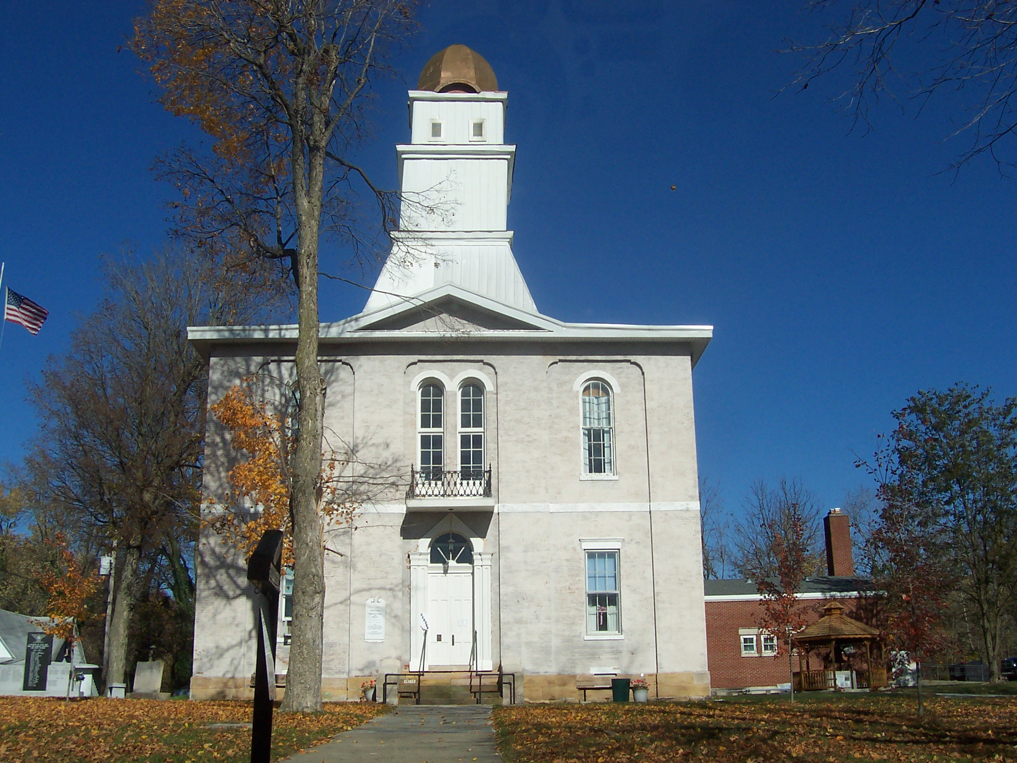
 Andrew Thomas House, in Carroll County
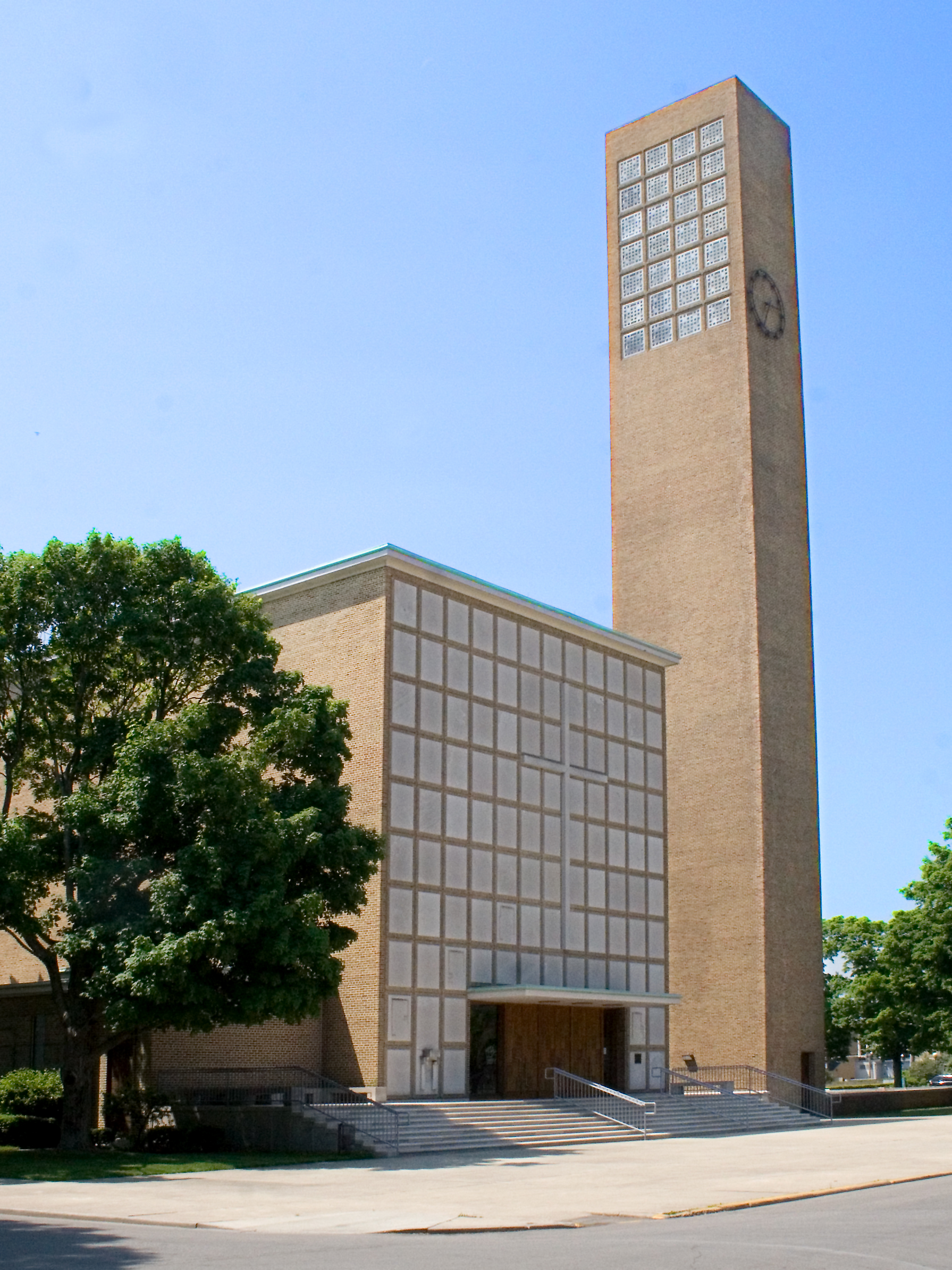
 First Christian Church, designed by Eliel Saarinen, in Bartholomew County
 Jeffries Ford Covered Bridge, destroyed by fire in 2002 but still NRHP-listed, in Parke County
 State Bank of Indiana, Branch of (Memorial Hall), in Vigo County
 USS LST 325 (tank landing ship), Vanderburgh County
County # of Sites 1 Adams 8 2 Allen 58 3 Bartholomew 21 4 Benton 5 5 Blackford 4 6 Boone 10 7 Brown 5 8 Carroll 22 9 Cass 15 10 Clark 13 11 Clay 14 12 Clinton 10 13 Crawford 1 14 Daviess 12 15 Dearborn 25 16 Decatur 10 17 DeKalb 25 18 Delaware 42 19 Dubois 11 20 Elkhart 34 21 Fayette 5 22 Floyd 18 23 Fountain 11 24 Franklin 12 25 Fulton 8 26 Gibson 9 27 Grant 16 28 Greene 6 29 Hamilton 29 30 Hancock 9 31 Harrison 6 32 Hendricks 19 33 Henry 13 34 Howard 11 35 Huntington 20 36 Jackson 15 37 Jasper 6 38 Jay 8 39 Jefferson 11 40 Jennings 7 41 Johnson 16 42 Knox 17 43 Kosciusko 15 44 LaGrange 7 45 Lake 59 46 LaPorte 16 47 Lawrence 12 48 Madison 17 49.1 Marion: Center Township 163 49.2 Marion: Other 61 49.3 Marion: Duplicates (1)[6] 49.4 Marion: Total 223 50 Marshall 15 51 Martin 1 52 Miami 12 53 Monroe 41 54 Montgomery 21 55 Morgan 27 56 Newton 5 57 Noble 10 58 Ohio 3 59 Orange 15 60 Owen 14 61 Parke 44 62 Perry 9 63 Pike 3 64 Porter 31 65 Posey 19 66 Pulaski 5 67 Putnam 20 68 Randolph 12 69 Ripley 12 70 Rush 24 71 St. Joseph 87 72 Scott 3 73 Shelby 12 74 Spencer 8 75 Starke 2 76 Steuben 13 77 Sullivan 6 78 Switzerland 9 79 Tippecanoe 42 80 Tipton 2 81 Union 1 82 Vanderburgh 93 83 Vermillion 8 84 Vigo 45 85 Wabash 25 86 Warren 3 87 Warrick 7 88 Washington 8 89 Wayne 32 90 Wells 4 91 White 4 92 Whitley 4 (Duplicates): 8[7] Total: 1,719 -
- This National Park Service list is complete through NPS recent listings posted November 10, 2011.[8]
Adams County
Allen County
Bartholomew County
Benton County
Blackford County
Boone County
Brown County
Carroll County
Cass County
Clark County
Clay County
Clinton County
Crawford County
Landmark name Image Date listed Location City or Town Summary 1 Potts Creek Rockshelter Archeological Site (12CR110) February 4, 1987 Address Restricted St. Croix Daviess County
DeKalb County
Dearborn County
Decatur County
Delaware County
Dubois County
Elkhart County
Fayette County
Floyd County
Fountain County
Franklin County
Fulton County
Gibson County
Grant County
Greene County
Hamilton County
Hancock County
Harrison County
Hendricks County
Henry County
Howard County
Huntington County
Jackson County
Jasper County
Jay County
Jefferson County
Jennings County
Johnson County
Knox County
Kosciusko County
La Porte County
LaGrange County
Lake County
Lawrence County
Madison County
Marion County
Martin County
Landmark name Image Date listed Location City or Town Summary 1 Martin County Courthouse 
June 17, 2005 220 Capital Ave.
38°40′11″N 86°47′51″W / 38.66972°N 86.7975°WShoals Marshall County
Miami County
Monroe County
Montgomery County
Morgan County
Newton County
Noble County
Ohio County
Orange County
Owen County
Parke County
Perry County
Pike County
Porter County
Posey County
Pulaski County
Putnam County
Randolph County
Ripley County
Rush County
St. Joseph County
Scott County
Shelby County
Spencer County
Starke County
Landmark name Image Date listed Location City or Town Summary 1 Starke County Bridge No. 39 
December 10, 1993 Junction of Main and Water Sts., across the former Pennsylvania Railroad cut
41°18′1″N 86°37′25″W / 41.30028°N 86.62361°WKnox 2 Starke County Courthouse 
November 12, 1986 Courthouse Sq.
41°17′56″N 86°37′21″W / 41.29889°N 86.6225°WKnox Steuben County
Sullivan County
Switzerland County
Tippecanoe County
Tipton County
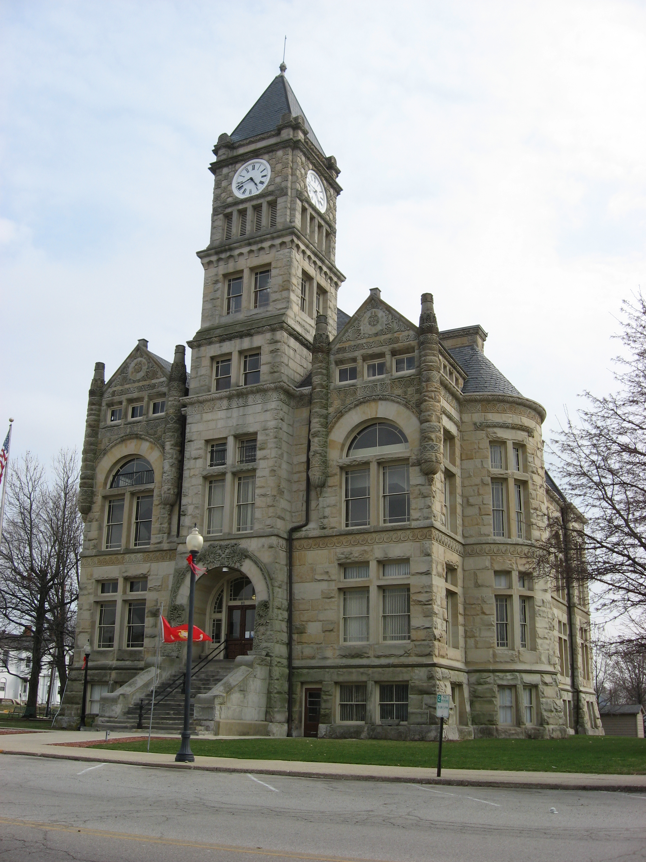
Landmark name Image Date listed Location City or Town Summary 1 Tipton County Courthouse 
March 1, 1984 Public Sq.
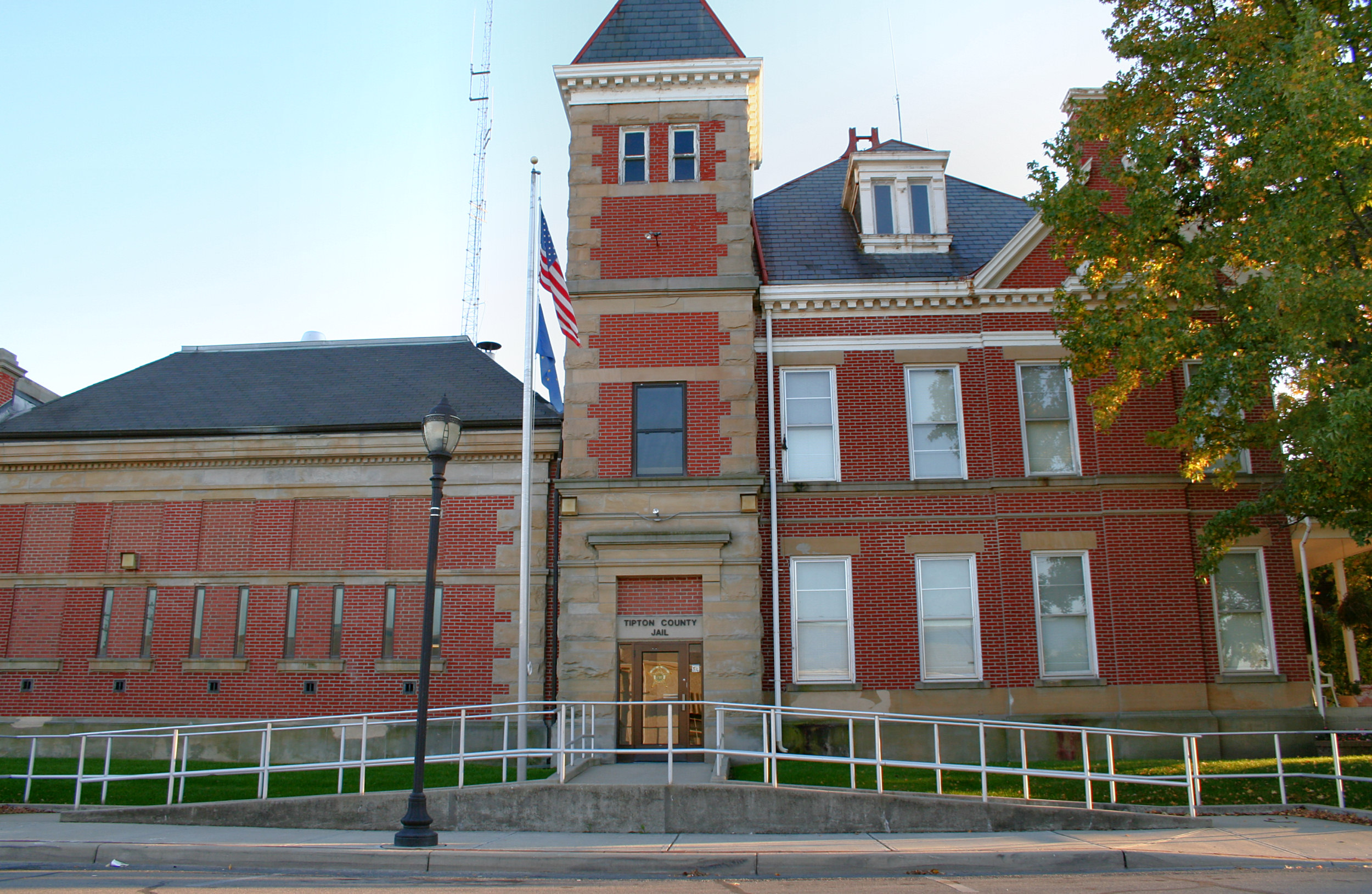
40°16′54″N 86°3′9″W / 40.28167°N 86.0525°WTipton 2 Tipton County Jail and Sheriff's Home 
May 17, 1984 203 S. West St.
40°16′50″N 86°2′34″W / 40.28056°N 86.04278°WTipton Union County
Landmark name Image Date listed Location City or Town Summary 1 Union County Courthouse 
July 21, 1987 Courthouse Sq.
39°38′5″N 84°55′50″W / 39.63472°N 84.93056°WLiberty Vanderburgh County
Vermillion County
Vigo County
Wabash County
Warren County
Warrick County
Washington County
Wayne County
Wells County
White County
Whitley County
See also
- List of National Historic Landmarks in Indiana
- List of Indiana covered bridges
- List of bridges on the National Register of Historic Places in Indiana
- Indiana Register of Historic Sites and Structures
References
- ^ The latitude and longitude information provided in this table was derived originally from the National Register Information System, which has been found to be fairly accurate for about 99% of listings. For about 1% of NRIS original coordinates, experience has shown that one or both coordinates are typos or otherwise extremely far off; some corrections may have been made. A more subtle problem causes many locations to be off by up to 150 yards, depending on location in the country: most NRIS coordinates were derived from tracing out latitude and longitudes off of USGS topographical quadrant maps created under the North American Datum of 1927, which differs from the current, highly accurate WGS84 GPS system used by Google maps. Chicago is about right, but NRIS longitudes in Washington are higher by about 4.5 seconds, and are lower by about 2.0 seconds in Maine. Latitudes differ by about 1.0 second in Florida. Some locations in this table may have been corrected to current GPS standards.
- ^ "National Register of Historic Places: Weekly List Actions". National Park Service, United States Department of the Interior. Retrieved on November 10, 2011.
- ^ "National Register Information System". National Register of Historic Places. National Park Service. 2009-03-13. http://nrhp.focus.nps.gov/natreg/docs/All_Data.html.
- ^ "National Register of Historic Places: Weekly List Actions". National Park Service. http://www.cr.nps.gov/nr/nrlist.htm. Retrieved January 2, 2009.
- ^ Weekly List Actions, National Register of Historic Places website
- ^ The Indianapolis Park and Boulevard System is split between Center Township and three other townships in Marion County
- ^ The Cavanaugh Bridge, the County Bridge No. 45, the Ennis Archaeological Site (12 OW 229), the Huffman Mill Covered Bridge, the Laughery Creek Bridge, the Patoka Bridges Historic District, the Secrest Ferry Bridge, and the Traders Point Eagle Creek Rural Historic District span the borders between Jackson and Washington counties, Daviess and Knox counties, Monroe and Owen counties, Perry and Spencer counties, Dearborn and Ohio counties, Gibson and Pike counties, Monroe and Owen counties, and Boone and Marion counties respectively.
- ^ "National Register of Historic Places: Weekly List Actions". National Park Service, United States Department of the Interior. Retrieved on November 10, 2011.
External links
- Indiana historical registers[dead link]
- Indiana Historic Sites and Structures Inventory
- Indiana State Historic Architectural and Archaeological Research Database
U.S. National Register of Historic Places Topics Lists by states Alabama • Alaska • Arizona • Arkansas • California • Colorado • Connecticut • Delaware • Florida • Georgia • Hawaii • Idaho • Illinois • Indiana • Iowa • Kansas • Kentucky • Louisiana • Maine • Maryland • Massachusetts • Michigan • Minnesota • Mississippi • Missouri • Montana • Nebraska • Nevada • New Hampshire • New Jersey • New Mexico • New York • North Carolina • North Dakota • Ohio • Oklahoma • Oregon • Pennsylvania • Rhode Island • South Carolina • South Dakota • Tennessee • Texas • Utah • Vermont • Virginia • Washington • West Virginia • Wisconsin • WyomingLists by territories Lists by associated states Other Categories:- National Register of Historic Places in Indiana
- National Register of Historic Places lists by state
- Indiana-related lists
-


Wikimedia Foundation. 2010.