- National Register of Historic Places listings in Marion County, Indiana
-
 Location of Marion County in Indiana
This is a list of the National Register of Historic Places listings in Marion County, Indiana.
This is intended to be a complete list of the properties and districts on the National Register of Historic Places in Marion County, Indiana, United States. Latitude and longitude coordinates are provided for many National Register properties and districts; these locations may be seen together in a Google map.[1]
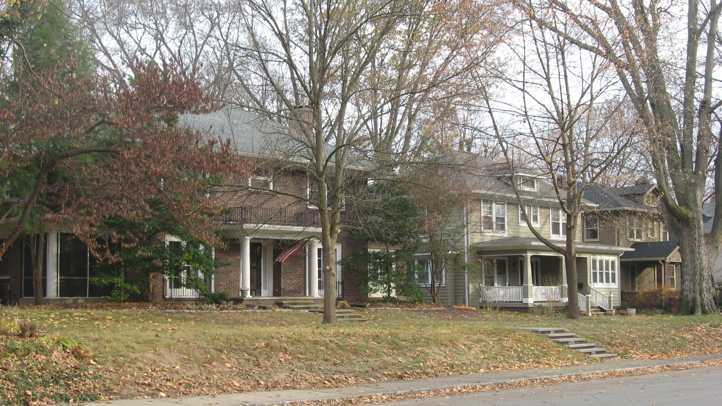
There are 223 properties and districts listed on the National Register in the county, including 8 National Historic Landmarks. Because Indianapolis is coextensive with Marion County, properties are listed by township rather than by city or town. Center Township is the location of 163 of these properties and districts, including 5 of the National Historic Landmarks; these properties and districts are listed separately. Properties and districts in Marion County's other townships are listed here. One district, the Indianapolis Park and Boulevard System, is split between Center Township and three other townships, and is thus included on both lists. Eight other properties, including seven in Center Township, were once listed but have been removed.
-
- This National Park Service list is complete through NPS recent listings posted November 10, 2011.[2]
Current listings
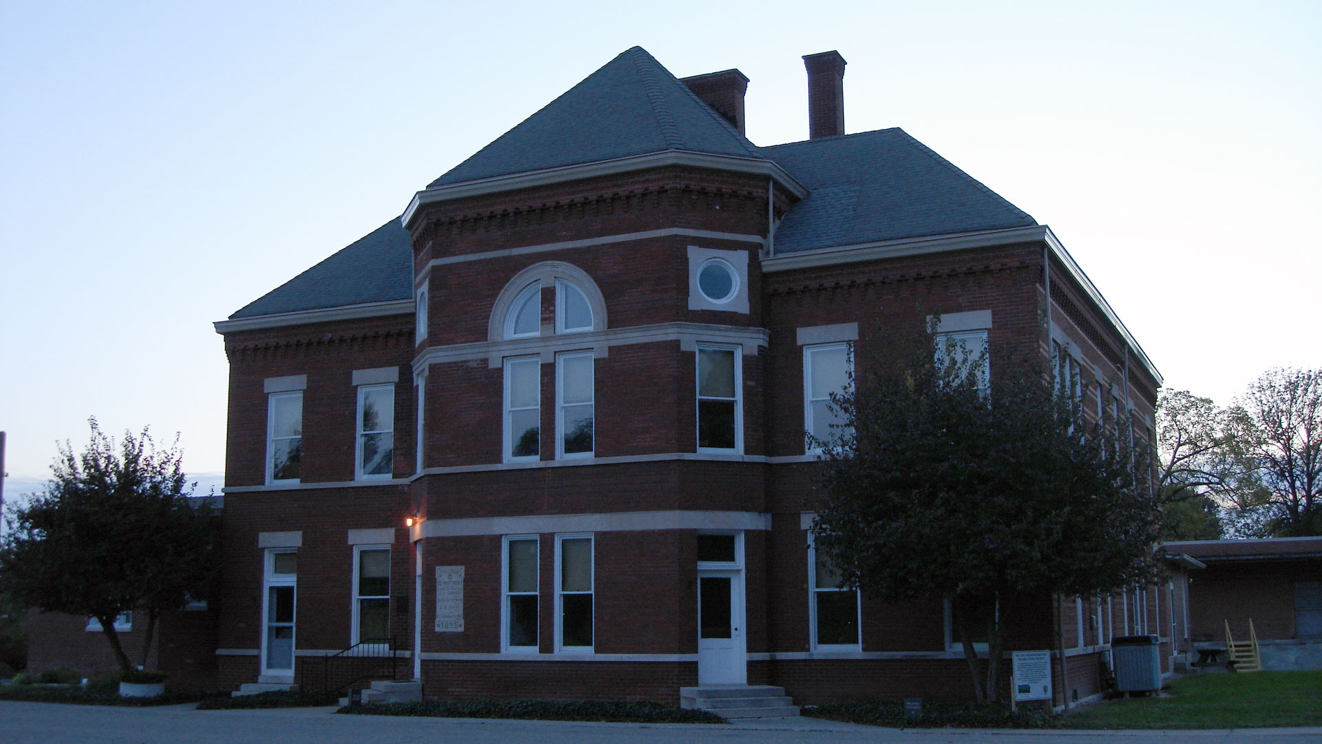
[3] Landmark name [4] Image Date listed Location City or town Summary 1 Administration Building, Indiana Central University 
March 15, 1984 Otterbein and Hanna Ave.
39°42′29″N 86°08′07″W / 39.708056°N 86.135278°WPerry 2 Allison Mansion 
December 18, 1970 3200 Cold Spring Rd
39°49′00″N 86°12′06″W / 39.816667°N 86.201667°WWayne 3 Anderson-Thompson House 
March 26, 1987 6551 Shelbyville Rd.
39°40′02″N 86°03′09″W / 39.667222°N 86.0525°WFranklin 4 Christopher Apple House 
September 17, 1980 11663 Pendleton Pike
39°52′12″N 85°57′34″W / 39.87°N 85.959444°WLawrence 5 Thomas Askren House 
April 19, 2006 6550 E. 16th St.
39°47′28″N 86°03′12″W / 39.791111°N 86.053333°WWarren 6 Aston Inn 
December 26, 1985 6620 N. Michigan Rd.
39°52′39″N 86°12′24″W / 39.8775°N 86.206667°WWashington 7 Benton House 
March 20, 1973 312 S. Downey Ave.
39°45′54″N 86°04′35″W / 39.765°N 86.076389°WWarren Part of the Irvington Historic District 8 Big Run Baptist Church and Cemetery 
December 6, 2005 6510 S. Franklin Rd.
39°40′33″N 86°01′08″W / 39.675833°N 86.018889°WFranklin 9 Joseph J. Bingham Indianapolis Public School No. 84 
December 6, 2004 440 E. 57th St.-5702 Central Ave.
39°51′34″N 86°09′05″W / 39.859444°N 86.151389°WWashington 10 Brendonwood Historic District 
December 6, 2004 Roughly bounded by Fall Creek, 56th St., and Brendon Forest Dr.
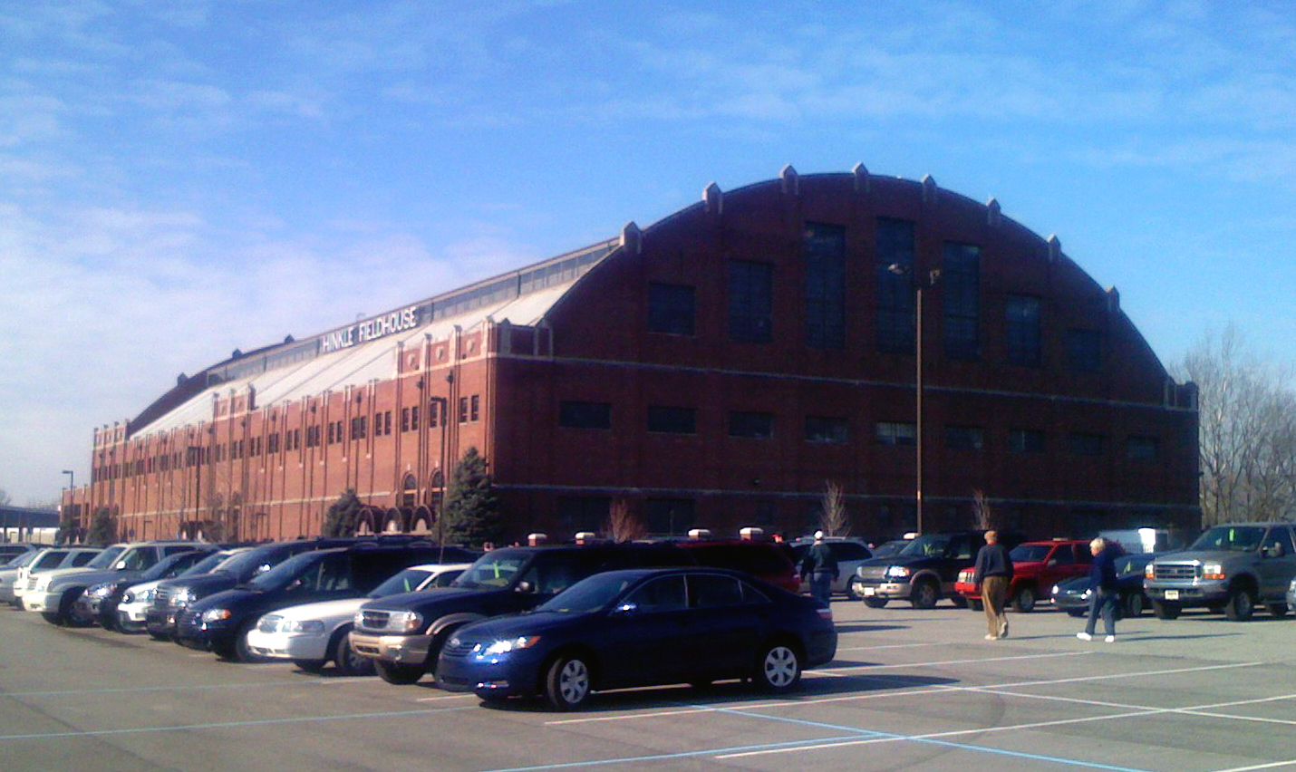
39°51′40″N 86°03′58″W / 39.861111°N 86.066111°WLawrence 11 Butler Fieldhouse 
December 22, 1983 Butler University campus, 49th St., and Boulevard Pl.
39°50′36″N 86°10′02″W / 39.843333°N 86.167222°WWashington 12 Camp Edwin F. Glenn 
December 1, 1995 Fort Benjamin Harrison
39°51′34″N 86°01′16″W / 39.859444°N 86.021111°WLawrence 13 Henry F. Campbell Mansion 
April 14, 1997 2550 Cold Spring Rd.
39°48′07″N 86°12′19″W / 39.801944°N 86.205278°WWayne 14 Christamore House 
March 21, 1985 502 N. Tremont St.
39°46′29″N 86°12′04″W / 39.774722°N 86.201111°WWayne 15 Henry P. Coburn Public School No. 66 
June 13, 1986 604 E. 38th St.
39°46′30″N 86°12′04″W / 39.775°N 86.201111°WWashington 16 Joseph J. Cole, Jr., House and 1925 Cole Brouette No. 70611 
June 25, 1997 4909 N. Meridian St.
39°50′35″N 86°09′24″W / 39.843056°N 86.156667°WWashington 17 Roy and Iris Corbin Lustron House 
October 9, 1997 1728 N. Leland Ave.
39°47′26″N 86°04′55″W / 39.790556°N 86.081944°WWarren 18 Cotton-Ropkey House 
March 22, 1984 6360 W. 79th St.
39°53′47″N 86°16′24″W / 39.896389°N 86.273333°WPike 19 Cumberland Historic District 
December 7, 2001 Roughly bounded by Munsie, Welland, Heflin, and Warehouse Sts.
39°46′36″N 85°57′23″W / 39.776667°N 85.956389°WWarren 20 Forest Hills Historic District 
June 30, 1983 Bounded by the Monon Railroad tracks, Kessler Boulevard, and College and Northview Aves.
39°51′32″N 86°08′35″W / 39.858889°N 86.143056°WWashington 21 Fort Benjamin Harrison Historic District 
September 6, 1995 E. 56th St.; also roughly bounded by Shafter Rd., Aultman Ave., and Glenn Rd.
39°51′34″N 86°00′46″W / 39.859444°N 86.012778°WLawrence Second set of boundaries represents a boundary increase of December 1, 1995 22 Fort Harrison Terminal Station 
March 16, 1984 Building 616 at Fort Benjamin Harrison
39°51′21″N 86°00′48″W / 39.855833°N 86.013333°WLawrence 23 Foster Hall 
December 6, 2005 7200 N. College Ave.
39°53′19″N 86°08′51″W / 39.888611°N 86.1475°WWashington 24 William H. H. Graham House 
July 15, 1982 5432 University Ave.
39°46′00″N 86°04′31″W / 39.766667°N 86.075278°WWarren 25 Hanna-Ochler-Elder House 
December 1, 1978 3801 Madison Ave.
39°42′41″N 86°08′36″W / 39.711389°N 86.143333°WPerry 26 Haughville Historic District 
December 9, 1992 Roughly bounded by 10th St., Belleview Pl., Walnut St., and Concord St.
39°46′40″N 86°12′22″W / 39.777778°N 86.206111°WWayne 27 Hiram A. Haverstick Farmstead 
December 26, 1985 7845 Westfield Boulevard
39°53′48″N 86°08′09″W / 39.896667°N 86.135833°WWashington 28 Hawthorne Branch Library No. 2 
May 18, 2000 70 N. Mount St.
39°46′03″N 86°12′06″W / 39.7675°N 86.201667°WWayne 29 Hillcrest Country Club 
September 29, 2004 6098 Fall Creek Rd.
39°52′25″N 86°03′40″W / 39.873611°N 86.061111°WLawrence 30 Hollingsworth House 
April 13, 1977 6054 Hollingsworth Rd.
39°51′51″N 86°14′50″W / 39.864167°N 86.247222°WPike 31 Homecroft Historic District 
January 11, 1996 Roughly bounded by Madison Ave., Southview Dr., Orinoco Ave., and Banta Rd.
39°40′12″N 86°07′55″W / 39.67°N 86.131944°WPerry 32 Indiana School for the Deaf 
June 27, 1991 1200 E. 42nd St.
39°50′06″N 86°08′16″W / 39.835°N 86.137778°WWashington 33 Indianapolis Motor Speedway 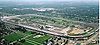
March 7, 1975 4790 W. 16th St.
39°47′54″N 86°13′58″W / 39.798333°N 86.232778°WWayne 34 Indianapolis Park and Boulevard System 
March 28, 2003 Roughly bounded by 38th St., Emerson, Southern and Tibbs Aves., extending along Fall Creek and Pleasant Run Parkways to Shadeland
39°47′25″N 86°08′38″W / 39.790278°N 86.143889°WLawrence, Warren, and Washington Extends into Center Township 35 Irvington Historic District 
May 29, 1987 Roughly bounded by Ellenberger Pk., Pleasant Run Creek, Arlington Ave., the former Baltimore and Ohio railroad tracks, and Emerson Ave.
39°46′13″N 86°04′25″W / 39.770278°N 86.073611°WWarren 36 Jamieson-Bennett House 
September 16, 2001 8452 Green Braes North Dr.
39°50′55″N 86°18′48″W / 39.848611°N 86.313333°WPike 37 Oliver Johnson's Woods Historic District 
June 22, 2004 Roughly bounded by Central and College Aves. and 44th and 46th Sts.
39°50′23″N 86°08′51″W / 39.839722°N 86.1475°WWashington 38 Johnson-Denny House 
August 24, 1979 4456 N. Park Ave.
39°50′15″N 86°08′55″W / 39.8375°N 86.148611°WWashington 39 Arthur Jordan Memorial Hall 
June 30, 1983 4600 Sunset Ave.
39°50′19″N 86°10′20″W / 39.838611°N 86.172222°WWashington 40 Julian-Clark House 
June 20, 1986 115 S. Audubon Rd.
39°46′07″N 86°04′11″W / 39.768611°N 86.069722°WWarren 41 Marcy Village Apartments 
March 24, 2004 4440-4567 Marcy Ln. and 1401 E. 46th St.
39°50′19″N 86°08′04″W / 39.838667°N 86.1345°WWashington 42 Marion County Bridge 0501F 
September 20, 2006 86th and 82nd Sts. over the White River
39°54′43″N 86°06′17″W / 39.911944°N 86.104722°WWashington 43 Michigan Road Toll House 
August 7, 1974 4702 Michigan Rd., NW.
39°50′29″N 86°11′20″W / 39.841389°N 86.188889°WWashington 44 New Augusta Historic District 
July 12, 1989 Roughly E. 71st St., E. 74th St., Coffman Rd., and New Augusta Rd.
39°53′02″N 86°14′19″W / 39.883889°N 86.238611°WPike 45 Nicholson-Rand House 
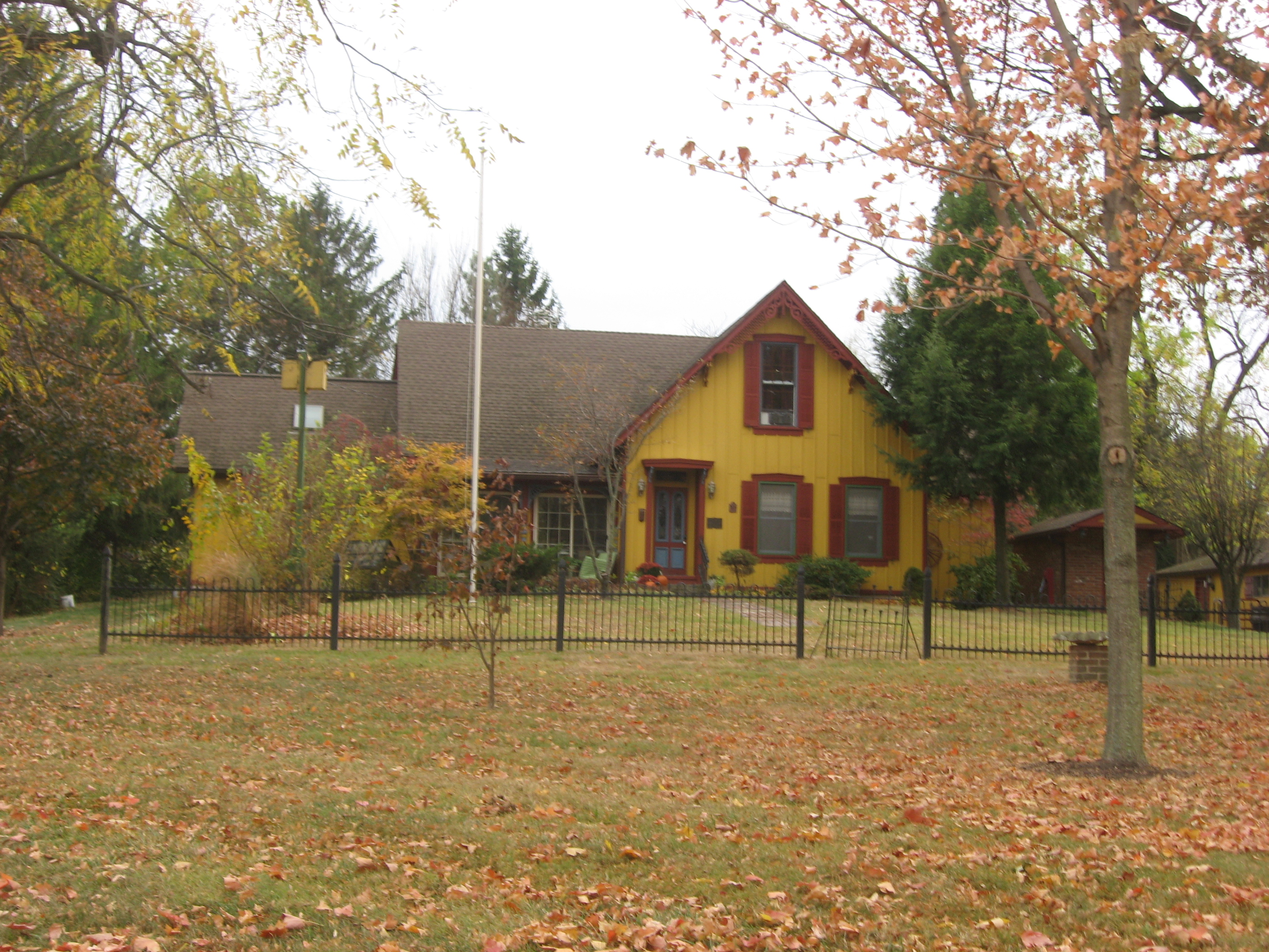
June 22, 2003 5010 W. Southport Rd.
39°39′38″N 86°14′46″W / 39.660556°N 86.246111°WDecatur American Gothic Revival Farmhouse built 1876 46 North Irvington Gardens Historic District 
June 27, 2008 Roughly bounded by 11th, 10th, Pleasant Run Golf Course, Arlington Ave., Pleasant Run Parkway N. Drive, and Ritter Ave.
39°46′46″N 86°04′15″W / 39.779444°N 86.070833°WWarren 47 North Meridian Street Historic District 
September 22, 1986 4000-5694 and 4001-5747 N. Meridian St.
39°50′33″N 86°09′26″W / 39.8425°N 86.157222°WWashington 48 Old Pathology Building 
April 25, 1972 3000 W. Washington St. (Central State Hospital)
39°46′12″N 86°12′48″W / 39.77°N 86.213333°WWayne 49 Old Southport High School 
September 28, 2003 6548 Orinoco Ave.
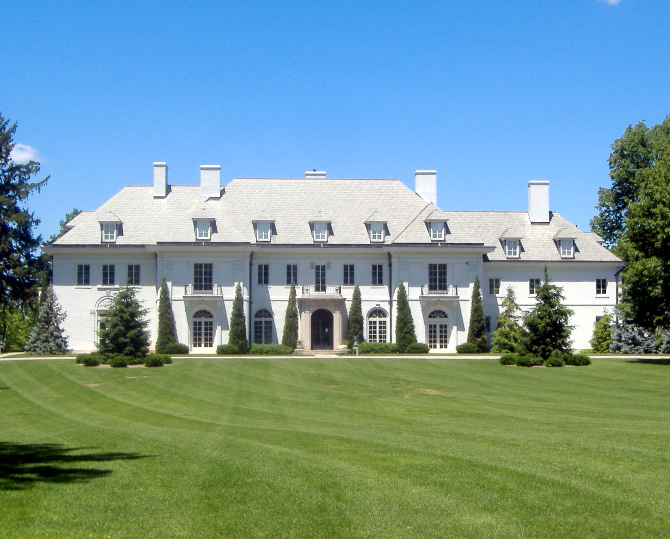
39°40′17″N 86°08′09″W / 39.671389°N 86.135833°WPerry 50 Oldfields 
June 15, 2000 1200 W. 38th St.
39°49′32″N 86°10′58″W / 39.825556°N 86.182778°WWashington Declared a National Historic Landmark District on July 31, 2003 51 Pleasanton in Irvington Historic District 
December 27, 2010 Roughly bounded by E. Michigan St., Pleasant Run Parkway North Dr., and Emerson Ave.
39°46′32″N 86°04′53″W / 39.775556°N 86.081389°WWarren Historic Residential Suburbs in the United States, 1830-1960 MPS 52 Carlos and Anne Recker House 
June 13, 1996 59 N. Hawthorne Ln.
39°46′19″N 86°04′41″W / 39.771944°N 86.078056°WWarren 53 Speedway Historic District 
September 15, 2005 Roughly bounded by 16th St., Main St., 10th St., and Winton Ave.
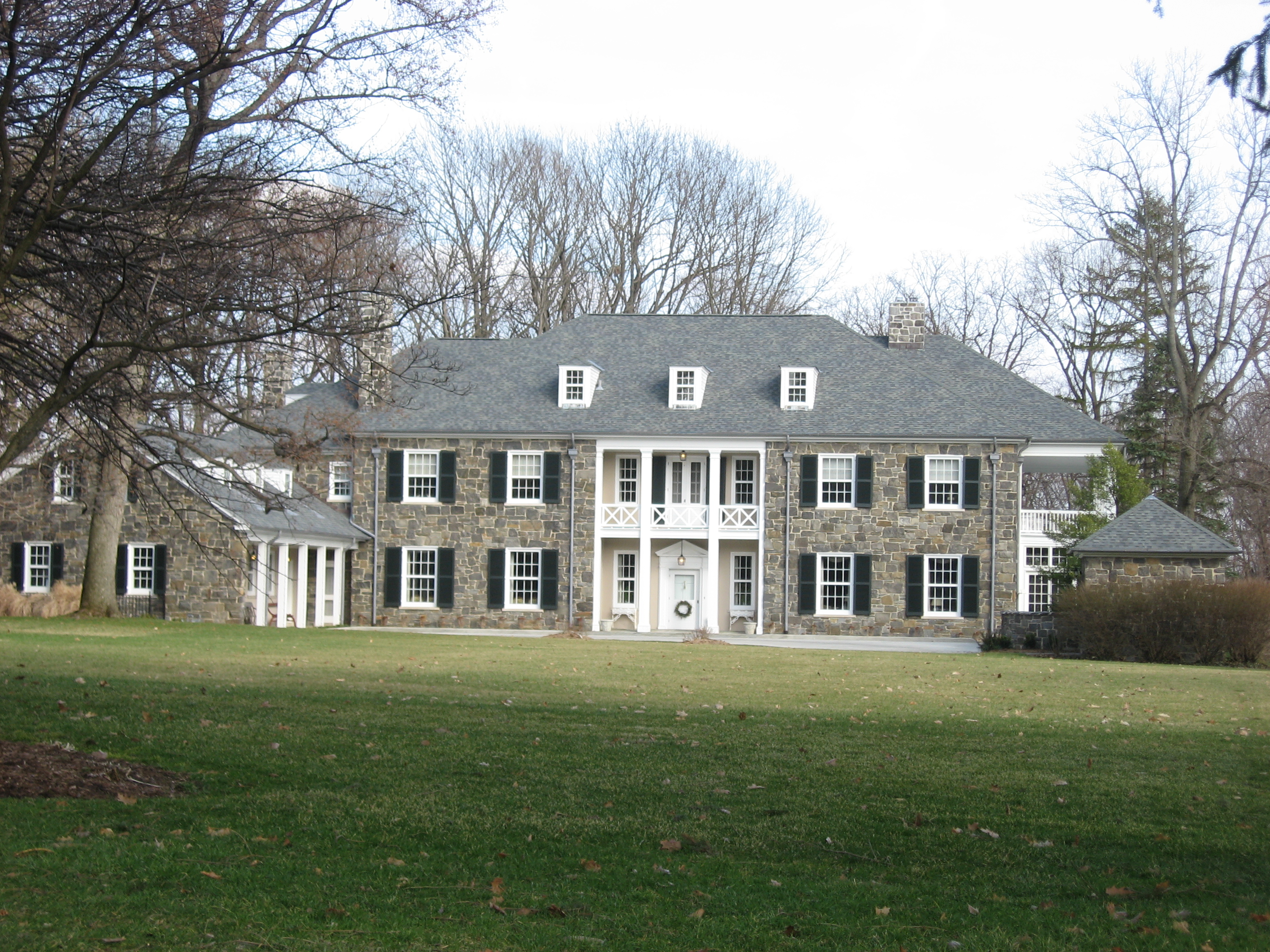
39°47′02″N 86°14′38″W / 39.783889°N 86.243889°WWayne 54 Stewart Manor (Charles B. Sommers House) 
October 8, 1976 3650 Cold Spring Rd.
39°49′14″N 86°12′10″W / 39.820556°N 86.202778°WWayne 55 George Stumpf House 
May 14, 1979 3225 S. Meridian St.
39°43′06″N 86°09′29″W / 39.718333°N 86.158056°WPerry 56 William N. Thompson House 
June 1, 1982 4343 N. Meridian St.
39°50′06″N 86°09′23″W / 39.835°N 86.156389°WWashington 57 George Washington Tomlinson House 
December 6, 2005 5140 Reed Rd.
39°50′48″N 86°17′24″W / 39.846667°N 86.29°WPike 58 Town of Crows Nest Historic District 
April 13, 2000 Roughly bounded by Kessler Boulevard, the White River, and Questover Circle
39°51′25″N 86°10′11″W / 39.856944°N 86.169722°WWashington 59 Traders Point Eagle Creek Rural Historic District 
June 17, 2009 Roughly between Interstate 865, Interstate 465, and Lafayette Rd.
39°53′53″N 86°17′05″W / 39.89805°N 86.284683°WPike Eagle Township and Pike Township, Indiana MPS. Extends into Eagle Township in Boone County.[5] 60 Washington Park Historic District 
June 24, 2008 Bounded by Pennsylvania St., Washington Boulevard, New Jersey, and the western side of Central Ave. between 40th and 43rd Sts.
39°49′53″N 86°09′08″W / 39.831339°N 86.152172°WWashington 61 Wheeler-Stokely Mansion 
December 6, 2004 3200 Cold Spring Rd.
39°48′44″N 86°12′09″W / 39.812222°N 86.2025°WWayne Former listing
[3] Landmark name Image Date listed Location City or town Summary 1 Tee Pee Restaurant 
February 21, 1989 3820 Fall Creek Boulevard
39°49′33″N 86°7′54.3″W / 39.82583°N 86.13175°WWashington Listed in 1986 See also
- List of National Historic Landmarks in Indiana
- National Register of Historic Places listings in Indiana
References
- ^ The latitude and longitude information provided in this table was derived originally from the National Register Information System, which has been found to be fairly accurate for about 99% of listings. For about 1% of NRIS original coordinates, experience has shown that one or both coordinates are typos or otherwise extremely far off; some corrections may have been made. A more subtle problem causes many locations to be off by up to 150 yards, depending on location in the country: most NRIS coordinates were derived from tracing out latitude and longitudes off of USGS topographical quadrant maps created under the North American Datum of 1927, which differs from the current, highly accurate WGS84 GPS system used by Google maps. Chicago is about right, but NRIS longitudes in Washington are higher by about 4.5 seconds, and are lower by about 2.0 seconds in Maine. Latitudes differ by about 1.0 second in Florida. Some locations in this table may have been corrected to current GPS standards.
- ^ "National Register of Historic Places: Weekly List Actions". National Park Service, United States Department of the Interior. Retrieved on November 10, 2011.
- ^ a b Numbers represent an ordering by significant words. Various colorings, defined here, differentiate National Historic Landmark sites and National Register of Historic Places Districts from other NRHP buildings, structures, sites or objects.
- ^ "National Register Information System". National Register of Historic Places. National Park Service. . http://nrhp.focus.nps.gov/natreg/docs/All_Data.html.
- ^ Fife, Camille B. National Register of Historic Places Inventory/Nomination: Traders Point Eagle Creek Rural Historic District. National Park Service, 2008-05, 90.
U.S. National Register of Historic Places Topics Lists by states Alabama • Alaska • Arizona • Arkansas • California • Colorado • Connecticut • Delaware • Florida • Georgia • Hawaii • Idaho • Illinois • Indiana • Iowa • Kansas • Kentucky • Louisiana • Maine • Maryland • Massachusetts • Michigan • Minnesota • Mississippi • Missouri • Montana • Nebraska • Nevada • New Hampshire • New Jersey • New Mexico • New York • North Carolina • North Dakota • Ohio • Oklahoma • Oregon • Pennsylvania • Rhode Island • South Carolina • South Dakota • Tennessee • Texas • Utah • Vermont • Virginia • Washington • West Virginia • Wisconsin • WyomingLists by territories Lists by associated states Other Municipalities and communities of Marion County, Indiana Cities Beech Grove | Indianapolis (balance) | Lawrence | Southport

Town Townships Included towns
(see Unigov)Clermont | Crows Nest | Cumberland‡ | Homecroft | Meridian Hills | North Crows Nest | Rocky Ripple | Spring Hill | Warren Park | Williams Creek | Wynnedale
Footnotes ‡This populated place also has portions in an adjacent county or counties
Categories:- National Register of Historic Places in Indianapolis, Indiana
- National Register of Historic Places in Indiana by county
-


Wikimedia Foundation. 2010.