- Wynnedale, Indiana
Infobox Settlement
official_name = Wynnedale, Indiana
settlement_type =Town
nickname =
motto =
imagesize =
image_caption =
image_
imagesize =
image_caption =
image_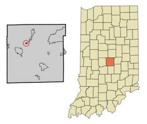
mapsize = 250px
map_caption = Location of Wynnedale in the state ofIndiana
mapsize1 =
map_caption1 =subdivision_type = Country
subdivision_name =United States
subdivision_type1 = State
subdivision_name1 =Indiana
subdivision_type2 = County
subdivision_name2 = Marion
subdivision_type3 = Township
subdivision_name3 = Washington
government_footnotes =
government_type =
leader_title =
leader_name =
leader_title1 =
leader_name1 =
established_title =
established_date =area_footnotes =
unit_pref = Imperial
area_magnitude =
area_total_km2 = 0.4
area_land_km2 = 0.4
area_water_km2 = 0.0
area_total_sq_mi = 0.2
area_land_sq_mi = 0.2
area_water_sq_mi = 0.0population_as_of = 2000
population_footnotes =
population_total = 275
population_density_km2 = 634.6
population_density_sq_mi = 1643.6timezone = Eastern (EST)
utc_offset = -5
timezone_DST = EDT
utc_offset_DST = -4
elevation_footnotes =
elevation_m = 231
elevation_ft = 758
latd = 39 |latm = 49 |lats = 51 |latNS = N
longd = 86 |longm = 11 |longs = 57 |longEW = Wpostal_code_type =
postal_code =
area_code =
blank_name = FIPS code
blank_info = 18-85742GR|2
blank1_name = GNIS feature ID
blank1_info = 0446358GR|3
website =
footnotes =Wynnedale is a town in Washington Township, Marion County,
Indiana ,United States . The population was 712 at the 2000 census. It has existed as an "included town" since 1970, when it was incorporated into Indianapolis as part ofUnigov . It is part of Indianapolis, but retains a functioning town government under IC 36-3-1-11 [ [http://www.in.gov/legislative/ic/code/title36/ar3/ch1.html Indiana Code 36-3-1 ] ] .Geography
Wynnedale is located at coor dms|39|49|51|N|86|11|57|W|city (39.830742, -86.199268)GR|1.
According to the
United States Census Bureau , the town has a total area of 0.2square mile s (0.4km² ), all of it land.Demographics
As of the
census GR|2 of 2000, there were 275 people, 108 households, and 84 families residing in the town. Thepopulation density was 1,643.6 people per square mile (624.6/km²). There were 112 housing units at an average density of 669.4/sq mi (254.4/km²). The racial makeup of the town was 64.73% White, 33.09% African American, 0.36% Native American, 0.36% Asian, 1.45% from other races. Hispanic or Latino of any race were 1.45% of the population.There were 108 households out of which 31.5% had children under the age of 18 living with them, 67.6% were married couples living together, 7.4% had a female householder with no husband present, and 22.2% were non-families. 20.4% of all households were made up of individuals and 8.3% had someone living alone who was 65 years of age or older. The average household size was 2.55 and the average family size was 2.82.
In the town the population was spread out with 21.1% under the age of 18, 3.6% from 18 to 24, 22.2% from 25 to 44, 32.7% from 45 to 64, and 20.4% who were 65 years of age or older. The median age was 48 years. For every 100 females there were 111.5 males. For every 100 females age 18 and over, there were 104.7 males.
The median income for a household in the town was $93,778, and the median income for a family was $101,931. Males had a median income of $80,969 versus $32,344 for females. The
per capita income for the town was $50,323. None of the families and 0.9% of the population were living below thepoverty line , including no under eighteens and 4.5% of those over 64.References
External links
Wikimedia Foundation. 2010.