- Decatur Township, Marion County, Indiana
-
Decatur Township
Marion County— Township — Map of Marion County with Decatur Township highlighted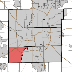
Coordinates: 39°41′44″N 86°15′42″W / 39.69556°N 86.26167°WCoordinates: 39°41′44″N 86°15′42″W / 39.69556°N 86.26167°W Country United States State Indiana County Marion Government – Type Indiana township Area – Total 32.4 sq mi (83.9 km2) – Land 32.3 sq mi (83.7 km2) – Water 0.1 sq mi (0.2 km2) Elevation 768 ft (234 m) Population (2000) – Total 24,726 – Density 765.1/sq mi (295.4/km2) Time zone Eastern (EST) (UTC-5) – Summer (DST) EDT (UTC-4) FIPS code 18-17092[1] GNIS feature ID 0453255[2] Decatur Township is the smallest in geographic size and in population of the nine townships in Marion County, Indiana, United States. Located on the southwest corner of the county, the township is home to the new Indianapolis International Airport main terminal. The city of Indianapolis and Marion County are a merged unit. Long one of the most rural sections of the county, Decatur Township has seen many new residential and commercial developments. One of the largest industrial parks in Indiana, AmeriPlex is in Decatur Township.
Contents
Population
Decatur Township was home to 27,881 residents in 2008 and has seen tremendous growth in recent years.
History
The township was settled in the 1820s by mostly Quakers from South Carolina. They settled along the banks of the White River. West Newton is a small quaker-settled town inside the township. Many of today's residents can trace their lineages back to these early settlers.
Key information
The township is the home of the Decatur Township Civic Council and the Metropolitan School District of Decatur Township. The Indianapolis Challenger Center calls Decatur Township home.
Camby (also sometimes called "West Union Station") is a neighborhood in western Decatur Township that also extends into neighboring Hendricks and Morgan counties, centered along Camby Road near State Road 67.[3] Its elevation is 764 feet (233 m), and it is located at 39°39′45″N 86°19′00″W / 39.6625°N 86.3166667°W (39.6625457, -86.3166582).[4] Camby has a post office with the ZIP code of 46113.[5]
Township elected officials
- U.S. Congress, District 4: Todd Rokita (R)
- U.S. Congress, District 7: André Carson (D)
- Indiana House, District 91: Robert Behning (R)
- Indiana House, District 25: Jeb Bardon (D)
- Indiana Senate, District 35: R. Michael Young (R)
- City-County Council, District 22: Bob Cockrum (R)
- Trustee: Stephen Rink (R)
- Small Claims Court Judge: William Fisher (R)
- Constable: Darrell McGaha (R)
- Township Board: District 1, Bob Frye (R); District 2, Stephanie McGaha (R); District 3, Sandra Filipovich (R); District 4, Joe Griffith (R); District 5, Larry Kugelman (R); District 6, Martha Fisher-Vaughn (R); District 7, David Knight (R)
- School Board: Judy Collins, Doug Greenwald, Dale Henson, Don Huffman, Cathy Wiseman
References
- ^ "American FactFinder". United States Census Bureau. http://factfinder.census.gov. Retrieved 2008-01-31.
- ^ "US Board on Geographic Names". United States Geological Survey. 2007-10-25. http://geonames.usgs.gov. Retrieved 2008-01-31.
- ^ DeLorme. Indiana Atlas & Gazetteer. 3rd ed. Yarmouth: DeLorme, 2004, p. 44. ISBN 0-89933-319-2.
- ^ Geographic Names Information System Feature Detail Report, Geographic Names Information System, 1979-02-14. Accessed 2008-06-01.
- ^ Zip Code Lookup
External links
- Indiana Township Association
- United Township Association of Indiana
- Decatur Township Fire Department Website
Municipalities and communities of Marion County, Indiana Cities Beech Grove | Indianapolis (balance) | Lawrence | Southport

Town Townships Included towns
(see Unigov)Clermont | Crows Nest | Cumberland‡ | Homecroft | Meridian Hills | North Crows Nest | Rocky Ripple | Spring Hill | Warren Park | Williams Creek | Wynnedale
Footnotes ‡This populated place also has portions in an adjacent county or counties
Categories:- Townships in Marion County, Indiana
- Geography of Indianapolis, Indiana

Wikimedia Foundation. 2010.