- Rocky Ripple, Indiana
Infobox Settlement
official_name = Rocky Ripple, Indiana
settlement_type =Town
nickname =
motto =
imagesize =
image_caption =
image_
imagesize =
image_caption =
image_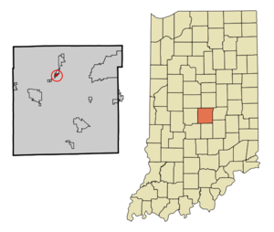
mapsize = 250px
map_caption = Location of Rocky Ripple in the state ofIndiana
mapsize1 =
map_caption1 =subdivision_type = Country
subdivision_name =United States
subdivision_type1 = State
subdivision_name1 =Indiana
subdivision_type2 = County
subdivision_name2 = Marion
subdivision_type3 = Township
subdivision_name3 = Washington
government_footnotes =
government_type =
leader_title =
leader_name =
leader_title1 =
leader_name1 =
established_title =
established_date =area_footnotes =
unit_pref = Imperial
area_magnitude =
area_total_km2 = 0.8
area_land_km2 = 0.8
area_water_km2 = 0.0
area_total_sq_mi = 0.3
area_land_sq_mi = 0.3
area_water_sq_mi = 0.0population_as_of = 2000
population_footnotes =
population_total = 712
population_density_km2 = 902.9
population_density_sq_mi = 2338.5timezone = Eastern (EST)
utc_offset = -5
timezone_DST = EDT
utc_offset_DST = -4
elevation_footnotes =
elevation_m = 215
elevation_ft = 705
latd = 39 |latm = 50 |lats = 50 |latNS = N
longd = 86 |longm = 10 |longs = 23 |longEW = Wpostal_code_type =
postal_code =
area_code =
blank_name = FIPS code
blank_info = 18-65556GR|2
blank1_name = GNIS feature ID
blank1_info = 0442234GR|3
website =
footnotes =Rocky Ripple is a town in Marion County,
Indiana ,United States . The population was 712 at the 2000 census. It has existed as an "included town" since 1970, when it was incorporated into Indianapolis as part ofUnigov . It is part of Indianapolis, but retains a functioning town government under IC 36-3-1-11 [ [http://www.in.gov/legislative/ic/code/title36/ar3/ch1.html Indiana Code 36-3-1 ] ] .Although not far from the city center, Rocky Ripple is a somewhat isolated area, located between the Central Canal and the White River; only two traffic-supporting bridges over the canal provide access to the town.Geography
Rocky Ripple is located at coor dms|39|50|50|N|86|10|23|W|city (39.847091, -86.173137)GR|1.
According to the
United States Census Bureau , the town has a total area of 0.3square mile s (0.8km² ).None of the area is covered with water.Demographics
As of the
census GR|2 of 2000, there were 712 people, 322 households, and 183 families residing in the town. Thepopulation density was 2,338.5 people per square mile (916.3/km²). There were 329 housing units at an average density of 1,080.6/sq mi (423.4/km²). The racial makeup of the town was 87.64% White, 9.27% African American, 0.14% Native American, 0.42% Asian, 0.28% from other races, and 2.25% from two or more races. Hispanic or Latino of any race were 1.69% of the population.There were 322 households out of which 24.8% had children under the age of 18 living with them, 39.4% were married couples living together, 13.4% had a female householder with no husband present, and 42.9% were non-families. 33.9% of all households were made up of individuals and 8.7% had someone living alone who was 65 years of age or older. The average household size was 2.21 and the average family size was 2.87.
In the town the population was spread out with 20.9% under the age of 18, 5.8% from 18 to 24, 33.0% from 25 to 44, 25.3% from 45 to 64, and 15.0% who were 65 years of age or older. The median age was 40 years. For every 100 females there were 89.9 males. For every 100 females age 18 and over, there were 87.7 males.
The median income for a household in the town was $44,464, and the median income for a family was $50,500. Males had a median income of $32,500 versus $30,000 for females. The
per capita income for the town was $22,691. About 1.1% of families and 2.4% of the population were below thepoverty line , including none of those under age 18 and 3.3% of those age 65 or over.References
External links
*
* [http://forecast.weather.gov/MapClick.php?CityName=Rocky+Ripple&state=IN&site=IND Rocky Ripple weather] (NWS)
Wikimedia Foundation. 2010.