- Crows Nest, Indiana
-
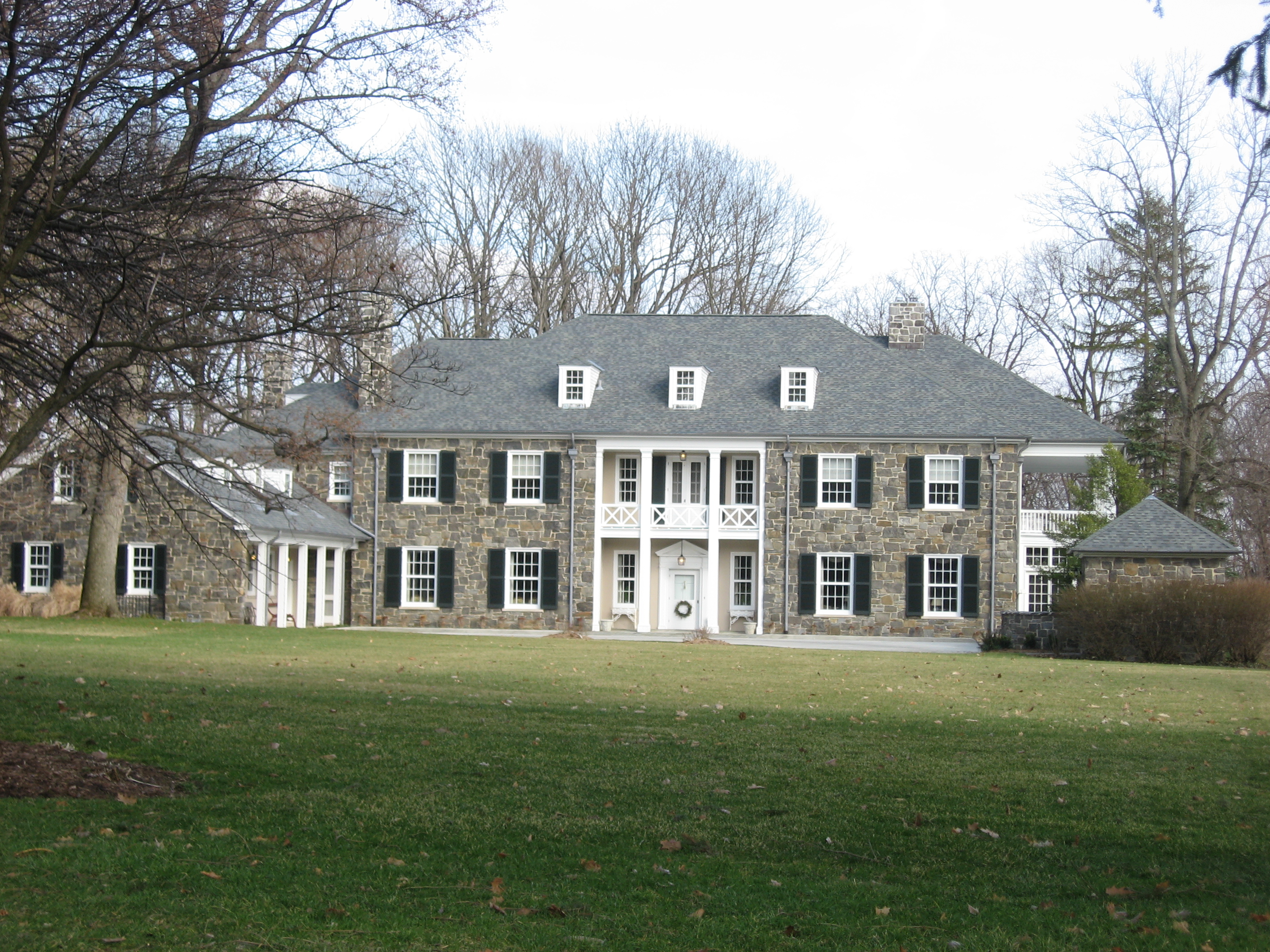
Town of Crows Nest, Indiana — Town — A typical house in Crows Nest Location in the state of Indiana
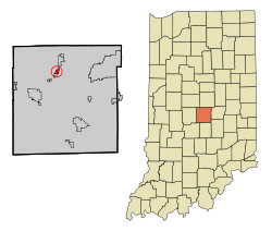
Coordinates: 39°51′8″N 86°10′22″W / 39.85222°N 86.17278°WCoordinates: 39°51′8″N 86°10′22″W / 39.85222°N 86.17278°W Country United States State Indiana County Marion Township Washington Area – Total 0.4 sq mi (1.2 km2) – Land 0.4 sq mi (1.2 km2) – Water 0.0 sq mi (0.0 km2) Elevation 774 ft (236 m) Population (2000) – Total 96 – Density 213.4/sq mi (82.4/km2) Time zone EST (UTC-5) – Summer (DST) EST (UTC-5) FIPS code 18-16156[1] GNIS feature ID 0433220[2] Crows Nest is an affluent town in Washington Township, Marion County, Indiana, approximately 7 miles (11 km) northwest of downtown Indianapolis. The town is adjacent to the neighboring community of North Crows Nest and it is just south off Kessler Boulevard on the private drive Sunset Lane. The town maintains its own police force.[1] The population was 96 at the 2000 census. It has existed as an "included town" since 1970, when it was incorporated into Indianapolis as part of Unigov. It is part of Indianapolis, but retains a functioning town government under IC 36-3-1-11.[3]
Crows Nest remains a very exclusive wooded residential enclave for the wealthy.[2]
Geography
Crows Nest is located at 39°51′8″N 86°10′22″W / 39.85222°N 86.17278°W (39.852208, -86.172811)[4].
According to the United States Census Bureau, the town has a total area of 0.4 square miles (1.2 km²), all of it land.
Demographics
As of the census[1] of 2000, there were 96 people, 39 households, and 31 families residing in the town. The population density was 215.2 people per square mile (82.4/km²). There were 41 housing units at an average density of 91.9 per square mile (35.2/km²). The racial makeup of the town was 100.00% White.
There were 39 households out of which 28.2% had children under the age of 18 living with them, 71.8% were married couples living together, 2.6% had a female householder with no husband present, and 20.5% were non-families. 17.9% of all households were made up of individuals and 12.8% had someone living alone who was 65 years of age or older. The average household size was 2.46 and the average family size was 2.77.
In the town the population was spread out with 19.8% under the age of 18, 6.3% from 18 to 24, 11.5% from 25 to 44, 41.7% from 45 to 64, and 20.8% who were 65 years of age or older. The median age was 52 years. For every 100 females there were 88.2 males. For every 100 females age 18 and over, there were 87.8 males.
The median income for a household in the town was $154,780, and the median income for a family was $153,320. Males had a median income of $100,000 versus $68,750 for females. The per capita income for the town was $100,565. None of the population or the families were below the poverty line.
References
- ^ a b "American FactFinder". United States Census Bureau. http://factfinder.census.gov. Retrieved 2008-01-31.
- ^ "US Board on Geographic Names". United States Geological Survey. 2007-10-25. http://geonames.usgs.gov. Retrieved 2008-01-31.
- ^ Indiana Code 36-3-1
- ^ "US Gazetteer files: 2010, 2000, and 1990". United States Census Bureau. 2011-02-12. http://www.census.gov/geo/www/gazetteer/gazette.html. Retrieved 2011-04-23.
Municipalities and communities of Marion County, Indiana Cities Beech Grove | Indianapolis (balance) | Lawrence | Southport

Town Townships Included towns
(see Unigov)Clermont | Crows Nest | Cumberland‡ | Homecroft | Meridian Hills | North Crows Nest | Rocky Ripple | Spring Hill | Warren Park | Williams Creek | Wynnedale
Footnotes ‡This populated place also has portions in an adjacent county or counties
National Register of Historic Places in Indianapolis, Indiana Administration Building, Indiana Central University • The Alameda • The Alexandra • Alfred M. Glossbrenner Mansion • Allison Mansion • The Ambassador • Anderson-Thompson House • Arthur Jordan Memorial Hall • Aston Inn • Athenaeum (Das Deutsche Haus) • August Sommer House • L.S. Ayres Annex Warehouse • The Baker • Balmoral Court • Bals-Wocher House • Bates-Hendricks House • Benjamin Franklin Public School Number 36 • Benjamin Harrison House • Benton House • Bethel A.M.E. Church • Big Run Baptist Church and Cemetery • Joseph J. Bingham Indianapolis Public School No. 84 • The Blacherne • Brendonwood Historic District • Broad Ripple Park Carousel • The Buckingham • The Burton • Bush Stadium • Butler Fieldhouse • Byram-Middleton House • Calvin I. Fletcher House • Camp Edwin F. Glenn • Carlos and Anne Recker House • The Cathcart • Central Court Historic District • Central Library (Indianapolis-Marion County Public Library) • The Chadwick • Charles Kuhn House • Chatham-Arch Historic District • Christ Church Cathedral • Christamore House • Christian Park School No. 82 • Circle Theater • City Market • Cole Motor Car Company • The Colonial • Columbia Club • Cottage Home Historic District • Cotton-Ropkey House • Coulter Flats • Crispus Attucks High School • Crown Hill Cemetery • Crown Hill National Cemetery • The Dartmouth • Delaware Court • Delaware Flats • The Devonshire • The Emelie • Ralph Waldo Emerson Indianapolis Public School No. 58 • Esplanade Apartments • Fidelity Trust Building • Flanner House Homes • Fletcher Place Historic District • Forest Hills Historic District • Fort Benjamin Harrison Historic District • Fort Benjamin Harrison Historic District (Boundary Increase) • Foster Hall • General German Protestant Orphans Home • George Philip Meier House • George Stumpf House • George Washington Tomlinson House • The Glencoe • Golden Hill Historic District • The Grover • Hammond Block (Budnick's Trading Mart) • Hanna-Ochler-Elder House • The Harriett • Haughville Historic District • Hawthorne Branch Library No. 2 • Heier's Hotel • Henry F. Campbell Mansion • Henry P. Coburn Public School No. 66 • Herron-Morton Place Historic District • Hillcrest Country club • Hiram A. Haverstick Farmstead • Hollingsworth House • Holy Rosary-Danish Church Historic District • Horace Mann Public School No. 13 • Hotel Washington • Independent Turnverein • Indiana Avenue Historic District • Indiana Oxygen Company • Indiana School for the Deaf • Indiana Statehouse • Indiana State Federation of Colored Women's Clubs • Indiana State Library and Historical Building • Indiana Theatre • Indiana World War Memorial Plaza • Indianapolis Fire Headquarters and Municipal Garage • Indianapolis Masonic Temple • Indianapolis Motor Speedway • Indianapolis News Building • Indianapolis Park and Boulevard System • Indianapolis Union Railroad Station • Indianapolis Union Station-Wholesale District • Irvington Historic District • James Whitcomb Riley House • Jamieson-Bennett House • John Fitch Hill House • John Greenleaf Whittier School, No. 33 • Johnson-Denny House • Joseph J. Cole, Jr., House and 1925 Cole Brouette No. 70611 • Julian-Clark House • Laurel and Prospect District • Linwood Colonial Apartments • Lockefield Garden Apartments • Lockerbie Square Historic District • Lockerbie Square Historic District Amendment (Boundary Increase) • The Lodge • Lombard Building • Louis Levey Mansion • Madame C. J. Walker Building • Majestic Building • Manchester Apartments • Marcy Village Apartments • Marion County Bridge 0501F • Marott Hotel • Marott's Shoes Building • Martens • Massachusetts • Massachusetts Avenue Commercial District • Mayleeno • McCormick Cabin Site • McKay • Merchants National Bank and Annex • Meridian Park Historic District • Michigan Road Toll House • Military Park • Morris-Butler House • Morrison Block (M. O'Connor Grocery Wholesalers) • Mt. Pisgah Lutheran Church • Myrtle Fern • New Augusta Historic District • Nicholson-Rand House • North Meridian Street Historic District • Northside Historic District • North Irvington Gardens Historic District • Nurses' Sunken Garden and Convalescent Park • Oldfields • Old Indianapolis City Hall • Old Northside Historic District • Old Pathology Building • Old Southport High School • Oliver Johnson's Woods Historic District • Oxford • Pearson Terrace • Pennsylvania • Pierson-Griffiths House • Plaza • The Propylaeum (John W. Schmidt House) • Prosser House • Ransom Place Historic District • Reserve Loan Life Insurance Company • Rink • Rink's Women's Apparel Store • Rivoli Theater • Roberts Park Methodist Episcopal Church • Roy and Iris Corbin Lustron House • Saint James Court • St. John's Church and Rectory • St. Joseph Neighborhood Historic District • St. Mary's Catholic Church • St. Philip Neri Parish Historic District • Savoy • Schnull-Rauch House • Scottish Rite Cathedral • Selig's Dry Goods Company Building • The Seville • Sheffield Inn • Shelton • Shortridge High School • Sid-Mar • Spink • Spink Arms Hotel • State Soldiers and Sailors Monument • State and Prospect District • Stewart Manor (Charles B. Sommers House) • Sylvania • Taylor Carpet Company Building • Test Building • Thomas Askren House • Thomas Moore House • Town of Crows Nest Historic District • U.S. Arsenal (Arsenal Technical High School) • U.S. Courthouse and Post Office • University Park • Vera and the Olga • Vienna • Virginia Avenue District • Washington Park Historic District • Washington Street-Monument Circle Historic District • H. P. Wasson and Company Building • West Washington Street Pumping Station • Wheeler-Schebler Carburetor Company • Wheeler-Stokely Mansion • Wil-Fra-Mar • William Buschmann Block • William H. H. Graham House • William N. Thompson House • Wilson • Woodruff Place • Woodstock Country Club • Wyndham • YWCA Blue Triangle Residence Hall
Categories:- National Register of Historic Places in Indianapolis, Indiana
- Neighborhoods in Indianapolis, Indiana
- Populated places in Marion County, Indiana
- Towns in Indiana
- Indianapolis metropolitan area

Wikimedia Foundation. 2010.