- National Register of Historic Places listings in Morgan County, Indiana
-
 Location of Morgan County in Indiana
This is a list of the National Register of Historic Places listings in Morgan County, Indiana.
This is intended to be a complete list of the properties and districts on the National Register of Historic Places in Morgan County, Indiana, United States. Latitude and longitude coordinates are provided for many National Register properties and districts; these locations may be seen together in a Google map.[1]
There are 27 properties and districts listed on the National Register in the county.
-
- This National Park Service list is complete through NPS recent listings posted November 10, 2011.[2]
Current listings
[3] Landmark name [4] Image Date listed Location City or town Summary 1 Blackstone House and Martinsville Telephone Company Building January 2, 1997 127 S. Main St.
39°25′33″N 86°25′41″W / 39.425833°N 86.428056°WMartinsville 2 Blankenship-Hodges-Brown House September 15, 2005 7455 W. Old State Road 67
39°23′42″N 86°34′03″W / 39.395°N 86.5675°WParagon 3 Bradford Estate April 3, 1989 5040 N. State Road 67
39°29′56″N 86°25′30″W / 39.498889°N 86.425°WMartinsville 4 Cedar Point Farm 
March 26, 2003 8185 E. State Road 252
39°22′14″N 86°16′47″W / 39.370556°N 86.279722°WMorgantown 5 Crawford-Gilpin House June 24, 2008 339 S. Ohio St.
39°25′26″N 86°25′24″W / 39.42375°N 86.423333°WMartinsville 6 Cross School 
June 16, 1983 Voiles and Townsend Rds.
39°23′27″N 86°22′53″W / 39.390833°N 86.381389°WMartinsville 7 East Washington Street Historic District April 18, 1997 Roughly E. Washington St. from Sycamore St. to Crawford St.
39°25′37″N 86°25′17″W / 39.426944°N 86.421389°WMartinsville 8 Elm Spring Farm September 16, 2001 1 mile north of Bain Rd. on Goose Creek Rd.
39°27′21″N 86°28′20″W / 39.455833°N 86.472222°WMartinsville 9 Hall School September 29, 2004 5955 W. Hurt Rd.
39°33′N 86°32′W / 39.55°N 86.54°WMonrovia 10 Hite-Finney House January 11, 1996 183 N. Jefferson St.
39°25′42″N 86°25′37″W / 39.428333°N 86.426944°WMartinsville 11 Lake Ditch Bridge September 16, 2001 Junction of Lake Ditch and Lake Ditch Rd.
39°34′35″N 86°31′35″W / 39.576389°N 86.526389°WMonrovia 12 Lamb's Creek Bridge 
December 28, 2000 Junction of Lamb's Creek and W. Old State Road 67
39°25′26″N 86°28′31″W / 39.423889°N 86.475278°WMartinsville 13 Franklin Landers-Black and Adams Farm September 22, 2000 2430 S. Old State Road 67
39°32′15″N 86°22′23″W / 39.5375°N 86.373056°WBrooklyn 14 Long Schoolhouse 
September 9, 1999 0.5 miles northwest of the junction of Jordan Rd. and Hinson Rd.
39°22′05″N 86°27′04″W / 39.368056°N 86.451111°WMartinsville 15 Martinsville Commercial Historic District 
April 1, 1998 Roughly bounded by Pike, Mulberry, Jackson, and Sycamore Sts.
39°25′39″N 86°25′41″W / 39.4275°N 86.428056°WMartinsville 16 Martinsville High School Gymnasium July 30, 1981 759 S. Main St.
39°25′09″N 86°25′40″W / 39.419167°N 86.427778°WMartinsville 17 Martinsville Northside Historic District January 2, 1997 Roughly bounded by Cunningham, Mulberry, Pike, and Graham Sts.
39°25′50″N 86°25′30″W / 39.430556°N 86.425°WMartinsville 18 Martinsville Sanitarium December 6, 2005 239 W. Harrison St.
39°25′52″N 86°25′55″W / 39.431111°N 86.431944°WMartinsville 19 Martinsville Vandalia Depot March 14, 1991 210 N. Marion St.
39°25′44″N 86°25′53″W / 39.428889°N 86.431389°WMartinsville 20 Mooresville Commercial Historic District March 26, 2003 Roughly one block north, south, east, and west of the corner of Main and Indiana
39°36′46″N 86°22′32″W / 39.612778°N 86.375556°WMooresville 21 Mooresville Friends Academy Building May 12, 1975 244 N. Monroe St.
39°36′54″N 86°22′53″W / 39.615°N 86.381389°WMooresville 22 Mooresville Gymnasium June 20, 1997 244 N. Monroe St.
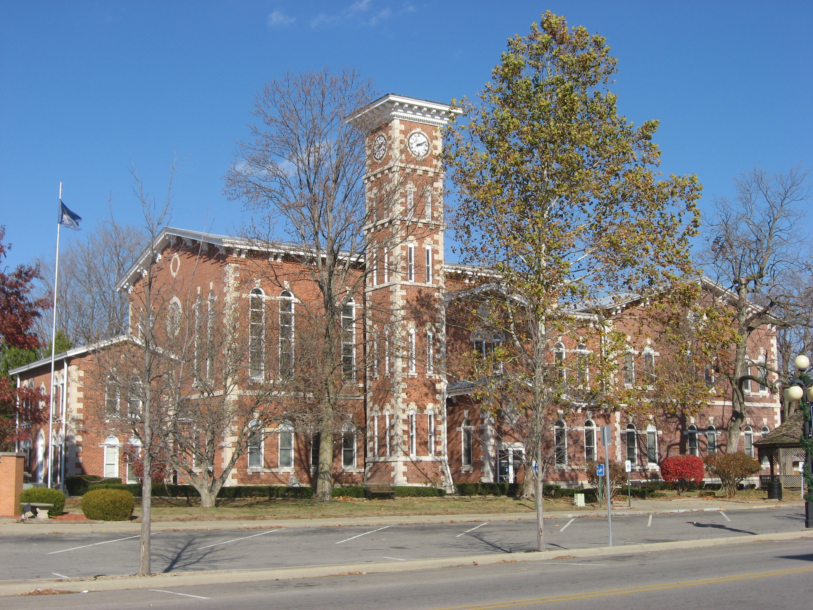
39°36′56″N 86°22′53″W / 39.615556°N 86.381389°WMooresville 23 Morgan County Courthouse 
January 11, 1996 Courthouse Square
39°25′39″N 86°25′41″W / 39.4275°N 86.428056°WMartinsville 24 Morgan County Sheriff's House and Jail May 30, 1996 110 W. Washington St.
39°25′38″N 86°25′49″W / 39.427222°N 86.430278°WMartinsville 25 Morgantown Historic District 
June 21, 2006 Approximately 4.5 blocks centered on Washington St., between Marion St. and east of Church St.
39°22′24″N 86°15′40″W / 39.373333°N 86.261111°WMorgantown 26 Neely House March 15, 2000 739 W. Washington St.
39°25′43″N 86°25′09″W / 39.428611°N 86.419167°WMartinsville 27 Wilbur School May 27, 1993 Wilbur Rd.
39°30′50″N 86°29′19″W / 39.513889°N 86.488611°WWilbur See also
- List of National Historic Landmarks in Indiana
- National Register of Historic Places listings in Indiana
References
- ^ The latitude and longitude information provided in this table was derived originally from the National Register Information System, which has been found to be fairly accurate for about 99% of listings. For about 1% of NRIS original coordinates, experience has shown that one or both coordinates are typos or otherwise extremely far off; some corrections may have been made. A more subtle problem causes many locations to be off by up to 150 yards, depending on location in the country: most NRIS coordinates were derived from tracing out latitude and longitudes off of USGS topographical quadrant maps created under the North American Datum of 1927, which differs from the current, highly accurate WGS84 GPS system used by Google maps. Chicago is about right, but NRIS longitudes in Washington are higher by about 4.5 seconds, and are lower by about 2.0 seconds in Maine. Latitudes differ by about 1.0 second in Florida. Some locations in this table may have been corrected to current GPS standards.
- ^ "National Register of Historic Places: Weekly List Actions". National Park Service, United States Department of the Interior. Retrieved on November 10, 2011.
- ^ Numbers represent an ordering by significant words. Various colorings, defined here, differentiate National Historic Landmark sites and National Register of Historic Places Districts from other NRHP buildings, structures, sites or objects.
- ^ "National Register Information System". National Register of Historic Places. National Park Service. . http://nrhp.focus.nps.gov/natreg/docs/All_Data.html.
U.S. National Register of Historic Places Topics Lists by states Alabama • Alaska • Arizona • Arkansas • California • Colorado • Connecticut • Delaware • Florida • Georgia • Hawaii • Idaho • Illinois • Indiana • Iowa • Kansas • Kentucky • Louisiana • Maine • Maryland • Massachusetts • Michigan • Minnesota • Mississippi • Missouri • Montana • Nebraska • Nevada • New Hampshire • New Jersey • New Mexico • New York • North Carolina • North Dakota • Ohio • Oklahoma • Oregon • Pennsylvania • Rhode Island • South Carolina • South Dakota • Tennessee • Texas • Utah • Vermont • Virginia • Washington • West Virginia • Wisconsin • WyomingLists by territories Lists by associated states Other Municipalities and communities of Morgan County, Indiana City 
Towns Bethany | Brooklyn | Monrovia | Mooresville | Morgantown | Paragon
Townships Unincorporated
communitiesAdams | Allman | Banta | Beech Grove | Bluffs | Briarwood | Brookmoor | Browns Crossing | Bunker Hill | Centerton | Champlin Meadows | Cope | Crestview Heights | Crown Center | Eminence | Exchange | Fewell Rhoades | Fields | Five Points | Fox Hill | Gasburg | Hall | Hyndsdale | Lake Hart | Landersdale | Little Point | Mahalasville | Maxwell | McDaniel | Miller | Plano | Prather | Ridgewood | Shelburne | Stines Mill Corner | Sundown Manor | Wakeland | Waverly | Waverly Woods | Whitaker | Wilbur | Willowbrook Estates | Wiser | Wolff | Woodcrest | Young
Categories:- National Register of Historic Places in Morgan County, Indiana
- National Register of Historic Places in Indiana by county
-


Wikimedia Foundation. 2010.