- National Register of Historic Places listings in Porter County, Indiana
-
 Location of Porter County in Indiana
This is a list of the National Register of Historic Places listings in Porter County, Indiana.
This is intended to be a complete list of the properties and districts on the National Register of Historic Places in Porter County, Indiana, United States. Latitude and longitude coordinates are provided for many National Register properties and districts; these locations may be seen together in a Google map.[1]
There are 31 properties and districts listed on the National Register in the county, including 1 National Historic Landmark.
-
- This National Park Service list is complete through NPS recent listings posted November 10, 2011.[2]
Current listings
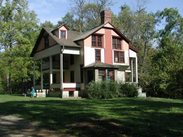
[3] Landmark name [4] Image Date listed Location City or town Summary 1 Joseph Bailly Homestead 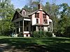
October 15, 1966 West of Porter on U.S. Route 20 on the Indiana Dunes National Lakeshore
41°37′30″N 87°05′35″W / 41.625°N 87.093056°WPorter Joseph Bailly acquired the Homestead and surrounding lands during 1830s when the Calumet was opened to white settlement. When he died in 1835, the Homestead went to his wife. 2 Bartlett Real Estate Office 
March 23, 2004 500 S. Broadway
41°40′24″N 86°59′12″W / 41.673333°N 86.986667°WBeverly Shores 3 Beverly Shores South Shore Railroad Station 
July 19, 1989 Broadway Ave. and U.S. Route 12
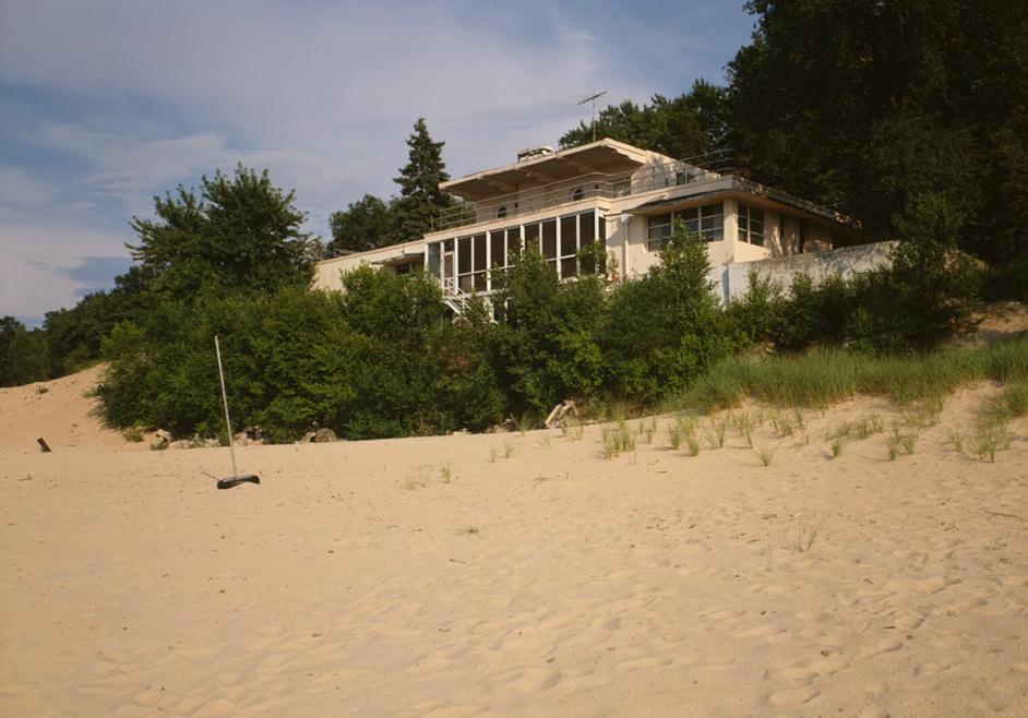
41°40′24″N 86°59′09″W / 41.673333°N 86.985833°WBeverly Shores Beverly Shores Station is the last example of the "Insull Spanish" architecture style used for station houses along the electric railroad lines acquired by Samuel Insull in the first part of the twentieth century. 4 Beverly Shores-Century of Progress Architectural District 
June 30, 1986 208, 210, 212, 214, and 215 Lake Front Dr.
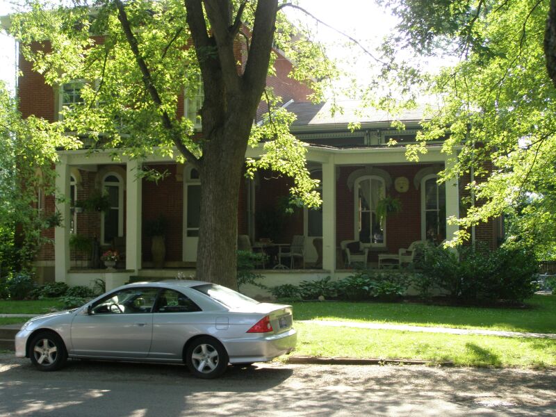
41°41′03″N 87°00′06″W / 41.684167°N 87.001667°WBeverly Shores The Century of Progress Architectural District consists of five buildings, all from the Homes of Tomorrow Exhibition during the 1933 Century of Progress World's Fair which took place in Chicago. 5 Conrad and Catherine Bloch House June 23, 2011 608 Academy St.
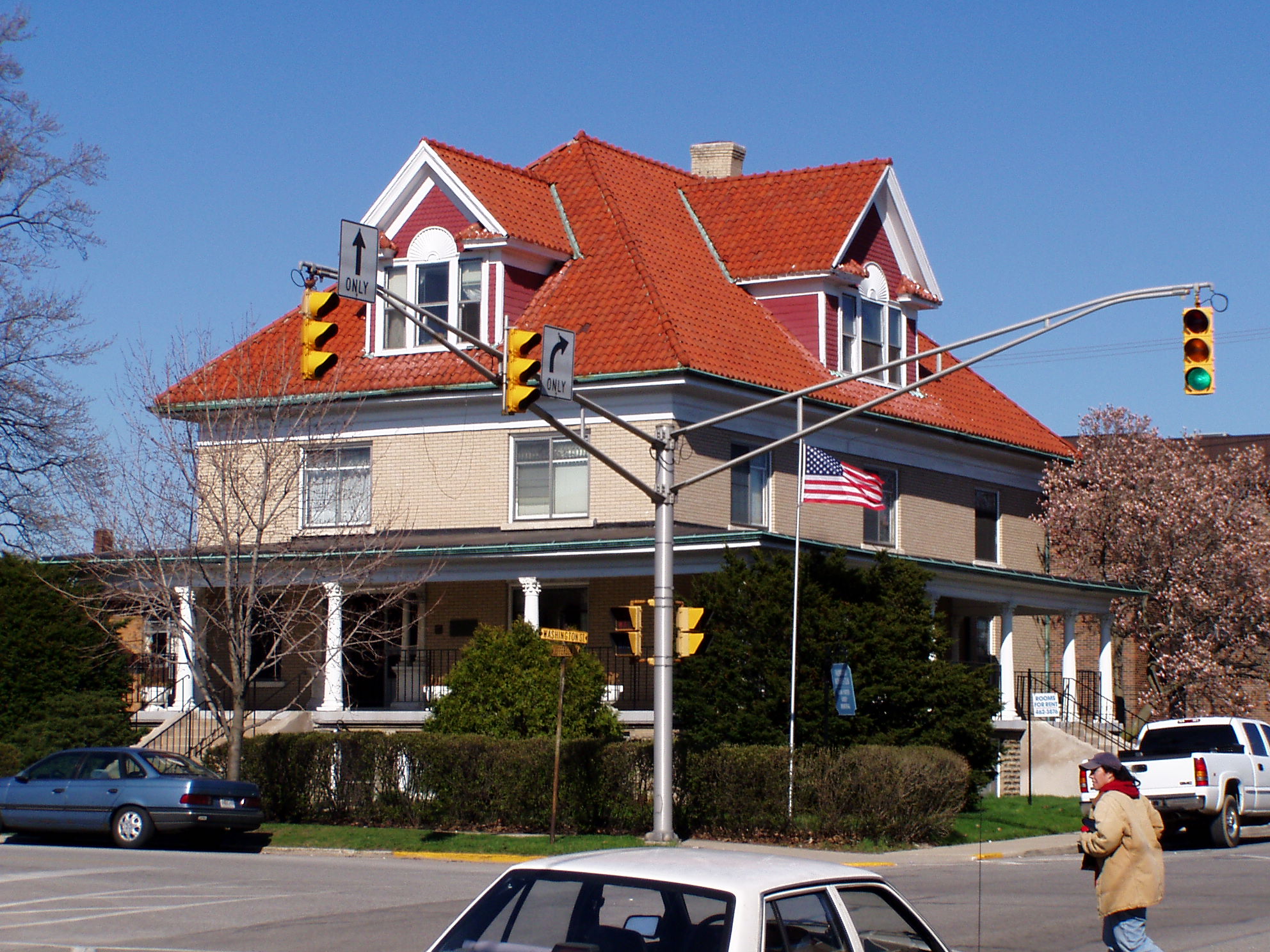
41°28′25″N 87°03′52″W / 41.473611°N 87.064444°WValparaiso 6 George Brown Mansion 
August 28, 1998 700 W. Porter Ave.
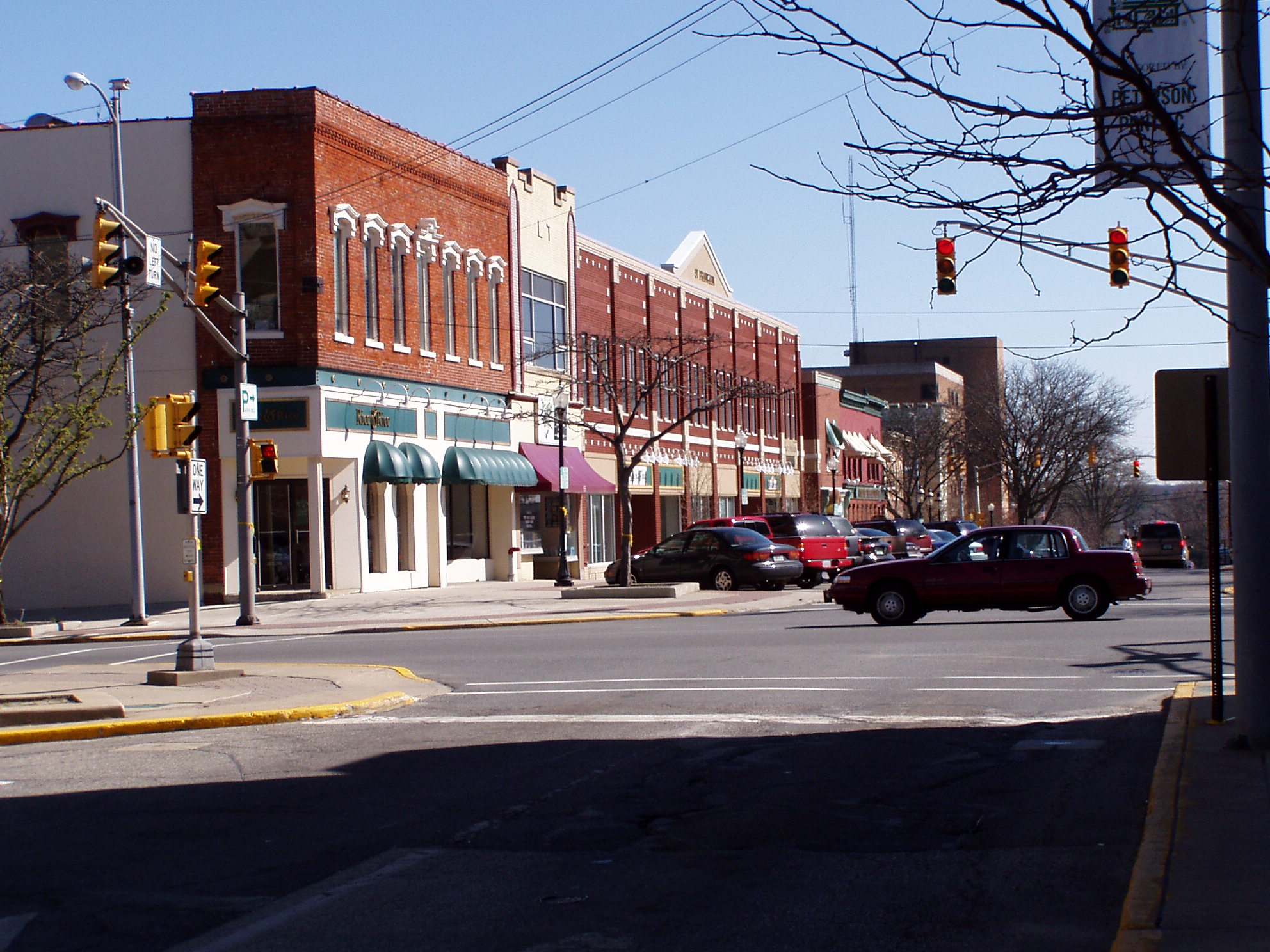
41°36′21″N 87°03′42″W / 41.605833°N 87.061667°WChesterton 7 Chesterton Commercial Historic District 
September 9, 1999 109-193 N. Calumet Rd. and 130-134 N. Calumet Rd.
41°36′44″N 87°03′09″W / 41.612117°N 87.052497°WChesterton The town’s location along the railroad helped industry to grow. Soon, there was a cooperage, sawmills, a washing machine factory, and an organ company. Among the better examples of the towns growth are the commercial building on the southwest corner of Broadway and Calumet Rd, and the old Chesterton Tribune Building. 8 Chesterton Residential Historic District 
December 24, 2009 Roughly a two-block area between Lincoln and W. Indiana Aves.
41°36′32″N 87°3′13″W / 41.60889°N 87.05361°W[5]Chesterton 9 Collier Lodge Site 
December 24, 2009 1099 Baum's Bridge Rd.
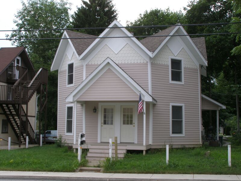
41°16′32″N 87°4′18″W / 41.27556°N 87.07167°W[6]Kouts 10 Norris and Harriet Coambs Lustron House 
September 17, 1992 411 Bowser Ave.
41°36′30″N 87°03′19″W / 41.608333°N 87.055278°WChesterton 11 Dune Acres Clubhouse January 25, 2007 Clubhouse Dr.
41°39′11″N 87°05′10″W / 41.653056°N 87.086111°WDune Acres 12 Clinton D. Gilson Barn 
September 20, 1984 522 W. 650S
41°20′22″N 87°09′59″W / 41.339444°N 87.166389°WHebron 13 Haste-Crumpacker House 
June 24, 2010 208 N Michigan St.
41°28′12″N 87°03′30″W / 41.47°N 87.058333°WValparaiso 14 Heritage Hall 
July 12, 1976 Campus Mall, S. College Ave.
41°27′43″N 87°03′15″W / 41.461944°N 87.054167°WValparaiso Heritage Hall is the oldest building on the campus of Valparaiso University. Erected in 1875, the building was named Flint Hall after the contractor. It was renamed after Richard Aaron Heritage, head of the music department from 1878-1894. 15 Imre and Maria Horner House 
September 25, 1996 2 Merrivale Ave.
41°41′33″N 86°58′46″W / 41.6925°N 86.979444°WBeverly Shores 16 Immanuel Lutheran Church 
February 19, 1982 308 N. Washington St.
41°28′16″N 87°03′38″W / 41.471111°N 87.060556°WValparaiso The congregation was founded in 1862 by 45 German families. The church was erected in 1891 by Henry Lemster and his son Charles. 17 Dr. David J. Loring Residence and Clinic 
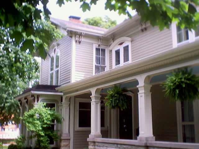
December 6, 1984 102 Washington St.
41°28′08″N 87°03′39″W / 41.468889°N 87.060833°WValparaiso The Loring Residence and Clinic was the first facility built to provide medical services to the community. Dr Loring used his home as his medical office until his death in 1914. 18 William McCallum House 
January 25, 2007 507 E. Lincolnway
41°28′05″N 87°03′15″W / 41.468056°N 87.054167°WValparaiso 19 New York Central Railroad Passenger Depot 
August 28, 1998 220 Broadway
41°36′41″N 87°03′16″W / 41.611389°N 87.054444°WChesterton 20 Nike Missile Site C47 January 21, 2000 County Roads 600N and 700N
41°31′41″N 87°10′20″W / 41.528056°N 87.172222°WPortage One of 300 Nike missile bases, and one of a dozen located around Chicago. The sites was decommissioned sold. This is one of the more complete sites. The Administrative area is used as a 'Paint Ball' site. The Launch Site remains in government ownership. 21 Porter County Jail and Sheriff's House 
June 23, 1976 153 Franklin St.
41°28′00″N 87°03′34″W / 41.466667°N 87.059444°WValparaiso The sheriff’s residence was built in 1860. The structure is Italianate in design. It is located on East Indiana Ave, which was Mechanic Street when the house was built. The Jail was added in 1871. 22 Porter County Memorial Hall 
May 23, 1984 104 Indiana Ave.
41°28′00″N 87°03′33″W / 41.466667°N 87.059167°WValparaiso Originally, the Chaplain Brown GAR Post No. 106. Designed in 1892 by local architect, Charles F. Lembke, using Romanesque styling, it was built in 1892-3 to seat 100 people. It was also used as the local opera house. 23 Porter Town Hall 
June 29, 2000 303 Franklin St.
41°36′59″N 87°04′20″W / 41.616389°N 87.072222°WPorter Replaced by a modern structure in 2006. 24 David Garland Rose House 
July 17, 1980 156 Garfield St.
41°27′58″N 87°03′05″W / 41.466111°N 87.051389°WValparaiso The David Garland Rose House was built circa 1860 in Valparaiso, Indiana, USA. This Gothic Revival house is unusual in that it is eight-sided, an octagon. 25 Eli Sigler House March 21, 2011 104 W. Church St.
41°19′03″N 87°12′00″W / 41.3175°N 87.2°WHebron 26 DeForest Skinner House 
June 24, 2008 208 Washington St.
41°28′14″N 87°03′39″W / 41.470486°N 87.060894°WValparaiso 27 Solomon Enclave April 27, 2011 901, 903, 907 E. Lake Front Dr.
41°41′58″N 86°57′45″W / 41.699444°N 86.9625°WBeverly Shores 28 Valparaiso Downtown Commercial District 
February 23, 1990 Roughly bounded by Jefferson, Morgan, Indiana, and Napoleon; also the northwestern corner of the junction of Lincolnway and Napoleon St.
41°28′03″N 87°03′36″W / 41.4675°N 87.06°WValparaiso Second set of addresses represents a boundary increase of December 27, 2010 29 Weller House April 22, 1982 1200 North Rd.
41°36′26″N 86°57′04″W / 41.607222°N 86.951111°WChesterton 30 Josephus Wolf House 
December 19, 2007 453 W. 700N
41°32′11″N 87°08′41″W / 41.536389°N 87.144722°WValparaiso 31 Martin Young House 
March 29, 2007 324 2nd St.
41°36′30″N 87°03′14″W / 41.608333°N 87.053889°WChesterton See also
- List of National Historic Landmarks in Indiana
- National Register of Historic Places listings in Indiana
References
- ^ The latitude and longitude information provided in this table was derived originally from the National Register Information System, which has been found to be fairly accurate for about 99% of listings. For about 1% of NRIS original coordinates, experience has shown that one or both coordinates are typos or otherwise extremely far off; some corrections may have been made. A more subtle problem causes many locations to be off by up to 150 yards, depending on location in the country: most NRIS coordinates were derived from tracing out latitude and longitudes off of USGS topographical quadrant maps created under North American Datum of 1927, which differs from the current, highly accurate GPS system used by Google maps. Chicago is about right, but NRIS longitudes in Washington are higher by about 4.5 seconds, and are lower by about 2.0 seconds in Maine. Latitudes differ by about 1.0 second in Florida. Some locations in this table may have been corrected to current GPS standards.
- ^ "National Register of Historic Places: Weekly List Actions". National Park Service, United States Department of the Interior. Retrieved on November 10, 2011.
- ^ Numbers represent an ordering by significant words. Various colorings, defined here, differentiate National Historic Landmark sites and National Register of Historic Places Districts from other NRHP buildings, structures, sites or objects.
- ^ "National Register Information System". National Register of Historic Places. National Park Service. . http://nrhp.focus.nps.gov/natreg/docs/All_Data.html.
- ^ "National Register of Historic Places Registration Form: Chesterton Commercial Historic District". Indianapolis: Indiana Department of Natural Resources. August 18, 2009. http://www.in.gov/dnr/historic/files/hp-ChestertonHD.pdf. Retrieved April 4, 2011.
- ^ Location derived from the relevant agenda of the Indiana Historic Preservation Review Board; the NRIS lists the site as "Address Restricted"
U.S. National Register of Historic Places Topics Lists by states Alabama • Alaska • Arizona • Arkansas • California • Colorado • Connecticut • Delaware • Florida • Georgia • Hawaii • Idaho • Illinois • Indiana • Iowa • Kansas • Kentucky • Louisiana • Maine • Maryland • Massachusetts • Michigan • Minnesota • Mississippi • Missouri • Montana • Nebraska • Nevada • New Hampshire • New Jersey • New Mexico • New York • North Carolina • North Dakota • Ohio • Oklahoma • Oregon • Pennsylvania • Rhode Island • South Carolina • South Dakota • Tennessee • Texas • Utah • Vermont • Virginia • Washington • West Virginia • Wisconsin • WyomingLists by territories Lists by associated states Other Municipalities and communities of Porter County, Indiana Cities 
Towns Beverly Shores | Burns Harbor | Chesterton | Dune Acres | Hebron | Kouts | Ogden Dunes | Porter | Town of Pines
Townships Unincorporated
communitiesBeverly Hill | Blackhawk Beach | Boone Grove | Brummitt Acres | Coolwood Acres | Graham Woods | Haglund | Hillcrest | Lakes of the Four Seasons‡ | Lake View | Lincoln Hills | Long Lake Island | Marian Manor | Northwood Park | Roble Woods | South Haven | Sylvan Manor | Wake Robin Fields | Westhill | Wheeler
Footnotes ‡This populated place also has portions in an adjacent county or counties
Categories:- National Register of Historic Places in Porter County, Indiana
- National Register of Historic Places in Indiana by county
-


Wikimedia Foundation. 2010.