- National Register of Historic Places listings in Davis County, Utah
-
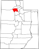
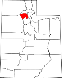 Location of Davis County in Utah
This is a list of the National Register of Historic Places listings in Davis County, Utah.
This is intended to be a complete list of the properties and districts on the National Register of Historic Places in Davis County, Utah, United States. Latitude and longitude coordinates are provided for many National Register properties and districts; these locations may be seen together in a Google map.[1]
There are 51 properties and districts listed on the National Register in the county.
-
- This National Park Service list is complete through NPS recent listings posted November 10, 2011.[2]
Contents
Current listings
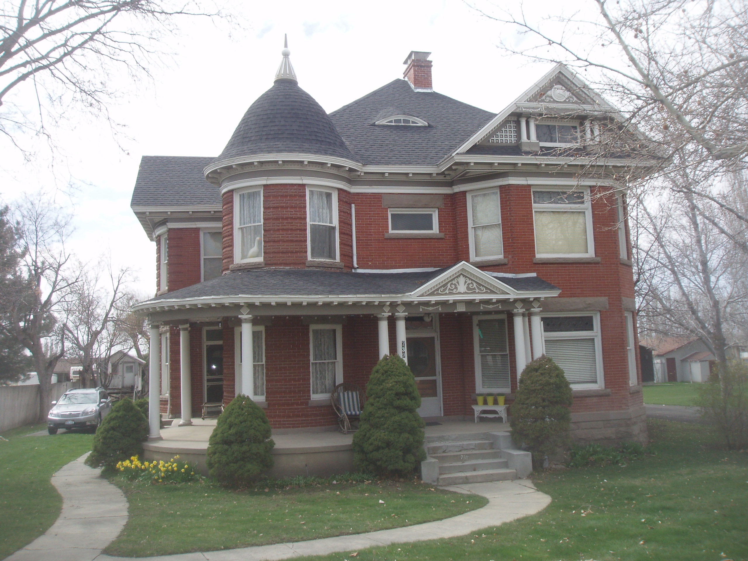
[3] Landmark name [4] Image Date listed Location City or town Summary 1 Joseph Adams House 
February 17, 1978 300 N. Adamswood Rd.
41°03′55″N 111°56′42″W / 41.065278°N 111.945°WLayton 2 James and Hannah Atkinson House 
July 15, 1999 1510 S. 1100 West
40°52′29″N 111°54′40″W / 40.874722°N 111.911111°WWoods Cross 3 Barnard-Garn-Barber House 
November 17, 1997 1198 N. Main St.
40°55′54″N 111°52′43″W / 40.931667°N 111.878611°WCenterville 4 John George Moroni Barnes House 
February 11, 1982 42 W. Center St.
41°02′07″N 111°56′20″W / 41.035278°N 111.938889°WKaysville 5 John R. Barnes House 
July 23, 1982 10 S. 100 West
41°02′05″N 111°56′23″W / 41.034722°N 111.939722°WKaysville 6 Henry Blood House 
April 29, 1980 95 S. 300 West
41°02′01″N 111°56′35″W / 41.033611°N 111.943056°WKaysville Home of Henry H. Blood, former Governor of Utah. 7 Bountiful Historic District 
October 26, 2005 Roughly bounded by 200 W., 500 S., 400 E., and 400 N.
40°53′21″N 111°52′42″W / 40.889167°N 111.878333°WBountiful 8 Bountiful Tabernacle 
January 1, 1976 Main and Center Sts.
40°53′21″N 111°52′43″W / 40.889167°N 111.878611°WBountiful 9 Thomas and Margaret Brandon House 
November 17, 1997 185 E. Center St.
40°55′06″N 111°52′34″W / 40.918333°N 111.876111°WCenterville 10 William Capener House 
January 5, 1984 252 N. 400 East
40°55′12″N 111°52′16″W / 40.92°N 111.871111°WCenterville 11 Clark Lane Historic District 
October 7, 1994 207-399 W. State and 33 N. 200 West
40°58′50″N 111°53′36″W / 40.980556°N 111.893333°WFarmington 12 Osmyn and Emily Deuel House 
November 17, 1997 271 S. 200 East
40°54′53″N 111°52′31″W / 40.914722°N 111.875278°WCenterville 13 John, Harriet, and Eliza Jennett Duncan House 
November 17, 1997 445 N. 400 East
40°55′19″N 111°52′21″W / 40.921944°N 111.8725°WCenterville 14 James and Jane Eldredge House 
June 10, 2005 564 W. 400 North
40°53′40″N 111°53′35″W / 40.894444°N 111.893056°WWest Bountiful 15 Farmer's Union Building 
November 30, 1978 12 S. Main St.
41°03′38″N 111°57′54″W / 41.060556°N 111.965°WLayton 16 Farmington Main Street Historic District October 20, 2011 Approximately Main St. from 200 South to 600 North, along 600 North to Park Lane and 100 North from Main St to 100 West
40°58′50″N 111°53′15″W / 40.980556°N 111.8875°WFarmington 17 Farmington Tithing Office 
March 28, 1985 110 N. Main St.
40°59′29″N 111°53′11″W / 40.991389°N 111.886389°WFarmington 18 Fielding Garr Ranch 
January 21, 1983 Off State Route 127
40°55′31″N 112°09′59″W / 40.925278°N 112.166389°WAntelope Island 19 First National Bank of Layton 
April 5, 2006 50 W. Gentile St.
41°03′38″N 111°57′57″W / 41.060556°N 111.965833°WLayton 20 Joseph N. and Algie Ford House 
November 18, 2005 1394 N. Main St.
40°56′12″N 111°52′39″W / 40.936667°N 111.8775°WCenterville 21 Ford-Rigby House 
November 17, 1997 1592 N. Main St.
40°56′27″N 111°52′47″W / 40.940833°N 111.879722°WCenterville 22 James Green House 
February 11, 1982 206 N. 100 East
40°53′30″N 111°52′38″W / 40.891667°N 111.877222°WBountiful 23 Hector C. Haight House 
May 17, 1985 208 N. Main St.
40°59′03″N 111°53′11″W / 40.984167°N 111.886389°WFarmington 24 Thomas and Caroline Harris House 
June 11, 1998 275 S. 200 East
40°54′54″N 111°52′30″W / 40.915°N 111.875°WCenterville 25 Harris-Tingey House 
November 17, 1997 269 E. Center St.
40°55′03″N 111°52′28″W / 40.9175°N 111.874444°WCenterville 26 Holland-Smith-Brown House 
November 17, 1997 19 S. 200 East
40°55′01″N 111°52′31″W / 40.916944°N 111.875278°WCenterville 27 Kilbourn-Leak House 
November 17, 1997 170 N. 200 East
40°55′10″N 111°52′31″W / 40.919444°N 111.875278°WCenterville 28 George Quincy Knowlton House 
April 17, 1995 93 E. 400 North
40°59′29″N 111°53′03″W / 40.991389°N 111.884167°WFarmington 29 George W. Layton House 
July 23, 1982 2767 W. Gentile St.
41°03′36″N 112°00′50″W / 41.06°N 112.013889°WLayton 30 John Henry Layton House 
February 11, 1982 683 W. Gentile St.
41°03′36″N 111°58′39″W / 41.06°N 111.9775°WLayton 31 Mills-Hancock House 
February 21, 2007 571 S. 400 West
40°55′06″N 111°52′52″W / 40.918333°N 111.881111°WCenterville 32 Nathan and Rebecca Cherry and Eliza Ford Porter Farmstead 
November 17, 1997 370 W. 400 South
40°54′48″N 111°53′05″W / 40.913333°N 111.884722°WCenterville 33 Nathan T. and Anna Porter House 
January 21, 2004 224 S. 210 West
40°54′55″N 111°52′55″W / 40.915278°N 111.881944°WCenterville 34 Melvin Harley Randall House 
June 20, 1980 390 E. Porter Lane
40°54′46″N 111°52′19″W / 40.912778°N 111.871944°WCenterville 35 Rich-Steeper House 
November 17, 1997 415 S. Main St.
40°54′46″N 111°52′42″W / 40.912778°N 111.878333°WCenterville 36 Richards House 
December 23, 1977 386 N. 100 East
40°59′12″N 111°53′02″W / 40.986667°N 111.883889°WFarmington 37 B.H., Louisa Smith and Cecilia Dibble Roberts House 
November 17, 1997 315 S. 300 East
40°54′51″N 111°52′21″W / 40.914167°N 111.8725°WCenterville Home of B. H. Roberts 38 Thomas J. and Amanda N. Smith House 
February 2, 2006 472 N. Main St.
41°02′35″N 111°56′48″W / 41.043056°N 111.946667°WKaysville 39 Smith-Larsen House 
November 17, 1997 280 E. Center St.
40°54′59″N 111°52′27″W / 40.916389°N 111.874167°WCenterville 40 Stayner-Steed House 
August 2, 1999 79 S. 100 East
40°58′45″N 111°53′04″W / 40.979167°N 111.884444°WFarmington 41 LeConte Stewart House 
June 28, 1996 172 W. 100 South
41°02′03″N 111°56′28″W / 41.034167°N 111.941111°WKaysville 42 William Henry and Mary Streeper House 
November 17, 1997 1020 N. Main St.
40°55′46″N 111°52′50″W / 40.929444°N 111.880556°WCenterville 43 John W., Janet (Nettie), and May Rich Taylor House 
October 30, 1997 49 E. 500 North
40°59′19″N 111°53′50″W / 40.988611°N 111.897222°WFarmington 44 Thurston-Chase Cabin 
November 17, 1997 975 N. Main St.
40°55′43″N 111°52′45″W / 40.928611°N 111.879167°WCenterville 45 Thomas Tingey House 
July 28, 1983 20 N. 300 East
40°55′03″N 111°52′23″W / 40.9175°N 111.873056°WCenterville 46 VanFleet Hotel 
December 19, 1991 88 E. State St.
40°58′48″N 111°53′05″W / 40.98°N 111.884722°WFarmington 47 Franklin and Amelia Walton House 
November 17, 1997 96 W. 280 South
40°54′53″N 111°52′50″W / 40.914722°N 111.880556°WCenterville 48 West Bountiful Historic District 
June 18, 2004 800 West (Onion St.) from 400 North to roughly 1350 North (both sides)
40°53′51″N 111°54′05″W / 40.8975°N 111.901389°WWest Bountiful 49 Thomas and Elizabeth Mills Whitaker House 
March 28, 1996 168 N. Main St.
40°55′08″N 111°52′43″W / 40.918889°N 111.878611°WCenterville 50 James D. Wilcox House 
November 26, 1985 93 E. 100 North
40°58′56″N 111°53′05″W / 40.982222°N 111.884722°WFarmington 51 Young Men's Hall-Tingey House 
November 17, 1997 85 S. 300 East
40°54′59″N 111°52′21″W / 40.916389°N 111.8725°WCenterville See also
References
- ^ The latitude and longitude information provided in this table was derived originally from the National Register Information System, which has been found to be fairly accurate for about 99% of listings. For about 1% of NRIS original coordinates, experience has shown that one or both coordinates are typos or otherwise extremely far off; some corrections may have been made. A more subtle problem causes many locations to be off by up to 150 yards, depending on location in the country: most NRIS coordinates were derived from tracing out latitude and longitudes off of USGS topographical quadrant maps created under the North American Datum of 1927, which differs from the current, highly accurate WGS84 GPS system used by Google maps. Chicago is about right, but NRIS longitudes in Washington are higher by about 4.5 seconds, and are lower by about 2.0 seconds in Maine. Latitudes differ by about 1.0 second in Florida. Some locations in this table may have been corrected to current GPS standards.
- ^ "National Register of Historic Places: Weekly List Actions". National Park Service, United States Department of the Interior. Retrieved on November 10, 2011.
- ^ Numbers represent an ordering by significant words. Various colorings, defined here, differentiate National Historic Landmark sites and National Register of Historic Places Districts from other NRHP buildings, structures, sites or objects.
- ^ "National Register Information System". National Register of Historic Places. National Park Service. . http://nrhp.focus.nps.gov/natreg/docs/All_Data.html.
External links
 Media related to National Register of Historic Places in Davis County, Utah at Wikimedia Commons
Properties on the National Register of Historic Places in Utah 

U.S. National Register of Historic Places Topics Lists by states Alabama • Alaska • Arizona • Arkansas • California • Colorado • Connecticut • Delaware • Florida • Georgia • Hawaii • Idaho • Illinois • Indiana • Iowa • Kansas • Kentucky • Louisiana • Maine • Maryland • Massachusetts • Michigan • Minnesota • Mississippi • Missouri • Montana • Nebraska • Nevada • New Hampshire • New Jersey • New Mexico • New York • North Carolina • North Dakota • Ohio • Oklahoma • Oregon • Pennsylvania • Rhode Island • South Carolina • South Dakota • Tennessee • Texas • Utah • Vermont • Virginia • Washington • West Virginia • Wisconsin • WyomingLists by territories Lists by associated states Other Municipalities and communities of Davis County, Utah Cities Bountiful | Centerville | Clearfield | Clinton | Farmington | Fruit Heights | Kaysville | Layton | North Salt Lake | South Weber | Sunset | Syracuse | West Bountiful | West Point | Woods Cross
 Categories:
- National Register of Historic Places in Utah by county
- Davis County, Utah
-


Wikimedia Foundation. 2010.