- National Register of Historic Places listings in Grand County, Utah
-
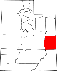 Location of Grand County in Utah
This is a list of the National Register of Historic Places listings in Grand County, Utah.
This is intended to be a complete list of the properties and districts on the National Register of Historic Places in Grand County, Utah, United States. Latitude and longitude coordinates are provided for many National Register properties and districts; these locations may be seen together in a Google map.[1]
There are 21 properties and districts listed on the National Register in the county, including 1 National Historic Landmark.
-
- This National Park Service list is complete through NPS recent listings posted November 10, 2011.[2]
Contents
Current listings
[3] Landmark name [4] Image Date listed Location City or town Summary 1 Apache Motel 
February 19, 2008 166 S. 400 East
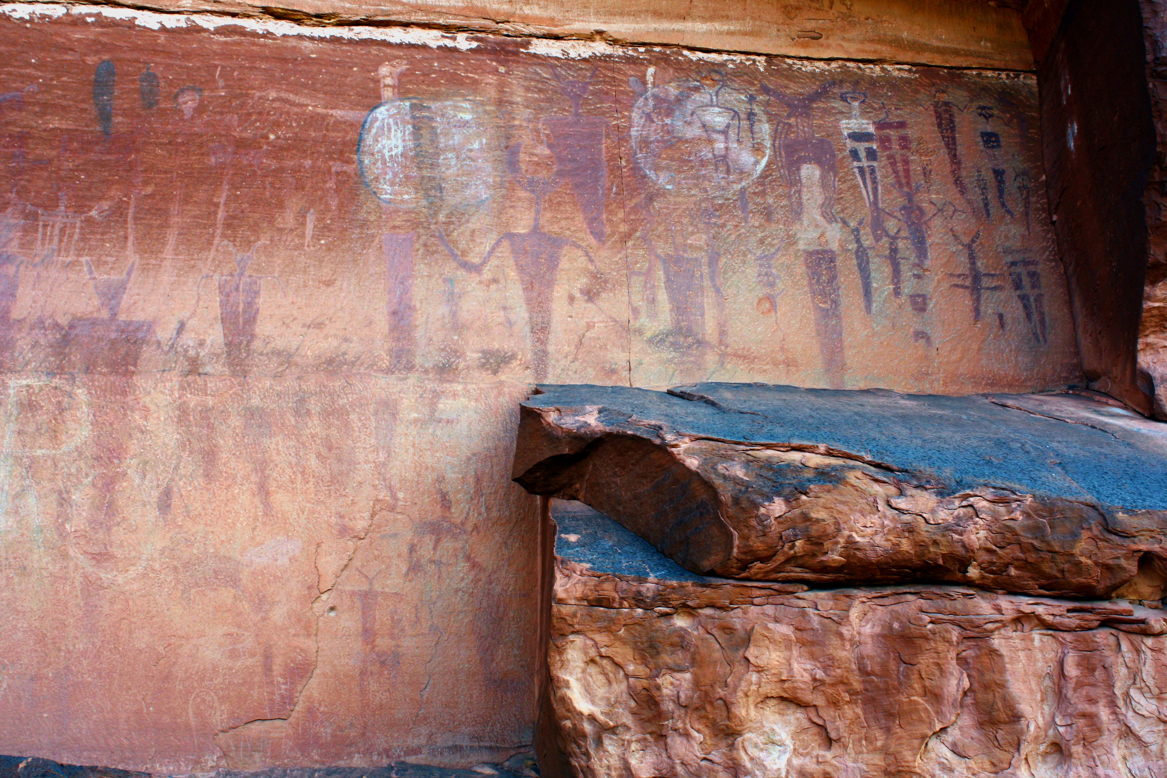
38°34′15″N 109°32′34″W / 38.570833°N 109.542778°WMoab 2 Courthouse Wash Pictographs 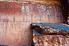
April 1, 1976 1 mile northwest of Moab in Arches National Park on State Route 163
38°36′26″N 109°34′47″W / 38.607222°N 109.579722°WMoab 3 Dalton Wells CCC Camp-Moab Relocation Center 
May 2, 1994 U.S. Route 191, approximately 13 miles north of Moab
38°42′46″N 109°41′58″W / 38.712778°N 109.699444°WMoab Little survives except for pylons which once held the entrance sign and cottonwood trees planted by camp workers. 4 Desolation Canyon November 24, 1968 Along the Green River in western Grand County between Ouray and Green River
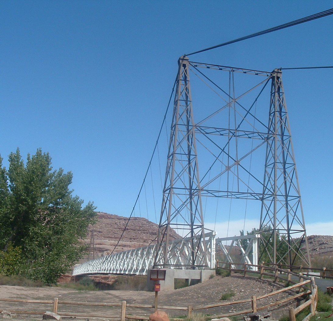
39°48′37″N 109°52′43″W / 39.81028°N 109.87861°W[5]Green River Split between Emery, Grand, Carbon, and Uintah counties 5 Dewey Bridge 
July 12, 1984 Northeast of Moab on State Route 128
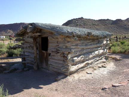
38°48′43″N 109°18′09″W / 38.811944°N 109.3025°WMoab Destroyed by fire in April 2008[6] 6 Elk Mountain Mission Fort Site 
June 15, 1978 Northwest of Moab off U.S. Route 160
38°35′19″N 109°33′45″W / 38.588611°N 109.5625°WMoab 7 Julien Inscription Panel October 6, 1988 Dark Angel vicinity
38°49′23″N 109°39′00″W / 38.823056°N 109.65°WMoab 8 Denis Julien Inscription May 23, 1991 Mouth of Hell Roaring Canyon, Green River Canyon
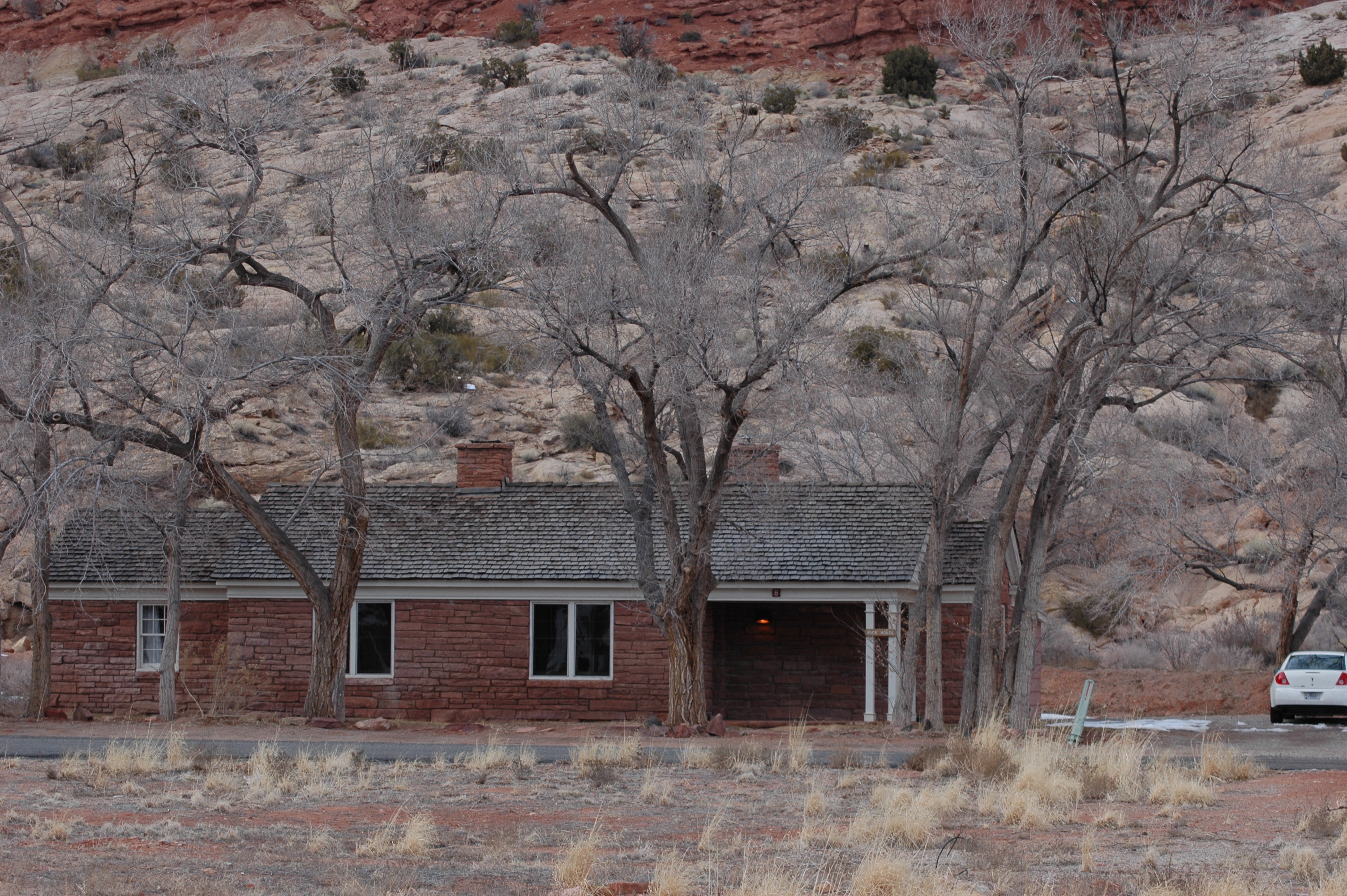
38°33′49″N 109°59′02″W / 38.563611°N 109.983889°WMoab 9 Moab Cabin 
February 14, 1980 56 S. 100 East
38°34′22″N 109°32′46″W / 38.572778°N 109.546111°WMoab 10 Moab LDS Church 
November 28, 1980 65 N. 200 East
38°34′27″N 109°32′43″W / 38.574167°N 109.545278°WMoab 11 Old Spanish Trail October 6, 1988 Visitor Center vicinity
38°36′44″N 109°37′14″W / 38.612222°N 109.620556°WMoab 12 Pinhook Battleground 
March 1, 1982 East of Moab
38°34′31″N 109°18′55″W / 38.575278°N 109.315278°WMoab 13 Ringhoffer Inscription October 6, 1988 Tower Arch
38°47′25″N 109°41′17″W / 38.790278°N 109.688056°WMoab 14 Robidoux Inscription July 23, 1982 West side of Westwater Creek in Book Cliffs, where East Canyon meets the main canyon
39°16′34″N 109°17′12″W / 39.276111°N 109.286667°WCisco 15 Rock House-Custodian's Residence 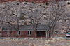
October 6, 1988 Arches National Park Visitor Center vicinity
38°37′04″N 109°36′55″W / 38.617778°N 109.615278°WMoab 16 John Henry Shafer House 
May 2, 2001 530 S. 400 East
38°33′54″N 109°32′36″W / 38.565°N 109.543333°WMoab 17 Star Hall 
May 14, 1993 159 E. Center St.
38°34′25″N 109°32′48″W / 38.573611°N 109.546667°WMoab 18 Arthur Taylor House 
February 28, 1980 1266 N. U.S. Route 191
38°35′34″N 109°33′46″W / 38.592778°N 109.562778°WMoab 19 Thompson Wash Rock Art District 
August 1, 1980 Address Restricted Thompson Springs 20 Orlando W. Warner House September 20, 1977 1010 E. Millcreek Dr.
38°33′44″N 109°31′56″W / 38.562222°N 109.532222°WMoab 21 Wolfe Ranch Historical District 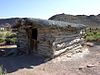
November 20, 1975 North of Moab in Arches National Park
38°44′15″N 109°31′19″W / 38.7375°N 109.521944°WMoab See also
References
- ^ The latitude and longitude information provided in this table was derived originally from the National Register Information System, which has been found to be fairly accurate for about 99% of listings. For about 1% of NRIS original coordinates, experience has shown that one or both coordinates are typos or otherwise extremely far off; some corrections may have been made. A more subtle problem causes many locations to be off by up to 150 yards, depending on location in the country: most NRIS coordinates were derived from tracing out latitude and longitudes off of USGS topographical quadrant maps created under the North American Datum of 1927, which differs from the current, highly accurate WGS84 GPS system used by Google maps. Chicago is about right, but NRIS longitudes in Washington are higher by about 4.5 seconds, and are lower by about 2.0 seconds in Maine. Latitudes differ by about 1.0 second in Florida. Some locations in this table may have been corrected to current GPS standards.
- ^ "National Register of Historic Places: Weekly List Actions". National Park Service, United States Department of the Interior. Retrieved on November 10, 2011.
- ^ Numbers represent an ordering by significant words. Various colorings, defined here, differentiate National Historic Landmark sites and National Register of Historic Places Districts from other NRHP buildings, structures, sites or objects.
- ^ "National Register Information System". National Register of Historic Places. National Park Service. . http://nrhp.focus.nps.gov/natreg/docs/All_Data.html.
- ^ Location and coordinates derived from its GNIS entry; the NRIS lists the site as "Address unknown"
- ^ Dewey Bridge Fire 4-06-2008, photograph
External links
 Media related to National Register of Historic Places in Grand County, Utah at Wikimedia Commons
Properties on the National Register of Historic Places in Utah 

U.S. National Register of Historic Places Topics Lists by states Alabama • Alaska • Arizona • Arkansas • California • Colorado • Connecticut • Delaware • Florida • Georgia • Hawaii • Idaho • Illinois • Indiana • Iowa • Kansas • Kentucky • Louisiana • Maine • Maryland • Massachusetts • Michigan • Minnesota • Mississippi • Missouri • Montana • Nebraska • Nevada • New Hampshire • New Jersey • New Mexico • New York • North Carolina • North Dakota • Ohio • Oklahoma • Oregon • Pennsylvania • Rhode Island • South Carolina • South Dakota • Tennessee • Texas • Utah • Vermont • Virginia • Washington • West Virginia • Wisconsin • WyomingLists by territories Lists by associated states Other Municipalities and communities of Grand County, Utah City 
Town CDP Unincorporated
communityIndian
reservationGhost towns Castleton | Cisco | Dewey | Miners Basin | Sego
Categories:- National Register of Historic Places in Utah by county
- Grand County, Utah
-


Wikimedia Foundation. 2010.