- National Register of Historic Places listings in San Juan County, Utah
-
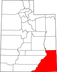 Location of San Juan County in Utah
This is a list of the National Register of Historic Places listings in San Juan County, Utah.
This is intended to be a complete list of the properties and districts on the National Register of Historic Places in San Juan County, Utah, United States. Latitude and longitude coordinates are provided for many National Register properties and districts; these locations may be seen together in a Google map.[1]
There are 33 properties and districts listed on the National Register in the county, including 1 National Historic Landmark.
-
- This National Park Service list is complete through NPS recent listings posted November 10, 2011.[2]
Contents
Current listings
[3] Landmark name [4] Image Date listed Location City or town Summary 1 Joseph Frederick Adams House October 24, 1985 Off U.S. Route 163
37°17′04″N 109°32′58″W / 37.284444°N 109.549444°WBluff 2 Alkali Ridge Historic District October 15, 1966 Along County Road 204 (Alkali Point Rd.), south of Monticello
37°40′50″N 109°22′40″W / 37.68056°N 109.37778°W[5]Monticello Also known as "Alkali Point"; a major proto-Pueblo archaeological site[4] 3 Aneth Terrace Archeological District 
August 1, 1980 Address Restricted[6] Aneth 4 Big Westwater Ruin July 16, 1980 Address Restricted[6] Blanding 5 Bluff Historic District November 2, 1995 Roughly bounded by Main St., U.S. Route 191, 2nd E. St., and the bluffs
37°17′16″N 109°33′03″W / 37.287778°N 109.550833°WBluff 6 Butler Wash Archeological District July 11, 1981 Address Restricted[6] Blanding 7 Cave Springs Cowboy Camp 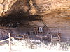
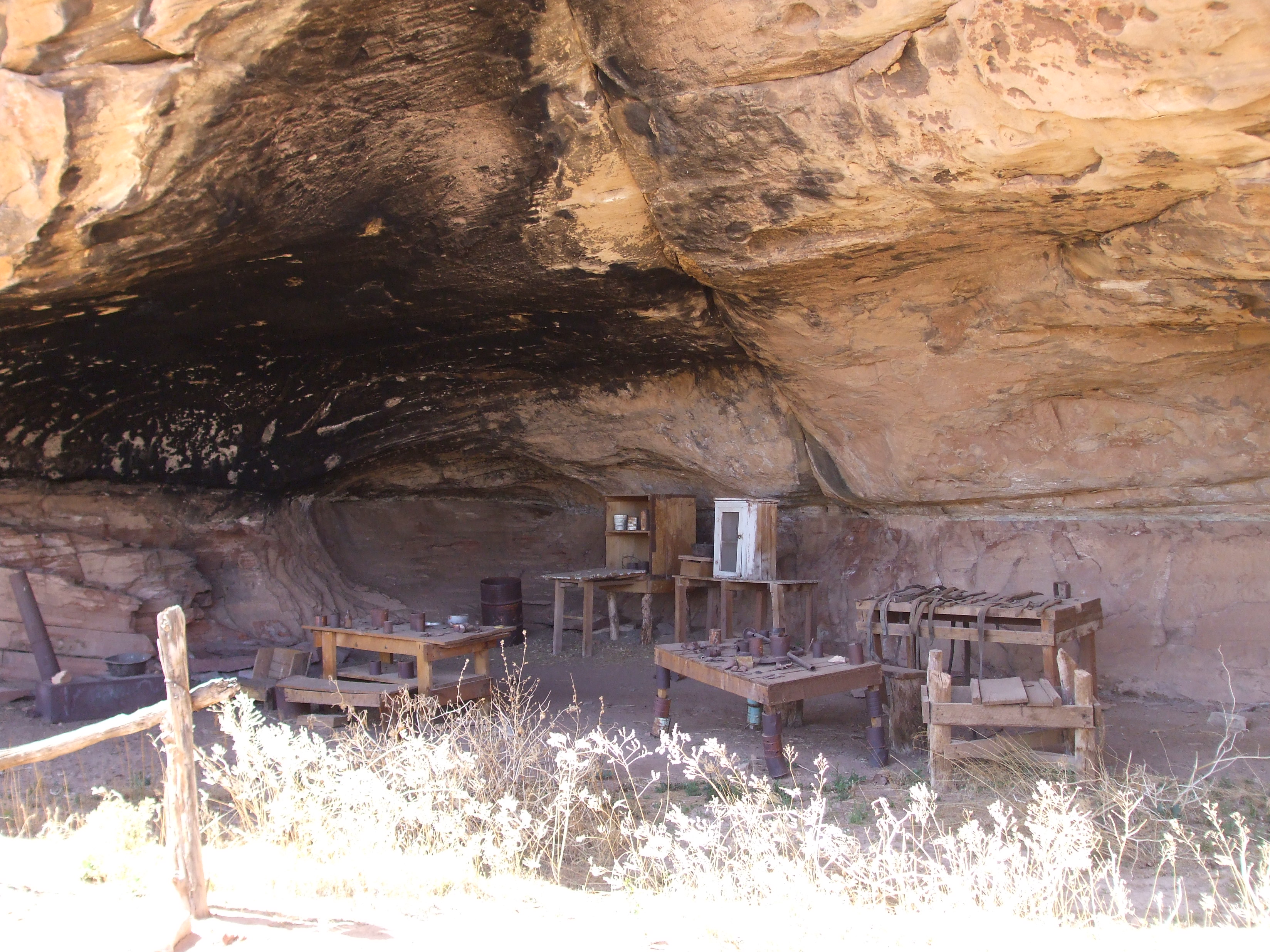
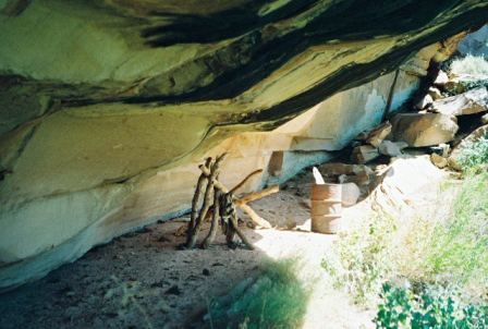
October 7, 1988 Cave Springs vicinity
38°09′34″N 109°45′12″W / 38.159444°N 109.753333°WMoab In the Needles district of Canyonlands National Park 8 James Bean Decker House August 4, 1983 189 N. 300 East
37°17′06″N 109°33′26″W / 37.285°N 109.557222°WBluff 9 Defiance House December 20, 1978 Address Restricted[6] Blanding 10 Edge of Cedars Indian Ruin August 12, 1971 West of Blanding
37°37′48″N 109°29′20″W / 37.63°N 109.488889°WBlanding 11 Goulding's Trading Post October 20, 1980 Off State Route 47
37°00′24″N 110°12′09″W / 37.006667°N 110.2025°WGouldings 12 Grand Gulch Archeological District June 14, 1982 Address Restricted[6] Blanding 13 Hole-in-the-Rock Trail 
August 9, 1982 A trail commencing at Escalante and terminating at Bluff
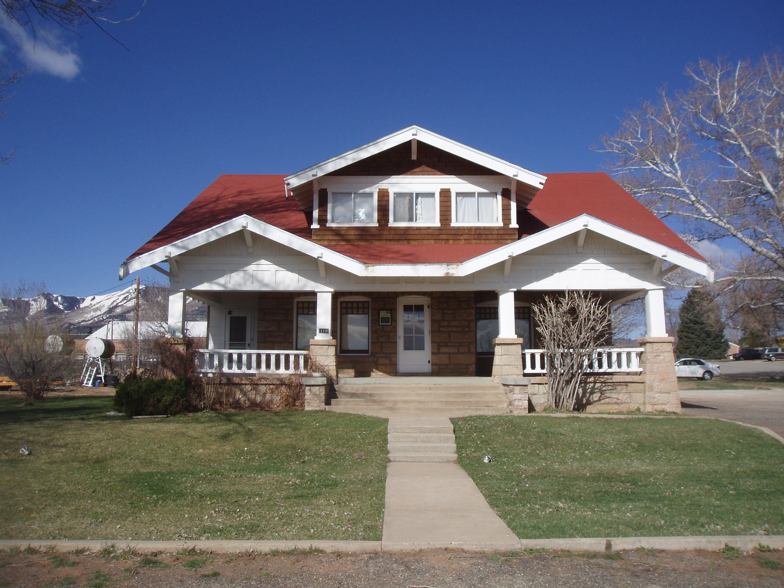
37°25′18″N 110°39′51″W / 37.421667°N 110.664167°WEscalante Split between Garfield, Kane, and San Juan counties 14 Hyland Hotel 
July 28, 1994 116 S. 100 West
37°52′14″N 109°20′38″W / 37.870556°N 109.343889°WMonticello 15 Indian Creek State Park 
March 15, 1976 14 miles north of Monticello
37°59′18″N 109°31′00″W / 37.988333°N 109.516667°WMonticello 16 Frederick Isaac and Mary M. Jones House 
August 14, 2003 117 E. 200 South
37°52′N 109°20′W / 37.87°N 109.34°WMonticello 17 Denis Julien Inscription (San Juan County, Utah) October 7, 1988 Lower Red Lake vicinity
38°09′16″N 109°55′32″W / 38.154444°N 109.925556°WMoab 18 Kirk's Cabin Complex 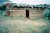
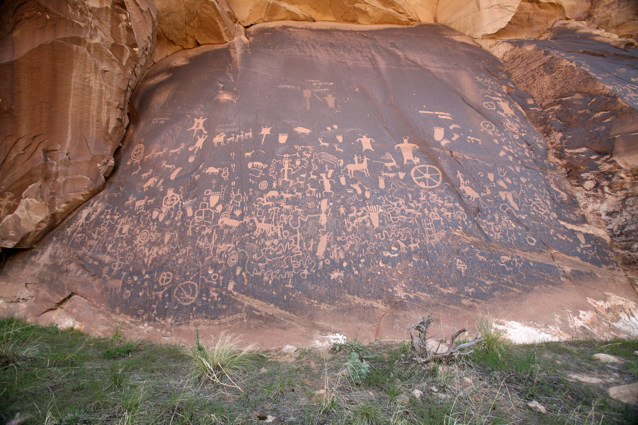
October 7, 1988 Upper Salt Walsh
37°59′16″N 109°44′27″W / 37.987778°N 109.740833°WMoab 19 Lost Canyon Cowboy Camp 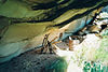
October 7, 1988 Lost Canyon vicinity
38°08′13″N 109°45′32″W / 38.136944°N 109.758889°WMoab 20 Murphy Trail and Bridge October 7, 1988 Murphy Point vicinity
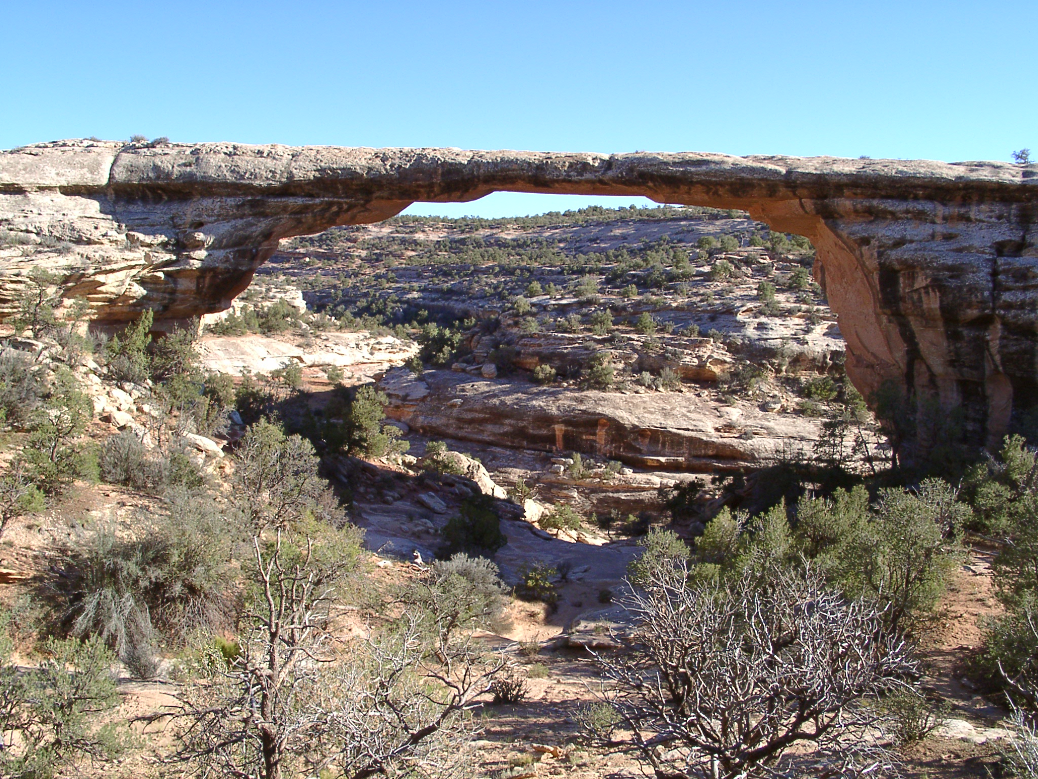
38°20′37″N 109°52′15″W / 38.343611°N 109.870833°WMoab 21 Natural Bridges Archeological District 
August 3, 2004 Address Restricted[6] Blanding 22 Neck and Cabin Springs Grazing Area December 18, 2009 Grand View Point Rd.
38°25′09″N 109°50′04″W / 38.419178°N 109.834572°WMoab 23 Jens Nielson House February 22, 1982 600 E. Black Locust Ave.
37°17′05″N 109°32′23″W / 37.284722°N 109.539722°WBluff 24 Oljato Trading Post June 20, 1980 Southwest of Blanding
37°02′11″N 110°19′03″W / 37.036389°N 110.3175°WBlanding 25 Owachomo Bridge Trail 
February 2, 1989 Armstrong Canyon
37°34′49″N 110°00′49″W / 37.580278°N 110.013611°WBlanding 26 Nancy Patterson Site November 21, 1980 Address Restricted[6] Blanding 27 Poncho House October 10, 1975 Address Restricted[6] Mexican Hat 28 Lemuel H. Redd, Jr. House May 18, 1983 300 E. Mulberry Ave.
37°17′06″N 109°33′16″W / 37.285°N 109.554444°WBluff 29 St. Christopher's Episcopal Mission November 18, 2002 State Route 163
37°17′06″N 109°30′49″W / 37.285°N 109.513611°WBluff 30 Salt Creek Archeological District March 31, 1975 Address Restricted[6] Monticello 31 Sand Island Petroglyph Site July 11, 1981 Address Restricted[6] Bluff 32 John Albert Scorup House April 13, 1983 210 N. 700 East
37°17′09″N 109°32′57″W / 37.285833°N 109.549167°WBluff 33 Swallow's Nest February 23, 1996 2 N. Grayson Parkway
37°37′30″N 109°28′18″W / 37.625°N 109.471667°WBlanding 34 Westwater Canyon Archeological District September 4, 1980 Address Restricted[6] Blanding See also
References
- ^ The latitude and longitude information provided in this table was derived originally from the National Register Information System, which has been found to be fairly accurate for about 99% of listings. For about 1% of NRIS original coordinates, experience has shown that one or both coordinates are typos or otherwise extremely far off; some corrections may have been made. A more subtle problem causes many locations to be off by up to 150 yards, depending on location in the country: most NRIS coordinates were derived from tracing out latitude and longitudes off of USGS topographical quadrant maps created under North American Datum of 1927, which differs from the current, highly accurate GPS system used by Google maps. Chicago is about right, but NRIS longitudes in Washington are higher by about 4.5 seconds, and are lower by about 2.0 seconds in Maine. Latitudes differ by about 1.0 second in Florida. Some locations in this table may have been corrected to current GPS standards.
- ^ "National Register of Historic Places: Weekly List Actions". National Park Service, United States Department of the Interior. Retrieved on November 10, 2011.
- ^ Numbers represent an ordering by significant words. Various colorings, defined here, differentiate National Historic Landmark sites and National Register of Historic Places Districts from other NRHP buildings, structures, sites or objects.
- ^ a b "National Register Information System". National Register of Historic Places. National Park Service. . http://nrhp.focus.nps.gov/natreg/docs/All_Data.html.
- ^ Location derived from the GNIS feature record for a historical marker on Alkali Ridge (USGS maps show this location in an area marked as "Alkali Point"); the NRIS lists the site as "Address Restricted"
- ^ a b c d e f g h i j k Some listings on the NRHP are highly sensitive sites and may be subject to looting or vandalism. The NRHP lists this site as "Address Restricted."
External links
 Media related to National Register of Historic Places in San Juan County, Utah at Wikimedia Commons
Properties on the National Register of Historic Places in Utah 

U.S. National Register of Historic Places Topics Lists by states Alabama • Alaska • Arizona • Arkansas • California • Colorado • Connecticut • Delaware • Florida • Georgia • Hawaii • Idaho • Illinois • Indiana • Iowa • Kansas • Kentucky • Louisiana • Maine • Maryland • Massachusetts • Michigan • Minnesota • Mississippi • Missouri • Montana • Nebraska • Nevada • New Hampshire • New Jersey • New Mexico • New York • North Carolina • North Dakota • Ohio • Oklahoma • Oregon • Pennsylvania • Rhode Island • South Carolina • South Dakota • Tennessee • Texas • Utah • Vermont • Virginia • Washington • West Virginia • Wisconsin • WyomingLists by territories Lists by associated states Other  Category:National Register of Historic Places •
  Portal:National Register of Historic Places
Municipalities and communities of San Juan County, Utah County seat: Monticello Cities 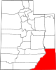
CDPs Unincorporated
communityGhost towns Categories:- National Register of Historic Places in Utah by county
- San Juan County, Utah
-


Wikimedia Foundation. 2010.