- National Register of Historic Places listings in Weber County, Utah
-
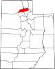
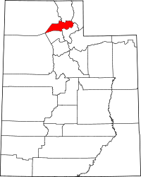 Location of Weber County in Utah
This is a list of the National Register of Historic Places listings in Weber County, Utah.
This is intended to be a complete list of the properties and districts on the National Register of Historic Places in Weber County, Utah, United States. Latitude and longitude coordinates are provided for many National Register properties and districts; these locations may be seen together in a Google map.[1]
There are 62 properties and districts listed on the National Register in the county.
-
- This National Park Service list is complete through NPS recent listings posted November 10, 2011.[2]
Contents
Current listings
[3] Landmark name [4] Image Date listed Location City or town Summary 1 American Can Company of Utah Building Complex 
November 16, 2005 2030 Lincoln Ave.
41°13′49″N 111°58′28″W / 41.230278°N 111.974444°WOgden 2 Arvondor Apartments 
December 31, 1987 823 23rd St.
41°13′28″N 111°57′27″W / 41.224444°N 111.9575°WOgden 3 Avelan Apartments 
December 31, 1987 449 27th St.
41°12′58″N 111°58′07″W / 41.216111°N 111.968611°WOgden 4 Avon Apartments 
December 31, 1987 961 25th St.
41°13′13″N 111°57′14″W / 41.220278°N 111.953889°WOgden 5 Barnhart Apartments 
December 31, 1987 336 27th St.
41°13′01″N 111°58′17″W / 41.216944°N 111.971389°WOgden 6 Gustav Becker House 
July 21, 1977 2408 Van Buren Ave.
41°13′21″N 111°57′00″W / 41.2225°N 111.95°WOgden 7 Bertha Eccles Community Art Center 
May 14, 1971 2580 Jefferson Ave.
41°13′07″N 111°57′50″W / 41.218611°N 111.963889°WOgden 8 Bigelow-Ben Lomond Hotel 
April 19, 1990 2510 Washington Boulevard
41°13′14″N 111°58′10″W / 41.220556°N 111.969444°WOgden 9 Browning Apartments 
December 19, 1985 2703 Washington Boulevard
41°12′58″N 111°58′13″W / 41.216111°N 111.970278°WOgden 10 John Moses Browning House 
April 24, 1973 505 27th St.
41°12′58″N 111°58′00″W / 41.216111°N 111.966667°WOgden Home of John Browning 11 Congregation B'rith Sholem Synagogue 
June 27, 1985 2750 Grant Ave.
41°12′56″N 111°58′21″W / 41.215556°N 111.9725°WOgden 12 Charles W. Cross House 
July 12, 1984 451 17th St.
41°14′10″N 111°58′46″W / 41.236111°N 111.979444°WOgden 13 John L. and Elizabeth Dalton House 
March 11, 1987 2622 Madison Ave.
41°13′05″N 111°57′41″W / 41.218056°N 111.961389°WOgden 14 Devil's Gate-Weber Hydroelectric Power Plant Historic District 
April 20, 1989 Interstate 84 east of its junction with U.S. Route 89
41°08′18″N 111°52′02″W / 41.138333°N 111.867222°WUintah 15 Downing Apartments 
December 31, 1987 357–359 27th St.
41°12′58″N 111°58′15″W / 41.216111°N 111.970833°WOgden Has been demolished 16 John F. and Lillia Dumke House 
February 14, 2007 1607 Kiesel Ave.
41°14′19″N 111°58′17″W / 41.238611°N 111.971389°WOgden 17 Eccles Avenue Historic District 
December 12, 1976 Bounded by 25th and 26th Sts. and Van Buren and Jackson Aves.
41°13′10″N 111°57′05″W / 41.219444°N 111.951389°WOgden 18 Eccles Building 
July 14, 1982 385 24th St.
41°13′22″N 111°58′10″W / 41.222778°N 111.969444°WOgden 19 El Monte Golf Course Clubhouse 
April 1, 1985 1300 Valley Dr.
41°14′01″N 111°56′40″W / 41.233611°N 111.944444°WOgden 20 Episcopal Church of the Good Shepherd 
April 3, 1973 2374 Grant Ave.
41°13′23″N 111°58′19″W / 41.223056°N 111.971944°WOgden 21 Fairview Apartments 
December 31, 1987 579–587 27th St.
41°12′58″N 111°58′36″W / 41.216111°N 111.976667°WOgden 22 Farnsworth Apartments 
December 31, 1987 2539 Jefferson Ave.
41°13′11″N 111°57′54″W / 41.219722°N 111.965°WOgden 23 Valasco Farr House 
June 13, 1978 700 Canyon Rd.
41°14′17″N 111°57′40″W / 41.238056°N 111.961111°WOgden 24 Fern-Marylyn Apartments 
December 31, 1987 2579 Adams Ave.
41°13′08″N 111°58′03″W / 41.218889°N 111.9675°WOgden 25 Flowers Apartments 
December 31, 1987 2681 Madison Ave.
41°13′01″N 111°57′43″W / 41.216944°N 111.961944°WOgden 26 Fontenelle Apartments 
December 31, 1987 2465–2475 Monroe Ave.
41°13′16″N 111°57′32″W / 41.221111°N 111.958889°WOgden 27 Geffas Apartments 
December 31, 1987 2675 Grant Ave.
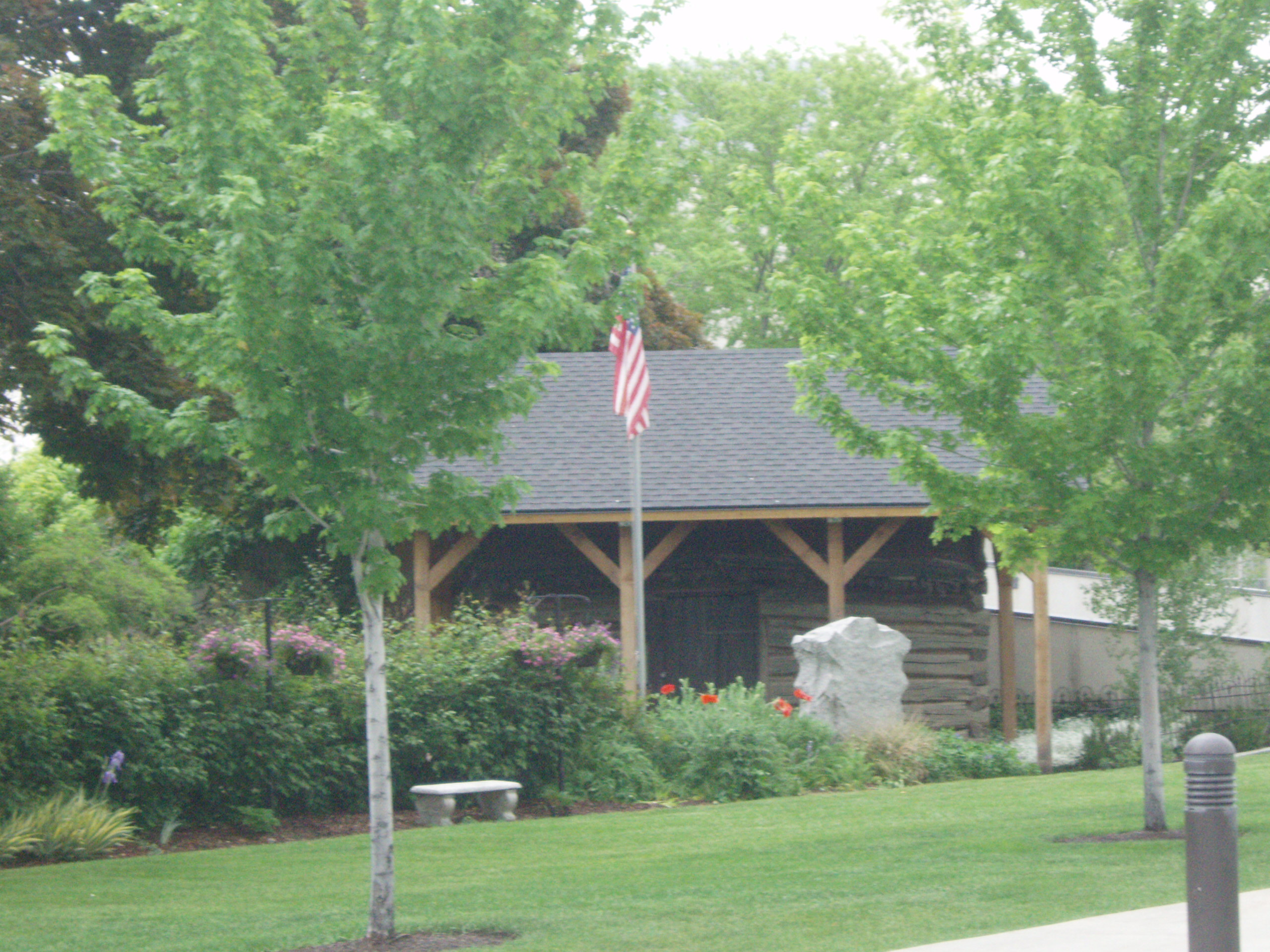
41°13′01″N 111°58′23″W / 41.216944°N 111.973056°WOgden 28 Miles Goodyear Cabin 
February 24, 1971 Tabernacle Sq.
41°13′41″N 111°58′17″W / 41.228056°N 111.971389°WOgden The first known permanent home in Utah, built circa 1841 by Miles Goodyear 29 Grant Steam Locomotive No. 223 
May 23, 1979 Union Station
41°13′20″N 111°58′47.5″W / 41.22222°N 111.979861°W[5]Ogden Moved from a previous location in Salt Lake City 30 Helms Apartments 
December 31, 1987 2248–2250 Jefferson Ave.
41°13′33″N 111°57′50″W / 41.225833°N 111.963889°WOgden 31 Hillcrest Apartments 
December 31, 1987 2485 Monroe Ave.
41°13′15″N 111°57′33″W / 41.220833°N 111.959167°WOgden 32 Jefferson Avenue Historic District 
September 25, 1998 Roughly along Jefferson Ave. between 25th and 27th Sts.
41°13′05″N 111°58′05″W / 41.218056°N 111.968056°WOgden 33 La Frantz Apartments 
December 31, 1987 461 27th St.
41°12′58″N 111°58′07″W / 41.216111°N 111.968611°WOgden 34 Ladywood Apartments 
December 31, 1987 670–690 26th St.
41°13′07″N 111°57′43″W / 41.218611°N 111.961944°WOgden 35 Lower 25th Street Historic District 
January 31, 1978 25th St. between Wall and Grant Aves.; also 2522 Wall Ave.; also Grant Ave. Ogden Second and third addresses represent separate boundary increases 36 Madison Elementary School 
February 19, 1982 2434 Madison Ave.
41°13′18″N 111°57′38″W / 41.221667°N 111.960556°WOgden 37 Don Maguire Duplex 
February 26, 1979 549–551 25th St.
41°13′13″N 111°57′44″W / 41.220278°N 111.962222°WOgden 38 McGregor Apartments 
December 31, 1987 802–810 25th St.
41°13′16″N 111°57′30″W / 41.221111°N 111.958333°WOgden 39 Mountain View Auto Court 
November 24, 1987 563 W. 24th St.
41°13′22″N 111°59′26″W / 41.222778°N 111.990556°WOgden 40 New Brigham Hotel 
June 14, 1979 2402–2410 Wall Ave.
41°13′21″N 111°58′41″W / 41.2225°N 111.978056°WOgden 41 North Ogden Elementary School 
April 1, 1985 474 E. 2650 North
41°18′29″N 111°57′55″W / 41.308056°N 111.965278°WNorth Ogden 42 Ogden Central Bench Historic District 
July 22, 2005 20th St to 30th St., Adams Ave. to Harrison Boulevard
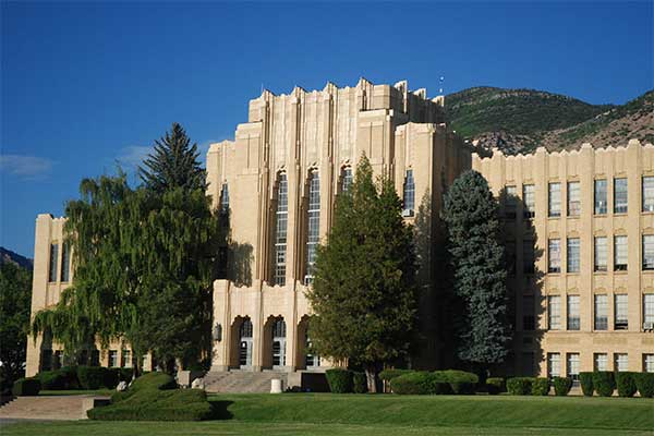
41°13′07″N 111°55′15″W / 41.218611°N 111.920833°WOgden 43 Ogden High School 
June 7, 1983 2828 Harrison Boulevard
41°12′47″N 111°56′46″W / 41.213056°N 111.946111°WOgden 44 Ogden Union Station 
April 11, 1971 25th St. at Wall Ave.; also 2501 Wall Ave.
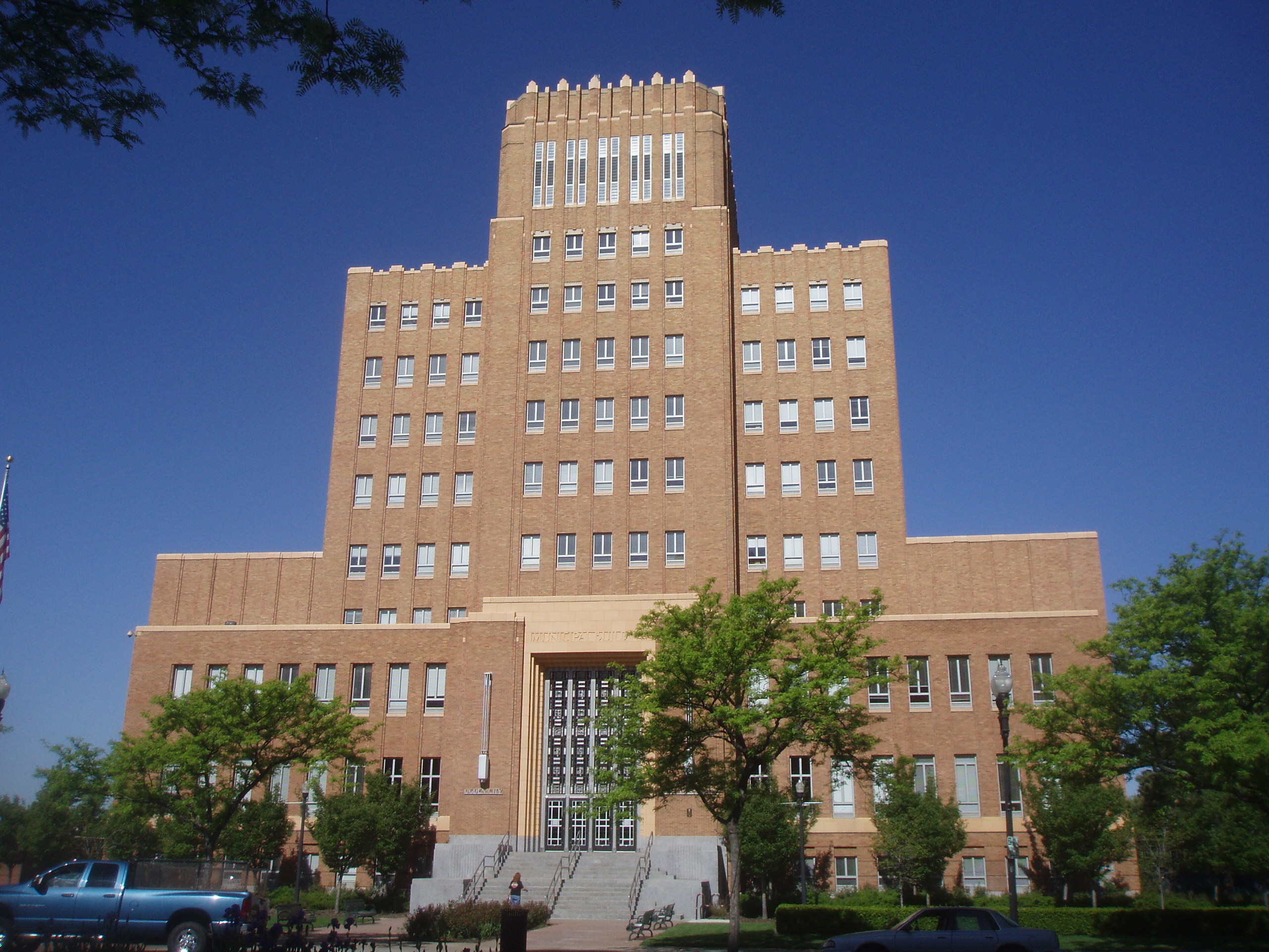
41°13′14″N 111°58′43″W / 41.220556°N 111.978611°WOgden 2501 Wall Ave. represents a boundary increase 45 Ogden/Weber Municipal Building 
June 7, 1983 2541 Washington Boulevard
41°13′11″N 111°58′13″W / 41.219722°N 111.970278°WOgden 46 Augustus B. Patton House 
February 19, 1982 1506 24th St.
41°13′21″N 111°56′21″W / 41.2225°N 111.939167°WOgden 47 Peery Apartments 
December 31, 1987 2461 Adams Ave.
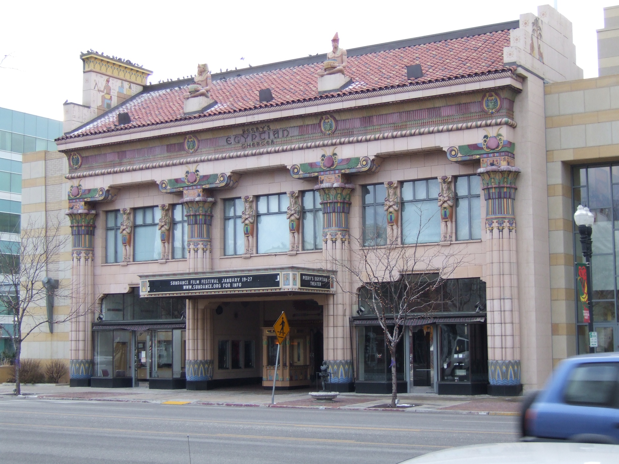
41°13′16″N 111°58′03″W / 41.221111°N 111.9675°WOgden 48 Peery's Egyptian Theatre 
December 12, 1978 2439 Washington Boulevard
41°13′18″N 111°58′12″W / 41.221667°N 111.97°WOgden 49 Pioneer Hydroelectric Power Plant Historic District 
April 21, 1989 12th St. at Canyon Rd.
41°14′38″N 111°56′46″W / 41.243889°N 111.946111°WOgden 50 Rose Apartments 
December 31, 1987 302–308 27th St.
41°13′01″N 111°58′20″W / 41.216944°N 111.972222°WOgden Has been demolished 51 Scowcroft Warehouse 
November 30, 1978 105 23rd St.
41°13′29″N 111°58′39″W / 41.224722°N 111.9775°WOgden 52 Heber Scowcroft House 
December 13, 1991 795 24th St.
41°13′18″N 111°57′31″W / 41.221667°N 111.958611°WOgden 53 William D. Skeen House 
August 9, 1982 2419 N. 4500 West
41°18′16″N 112°5′8″W / 41.30444°N 112.08556°W[6]Plain City 54 Dennis A. Smyth House 
February 11, 1982 635 25th St.
41°13′13″N 111°57′47″W / 41.220278°N 111.963056°WOgden 55 Sidney Stevens House 
December 2, 1977 2593 N. 400 East
41°18′19″N 111°58′05″W / 41.305278°N 111.968056°WNorth Ogden 56 Stone Farmstead 
July 6, 2004 301 W. 2nd St.
41°15′24″N 111°59′46″W / 41.256667°N 111.996111°WOgden 57 U.S. Post Office and Courthouse 
July 26, 1979 298 W. 24th St.
41°13′23″N 111°58′23″W / 41.223056°N 111.973056°WOgden 58 Upton Apartments 
December 31, 1987 2300–2314 Jefferson Ave.
41°13′28″N 111°57′50″W / 41.224444°N 111.963889°WOgden 59 US Forest Service Building 
May 24, 2006 507 25th St.
41°13′13″N 111°58′00″W / 41.220278°N 111.966667°WOgden 60 Utah School for the Deaf and Blind Boys' Dormitory 
April 1, 1985 846 20th St.
41°13′52″N 111°57′25″W / 41.231111°N 111.956944°WOgden 61 Andrew J. Warner House 
December 13, 1977 726 25th St.
41°13′16″N 111°57′37″W / 41.221111°N 111.960278°WOgden 62 Weber Stake Relief Society Building 
February 13, 1989 2148 Grant Ave.
41°13′41″N 111°58′20″W / 41.228056°N 111.972222°WOgden See also
References
- ^ The latitude and longitude information provided in this table was derived originally from the National Register Information System, which has been found to be fairly accurate for about 99% of listings. For about 1% of NRIS original coordinates, experience has shown that one or both coordinates are typos or otherwise extremely far off; some corrections may have been made. A more subtle problem causes many locations to be off by up to 150 yards, depending on location in the country: most NRIS coordinates were derived from tracing out latitude and longitudes off of USGS topographical quadrant maps created under the North American Datum of 1927, which differs from the current, highly accurate WGS84 GPS system used by Google maps. Chicago is about right, but NRIS longitudes in Washington are higher by about 4.5 seconds, and are lower by about 2.0 seconds in Maine. Latitudes differ by about 1.0 second in Florida. Some locations in this table may have been corrected to current GPS standards.
- ^ "National Register of Historic Places: Weekly List Actions". National Park Service, United States Department of the Interior. Retrieved on November 10, 2011.
- ^ Numbers represent an ordering by significant words. Various colorings, defined here, differentiate National Historic Landmark sites and National Register of Historic Places Districts from other NRHP buildings, structures, sites or objects.
- ^ "National Register Information System". National Register of Historic Places. National Park Service. . http://nrhp.focus.nps.gov/natreg/docs/All_Data.html.
- ^ "D&RGW Steam Locomotive #223". Ogden Union Station. http://www.theunionstation.org/museumsrailroad.html. Retrieved 28 January 2010.
- ^ Location derived from this state website; the NRIS lists it as "Address Unknown".
External links
 Media related to National Register of Historic Places in Weber County, Utah at Wikimedia Commons
Properties on the National Register of Historic Places in Utah 

U.S. National Register of Historic Places Topics Lists by states Alabama • Alaska • Arizona • Arkansas • California • Colorado • Connecticut • Delaware • Florida • Georgia • Hawaii • Idaho • Illinois • Indiana • Iowa • Kansas • Kentucky • Louisiana • Maine • Maryland • Massachusetts • Michigan • Minnesota • Mississippi • Missouri • Montana • Nebraska • Nevada • New Hampshire • New Jersey • New Mexico • New York • North Carolina • North Dakota • Ohio • Oklahoma • Oregon • Pennsylvania • Rhode Island • South Carolina • South Dakota • Tennessee • Texas • Utah • Vermont • Virginia • Washington • West Virginia • Wisconsin • WyomingLists by territories Lists by associated states Other Municipalities and communities of Weber County, Utah Cities Farr West | Harrisville | Hooper | Marriott-Slaterville | North Ogden | Ogden | Plain City | Pleasant View | Riverdale | Roy | South Ogden | Uintah | Washington Terrace | West Haven
Town CDP Unincorporated
communitiesNordic Valley | Warren | West Weber
Categories:- National Register of Historic Places in Utah by county
- Weber County, Utah
-


Wikimedia Foundation. 2010.