- National Register of Historic Places listings in Salt Lake County, Utah
-
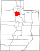
 Location of Salt Lake County in Utah
This is a list of the National Register of Historic Places listings in Salt Lake County, Utah.
This is intended to be a complete list of the properties and districts on the National Register of Historic Places in Salt Lake County, Utah, United States. Latitude and longitude coordinates are provided for many National Register properties and districts; these locations may be seen together in a Google map.[1]
There are 330 properties and districts listed on the National Register in the county, including 6 National Historic Landmarks. 213 of these sites, including 4 National Historic Landmarks, are located in Salt Lake City, and are listed separately; the remaining 117 sites, including 2 National Historic Landmarks, are listed here.
-
- This National Park Service list is complete through NPS recent listings posted November 10, 2011.[2]
Contents
Current listings
[3] Landmark name [4] Image Date listed Location City or town Summary 1 J. R. Allen House August 28, 1980 1047 E. 13200 South
40°30′44″N 111°51′41″W / 40.512222°N 111.861389°WDraper 2 Allsop-Jensen House August 8, 1996 8829 S. 400 East
40°35′28″N 111°52′42″W / 40.591111°N 111.878333°WSandy 3 Thomas and Beda Anderberg House December 30, 2004 28 E. Pioneer Ave.
40°35′52″N 111°53′25″W / 40.597778°N 111.890278°WSandy 4 Alfred C. and Annie L. Olsen Anderson House December 9, 1999 8850 S. 60 East
40°35′27″N 111°53′17″W / 40.590833°N 111.888056°WSandy 5 Charles M. and Fannie M. Allsop Anderson House December 9, 1999 498 E. Locust St.
40°35′24″N 111°52′43″W / 40.59°N 111.878611°WSandy 6 Frederick C. and Anna Anderson House July 9, 1997 8650 S. Center St.
40°35′38″N 111°53′06″W / 40.593889°N 111.885°WSandy 7 John A. Anderson House August 28, 1992 510 E. 8800 South
40°35′29″N 111°52′34″W / 40.591389°N 111.876111°WSandy 8 Y. Martin and Hannah Nelson Anderson House December 9, 1999 8832 S. 90 East
40°35′28″N 111°53′11″W / 40.591111°N 111.886389°WSandy 9 Nathaniel Baldwin House May 9, 1985 2374 Evergreen Ave.
40°41′47″N 111°49′20″W / 40.696389°N 111.822222°WMillcreek 10 Bateman Agriculture and Development Company August 8, 1996 198 E. 8760 South
40°35′31″N 111°53′00″W / 40.591944°N 111.883333°WSandy 11 Amanda Conk Best House December 4, 2008 3622 S. 1100 East
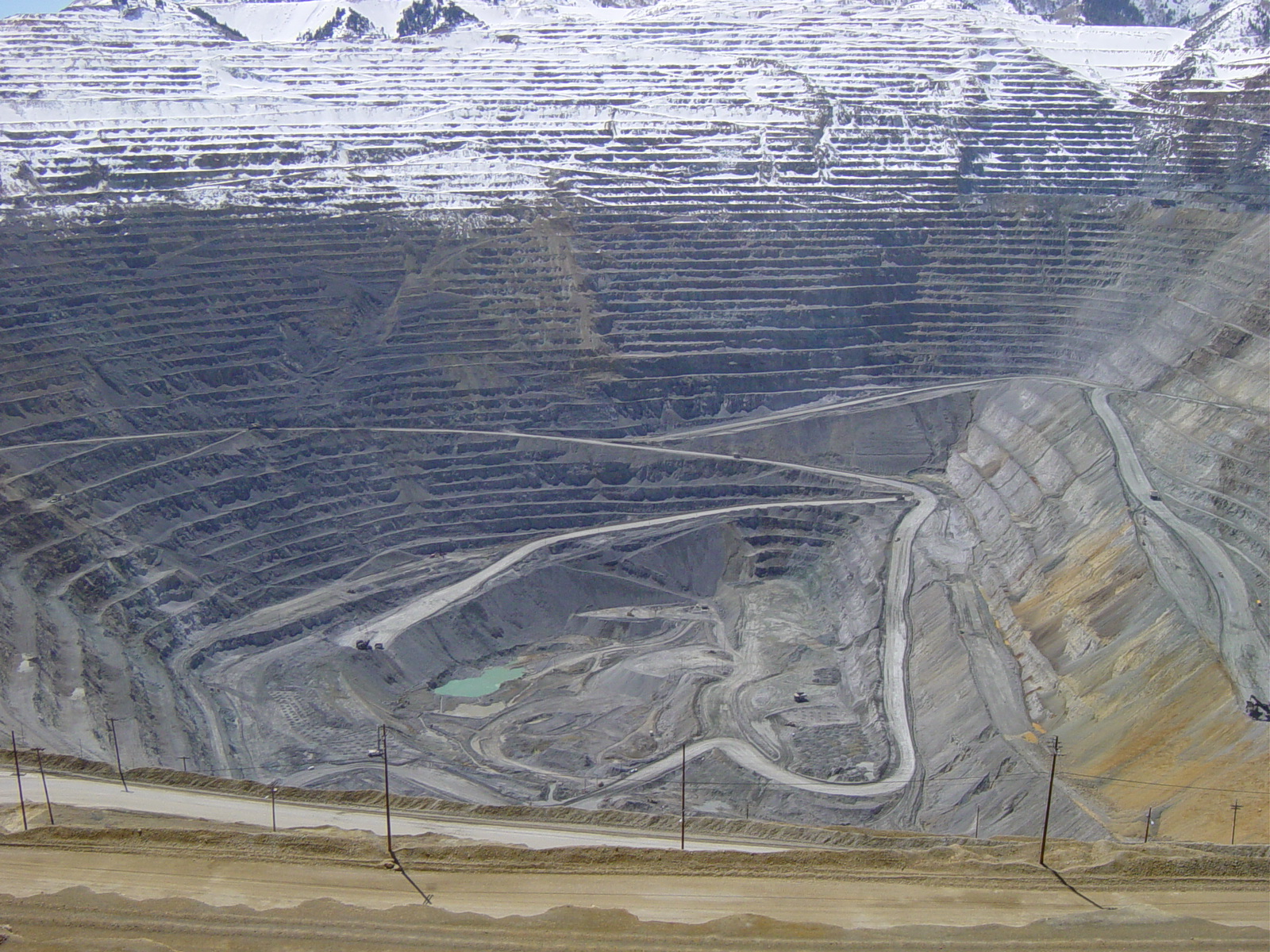
40°30′24″N 111°51′29″W / 40.50669°N 111.85807°WDraper 12 Bingham Canyon Open Pit Copper Mine 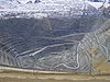
November 13, 1966 16 miles southwest of Salt Lake City on State Route 48
40°31′21″N 112°09′07″W / 40.5225°N 112.151944°WCopperton 13 Brady-Brady House December 30, 2004 8395 S. 1000 East
40°35′56″N 111°51′42″W / 40.598889°N 111.861667°WSandy 14 Brinton-Dahl House February 14, 1980 1501 Spring Lane
40°39′28″N 111°50′47″W / 40.657778°N 111.846389°WHolladay 15 David B. Brinton House May 22, 1978 1981 E. 4800 South
40°39′58″N 111°50′03″W / 40.666111°N 111.834167°WHolladay 16 Butler-Wallin House June 10, 2005 1045 E. 4500 South
40°40′29″N 111°51′38″W / 40.674722°N 111.860556°WMillcreek 17 John P. Cahoon House 
March 3, 1983 4872 S. Poplar St.
40°39′56″N 111°53′22″W / 40.665556°N 111.889444°WMurray 18 Santa Anna Casto House February 3, 1983 2731 Casto Lane
40°39′35″N 111°48′50″W / 40.659722°N 111.813889°WHolladay 19 Morton A. Cheesman House July 23, 1982 2320 Walker Lane
40°38′56″N 111°49′19″W / 40.648889°N 111.821944°WHolladay 20 William Christopherson House December 9, 1999 8847 S. 360 East
40°35′27″N 111°52′46″W / 40.590833°N 111.879444°WSandy 21 Copperton Community Methodist Church February 21, 2007 410 E. Hillcrest Rd.
40°34′24″N 112°05′46″W / 40.573333°N 112.096111°WCopperton 22 Copperton Historic District August 14, 1986 Roughly bounded by State Route 48, 5 East, Hillcrest, and 2 West Sts.
40°33′56″N 112°05′55″W / 40.565556°N 112.098611°WCopperton 23 Crescent Elementary School November 22, 2000 11020 S. State St.
40°33′05″N 111°53′27″W / 40.551389°N 111.890833°WSandy 24 Arthur and Ellen Cushing House November 6, 2000 123 E. Pioneer Ave.
40°35′48″N 111°53′09″W / 40.596667°N 111.885833°WSandy 25 Ernest and Sadie Cushing House August 8, 1996 60 E. Pioneer Ave.
40°35′43″N 111°55′59″W / 40.595278°N 111.933056°WSandy 26 James and Maria Long Cushing House December 9, 1999 68 E. Pioneer Ave.
40°35′46″N 111°53′18″W / 40.596111°N 111.888333°WSandy 27 Emma Olive Dobbs House August 8, 1996 578 E. 8885 South
40°35′31″N 111°52′25″W / 40.591944°N 111.873611°WSandy 28 Hannah Nash Dowding House November 6, 2000 8830 S. 60 East
40°35′28″N 111°53′21″W / 40.591111°N 111.889167°WSandy 29 Dowding-Rasmussen House November 6, 2000 98 E. Main St.
40°35′35″N 111°53′20″W / 40.593056°N 111.888889°WSandy 30 Draper Park School May 7, 1980 12441 S. 900 East
40°31′29″N 111°51′53″W / 40.524722°N 111.864722°WDraper 31 Draper Poultrymen and Egg Producers' Plant May 6, 2004 1071 E. Pioneer Rd.
40°31′33″N 111°51′42″W / 40.525833°N 111.861667°WDraper 32 Draper-Steadman House August 21, 1992 13518 S. 1700 West
40°30′19″N 111°56′18″W / 40.505278°N 111.938333°WRiverton 33 Emigration Canyon 
October 15, 1966 Eastern edge of Salt Lake City on State Route 65
40°45′03″N 111°49′04″W / 40.750833°N 111.817778°WEmigration Canyon 34 Empress Theatre May 9, 1985 9104 W. 2700 South
40°42′40″N 112°06′27″W / 40.711111°N 112.1075°WMagna 35 Evergreen Avenue Historic District February 14, 2007 Roughly bounded by Evergreen Ave., 2300 East, 3300 South, and 2700 East East Millcreek 36 Benjamin and Jane Cook Farrer House August 28, 1992 530 E. 8800 South
40°35′29″N 111°52′32″W / 40.591389°N 111.875556°WSandy 37 John William Farrer House August 28, 1992 39 E. Pioneer Ave.
40°35′47″N 111°53′19″W / 40.596389°N 111.888611°WSandy 38 Perry and Agnes Wadsworth Fitzgerald House May 6, 2004 1144 E. Pioneer Rd.
40°31′30″N 111°51′22″W / 40.525°N 111.856111°WDraper 39 Gardner Mill September 29, 1982 1050 W. 7800 South
40°36′33″N 111°55′21″W / 40.609167°N 111.9225°WWest Jordan 40 Archibald R. and Violet Clark Gardner House July 9, 1997 31 E. Pioneer Ave.
40°35′48″N 111°53′16″W / 40.596667°N 111.887778°WSandy 41 Garside-McMullin House December 17, 1982 10481 S. 1300 West
40°33′38″N 111°55′46″W / 40.560556°N 111.929444°WSouth Jordan 42 Granite Hydroelectric Power Plant Historic District April 20, 1989 State Route 152
40°37′09″N 111°46′53″W / 40.619167°N 111.781389°WCottonwood Heights 43 Granite LDS Ward Chapel-Avard Fairbanks Studio December 30, 2005 9800 S. 3100 East
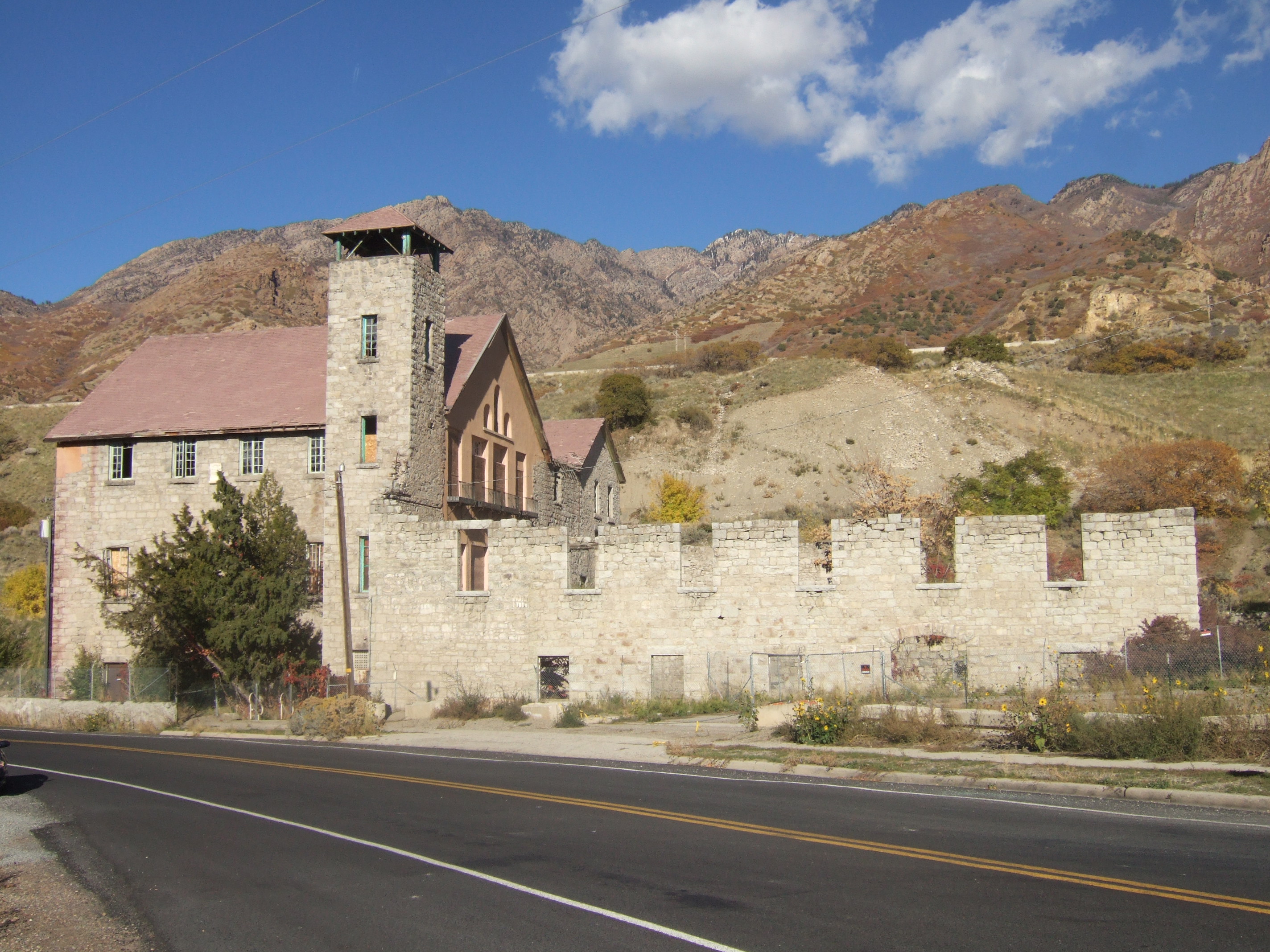
40°34′25″N 111°48′16″W / 40.573611°N 111.804444°WSandy 44 Granite Paper Mill 
April 16, 1971 6900 Big Cottonwood Canyon Rd.
40°37′37″N 111°47′57″W / 40.626944°N 111.799167°WCottonwood Heights 45 Riley H. and Sarah Ann Russell Graves House December 9, 1999 8585 S. 100 East
40°35′44″N 111°52′56″W / 40.595556°N 111.882222°WSandy 46 Alvin and Annie Green House April 6, 2000 8400 Danish Rd.
40°35′55″N 111°48′04″W / 40.598611°N 111.801111°WSandy 47 Orlando H. and Emma H. Hardcastle House December 9, 1999 8751 S. 40 East
40°35′33″N 111°53′18″W / 40.5925°N 111.888333°WSandy 48 Hawarden February 14, 1980 4396 S. 3200 West
West Valley City 49 Hintze-Anders House February 1, 1983 4249 S. 2300 East
40°40′48″N 111°49′25″W / 40.68°N 111.823611°WHolladay 50 Abba R. Holman Block August 28, 1992 142 E. Main St. (8720 South)
40°35′34″N 111°53′06″W / 40.592778°N 111.885°WSandy 51 Samuel and Geneva Holt Farmstead September 7, 2001 10317 S. 1300 West
40°33′50″N 111°55′34″W / 40.563889°N 111.926111°WSouth Jordan 52 Iris Theater, Apartments and Commercial Building 
September 7, 2001 4861 S. State St.
40°39′58″N 111°53′13″W / 40.666111°N 111.886944°WMurray 53 Hyrum and Selma Erickson Jacobson House December 9, 1999 8908 S. 220 East
40°35′24″N 111°53′00″W / 40.59°N 111.883333°WSandy 54 Amos and Ida Jensen House November 6, 2000 387 E. 8800 South
40°35′31″N 111°52′43″W / 40.591944°N 111.878611°WSandy 55 James B. and Ellen May Cushing Jensen House July 9, 1997 95 E. Pioneer Ave.
40°35′48″N 111°53′10″W / 40.596667°N 111.886111°WSandy 56 Joseph F. and Isabelle Jensen House June 11, 1998 428 E. 8800 South
40°35′31″N 111°52′44″W / 40.591944°N 111.878889°WSandy 57 Michael Jensen House December 9, 1999 565 E. 8800 South
40°35′30″N 111°52′32″W / 40.591667°N 111.875556°WSandy 58 Jensen-Clark House November 6, 2000 32 E. Main St.
40°35′35″N 111°53′22″W / 40.593056°N 111.889444°WSandy 59 Jensen-Jensen House November 6, 2000 55 E. Pioneer Ave.
40°35′48″N 111°53′19″W / 40.596667°N 111.888611°WSandy 60 David and Hattie S. Rasmuson Johnson House December 9, 1999 8649 S. 90 East
40°35′39″N 111°53′11″W / 40.594167°N 111.886389°WSandy 61 John A. and Annie C. Olsen Johnson House December 9, 1999 21 E. Pioneer Ave.
40°35′48″N 111°53′20″W / 40.596667°N 111.888889°WSandy 62 Jordan School District Administration Building April 1, 1985 9361 S. 400 East
40°34′53″N 111°53′23″W / 40.581389°N 111.889722°WSandy 63 Kearns-St. Ann's Orphanage October 3, 1980 430 E. 2100 South
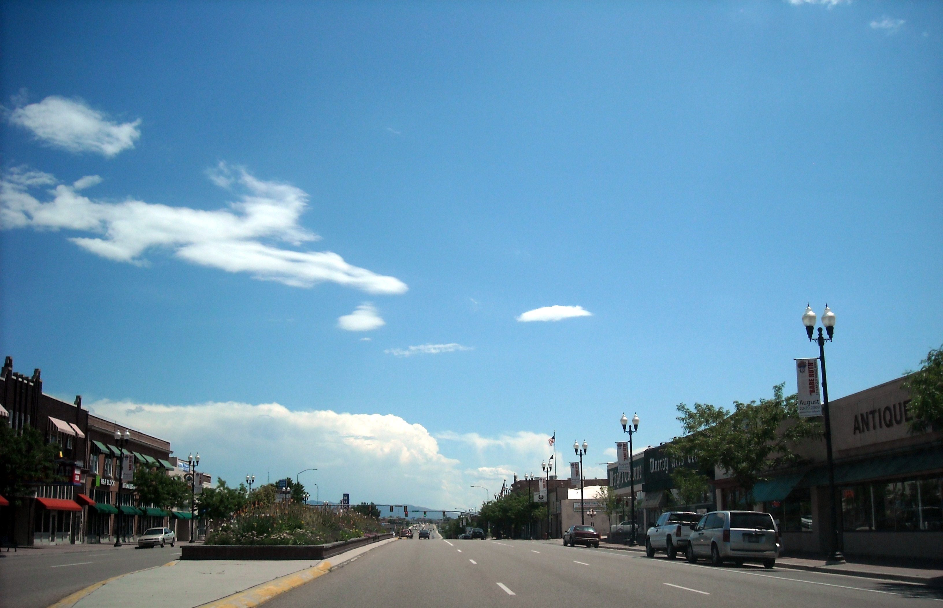
40°43′30″N 111°52′41″W / 40.725°N 111.878056°WSouth Salt Lake 64 William D. Kuhre House July 6, 1987 8586 S. 150 East
40°35′44″N 111°53′07″W / 40.595556°N 111.885278°WSandy 65 Little Dell Station August 12, 1971 East of Salt Lake City in Mountain Dell Canyon, near the junction of State Route 65 and 239
40°46′40″N 111°41′09″W / 40.777778°N 111.685833°WWasatch-Cache National Forest 66 William and Annie Livingston House October 16, 2002 2491 E. Valley View Ave.
40°39′51″N 111°49′07″W / 40.664167°N 111.818611°WHolladay 67 Magna Community Baptist Church June 5, 1986 2908 S. 8900 West
40°42′26″N 112°06′13″W / 40.707222°N 112.103611°WMagna 68 Anne P. Marriott House November 6, 2000 8543 S. 100 East
40°35′52″N 111°38′58″W / 40.597778°N 111.649444°WSandy 69 John and Mary Mattson House August 8, 1996 239 E. Main St.
40°35′36″N 111°52′56″W / 40.593333°N 111.882222°WSandy 70 David McDonald House May 29, 1980 4659 Highland Dr.
40°40′10″N 111°50′20″W / 40.669444°N 111.838889°WHolladay 71 William McLachlan Farmhouse February 14, 1980 4499 S. 3200 West
40°40′23″N 111°57′58″W / 40.673056°N 111.966111°WWest Valley City 72 Benjamin and Olivia Meek House November 29, 2001 12782 S. Fort St.
40°31′09″N 111°51′52″W / 40.519167°N 111.864444°WDraper 73 Joseph E. and Mina W. Mickelsen House May 6, 2004 782 E. Pioneer Rd.
40°31′29″N 111°51′46″W / 40.524722°N 111.862778°WDraper 74 S.J. Mickelsen Hardware Store and Lumber Yard May 6, 2004 12580-12582 S. Fort St.
40°31′22″N 111°51′51″W / 40.522778°N 111.864167°WDraper 75 Hyrum and Mary A. Terry Peterson Mickelson House December 9, 1999 8850 S. 120 East
40°35′26″N 111°53′09″W / 40.590556°N 111.885833°WSandy 76 Midvale City Hall April 7, 1994 12 E. Center St.
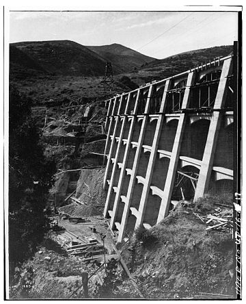
40°36′37″N 111°54′33″W / 40.610278°N 111.909167°WMidvale 77 Mountain Dell Dam 
June 20, 1980 North of Salt Lake City
40°45′06″N 111°43′12″W / 40.751667°N 111.72°WWasatch-Cache National Forest 78 Murray Downtown Historic District 
September 26, 2006 Roughly bounded by 4800 South, Poplar St., Vine St. and Center St.
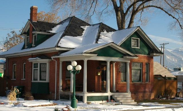
40°40′04″N 111°53′18″W / 40.667778°N 111.888333°WMurray 79 Murray Downtown Residential Historic District 
January 26, 2005 Roughly bounded by 4800 South, Clark St., Vine St., and Center St.
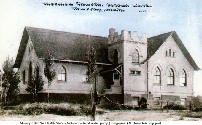
40°39′48″N 111°47′35″W / 40.663333°N 111.793056°WMurray 80 Murray LDS Second Ward Meetinghouse 
May 8, 2001 5056 S. 300 W. St.
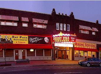
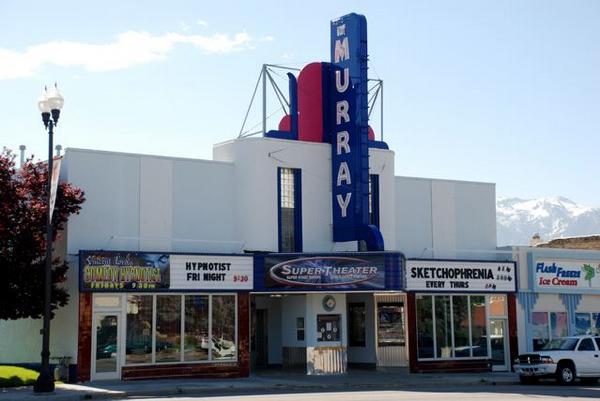
40°39′43″N 111°53′55″W / 40.661944°N 111.898611°WMurray 81 Murray Theater 
May 8, 2001 4961 S. State St.
40°39′52″N 111°46′07″W / 40.664444°N 111.768611°WMurray 82 August M. and Mabel Jensen Nelson House July 9, 1997 427 E. 8800 South
40°35′31″N 111°52′39″W / 40.591944°N 111.8775°WSandy 83 Nels A. Nelson House August 28, 1992 8840 S. 90 East
40°35′26″N 111°53′10″W / 40.590556°N 111.886111°WSandy 84 Oakwood November 16, 1979 2610 Evergreen St.
40°41′47″N 111°48′57″W / 40.696389°N 111.815833°WMillcreek 85 John and Elizabeth Brown Oldham House July 9, 1997 511 E. 8800 South
40°35′31″N 111°52′32″W / 40.591944°N 111.875556°WSandy 86 Orton-Malstrom House July 9, 1997 9325 S. 700 East
40°34′55″N 111°52′15″W / 40.581944°N 111.870833°WSandy 87 John Thomas and Myrtle Bodell Ostler House December 9, 1999 589 E. 8800 South
40°35′31″N 111°52′31″W / 40.591944°N 111.875278°WSandy 88 Mary Ellen Parmley House November 6, 2000 8850 S. 220 East
40°35′29″N 111°53′40″W / 40.591389°N 111.894444°WSandy 89 Charles Peterson House August 28, 1992 82 E. 8880 South
40°35′30″N 111°53′13″W / 40.591667°N 111.886944°WSandy 90 Peter and Ingrid C. Larson Pierson House December 9, 1999 31 E. 8680 South
40°35′38″N 111°53′19″W / 40.593889°N 111.888611°WSandy 91 Edward Pugh House August 31, 1978 1299 E. 4500 South
40°40′28″N 111°51′13″W / 40.674444°N 111.853611°WMillcreek 92 Riverton Elementary School August 8, 1996 12830 S. Redwood Rd.
40°31′06″N 111°56′22″W / 40.518333°N 111.939444°WRiverton 93 Riverton Historic District January 21, 2004 Roughly 12300 S. Redwood Rd. to 12600 S. Redwood Rd.
40°31′39″N 111°56′17″W / 40.5275°N 111.938056°WRiverton 94 Salt Lake County Library July 26, 1982 80 E. Center St.
40°36′37″N 111°54′28″W / 40.610278°N 111.907778°WMidvale 95 Sandy City Bank July 9, 1997 212 E. Main St.
40°35′33″N 111°52′55″W / 40.5925°N 111.881944°WSandy 96 Sandy Co-Op Block August 28, 1992 8750 S. Center St. (150 East)
40°35′33″N 111°53′05″W / 40.5925°N 111.884722°WSandy 97 Sandy Historic District April 20, 2007 Roughly bounded by State St., 9000 South, 700 East, and Pioneer Ave. Sandy 98 Sandy LDS Stake Recreational Hall November 6, 2000 295 E. 8800 South
40°35′32″N 111°52′51″W / 40.592222°N 111.880833°WSandy 99 Sandy Second Ward Chapel July 9, 1997 8630 S. 60 East
40°35′41″N 111°52′42″W / 40.594722°N 111.878333°WSandy 100 Sandy Tithing Office January 25, 1985 Approximately 8850 S. 280 East
40°35′27″N 111°52′53″W / 40.590833°N 111.881389°WSandy 101 Joseph M. and Celestia Smith House April 7, 1994 12357 S. Relation St. (1565 East)
40°31′31″N 111°50′46″W / 40.525278°N 111.846111°WDraper 102 Lauritz H. and Emma Smith House February 1, 2006 12423 S. Relation St.
40°31′32″N 111°50′48″W / 40.525556°N 111.846667°WDraper 103 Lauritz Smith House June 24, 1983 1350 E. 12400 South
40°31′29″N 111°51′02″W / 40.524722°N 111.850556°WDraper 104 Mary Smith House April 15, 1994 12544 S. Relation St. (1565 East)
40°31′24″N 111°50′49″W / 40.523333°N 111.846944°WDraper 105 Stairs Station Hydroelectric Power Plant Historic District April 20, 1989 State Route 152
40°37′29″N 111°44′41″W / 40.624722°N 111.744722°WBig Cottonwood Canyon 106 Niels and Mary Ann Fitzgerald Thompson House July 9, 1997 485 E. 8800 South
40°35′31″N 111°52′36″W / 40.591944°N 111.876667°WSandy 107 Utah Copper Company Mine Superintendent's House October 31, 1985 104 E. State Highway
40°33′56″N 112°05′53″W / 40.565556°N 112.098056°WCopperton 108 Utah-Idaho Sugar Factory February 13, 2009 2140 W. Sugar Factory Rd.
40°36′07″N 111°56′45″W / 40.601969°N 111.945906°WWest Jordan 109 Louis E. and Florence Jensen Van Dam House December 9, 1999 407 E. 8800 South
40°35′31″N 111°52′43″W / 40.591944°N 111.878611°WSandy 110 William Tyler and Amorilla Gammet Vincent House July 9, 1997 92 E. Pioneer Ave.
40°35′45″N 111°53′11″W / 40.595833°N 111.886389°WSandy 111 Glen M. and Roxie Walbeck House February 1, 2006 12875 S. Boulter St.
40°31′04″N 111°50′55″W / 40.5178°N 111.84855°WDraper 112 Wesley and Frances Walton House August 4, 1995 5197 S. Wesley Rd.
40°39′24″N 111°51′26″W / 40.656667°N 111.857222°WMurray 113 Warenski-Duvall Commercial Building and Apartments 
May 19, 2000 4867 S. State St.
40°39′57″N 111°53′12″W / 40.665833°N 111.886667°WMurray 114 Wasatch Mountain Club Lodge November 10, 1980 Southeast of Salt Lake City
40°35′45″N 111°35′01″W / 40.595833°N 111.583611°WBrighton 115 West Jordan Ward Meetinghouse April 14, 1995 1140 W. 7800 South
40°36′28″N 111°55′27″W / 40.607778°N 111.924167°WWest Jordan 116 Henry J. Wheeler Farm 
May 4, 1976 6343 S. 900 East
40°38′03″N 111°51′42″W / 40.634167°N 111.861667°WMurray 117 William W. and Christene Wilson House December 30, 2004 113 E. 8680 South
40°35′45″N 111°53′16″W / 40.595833°N 111.887778°WSandy See also
References
- ^ The latitude and longitude information provided in this table was derived originally from the National Register Information System, which has been found to be fairly accurate for about 99% of listings. For about 1% of NRIS original coordinates, experience has shown that one or both coordinates are typos or otherwise extremely far off; some corrections may have been made. A more subtle problem causes many locations to be off by up to 150 yards, depending on location in the country: most NRIS coordinates were derived from tracing out latitude and longitudes off of USGS topographical quadrant maps created under North American Datum of 1927, which differs from the current, highly accurate GPS system used by Google maps. Chicago is about right, but NRIS longitudes in Washington are higher by about 4.5 seconds, and are lower by about 2.0 seconds in Maine. Latitudes differ by about 1.0 second in Florida. Some locations in this table may have been corrected to current GPS standards.
- ^ "National Register of Historic Places: Weekly List Actions". National Park Service, United States Department of the Interior. Retrieved on November 10, 2011.
- ^ Numbers represent an ordering by significant words. Various colorings, defined here, differentiate National Historic Landmark sites and National Register of Historic Places Districts from other NRHP buildings, structures, sites or objects.
- ^ "National Register Information System". National Register of Historic Places. National Park Service. . http://nrhp.focus.nps.gov/natreg/docs/All_Data.html.
External links
 Media related to National Register of Historic Places in Salt Lake County, Utah at Wikimedia Commons
Properties on the National Register of Historic Places in Utah 

U.S. National Register of Historic Places Topics Lists by states Alabama • Alaska • Arizona • Arkansas • California • Colorado • Connecticut • Delaware • Florida • Georgia • Hawaii • Idaho • Illinois • Indiana • Iowa • Kansas • Kentucky • Louisiana • Maine • Maryland • Massachusetts • Michigan • Minnesota • Mississippi • Missouri • Montana • Nebraska • Nevada • New Hampshire • New Jersey • New Mexico • New York • North Carolina • North Dakota • Ohio • Oklahoma • Oregon • Pennsylvania • Rhode Island • South Carolina • South Dakota • Tennessee • Texas • Utah • Vermont • Virginia • Washington • West Virginia • Wisconsin • WyomingLists by territories Lists by associated states Other  Category:National Register of Historic Places •
  Portal:National Register of Historic Places
Municipalities and communities of Salt Lake County, Utah County seat: Salt Lake City Cities Bluffdale | Cottonwood Heights | Draper | Herriman | Holladay | Midvale | Murray | Riverton | Salt Lake City | Sandy | South Jordan | South Salt Lake | Taylorsville | West Jordan | West Valley City
Town CDPs Copperton | Emigration Canyon | Granite | Kearns | Magna | Millcreek | White City
Townships Copperton | Emigration Canyon | Kearns | Magna | Millcreek
Unincorporated
communityGhost towns Categories:- National Register of Historic Places in Utah by county
- Salt Lake County, Utah
-


Wikimedia Foundation. 2010.