- West Valley City, Utah
-
West Valley City — City — City of West Valley City 
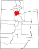
SealLocation of West Valley City, Utah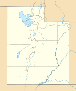
 West Valley City
Coordinates: 40°41′21″N 111°59′38″W / 40.68917°N 111.99389°WCoordinates: 40°41′21″N 111°59′38″W / 40.68917°N 111.99389°W Country United States State Utah County Salt Lake Government – Mayor Mike Winder Area – Total 35.5 sq mi (91.8 km2) – Land 35.4 sq mi (91.7 km2) – Water 0.1 sq mi (0.1 km2) Elevation 4,304 ft (1,312 m) Population (2010) – Total 129,480 – Density 3,076.3/sq mi (1,187.7/km2) Time zone Mountain (MST) (UTC-7) – Summer (DST) MDT (UTC-6) Area code(s) 385, 801 FIPS code 49-83470[1] GNIS feature ID 1437843[2] West Valley City is a city in Salt Lake County and a suburb of Salt Lake City in the U.S. state of Utah. The population was 129,480 at the 2010 census,[3] making it the second-largest city in Utah. The city incorporated in 1980 from a large, quickly-growing unincorporated area, which was variously known as Granger, Hunter, Chesterfield, and Redwood. It is a bedroom community of Salt Lake City and home to the Maverik Center and USANA Amphitheater.
Contents
History
The earliest known residents of the western Salt Lake Valley were Native American bands of the Ute and Shoshoni tribes.
Joseph Harker and his family were the first settlers in the territory known as "over Jordan" (referring to the land west of the Jordan River (Utah). The area was largely agricultural for over one hundred years.
The Granger area was settled by Welsh Latter-day Saints who had come to Utah with Dan Jones in 1849. Irrigation systems and agriculture were developed in the area, and it was Elias Smith who proposed the area's name on account of its successful farming. At other times high alkali content made farming difficult, but there were enough Latter-day Saints to form a separate Granger Ward in 1884. Granger and vicinity had about 1,000 people in 1930.[4]
Hunter was not settled until 1876. This settlement was started by Rasmus Nielsen, Edward Rushton, August Larsen and about seven others along with their families. Irrigation began in 1881 and the main crop was fruit trees.[5]
The city began to experience rapid growth in the 1970s, when the area that is now West Valley City consisted of the four separate communities of Hunter, Granger, Chesterfield, and Redwood. These four unincorporated areas merged in 1980 to form the present-day city. During the 2002 Olympic Winter Games, West Valley City was the official venue for men's and women's ice hockey.
On May 19, 2011, the city unveiled an official plan to create a downtown area for the city over the course of 10 years, building on plans and development that already existed. It will be known as Fairbourne Station (named after Joseph Fairbourne, an early settler who operated a weigh station in the area in the late 19th century) and will consist of approximately 40 acres, costing $500 million to build. The center will include a civic center (consisting of city hall, a courthouse, police headquarters, and a library), an 8-story Embassy Suites hotel, a plaza, and residential development, as well as the end of the West Valley TRAX line. Valley Fair Mall and the Maverik Center are located nearby, as is I-215. Much of the development has already occurred, with the TRAX line expected to open in 2011 and the hotel in 2012.[6]
Notorious serial killer Ted Bundy was arrested in Granger on August 16, 1975 on a routine traffic stop.
Geography
West Valley City is located at 40°41′21″N 111°59′38″W / 40.68917°N 111.99389°W (40.689181, -111.993867).[7]
According to the United States Census Bureau, the city has a total area of 35.5 square miles (91.8 km²), of which, 35.4 square miles (91.7 km²) of it is land and 0.1 square miles (0.2 km²) of it (0.17%) is water.
The city is located on the northwest side of the Salt Lake Valley, between Salt Lake City on the north, South Salt Lake on the east, Magna Township on the west, and Taylorsville and Kearns Township on the south. The Oquirrh Mountains loom over the city to the west, while the Jordan River marks the eastern boundary.
Government
West Valley City has a nonpartisan, strong city manager form of government, which means that the city manager is the CEO, while the mayor fills the role of chairman of the board, with the City Council acting as the "board." The mayor is a voting member of the City Council. The West Valley City Council meets each Tuesday night at 6:30 PM, except fifth Tuesdays. City Hall is located at 3600 South Constitution Boulevard.
The mayor and six councilors are elected to four-year terms. Mayoral elections are held the same year as three of the councilors. The other three councilors are staggered two years from the mayoral. Two council seats are at-large, or citywide, and the remaining four seats represent districts of approximately 28,000 residents. Officials are not subject to term limits. The most recent election was held in 2009.
Elected officials of West Valley City as of 2009 Official Position Term ends Mike Winder Mayor 2013 City Council members Corey L. Rushton At-large 2011 Don Christensen At-large 2013 Carolyn Burt District 1 2011 Steve Buhler District 2 2013 Russell K. Brooks District 3 2011 Steve Vincent District 4 2013 West Valley City Fire Department
WVFD is dispatched by VECC9-1-1
Demographics
Historical populations Census Pop. %± 1980 72,299 — 1990 86,976 20.3% 2000 108,896 25.2% 2010 129,480 18.9% source:[8][9] As of the census[1] of 2010, there were 129,480 people, 38,535 households, and 34,900 families residing in the city. The population density was 3,647.32 people per square mile (2,266.35/km²). There were 38,978 housing units at an average density of 1,097.97 per square mile (682.25/km²). The racial makeup of the city was 65.37% White, 1.96% African American, 1.26% Native American, 4.97% Asian, 3.64% Pacific Islander, 18.96% from other races, and 3.85% from two or more races. Hispanic or Latino of any race were 33.13% of the population.
There were 38,535 households out of which 47.1% had children under the age of 18 living with them, 61.3% were married couples living together, 13.2% had a female householder with no husband present, and 19.6% were non-families. 14.7% of all households were made up of individuals and 3.9% had someone living alone who was 65 years of age or older. The average household size was 3.36 and the average family size was 3.71.
In the city the population was spread out with 33.7% under the age of 18, 12.9% from 18 to 24, 30.7% from 25 to 44, 17.4% from 45 to 64, and 5.4% who were 65 years of age or older. The median age was 27 years. For every 100 females there were 102.3 males. For every 100 females age 18 and over, there were 100.5 males.
The median income for a household in the city was $45,773, and the median income for a family was $48,593. Males had a median income of $32,116 versus $22,693 for females. The per capita income for the city was $15,031. About 6.7% of families and 8.7% of the population were below the poverty line, including 11.0% of those under age 18 and 3.5% of those age 65 or over.
Education
The city lies in the Granite School District. It has 21 elementary schools, 4 junior high schools, and 2 high schools - Granger, which opened in 1958, and Hunter, which opened in 1990. The city is also the location of East Hollywood High School, a charter school specializing in film education.
Transportation
West Valley City is on the same address grid system as Salt Lake City, and therefore also follows the same street numbering system. I-215 runs through eastern portions of the city parallel to I-15, which lies farther east of the city. The SR-201 freeway lies along the northern border with Salt Lake City and continues west into Magna as an expressway. Bangerter Highway, which runs south from Salt Lake City International Airport, traverses the approximate center of the city as well on its way to serving the rapidly-growing western and southern ends of the valley. The proposed Mountain View Corridor will also run through the western portion of the city. The city also is served by several bus routes operated by the Utah Transit Authority, and a future transit center (including a TRAX light rail station) will be located in the city center near Valley Fair Mall and the Maverik Center. Completion of the light rail line and transit center are expected by 2011.
Sports and entertainment
West Valley City is home to the Maverik Center and the Utah Grizzlies of the ECHL as well as the Utah Blaze of the AFL. It is also home to the Utah Cultural Celebration Center, Stonebridge Golf Course, Westridge Golf Course, Rocky Mountain Raceway, USANA Amphitheatre, Hale Centre Theatre, and the Valley Fair Mall. WVC is also home to The Drive-in.
Key to the City
West Valley City has presented the Key to the city to several visiting dignitaries. Past recipients have included Mayor Yeah Samake of Ouelessebougou, Mali; Governor of Chiapas Juan Sabines Guerrero; and United States Secretary of State Hillary Clinton.[10] Most recently, the key was awarded to Tongan Queen Mother Halaevalu Mataʻaho ʻAhomeʻe on July 28, 2011, when she visited the city for the rededication of the Tongan United Methodist Church.[10]
Sister cities
West Valley City has a sister city, as designated by Sister Cities International:
 Nantou, Nantou, Taiwan Province, Republic of China (Taiwan)
Famous residents
- John Madsen, NFL tight end for the Cleveland Browns
- Naufahu Tahi, full back, Minnesota Vikings [11]
- Tadd Gadduang, Finalist, So You Think You Can Dance [12]
See also
Sources
- ^ a b "American FactFinder". United States Census Bureau. http://factfinder.census.gov. Retrieved 2008-01-31.
- ^ "US Board on Geographic Names". United States Geological Survey. 2007-10-25. http://geonames.usgs.gov. Retrieved 2008-01-31.
- ^ Utah Trend Report 2: State and Complete Places (Sub-state 2010 Census Data). Missouri Census Data Center. Accessed 2011-02-26.
- ^ Jenson, Andrew. Encyclopedic History of the Church of Jesus Christ of Latter-day Saints. (Salt Lake City: Deseret News Press, 1941) p. 295
- ^ Jenson. Encyclopedic History. p. 346
- ^ New name for WVC project: Fairbourne Station. Salt Lake Tribune. May 19, 2011.
- ^ "US Gazetteer files: 2010, 2000, and 1990". United States Census Bureau. 2011-02-12. http://www.census.gov/geo/www/gazetteer/gazette.html. Retrieved 2011-04-23.
- ^ "CENSUS OF POPULATION AND HOUSING (1790-2000)". U.S. Census Bureau. http://www.census.gov/prod/www/abs/decennial/index.html. Retrieved 2010-07-17.
- ^ Census number enumerated in 1980 prior to incorporation as West Valley CDP.
- ^ a b "Tonga’s Queen Mother coming to West Valley City to rededicate Methodist church". Salt Lake Tribune. 2011-07-29. http://www.sltrib.com/sltrib/news/52288527-78/valley-west-tonga-church.html.csp. Retrieved 2011-07-31.
- ^ http://www.vikings.com/team/roster/Naufahu-Tahi/b6b485c5-2900-45ad-84ea-f0f0e7e6427d
- ^ http://www.fox.com/dance/bios/contestants/tadd-gadduang
External links
 Media related to West Valley City, Utah at Wikimedia Commons
- West Valley City official website
- Chamber of Commerce/Tourism website
- The Oquirrh Times newspaper - West Valley News, Magna Times & Kearns Post Newspapers combined
Municipalities and communities of Salt Lake County, Utah Cities Bluffdale | Cottonwood Heights | Draper | Herriman | Holladay | Midvale | Murray | Riverton | Salt Lake City | Sandy | South Jordan | South Salt Lake | Taylorsville | West Jordan | West Valley City
Town CDPs Copperton | Emigration Canyon | Granite | Kearns | Magna | Millcreek | White City
Townships Copperton | Emigration Canyon | Kearns | Magna | Millcreek
Unincorporated
communityGhost towns  State of UtahSalt Lake City (capital)
Topics - Cities
- Congressional districts
- Counties
- Flag
- Geography
- Government
- Governors
- History
- People
- Portal
- Symbols
- Visitor Attractions
Society - Demographics
- Economy
- Politics
Regions Largest cities - American Fork
- Bountiful
- Cedar City
- Clearfield
- Cottonwood Heights
- Draper
- Holladay
- Kaysville
- Layton
- Lehi
- Logan
- Midvale
- Murray
- Ogden
- Orem
- Pleasant Grove
- Provo
- Riverton
- Roy
- St. George
- Salt Lake City
- Sandy
- South Jordan
- South Salt Lake
- Spanish Fork
- Springville
- Taylorsville
- Tooele
- West Jordan
- West Valley City
Counties Attractions Categories:- Cities in Utah
- Salt Lake City metropolitan area
- Populated places established in 1849
- Populated places established in 1980
- Populated places in Salt Lake County, Utah
- Wasatch Front
- West Valley City, Utah


Wikimedia Foundation. 2010.