- Cottonwood Heights, Utah
-
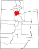
Cottonwood Heights, Utah — City — Coordinates: 40°37′2″N 111°49′13″W / 40.61722°N 111.82028°WCoordinates: 40°37′2″N 111°49′13″W / 40.61722°N 111.82028°W Country United States State Utah County Salt Lake Incorporated January 14, 2005 Named for Cottonwood trees Area – Total 6.8 sq mi (17.6 km2) – Land 6.8 sq mi (17.6 km2) – Water 0.0 sq mi (0.0 km2) Elevation 4,823 ft (1,470 m) Population (2010) – Total 33,433 – Density 4,052.9/sq mi (1,564.8/km2) Time zone Mountain (MST) (UTC-7) – Summer (DST) MDT (UTC-6) Area code(s) 385, 801 FIPS code 49-16270[1] GNIS feature ID 1440025[2] Cottonwood Heights is a city located in Salt Lake County, Utah, United States, along the east bench of the Salt Lake Valley. It lies south of the cities of Holladay and Murray, east of Midvale, and north of Sandy within the Salt Lake City, Utah Metropolitan Statistical Area. Following a successful incorporation referendum in May 2004, the city was inaugurated on January 14, 2005. Cottonwood Heights had been a Census-designated place (CDP) before incorporation. The population as of the 2010 census was 33,433.[3] This is a significant increase over the CDP's 2000 census count of 27,569.
The corporate offices of Cafe Rio, Extra Space Storage, JetBlue Airways, Mrs. Fields, Overstock.com and Fusion-io are located in the city. [1]
In 2007, Money magazine rated Cottonwood Heights at #100 on their Best Places to Live list.
Contents
Geography
Cottonwood Heights is located at 40°37′2″N 111°49′13″W / 40.61722°N 111.82028°W (40.617147, -111.820361).[4]
According to the United States Census Bureau, the CDP had a total area of 6.8 square miles (17.6 km²), all of it land.
Demographics
Historical populations Census Pop. %± 1980 22,665 — 1990 28,766 26.9% 2000 27,569 −4.2% 2010 33,433 21.3% source:[5] As of the census[1] of 2000, there were 27,569 people, 9,439 households, and 7,249 families residing in the CDP. The population density was 4,052.9 people per square mile (1,565.4/km²). There were 9,932 housing units at an average density of 1,460.1 per square mile (563.9/km²). The racial makeup of the CDP was 93.57% White, 0.70% African American, 0.27% Native American, 2.28% Asian, 0.32% Pacific Islander, 1.11% from other races, and 1.75% from two or more races. Hispanic or Latino of any race were 3.07% of the population.
There were 9,439 households out of which 36.2% had children under the age of 18 living with them, 63.5% were married couples living together, 9.7% had a female householder with no husband present, and 23.2% were non-families. 16.1% of all households were made up of individuals and 3.1% had someone living alone who was 65 years of age or older. The average household size was 2.92 and the average family size was 3.31.
In the CDP the population was spread out with 26.4% under the age of 18, 12.6% from 18 to 24, 28.0% from 25 to 44, 25.1% from 45 to 64, and 7.8% who were 65 years of age or older. The median age was 32 years. For every 100 females there were 101.9 males. For every 100 females age 18 and over, there were 100.5 males.
The median income for a household in the CDP was $62,814, and the median income for a family was $70,083 (these figures had risen to $65,463 and $81,715 respectively as of a 2007 estimate).[6] Males had a median income of $43,114 versus $31,046 for females. The per capita income for the CDP was $26,935. About 2.8% of families and 3.9% of the population were below the poverty line, including 5.9% of those under age 18 and 0.7% of those age 65 or over.
Police services
On January 8, 2008, the Cottonwood Heights City Council voted to create its own police department and withdraw from its current contract with the Salt Lake County Sheriff's Department. By June 2011, their operating budget had increased $600,000. Mayor Cullimore confirmed that his officers are writing more traffic tickets since splitting from the County.[7]
References
- ^ a b "American FactFinder". United States Census Bureau. http://factfinder.census.gov. Retrieved 2008-01-31.
- ^ "US Board on Geographic Names". United States Geological Survey. 2007-10-25. http://geonames.usgs.gov. Retrieved 2008-01-31.
- ^ Utah Trend Report 2: State and Complete Places (Sub-state 2010 Census Data). Missouri Census Data Center. Accessed 2011-02-26.
- ^ "US Gazetteer files: 2010, 2000, and 1990". United States Census Bureau. 2011-02-12. http://www.census.gov/geo/www/gazetteer/gazette.html. Retrieved 2011-04-23.
- ^ "CENSUS OF POPULATION AND HOUSING (1790-2000)". U.S. Census Bureau. http://www.census.gov/prod/www/abs/decennial/index.html. Retrieved 2010-07-31.
- ^ http://factfinder.census.gov/servlet/ACSSAFFFacts?_event=Search&geo_id=16000US4863572&_geoContext=01000US%7C04000US48%7C16000US4863572&_street=&_county=cottonwood+heights&_cityTown=cottonwood+heights&_state=04000US49&_zip=&_lang=en&_sse=on&ActiveGeoDiv=geoSelect&_useEV=&pctxt=fph&pgsl=160&_submenuId=factsheet_1&ds_name=ACS_2007_3YR_SAFF&_ci_nbr=null&qr_name=null®=null%3Anull&_keyword=&_industry=
- ^ "Is having more police agencies costing taxpayers more?" ABC4.com, June 16, 2011
External links
Municipalities and communities of Salt Lake County, Utah Cities Bluffdale | Cottonwood Heights | Draper | Herriman | Holladay | Midvale | Murray | Riverton | Salt Lake City | Sandy | South Jordan | South Salt Lake | Taylorsville | West Jordan | West Valley City
Town CDPs Copperton | Emigration Canyon | Granite | Kearns | Magna | Millcreek | White City
Townships Copperton | Emigration Canyon | Kearns | Magna | Millcreek
Unincorporated
communityGhost towns  State of UtahSalt Lake City (capital)
Topics - Cities
- Congressional districts
- Counties
- Flag
- Geography
- Government
- Governors
- History
- People
- Portal
- Symbols
- Visitor Attractions
Society - Demographics
- Economy
- Politics
Regions Largest cities - American Fork
- Bountiful
- Cedar City
- Clearfield
- Cottonwood Heights
- Draper
- Holladay
- Kaysville
- Layton
- Lehi
- Logan
- Midvale
- Murray
- Ogden
- Orem
- Pleasant Grove
- Provo
- Riverton
- Roy
- St. George
- Salt Lake City
- Sandy
- South Jordan
- South Salt Lake
- Spanish Fork
- Springville
- Taylorsville
- Tooele
- West Jordan
- West Valley City
Counties Attractions Categories:- Cities in Utah
- Populated places in Salt Lake County, Utah
- Former census-designated places in Utah
- Salt Lake City metropolitan area
- Populated places established in 2005

Wikimedia Foundation. 2010.