- Draper, Utah
-
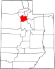
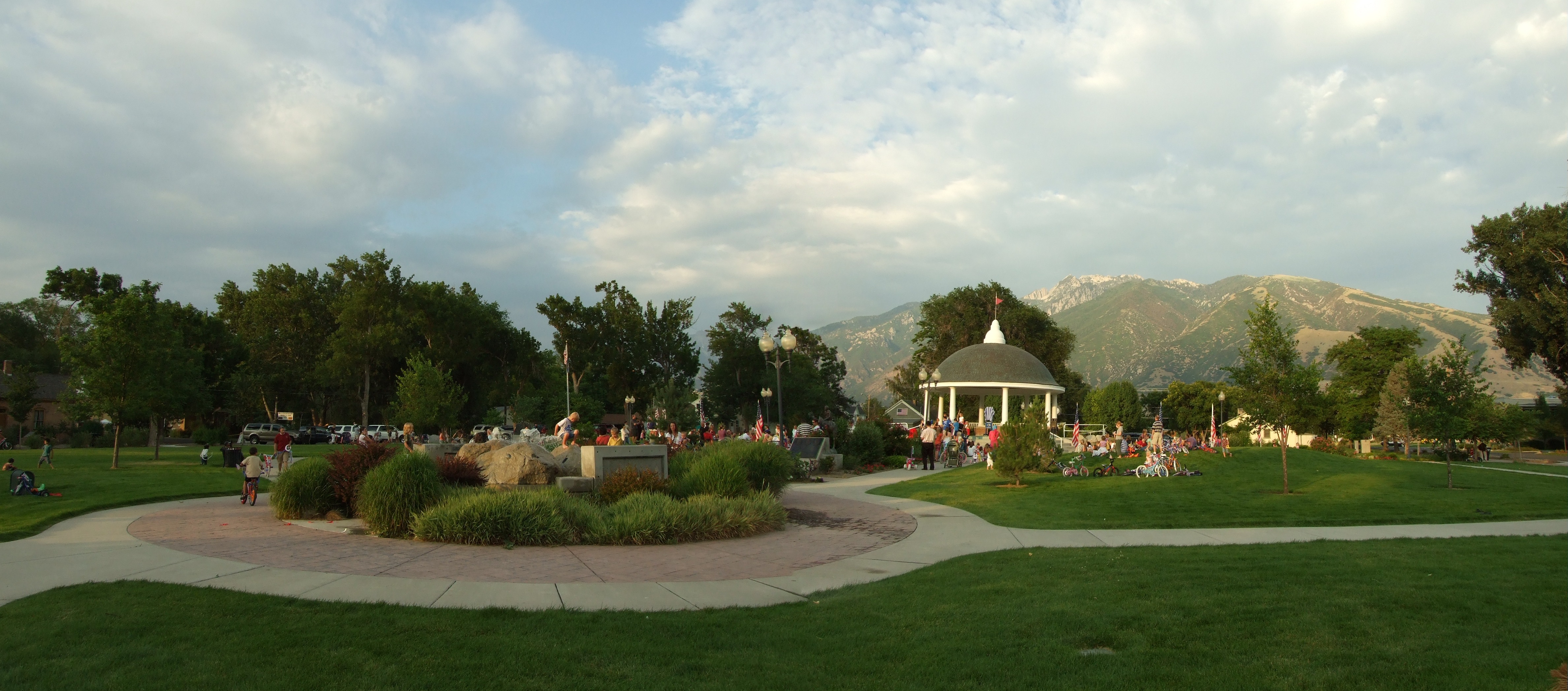
Draper, Utah — City — Draper Historic Park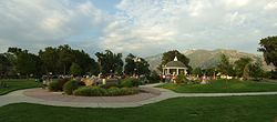 Location of Draper, Utah
Coordinates: 40°30′53″N 111°52′23″W / 40.51472°N 111.87306°WCoordinates: 40°30′53″N 111°52′23″W / 40.51472°N 111.87306°W Country United States State Utah Counties Salt Lake, Utah Settled 1849 Founder Ebenezer Brown Named for William Draper Government – Mayor Darrell H. Smith Area – Total 30.4 sq mi (78.6 km2) – Land 30.3 sq mi (78.6 km2) – Water 0.1 sq mi (0.0 km2) Elevation 4,505 ft (1,373 m) Population (2006[1]) – Total 36,873 – Density 1,212.9/sq mi (469.1/km2) Time zone Mountain (MST) (UTC-7) – Summer (DST) MDT (UTC-6) ZIP code 84020 Area code(s) 385, 801 FIPS code 49-20120 GNIS feature ID 1427473 Website www.draper.ut.us Draper is a city in Salt Lake and Utah Counties in the U.S. state of Utah, located about 20 miles (32 km) south of Salt Lake City along the Wasatch Front. Between 1990 and 2000 Draper was Utah's fastest-growing city over 5,000 people (as of 2000). Its population in 1990 was 7,143 and had grown to 25,220 by the 2000 census. By 2008, the population is estimated to have increased to 42,317.[2]
Draper is part of two metropolitan areas - the Salt Lake County portion is included in the Salt Lake City metropolitan area, while the Utah County portion is part of the Provo-Orem metropolitan area.
The Utah State Prison is located in Draper, near Point of the Mountain (alongside Interstate 15). The execution of Gary Gilmore took place here on January 24, 1977.
The winds on Traverse Ridge make it one of the world's best hang-gliding or paragliding spots.[citation needed]
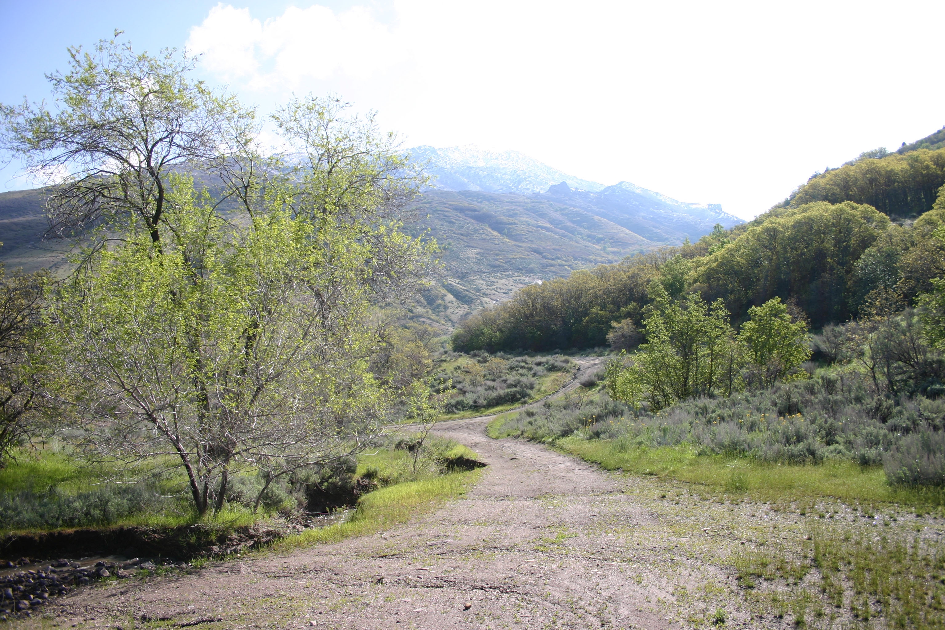
 Corner Canyon, Draper, Utah.
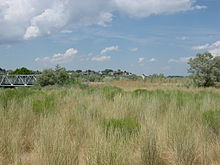 Jordan River Parkway, Draper, Utah.
In 2004, Draper citizens voted for a tax increase that would pay for the purchase of key pieces of property in the Corner Canyon area. The aim of this measure was to protect and preserve the Corner Canyon area for the future enjoyment of citizens of the city and the Salt Lake Valley area. In the fall of 2005, 1,021 acres (4.13 km2) of property were identified and purchased for the development of Corner Canyon Regional Park, which will consist of parks, trails and other recreation areas.
Draper is home to the main customer service center of eBay, the tech call center of PGP Corporation, the call center of Musician's Friend, and the headquarters of 1-800 Contacts. Draper is also home to Utah's first Ikea, which opened in Spring 2007.[1] In August 2006, The Church of Jesus Christ of Latter-day Saints broke ground for a temple in Draper; it has since been finished and was dedicated on March 20, 2009.
Contents
Geography
Draper is located at 40°30′53″N 111°52′23″W / 40.51472°N 111.87306°W (40.514843, -111.872940). It lies roughly midway between Salt Lake City and Provo.
According to the United States Census Bureau, the city has a total area of 30.4 square miles (78.6 km²), of which, 30.3 square miles (78.6 km²) of it is land and 0.03% is water.
Draper shares city borders with Riverton and Bluffdale to the west, South Jordan to the northwest, Sandy to the north, Alpine to the southeast, Highland to the south, and Lehi to the southwest.
Demographics
Historical populations Census Pop. %± 1980 5,521 — 1990 7,257 31.4% 2000 25,220 247.5% Est. 2009 43,217 71.4% The racial makeup of the city was 91.25% White, 1.52% African American, 0.75% Native American, 1.30% Asian, 0.36% Pacific Islander, 2.71% from other races, and 2.10% from two or more races. Hispanic or Latino of any race were 5.82% of the population.
There were 6,305 households out of which 54.7% had children under the age of 18 living with them, 77.8% were married couples living together, 5.6% had a female householder with no husband present, and 13.9% were non-families. 10.6% of all households were made up of individuals and 2.0% had someone living alone who was 65 years of age or older. The average household size was 3.40 and the average family size was 3.69.
In the city the population was spread out with 32.0% under the age of 18, 11.2% from 18 to 24, 38.3% from 25 to 44, 14.8% from 45 to 64, and 3.7% who were 65 years of age or older. The median age was 29 years. For every 100 females there were 129.9 males. For every 100 females age 18 and over, there were 141.9 males.
The median income for a household in the city was $72,341, and the median income for a family was $76,858 (these figures had risen to $80,524 and $89,871 respectively as of a 2007 estimate.[3] Males had a median income of $50,915 versus $31,742 for females. The per capita income for the city was $22,747. About 1.8% of families and 2.7% of the population were below the poverty line, including 3.1% of those under age 18 and none of those age 65 or over.
Government
The Utah Department of Corrections has its headquarters in Draper.[4]
Economy
Top employers
According to the City's 2010 Comprehensive Annual Financial Report,[5] the top employers in the city are:
# Employer # of Employees 1 Utah State Prison 1,000-1,999 2 eBay 1,000-1,999 3 Affiliated Computer Services 500-999 4 1-800 Contacts 500-999 5 Swire Coca-Cola, USA 500-999 6 Investools 250-499 7 Harmons 250-499 8 Musician's Friend 250-499 9 IKEA 250-499 10 Edwards Lifesciences 100-249 References
- ^ Draper City Official Website
- ^ "Subcounty population estimates: Utah 2000-2008" (CSV). United States Census Bureau, Population Division. 2009-07-01. http://www.census.gov/popest/cities/files/SUB-EST2008-49.csv. Retrieved 2009-08-16.
- ^ American FactFinder
- ^ "Contact Us." Utah Department of Corrections. Retrieved on December 8, 2009.
- ^ City of Draper Comprehensive Annual Financial Report
External links
 Media related to Draper, Utah at Wikimedia Commons
Municipalities and communities of Salt Lake County, Utah Cities Bluffdale | Cottonwood Heights | Draper | Herriman | Holladay | Midvale | Murray | Riverton | Salt Lake City | Sandy | South Jordan | South Salt Lake | Taylorsville | West Jordan | West Valley City
Town CDPs Copperton | Emigration Canyon | Granite | Kearns | Magna | Millcreek | White City
Townships Copperton | Emigration Canyon | Kearns | Magna | Millcreek
Unincorporated
communityGhost towns Municipalities and communities of Utah County, Utah Cities Alpine | American Fork | Cedar Hills | Draper | Eagle Mountain | Elk Ridge | Highland | Lehi | Lindon | Mapleton | Orem | Payson | Pleasant Grove | Provo | Salem | Santaquin | Saratoga Springs | Spanish Fork | Springville | Woodland Hills
Towns Cedar Fort | Fairfield | Genola | Goshen | Vineyard
CDPs Benjamin | Elberta | Lake Shore | Palmyra | Spring Lake | West Mountain
Unincorporated
communitiesIndian
reservationGhost towns  State of UtahSalt Lake City (capital)
Topics - Cities
- Congressional districts
- Counties
- Flag
- Geography
- Government
- Governors
- History
- People
- Portal
- Symbols
- Visitor Attractions
Society - Demographics
- Economy
- Politics
Regions Largest cities - American Fork
- Bountiful
- Cedar City
- Clearfield
- Cottonwood Heights
- Draper
- Holladay
- Kaysville
- Layton
- Lehi
- Logan
- Midvale
- Murray
- Ogden
- Orem
- Pleasant Grove
- Provo
- Riverton
- Roy
- St. George
- Salt Lake City
- Sandy
- South Jordan
- South Salt Lake
- Spanish Fork
- Springville
- Taylorsville
- Tooele
- West Jordan
- West Valley City
Counties Attractions Categories:- Cities in Utah
- Populated places in Salt Lake County, Utah
- Populated places in Utah County, Utah
- Salt Lake City metropolitan area
- Provo–Orem metropolitan area
- Populated places established in 1849


Wikimedia Foundation. 2010.