- Salem, Utah
Infobox Settlement
official_name = Salem, Utah
settlement_type =City
nickname =
motto =
imagesize =
image_caption =
image_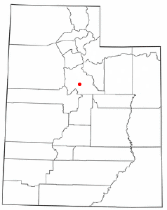
mapsize = 250px
map_caption = Location of Salem, Utah
mapsize1 =
map_caption1 =subdivision_type = Country
subdivision_name =United States
subdivision_type1 = State
subdivision_name1 =Utah
subdivision_type2 = County
subdivision_name2 = Utahgovernment_footnotes =
government_type =
leader_title =
leader_name =
leader_title1 =
leader_name1 =
established_title =
established_date =unit_pref = Imperial
area_footnotes =area_magnitude =
area_total_km2 = 13.8
area_land_km2 = 13.7
area_water_km2 = 0.1
area_total_sq_mi = 5.3
area_land_sq_mi = 5.3
area_water_sq_mi = 0.0population_as_of = 2000
population_footnotes =
population_total = 4372
population_density_km2 = 318.6
population_density_sq_mi = 825.0timezone = Mountain (MST)
utc_offset = -7
timezone_DST = MDT
utc_offset_DST = -6
elevation_footnotes =
elevation_m = 1405
elevation_ft = 4610
latd = 40 |latm = 3 |lats = 2 |latNS = N
longd = 111 |longm = 40 |longs = 21 |longEW = Wpostal_code_type =
ZIP code
postal_code = 84653
area_code = 801
blank_name = FIPS code
blank_info = 49-65770GR|2
blank1_name = GNIS feature ID
blank1_info = 1445262GR|3
website =
footnotes =Salem is a city in Utah County,
Utah ,United States . It is part of the Provo–Orem, Utah Metropolitan Statistical Area. The population was 4,372 at the 2000 census. It was originally known as "Pond Town".Geography
Salem is located at coor dms|40|3|2|N|111|40|21|W|city (40.050662, -111.672408)GR|1.
According to the
United States Census Bureau , the city has a total area of 5.3square mile s (13.8km² ), of which, 5.3 square miles (13.7 km²) of it is land and 0.04 square miles (0.1 km²) of it (0.38%) is water.Demographics
As of the
census GR|2 of 2000, there were 4,372 people, 1,128 households, and 1,009 families residing in the city. Thepopulation density was 825.0 people per square mile (318.5/km²). There were 1,166 housing units at an average density of 220.0/sq mi (84.9/km²). The racial makeup of the city was 97.07% White, 0.07% African American, 0.09% Native American, 0.14% Asian, 0.27% Pacific Islander, 1.40% from other races, and 0.96% from two or more races. Hispanic or Latino of any race were 2.79% of the population.There were 1,128 households out of which 56.0% had children under the age of 18 living with them, 82.3% were married couples living together, 5.1% had a female householder with no husband present, and 10.5% were non-families. 9.7% of all households were made up of individuals and 5.1% had someone living alone who was 65 years of age or older. The average household size was 3.86 and the average family size was 4.14.
In the city the population was spread out with 40.6% under the age of 18, 10.2% from 18 to 24, 25.0% from 25 to 44, 16.4% from 45 to 64, and 7.8% who were 65 years of age or older. The median age was 24 years. For every 100 females there were 102.3 males. For every 100 females age 18 and over, there were 98.2 males.
The median income for a household in the city was $54,813, and the median income for a family was $57,557. Males had a median income of $40,116 versus $22,798 for females. The
per capita income for the city was $16,507. About 3.1% of families and 4.1% of the population were below thepoverty line , including 5.2% of those under age 18 and 5.7% of those age 65 or over.chools
Salem is served by
Nebo School District . Public schools in this district that serve Salem residents include the following:Spanish Fork High School , Spanish Fork Junior High School, Spanish Fork Middle School, Mount Loafer Elementary, Salem Elementary. Starting in the fall of 2008 Salem and the surrounding areas will be attending the recently established Salem Hills High School.External links
* [http://www.pondtown.org City's Official Website]
Wikimedia Foundation. 2010.