- Magna, Utah
-
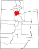
Magna, Utah — CDP — Downtown Magna Location of Magna, Utah
Coordinates: 40°42′6″N 112°5′9″W / 40.70167°N 112.08583°WCoordinates: 40°42′6″N 112°5′9″W / 40.70167°N 112.08583°W Country United States State Utah County Salt Lake Area - Total 7.4 sq mi (19.2 km2) - Land 7.4 sq mi (19.2 km2) - Water 0.0 sq mi (0.0 km2) Elevation 4,278 ft (1,304 m) Population (2010) - Total 26,505 - Density 3,066.2/sq mi (1,183.9/km2) Time zone Mountain (MST) (UTC-7) - Summer (DST) MDT (UTC-6) ZIP code 84044 Area code(s) 385, 801 FIPS code 49-47290[1] GNIS feature ID 1430037[2] Magna is a census-designated place (CDP) and township in Salt Lake County, Utah, United States. The population was 26,505 at the 2010 census, a moderate increase over the 2000 figure of 22,770. Magna is home to the Kennecott Smokestack, the tallest free-standing structure in the United States west of the Mississippi River according to the Kennecott website.[citation needed]
Contents
History
Settlement
Settlement of the area began in 1851 shortly after the Mormon pioneers reached the Salt Lake Valley. Early farmers settled in 1868 at the base of the northern Oquirrh Mountains and called their community Pleasant Green. By 1900, there were about 20 families in the area. One of the first Pleasant Green pioneers was Abraham Coon, who established a livestock ranch and settlement called “Coonville” in a canyon mouth at about 5400 South. The canyon is now known as Coon Canyon, and Coon Creek flowing out of it, is one of the major Oquirrh Mountain drainages. Coon Creek flows north and west through Magna to the Great Salt Lake.
In 1897, the first LDS Ward, Pleasant Green Ward, was constructed. Prior to the construction of the ward house church was held in the homes of the settlers. The Pleasant Green Cemetery located in the Oquirrh foothills, about 3500 South, where many community pioneers are buried, was established in 1883. In 1890, in response to a law requiring all children to receive free public education, the first school was built in the community.
1900-1960
In the early 1900s, copper mining activity in the Oquirrhs began transforming the Pleasant Green area from an agricultural hamlet to an industrial community. D.C. Jackling established the Utah Copper Company, which later became Kennecott Copper Corp. In 1906, the company began constructing its Magna Mill. He chose the name “Magna” from the Latin word meaning “great” or “superior".
Boston Consolidated Copper constructed a second mill in the area in 1909. In 1911, the companies merged and the mill was renamed Arthur Mill. Construction workers lived in a temporary settlement known as “Ragtown". Several substantial homes were built in the tent city and later moved to the present community. As the mills began operating, some local farmers traded in their plows for a steady company paycheck and began moving in to work at the mills.
In 1906, the community's name was changed from "Pleasant Green" to "Magna", because postal officials were uncomfortable with the old name's similarity to Pleasant Grove, another Utah community. By 1909, the Hawthorne School (no longer standing) had been built in the eastern Magna area. In 1908, the Webster School (destroyed by fire and demolished in June 2004)[3] was built at the west end of what is now Main Street. In 1924, the first building of the present Cyprus High School was completed. Over the years, buildings and additions have been constructed on the campus.
At the time, commuting to work by automobile was not practical. Few mine workers had cars and cross valley roads were in marginal condition. Workers lived in the town and walked to the mills. Downtown Magna included churches, saloons, fraternal halls, and stores. Several small neighborhoods, such as Japtown, Snaketown, and Little Italy, developed around Main Street. Many early residents were immigrants, primarily from Eastern Europe.
Between 1915 and 1960, the town's fortunes fluctuated with the copper industry. During the Great Depression, the mills shut down for a period and workers were laid off. But in about 1940, there was a resurgence as the pending war boosted copper demand. Growth continued after World War II, through the 1960s.
1960-1980
By the 1960s, the community was experiencing the first signs of a suburban transition. The Hercules Powder Co., once a small dynamite manufacturing firm, had begun producing rocket motors at its Bacchus Works south of the Magna community. The increased jobs were one factor encouraging subdivision development in the Magna, Kearns and West Valley areas.
In 1961, the voters in the Magna Improvement District (now the Magna Water and Sewer District) approved a bond that financed a sewage treatment plant, water storage tanks, pumps and well development. The improvements created sufficient capacity to serve more than double the population at the time and helped open the way for development. Not only did Magna's population begin shifting southward during the 1960s, but also automobile commuting, both to work and shopping, became common. As business activity moved to other areas, Main Street slowly began to deteriorate. Presently, some of the commercial space there is vacant.
During the 1970s, as part of a general west valley suburbanization trend, the community experienced more dramatic growth. Inexpensive land south and east of the historic town center began being developed into moderately priced single-family homes. The new neighborhoods tended to attract middle-income working class couples with younger families. While the community had grown from approximately 8,900 in 1960 to 10,000 in 1970, the population had increased to over 23,000 by 2000. This increase is about double the countywide growth rate.
1980-present
The process for Magna to become a township took over 10 years. Growth and development continue to define Magna. The west bench plan will have a major impact on the future of Magna. Kennecott Land plans major development in the areas immediately surrounding Magna. The area west of Magna long I-80 is currently slated to become one of 2 major "urban centers" for Kennecott Land's west bench development plan. The Historic Main Street underwent a major remodel in 2006, and the Empress Theater opened its doors during the same year. Main Street has also become a popular location for film makers.[specify] Several movies and TV shows have been filmed in the last few years on Main Street.
Geography
Magna is located at 40°42′6″N 112°5′9″W / 40.70167°N 112.08583°W (40.701579, -112.085874)[4] at an altitude of 4,300 feet above sea level.
According to the United States Census Bureau, the CDP has a total area of 7.4 square miles (19.2 km²), all of it land. The community lies just to the northeast of the Oquirrh Mountains and is directly south of the Great Salt Lake.
Demographics
Historical populations Census Pop. %± 1950 3,502 — 1960 6,642 89.7% 1970 5,509 −17.1% 1980 13,138 138.5% 1990 17,629 34.2% 2000 22,770 29.2% 2010 26,505 16.4% source:[5] As of the census[1] of 2000, there were 22,770 people, 6,562 households, and 5,446 families residing in the CDP. The population density was 3,066.2 people per square mile (1,183.2/km²). There were 6,799 housing units at an average density of 915.6/sq mi (353.3/km²). The racial makeup of the CDP was 86.26% White, 0.64% African American, 0.90% Native American, 0.60% Asian, 1.41% Pacific Islander, 7.80% from other races, and 2.41% from two or more races. Hispanic or Latino of any race were 15.00% of the population.
There were 6,562 households out of which 51.9% had children under the age of 18 living with them, 65.9% were married couples living together, 11.4% had a female householder with no husband present, and 17.0% were non-families. 13.1% of all households were made up of individuals and 4.8% had someone living alone who was 65 years of age or older. The average household size was 3.46 and the average family size was 3.77.
In the CDP the population was spread out with 36.2% under the age of 18, 12.3% from 18 to 24, 31.2% from 25 to 44, 14.3% from 45 to 64, and 6.0% who were 65 years of age or older. The median age was 26 years. For every 100 females there were 101.8 males. For every 100 females age 18 and over, there were 100.0 males.
The median income for a household in the CDP was $42,845, and the median income for a family was $45,632. Males had a median income of $32,071 versus $22,277 for females. The per capita income for the CDP was $14,355. About 5.7% of families and 7.6% of the population were below the poverty line, including 8.6% of those under age 18 and 9.2% of those age 65 or over.
Education
Magna lies within the Granite School District and is home to 5 elementary schools. Copper Hills, Lake Ridge, Magna, Pleasant Green and 1 Unnamed School currently under construction. It also has 2 junior high schools, Brockbank and Matheson, and Cyprus High School, whose sport teams compete in 4A-level competition (1A being the lowest and 5A the highest).
Transportation
Magna lies on the grid system of the Salt Lake Valley, between 7200 and 9200 West and 2100 and 4100 South. SR-201 runs along the northern border as an expressway and intersects with I-80 to the west. 3500 South is the major east-west local road, while 8400 West (SR-111) is the major north-south road. The Utah Transit Authority operates 3 bus routes into the community - #335 comes from downtown Salt Lake City, while #35 and #475 begin at the West Valley City town center (near Valley Fair Mall and the E Center) and come down 3500 South - #475 continues on to Tooele. It also operates a bus rapid transit route from West Valley City, designated as 35M. This is the first (and currently only) BRT route operated by UTA.
See also
Sources
- Irene Hulse, Frome Rags to Riches (a history of Magna), Tooele Transcript Press, 1964.
- Douglas Palmer, "Good Facilities Aid Growing Magna," Deseret News, October 30, 1962.
- The Magna Community Master Plan, Salt Lake County Public Works Department Planning Division, February 1989.
- Magna Town Council
References
- ^ a b "American FactFinder". United States Census Bureau. http://factfinder.census.gov. Retrieved 2008-01-31.
- ^ "US Board on Geographic Names". United States Geological Survey. 2007-10-25. http://geonames.usgs.gov. Retrieved 2008-01-31.
- ^ [1]
- ^ "US Gazetteer files: 2010, 2000, and 1990". United States Census Bureau. 2011-02-12. http://www.census.gov/geo/www/gazetteer/gazette.html. Retrieved 2011-04-23.
- ^ "CENSUS OF POPULATION AND HOUSING (1790-2000)". U.S. Census Bureau. http://www.census.gov/prod/www/abs/decennial/index.html. Retrieved 2010-07-31.
External links
Municipalities and communities of Salt Lake County, Utah Cities Bluffdale | Cottonwood Heights | Draper | Herriman | Holladay | Midvale | Murray | Riverton | Salt Lake City | Sandy | South Jordan | South Salt Lake | Taylorsville | West Jordan | West Valley City
Town CDPs Copperton | Emigration Canyon | Granite | Kearns | Magna | Millcreek | White City
Townships Copperton | Emigration Canyon | Kearns | Magna | Millcreek
Unincorporated
communityGhost towns  State of Utah
Topics Cities | Congressional districts | Counties | Flag | Geography | Government | Governors | History | People | Portal | Symbols | Visitor Attractions
Society Crime · Demographics · Economy · Politics
Regions Largest cities American Fork | Bountiful | Cedar City | Clearfield | Cottonwood Heights | Draper | Holladay | Kaysville | Layton | Lehi | Logan | Midvale | Murray | Ogden | Orem | Pleasant Grove | Provo | Riverton | Roy | St. George | Salt Lake City | Sandy | South Jordan | South Salt Lake | Spanish Fork | Springville | Taylorsville | Tooele | West Jordan | West Valley City
Counties Attractions Categories:- Populated places established in 1851
- Wasatch Front
- Townships in Salt Lake County, Utah
- Census-designated places in Utah
- Salt Lake City metropolitan area
- Mining communities in Utah


Wikimedia Foundation. 2010.