- Duchesne County, Utah
-
Duchesne County, Utah 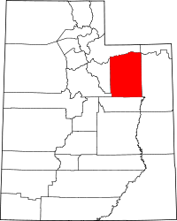
Location in the state of Utah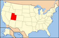
Utah's location in the U.S.Founded 1915 Named for Duchesne River Seat Duchesne Largest city Roosevelt Area
- Total
- Land
- Water
3,256 sq mi (8,433 km²)
3,238 sq mi (8,387 km²)
18 sq mi (46 km²), 0.55%Population
- (2010)
- Density
18,607
5.7/sq mi (2/km²)Website www.duchesnegov.net Duchesne County (
 /duːˈʃeɪn/) is a county located in the U.S. state of Utah. As of 2010 the population was 18,607, a 29.5% increase over the 2000 figure of 14,371. [1] Its county seat is Duchesne and the largest city is Roosevelt.[2]
Contents
Geography
According to the U.S. Census Bureau, the county has a total area of 3,256 square miles (8,433.0 km2), of which 3,238 square miles (8,386.4 km2) is land and 18 square miles (46.6 km2) (0.55%) is water. The northern part of the county contains part of the Uinta Mountains. The highest natural point in Utah, Kings Peak at 13,528 feet (4,123 m), is located in Duchesne County.
Adjacent counties
- Summit County, Utah - (north)
- Daggett County, Utah - (northeast)
- Uintah County, Utah - (east)
- Carbon County, Utah - (south)
- Utah County, Utah - (southwest)
- Wasatch County, Utah - (west)
Name
Its name is of uncertain origin, there being seven origins given:
- The Ute Indian word doo-shane meaning dark canyon.
- Fort Duquesne, built by the French in what is now Pittsburgh, Pennsylvania.
- Rose du Chesne, founder of the Sacred Heart in Utah.
- An early Indian chief in the region.
- An 1830s French fur trapper.
- Andre Duchesne, a French geographer and historian
- Prairie du Chien, Wisconsin, is about 200 miles northwest of Nauvoo, Illinois and sixty mies south of the Black River, which led to the LDS Chruch's 1840's lumber mills on the Mississippi river. (Robert Flanders, Nauvoo, page 289)
National protected areas
- Ashley National Forest (part)
- Wasatch National Forest (part)
Demographics
Historical populations Census Pop. %± 1920 9,093 — 1930 8,263 −9.1% 1940 8,958 8.4% 1950 8,134 −9.2% 1960 7,179 −11.7% 1970 7,299 1.7% 1980 12,565 72.1% 1990 12,645 0.6% 2000 14,371 13.6% 2010 18,607 29.5% Source: US Census Bureau As of the census[3] of 2010, there were 18,607 people, 6,003 households, and 4,703 families residing in the county. The population density was 5.7 people per square mile (2/km²). There were 6,988 housing units at an average density of 2 per square mile (1/km²). The racial makeup of the county was 89.15% White, 0.24% Black or African American, 4.53% Native American, 0.28% Asian, 0.27% Pacific Islander, 2.64% from other races, and 2.89% from two or more races. 6.00% of the population were Hispanic or Latino of any race.[4]
There were 6,003 households out of which 40.23% had children under the age of 18 living with them, 64.72% were married couples living together, 8.65% had a female householder with no husband present, and 21.66% were non-families. 45.0% of all households had individuals under 18 and 22.6% had someone living alone who was 65 years of age or older. The average household size was 3.05 and the average family size was 3.47.
In the county, the population was spread out with 33.91% under the age of 18, 6.56% from 20 to 24, 25.38% from 25 to 44, 20.92% from 45 to 64, and 10.66% who were 65 years of age or older. The median age was 29.7 years. For every 100 females there were 102.80 males. For every 100 females age 18 and over, there were 100.00 males.
The median income for a household in the county was $31,298, and the median income for a family was $35,350. Males had a median income of $31,988 versus $19,692 for females. The per capita income for the county was $12,326. About 14.20% of families and 16.80% of the population were below the poverty line, including 19.60% of those under age 18 and 12.40% of those age 65 or over.
Largest cities in Duchesne County, UT
City Population Roosevelt 4,299 Duchesne City 1,408 Myton 539 Neola 533 Altamont 178 Elected Officials
Clair Poulson, West Side Precinct Justice Court Judge
Jack Petersen, East Side Precinct Justice Court Judge
Travis Mitchel, Sheriff
Diane Freston, County Clerk-Auditor
Cities and towns
Unincorporated communities
References
- ^ "Duchesne County Quickfacts from the US Census Bureau". http://quickfacts.census.gov/qfd/states/49/49013.html.
- ^ "Find a County". National Association of Counties. http://www.naco.org/Counties/Pages/FindACounty.aspx. Retrieved 2011-06-07.
- ^ "American FactFinder". United States Census Bureau. http://factfinder.census.gov. Retrieved 2008-01-31.
- ^ "2010 Census Interactive Population Search". http://http://2010.census.gov/2010census/popmap/ipmtext.php?fl=49.
See also
- Ashley National Forest
- High Uintas Wilderness
- National Register of Historic Places listings in Duchesne County, Utah

Summit County Daggett County Wasatch County 
Uintah County  Duchesne County, Utah

Utah County Carbon County Municipalities and communities of Duchesne County, Utah Cities 
Towns CDPs Unincorporated
communitiesAltonah | Fruitland | Hanna | Mountain Home | Strawberry | Talmage
Indian
reservationGhost town Harper
 State of Utah
Topics - Cities
- Congressional districts
- Counties
- Flag
- Geography
- Government
- Governors
- History
- People
- Portal
- Symbols
- Visitor Attractions
Society - Demographics
- Economy
- Politics
Regions Largest cities - American Fork
- Bountiful
- Cedar City
- Clearfield
- Cottonwood Heights
- Draper
- Holladay
- Kaysville
- Layton
- Lehi
- Logan
- Midvale
- Murray
- Ogden
- Orem
- Pleasant Grove
- Provo
- Riverton
- Roy
- St. George
- Salt Lake City
- Sandy
- South Jordan
- South Salt Lake
- Spanish Fork
- Springville
- Taylorsville
- Tooele
- West Jordan
- West Valley City
Counties Attractions Categories:- Utah counties
- Duchesne County, Utah
- 1915 establishments in the United States
- Populated places established in 1915


Wikimedia Foundation. 2010.