- Myton, Utah
-
Myton, Utah — City — Agricultural building in Myton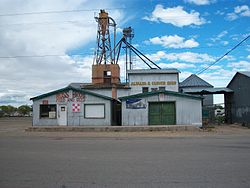 Location of Myton, Utah
Coordinates: 40°11′47″N 110°3′51″W / 40.19639°N 110.06417°WCoordinates: 40°11′47″N 110°3′51″W / 40.19639°N 110.06417°W Country United States State Utah County Duchesne Named for Howell P. Myton Area – Total 1.0 sq mi (2.6 km2) – Land 1.0 sq mi (2.6 km2) – Water 0.0 sq mi (0.0 km2) Elevation 5,085 ft (1,550 m) Population (2000) – Total 539 – Density 536.2/sq mi (207.0/km2) Time zone Mountain (MST) (UTC-7) – Summer (DST) MDT (UTC-6) ZIP code 84052 Area code(s) 435 FIPS code 49-53340[1] GNIS feature ID 1430626[2] Myton is a city in Duchesne County, Utah, United States. Established in 1905, Myton had a population of 539 at the 2000 census.
Contents
Geography
Myton is located at 40°11′47″N 110°3′51″W / 40.19639°N 110.06417°W (40.196332, -110.064174).[3]
According to the United States Census Bureau, the city has a total area of 1.0 square miles (2.6 km²), all of it land.
Demographics
Historical populations Census Pop. %± 1910 1,049 — 1920 479 −54.3% 1930 395 −17.5% 1940 437 10.6% 1950 435 −0.5% 1960 329 −24.4% 1970 322 −2.1% 1980 500 55.3% 1990 468 −6.4% 2000 539 15.2% As of the census[1] of 2000, there were 539 people, 163 households, and 131 families residing in the city. The population density was 536.2 people per square mile (206.0/km²). There were 189 housing units at an average density of 188.0 per square mile (72.3/km²). The racial makeup of the city was 77.55% White, 11.13% Native American, 0.74% Asian, 7.61% from other races, and 2.97% from two or more races. Hispanic or Latino of any race were 12.62% of the population.
There were 163 households out of which 48.5% had children under the age of 18 living with them, 59.5% were married couples living together, 14.7% had a female householder with no husband present, and 19.6% were non-families. 14.7% of all households were made up of individuals and 3.7% had someone living alone who was 65 years of age or older. The average household size was 3.31 and the average family size was 3.68.
In the city the population was spread out with 37.8% under the age of 18, 12.2% from 18 to 24, 23.6% from 25 to 44, 18.9% from 45 to 64, and 7.4% who were 65 years of age or older. The median age was 25 years. For every 100 females there were 97.4 males. For every 100 females age 18 and over, there were 92.5 males.
The median income for a household in the city was $23,472, and the median income for a family was $25,500. Males had a median income of $26,500 versus $32,917 for females. The per capita income for the city was $8,678. About 32.6% of families and 38.4% of the population were below the poverty line, including 48.5% of those under age 18 and 8.9% of those age 65 or over.
References
- ^ a b "American FactFinder". United States Census Bureau. http://factfinder.census.gov. Retrieved 2008-01-31.
- ^ "US Board on Geographic Names". United States Geological Survey. 2007-10-25. http://geonames.usgs.gov. Retrieved 2008-01-31.
- ^ "US Gazetteer files: 2010, 2000, and 1990". United States Census Bureau. 2011-02-12. http://www.census.gov/geo/www/gazetteer/gazette.html. Retrieved 2011-04-23.
External links
Municipalities and communities of Duchesne County, Utah Cities 
Towns CDPs Unincorporated
communitiesAltonah | Fruitland | Hanna | Mountain Home | Strawberry | Talmage
Indian
reservationGhost town Harper
Categories:- Cities in Utah
- Populated places in Duchesne County, Utah
- Populated places established in 1905


Wikimedia Foundation. 2010.