- Emery County, Utah
Infobox U.S. County
county = Emery County
state = Utah
seallink =
map size = 150
founded year = 1880
seat wl = Castle Dale
largest city wl = Huntington
area_total_sq_mi = 4462
area_total_km2 = 11555
area_land_sq_mi = 4452
area_land_km2 = 11530
area_water_sq_mi = 10
area_water_km2 = 25
area percentage = 0.22%
census yr = 2000
pop = 10860
density mi
density km
time zone
UTC offset
DST offset
footnotes
web
named for =George W. Emery
ex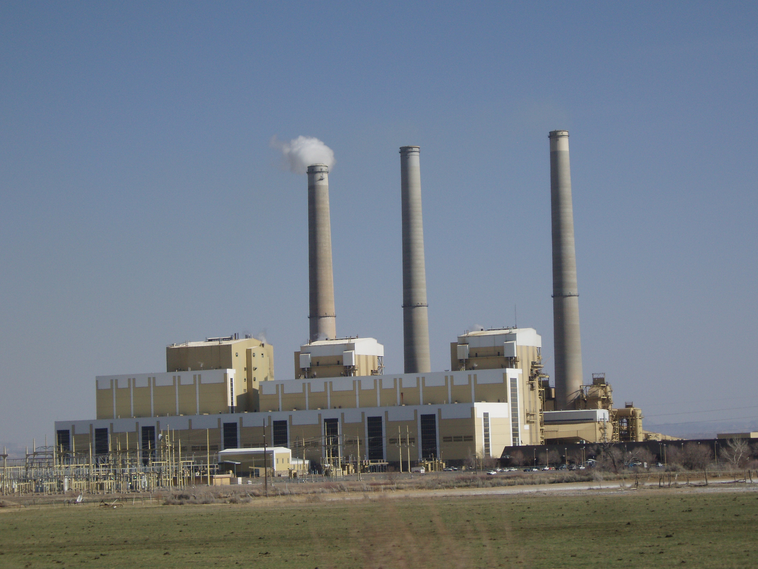
ex image size = 300px
ex image cEmery County is a
county located in theU.S. state ofUtah . As of 2000 the population was 10,860, and by 2005 had been estimated to decrease to 10,711. It was named forGeorge W. Emery , governor of the Utah Territory in 1875. Itscounty seat is Castle Dale and the largest city is HuntingtonGR|6.On Monday,
August 6 ,2007 , at 2:48 A.M.,UtahAmerican Energy 'sCrandall Canyon Mine , 15 miles (24 km) west north-west of Huntington, collapsed; trapping 6 workers inside. The mine, located just off State Route 31, is about 34 miles (55 km) southeast of Fairview, and 140 miles (225 km) south of Salt Lake City (100 miles, or 161 km, on a flight line). The workers are approximately about 3.4 miles (5.5 km) from the mine entrance and 1500 feet (457 m) underground. The collapse registered recordedseismic waves in magnitude 3.9 to 4.0, byseismograph stations of theUniversity of Utah .Emery County, the state's No. 2 coal-producer, was also the site of a fire that killed 27 people in the
Wilberg Mine in December 1984. [ [http://www.cnn.com/2007/US/08/06/utah.mine.ap/index.html?section=cnn_latest "6 miners trapped in Utah coal mine collapse" @ CNN.com] ] [ [http://news.yahoo.com/s/nm/20070806/us_nm/mine_utah_dc_4 "Six miners trapped after Utah coal mine collapses" @ Yahoo! News] ] [ [http://news.yahoo.com/s/ap/20070807/ap_on_re_us/utah_mine_collapse;_ylt=AiZOtpLFlbJrPqyfEecHthsXIr0F "Utah mine owner: Rescue will take 3 days" @ from AP at Yahoo! News] ]History and archaeology
Range Creek rises in Emery County, and has recently been shown to have astonishingly pristine remains of theFremont culture . The State ofUtah owns the site and is currently identifying the remains and developing a long-term conservation plan.Geography
According to the U.S. Census Bureau, the county has a total area of 4,462
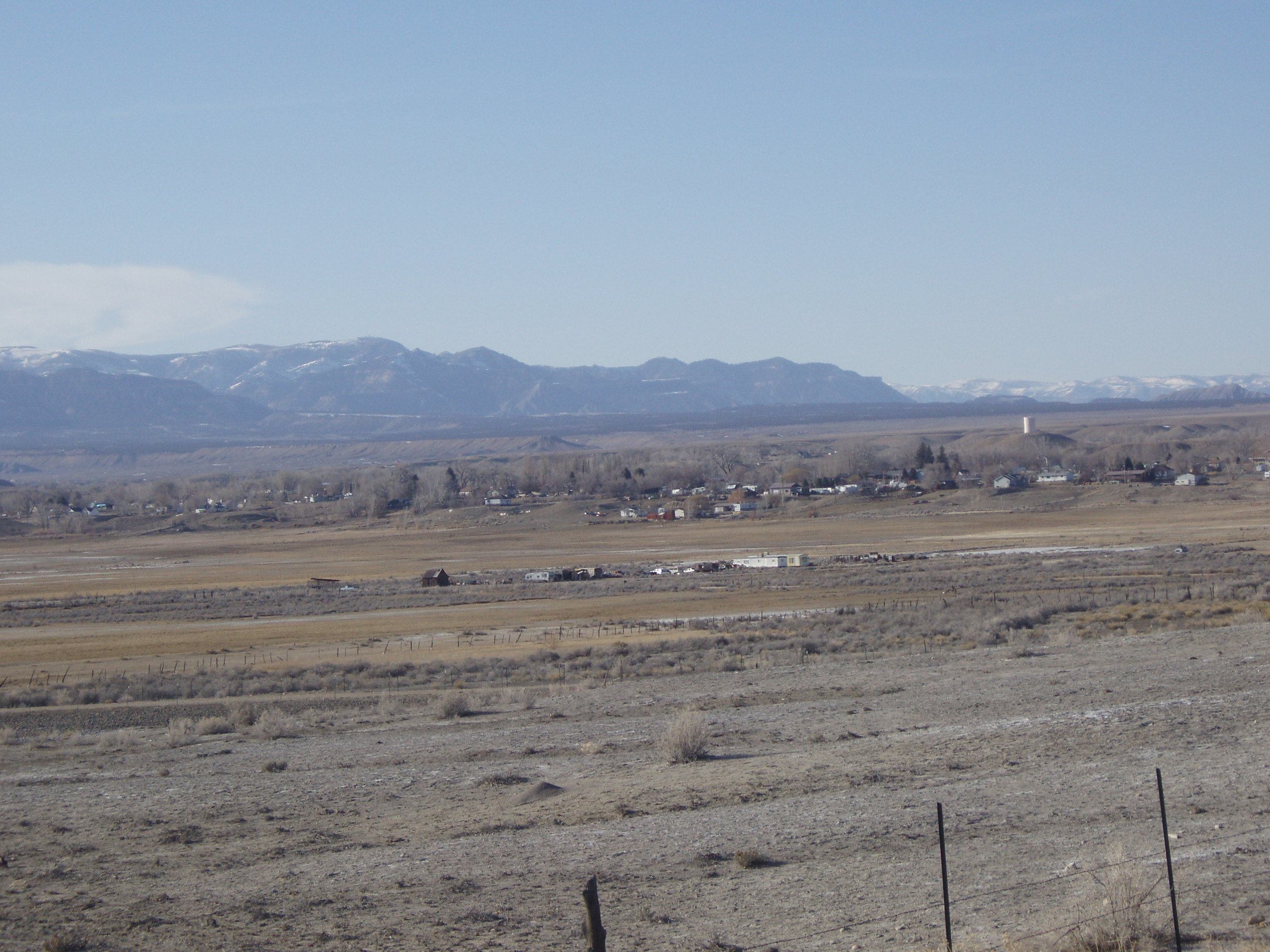
square mile s (11,555km² ), of which, 4,452 square miles (11,530 km²) of it is land and 10 square miles (25 km²) of it (0.22%) is water. The Green River forms the eastern boundary. TheWasatch Plateau , a mountainous area, sits along the western boundary. The main population of the county lives along the base of these mountains. TheSan Rafael Swell occupies most of the area to the east.Adjacent Counties
*
Carbon County, Utah (north)
*Grand County, Utah (east)
*Wayne County, Utah (south)
*Sevier County, Utah (southwest)
*Sanpete County, Utah (northwest)National
protected area s*
Capitol Reef National Park (part)
*Manti-La Sal National Forest (part)Demographics
As of the
census GR|2 of 2000, there were 10,860 people, 3,468 households, and 2,798 families residing in the county. Thepopulation density was 2 people per square mile (1/km²). There were 4,093 housing units at an average density of 1 per square mile (0/km²). The racial makeup of the county was 95.64% White, 0.18% Black or African American, 0.65% Native American, 0.31% Asian, 0.10% Pacific Islander, 1.87% from other races, and 1.24% from two or more races. 5.23% of the population were Hispanic or Latino of any race.There were 3,468 households out of which 45.90% had children under the age of 18 living with them, 69.80% were married couples living together, 7.20% had a female householder with no husband present, and 19.30% were non-families. 17.60% of all households were made up of individuals and 8.10% had someone living alone who was 65 years of age or older. The average household size was 3.10 and the average family size was 3.53.
In the county, the population was spread out with 35.40% under the age of 18, 9.60% from 18 to 24, 24.10% from 25 to 44, 20.90% from 45 to 64, and 10.10% who were 65 years of age or older. The median age was 30 years. For every 100 females there were 100.80 males. For every 100 females age 18 and over, there were 97.50 males.
The median income for a household in the county was $39,850, and the median income for a family was $44,086. Males had a median income of $39,059 versus $18,929 for females. The
per capita income for the county was $14,243. About 9.40% of families and 11.50% of the population were below thepoverty line , including 14.00% of those under age 18 and 8.10% of those age 65 or over.Cities and towns
right|thumb|300px|Cleveland as seen from the south
*Castle Dale
*Clawson
*Cleveland
*Elmo
*Emery
*Ferron
*Green River
*Huntington
*Mohrland (ghost town)
*Orangeville
*Woodside (ghost town)Annual events
* Castle Valley Pageant
* Elmo Horse and Buggy Days
* Emery County Fair
* Ferron Peach Days
* Green River Melon Days
* Huntington Heritage Days
* San Rafael Swell Mountain Bike FestivalNewspapers
* [http://www.theemerycountyreview.com The Emery County Review] (Weekly)
* [http://www.ecprogress.com Emery County Progress] (Weekly)Schools
*Emery High School
*Green River High School
*Canyon View Junior High School
*San Rafael Junior High Schoolite seeing
*Joe's Valley Reservoir
*San Rafael Reef
*San Rafael Swell
*Buckhorn Draw Pictograph Panel
*The Wedge
*Huntington Reservoir
*Cottonwood Canyon
*Goblin Valley State Park
*Rochester Rock Art Panel References
External links
* [http://www.emerycounty.com/ Official Website of Emery County]

Wikimedia Foundation. 2010.