- National Register of Historic Places listings in Emery County, Utah
-
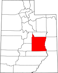 Location of Emery County in Utah
This is a list of the National Register of Historic Places listings in Emery County, Utah.
This is intended to be a complete list of the properties and districts on the National Register of Historic Places in Emery County, Utah, United States. Latitude and longitude coordinates are provided for many National Register properties and districts; these locations may be seen together in a Google map.[1]
There are 21 properties and districts listed on the National Register in the county, including 1 National Historic Landmark.
-
- This National Park Service list is complete through NPS recent listings posted November 10, 2011.[2]
Contents
Current listings
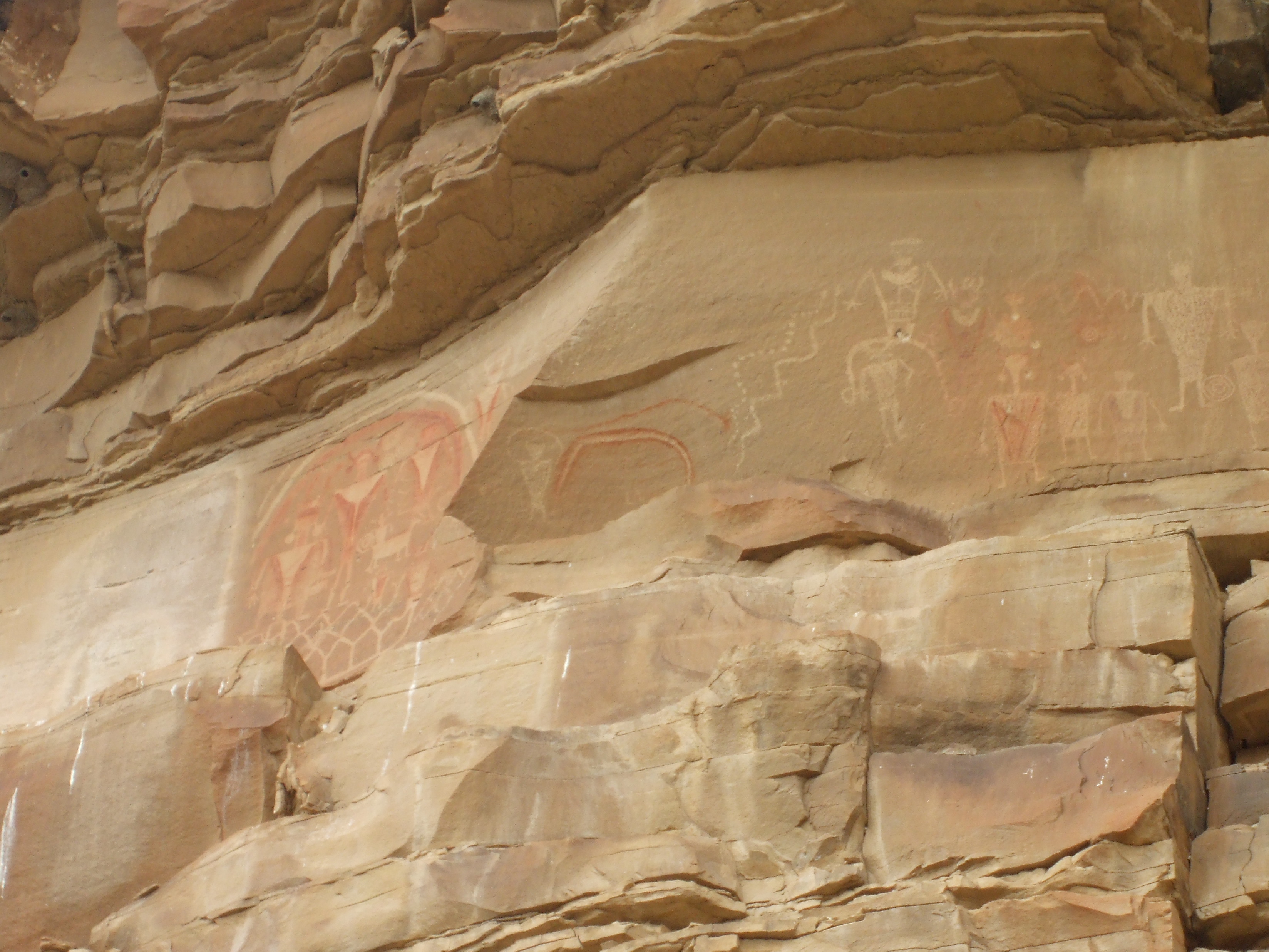
[3] Landmark name [4] Image Date listed Location City or town Summary 1 Black Dragon Canyon Pictographs September 4, 1980 Address Restricted Green River 2 Buckhorn Wash Rock Art Sites 
August 1, 1980 Address Restricted Castle Dale 3 Castle Dale High School Shop 
April 1, 1985 300 N. Center St.
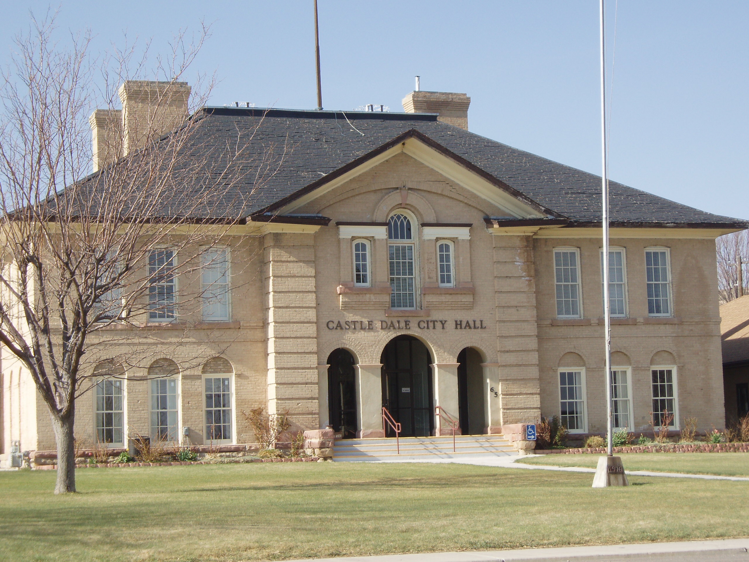
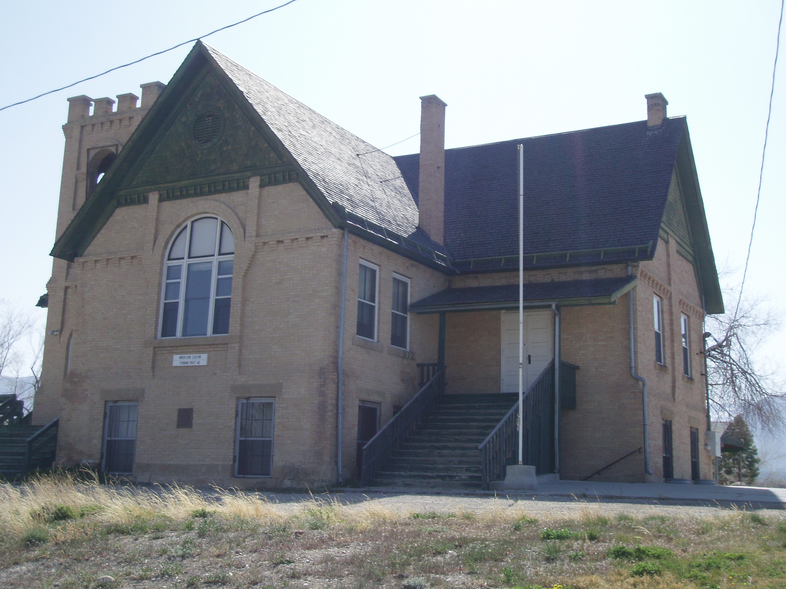
39°12′59″N 111°01′13″W / 39.216389°N 111.020278°WCastle Dale 4 Castle Dale School 
September 6, 1978 61 E. 100 North
39°12′51″N 111°01′02″W / 39.214167°N 111.017222°WCastle Dale Now the Castle Dale City Hall 5 Paul C. Christensen House 
December 2, 1980 15 E. 100 North
39°12′50″N 111°01′07″W / 39.213889°N 111.018611°WCastle Dale 6 Denver and Rio Grande Lime Kiln 
August 26, 1980 Southeast of Cleveland, along County Rd. 335 south of Little Cedar Mountain
39°11′16″N 110°42′09″W / 39.187847°N 110.702569°WCleveland 7 Desolation Canyon November 24, 1968 Along the Green River in northeastern Emery County between Ouray and Green River
39°25′0″N 110°0′40″W / 39.416667°N 110.01111°W[5]Green River Split between Emery, Grand, Carbon, and Uintah counties 8 Emery LDS Church 
February 22, 1980 Off State Route 10
38°55′27″N 111°14′48″W / 38.924167°N 111.246667°WEmery 9 Ferron Box Pictographs and Petroglyphs 
July 11, 1980 Address Restricted Ferron 10 Ferron Presbyterian Church and Cottage 
September 6, 1978 Mill Rd. and 3rd West
39°05′36″N 111°08′28″W / 39.093333°N 111.141111°WFerron 11 Green River Presbyterian Church January 5, 1989 134 W. 3rd Ave.
38°59′45″N 110°09′54″W / 38.995833°N 110.165°WGreen River 12 Huntington Roller Mill and Miller's House 
September 27, 1979 400 North and 550 West Sts.
39°20′02″N 110°58′36″W / 39.333889°N 110.976667°WHuntington 13 Huntington Tithing Granary 
January 25, 1985 45 W. 300 North, rear
39°19′53″N 110°57′55″W / 39.331389°N 110.965278°WHuntington 14 Peter Johansen House 
March 19, 1980 830 N. Center St.
39°13′35″N 111°01′07″W / 39.226389°N 111.018611°WCastle Dale 15 Lars Peter Larson House 
February 13, 1980 210 E. 100 South
39°20′49″N 110°50′49″W / 39.346944°N 110.846944°WCleveland 16 Leander Lemmon House 
September 12, 2002 45 W. Center St.
39°19′34″N 110°57′54″W / 39.326111°N 110.965°WHuntington 17 Rochester-Muddy Creek Petroglyph Site 
June 26, 1975 Address Restricted Emery 18 San Rafael Bridge 
June 3, 1996 County Road 3-32 over the San Rafael River, approximately 23 miles southeast of Castle Dale
39°04′52″N 110°39′49″W / 39.081111°N 110.663611°WCastle Dale 19 Justus Wellington Seeley II House 
November 15, 1979 Center and 100 South Sts.
39°12′40″N 111°01′06″W / 39.211111°N 111.018333°WCastle Dale 20 Samuel Singleton House 
November 8, 1979 South of Ferron on State Route 10
39°05′02″N 111°07′57″W / 39.083889°N 111.1325°WFerron 21 Temple Mountain Wash Pictographs March 15, 1976 Address Restricted Hanksville See also
References
- ^ The latitude and longitude information provided in this table was derived originally from the National Register Information System, which has been found to be fairly accurate for about 99% of listings. For about 1% of NRIS original coordinates, experience has shown that one or both coordinates are typos or otherwise extremely far off; some corrections may have been made. A more subtle problem causes many locations to be off by up to 150 yards, depending on location in the country: most NRIS coordinates were derived from tracing out latitude and longitudes off of USGS topographical quadrant maps created under the North American Datum of 1927, which differs from the current, highly accurate WGS84 GPS system used by Google maps. Chicago is about right, but NRIS longitudes in Washington are higher by about 4.5 seconds, and are lower by about 2.0 seconds in Maine. Latitudes differ by about 1.0 second in Florida. Some locations in this table may have been corrected to current GPS standards.
- ^ "National Register of Historic Places: Weekly List Actions". National Park Service, United States Department of the Interior. Retrieved on November 10, 2011.
- ^ Numbers represent an ordering by significant words. Various colorings, defined here, differentiate National Historic Landmark sites and National Register of Historic Places Districts from other NRHP buildings, structures, sites or objects.
- ^ "National Register Information System". National Register of Historic Places. National Park Service. . http://nrhp.focus.nps.gov/natreg/docs/All_Data.html.
- ^ Location and coordinates derived from its GNIS entry; the NRIS lists the site as "Address unknown"
External links
 Media related to National Register of Historic Places in Emery County, Utah at Wikimedia Commons
Properties on the National Register of Historic Places in Utah 

U.S. National Register of Historic Places Topics Lists by states Alabama • Alaska • Arizona • Arkansas • California • Colorado • Connecticut • Delaware • Florida • Georgia • Hawaii • Idaho • Illinois • Indiana • Iowa • Kansas • Kentucky • Louisiana • Maine • Maryland • Massachusetts • Michigan • Minnesota • Mississippi • Missouri • Montana • Nebraska • Nevada • New Hampshire • New Jersey • New Mexico • New York • North Carolina • North Dakota • Ohio • Oklahoma • Oregon • Pennsylvania • Rhode Island • South Carolina • South Dakota • Tennessee • Texas • Utah • Vermont • Virginia • Washington • West Virginia • Wisconsin • WyomingLists by territories Lists by associated states Other Municipalities and communities of Emery County, Utah Cities 
Towns Unincorporated
communityIndian
reservationGhost towns Connellsville | Desert Lake | Mohrland | Victor | Woodside
Categories:- National Register of Historic Places in Utah by county
- Emery County, Utah
-


Wikimedia Foundation. 2010.