- National Register of Historic Places listings in Salt Lake City, Utah
-
 Salt Lake City and its surrounding area
This is a list of the National Register of Historic Places listings in Salt Lake City, Utah.
This is intended to be a complete list of the properties and districts on the National Register of Historic Places in Salt Lake City, Utah, United States. Latitude and longitude coordinates are provided for many National Register properties and districts; these locations may be seen together in a Google map.[1]
There are 330 properties and districts listed on the National Register in Salt Lake County, including 6 National Historic Landmarks. 213 of these sites, including 4 National Historic Landmarks, are located in Salt Lake City, and are listed here; the remaining 117 sites, including 2 National Historic Landmarks, are listed separately. 4 other sites in the city were once listed, but have since been removed.
-
- This National Park Service list is complete through NPS recent listings posted November 10, 2011.[2]
Current listings
[3] Landmark name[4] Image Date listed Location Summary 1 19th Ward Meetinghouse and Relief Society Hall May 28, 1976 168 W. 500 North
40°46′49″N 111°53′42″W / 40.78028°N 111.895°W2 Altadena Apartments January 27, 2010 310 S. 300 East
40°45′44.82″N 111°52′58.16″W / 40.76245°N 111.8828222°W3 Fortunato Anselmo House May 21, 1979 164 S. 900 East
40°45′56″N 111°51′54″W / 40.76556°N 111.865°W4 George Arbuckle House February 12, 1982 747 E. 1700 South
40°44′2″N 111°52′8″W / 40.73389°N 111.86889°W5 Armista Apartments October 20, 1989 555 E. 100 South
40°46′4″N 111°52′2″W / 40.76778°N 111.86722°W6 Francis Armstrong House May 23, 1980 667 E. 100 South
40°46′3″N 111°52′16″W / 40.7675°N 111.87111°W7 Ashby Apartments November 16, 2006 358 E. 100 South
40°46′1″N 111°52′49″W / 40.76694°N 111.88028°W8 Avenues Historic District August 27, 1980 Roughly bounded by 1st and 9th Aves. and State and Virginia Sts.
40°46′23″N 111°52′10″W / 40.77306°N 111.86944°W9 B'nai Israel Temple November 16, 1978 249 S. 400 East
40°45′48″N 111°52′42″W / 40.76333°N 111.87833°W10 Charles Baldwin House February 11, 1982 229 S. 1200 East
40°45′52″N 111°51′21″W / 40.76444°N 111.85583°W11 Simon Bamberger House 
May 30, 1975 623 E. 100 South
40°46′3″N 111°52′19″W / 40.7675°N 111.87194°WSimon Bamberger was governor of Utah from 1917-1921. 12 Jeremiah Beattie House July 7, 1983 655 E. 200 South
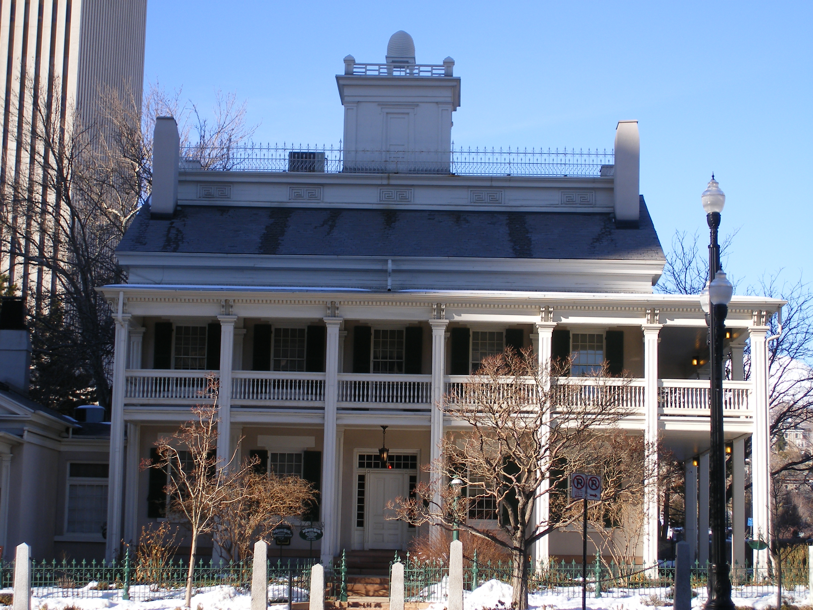
40°45′56″N 111°52′13″W / 40.76556°N 111.87028°W13 Beehive House 
February 26, 1970 67 E. South Temple St.
40°46′8″N 111°53′7″W / 40.76889°N 111.88528°W14 William F. Beer Estate December 6, 1977 181 B St. and 222 4th Ave.
40°46′24″N 111°52′52″W / 40.77333°N 111.88111°W15 Ebenezer Beesley House July 16, 1979 80 W. 200 North
40°46′35″N 111°53′34″W / 40.77639°N 111.89278°W16 Benworth-Chapman Apartments and Chapman Cottages December 30, 2004 227 S. 400 East
40°45′51″N 111°52′43″W / 40.76417°N 111.87861°W17 Bertolini Block September 29, 1976 143½ W. 200 South
40°45′53″N 111°53′41″W / 40.76472°N 111.89472°W18 Best-Cannon House October 3, 1980 1146 S. 900 East
40°44′42″N 111°51′32″W / 40.745°N 111.85889°W19 Bigelow Apartments December 30, 2004 225 S. 400 East
40°45′50″N 111°52′43″W / 40.76389°N 111.87861°W20 Broadway Hotel August 17, 1982 222 W. 300 South
40°45′47″N 111°53′49″W / 40.76306°N 111.89694°W21 Brooks Arcade August 17, 1982 260 S. State St.
40°45′51″N 111°53′17″W / 40.76417°N 111.88806°W22 Building at Rear, 537 West 200 South December 27, 1982 Rear, 537 W. 200 South
40°45′52″N 111°54′21″W / 40.76444°N 111.90583°W23 Building at 561 West 200 South December 27, 1982 561 W. 200 South
40°45′54″N 111°54′24″W / 40.765°N 111.90667°W24 George M. Cannon House July 18, 1983 720 E. Ashton Ave.
40°43′10″N 111°52′11″W / 40.71944°N 111.86972°W25 Capitol Building 
October 11, 1978 Capitol Hill
40°46′40″N 111°50′24″W / 40.77778°N 111.84°W26 Capitol Hill Historic District August 2, 1982 Roughly bounded by Beck, Main and Wall Sts., 300 N. Victory Rd., and Capitol Boulevard; also roughly bounded by 300 North, 400 West, 800 North, Wall St., and 200 West
40°46′43″N 111°53′33″W / 40.77861°N 111.8925°WSecond set of boundaries represents a boundary increase 27 Carlson Hall 
April 12, 1996 369 S. University St.
40°45′41″N 111°51′4″W / 40.76139°N 111.85111°W28 Cathedral of the Madeleine 
March 11, 1971 331 E. South Temple St.
40°46′12″N 111°52′52″W / 40.77°N 111.88111°W29 Centennial Home September 7, 2001 307 Virginia St.
40°46′31″N 111°51′6″W / 40.77528°N 111.85167°W30 Central City Historic District August 22, 1996 Roughly bounded by South Temple, 900 South, 500 East, and 700 East Sts.; also roughly bounded by South Temple, 400 South, 700 East, and 1100 East
40°45′33″N 111°52′24″W / 40.75917°N 111.87333°WSecond set of boundaries represents a boundary increase 31 Central Warehouse August 17, 1982 520 W. 200 South
40°45′55″N 111°54′20″W / 40.76528°N 111.90556°W32 Chapman Branch Library 
January 20, 1980 577 S. 900 West
40°45′24″N 111°54′58″W / 40.75667°N 111.91611°W33 Isaac Chase Mill 
June 15, 1970 Liberty Park, 600 East
40°44′36″N 111°52′25″W / 40.74333°N 111.87361°W34 City Creek Canyon Historic District March 12, 1980 Bounded by Capitol Boulevard, A St., 4th Ave. and Canyon Rd.
40°46′49″N 111°52′59″W / 40.78028°N 111.88306°W35 Isaac C. and Dorothy S. Clark House January 11, 2002 1430 E. Federal Way
40°46′5″N 111°50′57″W / 40.76806°N 111.84917°W36 Clift Building August 17, 1982 272 S. Main St.
40°45′47″N 111°53′27″W / 40.76306°N 111.89083°W37 Cluff Apartments October 20, 1989 1270-1280 E. 200 South
40°45′53″N 111°51′12″W / 40.76472°N 111.85333°W38 Henry A. and Tile S. Cohn House August 5, 1996 1369 E. Westminister Ave.
40°43′46″N 111°51′2″W / 40.72944°N 111.85056°W39 Congregation Montefiore June 27, 1985 355 S. 300 East
40°45′41″N 111°52′53″W / 40.76139°N 111.88139°W40 Congregation Sharey Tzedek Synagogue June 27, 1985 833 S. 200 East
40°45′4″N 111°53′3″W / 40.75111°N 111.88417°W41 Continental Bank Building December 27, 1982 200 S. Main St.
40°45′53″N 111°53′27″W / 40.76472°N 111.89083°W42 Converse Hall April 20, 1978 1840 S. 1300 East
40°43′55″N 111°51′14″W / 40.73194°N 111.85389°W43 Cornell Apartments October 20, 1989 101 S. 600 East
40°46′1″N 111°52′8″W / 40.76694°N 111.86889°W44 Corona Apartments October 20, 1989 335 S. 200 East
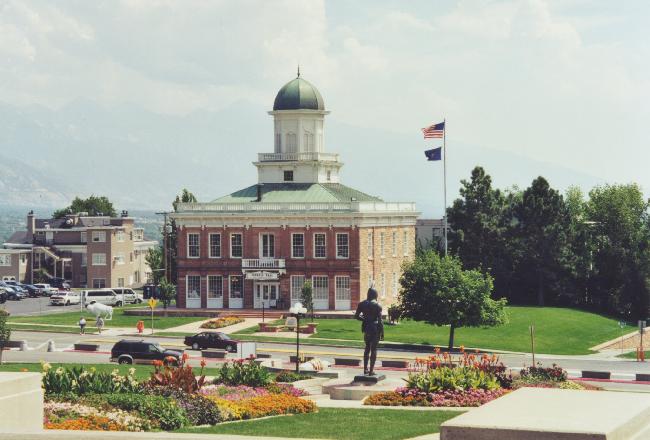
40°45′43″N 111°53′3″W / 40.76194°N 111.88417°W45 Council Hall 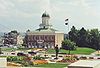
May 14, 1971 Capitol Hill at head of State St.
40°46′33″N 111°53′13″W / 40.77583°N 111.88694°W46 Almon A. Covey House October 3, 1980 1211 E. 100 South
40°46′3″N 111°51′21″W / 40.7675°N 111.85583°W47 Hyrum T. Covey House October 3, 1980 1229 E. 100 South
40°46′3″N 111°51′19″W / 40.7675°N 111.85528°W48 Cramer House August 17, 1982 241 Floral St.
40°45′50″N 111°53′16″W / 40.76389°N 111.88778°W49 Crown Cleaning and Dyeing Company Building July 11, 2003 1989 S. 1100 East
40°43′40″N 111°51′31″W / 40.72778°N 111.85861°W50 William Culmer House 
April 18, 1974 33 C St.
40°46′14″N 111°52′43″W / 40.77056°N 111.87861°WNow the Sacred Heart Center of the Roman Catholic Diocese of Salt Lake City 51 Byron Cummings House October 13, 1983 936 E. 1700 South
40°44′0″N 111°51′49″W / 40.733333°N 111.86361°W52 Genevieve & Alexander Curtis House September 9, 2010 1119 E. Westminster Ave.
40°43′46″N 111°51′32″W / 40.72944°N 111.85889°W53 Daft Block May 28, 1976 128 S. Main St.
40°45′59″N 111°53′26″W / 40.76639°N 111.89056°W54 Davis Deaconess Home January 24, 1995 347 S. 400 East
40°45′41″N 111°52′44″W / 40.76139°N 111.87889°W55 Denver and Rio Grande Railroad Station 
September 25, 1975 300 South and Rio Grande
40°45′46″N 111°54′14″W / 40.76278°N 111.90389°W56 Devereaux House March 11, 1971 334 W. South Temple St.
40°46′13″N 111°54′2″W / 40.77028°N 111.90056°W57 Harper J. Dininny House October 13, 1983 925 E. Logan Ave.
40°44′4″N 111°51′49″W / 40.73444°N 111.86361°W58 Henry Dinwoody House July 24, 1974 411 E. 100 South
40°46′4″N 111°52′42″W / 40.76778°N 111.87833°W59 Exchange Place Historic District August 10, 1978 Exchange Place and S. Main St.
40°45′38″N 111°53′22″W / 40.76056°N 111.88944°W60 J. Leo Fairbanks House April 26, 1984 1228 Bryan Ave.
40°44′8″N 111°51′19″W / 40.73556°N 111.85528°W61 Felt Electric August 17, 1982 165 S. Regent St.
40°45′55″N 111°53′20″W / 40.76528°N 111.88889°W62 Fifth Ward Meetinghouse December 8, 1978 740 S. 300 West
40°46′50″N 111°54′25″W / 40.78056°N 111.90694°W63 Firestation No. 8 July 28, 1983 258 S. 1300 East
40°45′49″N 111°51′13″W / 40.76361°N 111.85361°W64 First Church of Christ, Scientist July 30, 1976 352 E. 300 South
40°45′45″N 111°52′49″W / 40.7625°N 111.88028°W65 First Methodist Episcopal Church January 24, 1995 200 S. 200 East
40°46′24″N 111°54′29″W / 40.77333°N 111.90806°W66 First National Bank May 24, 1976 163 S. Main St.
40°45′56″N 111°53′24″W / 40.76556°N 111.89°W67 First Security Bank Building September 28, 2005 405 S. Main St.
40°45′36″N 111°53′23″W / 40.76°N 111.88972°W68 Ford Motor Company Service Building November 2, 2000 280 S. 400 West
40°45′47″N 111°54′8″W / 40.76306°N 111.90222°W69 Forest Dale Historic District April 23, 2009 Roughly bounded by 700 East, Interstate 80, Commonwealth Ave., and 900 East
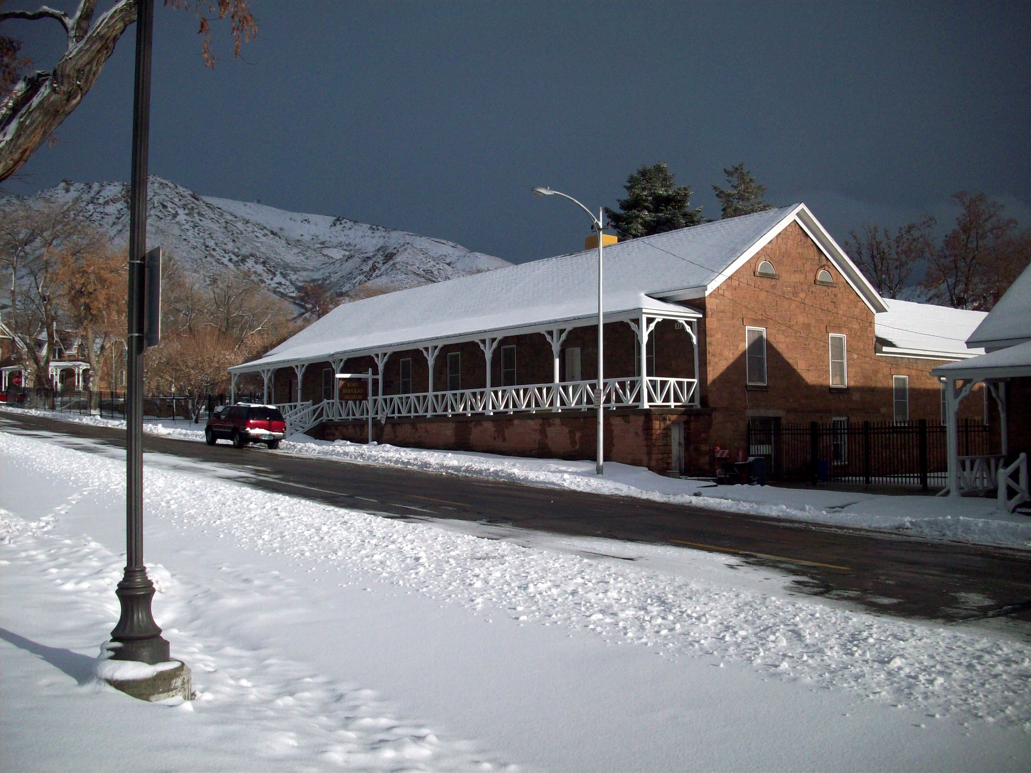
40°43′19.92″N 111°52′5.23″W / 40.7222°N 111.8681194°W70 Fort Douglas 
June 15, 1970 Fort Douglas Military Reservation
40°45′52″N 111°49′58″W / 40.76444°N 111.83278°W71 J. A. Fritsch Block July 30, 1976 158 E. 200 South
40°45′53″N 111°53′7″W / 40.76472°N 111.88528°W72 W.P. Fuller Paint Company Office and Warehouse September 15, 2005 404 W. 400 South
40°45′40″N 111°54′8″W / 40.76111°N 111.90222°W73 General Engineering Company Building January 21, 1980 159 W. Pierpont Ave.
40°45′49″N 111°53′44″W / 40.76361°N 111.89556°W74 Gibbs-Thomas House July 12, 1984 137 N. West Temple St.
40°46′22″N 111°53′36″W / 40.77278°N 111.89333°W75 Gilmer Park Historic District March 28, 1996 Roughly bounded by 1100 East, 900 South, 1300 East, and Harv Ave.
40°44′48″N 111°51′21″W / 40.74667°N 111.85583°W76 Granite LDS Stake Tabernacle 
July 11, 2003 2005 S. 900 East
40°43′35″N 111°51′50″W / 40.72639°N 111.86389°W77 Granite Lumber Company Building July 11, 2003 1090 E. 2100 South
40°43′31″N 111°51′33″W / 40.72528°N 111.85917°W78 Greenwald Furniture Company Building December 27, 1982 35 W. 300 South
40°45′45″N 111°53′29″W / 40.7625°N 111.89139°W79 Nels G. Hall House October 3, 1980 1340 2nd Ave.
40°46′18″N 111°50′56″W / 40.77167°N 111.84889°W80 Nephi J. Hansen House December 9, 1999 1797 S. 1400 East
40°43′51″N 111°51′0″W / 40.73083°N 111.85°W81 Harris Apartments September 24, 1991 836 S. 500 East
40°45′3″N 111°52′34″W / 40.75083°N 111.87611°W82 William Hawk Cabin December 29, 1978 458 N. 300 West
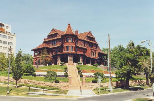
40°46′54″N 111°53′53″W / 40.78167°N 111.89806°W83 Henderson Block January 30, 1978 375 W. 200 South
40°45′52″N 111°54′5″W / 40.76444°N 111.90139°W84 Thomas and Mary Hepworth House 
April 21, 2000 725 W. 200 North
40°46′25″N 111°54′40″W / 40.77361°N 111.91111°W85 Herald Building July 30, 1976 165-169 S. Main St.
40°45′56″N 111°53′24″W / 40.76556°N 111.89°W86 Highland Park Historic District April 23, 1998 Roughly bounded by Parkway Ave., 1500 East, 2700 South, and Elizabeth St.
40°42′56″N 111°51′7″W / 40.71556°N 111.85194°W87 Lewis S. Hills House August 18, 1977 126 S. 200 West
40°46′0″N 111°53′47″W / 40.766667°N 111.89639°W88 Lewis S. Hills House August 3, 1990 425 E. 100 South
40°46′3″N 111°52′41″W / 40.7675°N 111.87806°W89 Hollywood Apartments April 7, 1994 234 E. 100 South
40°46′1″N 111°53′2″W / 40.76694°N 111.88389°W90 Holy Trinity Greek Orthodox Church 
July 8, 1975 279 S. 200 West
40°45′49″N 111°53′54″W / 40.76361°N 111.89833°W91 Hotel Albert August 17, 1982 121 S. West Temple St.
40°46′0″N 111°53′35″W / 40.766667°N 111.89306°W92 Hotel Utah 
January 3, 1978 South Temple and Main St.
40°46′11″N 111°53′23″W / 40.76972°N 111.88972°WNow the Joseph Smith Memorial Building 93 Hotel Victor August 17, 1982 155 W. 200 South
40°45′53″N 111°53′42″W / 40.76472°N 111.895°W94 Immanuel Baptist Church December 12, 1978 401 E. 200 South
40°46′4″N 111°53′0″W / 40.76778°N 111.883333°W95 Independent Order of Odd Fellows Hall November 7, 1977 26 W. Market St.
40°45′41″N 111°53′30″W / 40.76139°N 111.89167°W96 Irving Junior High School December 22, 1978 1179 E. 2100 South
40°43′34″N 111°51′25″W / 40.72611°N 111.85694°W97 Ivanhoe Apartments October 20, 1989 417 E. 300 South
40°45′47″N 111°52′41″W / 40.76306°N 111.87806°W98 Japanese Church of Christ August 17, 1982 268 W. 100 South
40°46′3″N 111°53′54″W / 40.7675°N 111.89833°W99 John W. Judd House October 13, 1983 918 E. Logan Ave.
40°44′3″N 111°51′50″W / 40.73417°N 111.86389°W100 Judge Building December 26, 1979 8 E. 300 South
40°45′46″N 111°53′24″W / 40.76278°N 111.89°W101 Emanuel Kahn House 
July 21, 1977 678 E. South Temple St.
40°46′9″N 111°52′15″W / 40.76917°N 111.87083°WNow the Anniversary Inn bed and breakfast 102 Karrick Block June 16, 1976 236 S. Main St.
40°45′49″N 111°53′26″W / 40.76361°N 111.89056°W103 Kearns Building August 17, 1982 132 S. Main St.
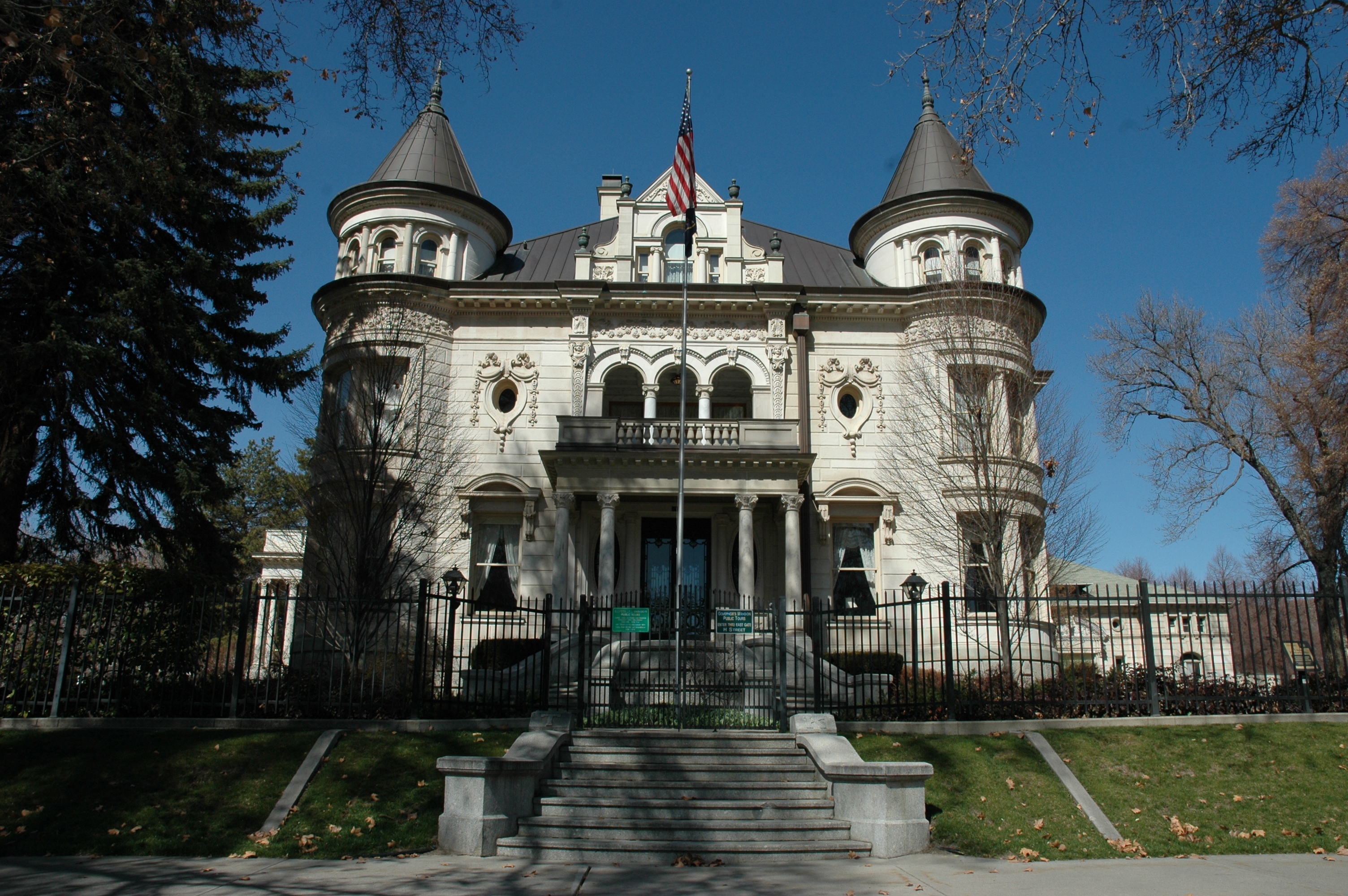
40°45′58″N 111°53′27″W / 40.76611°N 111.89083°W104 Thomas Kearns Mansion and Carriage House 
February 26, 1970 603 E. South Temple St.
40°46′11″N 111°52′23″W / 40.76972°N 111.87306°WServes as the Utah Governor's Mansion 105 David Keith Mansion and Carriage House 
May 14, 1971 529 E. South Temple St.
40°46′11″N 111°52′30″W / 40.76972°N 111.875°W106 Keith-O'Brien Building August 16, 1977 242-256 S. Main St.
40°45′49″N 111°53′27″W / 40.76361°N 111.89083°W107 Albert H. Kelly House 
July 20, 1983 418 S. 200 West
40°45′36″N 111°53′49″W / 40.76°N 111.89694°W108 John B. Kelly House 
July 20, 1983 422 S. 200 West
40°45′36″N 111°53′49″W / 40.76°N 111.89694°W109 Keyser-Cullen House December 9, 1999 941 E. 500 South
40°45′32″N 111°51′48″W / 40.75889°N 111.86333°W110 Malcolm and Elizabeth Keyser House December 4, 2008 381 E. 11th Ave.
40°46′57.072″N 111°52′40.836″W / 40.78252°N 111.87801°W111 Ladies Literary Club Clubhouse 
October 11, 1978 850 E. South Temple St.
40°46′10″N 111°51′58″W / 40.76944°N 111.86611°W112 John C. and Mary Landenberger House January 26, 2005 58 N. Virginia St.
40°46′11″N 111°51′48″W / 40.76972°N 111.86333°W113 James and Susan R. Langton House November 19, 1982 648 E. 100 South
40°46′1″N 111°52′19″W / 40.76694°N 111.87194°W114 Lefler-Woodman Building December 17, 1992 859 E. 900 South
40°45′0″N 111°51′55″W / 40.75°N 111.86528°W115 Dr. David and Juanita Lewis House November 29, 2001 1403 E. Westminster Ave.
40°43′45″N 111°51′1″W / 40.72917°N 111.85028°W116 Liberty Park 
December 11, 1980 Roughly bounded by 500 East, 700 East, 900 South, and 1300 South
40°44′44.55″N 111°52′26.1″W / 40.7457083°N 111.873917°W117 Lincoln Arms Apartments October 20, 1989 242 E. 100 South
40°46′1″N 111°52′59″W / 40.76694°N 111.88306°W118 Lollin Block August 18, 1977 238 S. Main St.
40°45′51″N 111°53′27″W / 40.76417°N 111.89083°W119 Henry Luce House October 13, 1983 921 E. 1700 South
40°44′1″N 111°51′50″W / 40.73361°N 111.86389°W120 Walter C. Lyne House 
March 9, 1979 1135 E. South Temple St.
40°46′11″N 111°51′28″W / 40.76972°N 111.85778°W121 Mabry-Van Pelt House October 13, 1983 946 E. 1700 South
40°44′0″N 111°51′47″W / 40.733333°N 111.86306°W122 Millard F. Malin House July 7, 1983 133 S. 400 East
40°45′51″N 111°52′43″W / 40.76417°N 111.87861°W123 James G. McAllister House December 17, 1982 306 Douglas St.
40°45′45″N 111°51′17″W / 40.7625°N 111.85472°W124 McCornick Building August 24, 1977 10 W. 100 South
40°46′3″N 111°53′26″W / 40.7675°N 111.89056°W125 Alfred W. McCune Mansion 
June 13, 1974 200 N. Main St.
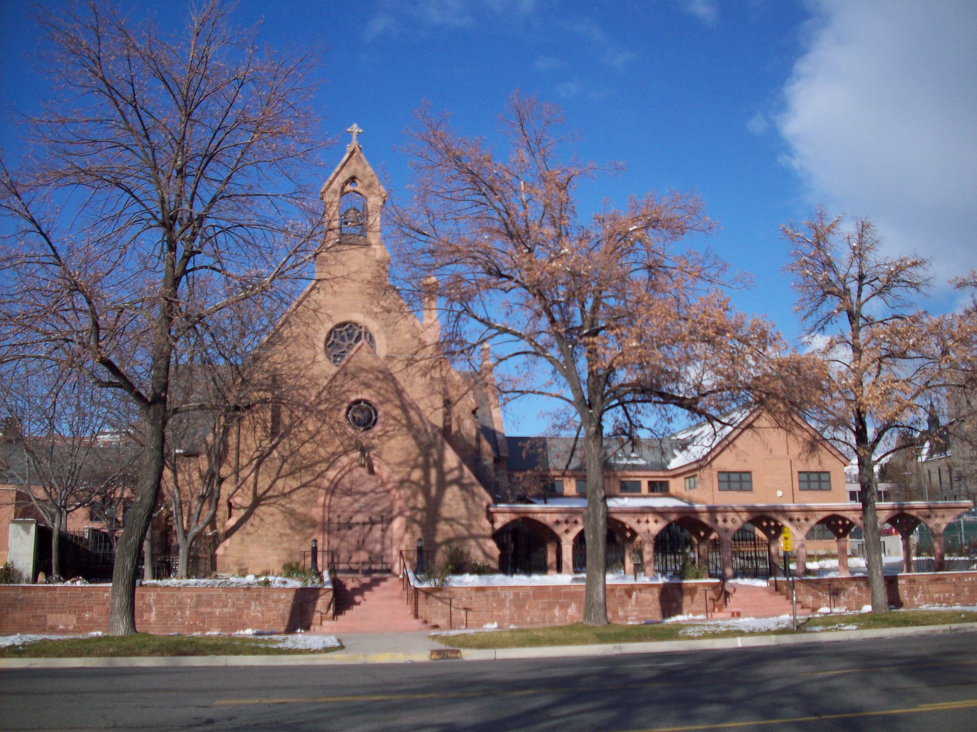
40°46′26″N 111°53′24″W / 40.77389°N 111.89°W126 J. G. McDonald Chocolate Company Building March 29, 1978 155-159 W. 300 South
40°45′45″N 111°53′44″W / 40.7625°N 111.89556°W127 McIntyre Building July 15, 1977 68-72 S. Main St.
40°46′4″N 111°53′26″W / 40.76778°N 111.89056°W128 McIntyre House July 17, 1978 259 7th Ave.
40°46′39″N 111°52′48″W / 40.7775°N 111.88°W129 Joseph and Marie N. McRae House December 20, 2002 452 E. 500 South
40°45′30″N 111°52′38″W / 40.75833°N 111.87722°W130 Frederick A.E. Meyer House 
July 7, 1983 929 E. 200 South
40°45′55″N 111°51′49″W / 40.76528°N 111.86361°W131 Alexander Mitchell House October 13, 1983 1620 S. 1000 East
40°44′3″N 111°51′43″W / 40.73417°N 111.86194°W132 Richard Vaughen Morris House April 29, 1980 314 Quince St.
40°46′34″N 111°53′40″W / 40.77611°N 111.89444°W133 Morrison-Merrill Lumber Company Office and Warehouse December 17, 1998 205 N. 400 West
40°46′26″N 111°54′7″W / 40.77389°N 111.90194°W134 Mountain States Telephone and Telegraph Co. Garage November 24, 1998 1075 E. Hollywood Ave.
40°43′39″N 111°51′36″W / 40.7275°N 111.86°W135 William A. Nelden House October 19, 1978 1172 E. 100 South
40°46′1″N 111°51′23″W / 40.76694°N 111.85639°W136 Nelson-Beesley House June 20, 1980 533 11th Ave.
40°46′56″N 111°52′22″W / 40.78222°N 111.87278°W137 Carl M. Neuhausen House October 3, 1980 1265 E. 100 South
40°46′4″N 111°51′15″W / 40.76778°N 111.85417°W138 New York Hotel March 10, 1980 42 Post Office Pl.
40°45′42″N 111°53′31″W / 40.76167°N 111.89194°W139 Old Clock at Zion's First National Bank December 27, 1982 Southwestern corner of 100 South and Main St.
40°46′1″N 111°53′27″W / 40.76694°N 111.89083°W140 Old Pioneer Fort Site October 15, 1974 400 South and 200 West
40°45′43″N 111°54′1″W / 40.76194°N 111.90028°W141 Oregon Shortline Railroad Company Building June 23, 1976 126-140 Pierpont Ave.
40°45′51″N 111°53′39″W / 40.76417°N 111.89417°W142 Oquirrh School September 12, 2008 350 S. 400 East
40°45′41.436″N 111°52′49.692″W / 40.76151°N 111.88047°W143 Frank M. Orem House August 5, 1983 274 S. 1200 East
40°45′48″N 111°51′24″W / 40.76333°N 111.85667°W144 Orpheum Theatre September 30, 1976 46 W. 200 South
40°45′55″N 111°53′32″W / 40.76528°N 111.89222°W145 Ottinger Hall April 16, 1971 233 Canyon Rd.
40°46′32″N 111°53′7″W / 40.77556°N 111.88528°W146 Peter Pan Apartments September 12, 2008 446 E. 300 South
40°45′44.82″N 111°52′41.412″W / 40.76245°N 111.87817°W147 Pacific Northwest Pipeline Building January 24, 2011 315 E. 200 South
40°45′56″N 111°52′54″W / 40.76556°N 111.88167°W148 Park Hotel December 17, 1992 422-432 W. 300 South
40°45′47″N 111°54′10″W / 40.76306°N 111.90278°W149 Clifford R. Pearsall House October 13, 1983 950 E. Logan Ave.
40°44′3″N 111°51′46″W / 40.73417°N 111.86278°W150 Piccardy Apartments September 12, 2008 115 S. 300 East
40°45′59.976″N 111°52′56.172″W / 40.76666°N 111.88227°W151 Peery Hotel February 17, 1978 270-280 S. West Temple, 102-120 W. 300 South
40°45′47″N 111°53′36″W / 40.76306°N 111.89333°W152 John Platts House August 25, 1972 364 Quince St.
40°46′40″N 111°53′39″W / 40.77778°N 111.89417°W153 Lorenzo and Emma Price House and Barn August 6, 1998 1205 E. 1300 South
40°44′31″N 111°51′20″W / 40.74194°N 111.85556°W154 Lewis A. Ramsey House May 28, 1999 128 S. 1000 East
40°45′59″N 111°51′44″W / 40.76639°N 111.86222°W155 Richardson-Bower Building July 11, 2003 1019 E. 2100 South
40°43′32″N 111°51′41″W / 40.72556°N 111.86139°W156 Rowland Hall-St. Mark's School July 26, 1979 205 1st Ave.
40°46′17″N 111°52′55″W / 40.77139°N 111.88194°W157 Jonathan C. and Eliza K. Royle House 
January 3, 1983 635 E. 100 South
40°46′3″N 111°52′21″W / 40.7675°N 111.8725°W158 Eliza Gray Rumel House July 7, 1983 358 S. 500 East
40°45′41″N 111°52′35″W / 40.76139°N 111.87639°W159 St. Mark's Episcopal Cathedral 
September 22, 1970 231 E. 100 South
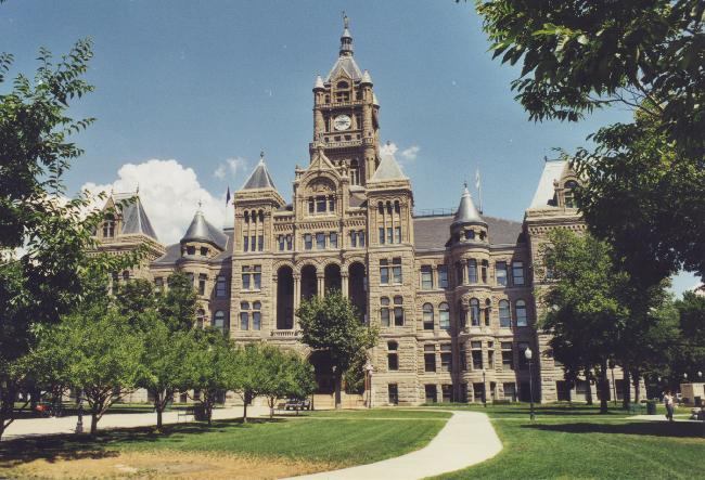
40°46′4″N 111°53′0″W / 40.76778°N 111.883333°W160 Salt Lake City and County Building 
June 15, 1970 451 Washington Sq.
40°45′35″N 111°53′9″W / 40.75972°N 111.88583°W161 Salt Lake City East Side Historic District September 3, 2003 Roughly bounded by 400 South, University St., 900 South, and 700 East
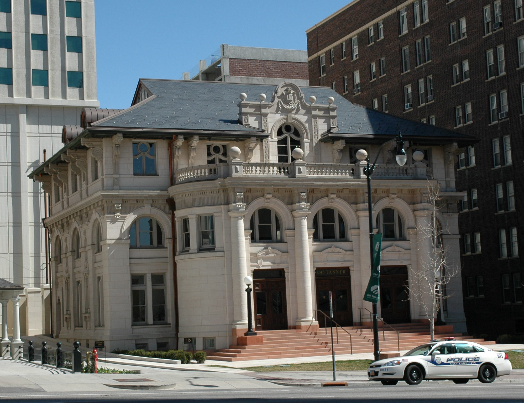
40°45′18.74″N 111°51′44.74″W / 40.7552056°N 111.8624278°W162 Salt Lake City Public Library 
August 7, 1979 15 S. State St.
40°46′7″N 111°53′13″W / 40.76861°N 111.88694°WHoused the Hansen Planetarium 1965–2003, O.C. Tanner Jewelry since 2009 163 Salt Lake Engineering Works-Bogue Supply Company Building August 14, 2003 741 W. 400 South
40°45′37″N 111°54′46″W / 40.76028°N 111.91278°W164 Salt Lake Hardware Company Warehouse October 4, 2001 155 N. 400 West
40°46′19″N 111°54′9″W / 40.77194°N 111.9025°W165 Salt Lake Northwest Historic District March 29, 2001 Roughly bounded by 1100 West, 600 North, 500 West, and North Temple
40°46′48″N 111°54′58″W / 40.78°N 111.91611°W166 Salt Lake Stamp Company Building December 27, 1982 43 W. 200 South
40°45′45″N 111°53′30″W / 40.7625°N 111.89167°W167 Salt Lake Stock and Mining Exchange Building July 30, 1976 39 Exchange Place
40°45′42″N 111°53′21″W / 40.76167°N 111.88917°W168 Salt Lake Union Pacific Railroad Station 
July 9, 1975 South Temple at 400 West
40°46′10″N 111°54′9″W / 40.76944°N 111.9025°W169 Sampson Apartments January 27, 2010 276 E. 300 South
40°45′45.99″N 111°52′59.84″W / 40.762775°N 111.8832889°W170 Sarah Daft Home for the Aged September 12, 2002 737 S. 1300 East
40°45′12″N 111°52′36″W / 40.75333°N 111.87667°W171 Seventh-day Adventist Meetinghouse and School February 6, 2007 1840 S. 800 East
40°43′47″N 111°52′4″W / 40.72972°N 111.86778°W172 Silver Brothers' Iron Works Office and Warehouse May 20, 1999 550 W. 700 South
40°45′16″N 111°54′20″W / 40.75444°N 111.90556°W173 Smith Apartments October 20, 1989 228 S. 300 East
40°45′51″N 111°52′45″W / 40.76417°N 111.87917°W174 George Albert Smith House March 12, 1993 1302 E. Yale Ave.
40°44′44″N 111°51′11″W / 40.74556°N 111.85306°W175 Smith-Bailey Drug Company Building August 17, 1982 171 W. 200 South
40°45′53″N 111°53′45″W / 40.76472°N 111.89583°W176 South Temple Historic District 
July 14, 1982 100 E. to 1350 E. South Temple St.
40°46′10″N 111°52′11″W / 40.76944°N 111.86972°W177 Sprague Branch of the Salt Lake City Public Library July 11, 2003 2131 S. Highland Dr.
40°43′30″N 111°51′30″W / 40.725°N 111.85833°W178 Stratford Hotel December 27, 1982 175 E. 200 South
40°45′55″N 111°53′6″W / 40.76528°N 111.885°W179 Sugar House LDS Ward Building July 11, 2003 1950 S. 1200 East
40°43′40″N 111°51′24″W / 40.72778°N 111.85667°W180 Sugar House Monument July 11, 2003 1100 East and 2100 South
40°43′32″N 111°51′34″W / 40.72556°N 111.85944°W181 Sweet Candy Company Building 
December 28, 2000 224 S. 200 West
40°45′52″N 111°53′48″W / 40.76444°N 111.89667°W182 Temple Square 
October 15, 1966 Temple Square
40°46′14″N 111°53′29″W / 40.77056°N 111.89139°W183 Tenth Ward Square 
November 11, 1977 400 South and 800 East
40°45′37″N 111°52′5″W / 40.76028°N 111.86806°W184 Third Presbyterian Church Parsonage May 19, 2000 1068 E. Blaine Ave.
40°43′56″N 111°51′35″W / 40.73222°N 111.85972°W185 Tracy Loan and Trust Company Building October 10, 1978 151 S. Main St.
40°45′57″N 111°53′24″W / 40.76583°N 111.89°W186 Trinity A.M.E. Church 
July 30, 1976 239 E. 600 South
40°45′24″N 111°53′1″W / 40.75667°N 111.88361°W187 Frank M. and Susan E. Ulmer House December 20, 2002 1458 S. 1300 East
40°44′16″N 111°51′12″W / 40.73778°N 111.85333°W188 University Neighborhood Historic District December 13, 1995 Roughly bounded by 500 South, South Temple, 1100 East and University St.
40°46′23″N 111°51′20″W / 40.77306°N 111.85556°W189 University of Utah Circle 
April 20, 1978 University of Utah campus
40°45′54″N 111°50′59″W / 40.765°N 111.84972°W190 US Post Office-Sugar House February 18, 1994 2155 S. Highland Dr.
40°43′27″N 111°51′30″W / 40.72417°N 111.85833°W191 Utah Commercial and Savings Bank Building 
June 18, 1975 22 E. 100 South
40°46′1″N 111°53′23″W / 40.76694°N 111.88972°W192 Utah Slaughter Company Warehouse August 17, 1982 370 W. 100 South
40°46′3″N 111°54′5″W / 40.7675°N 111.90139°W193 Utah State Fair Grounds 
January 27, 1981 1000 West and North Temple Sts.
40°46′45″N 111°56′23″W / 40.77917°N 111.93972°W194 Utah State Liquor Agency No. 22 July 11, 2003 1938 S. 1100 East
40°43′41″N 111°51′31″W / 40.72806°N 111.85861°W195 Veterans Administration Hospital June 16, 1996 401 E. 12th Ave.
40°47′4″N 111°52′40″W / 40.78444°N 111.87778°W196 Walker Bank Building 
October 4, 2006 175 S. Main St.
40°45′55″N 111°53′24″W / 40.76528°N 111.89°W197 Warehouse District August 17, 1982 200 South and Pierpont Ave. between 300 and 400 West
40°45′47″N 111°54′10″W / 40.76306°N 111.90278°W198 Wasatch Springs Plunge May 15, 1980 840 N. 300 West
40°47′21″N 111°53′57″W / 40.78917°N 111.89917°W199 Charles H. Weeks House October 13, 1983 935 E. Logan Ave.
40°44′4″N 111°51′48″W / 40.73444°N 111.86333°W200 Wells Historic District April 21, 2010 Roughly bounded by 700 East, State St., 1300 South, and 2100 South
40°44′0.76″N 111°52′47.09″W / 40.7335444°N 111.8797472°W201 Westminster College President's House September 7, 2001 1733 S. 1300 East
40°43′59″N 111°51′9″W / 40.73306°N 111.8525°W202 Westmoreland Place Historic District April 27, 2011 Roughly bounded by 1300 South, 1500 East, Sherman Ave. & 1600 East Sts.
40°44′27″N 111°50′48″W / 40.74083°N 111.84667°W203 Nelson Wheeler Whipple House September 26, 1979 564 W. 400 North
40°45′11″N 111°53′58″W / 40.75306°N 111.89944°W204 John M. Whitaker House March 30, 1978 975 Garfield Ave.
40°43′48″N 111°51′43″W / 40.73°N 111.86194°W205 Woodruff Villa July 14, 1982 1622 S. 500 East
40°44′3″N 111°52′34″W / 40.73417°N 111.87611°W206 Asahel Hart Woodruff House July 14, 1982 1636 S. 500 East
40°44′2″N 111°52′34″W / 40.73389°N 111.87611°W207 Wilford Woodruff Farm House July 14, 1982 1604 S. 500 East
40°44′4″N 111°52′34″W / 40.73444°N 111.87611°W208 Woodruff-Riter House 
July 26, 1979 225 N. State St.
40°46′27″N 111°53′16″W / 40.77417°N 111.88778°W209 Yalecrest Historic District November 8, 2007 Roughly bounded by Sunnyside Ave. (840 South) to 1300 South, and 1300 East to 1800 East
40°44′48.4″N 111°50′43″W / 40.746778°N 111.84528°W210 Thomas Yardley House October 13, 1983 955 E. Logan Ave.
40°44′4″N 111°51′45″W / 40.73444°N 111.8625°W211 Brigham Young Complex 
October 15, 1966 63-67 E. South Temple St.
40°46′11″N 111°53′17″W / 40.76972°N 111.88806°W212 Z.C.M.I. Cast Iron Front 
September 22, 1970 15 S. Main St.
40°46′8″N 111°53′24″W / 40.76889°N 111.89°W213 ZCMI General Warehouse December 28, 2005 230 S. 500 West
40°45′52″N 111°54′19″W / 40.76444°N 111.90528°WFormer listings
Landmark name Image Date delisted Location Summary 1 Building at 592-98 West 200 South September 3, 2009 592-98 W. 200 South
40°45′54″N 111°54′26″W / 40.765°N 111.90722°WListed August 17, 1982; removed September 3, 2009[5] 2 Redman Van and Storage Company Building February 21, 2007 1240 East 2100 South Listed July 11, 2003;[6] removed from NRHP February 21, 2007[7] 3 Tampico Restaurant February 1, 1995 169 Regent St.
40°45′55″N 111°53′20″W / 40.76528°N 111.88889°WListed December 27, 1982; removed February 1, 1995[8] 4 Technical High School May 15, 2001 241 N. 300 West
40°46′29″N 111°54′6″W / 40.77472°N 111.90167°WListed February 19, 1980; removed May 15, 2001[9] See also
References
- ^ The latitude and longitude information provided in this table was derived originally from the National Register Information System, which has been found to be fairly accurate for about 99% of listings. For about 1% of NRIS original coordinates, experience has shown that one or both coordinates are typos or otherwise extremely far off; some corrections may have been made. A more subtle problem causes many locations to be off by up to 150 yards, depending on location in the country: most NRIS coordinates were derived from tracing out latitude and longitudes off of USGS topographical quadrant maps created under the North American Datum of 1927, which differs from the current, highly accurate WGS84 GPS system used by Google maps. Chicago is about right, but NRIS longitudes in Washington are higher by about 4.5 seconds, and are lower by about 2.0 seconds in Maine. Latitudes differ by about 1.0 second in Florida. Some locations in this table may have been corrected to current GPS standards.
- ^ "National Register of Historic Places: Weekly List Actions". National Park Service, United States Department of the Interior. Retrieved on November 10, 2011.
- ^ Numbers represent an ordering by significant words. Various colorings, defined here, differentiate National Historic Landmark sites and National Register of Historic Places Districts from other NRHP buildings, structures, sites or objects.
- ^ "National Register Information System". National Register of Historic Places. National Park Service. 2008-04-24. http://nrhp.focus.nps.gov/natreg/docs/All_Data.html.
- ^ "National Register of Historic Places Listings: September 11, 2009". U.S. National Park Service. http://www.nps.gov/history/nr/listings/20090911.htm. Retrieved September 29, 2009.
- ^ "National Register of Historic Places Listings: August 8, 2003". U.S. National Park Service. http://www.nps.gov/nr/listings/20030808.htm. Retrieved September 29, 2009.
- ^ "National Register of Historic Places Listings: March 3, 2007". U.S. National Park Service. http://www.nps.gov/nr/listings/20070302.HTM. Retrieved September 29, 2009.
- ^ "National Register of Historic Places Weekly Action Lists: 1995". U.S. National Park Service. http://www.nps.gov/nr/listings/Weekly_Register_List_1995.pdf. Retrieved April 28, 2011.
- ^ "National Register of Historic Places Listings: May 25, 2001". U.S. National Park Service. http://www.nps.gov/nr/listings/20010525.htm. Retrieved April 28, 2011.
Properties on the National Register of Historic Places in Utah 

U.S. National Register of Historic Places Topics Lists by states Alabama • Alaska • Arizona • Arkansas • California • Colorado • Connecticut • Delaware • Florida • Georgia • Hawaii • Idaho • Illinois • Indiana • Iowa • Kansas • Kentucky • Louisiana • Maine • Maryland • Massachusetts • Michigan • Minnesota • Mississippi • Missouri • Montana • Nebraska • Nevada • New Hampshire • New Jersey • New Mexico • New York • North Carolina • North Dakota • Ohio • Oklahoma • Oregon • Pennsylvania • Rhode Island • South Carolina • South Dakota • Tennessee • Texas • Utah • Vermont • Virginia • Washington • West Virginia • Wisconsin • WyomingLists by territories Lists by associated states Other Salt Lake City Information Buildings and sites · Climate · Education · Notable citizens · Geography · History · Libraries · Mayors · Media · TransportationNeighborhoods 9th and 9th · The Avenues · Capitol Hill · Central City · Downtown · Foothill · Federal Heights · Glendale · Poplar Grove · Rose Park · Sugar HouseSports Teams Entertainment The DepotCategories:- National Register of Historic Places in Utah
- History of Salt Lake City, Utah
-


Wikimedia Foundation. 2010.