- National Register of Historic Places listings in Saline County, Nebraska
-
 Location of Saline County in Nebraska
This is a list of the National Register of Historic Places listings in Saline County, Nebraska. It is intended to be a complete list of the properties and districts on the National Register of Historic Places in Saline County, Nebraska, United States. The locations of National Register properties and districts for which the latitude and longitude coordinates are included below, may be seen in a Google map.[1]
There are 19 properties and districts listed on the National Register in the county. Another site that was once listed on the Register has since been removed.
-
- This National Park Service list is complete through NPS recent listings posted November 10, 2011.[2]
Contents
Listings county-wide
[3] Landmark name Image Date listed Location City or town Summary 1 Jesse C. Bickle House November 23, 1977 West of Crete off Nebraska Highway 33
40°37′35″N 96°58′03″W / 40.626389°N 96.9675°WCrete 2 College Hill Historic District February 10, 1983 Roughly bounded by Juniper, 15th, Boswell and 9th Sts.
40°37′26″N 96°57′16″W / 40.623889°N 96.954444°WCrete 3 Doane College Historic Buildings August 16, 1977 Doane College campus
40°37′19″N 96°57′03″W / 40.621944°N 96.950833°WCrete 4 Hotel Wilber 
September 20, 1978 2nd and Wilson Sts.
40°28′56″N 96°57′42″W / 40.482222°N 96.961667°WWilber 5 Johnston-Muff House September 19, 1977 1422 Boswell Ave.
40°37′36″N 96°57′04″W / 40.626667°N 96.951111°WCrete 6 Richard R. Kiddle House September 12, 1985 819 8th St.
40°38′51″N 97°16′57″W / 40.6475°N 97.2825°WFriend 7 Mann-Zwonecek House December 29, 1978 524 W. 1st St.
40°29′01″N 96°58′01″W / 40.483611°N 96.966944°WWilber 8 Frank Pisar Farmstead 
August 6, 1986 Address Restricted Dorchester 9 Rad Saline Center cis. 389 Z.C.B.J. January 4, 1996 Off Nebraska Highway 15, about 9 miles north of Western
40°31′29″N 97°10′41″W / 40.524722°N 97.178056°WWestern 10 Frank J. Rademacher House March 11, 1980 1424 Grove St.
40°37′34″N 96°57′14″W / 40.626111°N 96.953889°WCrete 11 Saline County Bank April 5, 1990 East of Nebraska Highway 15 in downtown Western
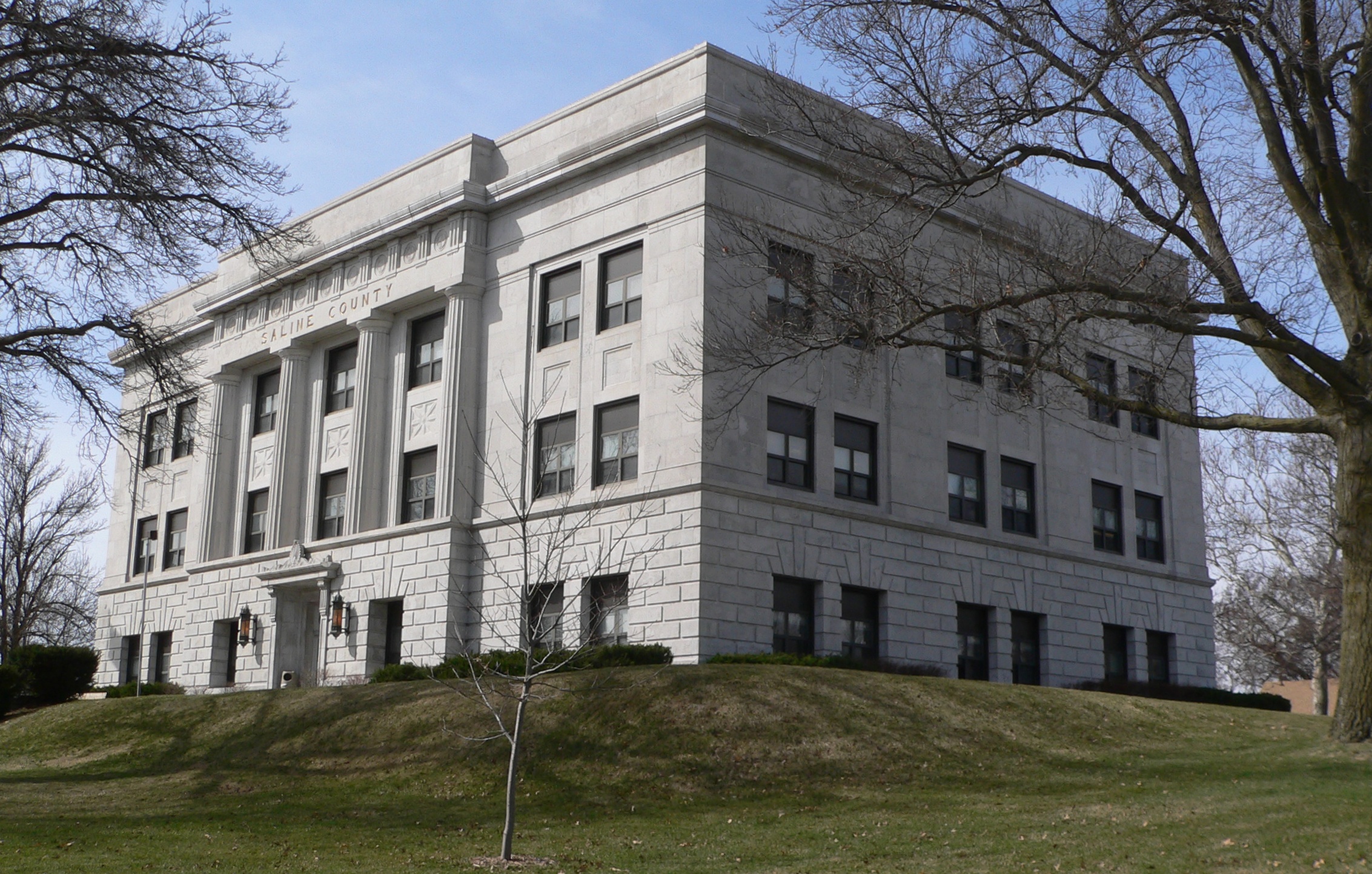
40°23′37″N 97°11′50″W / 40.393611°N 97.197222°WWestern 12 Saline County Courthouse 
July 5, 1990 215 S. Court
40°28′55″N 96°57′56″W / 40.481944°N 96.965556°WWilber 13 Sokol Pavilion 
July 23, 1998 315 S. Wilson St.
40°28′50″N 96°57′41″W / 40.480556°N 96.961389°WWilber 14 Telocvicna Jednota "T.J." Sokol Hall November 26, 2003 12th St. and Norman Ave.
40°37′28″N 96°57′44″W / 40.624444°N 96.962222°WCrete 15 Telocvicna Jednota Sokol January 18, 1985 Address Restricted Wilber 16 Trinity Memorial Episcopal Church September 14, 1979 14th and Juniper Sts.
40°37′33″N 96°57′27″W / 40.625833°N 96.9575°WCrete 17 Warren's Opera House September 28, 1988 511 2nd St.
40°39′12″N 97°17′13″W / 40.653333°N 97.286944°WFriend 18 Michael Witt Fachwerkbau January 14, 1980 Address Restricted
40°24′18″N 97°09′14″W / 40.405°N 97.153889°WWestern 19 Z.C.B.J. Rad Tabor No. 74 August 23, 1985 Junction of County Roads I and 1300
40°34′56″N 97°07′20″W / 40.582222°N 97.122222°WDorchester Former listing
- William Freidell House, delisted on September 7, 2005
See also
- List of National Historic Landmarks in Nebraska
- National Register of Historic Places listings in Nebraska
References
- ^ The latitude and longitude information provided in this table was derived originally from the National Register Information System, which has been found to be fairly accurate for about 99% of listings. For about 1% of NRIS original coordinates, experience has shown that one or both coordinates are typos or otherwise extremely far off; some corrections may have been made. A more subtle problem causes many locations to be off by up to 150 yards, depending on location in the country: most NRIS coordinates were derived from tracing out latitude and longitudes off of USGS topographical quadrant maps created under the North American Datum of 1927, which differs from the current, highly accurate WGS84 GPS system used by Google maps. Chicago is about right, but NRIS longitudes in Washington are higher by about 4.5 seconds, and are lower by about 2.0 seconds in Maine. Latitudes differ by about 1.0 second in Florida. Some locations in this table may have been corrected to current GPS standards.
- ^ "National Register of Historic Places: Weekly List Actions". National Park Service, United States Department of the Interior. Retrieved on November 10, 2011.
- ^ Numbers represent an ordering by significant words. Various colorings, defined here, differentiate National Historic Landmark sites and National Register of Historic Places Districts from other NRHP buildings, structures, sites or objects.
U.S. National Register of Historic Places Topics Lists by states Alabama • Alaska • Arizona • Arkansas • California • Colorado • Connecticut • Delaware • Florida • Georgia • Hawaii • Idaho • Illinois • Indiana • Iowa • Kansas • Kentucky • Louisiana • Maine • Maryland • Massachusetts • Michigan • Minnesota • Mississippi • Missouri • Montana • Nebraska • Nevada • New Hampshire • New Jersey • New Mexico • New York • North Carolina • North Dakota • Ohio • Oklahoma • Oregon • Pennsylvania • Rhode Island • South Carolina • South Dakota • Tennessee • Texas • Utah • Vermont • Virginia • Washington • West Virginia • Wisconsin • WyomingLists by territories Lists by associated states Other Municipalities and communities of Saline County, Nebraska Cities 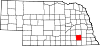
Villages De Witt | Dorchester | Swanton | Tobias | Western
Categories:- National Register of Historic Places in Nebraska by county
- Saline County, Nebraska
- Buildings and structures in Saline County, Nebraska
-


Wikimedia Foundation. 2010.