- National Register of Historic Places listings in the Northern Mariana Islands
-
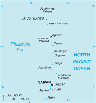
 Map of the Northern Mariana Islands
This is a list of the buildings, sites, districts, and objects listed on the National Register of Historic Places in the Northern Mariana Islands. There currently 36 listed sites spread across the four municipalites of the Northern Mariana Islands. There are no sites listed on any of the islands that make up the Northern Islands Municipality.
-
- This National Park Service list is complete through NPS recent listings posted November 10, 2011.[1]
Contents
Numbers of listings
The following are approximate tallies of current listings in American Samoa on the National Register of Historic Places. These counts are based on entries in the National Register Information Database as of April 24, 2008[2] and new weekly listings posted since then on the National Register of Historic Places web site.[3] There are frequent additions to the listings and occasional delistings and the counts here are not official. Also, the counts in this table exclude boundary increase and decrease listings which modify the area covered by an existing property or district and which carry a separate National Register reference number.
Municipality # of Sites 1 Northern Islands 0 2 Rota 9 3 Saipan 20 4 Tinian 7 Total: 36 Rota
Landmark name Image Date listed Location Village Summary 1 Chugai' Pictograph Site August 31, 1998 Address Restricted Chugai' 2 Commissioner's Office April 17, 1981 North of Songsong Village
14°10′2″N 145°9′46″E / 14.16722°N 145.16278°ESongsong 3 Dugi Archeological Site February 11, 1985 Address Restricted Songsong 4 Japanese Coastal Defense Gun November 2, 1984 Northeast of Songsong
14°7′13″N 145°9′59″E / 14.12028°N 145.16639°ESongsong 5 Japanese Hospital April 16, 1981 West side of Sasanhaya Bay
14°8′13″N 145°8′18″E / 14.13694°N 145.13833°ESongsong 6 Mochong September 11, 1985 Address Restricted Songsong 7 Nanyo Kohatsu Kabushiki Kaisha Sugar Mill April 16, 1981 Southwest of Songsong Village, near the harbor
14°8′9″N 145°8′15″E / 14.13583°N 145.1375°ESongsong 8 Rectory April 16, 1981 North end of the island
14°9′59″N 145°10′0″E / 14.16639°N 145.166667°ESongsong 9 Rota Latte Stone Quarry 
December 23, 1974 Address Restricted Songsong Saipan
Landmark name Image Date listed Location Village Summary 1 Landing Beaches, Aslito–Isley Field and Marpi Point February 4, 1985 Saipan International Airport and Beaches
15°6′55″N 145°43′1″E / 15.11528°N 145.71694°EChalan Kanoa 2 Isley Field Historic District June 26, 1981 Saipan International Airport
15°7′20″N 145°43′58″E / 15.12222°N 145.73278°EChalan Kanoa 3 Unai Obyan Latte Site February 5, 1985 Address Restricted Chalan Kanoa 4 Waherak MAIHER January 31, 1978 Public Works Headquarters Compound Chalan Kanoa 5 Campaneyan Kristo Rai October 30, 1984 Beach Road
15°12′11″N 145°43′4″E / 15.20306°N 145.71778°EGarapan 6 Chalan Galaide October 4, 1987 Address Restricted Garapan 7 Japanese Hospital December 19, 1974 Route 3
15°12′6″N 145°43′8″E / 15.20167°N 145.71889°EGarapan 8 Japanese Jail Historic and Archeological District April 8, 2011 Chichirica Avenue and Ghiyobw Street
15°21′1″N 145°43′7.5″E / 15.35028°N 145.71875°EGarapan 9 Japanese Lighthouse December 19, 1974 Navy Hill
15°12′48″N 145°43′59″E / 15.21333°N 145.73306°EGarapan 10 Managaha Island Historic District November 5, 1984 West of Saipan
15°14′29″N 145°42′45″E / 15.24139°N 145.7125°EGarapan 11 Sabanetan Toro Latte Site November 8, 1984 Address Restricted Garapan 12 Laulau Kattan Latte Site October 30, 2000 Address Restricted Kagman III Homestead 13 Hachiman Jinja June 21, 2003 Lot numbers H 300–11 and H 300–4
15°10′44″N 145°45′40″E / 15.17889°N 145.76111°EKannat Taddong Papago 14 Unai Achugao Archaeological Site August 8, 1996 Address Restricted Punton Achugao 15 Japanese 20mm Cannon Blockhouse August 25, 1995 Northwest of Punton Opyan
15°6′46″N 145°42′17″E / 15.11278°N 145.70472°ESaipan Island 16 Tachognya February 13, 1986 Address Restricted San Jose 17 Banzai Cliff August 27, 1976 Bandero, Magpi area
15°17′17″N 145°48′58″E / 15.28806°N 145.81611°ESan Roque 18 Suicide Cliff September 30, 1976 Bandero
15°16′38″N 145°48′35″E / 15.27722°N 145.80972°ESan Roque 19 Unai Lagua Japanese Defense Pillbox June 1, 1984 Unai Lagua
15°16′25″N 145°49′42″E / 15.27361°N 145.82833°ESan Roque 20 Brown Beach One Japanese Fortifications February 28, 2007 Unai Laolao Kattan (North Laolao Beach) along the east coast of Saipan
15°10′33″N 145°47′5″E / 15.17583°N 145.78472°EUnai Laolao Kattan Tinian
Landmark name Image Date listed Location Village Summary 1 House of Taga 
December 19, 1974 San Jose Village
14°58′0.5″N 145°37′20″E / 14.966806°N 145.62222°ESan Jose Village 2 Japanese Structure April 16, 1981 Near Red 2 Beach
14°58′16″N 145°37′14″E / 14.97111°N 145.62056°ETinian Village 3 Nanyo Kohatsu Kabushiki Kaisha Administration Building April 16, 1981 Near Red 2 Beach
14°58′20″N 145°37′8″E / 14.97222°N 145.61889°ETinian Village 4 Nanyo Kohatsu Kabushiki Kaisha Ice Storage Building April 17, 1981 Near Red 2 Beach
14°58′4″N 145°37′23″E / 14.96778°N 145.62306°ETinian Village 5 Nanyo Kohatsu Kabushiki Kaisha Laboratory April 16, 1981 Near Red 2 Beach
14°58′20″N 145°37′7″E / 14.97222°N 145.61861°ETinian Village 6 Tinian Landing Beaches, Ushi Point Field, Tinian Island 
December 30, 1985 15°4′10″N 145°37′0″E / 15.06944°N 145.616667°E Tinian Village 7 Unai Dangkulo Petroglyph Site October 27, 1999 Address Restricted Unai Dangkulo See also
References
- ^ "National Register of Historic Places: Weekly List Actions". National Park Service, United States Department of the Interior. Retrieved on November 10, 2011.
- ^ "National Register Information System". National Register of Historic Places. National Park Service. 2008-04-24. http://nrhp.focus.nps.gov/natreg/docs/All_Data.html.
- ^ "National Register of Historic Places: Weekly List Actions". National Park Service. http://www.cr.nps.gov/nr/nrlist.htm. Retrieved January 16, 2009.
U.S. National Register of Historic Places Topics Lists by states Alabama • Alaska • Arizona • Arkansas • California • Colorado • Connecticut • Delaware • Florida • Georgia • Hawaii • Idaho • Illinois • Indiana • Iowa • Kansas • Kentucky • Louisiana • Maine • Maryland • Massachusetts • Michigan • Minnesota • Mississippi • Missouri • Montana • Nebraska • Nevada • New Hampshire • New Jersey • New Mexico • New York • North Carolina • North Dakota • Ohio • Oklahoma • Oregon • Pennsylvania • Rhode Island • South Carolina • South Dakota • Tennessee • Texas • Utah • Vermont • Virginia • Washington • West Virginia • Wisconsin • WyomingLists by territories American Samoa • District of Columbia • Guam • Minor Outlying Islands • Northern Mariana Islands • Puerto Rico • Virgin IslandsLists by associated states Other  Commonwealth of Northern Mariana Islands
Topics - The archipelago
- Geography
- Politics
- Economy
- Campaign
- Radio stations
- Television stations
Islands - Agrihan (Agrigan)
- Aguijan (Agiguan)
- Alamagan
- Anatahan
- Asuncion
- Farallon de Medinilla
- Farallon de Pajaros (Uracas)
- Guguan
- Mañagaha
- Maug Islands (Ma'ok)
- Pagan
- Rota (Luta)
- Saipan
- Sarigan
- Tinian
- Zealandia Bank
Municipalities Categories:- National Register of Historic Places in the Northern Mariana Islands
-


Wikimedia Foundation. 2010.