- National Register of Historic Places listings on the island of Hawaii
-
 Location of the island of Hawaii
This is a list of properties and districts on the island of Hawaii in the U.S. state of Hawaii that are listed on the National Register of Historic Places. The island is coterminous with Hawaii County, the state's only county that covers exactly one island. There are 73 properties and districts on the island, including 10 historic districts, six National Historic Landmarks, and one National Historic Landmark District.

Current listings
Landmark name Image Date listed Location Community Summary 1 1790 Footprints 
August 7, 1974 9.1 miles south of park headquarters on Hawaii Route 11, then along a foot trail to the southeast for 1 mile
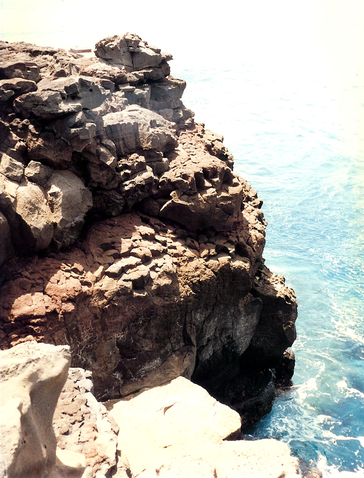
19°23′0″N 155°20′7″W / 19.383333°N 155.33528°WHawaii Volcanoes National Park Footprints left in solidified ash from Kilauea eruption 2∞ Ahole Holua Complex November 26, 1973 South of Milolii on Ahole Bay
19°8′27″N 155°54′58″W / 19.14083°N 155.91611°WMilolii 3 Ahua A Umi Heiau 
August 13, 1974 Address Restricted North Kona Royal complex on high remote plateau 4 Ainahou Ranch 
February 8, 1995 Off Chain of Craters Road in Hawaii Volcanoes National Park
19°20′37″N 155°13′44″W / 19.34361°N 155.22889°WHawaii Volcanoes National Park Built by Shipman family as refuge from World War II, used to raise endangered Hawaiian Goose 5 Ainapo Trail 
August 30, 1974 Hawaii Volcanoes National Park
19°27′39″N 155°34′39″W / 19.46083°N 155.5775°WMauna Loa Ancient trail to the Mokuaweoweo summit 6 Ala Loa 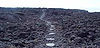
June 5, 1987 Off Hawaii Route 19 from Kiholo Bay to Kalahuipaua'a
19°53′49″N 155°54′2″W / 19.89694°N 155.90056°WSouth Kohala Part of Ala Kahakai National Historic Trail 7 Anna Ranch April 28, 2008 65-1480 Kawaihae Rd.
20°1′22.59″N 155°45′59.37″W / 20.0229417°N 155.7664917°WKamuela 8 Bobcat Trail Habitation Cave (50-10-30-5004) May 15, 1986 Address Restricted Pohakuluoa 9∞ Bond District 
March 30, 1978 Southeast of Kapaau off Hawaii Route 270
20°13′33″N 155°47′33″W / 20.22583°N 155.7925°WKapaau Homestead of Elias Bond, Kalahikiola Church, and Kohala Seminary 10 Francis H. Ii Brown House August 21, 1986 Keawaiki Bay
19°53′16″N 155°54′22″W / 19.88778°N 155.90611°WWaimea Beach home for golfing champion Francis Hyde ʻĪʻī Brown (1892–1976) 11∞ Chee Ying Society July 20, 1978 Hawaii Route 24
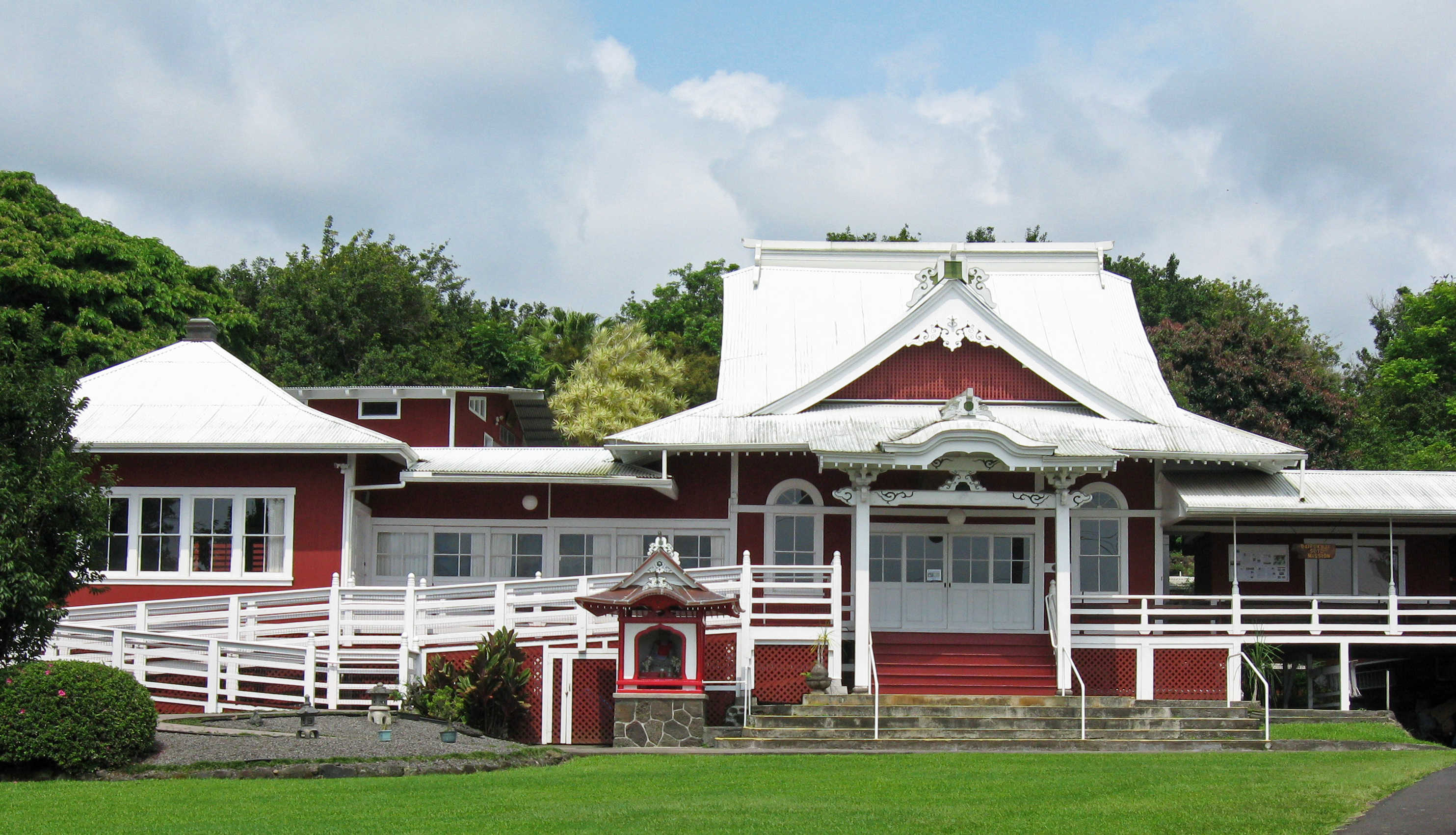
20°5′5″N 155°28′34″W / 20.08472°N 155.47611°WHonokaʻa 12 Daifukuji Soto Zen Mission 
April 21, 1994 Mamalahoa Highway
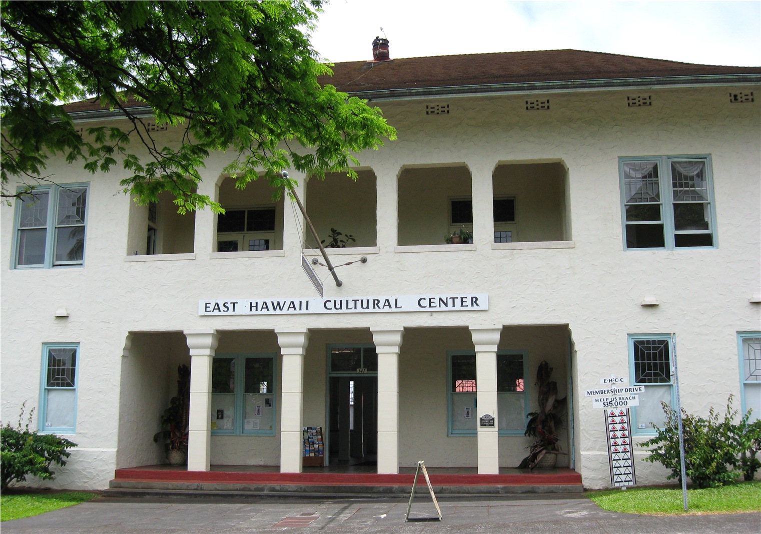
19°32′32″N 155°55′41″W / 19.54222°N 155.92806°WHonalo Buddhist Temple built 1920–1921 13 District Courthouse and Police Station 
September 4, 1979 141 Kalakaua St.
19°43′46″N 155°5′17″W / 19.72944°N 155.08806°WHilo Built in 1932; now home of East Hawaii Cultural Center 14 Greenwell Store 
May 22, 1978 Hawaii Route 11
19°30′55″N 155°55′24″W / 19.51528°N 155.92333°WKealakekua Store built in 1870 now houses the Kona Historical Society Museum 15 Thomas Guard House 
December 23, 2003 240 Kaʻiulani St.
19°43′40″N 155°6′3″W / 19.72778°N 155.10083°WHilo Neoclassical style home, architects Clinton Briggs Ripley and Louis Davis (architect) 16 Hale Halawai O Holualoa 
June 5, 1987 76-6224 Aliʻi Dr.
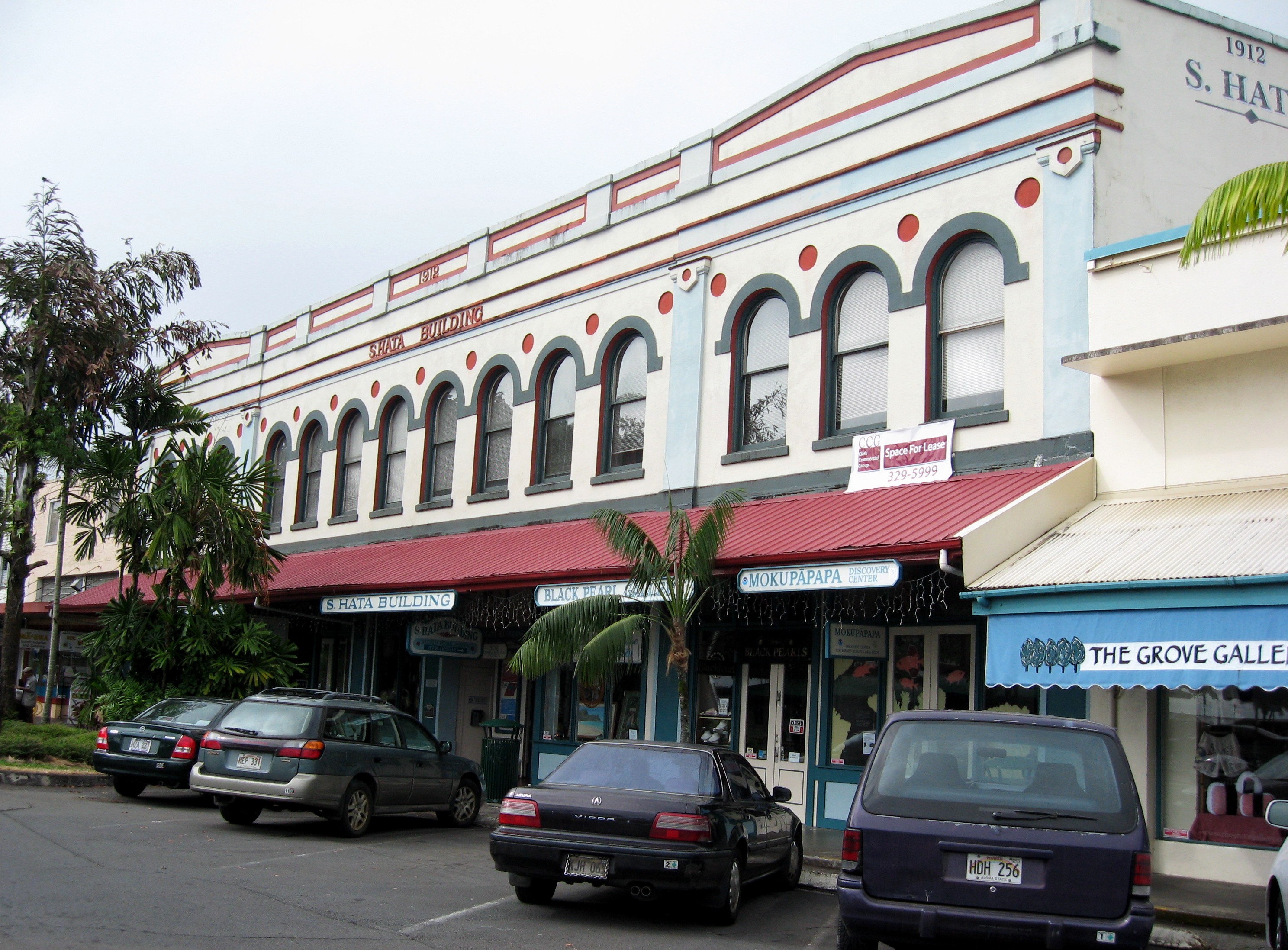
19°36′36″N 155°58′41″W / 19.61°N 155.97806°WKailua-Kona Known as the "Living Stones Church" 17 S. Hata Building 
August 27, 1991 318 Kamehameha Ave.
19°43′41″N 155°5′17″W / 19.72806°N 155.08806°WHilo Built by Japanese American family business in 1912 18 Heiau in Kukuipahu April 24, 1973 Address Restricted Hawi 19 Walter Irving and Jean Henderson House February 28, 2011 82 Halaulani Place
19°43′58″N 155°5′29″W / 19.73278°N 155.09139°WHilo Halaulani Place, 1917-1960 MPS 20 W.H. Hill House February 28, 2011 91 Halaulani Place
19°44′0″N 155°5′28″W / 19.733333°N 155.09111°WHilo Halaulani Place, 1917-1960 MPS 21 Hilo Masonic Lodge Hall-Bishop Trust Building 
April 21, 1994 Junction of Keawe and Waianuenue Streets
19°43′33″N 155°5′17″W / 19.72583°N 155.08806°WHilo Also known as the Kaikodo (Restaurant) Building 22 James M. Hind House February 3, 1994 Skilled Camp, House J
20°6′58″N 155°34′51″W / 20.11611°N 155.58083°WHawi 23∞ Holualoa 4 Archeological District (State Site No. 50-10-37-23.661) 
June 8, 2005 Aliʻi Drive
19°36′21″N 155°58′39″W / 19.60583°N 155.9775°WKailua-Kona Complex of temples and royal residences 24† Honokohau Settlement 
October 15, 1966 Address Restricted Kailua-Kona Inside Kaloko-Honokohau National Historical Park 25 Hulihee Palace 
May 25, 1973 Aliʻi Drive
19°38′32″N 155°59′51″W / 19.64222°N 155.9975°WKailua-Kona Built by Governor Kuakini 26 Imiola Church 
August 28, 1975 Northeast of Waimea on Hawaii Route 19
20°1′50″N 155°39′56″W / 20.03056°N 155.66556°WWaimea 1855 church with solid koa wood interior 27∞ Kahaluu Historic District 
December 27, 1974 Address Restricted Holualoa Complex of temples and royal residences 28 Kahikolu Church 
November 15, 1982 Southeast of Napoopoo
19°28′10″N 155°54′55″W / 19.46944°N 155.91528°WNapoopoo Built in 1852 on ruins of 1833 church 29 Kalaoa Permanent House Site 10,205 
November 21, 1992 Near Kalihi Point, Natural Energy Laboratory of Hawaii
19°43′35″N 156°3′31″W / 19.72639°N 156.05861°WKailua-Kona Ancient house site 30∞ Kaloko-Honokohau National Historical Park 
November 10, 1978 Island of Hawaii
19°41′4.91″N 156°1′21.66″W / 19.6846972°N 156.0226833°WKailua-Kona Ancient fish ponds and settlement ruins 31† Kamakahonu, Residence Of King Kamehameha I 
October 15, 1966 On the northwestern edge of Kailua Bay, north and west of Kailua Wharf Kailua-Kona Kamehameha I lived here after unifying the islands 32 Kamehameha Hall 
May 20, 1993 1162 Kalanianaole Ave.
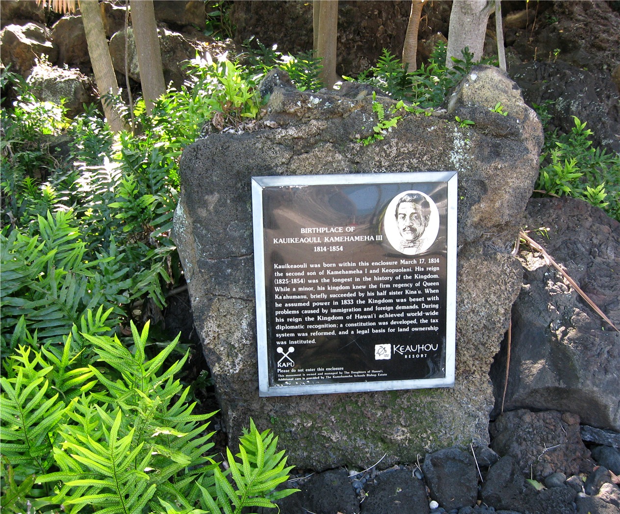
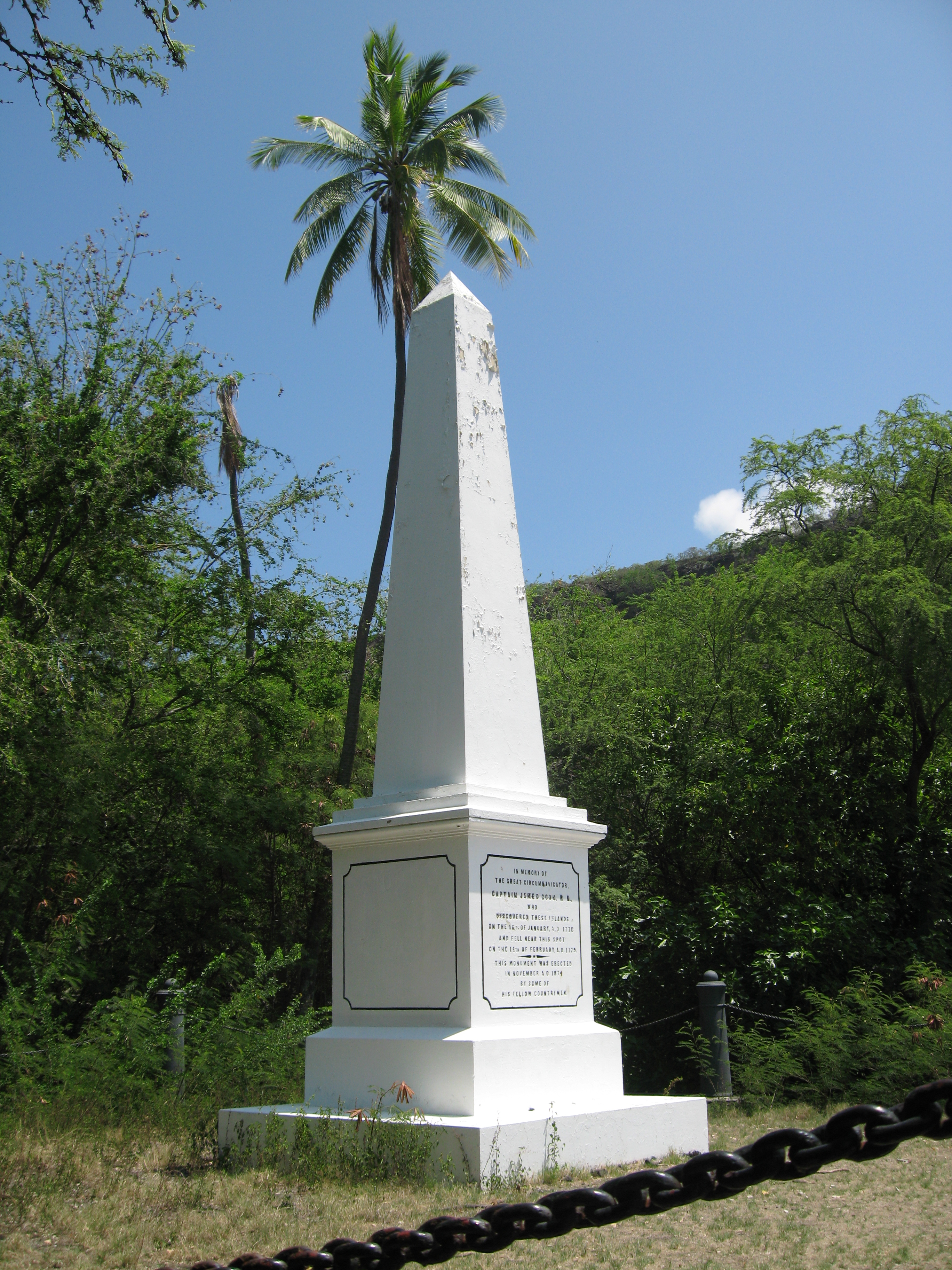
19°43′53″N 155°2′42″W / 19.73139°N 155.045°WHilo Meeting house of the Royal Order of Kamehameha I 33 Kamehameha III's Birthplace 
July 24, 1978 Off Alii Dr.
19°34′0″N 155°57′50″W / 19.566667°N 155.96389°WKeauhou Marker at Keauhou Bay 34 Kamoa Point Complex 
July 14, 1983 Address Restricted Kailua-Kona Royal complex on Holualoa Bay 35∞ Kealakekua Bay Historical District 
December 12, 1973 Southwest of Captain Cook off Hawaii Route 11
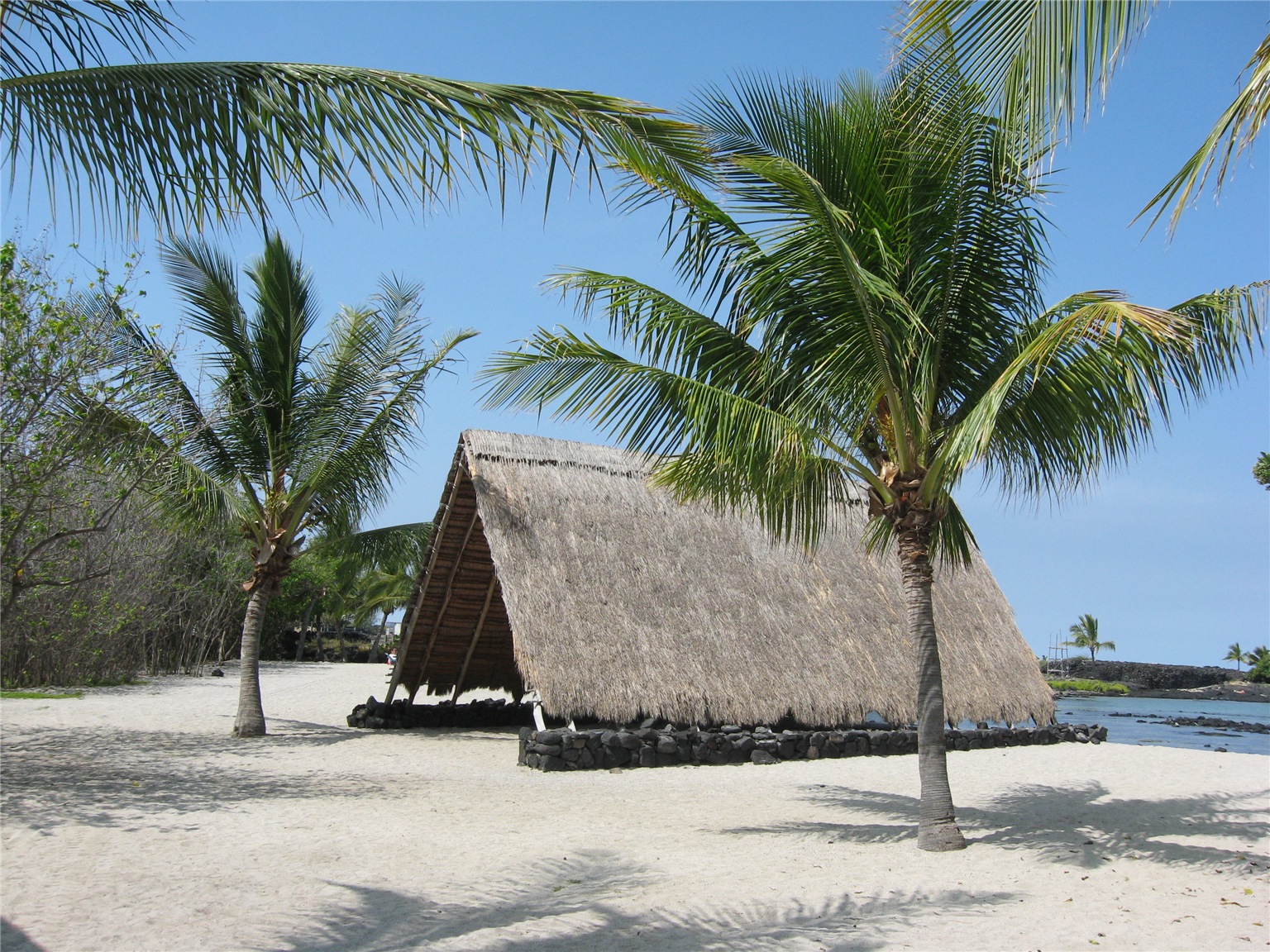
19°28′29″N 155°55′27″W / 19.47472°N 155.92417°WCaptain Cook Religious center in use during early European visits 36† Keauhou Holua Slide 
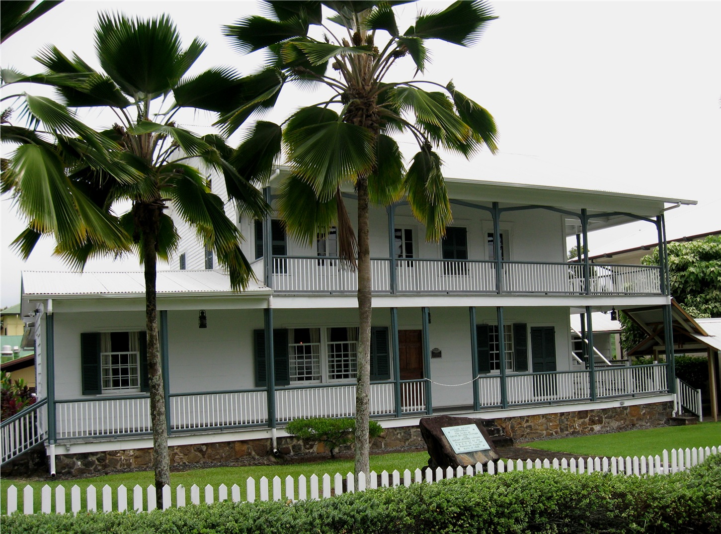
October 15, 1966 East of Hawaii Route 18 Keauhou Hawaiian lava sledding "extreme sport" course 37 Kii Petroglyphs July 12, 1984 Address Restricted Waiohinu 38 Kilauea Crater 
July 24, 1974 Southwest of Hilo in Hawaii Volcanoes National Park
19°25′2″N 155°16′36″W / 19.41722°N 155.27667°WHilo Active volcano is a world heritage site 39 Kohala District Courthouse August 31, 1979 Government Rd.
20°13′59″N 155°48′3″W / 20.23306°N 155.80083°WKapaau 40 Kuamo'o Burials 
August 13, 1974 Address Restricted Kailua-Kona Site of 1819 battle, South of Keauhou Bay 41∞ Lapakahi Complex July 2, 1973 Akoni Pule Highway
20°10′31″N 155°53′50″W / 20.17528°N 155.89722°WMahukona Reconstructed ancient fishing village; State Historical Park and Marine Life Conservation District 42 Levi and Netti Lyman House February 28, 2011 40 Halaulani Place
19°43′57″N 155°5′33″W / 19.7325°N 155.0925°WHilo Halaulani Place, 1917-1960 MPS 43 Rev. D.B. Lyman House 
March 24, 1978 276 Haili St.
19°43′38″N 155°5′35″W / 19.72722°N 155.09306°WHilo 1838 missionary house is now a museum 44 Mahana Archeological District (50HA10230) October 14, 1986 Address Restricted Naalehu 45 Manuka Bay Petroglyphs September 19, 1973 Address Restricted Waiohinu 46† Mauna Kea Adz Quarry October 15, 1966 24 miles northwest of Hilo[1] Hilo The largest primitive basalt quarry in the world 47 Mokuaikaua Church 
October 3, 1978 Off Hawaii Route 11
19°38′39″N 155°59′48″W / 19.64417°N 155.99667°WKailua-Kona Oldest Christian Church in Hawaii 48† Mookini Heiau 
October 15, 1966 Northern tip of Hawaii, 1 mile west of Upolu Point Airport
20°15′44″N 155°52′59″W / 20.26222°N 155.88306°WHawi State Monument includes Kamehameha I birthplace 49 Edward H. and Claire Moses House February 28, 2011 105 Halaulani Place
19°43′59″N 155°5′32″W / 19.73306°N 155.09222°WHilo Halaulani Place, 1917-1960 MPS 50 A. Nanbu Hotel-Holy's Bakery November 18, 1999 Akoni Pule Highway
20°13′55″N 155°47′57″W / 20.23194°N 155.79917°WKapaau 51 Old Volcano House No. 42 
July 24, 1974 Southwest of Hilo on Hawaii Route 11 in Hawaii Volcanoes National Park
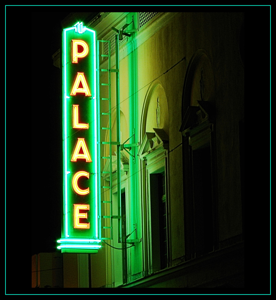
19°26′2″N 155°15′39″W / 19.43389°N 155.26083°WHilo Built in 1877; now Volcano Art Center gallery 52 Palace Theater 
May 11, 1993 38 Haili St.
19°43′28″N 155°5′11″W / 19.72444°N 155.08639°WHilo A movie theater built in 1925, today an arthouse 53 James and Catherine Parker House February 28, 2011 72 Halaulani Place
19°43′58″N 155°5′29″W / 19.73278°N 155.09139°WHilo Halaulani Place, 1917-1960 MPS 54 Pu'uhonua O Honaunau National Historical Park 
October 15, 1966 20 miles south of Kailua-Kona
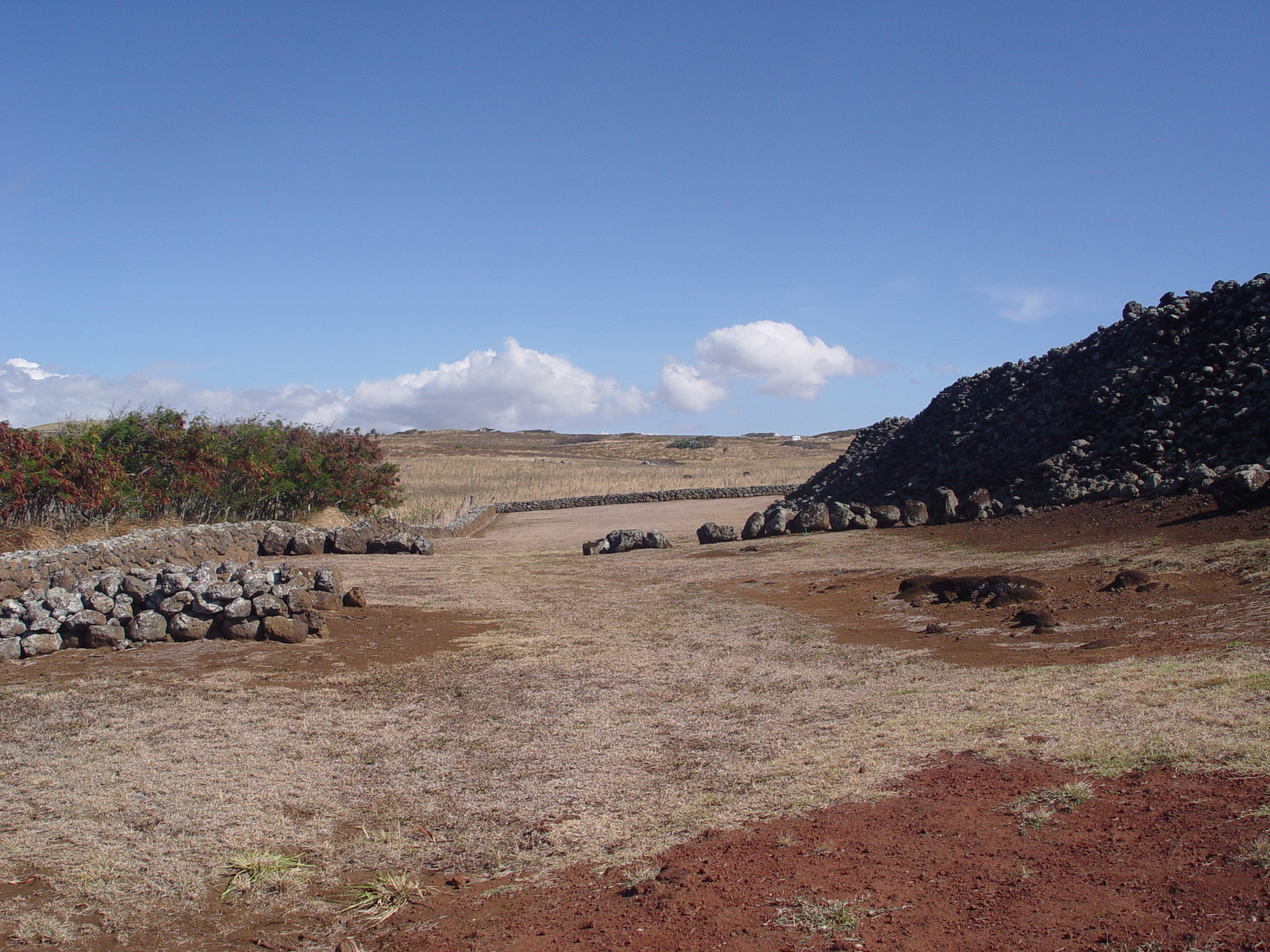
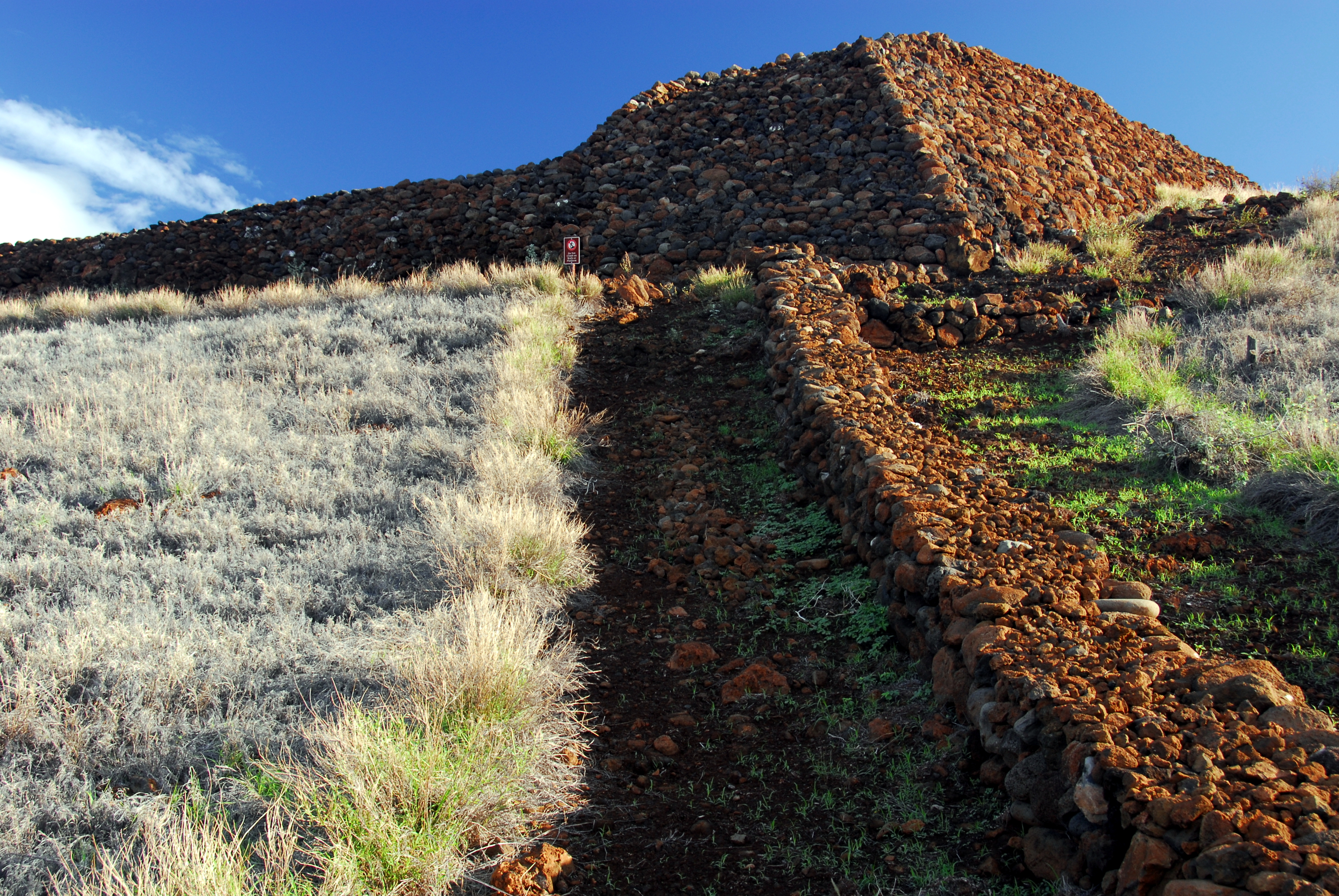
19°25′21.972″N 155°54′35.028″W / 19.42277°N 155.90973°WHōnaunau Large ancient religious site formerly known as the "City of Refuge" 55† Pu'ukohola Heiau 
October 15, 1966 0.9 miles southeast of Kawaihae
20°1′35″N 155°49′12″W / 20.02639°N 155.82°WKawaihae Kamehameha I temple built in 1790 56 Pu'ukohola Heiau National Historic Site 
August 17, 1972 Northern end of Hawaii off Hawaii Route 26, about 1 mile southeast of Kawaihae
20°1′52″N 155°49′30″W / 20.03111°N 155.825°WKawaihae see above 57 Pua'a-2 Agricultural Fields Archeological District (50HA10229) October 14, 1986 Address Restricted Holualoa Potentially destroyed[2] 58∞ Puako Petroglyph Archeological District June 6, 2007 Address Restricted Puako 59∞ Puna-Ka'u Historic District July 1, 1974 Hawaii Volcanoes National Park
19°17′42″N 155°14′31″W / 19.295°N 155.24194°WPāhala 60 St. Benedict's Catholic Church May 31, 1979 Off Hawaii Route 11
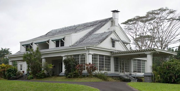
19°26′21″N 155°53′33″W / 19.43917°N 155.8925°WHōnaunau Another "Painted Church" 61 W.H. Shipman House 
June 23, 1978 141 Kaʻiulani Street
19°43′27″N 155°5′58″W / 19.72417°N 155.09944°WHilo Built in 1899 for William Herbert Shipman, now a "Bed and Breakfast" Hotel 62‡ South Point Complex 
October 15, 1966 Southern point of Hawaii
18°54′57″N 155°40′35″W / 18.91583°N 155.67639°WNaalehu Southernmost point in the United States 63 Star of the Sea Church-Kalapana Painted Church 
May 14, 1997 Hawaii Route 130, 0.7 miles north of Kaimu
19°22′34″N 154°58′1″W / 19.37611°N 154.96694°WKaimu Small church near villages destroyed by lava flows 64 Tong Wo Society Building June 9, 1978 Hawaii Route 27
20°13′40″N 155°46′10″W / 20.22778°N 155.76944°WHalaula 65 Herbert Austin Truslow House February 28, 2011 52 Halaulani Place
19°43′57″N 155°5′31″W / 19.7325°N 155.09194°WHilo Halaulani Place, 1917-1960 MPS 66 U.S. Post Office and Office Building 
October 1, 1974 Kinoole and Waianuenue Sts.
19°43′49″N 155°5′31″W / 19.73028°N 155.09194°WHilo Built in 1915, still used as Federal offices 67 Uchida Coffee Farm 
February 9, 1995 Off Mamalahoa Highway
19°29′24″N 155°54′49″W / 19.49°N 155.91361°WKealakekua Restored Japanese Kona coffee farm 68 Volcano Block Building 
January 7, 1993 27-37 Waianuenue Ave.
19°43′44″N 155°5′24″W / 19.72889°N 155.09°WHilo Commercial building built in 1914 with notable tenants 69 Waiakea Mission Station-Hilo Station 
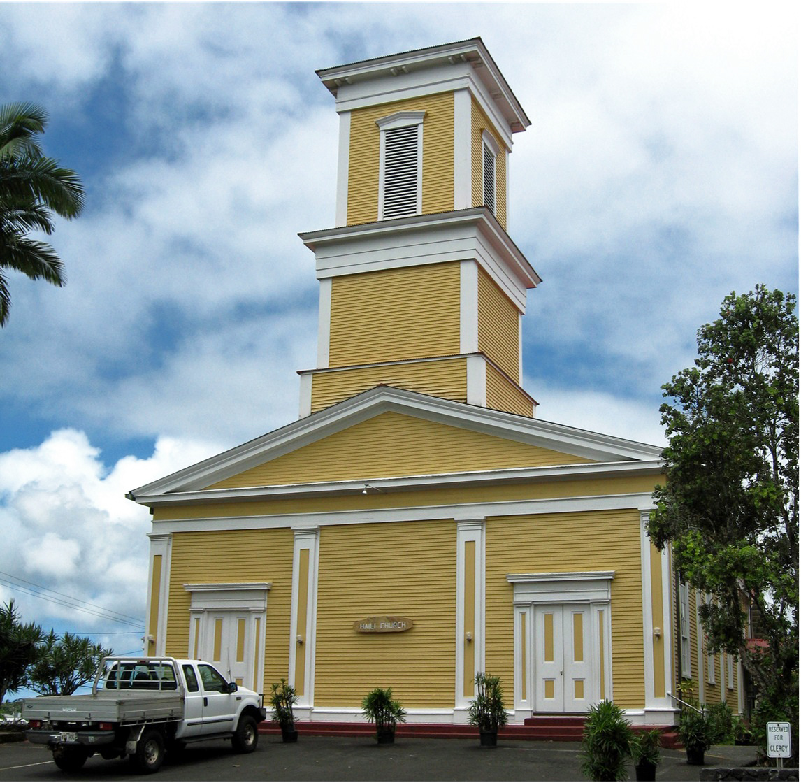
April 23, 2002 211 Haili St.
19°43′37″N 155°5′31″W / 19.72694°N 155.09194°WHilo Haili Church built by Titus Coan 1854 70 Waimea Elementary School June 8, 2005 Hawaii Route 19, Kawaihae Rd. TMK (3)6-5-07:3
20°1′25″N 155°40′21″W / 20.02361°N 155.6725°WKamuela 71 Whitney Seismograph Vault No. 29 
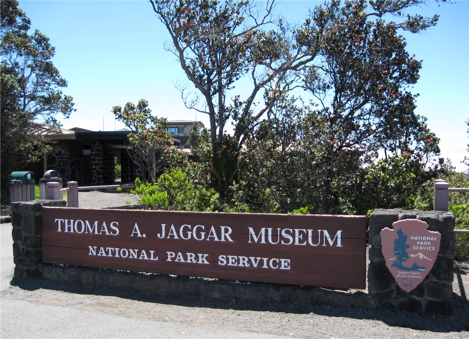
July 24, 1974 Southwest of Hilo on Hawaii Route 11 in Hawaii Volcanoes National Park
19°25′59″N 155°15′40″W / 19.43306°N 155.26111°WHilo Original home of Hawaiian Volcano Observatory founded by Thomas Jaggar in 1912 72 Wilkes Campsite 
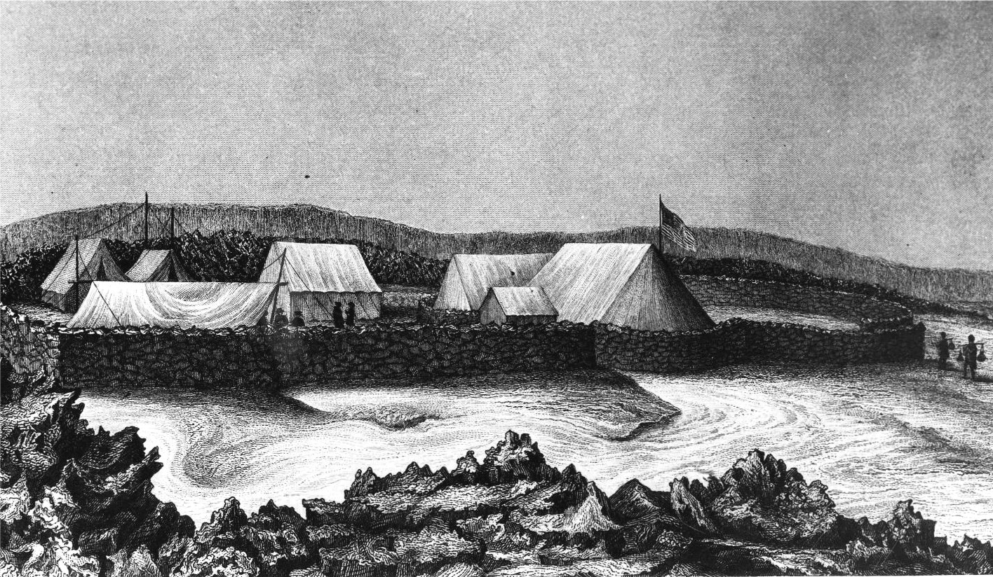
July 24, 1974 West of Hilo at Mauna Loa Volcano in Hawaii Volcanoes National Park
19°28′14″N 155°35′6″W / 19.47056°N 155.585°WHilo Ruins of 1840 Charles Wilkes camp site at Mokuaweoweo summit 73 A.J. Williamson House May 9, 1997 31 Halaulani Pl.
19°44′11″N 155°5′44″W / 19.73639°N 155.09556°WHilo Key to color codes
NRHP-listed property ∞ NRHP-listed Historic district † NRHP-listed National Historic Landmark property ‡ NRHP-listed National Historic Landmark District NRHP-listed National Historic Site NRHP-listed National Historical Park See also
- List of National Historic Landmarks in Hawaii
- National Register of Historic Places listings in Hawaii
References
- ^ Location derived from this[dead link] National Park Service website; the NRIS lists it as "Address Restricted"
- ^ State approved permits to bulldoze ancient sites in Honolulu Advertiser, May 10, 2007
External links
U.S. National Register of Historic Places Topics Lists by states Alabama • Alaska • Arizona • Arkansas • California • Colorado • Connecticut • Delaware • Florida • Georgia • Hawaii • Idaho • Illinois • Indiana • Iowa • Kansas • Kentucky • Louisiana • Maine • Maryland • Massachusetts • Michigan • Minnesota • Mississippi • Missouri • Montana • Nebraska • Nevada • New Hampshire • New Jersey • New Mexico • New York • North Carolina • North Dakota • Ohio • Oklahoma • Oregon • Pennsylvania • Rhode Island • South Carolina • South Dakota • Tennessee • Texas • Utah • Vermont • Virginia • Washington • West Virginia • Wisconsin • WyomingLists by territories Lists by associated states Other  Category:National Register of Historic Places •
  Portal:National Register of Historic Places
Municipalities and communities of Hawaii County, Hawaii County seat: Hilo CDPs Ainaloa | Captain Cook | Eden Roc | Fern Acres | Fern Forest | Halaula | Hawaiian Acres | Hawaiian Beaches | Hawaiian Ocean View | Hawaiian Paradise Park | Hawi | Hilo | Holualoa | Honalo | Honaunau-Napoopoo | Honokaa | Honomu | Kahaluu-Keauhou | Kailua | Kalaoa | Kapaau | Keaau | Kealakekua | Kukuihaele | Kurtistown | Laupāhoehoe | Leilani Estates | Mountain View | Naalehu | Nanawale Estates | Orchidlands Estates | Paauilo | Pahala | Pahoa | Papaikou | Pepeekeo | Paukaa | Puako | Volcano | Waikoloa Village | Waimea | Wainaku

Unincorporated
communitiesDistricts Categories:- NRHP articles with dead external links
- Hawaii-related lists
- National Register of Historic Places in Hawaii


Wikimedia Foundation. 2010.