- Kailua, Hawaii County, Hawaii
Infobox Settlement
official_name = Kailua, Hawaii
other_name =
native_name =
nickname =
settlement_type = CDP
motto =
imagesize =
image_caption = Oceanfront south of Huliheokinae Palace
flag_size =
image_
seal_size =
image_shield =
shield_size =
image_blank_emblem =
blank_emblem_type =
blank_emblem_size =
flag_size =
image_
seal_size =
image_shield =
shield_size =
image_blank_emblem =
blank_emblem_type =
blank_emblem_size =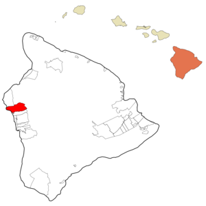
mapsize = 250px
map_caption = Location in Hawaii County and the state ofHawaii
mapsize1 =
map_caption1 =
subdivision_type = Country
subdivision_name =United States
subdivision_type1 = State
subdivision_name1 =Hawaii
subdivision_type2 = County
subdivision_name2 = Hawaii
subdivision_type3 =
subdivision_name3 =
subdivision_type4 =
subdivision_name4 =
government_footnotes =
government_type =
leader_title =
leader_name =
leader_title1 =
leader_name1 =
leader_title2 =
leader_name2 =
leader_title3 =
leader_name3 =
leader_title4 =
leader_name4 =
established_title =
established_date =
established_title2 =
established_date2 =
established_title3 =
established_date3 =
area_magnitude =
unit_pref = Imperial
area_footnotes =
area_total_km2 = 103.0
area_land_km2 = 103.0
area_water_km2 = 0.0
area_total_sq_mi = 39.8
area_land_sq_mi = 39.8
area_water_sq_mi = 0.0
area_water_percent =
area_urban_km2 =
area_urban_sq_mi =
area_metro_km2 =
area_metro_sq_mi =
area_blank1_title =
area_blank1_km2 =
area_blank1_sq_mi =
population_as_of = 2000
population_footnotes =
population_note =
population_total = 9870
population_density_km2 = 107.3
population_density_sq_mi = 278
population_metro =
population_density_metro_km2 =
population_density_metro_sq_mi =
population_urban =
population_density_urban_km2 =
population_density_urban_sq_mi =
population_blank1_title =
population_blank1 =
population_density_blank1_km2 =
population_density_blank1_sq_mi =
timezone = Hawaii-Aleutian
utc_offset = -10
timezone_DST =
utc_offset_DST =
latd = 19
latm = 39
lats = 0
latNS = N
longd = 155
longm = 59
longs = 39
longEW = W
elevation_footnotes =
elevation_m =
elevation_ft =
postal_code_type =ZIP code
postal_code = 96740
area_code = 808
blank_name = FIPS code
blank_info = 15-03850
blank1_name = GNIS feature ID
blank1_info = 0358717
website =
footnotes =Kailua is a
census-designated place (CDP) in Hawaiokinai County, Hawaiokinai,United States , in the North Kona District of the Island of Hawaiokinai. The population was 9,870 at the 2000 census. It is the center of commerce and of the tourist industry on West Hawaiokinai. The town's post office is designated Kailua-Kona to differentiate it from the larger, Kailua located on windward Ookinaahu, although it is referred to as "Kona" in everyday speech. Many place names in theHawaiian Islands are repeated on several islands, but the two Kailuas are the only confusing conflict in this regard. The city is served byKona International Airport . Kailua was the closest major settlement to theepicenter of the 2006 Hawaiokinai Earthquake.History
The community was established by King
Kamehameha I to be his seat of government (he was originally the chief of Kona before consolidating rule of the archipelago), and the capital of the newly unified Kingdom of Hawaiokinai. (The capital was later moved to Lāhainā, then, to Honolulu.) Royal fishponds at Kaloko-Honokōhau National Historical Park were the hub of unifiedHawaiian culture . The town then functioned as a retreat of the Hawaiian royal family. Up until the late 1900’s, Kailua-Kona was primarily a small fishing village. [Doughty, Andrew. "Hawaii The Big Island Revealed: The Ultimate Guidebook", 4th ed, p. 58. Lihuokinae: Wizard. ISBN 13: 978-0-9717279-4-6. ISBN 10: 0-9717279-4-5.] More recently, this region has undergone a real estate and construction boom fueled by tourism and investment.Geography
Kailua is located at coor dms|19|39|0|N|155|59|39|W|city (19.649973, -155.994028)GR|1, along the shoreline of Kailua Bay and up the southern slope of Hualālai volcano. There are no major rivers or streams in Kailua or on the Kona side of Hawaii. [Doughty, Andrew. "Hawaii The Big Island Revealed: The Ultimate Guidebook", 4th ed, p. 26. Lihuokinae: Wizard. ISBN 13: 978-0-9717279-4-6. ISBN 10: 0-9717279-4-5.]
According to the
United States Census Bureau , the CDP has a total area of 39.8square mile s (103.0km² ), of which, 35.5 square miles (91.9 km²) of it is land and 4.3 square miles (11.0 km²) of it is water. The total area is 10.71% water.The Kailua-Kona postal code is 96740. Other communities located in this zip code include: Kalaoa, Kealakehe, Kahaluokinau, and Keauhou.
Climate
The coldest month in Kona is February and the average high in February is 80 F while the average low is 64 F. August is the warmest month and the average high is 87 F while the average low is 69 F. Humidity is between 50% and 80%. The temperature change between night and day is greater than the temperature change between winter and summer. Mornings are typically clear while thermal clouds created in the day raises the temperature during the day. [Doughty, Andrew. "Hawaii The Big Island Revealed: The Ultimate Guidebook", 4th ed, p. 26. Lihuokinae: Wizard. ISBN 13: 978-0-9717279-4-6. ISBN 10: 0-9717279-4-5.]
Vog can cover parts of the Kona coast from time to time depending on the activity of theKilauea and the island winds. Kailua is located on the leeward side of the Hualalai Volcano sheltering the town from wind and rain. [Doughty, Andrew. "Hawaii The Big Island Revealed: The Ultimate Guidebook", 4th ed, p. 58. Lihuokinae: Wizard. ISBN 13: 978-0-9717279-4-6. ISBN 10: 0-9717279-4-5.]Demographics
As of the
census GR|2 of 2000, there were 9,870 people, 3,537 households, and 2,429 families residing in the CDP. Thepopulation density was 278.0 people per square mile (107.3/km²). There were 4,322 housing units at an average density of 121.7/sq mi (47.0/km²). The racial makeup of the CDP was 38.65% White, 0.46% Black or African American, 0.46% Native American, 18.28% Asian, 13.16% Pacific Islander, 1.93% from other races, and 27.07% from two or more races. 10.20% of the population were Hispanic or Latino of any race.There were 3,537 households out of which 35.0% have children under the age of 18 living with them, 49.6% were married couples living together, 13.6% had a female householder with no husband present, and 31.3% were non-families. 22.6% of all households were made up of individuals and 7.2% had someone living alone who was 65 years of age or older. The average household size was 2.78 and the average family size was 3.26.
In the CDP the population was spread out with 27.3% under the age of 18, 9.0% from 18 to 24, 28.8% from 25 to 44, 24.9% from 45 to 64, and 10.0% who were 65 years of age or older. The median age was 36 years. For every 100 females there were 98.8 males. For every 100 females age 18 and over, there were 95.8 males.
The median income for a household in the CDP was $40,874, and the median income for a family was $46,657. Males had a median income of $30,353 versus $26,471 for females. The
per capita income for the CDP was $20,624. 10.8% of the population and 6.5% of families were below thepoverty line . Out of the total population, 11.9% of those under the age of 18 and 3.9% of those 65 and older were living below the poverty line.Attractions and Events
Kona is the site of the annual
Ironman Triathlon World Championship and the Hawaiian International Billfish Tournament.Kona coffee is the variety ofCoffea arabica cultivated on the slopes ofMount Hualalai andMauna Loa in the North and SouthKona District s.Points of interest
* Kailua Pier is the starting and finishing point for the world-famous
Ironman Triathlon World Championship and is a great place to watch the sunset. [ [http://www.gohawaii.com/big_island/plan/things_to_do_on_big_island/attractions/points_of_interest/kailua_kona Hawaii's Official Tourism Site - Kailua-Kona, Hawaii's Big Island ] ]
*Sadie Seymour Botanical Gardens
* Huliheokinae Palace, the residence of members of the Hawaiian royal family until 1914.
* Mokuaikaua Church, Hawaiokinai's first Christian church built in 1820.
*Kona Hawaii Temple , Hawaiokinai's 2nd Temple ofThe Church of Jesus Christ of Latter-day Saints (Mormon)
*Historic Kona Inn.
*Ahuokinaena Heiau
*Kamakahonu Beach
*Kahaluokinau Beach Park
*White Sands/Magic Sands Beach
*Saint Michael the Archangel Catholic Church
*Aliokinai Drive, Kailua's oceanfront downtown street starting at Kailua Pier.
*Kailua is home to one ofYouth With A Mission 's largest training centres, a campus of theUniversity of the Nations References
External links
* [http://www.konafriends.com/live-hawaii-webcam.html Live Webcam]
Wikimedia Foundation. 2010.