- Hawaii
-
This article is about the U.S. state of Hawaii. For its "Big Island", see Hawaii (island). For other uses, see Hawaii (disambiguation).
Coordinates: 21°18′41″N 157°47′47″W / 21.31139°N 157.79639°W
State of Hawaii
Mokuʻāina o Hawaiʻi

Flag Seal Nickname(s): The Aloha State Motto(s): Ua Mau ke Ea o ka ʻĀina i ka Pono
("The Life of the Land is Perpetuated in Righteousness")
Anthem: Hawaiʻi Ponoʻī
("Hawaii’s Own True Sons")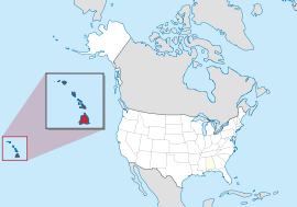
Official language(s) English, Hawaiian Demonym Hawaiian (see notes)[1] Capital
(and largest city)Honolulu Area Ranked 43rd in the U.S. - Total 10,931 sq mi
(28,311 km2)- Width n/a miles (n/a km) - Length 1,522 miles (2,450 km) - % water 41.2 - Latitude 18° 55′ N to 28° 27′ N - Longitude 154° 48′ W to 178° 22′ W Population Ranked 40th in the U.S. - Total 1,360,301 (2010 Census)[2]
1,211,537 (2000)- Density 188.6/sq mi (72.83/km2)
Ranked 13th in the U.S.- Median income $63,746 (5th) Elevation - Highest point Mauna Kea[3][4][5][6]
13,803 ft (4207.3 m)- Mean 3,030 ft (920 m) - Lowest point Pacific Ocean[4]
sea levelBefore statehood Territory of Hawaii Admission to Union August 21, 1959 (50th) Governor Neil Abercrombie Lieutenant Governor Brian Schatz Legislature State Legislature - Upper house Senate - Lower house House of Representatives U.S. Senators Daniel Inouye (D)
Daniel Akaka (D)U.S. House delegation 1: Colleen Hanabusa (D)
2: Mazie Hirono (D) (list)Time zone Hawaii-Aleutian time zone: UTC-10
(no daylight saving time)Abbreviations HI US-HI Website hawaii.gov Hawaii State symbols Animate insignia Bird(s) Hawaiian Goose Fish Humuhumunukunukuāpuaʻa Flower(s) Hawaiian hibiscus Mammal(s) Humpback whale Reptile Gold dust day gecko Tree Kukui nut tree Inanimate insignia Food Coconut muffin Gemstone Black coral Slogan(s) The Islands of Aloha Soil Hilo Song(s) Hawaiʻi Ponoʻi Sport Surfing, Outrigger canoeing Tartan Hawaii State Tartan Route marker(s) 
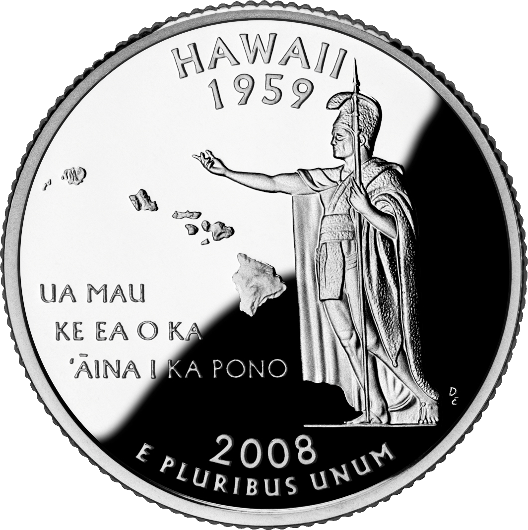
State Quarter 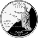
Released in 2008 Lists of United States state insignia Hawaii (
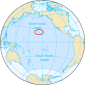
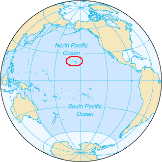
 i/həˈwaɪ.iː/ or /həˈwaɪʔiː/ in English; Hawaiian: Mokuʻāina o Hawaiʻi) is the newest of the 50 U.S. states (August 21, 1959), and is the only U.S. state made up entirely of islands. It is the northernmost island group in Polynesia, occupying most of an archipelago in the central Pacific Ocean, southwest of the continental United States, southeast of Japan, and northeast of Australia. Hawaii’s diverse natural scenery, warm tropical climate, abundance of public beaches and oceanic surrounding, and active volcanoes make it a popular destination for tourists, surfers, biologists, and volcanologists alike. Due to its mid-Pacific location, Hawaii has many North American and Asian influences along with its own vibrant native culture. Hawaii has over a million permanent residents along with many visitors and U.S. military personnel. Its capital is Honolulu on the island of Oʻahu.
The state encompasses nearly the entire volcanic Hawaiian Island chain, which comprises hundreds of islands spread over 1,500 miles (2,400 km). At the southeastern end of the archipelago, the eight "main islands" are (from the northwest to southeast) Niʻihau, Kauaʻi, Oʻahu, Molokaʻi, Lānaʻi, Kahoʻolawe, Maui, and Hawaiʻi. The last is by far the largest and is often called "The Big Island" to avoid confusion with the state as a whole. The archipelago is physiographically and ethnologically part of the Polynesian subregion of Oceania.
Hawaii's coastline is approximately 750 miles (1,210 km) long, which is fourth in the United States after Alaska, Florida, and California.
In standard American English, Hawaii is generally pronounced /həˈwaɪ.iː/. In the Hawaiian language, it is generally pronounced [hɐˈwɐiʔi] or [hɐˈvɐiʔi].[citation needed]
Hawaii is one of two states that do not observe daylight saving time, the other being Arizona.
Etymology
The Hawaiian language word Hawaiʻi derives from Proto-Polynesian *Sawaiki, with the reconstructed meaning "homeland";[7] Hawaiʻi cognates are found in other Polynesian languages, including Māori (Hawaiki), Rarotongan (ʻAvaiki), and Samoan (Savaiʻi). (See also Hawaiki).
According to Pukui and Elbert,[8] "Elsewhere in Polynesia, Hawaiʻi or a cognate is the name of the underworld or of the ancestral home, but in Hawaiʻi, the name has no meaning."[9]
Geography and environment
The main Hawaiian Islands are:
Island Nickname Location Area Highest point Elevation Population
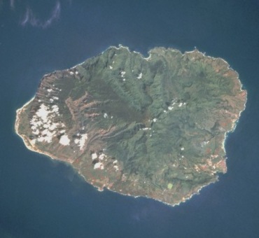
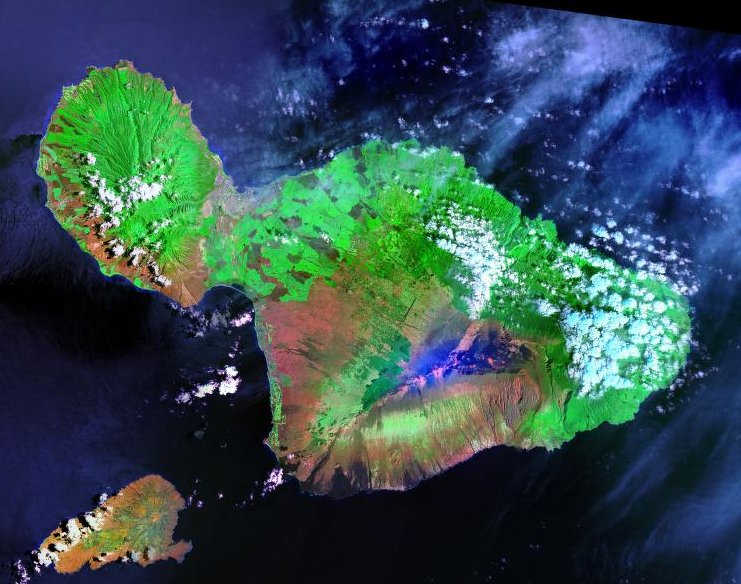
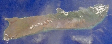
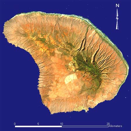
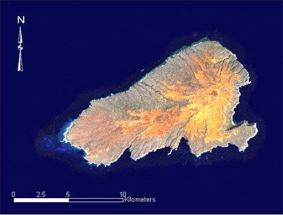
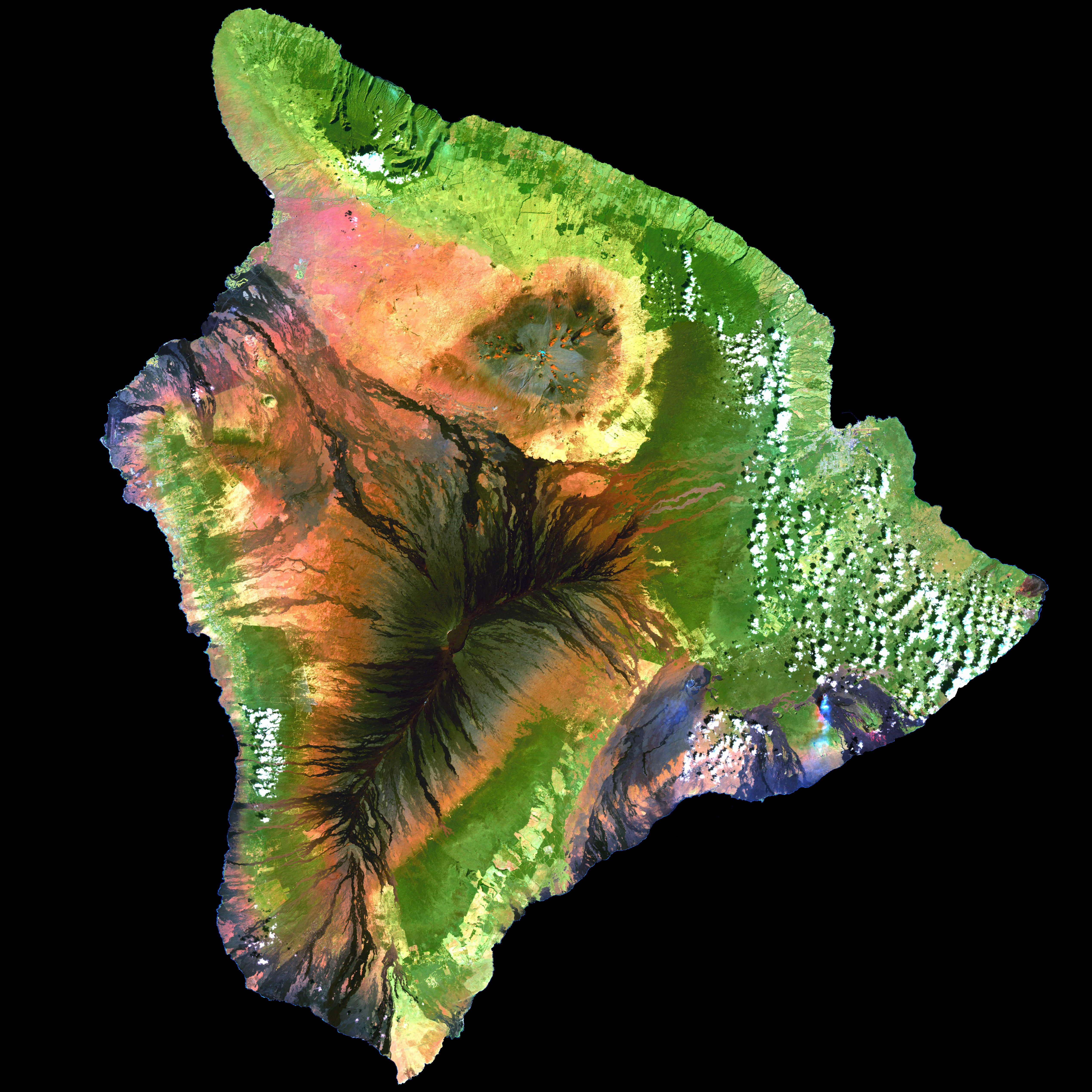
(as of 2010)Density Hawaiʻi[10] The Big Island 19°34′N 155°30′W / 19.567°N 155.5°W 4,028.0 sq mi (10,432.5 km2) Mauna Kea 13,796 ft (4,205 m) 185,079 45.948/sq mi (17.7407/km2) Kauaʻi[11] The Garden Isle 22°05′N 159°30′W / 22.083°N 159.5°W 552.3 sq mi (1,430.5 km2) Kawaikini 5,243 ft (1,598 m) 66,921 121.168/sq mi (46.783/km2) Kahoʻolawe[12] The Target Isle 20°33′N 156°36′W / 20.55°N 156.6°W 44.6 sq mi (115.5 km2) Puʻu Moaulanui 1,483 ft (452 m) 0 0 Lānaʻi[13] The Pineapple Isle 20°50′N 156°56′W / 20.833°N 156.933°W 140.5 sq mi (363.9 km2) Lānaʻihale 3,366 ft (1,026 m) 3,135 22.313/sq mi (8.615/km2) Maui[14] The Valley Isle 20°48′N 156°20′W / 20.8°N 156.333°W 727.2 sq mi (1,883.4 km2) Haleakalā 10,023 ft (3,055 m) 144,444 198.630/sq mi (76.692/km2) Molokaʻi[15] The Friendly Isle 21°08′N 157°02′W / 21.133°N 157.033°W 260.0 sq mi (673.4 km2) Kamakou 4,961 ft (1,512 m) 7,345 28.250/sq mi (10.9074/km2) Niʻihau[16] The Forbidden Isle 21°54′N 160°10′W / 21.9°N 160.167°W 69.5 sq mi (180.0 km2) Mount Pānīʻau 1,250 ft (381 m) 170 2.45/sq mi (0.944/km2) Oʻahu[17] The Gathering Place 21°28′N 157°59′W / 21.467°N 157.983°W 596.7 sq mi (1,545.4 km2) Mount Kaʻala 4,003 ft (1,220 m) 953,207 1,597.46/sq mi (616.78/km2)  A true-color satellite view of Hawaii shows that most of the vegetation on the islands grow on the north-east sides which face the wind. The silver glow around the calmer south-west of the islands is the result of the shelter provided from the islands.[18]
Topography
 Pāhoehoe and ʻAʻā lava flows side by side at the Big Island of Hawaiʻi in September, 2007
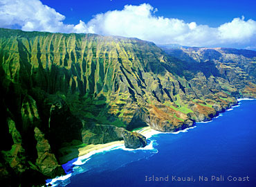
 Nā Pali coast, Kauaʻi
An archipelago situated some 2,000 mi (3,200 km) southwest of the North American mainland,[19] Hawaii is the southernmost state of the United States and the second westernmost state after Alaska. Only Hawaii and Alaska do not share a border with another U.S. state.
Hawaii is the only state of the United States that is not geographically located in North America, grows coffee, is completely surrounded by water, is entirely an archipelago, has royal palaces, and does not have a straight line in its state boundary.
Hawaii’s tallest mountain, Mauna Kea, stands at 13,796 ft (4,205 m)[20] but is taller than Mount Everest if followed to the base of the mountain, which, lying at the floor of the Pacific Ocean, rises about 33,500 ft (10,200 m).[21]
The eight main islands, Hawaiʻi, Maui, Oʻahu, Kahoʻolawe, Lanaʻi, Molokaʻi, Kauaʻi and Niʻihau are accompanied by many others. Kaʻala is a small island near Niʻihau that is often overlooked. The Northwest Hawaiian Islands are a series of nine small, older masses northwest of Kauaʻi that extend from Nihoa to Kure that are remnants of once much larger volcanic mountains. There are also more than 100 small rocks and islets, such as Molokini, that are either volcanic, marine sedimentary or erosional in origin, totaling 130 or so across the archipelago.[22]
Geology
All the Hawaiian islands were formed from volcanic activity initiated at an undersea magma source called a hotspot. As the tectonic plate beneath much of the Pacific Ocean moves to the northwest, the hot spot remains stationary, slowly creating new volcanoes. Due to the hotspot’s location, the only active volcanoes are located around the southern half of the Big Island. The newest volcano, Lōʻihi Seamount, is located south of the Big Island’s coast.
The last volcanic eruption outside the Big Island occurred at Haleakalā on Maui before the late 18th century, though it could have been hundreds of years earlier.[23] In 1790, Kīlauea exploded with the deadliest eruption (of the modern era) known to have occurred in what is now the United States.[24] As many as 5,405 warriors and their families marching on Kīlauea were killed by that eruption.[25]
Volcanic activity and subsequent erosion have created impressive geological features. The Big Island has the third highest point among the world’s islands.[26]
Slope instability of the volcanoes has generated damaging earthquakes with related tsunamis, particularly in 1868 and 1975.[27]
Flora and fauna
Because the islands are so far from other land habitats, life before human activity is said to have arrived by the “3 W’s”: wind (carried through the air), waves (brought by ocean currents), and wings (birds, insects, and whatever they brought with them). This isolation, and the wide range of environments (extreme altitude, tropical climate) produced a vast array of endemic flora and fauna (see Endemism in the Hawaiian Islands). Hawaii has more endangered species and has lost a higher percentage of its endemic species than any other U.S. state.[28]
Protected areas
Several areas in Hawaii are under the protection of the National Park Service.[29] Hawaii has two national parks: Haleakala National Park near Kula, on Maui, includes Haleakalā, the dormant volcano that formed east Maui; and Hawaii Volcanoes National Park in the southeast region of the island of Hawaiʻi, which includes the active volcano Kīlauea and its various rift zones.
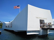
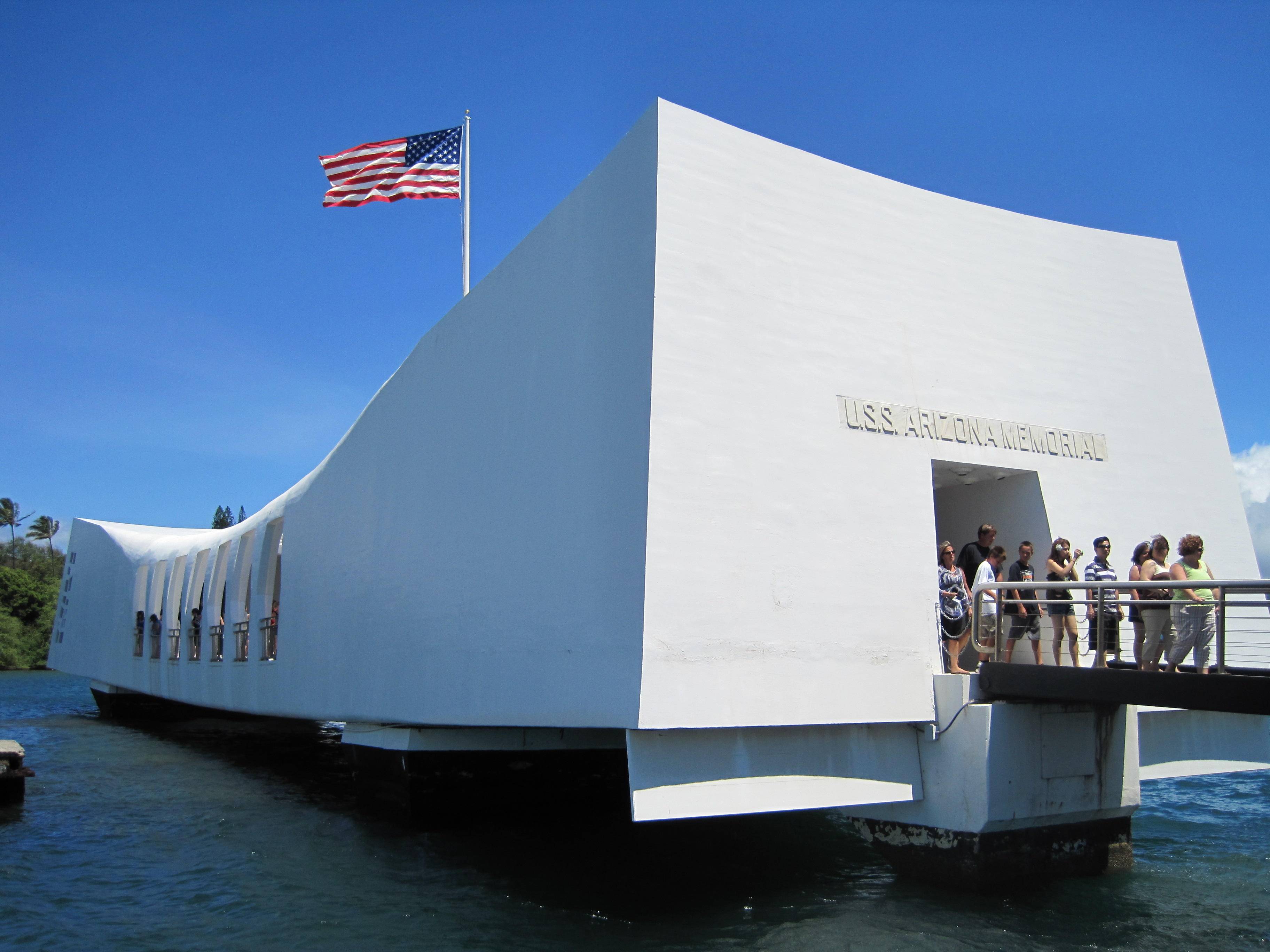
There are three national historical parks: Kalaupapa National Historical Park in Kalaupapa, Molokaʻi, the site of a former Hansen’s disease colony; Kaloko-Honokōhau National Historical Park in Kailua-Kona on the island of Hawaiʻi; and Puʻuhonua o Hōnaunau National Historical Park, an ancient place of refuge. Other areas under the control of the National Park Service include Ala Kahakai National Historic Trail on the Big Island and the USS Arizona Memorial at Pearl Harbor on Oʻahu.
The Papahānaumokuākea Marine National Monument was proclaimed by President George W. Bush on June 15, 2006. The monument covers roughly 140,000 square miles (360,000 km2) of reefs, atolls and shallow and deep sea out to 50 miles (80 km) offshore in the Pacific Ocean, larger than all of America’s National Parks combined.[30]
Climate
Hawaii’s climate is typical for the tropics, although temperatures and humidity tend to be a bit less extreme due to near-constant trade winds from the east. Summer highs are usually in the upper 80s °F, (around 31 °C) during the day and mid 70s, (around 24 °C) at night. Winter day temperatures are usually in the low to mid 80s, (around 28 °C) and (at low elevation) seldom dipping below the mid 60s (18 °C) at night. Snow, not usually associated with the tropics, falls at 4,205 metres (13,796 ft) on Mauna Kea and Mauna Loa on the Big Island in some winter months. Snow rarely falls on Haleakala. Mount Waiʻaleʻale, on Kauaʻi, has the second highest average annual rainfall on Earth, about 460 inches (11.7 m). Most of Hawaii has only two seasons: the dry season from May to October, and the wet season from October to April.[31]
Local climates vary considerably on each island, grossly divisible into windward (Koʻolau) and leeward (Kona) areas based upon location relative to the higher mountains. Windward sides face cloud cover, so resorts concentrate on sunny leeward coasts.
Monthly normal low and high temperatures for various Hawaiian cities[32] City Jan. Feb. Mar. Apr. May Jun. Jul. Aug. Sep. Oct. Nov. Dec. Hilo 64 °F / 17.8 °C 64 °F / 17.8 °C 65 °F / 18.3 °C 66 °F / 18.9 °C 67 °F / 19.4 °C 68 °F / 20.0 °C 69 °F / 20.6 °C 69 °F / 20.6 °C 69 °F / 20.6 °C 68 °F / 20.0 °C 67 °F / 19.4 °C 65 °F / 18.3 °C 79 °F / 26.1 °C 79 °F / 26.1 °C 79 °F / 26.1 °C 79 °F / 26.1 °C 81 °F / 27.2 °C 82 °F / 27.8 °C 82 °F / 27.8 °C 83 °F / 28.3 °C 83 °F / 28.3 °C 83 °F / 28.3 °C 81 °F / 27.2 °C 80 °F / 26.7 °C Honolulu 66 °F / 18.9 °C 65 °F / 18.3 °C 67 °F / 19.4 °C 68 °F / 20.0 °C 70 °F / 21.1 °C 72 °F / 22.2 °C 74 °F / 23.3 °C 75 °F / 23.9 °C 74 °F / 23.3 °C 73 °F / 22.8 °C 71 °F / 21.7 °C 68 °F / 20.0 °C 80 °F / 26.7 °C 81 °F / 27.2 °C 82 °F / 27.8 °C 83 °F / 28.3 °C 85 °F / 29.4 °C 87 °F / 30.6 °C 88 °F / 31.1 °C 89 °F / 31.7 °C 89 °F / 31.7 °C 87 °F / 30.6 °C 84 °F / 28.9 °C 82 °F / 27.8 °C Kahului 63 °F / 17.2 °C 63 °F / 17.2 °C 65 °F / 18.3 °C 66 °F / 18.9 °C 67 °F / 19.4 °C 69 °F / 20.6 °C 71 °F / 21.7 °C 71 °F / 21.7 °C 70 °F / 21.1 °C 69 °F / 20.6 °C 68 °F / 20.0 °C 65 °F / 18.3 °C 80 °F / 26.7 °C 81 °F / 27.2 °C 82 °F / 27.8 °C 82 °F / 27.8 °C 84 °F / 28.9 °C 86 °F / 30.0 °C 87 °F / 30.6 °C 88 °F / 31.1 °C 88 °F / 31.1 °C 87 °F / 30.6 °C 84 °F / 28.9 °C 82 °F / 27.8 °C Lihuʻe 65 °F / 18.3 °C 66 °F / 18.9 °C 67 °F / 19.4 °C 69 °F / 20.6 °C 70 °F / 21.1 °C 73 °F / 22.8 °C 74 °F / 23.3 °C 74 °F / 23.3 °C 74 °F / 23.3 °C 73 °F / 22.8 °C 71 °F / 21.7 °C 68 °F / 20.0 °C 78 °F / 25.6 °C 78 °F / 26.6 °C 78 °F / 26.6 °C 79 °F / 26.1 °C 81 °F / 27.2 °C 83 °F / 28.3 °C 84 °F / 28.9 °C 85 °F / 29.4 °C 85 °F / 29.4 °C 84 °F / 28.9 °C 81 °F / 27.2 °C 79 °F / 26.1 °C History

History of Hawaii Ancient times Monarchy Provisional Government Republic Territory State Hawaii is one of four states that were independent prior to becoming part of the United States, along with the Vermont Republic (1791), the Republic of Texas (1845), and the California Republic (1846), and one of two, along with Texas, that had formal diplomatic recognition internationally.[33] The Kingdom of Hawaii was sovereign from 1810 until 1893 when the monarchy was overthrown by resident American (and some European) businessmen. It was an independent republic from 1894 until 1898, when it was annexed by the United States as a territory, becoming a state in 1959.[34]
Hawaii was the target of a surprise attack on Pearl Harbor by Imperial Japan on December 7, 1941. The attack on Pearl Harbor and other military and naval installations on Oʻahu, carried out by aircraft and by midget submarines, brought the United States into World War II.
Pre-European contact—Ancient Hawaiʻi (800–1778)
The earliest habitation supported by archaeological evidence dates to as early as 300 CE, probably by Polynesian settlers from the Marquesas, followed by a second wave of migration from Raiatea and Bora Bora in the 11th century. The first recorded European contact with the islands was in 1778 by British explorer James Cook.
Polynesians from the Marquesas and possibly the Society Islands may have first populated the Hawaiian Islands between 300 and 500 CE. There is a great deal of debate regarding these dates.[35]
Some archaeologists and historians believe that an early settlement from the Marquesas and a later wave of immigrants from Tahiti, c. 1000, introduced a new line of high chiefs, the Kapu system, the practice of human sacrifice and the building of heiaus. This later immigration is detailed in folk tales about Paʻao. Other authors argue that there is no archaeological or linguistic evidence for a later influx of Tahitian settlers, and that Paʻao must be regarded as a myth.
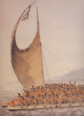 Kalaniʻōpuʻu, King of Hawaii bringing presents to Captain Cook. Illustrated by John Webber, artist aboard Cook's ship.
Regardless of the question of Paʻao, historians agree that the history of the islands was marked by a slow but steady growth in population and the size of the chiefdoms, which grew to encompass whole islands. Local chiefs, called aliʻi, ruled their settlements and launched wars to extend their sway and defend their communities from predatory rivals.
James Cook—European arrival and the Kingdom of Hawaii (1778–1893)
The 1778 arrival of British explorer James Cook was Hawaii’s first documented contact with European explorers. Cook named the islands the "Sandwich Islands" in honor of his sponsor John Montagu, 4th Earl of Sandwich. He published the islands' location and reported the native name as Owyhee. This spelling lives on in Owyhee County, Idaho, after three Hawaiian members of a trapping party killed in that area.
Cook visited the islands twice. During his second visit in 1779, he attempted to abduct the King of the Big Island of Hawaii, Kalaniʻōpuʻu, and hold him as ransom for the return of a ship's boat that was taken by a minor chief and his men, a tactic that had worked for Cook in Tahiti and other islands.[36] Kalaniʻōpuʻu and his supporters fought back and Cook and four Marines were killed as Cook's party retreated to the beach and launched their boats.
After Cook's visit and the publication of several books relating his voyages, the Hawaiian islands received many European visitors: explorers, traders, and eventually whalers who found the islands a convenient harbor and source of supplies. Early British influence can be seen in the design of the flag of Hawaii which has the British Union Flag in the corner.
These visitors introduced diseases to the once-isolated islands and the Hawaiian population plunged precipitously[37] because native Hawaiians had no resistance to influenza, smallpox, and measles, among others. During the 1850s, measles killed a fifth of Hawaii's people.[38]
Historical records indicated that the earliest immigration of the Chinese came from Guangdong province: a few sailors in 1778 with Captain Cook's journey, more in 1788 with Kaina, and some in 1789 with an American trader who settled in Hawaii in the late 18th century.
House of Kamehameha
During the 1780s and 1790s, chiefs were often fighting for power. After a series of battles that ended in 1795 and forced cession of the island of Kauaʻi in 1810, all inhabited islands were subjugated under a single ruler who became known as King Kamehameha the Great. He established the House of Kamehameha, a dynasty that ruled the kingdom until 1872.
After Kamehameha II inherited the throne in 1819, American Protestant missionaries to Hawaii converted many Hawaiians to Christianity. Their influence ended many ancient practices, and Kamehameha III was the first Christian king. One prominent Protestant missionary, Hiram Bingham I, was a trusted adviser to the monarchy during this period. Other missionaries and their descendants became active in commercial and political affairs, leading to future conflicts between the monarchy and its restive American subjects.
Missionaries from other Christian denominations (such as Catholics, Mormons, and Episcopalians) were active, but never converted more than a minority of the Native Hawaiian population.
The death of the bachelor King Kamehameha V—who did not name an heir—resulted in the popular election of Lunalilo over Kalākaua. Lunalilo died the next year, also without naming an heir. Perhaps "the People's King" (Lunalilo) wanted the people to choose his successor as they had chosen him. In 1874 the election was contested within the legislature between Kalākaua and Emma. This led to riots and the landing of U.S. and British troops, and governance passed to the House of Kalākaua.
1887 Constitution
In 1887, Kalākaua was forced to sign the 1887 Constitution of the Kingdom of Hawaii, which stripped the king of much of his authority. There was a property qualification for voting, which disenfranchised many poorer Hawaiians and favored the wealthier white community. Resident whites were allowed to vote, but resident Asians were excluded. Because the 1887 Constitution was signed under threat of violence, it is known as the "Bayonet Constitution". King Kalākaua, reduced to a figurehead, reigned until his death in 1891. His sister, Liliʻuokalani, succeeded him on the throne.
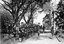 Ship's landing force at the time of the overthrow of the Hawaiian monarchy, January 1893.
In 1893, Queen Liliʻuokalani announced plans for a new constitution. On January 14, 1893, a group of mostly Euro-American business leaders and residents formed a Committee of Safety to overthrow the Kingdom and seek annexation by the United States. United States Government Minister John L. Stevens, responding to a request from the Committee of Safety, summoned a company of U.S. Marines. As one historian noted, the presence of these troops effectively made it impossible for the monarchy to protect itself.[39]
Overthrow of 1893—the Republic of Hawaii (1894–1898)
In January 1893, Queen Liliʻuokalani was overthrown and replaced by a Provisional Government composed of members of the Committee of Safety. Controversy filled the following years as the queen tried to re-establish her throne. The administration of President Grover Cleveland commissioned the Blount Report, which concluded that the removal of Liliʻuokalani was illegal. The U.S. government first demanded that Queen Liliʻuokalani be reinstated, but the Provisional Government refused. Congress followed with another investigation, and submitted the Morgan Report on February 26, 1894, which found all parties (including Minister Stevens) with the exception of the queen "not guilty" from any responsibility for the overthrow.[40] The accuracy and impartiality of both the Blount and Morgan reports has been questioned by partisans on both sides of the debate over the events of 1893.[39][41][42][43]
In 1993, a joint Apology Resolution regarding the overthrow was passed by Congress and signed by President Clinton, apologizing for the overthrow of the Hawaiian Kingdom.[43] It is the first time in American history that the United States government has apologized for overthrowing the government of a sovereign nation.
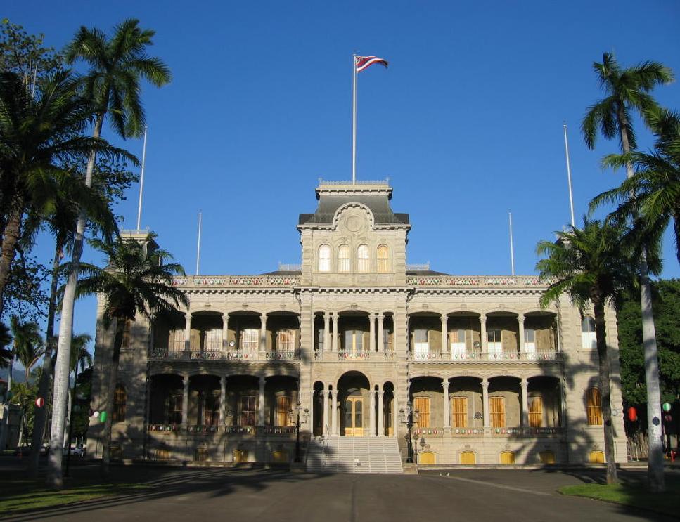
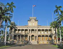 ʻIolani Palace in Honolulu, formerly the residence of the Hawaiian monarch, was the capitol of the Republic of Hawaii.
The Provisional Government of Hawaii ended on July 4, 1894, replaced by the Republic of Hawaii.
The first Japanese immigrants arrived in Hawaii in 1885 as contract laborers for the sugar cane and pineapple plantations. Puerto Rican immigration to Hawaii began when Puerto Rico's sugar industry was devastated by two hurricanes in 1899. The devastation caused a world-wide shortage of sugar and a huge demand for the product from Hawaii. Hawaiian sugar plantation owners began to recruit the jobless, but experienced, laborers in Puerto Rico. Two distinct waves of Korean immigration to Hawaii have occurred in the last century. The first arrived in between 1903 and 1924; the second wave began in 1965.
Annexation—the Territory of Hawaii (1898–1959)
After William McKinley won the presidential election in 1896, Hawaii's annexation to the U.S. was again discussed. The previous president, Grover Cleveland, was a friend of Queen Liliʻuokalani. McKinley was open to persuasion by U.S. expansionists and by annexationists from Hawaii. He met with three annexationists from Hawaii: Lorrin Thurston, Francis March Hatch and William Ansel Kinney. After negotiations, in June 1897, Secretary of State John Sherman agreed to a treaty of annexation with these representatives of the Republic of Hawaii.[44]
The treaty was never ratified by the U.S. Senate. Instead, the Newlands Resolution by both houses of Congress annexed the Republic to the United States and it became the Territory of Hawaii. Despite some opposition in the islands, the Newlands Resolution was passed by the House June 15, 1898, by a vote of 209 to 91, and by the Senate on July 6, 1898, by a vote of 42 to 21.
In 1900, Hawaii was granted self-governance and retained ʻIolani Palace as the territorial capitol building. Despite several attempts to become a state, Hawaii remained a territory for sixty years. Plantation owners and key capitalists, who maintained control through financial institutions, or "factors," known as the "Big Five", found territorial status convenient, enabling them to continue importing cheap foreign labor; such immigration was prohibited in various states.
Political Changes of 1954—the State of Hawaii (1959–present)
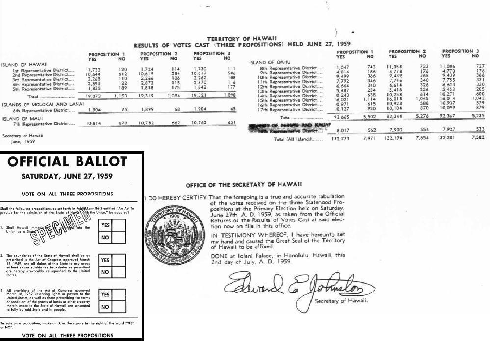
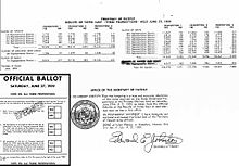 All representative districts voted at least 93% in favor of Admission acts. Ballot (inset) and referendum results for the Admission Act of 1959Main article: Democratic Revolution of 1954 (Hawaii)
In the 1950s the power of the plantation owners was finally broken by descendants of immigrant laborers. Because they were born in a U.S. territory, they were legal U.S. citizens. The Hawaii Republican Party, strongly supported by plantation owners, was voted out of office. The Democratic Party of Hawaii dominated politics for 40 years. Expecting to gain full voting rights, Hawaii's residents actively campaigned for statehood.
In March 1959, Congress passed the Hawaii Admission Act and U.S. President Dwight D. Eisenhower signed it into law. (The act excluded Palmyra Atoll, part of the Kingdom and Territory of Hawaii, from the new state.) On June 27 of that year, a referendum asked residents of Hawaii to vote on the statehood bill. Hawaii voted 17 to 1 to accept. The choices were to accept the Act or to remain a territory, without the option of independence.[45][46][47] The United Nations Special Committee on Decolonization later removed Hawaii from the United Nations list of Non-Self-Governing Territories.
After statehood, Hawaii quickly modernized via construction and a rapidly growing tourism economy. Later, state programs promoted Hawaiian culture. The Hawaii State Constitutional Convention of 1978 incorporated programs such as the Office of Hawaiian Affairs to promote indigenous language and culture.
Cities and towns
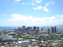
The movement of the Hawaiian royal family from the Big Island to Maui, and subsequently to Oʻahu, explains why population centers exist where they do today. Kamehameha III chose the largest city, Honolulu, as his capital because of its natural harbor, the present-day Honolulu Harbor.
Now the state capital, Honolulu is located along the southeast coast of Oʻahu. The previous capital was Lahaina, Maui, and before that Kailua-Kona, Hawaii. Some major towns are Hilo; Kāneʻohe; Kailua; Pearl City; Waipahu; Kahului; Kailua-Kona. Kīhei; and Līhuʻe.
Demographics
Population
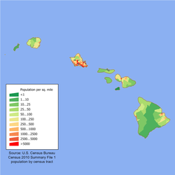
Historical populations Census Pop. %± 1900 154,001 — 1910 191,874 24.6% 1920 255,881 33.4% 1930 368,300 43.9% 1940 422,770 14.8% 1950 499,794 18.2% 1960 632,772 26.6% 1970 769,913 21.7% 1980 964,691 25.3% 1990 1,108,229 14.9% 2000 1,211,537 9.3% 2010 1,360,301 12.3% Source: 1910–2010[48] As of 2005, Hawaii has an estimated population of 1,275,194, an increase of 13,070, or 1.0%, from the prior year and an increase of 63,657, or 5.3%, since 2000. This includes a natural increase of 48,111 people (that is 96,028 births minus 47,917 deaths) and an increase due to net migration of 16,956 people into the state. Immigration from outside the United States resulted in a net increase of 30,068 people, and migration within the country produced a net loss of 13,112 people. The center of population of Hawaii is located between the two islands of Oʻahu and Molokaʻi.[49]
Hawaii has a de facto population of over 1.3 million, due to large military and tourist populations. Oʻahu, nicknamed "The Gathering Place", is the most populous island (and has the highest population density), with a resident population of just under one million in 597 square miles (1,546 km2), about 1,650 people per square mile (for comparison, New Jersey, which has 8,717,925 people in 7,417 square miles (19,210 km2) is the most-densely populated state with 1,134 people per square mile.)[50] Hawaii's 1,275,194 people, spread over 6,423 square miles (16,640 km2) (including many unpopulated islands), results in an average population density of 188.6 persons per square mile,[51] which makes Hawaii less densely populated than Ohio and Illinois.[52]
The average projected lifespan of those born in Hawaii in 2000 was 79.8 years (77.1 years if male, 82.5 if female), longer than any other state.[53]
U.S. military personnel make up approximately 1.3% of the population in the islands.
Race and ethnicity
See also: Africans in HawaiiAccording to the 2010 U.S. Census, Hawaii had a population of 1,360,301. In terms of race and ethnicity, the state was 24.7% White (22.7% Non-Hispanic White Alone), 1.6% Black or African American, 0.3% American Indian and Alaska Native, 38.6% Asian, 10.0% Native Hawaiian and Other Pacific Islander, 1.2% from Some Other race, and 23.6% from Two or More Races. Hispanics and Latinos of any race made up 8.9% of the population.
Hawaii is demographically unique because it has the highest percentage of Asian Americans and Multiracial Americans, as well as the lowest percentage of White Americans. Hawaii's Asian population mainly consists of 198,000 (14.6%) Filipino Americans and 185,000 (13.6%) Japanese Americans. In addition, there are roughly 55,000 (4.0%) Chinese Americans and 24,000 (1.8%) Korean Americans. Indigenous Hawaiians number over 80,000, which is 5.9% of the population. Over 120,000 (8.8%) Hispanic and Latino Americans make Hawaii their home. Mexicans number over 35,000 (2.6%); Puerto Ricans exceed 44,000 (3.2%). Multiracial Americans form almost one-quarter of Hawaii's population, exceeding 320,000 people. Eurasian Americans are a prominent mixed-race group; there are roughly 66,000 (4.9%) Eurasian Americans in Hawaii. The Non-Hispanic White population numbers at 310,000 and forms just over one-fifth of the population. The multiracial population outnumbers the non-Hispanic white population by about 10,000 people.[54]
The five largest European ancestries in Hawaii are German (7.4%), Irish (5.2%), English (4.6%), Portuguese (4.3%), and Italian (2.7%).
Approximately 82.2% of Hawaii's residents were born in the United States. Roughly 75.0% of the foreign-born residents hail from Asia.[55]
Hawaii is a majority-minority state. Non-Hispanic whites do not form a majority. Hawaii was the second majority-minority state. Both Hawaii and New Mexico have been majority-minority since the early 20th century.
Ancestry groups
Population of Hawaii[56] Ancestry Percentage Main article: Filipino 13.6% See Filipino American Japanese 12.6% See Japanese American Polynesian 9.0% See Native Hawaiians German 7.4% See German American Irish 5.2% See Irish American English 4.6% See English American Portuguese 4.3% See Portuguese American Chinese 4.1% See Chinese American Korean 3.1% See Korean American Mexican 2.9% See Mexican American Puerto Rican 2.8% See Puerto Rican Italian 2.7% See Italian American African 2.4% See African American French 1.7% See French American Scottish 1.2% See Scottish American The largest ancestry groups in Hawaii as of 2008 are in the table at right. The third group of foreigners to arrive upon Hawaii's shores, after those from Polynesia and Europe, was from Han China. Chinese workers on Western trading ships settled in Hawaii starting in 1789. In 1820 the first American missionaries came to preach Christianity and teach the Hawaiians Western ways. They were instrumental in convincing the Hawaiian Chiefs to end human sacrifice.[citation needed]
A large proportion of Hawaii's population is now of Asian ancestry (especially Chinese, Japanese and Filipino.) Many are descendants of those immigrants brought to work on the sugar plantations in the 1850s and after. The first 153 Japanese immigrants arrived in Hawaii on June 19, 1868. They were not "legally" approved by the Japanese government because the contract was between a broker and the Tokugawa shogunate, by then replaced by the Meiji Restoration. The first Japanese government-approved immigrants arrived on February 9, 1885 after Kalākaua's petition to Emperor Meiji when Kalākaua visited Japan in 1881.[citation needed]
Almost 13,000 Portuguese had come by 1899. They too worked on the sugar plantations. By October 17, 1901, 5,000 Puerto Ricans had made new homes on the four islands.[citation needed]
Languages
The State of Hawaii has two official languages recognized in its 1978 constitution: English and Hawaiian. Article XV, Section 4, specifies that "Hawaiian shall be required for public acts and transactions only as provided by law" [italic added]. Hawaii Creole English (locally referred to as 'Pidgin') is the native language of many born-and-raised residents and is a second language for many other residents.
English
As of the 2000 Census, 73.44% of Hawaii residents age 5 and older speak only English at home.[57]
According to the 2008 American Community Survey, 74.6% of Hawaii's residents over the age of five speak only English at home.[56]
Minority languages
In addition, 2.6% of the state's residents speak Spanish; 1.6% speak other Indo-European languages; 21.0% speak an Asian language; and 0.2% speak a different language at home.[56]
After English, other popular languages are Tagalog (most are bilingual in Filipino), Japanese, and Ilokano. Significant European immigrants and descendants also speak their native languages; the most numerous are Spanish, German, Portuguese and French.
Tagalog speakers make up 5.37% (which includes non-native speakers of Filipino language, the national co-official Tagalog-based language), followed by Japanese at 4.96%, Ilokano at 4.05%, Chinese at 1.92%, Hawaiian at 1.68%, Spanish at 1.66%, Korean at 1.61%, and Samoan at 1.01%.[57]
Hawaiian
The Hawaiian language has about 2000 native speakers, less than 0.1% of the total population.[58] According to the United States Census, there were 27,160 total speakers of the language in Hawaii in 2005.[59]
Hawaiian is a Polynesian member of the Austronesian language family.[60] It is closely related to other Polynesian languages, such as Marquesan, Tahitian, Māori, Rapa Nui (the language of Easter Island), and less closely to Samoan, and Tongan.
According to Schütz (1994), the Marquesans colonized the archipelago in roughly 300 AD[61] followed by later waves of immigration from the Society Islands and Samoa-Tonga. Those Polynesians remained in the islands, thereby becoming the Hawaiian people. Their languages, over time, became the Hawaiian language.[62] Kimura and Wilson (1983) also state, "Linguists agree that Hawaiian is closely related to Eastern Polynesian, with a particularly strong link in the Southern Marquesas, and a secondary link in Tahiti, which may be explained by voyaging between the Hawaiian and Society Islands."[63] Before the arrival of Captain James Cook, the Hawaiian language had no written form. That form was developed mainly by American Protestant missionaries during 1820–1826. They assigned letters from the Latin alphabet that corresponded to the Hawaiian sounds.
Interest in Hawaiian increased significantly in the late 20th century. With the help of the Office of Hawaiian Affairs, specially designated immersion schools were established where all subjects would be taught in Hawaiian. Also, the University of Hawaii developed a Hawaiian language graduate studies program. Municipal codes were altered to favor Hawaiian place and street names for new civic developments.
Hawaiian distinguishes between long and short vowels. In modern practice, vowel length is indicated with a macron (kahakō). Also, Hawaiian uses the glottal stop as a consonant (ʻokina). It is written as a symbol similar to the apostrophe or opening single quote.
Hawaiian-language newspapers published from 1834–1948 and traditional native speakers of Hawaiian generally omit the marks in their own writing. The ʻokina and kahakō are intended to help non-native speakers.
Hawaiian Pidgin
Some locals speak Hawaii Creole English (HCE), often called "pidgin". The lexicon of HCE derives mainly from English but also has words from Hawaiian, Chinese, Japanese, Portuguese, Ilocano and Tagalog. During the 19th century, the increase in immigration (mainly from China, Japan, Portugal—and especially from the Azores archipelago—and Spain), caused a variant of English to develop. By the early 20th century pidgin speakers had children who acquired the pidgin as their first language. HCE speakers use some Hawaiian words without those words being considered archaic. Most place names are retained from Hawaiian, as are some names for plants or animals. For example, tuna fish are often called ahi.
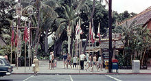 International Market Place, Honolulu, 1958.
HCE speakers have modified the meanings of certain English words. For example, "aunty" and "uncle" refer to any adult who is a friend, or to show respect for an elder. Simplified grammar is used. For example, instead of "It is hot today, isn't it?", an HCE speaker would say simply "stay hot, eh?" When a word does not come to mind quickly, the term "da kine" refers to any word you cannot think of. Through the surfing boom in Hawaii, HCE has influenced surfer slang. Some HCE expressions, such as brah and da kine, have found their way to other places.
Spelling of state name
A somewhat divisive political issue arose when the constitution of the State of Hawaii added Hawaiian as a second official state language: the exact spelling of the state's name, which in the islands' language is Hawai'i (the apostrophe marking a Hawaiian consonant, a cut-off of breath before the final i). In the Hawaii Admission Act that granted Hawaiian statehood, the federal government recognized Hawaii to be the official state name. Official government publications, as well as department and office titles, use the traditional Hawaiian spelling, with no symbols for glottal stops or vowel length.[64] In contrast, some private entities, including a local newspaper, do use such symbols.
The title of the state constitution is "The Constitution of the State of Hawaii". In Article XV, Section 1 uses "The State of Hawaii", Section 2 "the island of Oahu", Section 3 "The Hawaiian flag", and Section 5 specifies the state motto as "Ua mau ke ea o ka aina i ka pono". Since these documents predate the modern use of the ʻokina and the kahakō in Hawaiian orthography, the diacritics were not used.
The nuances in the Hawaiian language debate are often not obvious or appreciated among English speakers outside Hawaii.[65]
Religion
 A church in Hawaii, 1958
The largest denominations by number of adherents were the Catholic Church with 240,813 in 2000[66] and The Church of Jesus Christ of Latter-day Saints with 68,128 in 2009.[67]
According to data provided by religious establishments, religion in Hawaii in 2000 was distributed as follows:[68][69][70]
- Christianity: 351,000 (28.9%)
- Buddhism: 110,000 (9%)
- Judaism: 10,000 (0.8%)
- Other: 100,000 (10%)*
- Unaffiliated: 650,000 (51.1%)**
"Other" are religions other than Christianity, Buddhism, or Judaism; this group includes Bahá'í Faith, Confucianism, Daoism, the Hawaiian religion, Hinduism, Islam, Sikhism, Shintoism, Zoroastrianism, and other religions.
"Unaffiliated" refers to people who do not belong to a congregation; this group includes agnostics, atheists, humanists, and the irreligious.
A 2009 Gallup poll found religion was distributed as follows, excluding those of other non-Judeo-Christian religions and those who had "no opinion":[71]
- Protestant/Other Christian: 37.8%
- Roman Catholic: 22.8%
- Mormonism: 3.3%
- Judaism: 0.7%
- Irreligious, Agnostic, Atheist: 21.0%
A special case is Hoʻoponopono, an ancient Hawaiian practice of reconciliation and forgiveness, combined with prayer. It is both philosophy and way of life. Traditionally hoʻoponopono is practiced by healing priests or kahuna lapaʻau among family members of a person who is physically ill.
Economy
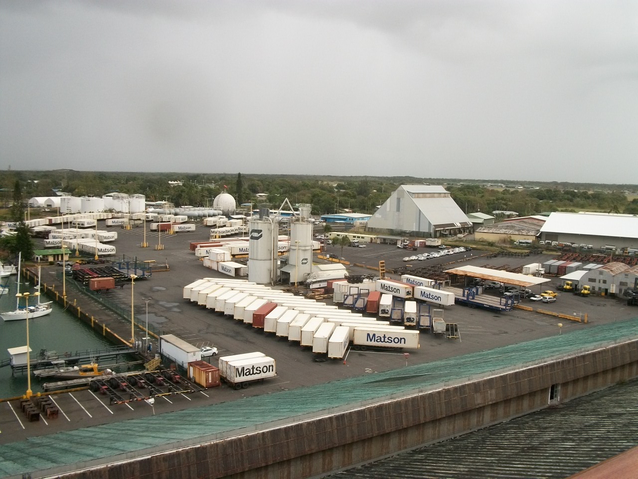
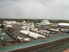 A shipping dock in Hawaii
The history of Hawaii can be traced through a succession of dominant industries: sandalwood,[72] whaling,[73] sugarcane (see Sugar plantations in Hawaii), pineapple, military, tourism, and education. Since statehood in 1959, tourism has been the largest industry, contributing 24.3% of the Gross State Product (GSP) in 1997, despite efforts to diversify. The gross output for the state in 2003 was US$47 billion; per capita income for Hawaii residents was US$30,441.
Hawaiian exports include food and apparel. These industries play a small role in the Hawaiian economy, however, due to the considerable shipping distance to viable markets, such as the West Coast of the United States. Food exports include coffee (see coffee production in Hawaii), macadamia nuts, pineapple, livestock, and sugarcane. Agricultural sales for 2002, according to the Hawaii Agricultural Statistics Service, were US$370.9 million from diversified agriculture, US$100.6 million from pineapple, and US$64.3 million from sugarcane.
Hawaii has a relatively high state tax burden. In 2003, Hawaii residents had the highest state tax per capita at US$2,838. This is partly because education, health care and social services are all provided directly by the state, as opposed to local government in all other states.
Millions of tourists contribute to the tax take by paying the general excise tax and hotel room tax; thus not all taxes come directly from residents. Business leaders, however, consider the state's tax burden too high, contributing to both higher prices and the perception of an unfriendly business climate.[74] See the list of businesses in Hawaii for more on commerce.
Hawaii was one of the few states to control gasoline prices through a Gas Cap Law. Since oil company profits in Hawaii compared to the mainland U.S. were under scrutiny, the law tied local gasoline prices to those of the mainland. It took effect in September 2005 amid price fluctuations caused by Hurricane Katrina, but was suspended in April 2006.
As of January 2010, the state's unemployment rate was 6.9%.[75]
In 2009, the United States military spent $12.2 billion in Hawaii, accounting for 18% of spending in the state for that year. 75,000 United States Department of Defense personnel reside in Hawaii.[76]
Cost of living
The cost of living in Hawaii, specifically Honolulu, is quite high compared to most major cities in the United States. However, the cost of living in Honolulu is 6.7% lower than in New York, NY and 3.6% lower than in San Francisco, CA.[77] These numbers may not take into account certain costs, such as increased travel costs for longer flights, additional shipping fees, and the loss of promotional participation opportunities for customers "outside the continental United States". While some online stores do offer free shipping on orders to Hawaii,[78] many merchants exclude Hawaii, Alaska, Puerto Rico and certain other US territories.
The median home value in Hawaii in the 2000 US Census was $272,700 while the national median home value was less than half, at $119,600. Hawaii home values were the highest of all states, including California with a median home value of $211,500.[79] More recent research from the National Association of Realtors® places the 2010 median sale price of a single family home in Honolulu, Hawaii at $607,600 and the US median sales price at $173,200. The sale price of single family homes in Hawaii was the highest of any US city in 2010, just above the "Silicon Valley" area of California ($602,000).[80]
Culture
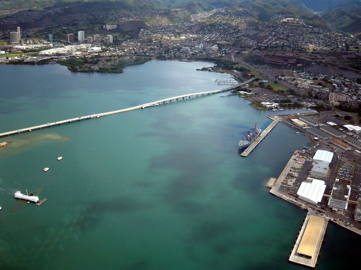
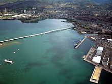 Part of Pearl Harbor, with Aloha Stadium, the USS Arizona, USS Bowfin (submarine), museums, Admiral Clarey Bridge, and naval yards visible.
The aboriginal culture of Hawaii is Polynesian. Hawaii represents the northernmost extension of the vast Polynesian triangle of the south and central Pacific Ocean. While traditional Hawaiian culture remains only as vestiges in modern Hawaiian society, there are reenactments of the ceremonies and traditions throughout the islands. Some of these cultural influences are strong enough to affect the United States at large, including the popularity (in greatly modified form) of luaus and hula.
Hawaii is home to numerous cultural events. The annual Merrie Monarch Festival is an international Hula competition.[81] The state is also home to the Hawaii International Film Festival, the premier film festival for pacific rim cinema.[82] Honolulu is also home to the state's long running GLBT film festival, the Rainbow Film Festival.[83][84]
Health
Main article: Hawaii Prepaid Health Care ActHawaii's health care system insures 92% (2009) of residents. Under the state's plan, businesses are required to provide insurance to employees who work more than twenty hours per week. Heavy regulation of insurance companies helps keep the cost to employers down. Due in part to heavy emphasis on preventive care, Hawaiians require hospital treatment less frequently than the rest of the United States, while total health care expenses (measured as a percentage of state GDP) are substantially lower. Given these achievements, proponents of universal health care elsewhere in the U.S. sometimes use Hawaii as a model for proposed federal and state health care plans.
Education
Public schools
Hawaii has the U.S.' only school system that is unified statewide. Policy decisions are made by the fourteen-member state Board of Education. The Board sets policy and hires the superintendent of schools, who oversees the state Department of Education. The Department of Education is divided into seven districts, four on Oʻahu and one for each of the three other counties.
The main rationale for centralization is to combat inequalities between highly populated Oʻahu and the more rural Neighbor Islands, and between lower-income and more affluent areas. In most of the United States, schools are funded from local property taxes.
Educators struggle with children of non-native-English-speaking immigrants, whose cultures are different from those of the mainland (where most course materials and testing standards originate).
Public elementary, middle, and high school test scores in Hawaii are below national averages on tests mandated under the No Child Left Behind Act. Some of the gap has been attributed to the Hawaii Board of Education's requirement that all eligible students take these tests and report all student test scores (other states, Texas and Michigan for example, do not). Results reported in August, 2005, indicate that of 282 schools across the state, 185 (2/3) failed to reach federal minimum performance standards in math and reading.[85]
On the other hand, the ACT college placement tests show that in 2005, seniors scored slightly above the national average (21.9 compared with 20.9).[86] In the widely accepted SAT examinations, Hawaii's college-bound seniors tend to score below the national average in all categories except mathematics.
Other schools
Hawaii educates more students in independent institutions of secondary education than any other state in the United States.[dubious ] It has four of the largest independent schools: ʻIolani School, Kamehameha Schools, Mid-Pacific Institute, and Punahou School. The second Buddhist high school in the United States, and first Buddhist high school in Hawaii, Pacific Buddhist Academy, was founded in 2003. The first native controlled public charter school was the Kanu O Ka Aina New Century Charter School.
Independent and charter schools can select their students, while the regular public schools must take all students in their district. The Kamehameha Schools are the only schools in the United States that openly grant admission to students based on ancestry, and the wealthiest schools in the United States, if not the world, having over nine billion US dollars in estate assets. In 2005, Kamehameha enrolled 5,398 students, 8.4% of the Native Hawaiian children in the state.[87]
See also: List of elementary schools in Hawaii, List of middle schools in Hawaii, and List of high schools in HawaiiColleges and universities
Graduates of secondary schools in Hawaii often enter directly into the work force. Some attend colleges and universities on the mainland or other countries, and the rest attend an institution of higher learning in Hawaii.
The largest is the University of Hawaii System. It consists of: the research university at Mānoa; two comprehensive campuses Hilo and West Oʻahu; and seven Community Colleges. Private universities include Brigham Young University–Hawaii, Chaminade University of Honolulu, Hawaii Pacific University, Wayland Baptist University, or University of the Nations. The Saint Stephen Diocesan Center is a seminary of the Roman Catholic Diocese of Honolulu.
Law and government

The state government of Hawaii is modeled after the federal government with adaptations originating from the kingdom era of Hawaiian history. As codified in the Constitution of Hawaii, there are three branches of government: executive, legislative and judicial.
The executive branch is led by the Governor of Hawaii assisted by the Lieutenant Governor of Hawaii, both elected on the same ticket. The governor is the only state public official elected statewide; all others are appointed by the governor. The lieutenant governor acts as the Secretary of State. The governor and lieutenant governor oversee twenty agencies and departments from offices in the State Capitol. The official residence of the governor is Washington Place.
The legislative branch consists of the bicameral Hawaii State Legislature, which is composed of the 51-member Hawaii House of Representatives led by the Speaker of the House and the 25-member Hawaii Senate led by the President of the Senate. The Legislature meets at the State Capitol.
The unified judicial branch of Hawaii is the Hawai'i State Judiciary. The state's highest court is the Supreme Court of Hawaii, which uses Aliʻiōlani Hale as its chambers.
Unique to Hawaii is the lack of municipal governments. All local governments are administered at the county level. The only incorporated area in the state is a consolidated city–county, Honolulu County, which governs the entire island of Oahu. County executives are the referred to as mayors: The mayor of Hawaii County, mayor of Honolulu, mayor of Kauaʻi and mayor of Maui. The mayors are all elected in nonpartisan races.
Federal government
Hawaii is represented in the United States Congress by two Senators and two Representatives. All four are Democrats.
Colleen Hanabusa represents the 1st congressional district in the House, representing southeastern Oahu, including central Honolulu. Mazie Hirono represents the 2nd congressional district, representing the rest of the state, which is mainly rural.
Daniel Inouye is the senior senator, having served since January 3, 1963. In June 2010, Inouye became the longest-serving current Senator; he is the current President pro tempore of the United States Senate, a position traditionally given to the longest-serving Senator of the majority party. Daniel Akaka is the junior Senator, having served since May 16, 1990. Inouye and Akaka were both born in 1924, making them the oldest current Senate duo.
Federal officials in Hawaii are based at the Prince Kūhiō Federal Building near the Aloha Tower and Honolulu Harbor in Honolulu. The Federal Bureau of Investigation, Internal Revenue Service and the Secret Service maintain their offices there, and the building is the also the site of federal District Court for the District of Hawaii and the United States Attorney for the District of Hawaii.
National politics
Presidential elections results Year Republican Democratic 2008 26.58% 120,446 71.85% 325,588 2004 45.26% 194,191 54.01% 231,708 2000 37.46% 137,845 55.79% 205,286 1996 31.64% 113,943 56.93% 205,012 1992 36.70% 136,822 48.09% 179,310 1988 44.75% 158,625 54.27% 192,364 1984 55.10% 185,050 43.82% 147,154 1980 42.90% 130,112 44.80% 135,879 1976 48.06% 140,003 50.59% 147,375 1972 62.48% 168,865 37.52% 101,409 1968 38.70% 91,425 59.83% 141,324 1964 21.24% 44,022 78.76% 163,249 1960 49.97% 92,295 50.03% 92,410 Hawaii supported Democrats in 10 of the last 12 presidential elections. The exceptions were 1972 and 1984. In 2004, John Kerry won the state's four electoral votes by a margin of nine percentage points with 54% of the vote. Every county supported the Democratic candidate. In 1964, favorite son candidate Senator Hiram Fong of Hawaii sought the Republican presidential nomination, while Patsy Mink ran in the Oregon primary in 1972.
Honolulu native, the 44th United States President Barack Obama, then serving as United States Senator from Illinois, was elected President of the United States on November 4, 2008. Obama had won the Hawaiian Democratic Caucus on February 19, 2008 with 76% of the vote. He was the third Hawaii-born candidate to seek the nomination of a major party and the first presidential nominee from Hawaii.[88][89]
Transportation
A system of state highways encircles each main island. Only Oʻahu has federal highways, and is the only area outside the contiguous 48 states to have signed Interstate highways. Travel can be slow due to narrow winding roads, and congestion in cities. Each major island has a public bus system.
Commercial airlines provide most mainland and inter-island travel. Hawaiian Airlines, Mokulele Airlines, and go! use jets between the larger airports in Honolulu, Līhuʻe, Kahului, Kona, and Hilo, while Island Air and Pacific Wings serve smaller airports. These airlines also provide air freight service between the islands.
Private steamships and ferries were the sole way of traveling between the islands from the 19th century until the 1950s.[citation needed] Seaflite operated hydrofoils between the major islands in the mid-1970s.[90] The Hawaii Superferry operated between Oʻahu and Maui between December 2007 and March 2009, with additional routes planned for other islands. Legal issues over environmental impact statements and protests ended the service, though the company operating Superferry has expressed a wish to begin ferry service again at a future date.[91] Currently there is passenger ferry service in Maui County between Moloka'i and Maui, and between Lana'i and Maui, though neither of these takes vehicles. Norwegian Cruise Lines also provides passenger cruise ship service between the islands.[citation needed]
At one time, Hawaii had a network of railroads on each of the larger islands that helped move farm commodities as well as passengers. These railroads were all narrow gauge (3 ft (914 mm) gauge for the majority although there were some 2 ft 6 in (762 mm) gauge on some of the smaller islands – standard US gauge is 4 ft 8 1⁄2 in (1,435 mm)). The largest by far was the Oahu Railway and Land Company (OR&L) which ran multiple lines from Honolulu across the western and northern part of Oahu. The OR&L was an important player moving troops and goods during World War II. Traffic on this line was busy enough that there were signals on the lines facilitating movement of trains and wigwag signals at some railroad crossings for the protection of motorists. The mainline was officially abandoned in 1947, although part of it was bought by the US Navy and operated until 1970. Thirteen miles (21 km) of track remain and preservationists occasionally run trains over a portion of this line.[92]
Sister cities and twin towns
See also: List of sister cities in HawaiiSee also
- Outline of Hawaii
- Index of Hawaii-related articles
- List of people from Hawaii
- List of places in Hawaii
- National Register of Historic Places listings in Hawaii
References
- ^ Local usage generally reserves Hawaiian as an ethnonym referring to Native Hawaiians. Hawaii resident or islander is the preferred local form to refer to state residents in general regardless of ethnicity. The Associated Press Stylebook, 42nd ed. (2007), also prescribes this usage (p. 112).
- ^ "Annual Estimates of the Resident Population for the United States, Regions, States, and Puerto Rico: April 1, 2000 to July 1, 2008". United States Census Bureau. http://www.census.gov/popest/states/tables/NST-EST2008-01.csv. Retrieved February 6, 2009.
- ^ "Summit USGS 1977". NGS data sheet. U.S. National Geodetic Survey. http://www.ngs.noaa.gov/cgi-bin/ds_mark.prl?PidBox=TU2314. Retrieved October 20, 2011.
- ^ a b "Elevations and Distances in the United States". United States Geological Survey. 2001. http://egsc.usgs.gov/isb/pubs/booklets/elvadist/elvadist.html. Retrieved October 21, 2011.
- ^ Elevation adjusted to North American Vertical Datum of 1988.
- ^ The summit of Mauna Kea is the highest point in Oceania. Mauna Kea is also the tallest mountain on Earth as measured from base to summit. The shield volcano sits on the floor of the Pacific Ocean at a depth of 5,998 meters (19,678 ft) for a total height of 10,205.3 meters (33,482 ft)
- ^ Pollex—a reconstruction of the Proto-Polynesian lexicon, Biggs and Clark, 1994. The asterisk preceding the word signifies that it is a reconstructed word form.
- ^ Pukui and Elbert 1986, p. 62.
- ^ Pukui, Elbert, and Mookini 1974.
- ^ U.S. Geological Survey Geographic Names Information System: Island of Hawaiʻi
- ^ U.S. Geological Survey Geographic Names Information System: Kauaʻi Island
- ^ U.S. Geological Survey Geographic Names Information System: Kahoʻolawe Island
- ^ U.S. Geological Survey Geographic Names Information System: Lānaʻi Island
- ^ U.S. Geological Survey Geographic Names Information System: Maui Island
- ^ U.S. Geological Survey Geographic Names Information System: Molokaʻi Island
- ^ U.S. Geological Survey Geographic Names Information System: Niʻihau Island
- ^ U.S. Geological Survey Geographic Names Information System: Oʻahu Island
- ^ "Hawaiian Islands : Image of the Day". Earthobservatory.nasa.gov. http://earthobservatory.nasa.gov/IOTD/view.php?id=3510. Retrieved November 5, 2010.
- ^ "What constitutes the United States, what are the official definitions?". United States Geological Survey. Archived from the original on October 21, 2004. http://web.archive.org/web/20041021120319/http://interactive2.er.usgs.gov/faq/list_faq_by_category/get_answer.asp?id=795. Retrieved July 3, 2007.
- ^ "Mauna Kea Volcano, Hawaii". Hvo.wr.usgs.gov. http://hvo.wr.usgs.gov/volcanoes/maunakea/. Retrieved 2011-11-05.
- ^ Unke, Beata (2001). "Height of the Tallest Mountain on Earth". The Physics Factbook. http://hypertextbook.com/facts/2001/BeataUnke.shtml.
- ^ Rubin, Ken. "General Information about Hawaiian Shield Volcanoes". http://www.soest.hawaii.edu/GG/HCV/haw_volc.html. Retrieved December 2009.
- ^ "Youngest lava flows on East Maui probably older than A.D. 1790". United States Geological Survey. September 9, 1999. http://hvo.wr.usgs.gov/volcanowatch/1999/99_09_09.html. Retrieved October 4, 1999.
- ^ "Living on Active Volcanoes—The Island of Hawaii, U.S. Geological Survey Fact Sheet 074-97". Pubs.usgs.gov. http://pubs.usgs.gov/fs/fs074-97/. Retrieved 2011-11-05.
- ^ Human Footprints in Relation to the 1790 Eruption of Kīlauea, Swanson, D. A.; Rausch, J., American Geophysical Union.
- ^ "Largest islands of the world". Worldatlas.com. http://www.worldatlas.com/aatlas/infopage/islands.htm. Retrieved April 16, 2011.
- ^ Pacific Tsunami Warning Center (November 12, 2009). "Tsunami Safety & Preparedness in Hawai`i". http://www.prh.noaa.gov/ptwc/hawaii.php. Retrieved November 12, 2009.
- ^ Howard Youth. "Hawaii's Forest Birds Sing the Blues". http://nationalzoo.si.edu/Publications/ZooGoer/1995/1/hawaiisforestbirds.cfm. Retrieved October 31, 2008.
- ^ "Hawaii". National Park Service. http://www.nps.gov/state/HI. Retrieved July 15, 2008.
- ^ Joshua Reichert and Theodore Roosevelt IV. "Treasure Islands". http://www.pewtrusts.org/ideas/ideas_item.cfm?content_item_id=3417&content_type_id=15&page=15&issue=16&issue_name=Protecting%20ocean%20life&name=Op-eds%20(Pew). Retrieved June 15, 2006.
- ^ "Climate of Hawaii". Prh.noaa.gov. http://www.prh.noaa.gov/hnl/pages/climate_summary.php. Retrieved 2011-11-05.
- ^ "Hawaii Weather|Hawaii Weather Forecast|Hawaii Climate". Weatherbyday.com. http://www.weatherbyday.com/hawaii/. Retrieved 2011-11-05.
- ^ "United States Code: Title 20,7512. Findings | LII / Legal Information Institute". Law.cornell.edu. http://www.law.cornell.edu/uscode/html/uscode20/usc_sec_20_00007512----000-.html. Retrieved 2011-11-05.
- ^ "Hawaii State Government". Netstate.com. http://www.netstate.com/states/government/hi_government.htm. Retrieved 2011-11-05.
- ^ The Evolution of the Polynesian Chiefdoms. Cambridge University Press. 1989. pp. 77–79. ISBN 0521273161.
- ^ Kuykendall, "The Hawaiian Kingdom Volume I: Foundation and Transformation", p18 "Cook's plan was to get the king on board the Resolution and keep him there until the stolen boat was returned—a plan that had been effective under similar circumstances in the south Pacific".
- ^ "Hawaii (state, United States)". Britannica.com. http://www.britannica.com/EBchecked/topic/257332/Hawaii. Retrieved 2011-11-05.
- ^ Migration and Disease. Digital History.
- ^ a b Russ, William Adam (1992). The Hawaiian Revolution (1893–94). Associated University Presses. p. 350. ISBN 0945636431.
- ^ Kuykendall, R.S. (1967) The Hawaiian Kingdom, 1874–1893. Honolulu: University of Hawaii Press. p. 648.
- ^ Kinzer, Stephen (2006). Overthrow: America's Century of Regime Change From Hawaii to Iraq. Times Books. ISBN 0805078614.
- ^ "Limbaugh repeated false claim that U.S. was "strictly neutral" in overthrow of Hawaiian queen". Media Matters. http://mediamatters.org/items/200508220002.
- ^ a b Hawaii Divided Against Itself Cannot Stand[dead link] by Bruce Fein
- ^ "1897 Hawaii Annexation Treaty". The Morgan Report. http://morganreport.org/mediawiki/index.php?title=1897_Annexation_Treaty. Retrieved August 14, 2010.
- ^ "Human Rights differs from Equal Rights". Moolelo.com. 2005-01-21. http://www.moolelo.com/human-rights.html. Retrieved 2011-11-05.
- ^ "Support For The Hawaiian Sovereignty Elections Council". Hawaii-nation.org. http://hawaii-nation.org/pleb.html. Retrieved 2011-11-05.
- ^ Hawaii Reporter: Hawaii Reporter[dead link]
- ^ "Resident Population Data – 2010 Census". 2010.census.gov. http://2010.census.gov/2010census/data/apportionment-pop-text.php. Retrieved April 16, 2011.
- ^ "Population and Population Centers by State – 2000". United States Census Bureau. http://www.census.gov/geo/www/cenpop/statecenters.txt. Retrieved December 4, 2008.
- ^ "New Jersey Quickfacts". Quickfacts.census.gov. http://quickfacts.census.gov/qfd/states/34000.html. Retrieved 2011-11-05.
- ^ "Hawaii Quickfacts". Quickfacts.census.gov. http://quickfacts.census.gov/qfd/states/15000.html. Retrieved 2011-11-05.
- ^ Top 12 states in population density[dead link]
- ^ "Average life expectancy at birth by state". http://www.census.gov/population/projections/MethTab2.xls. Retrieved 2011-11-05.
- ^ http://factfinder2.census.gov/faces/tableservices/jsf/pages/productview.xhtml?pid=DEC_10_DP_DPDP1&prodType=table
- ^ American FactFinder, United States Census Bureau. "Hawaii – Selected Social Characteristics in the United States: 2008". Factfinder.census.gov. http://factfinder.census.gov/servlet/ADPTable?_bm=y&-geo_id=04000US15&-qr_name=ACS_2008_1YR_G00_DP2&-context=adp&-ds_name=&-tree_id=308&-_lang=en&-redoLog=true&-format=. Retrieved May 15, 2010.
- ^ a b c American FactFinder, United States Census Bureau. "Hawaii – ACS Demographic and Housing Estimates: 2008". Factfinder.census.gov. http://factfinder.census.gov/servlet/ADPTable?_bm=y&-context=adp&-qr_name=ACS_2008_1YR_G00_DP5&-ds_name=ACS_2008_1YR_G00_&-tree_id=308&-redoLog=true&-_caller=geoselect&-geo_id=04000US15&-format=&-_lang=en. Retrieved May 15, 2010.
- ^ a b "Language Map Data Center". Mla.org. 2007-07-17. http://www.mla.org/map_data_results&state_id=15&mode=state_tops. Retrieved 2011-11-05.
- ^ Lyovin, Anatole V. (1997). An Introduction to the Languages of the World, p. 258. New York: Oxford University Press, Inc. ISBN 0-19-508116-1.
- ^ U.S. Census (2005). "U.S. Census Press Releases". http://www.census.gov/Press-Release/www/releases/archives/facts_for_features_special_editions/004522.html.[dead link]. Public Information Offce
- ^ Lyovin (1997:257–258)
- ^ Schütz (1994:334–336; 338 20n)
- ^ Elbert & Pukui (1979:35–36)
- ^ Kimura & Wilson (1983:185)
- ^ "Hawaiian language". Wow Polynesia. December 2, 2009. http://www.wowpolynesia.com/hawaiian-language/. Retrieved April 16, 2011.
- ^ "Ocean City – Somers Point – North Wildwood – Wildwood – Wildwood Crest Real Estate for Sale". Joezarroli.com. August 17, 2005. http://joezarroli.com/agent/additionalpage_p.php?username=zarroliprops&pageno=7. Retrieved April 16, 2011.
- ^ "State Membership Reports". thearda.com. http://www.thearda.com/mapsReports/reports/state/15_2000.asp. Retrieved June 15, 2010.
- ^ "LDS Newsroom Statistical Information". Newsroom.lds.org. Archived from the original on July 30, 2008. http://web.archive.org/web/20080730060850/http://newsroom.lds.org/ldsnewsroom/eng/statistical-information. Retrieved May 15, 2010.
- ^ "State of Hawaii Data Book 2000, Section 1 Population, Table 1.47". Hawaii.gov. http://www.hawaii.gov/dbedt/info/economic/databook/db2000. Retrieved 2011-11-05.
- ^ Glenmary Research Center[dead link]
- ^ "Survey shows partial picture". The Honolulu Advertiser. 2002-09-21. http://the.honoluluadvertiser.com/article/2002/Sep/21/il/il11afaith.html. Retrieved 2011-11-05.
- ^ "Religious Identity: States Differ Widely". Gallup.com. http://www.gallup.com/poll/122075/Religious-Identity-States-Differ-Widely.aspx#2. Retrieved 2011-11-05.
- ^ "Hawaii sandalwood trade". Hawaiihistory.org. http://www.hawaiihistory.org/index.cfm?fuseaction=ig.page&PageID=274. Retrieved 2011-11-05.
- ^ "Whaling in Hawaii". Hawaiihistory.org. 1999-06-16. http://www.hawaiihistory.org/index.cfm?fuseaction=ig.page&PageID=287. Retrieved 2011-11-05.
- ^ "Honolulu Star-Bulletin Hawaii News". Starbulletin.com. 2006-11-30. http://starbulletin.com/2004/05/21/news/story1.html. Retrieved 2011-11-05.
- ^ Bls.gov; Local Area Unemployment Statistics
- ^ Associated Press, "Study: Military spent $12B in Hawaii in 2009", Military Times, June 1, 2011.
- ^ Cost of Living Wizard on The New York Times website
- ^ FreeShipping.org for examples of stores that ship free to Hawaii
- ^ Historic Housing Values on www.census.gov
- ^ "Metropolitan Median Prices". Realtor.org. 2005-02-15. http://www.realtor.org/research/research/metroprice. Retrieved 2011-11-05.
- ^ "Merrie Monarch Festival 2005". The Honolulu Advertiser. http://the.honoluluadvertiser.com/current/il/merriemonarch05. Retrieved May 15, 2010.
- ^ [1][dead link]
- ^ USA. "19th Annual Honolulu Rainbow Film Festival at Doris Duke Theatre :: Honolulu Hawaii Nightlife Event Guide". Hnlnow.com. http://www.hnlnow.com/events/index.php?com=detail&eID=10075&year=2008&month=5. Retrieved May 15, 2010.
- ^ "Honolulu Star-Bulletin Features". Archives.starbulletin.com. 2001-05-29. http://archives.starbulletin.com/2001/05/29/features/index.html. Retrieved 2011-11-05.
- ^ POSTED: 5:58 pm HST August 18, 2005 (August 18, 2005). "Two-Thirds Of Hawaii Schools Do Not Meet Requirements – Education News Story – KITV Honolulu". Thehawaiichannel.com. http://www.thehawaiichannel.com/education/4870699/detail.html. Retrieved May 15, 2010.
- ^ Honolulu Advertiser, August 17, 2005, p. B1
- ^ Ishibasha, Koren (November 2005). "Official Enrollment". Archived from the original on February 25, 2010. http://www.webcitation.org/5noCEgxNn. Retrieved December 2009.
- ^ Rudin, Ken (December 23, 2009). "NPR's ''Political Junkie'', 23 December 2009, accessed 30 December 2009". Npr.org. http://www.npr.org/blogs/politicaljunkie/2009/12/todays_junkie_segment_on_totn_5.html. Retrieved May 15, 2010.
- ^ Heard on Tell Me More (October 29, 2008). "Asian Writer Ponders First Asian President Too". Npr.org. http://www.npr.org/templates/transcript/transcript.php?storyId=96126355. Retrieved May 15, 2010.
- ^ Cataluna, Lee (December 23, 2005). "Nothing Smooth On Seaflite". The Honolulu Advertiser. http://the.honoluluadvertiser.com/article/2005/Dec/23/ln/FP512230359.html.
- ^ "Aloha, Superferry Alakai leaves Hawaii to find job". Honolulu Star-Bulletin. March 29, 2009. http://www.starbulletin.com/news/20090329_Aloha_Superferry.html.[dead link]
- ^ Hawaiian Railway Album – WW II Photographs Vol 2; Victor Norton Jr. and Gale E. Treiber; 2005; Railroad Press – Hanover, PA
Further reading
- The Constitution of the State of Hawaii. Article XV.
- Bushnell, O. A. 1993. The Gifts of Civilization: Germs and Genocide in Hawaii. ISBN 0824814576. Honolulu: University of Hawaii Press
- Kinzer, Stephen 2007, Overthrow: America's Century of Regime Change from Hawaii to Iraq. ISBN 0805082409. Times Books
- Lyovin, Anatole V. (1997). An Introduction to the Languages of the World. New York: Oxford University Press, Inc. ISBN 0-19-508116-1.
- Pukui, Mary Kawena; Samuel H. Elbert (1986). Hawaiian Dictionary. Honolulu: University of Hawaii Press. ISBN 0-8248-0703-0.
- Schamel, Wynell and Charles E. Schamel. "The 1897 Petition Against the Annexation of Hawaii." Social Education 63, 7 (November/December 1999): 402–408.
- Stokes, John F.G. 1932. "Spaniard and the Sweet Potato in Hawaii and Hawaiian-American Contacts." American Anthropologist, New Series, v, 34, n, 4, pp. 594–600.
External links
- Official website
- Hawaii at the Open Directory Project
- Hawaii travel guide from Wikitravel
- Hawaii State Fact Sheet from the U.S. Department of Agriculture
- USGS real-time, geographic, and other scientific resources of Hawaii
- Energy Data & Statistics for Hawaii
- Satellite image of Hawaiian Islands at NASA's Earth Observatory
- Documents relating to Hawaiian Statehood, Dwight D. Eisenhower President Library
- Happily a State, Forever an Island by The New York Times
- Hawaii Then and Now – slideshow by Life magazine
 OpenStreetMap has geographic data related to Hawaii
Preceded by
AlaskaList of U.S. states by date of statehood
Admitted on August 21, 1959 (50th)Most recent 
 Russia
 Japan • Pacific Ocean
 Alaska
Pacific OceanPacific Ocean •  California
 PRC • Pacific Ocean
Pacific Ocean •  Mexico
 Hawaii

Pacific Ocean
 Australia
Pacific Ocean Pacific Ocean United States (Outline) History Pre-Columbian era · Colonial era (Thirteen Colonies · Colonial American military history) · American Revolution (War) · Federalist Era · War of 1812 · Territorial acquisitions · Territorial evolution · Mexican–American War · Civil War · Reconstruction era · Indian Wars · Gilded Age · African-American Civil Rights Movement (1896–1954) · Spanish–American War · Imperialism · World War I · Roaring Twenties · Great Depression · World War II (Home front) · Cold War · Korean War · Space Race · African-American Civil Rights Movement (1955–1968) · Feminist Movement · Vietnam War · Post-Cold War (1991–present) · War on Terror (War in Afghanistan · Iraq War) · Timeline of modern American conservatismTopicsDemographic · Discoveries · Economic (Debt Ceiling) · Inventions (before 1890 · 1890–1945 · 1946–1991 · after 1991) · Military · Postal · Technological and industrialFederal
governmentLegislature - Congress
Senate
· Vice President
· President pro tem
House of Representatives
· Speaker
Judiciary - Supreme Court
Federal courts
Courts of appeal
District courtsExecutive - President
Executive Office
Cabinet / Executive departments
Civil service
Independent agencies
Law enforcement
Public policy
Intelligence
Central Intelligence Agency
Defense Intelligence Agency
National Security Agency
Federal Bureau of InvestigationPolitics Divisions · Elections (Electoral College) · Foreign policy · Foreign relations · Ideologies · Local governments · Parties (Democratic Party · Republican Party · Third parties) · Political status of Puerto Rico · Red states and blue states · Scandals · State governments · Uncle SamGeography Cities, towns, and villages · Counties · Extreme points · Islands · Mountains (Peaks · Appalachian · Rocky) · National Park System · Regions (Great Plains · Mid-Atlantic · Midwestern · New England · Northwestern · Southern · Southwestern · Pacific · Western) · Rivers (Colorado · Columbia · Mississippi · Missouri · Ohio · Rio Grande) · States · Territory · Water supply and sanitationEconomy Agriculture · Banking · Communications · Companies · Dollar · Energy · Federal Budget · Federal Reserve System · Financial position · Insurance · Mining · Public debt · Taxation · Tourism · Trade · Transportation · Wall StreetSociety TopicsCrime · Demographics · Education · Family structure · Health care · Health insurance · Incarceration · Languages (American English · Spanish · French) · Media · People · Public holidays · Religion · SportsArchitecture · Art · Cinema · Cuisine · Dance · Fashion · Flag · Folklore · Literature · Music · Philosophy · Radio · Television · TheaterIssues Book ·
  Category ·
  Portal ·
  WikiProjectCategories:
- Hawaii
- States and territories established in 1959
- States of the United States


Wikimedia Foundation. 2010.