- Howland Island
-
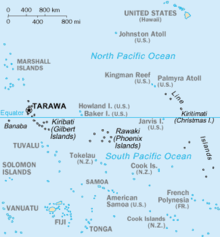
 Howland IslandLocation of Howland Island in the Pacific Ocean
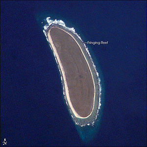 Howland Island seen from space
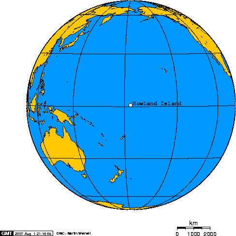
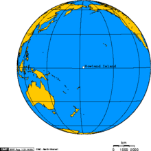 Orthographic projection centered over Howland Island
Howland Island (
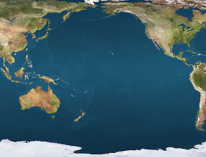
 /ˈhaʊlənd/) is an uninhabited coral island located just north of the equator in the central Pacific Ocean, about 1,700 nautical miles (3,100 km) southwest of Honolulu. The island lies almost halfway between Hawaii and Australia and is an unincorporated, unorganized territory of the United States. Geographically, it is part of the Phoenix Islands. For statistical purposes, Howland is grouped as one of the United States Minor Outlying Islands.
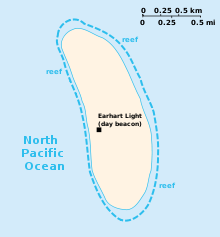
Howland is located at 0°48′07″N 176°38′3″W / 0.80194°N 176.63417°WCoordinates: 0°48′07″N 176°38′3″W / 0.80194°N 176.63417°W.[1] It covers 450 acres (1.8 km2), with 4 miles (6.4 km) of coastline. The island has an elongated shape on a north-south axis. There is no lagoon.
Howland Island National Wildlife Refuge consists of the 455 acres (1.84 km2) island and the surrounding 32,074 acres (129.80 km2) of submerged land. The island is managed by the U.S. Fish and Wildlife Service as an insular area under the U.S. Department of the Interior and is part of the Pacific Remote Islands Marine National Monument.
The atoll has no economic activity. It is perhaps best known as the island Amelia Earhart never reached. Airstrips built in the late 1930s to accommodate her planned stopover were never used, subsequently damaged, not maintained and gradually disappeared. There are no harbors or docks. The reefs may pose a hazard. There is one boat landing area along the middle of the sandy beach on the west coast together with a crumbling day beacon. The island is visited every two years by the U.S. Fish and Wildlife Service.[2]
Contents
Flora and fauna
 Map of Howland Island
The climate is equatorial, with little rainfall and a burning sun. Temperatures are moderated somewhat by a constant wind from the east. The terrain is low-lying and sandy: a coral island surrounded by a narrow fringing reef with a slightly raised central area. The highest point is about six meters above sea level.
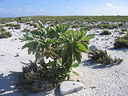
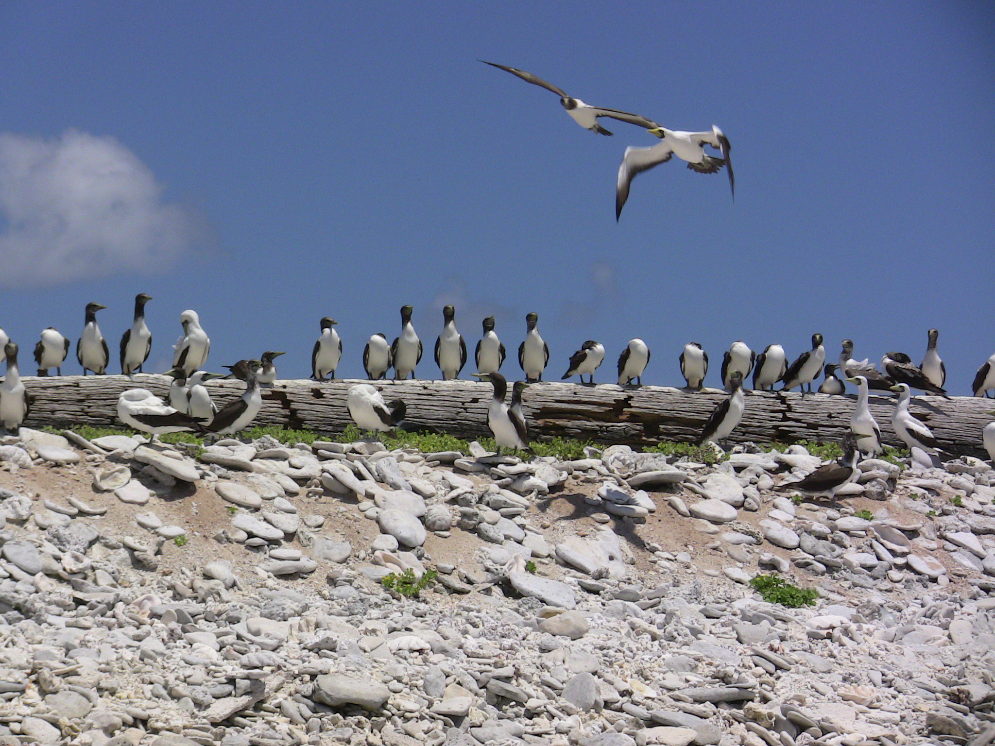
There are no natural fresh water resources.[3] The landscape features scattered grasses along with prostrate vines and low-growing pisonia trees and shrubs. A 1942 eyewitness description spoke of "a low grove of dead and decaying kou trees" on a very shallow hill at the island's center, but 58 years later (2000) a visitor accompanying a scientific expedition reported seeing "a flat bulldozed plain of coral sand, without a single tree" and some traces of building ruins.[4] Howland is primarily a nesting, roosting and foraging habitat for seabirds, shorebirds and marine wildlife.
The U.S. claims an Exclusive Economic Zone of 200 nautical miles (370 km) and a territorial sea of 12 nautical miles (22 km) around the island.
Since Howland Island is uninhabited, no time zone is specified. It lies within a nautical time zone which is 12 hours behind UTC.
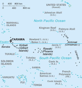
 Map of the central Pacific Ocean showing Howland Island and nearby Baker Island just north of the Equator and east of Tarawa.
History
Prehistoric settlement
Sparse remnants of trails and other artifacts indicate a sporadic early Polynesian presence. A canoe, a blue bead, pieces of bamboo, and other relics of early settlers have been found.[N 1] The island's prehistoric settlement may have begun about 1000 BC when eastern Melanesians traveled north[6] and may have extended down to Rawaki, Kanton, Manra and Orona of the Phoenix Islands, 500 to 700 km southeast. K.P. Emery, an ethnologist for Honolulu's Bernice P. Bishop Museum, indicated that settlers on Manra Island were apparently of two distinct groups, one Polynesian and the other Micronesian,[7] hence the same might have been true on Howland Island, though no proof of this has been forthcoming.
The difficult life on these isolated islands along with unreliable fresh water supplies may have led to the dereliction or extinction of the settlements, much the same as other islands in the area (such as Kiritimati and Pitcairn) were abandoned.[8]
Sightings by whalers
Captain George B. Worth of the Nantucket whaler Oeno sighted Howland around 1822 and called it "Worth Island".[9][10] Daniel MacKenzie of the American whaler Minerva Smith was unaware of Worth's sighting when he charted the island in 1828 and named it after his ship's owners[11] on 1 December 1828. Howland Island was at last named after a lookout who sighted it from the whaleship Isabella of New Bedford on 9 September 1842.
U.S. possession and guano mining
Howland Island was uninhabited when the United States took possession of it in 1857 under the Guano Islands Act of 1856. The island was a known navigation hazard for many decades and several ships were wrecked there. Its guano deposits were mined by American companies until October 1878. John T. Arundel and Company, a British firm using laborers from the Cook Islands and Niue, occupied the island from 1886 to 1891.[12]
In the late 19th Century there were British claims on the island, as well as attempts at setting up mining. To clarify American sovereignty, Executive Order 7358 was issued on 13 May 1936.[13]
Itascatown (1935–1942)
In 1935 a brief attempt at colonization was made, part of a larger project administered by the Department of Commerce to establish a permanent U.S. presence on the equatorial Line Islands. It began with a rotating group of four alumni and students from the Kamehameha School for Boys, a private school in Honolulu. Although the recruits had signed on as part of a scientific expedition and expected to spend their three month assignment collecting botanical and biological samples, once out to sea they were told, "Your names will go down in history" and that the islands would become "famous air bases in a route that will connect Australia with California".
The settlement was named Itascatown after the USCGC Itasca that brought the colonists to Howland and made regular cruises between the other Line Islands during that era. Itascatown was a line of a half-dozen small wood-framed structures and tents near the beach on the island's western side. The fledgling colonists were given large stocks of canned food, water, and other supplies including a gasoline powered refrigerator, radio equipment, complete medical kits and (characteristic of that era) vast quantities of cigarettes. Fishing provided much-needed variety for their diet. Most of the colonists' endeavors involved making hourly weather observations and gradually developing a rudimentary infrastructure on the island, including the clearing of a landing strip for airplanes. During this period the island was on Hawaii time, which was then 10.5 hours behind UTC.[N 2] Similar colonization projects were started on nearby Baker Island, Jarvis Island and two other islands.
Kamakaiwi Field
Ground for a rudimentary aircraft landing area was cleared during the mid-1930s, in anticipation that the island might eventually be used as a stopover for a commercial trans-Pacific air route and also to further U.S. territorial claims in the region against rival claims from Great Britain. In keeping with its intended aviation role, Howland Island became a scheduled refueling stop for American pilot Amelia Earhart and navigator Fred Noonan on their round-the-world flight in 1937. WPA funds were used by the Bureau of Air Commerce to construct three graded, unpaved runways meant to accommodate Earhart's modern twin-engined Lockheed Model 10 Electra.
The facility was named Kamakaiwi Field after James Kamakaiwi, a young Hawaiian who had arrived with the first group of four colonists, was subsequently picked as leader and spent a total of over three years on Howland, far longer than the average recruit. It has also been referred to as WPA Howland Airport (the WPA contributed about 20% of the $12,000 cost). Earhart and Noonan took off from Lae, New Guinea and their radio transmissions were picked up on the island when their aircraft reached the vicinity but they were never seen again.
Japanese attacks during World War II
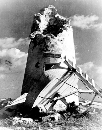
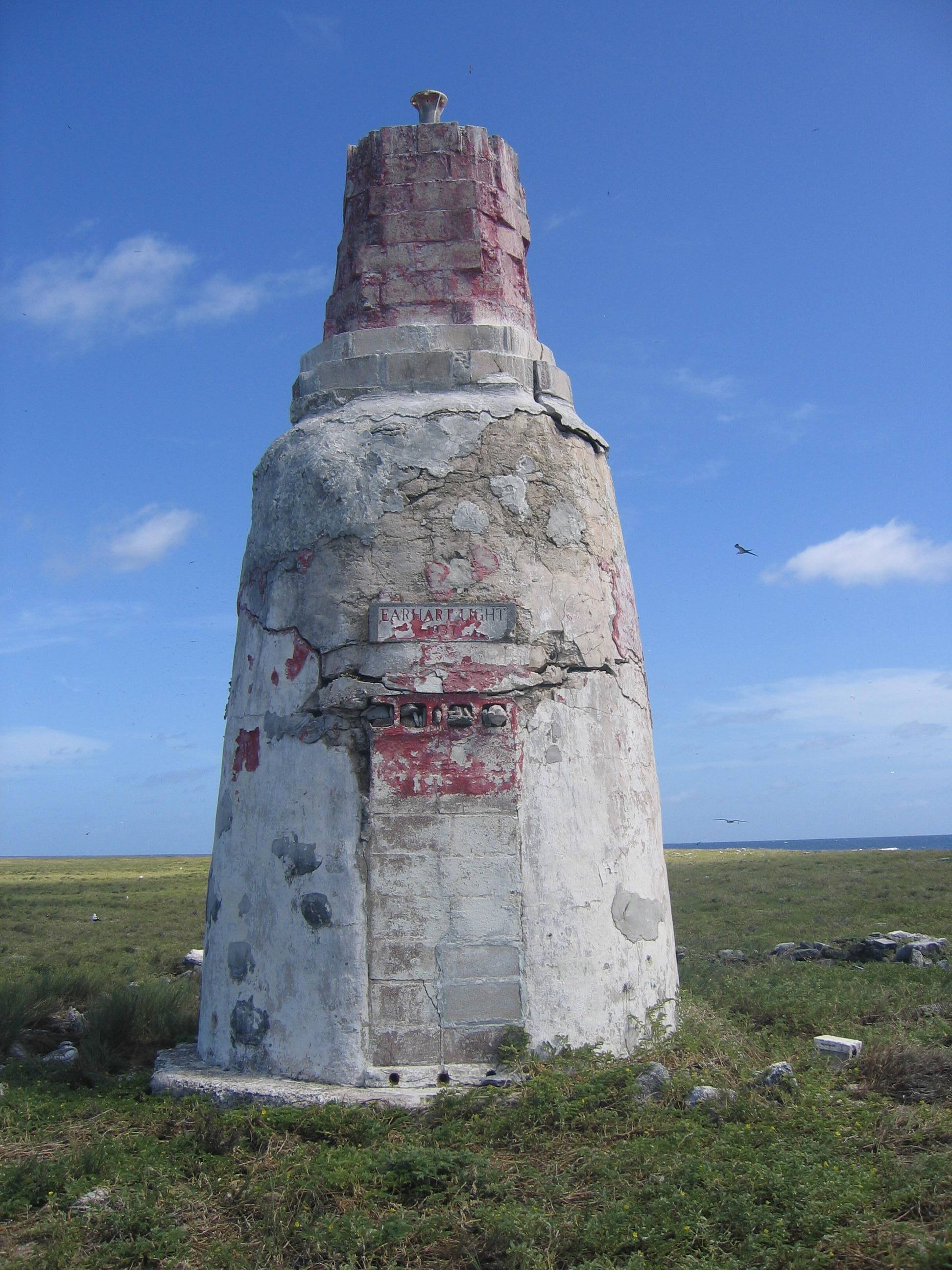
 Earhart Light, pictured here showing damage it sustained during World War II, was named for Amelia Earhart during the late 1930s.
A Japanese air attack on 8 December 1941 by 14 twin-engined bombers killed two of the Kamehameha School colonists: Richard "Dicky" Kanani Whaley, and Joseph Kealoha Keliʻhananui. The raid came one day after the Japanese attack on Pearl Harbor and damaged the three airstrips of Kamakaiwi Field. Two days later a Japanese submarine shelled what was left of the colony's few buildings into ruins.[15] A single bomber returned twice during the following weeks and dropped more bombs on the rubble of tiny Itascatown. The two survivors were finally evacuated by a U.S. Navy destroyer on 31 January 1942. Howland was occupied by a battalion of the United States Marine Corps in September 1943 and known as Howland Naval Air Station until May 1944.
All attempts at habitation were abandoned after 1944. Colonization projects on the other four islands were also disrupted by the war and ended at this time.[16]
On 10 June 1944 a U.S. Navy Martin PBM-3-D Mariner flying boat (BuNo 48199),piloted by William Hines, had an engine fire and made a forced landing in the ocean offshore of Howland. Hines beached the aircraft and although it burned, the crew escaped unharmed, was rescued by the USCGC Balsam (the same ship that later took Unit 92 to Gardner Island), transferred to a sub chaser and taken to Canton Island.[17]
Kamakaiwi Field suffered additional damage during World War II and all but disappeared. Ironically, while Howland Island was colonized in 1935 as a future aviation facility and is known in popular culture mostly because of its association with the last flight of Earhart and Noonan, no aircraft is known to have ever landed there, although anchorages nearby could be used by floatplanes and flying boats during World War II.
Wildlife refuge
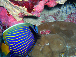
 Angelfish and Hump Coral - Howland Island NWR.
By the 1970s Howland Island was overrun by a population of feral cats, descendants of those brought by earlier colonists. The felines were gradually removed during the 1980s and the area was designated a bird and wildlife refuge. However, abandoned military debris continued to be a concern. Amateur radio enthusiasts made several authorized visits to the island during the 1990s and early 2000s. In 2006, trespassing by commercial fishing boats and their helicopters was cited as a serious problem.
Public entry to the island is by special-use permit from the U.S. Fish and Wildlife Service only and is generally restricted to scientists and educators. Representatives from the agency visit the island on average once every two years, often coordinating transportation with amateur radio operators or the U.S. Coast Guard to defray the high cost of logistical support required to visit this remote atoll.
Earhart Light
The Earhart Light (named after Amelia Earhart) is a day beacon or navigational landmark shaped somewhat like a short lighthouse (with no illumination), painted with wide stripes and meant to be seen from several miles out to sea during daylight hours. It is located near the boat landing at the middle of the west coast by the former site of Itascatown. It was partially destroyed during early World War II by the Japanese attacks, but was rebuilt in the early 1960s by the US Coast Guard.[18] By 2000, the Earhart beacon was said to be crumbling and it had not been painted in decades.[19]
Howland Island was overflown in 1967 by Ann Dearing Holtgren Pellegreno and in 1997 by Linda Finch during memorial circumnavigation flights to commemorate Earhart's 1937 world flight. No landings were attempted but both Pellegreno and Finch flew low enough to drop a wreath on the island.[20]
Image gallery
-

Earhart Light with post World War II repairs
-
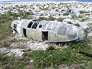
Aircraft wreckage on Howland
-
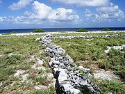
Itascatown settlement remains
-

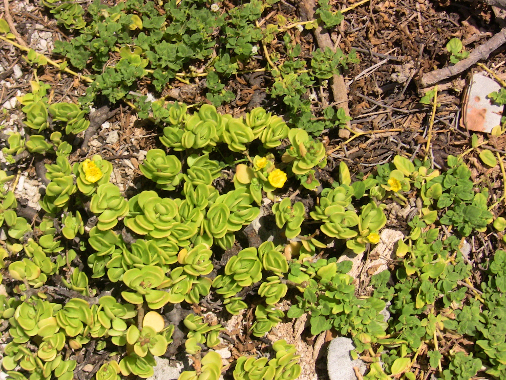
Howland island flora
-
Howland island flora (leeward)
-

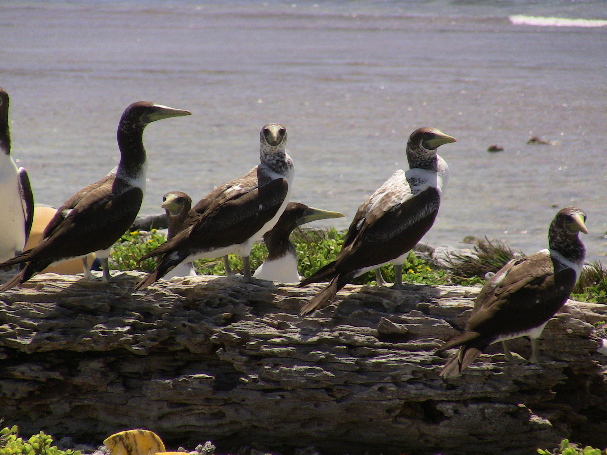
Brown
-

Brown
-
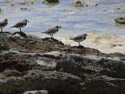
Ruddy turnstones
See also
- History of the Pacific Islands
- Phoenix Islands
- List of Guano Island claims
References
- Notes
- ^ Quote: "Howland's Island, although naturally uninhabitable, gave various indications of early visitors, probably natives drifting from windward islands, whose traces were still visible in the remains of a canoe, a blue bead, pieces of bamboo, and other distinctly characteristic belongings."[5]
- ^ Quote: Thursday, 1 July 1937... Howland Island was using the 10+30 hour time zone — the same as Hawaii standard time..."[14]
- Citations
- ^ "Howland Island". Geographic Names Information System, U.S. Geological Survey. http://geonames.usgs.gov/pls/gnispublic/f?p=gnispq:3:::NO::P3_FID:1393033. Retrieved 24 February 2009.
- ^ "Howland Island National Wildlife Refuge." fws.gov. Retrieved: 29 April 2010.
- ^ "United States Pacific Island Wildlife Refuges." CIA: The World Factbook. ISSN 1553-8133. Retrieved: 25 November 2010.
- ^ Payne, Roger. "At Howland Island, 2000." pbs.org. Retrieved: 6 July 2008.
- ^ Hague, James D. Web copy "Our Equatorial Islands with an Account of Some Personal Experiences." Century Magazine, Vol. LXIV, No. 5, September 1902. Retrieved: 3 January 2008.
- ^ Suárez 2004, p. 17.
- ^ Bryan, E.H. "Sydney Island." janeresture.com. Retrieved: 7 July 2008.
- ^ Irwin 1992, pp. 176–179.
- ^ Sharp 1960, p. 210.
- ^ Bryan 1942, pp. 38–41.
- ^ Maude 1968, p. 130.
- ^ Bryan 1942
- ^ "Memorandum of Secretary of State Cordell Hull to the President, 18 February 1936." Presidential Private File, Franklin D. Roosevelt Library, Hyde Park, N.Y. Retrieved: 18 March 2010.
- ^ Long 1999, p. 206.
- ^ Butler 1999, p. 419.
- ^ H"owland Island." worldstatesmen.org. Retrieved: October 10, 2010.
- ^ "Report 48199." vpnavy.org. Retrieved: October 10, 2010.
- ^ "Voyage to Howland Island of the USCGC Kukui." US Coast Guard. Retrieved: October 10, 2010.
- ^ "Historic Light Station Information and Photography: Pacific Rim". United States Coast Guard Historian's Office. http://www.uscg.mil/history/weblighthouses/LHPACIFIC.asp. Retrieved October 10, 2010.
- ^ Safford et al. 2003, pp. 76–77.
- Bibliography
- Bryan, Edwin H., Jr. American Polynesia and the Hawaiian Chain. Honolulu, Hawaii: Tongg Publishing Company, 1942.
- Butler, Susan. East to the Dawn: The Life of Amelia Earhart. Cambridge, MA: Da Capa Press, 1999. ISBN 0-306-80887-0.
- "Eyewitness account of the Japanese raids on Howland Island (includes a grainy photo of Itascatown)." ksbe.edu. Retrieved: October 10, 2010.
- Irwin, Geoffrey. The Prehistroric Exploration and Colonisation of the Pacific. Cambridge, UK: Cambridge University Press, 1992. ISBN 0-52147-651-8.
- Long, Elgen M. and Marie K. Long. Amelia Earhart: The Mystery Solved. New York: Simon & Schuster, 1999. ISBN 0-684-86005-8.
- Maude, H.E. Of Islands and Men: Studies in Pacific History. Melbourne, Australia: Oxford University Press, 1968.
- Safford, Laurance F. with Cameron A. Warren and Robert R. Payne. Earhart's Flight into Yesterday: The Facts Without the Fiction. McLean, Virginia: Paladwr Press, 2003. ISBN 1-888962-20-8.
- Sharp, Andrew. The Discovery of the Pacific Islands. Oxford: Oxford University Press, 1960.
- Suárez, Thomas. Early Mapping of the Pacific. Singapore: Periplus Editions, 2004. ISBN 0-79460-092-1.
External links
- Howland in Google Maps
- Geography, history and nature on Howland Island
- "Historic Light Station Information and Photography: Pacific Rim". United States Coast Guard Historian's Office. http://www.uscg.mil/history/weblighthouses/LHPACIFIC.asp.
- Howland Island National Wildlife Refuge
- 'Voyage of the Odyssey' – pictures and travelogue
- Howland Island at Infoplease
- Howland Island – Small Island, Big History
- Pictures of the 1993 expedition to Howland island
History of the United States by political division States - Alabama
- Alaska
- Arizona
- Arkansas
- California
- Colorado
- Connecticut
- Delaware
- Florida
- Georgia
- Hawaii
- Idaho
- Illinois
- Indiana
- Iowa
- Kansas
- Kentucky
- Louisiana
- Maine
- Maryland
- Massachusetts
- Michigan
- Minnesota
- Mississippi
- Missouri
- Montana
- Nebraska
- Nevada
- New Hampshire
- New Jersey
- New Mexico
- New York
- North Carolina
- North Dakota
- Ohio
- Oklahoma
- Oregon
- Pennsylvania
- Rhode Island
- South Carolina
- South Dakota
- Tennessee
- Texas
- Utah
- Vermont
- Virginia
- Washington
- West Virginia
- Wisconsin
- Wyoming
Federal district Insular areas - American Samoa
- Guam
- Northern Mariana Islands
- Puerto Rico
- U.S. Virgin Islands
Outlying islands - Bajo Nuevo Bank
- Baker Island
- Howland Island
- Jarvis Island
- Johnston Atoll
- Kingman Reef
- Midway Atoll
- Navassa Island
- Palmyra Atoll
- Serranilla Bank
- Wake Island
Protected areas of the United States by political division States - Alabama
- Alaska
- Arizona
- Arkansas
- California
- Colorado
- Connecticut
- Delaware
- Florida
- Georgia
- Hawaii
- Idaho
- Illinois
- Indiana
- Iowa
- Kansas
- Kentucky
- Louisiana
- Maine
- Maryland
- Massachusetts
- Michigan
- Minnesota
- Mississippi
- Missouri
- Montana
- Nebraska
- Nevada
- New Hampshire
- New Jersey
- New Mexico
- New York
- North Carolina
- North Dakota
- Ohio
- Oklahoma
- Oregon
- Pennsylvania
- Rhode Island
- South Carolina
- South Dakota
- Tennessee
- Texas
- Utah
- Vermont
- Virginia
- Washington
- West Virginia
- Wisconsin
- Wyoming
Federal district Insular areas - American Samoa
- Guam
- Northern Mariana Islands
- Puerto Rico
- U.S. Virgin Islands
Outlying islands Midway Atoll · Navassa Island
Pacific Remote Islands Marine National Monument (Baker Island · Howland Island · Jarvis Island · Johnston Atoll · Kingman Reef · Palmyra Atoll · Wake Island)Categories:- Howland Island
- Islands claimed under the Guano Islands Act
- Pacific Remote Islands Marine National Monument
- Former populated places in Oceania
- Coral reefs of the United States
-


Wikimedia Foundation. 2010.