- Jarvis Island
-
For the peninsula in Yarmouth, Nova Scotia, see Bunker's Island, Nova Scotia.
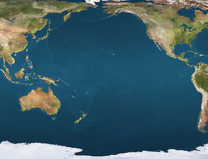
 JarvisLocation of Jarvis Island in the Pacific Ocean
 NASA picture of Jarvis Island; note the submerged reef beyond the eastern end.
Jarvis Island (
 /ˈdʒɑrvɨs/; formerly known as Bunker Island) is an uninhabited 4.5 square kilometer (1.75 sq. mile) coral island located in the South Pacific Ocean at 0°22′S 160°01′W / 0.367°S 160.017°WCoordinates: 0°22′S 160°01′W / 0.367°S 160.017°W, about halfway between Hawaii and the Cook Islands.[1] It is an unincorporated, unorganized territory of the United States, administered by the United States Fish and Wildlife Service of the United States Department of the Interior as part of the National Wildlife Refuge system.[2] Unlike most coral atolls, the lagoon on Jarvis is wholly dry.
Jarvis is one of the southern Line Islands and for statistical purposes is also grouped as one of the United States Minor Outlying Islands.
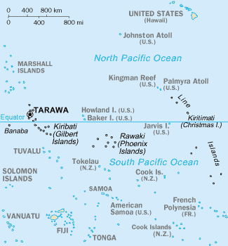
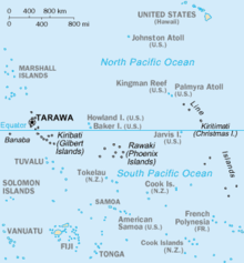 Map of the central Pacific Ocean showing Jarvis and neighboring islands.
Contents
Geography and ecology
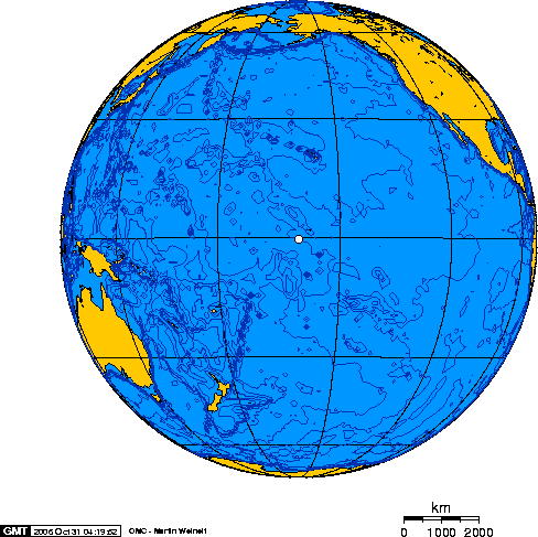
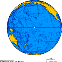 Map of Jarvis IslandOrthographic projection over Jarvis Island
While a few offshore anchorage spots are marked on maps, Jarvis island has no ports or harbors, and swift currents are a hazard. There is a boat landing area in the middle of the western shoreline near a crumbling day beacon, and another near the southwest corner of the island.[3] The center of Jarvis island is a dried lagoon where deep guano deposits accumulated, which were mined for about 20 years during the nineteenth century. The island has a tropical desert climate, with high daytime temperatures, constant wind, and strong sun. Nights, however, are quite cool. The ground is mostly sandy and reaches 7 meters (23 ft) at its highest point. The low-lying coral island has long been noted as hard to sight from small ships and is surrounded by a narrow fringing reef.
Located only 25 miles south of the equator, Jarvis has no known natural freshwater lens and scant rainfall.[4][5] This creates a very bleak, flat landscape without any plants larger than shrubs.[6] There is no evidence that the island has ever supported a self-sustaining human population. Its sparse bunch grass, prostrate vines and low-growing shrubs are primarily a nesting, roosting, and foraging habitat for seabirds, shorebirds, and marine wildlife.[2]
History
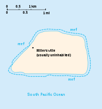
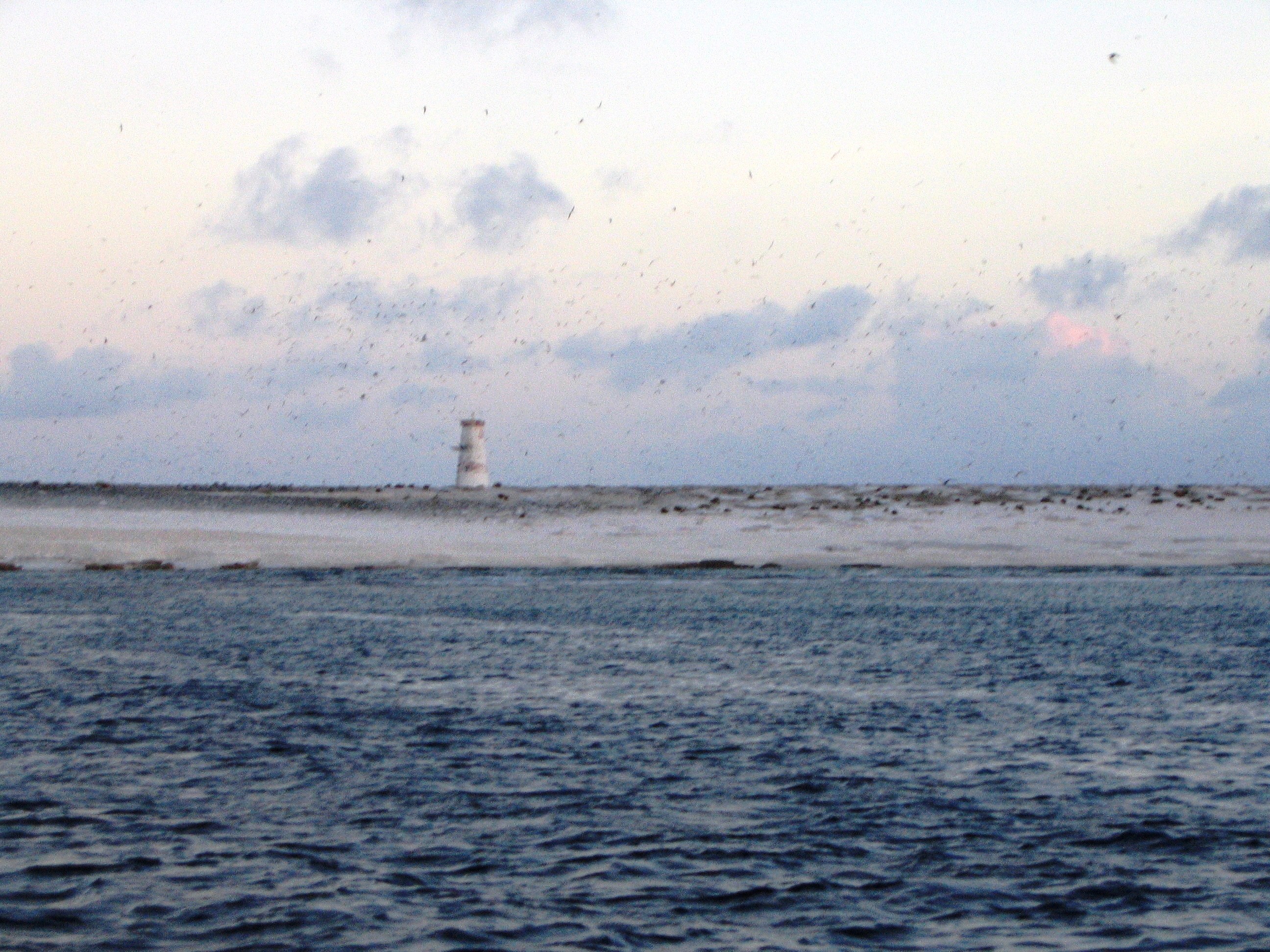
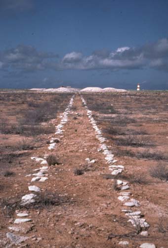
 Western shore of Jarvis Island with day beacon at the site of Millersville in October 2003
 Remains of a guano tramway on Jarvis Island, looking west with 125-year-old heaps of mined but never-shipped guano in the background near the day beacon
Discovery
The island's first known sighting by Europeans was on 21 August 1821 by the British ship Eliza Francis (or Eliza Frances) owned by Edward, Thomas and William Jarvis[7][8] and commanded by Captain Brown. In March 1857 the uninhabited island was claimed for the United States under the Guano Islands Act and formally annexed on 27 February 1858.
Nineteenth century guano mining
Beginning in 1858, several support structures were built, along with a two-story, eight-room "superintendent's house" featuring an observation cupola and wide verandahs. Tram tracks were laid down for bringing mined guano to the western shore. One of the first loads was taken by Samuel Gardner Wilder.[9] For the following twenty-one years, Jarvis was commercially mined for guano, sent to the United States as fertilizer, but the island was abruptly abandoned in 1879, leaving behind about a dozen buildings and 8,000 tonnes of mined guano. New Zealand entrepreneurs then made unsuccessful attempts to continue guano extraction on Jarvis, and the two-story house was sporadically inhabited during the early 1880s. Squire Flockton was left alone on the island as caretaker for several months and committed suicide there in 1883, apparently from gin-fueled despair.[10] His wooden grave marker was a carved plank which could be seen in the island's tiny three-grave cemetery for decades.
The United Kingdom annexed the island on 3 June 1889. Phosphate and copra entrepreneur John T. Arundel visited the island in 1909 and near the beach landing on the western shore a tumbled, pyramidal day beacon made from slats of wood was repaired, painted white and stood at least until 1942.
Wreck of barquentine Amaranth
On 30 August 1913, the barquentine Amaranth (C.W. Nielson, captain) was carrying a cargo of coal from Newcastle, New South Wales to San Francisco when it wrecked on Jarvis' southern shore. Ruins of ten wooden guano-mining buildings, the two-story house among them, could still be seen by the Amaranth crew, who left Jarvis aboard two lifeboats. One reached Pago Pago, American Samoa and the other made Apia in Western Samoa. The ship's scattered remains were noted and scavenged for many years, and rounded fragments of coal from the Amaranth's hold were still being found on the south beach in the late 1930s.[11]
Millersville (1935-1942)
Jarvis Island was reclaimed by the United States government and colonized from 26 March 1935 onwards, under the Baker, Howland and Jarvis Colonization Scheme (see also Howland Island and Baker Island). President Franklin D. Roosevelt assigned administration of the island to the U.S. Department of the Interior on 13 May 1936.[2] Starting out as a cluster of large, open tents pitched next to the still-standing white wooden day beacon, the Millersville settlement on the island's western shore was named after a bureaucrat with the United States Department of Air Commerce. The settlement grew into a group of shacks built mostly with wreckage from the Amaranth (lumber from which was also used by the young Hawaiian colonists to build surfboards), but later, stone and wood dwellings were built and equipped with refrigeration, radio equipment, and a weather station.[12] A crude aircraft landing area was cleared on the northeast side of the island, and a T-shaped marker which was intended to be seen from the air was made from gathered stones, but no airplane is known to have ever landed there.
At the beginning of World War II, an Imperial Japanese Navy submarine surfaced off the west coast of the Island. Believing that it was a U.S. Navy submarine which had come to fetch them, the four young colonists rushed down the steep western beach in front of tiny Millersville towards the shore. The submarine answered their waves with fire from its deck gun, but no one was hurt in the attack. On 7 February 1942, the USCGC Taney evacuated the colonists, then shelled and burned the dwellings. The roughly cleared landing area on the island's northeast end was later shelled by the Japanese, leaving crater holes.[13]
IGY, bird sanctuary
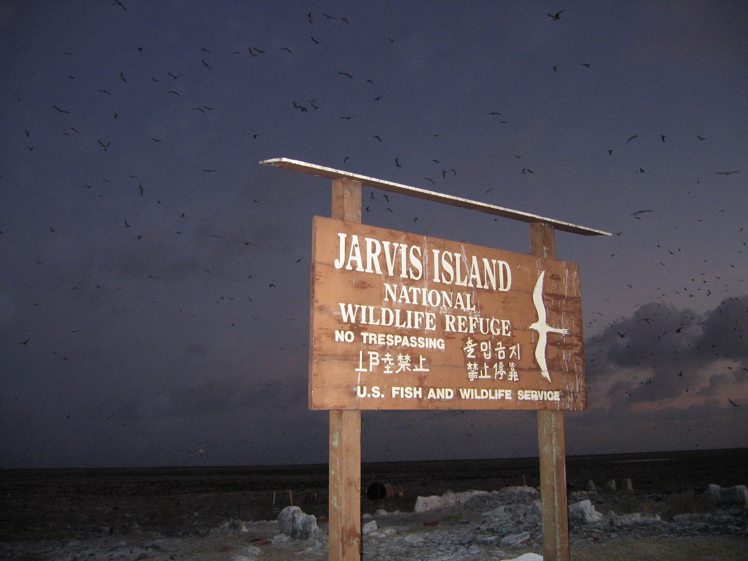
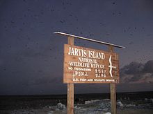 Guano-stained US Fish and Wildlife sign on Jarvis Island
Jarvis was visited by scientists during the International Geophysical Year from July 1957 until November 1958. In January 1958 all scattered building ruins from both the nineteenth century guano diggings and the 1935-1942 colonization attempt were swept away without a trace by a severe storm which lasted several days and was witnessed by the scientists. When the IGY research project ended the island was abandoned again.[14] By the early 1960s a few sheds, a century of accumulated trash, the scientists' house from the late 1950s and a solid, short lighthouse-like day beacon built two decades before were the only signs of human habitation on Jarvis.
Since 27 June 1974 Jarvis Island has been administered by the U.S. Fish and Wildlife Service as the Jarvis Island National Wildlife Refuge (one of the United States Pacific Island Wildlife Refuges). A feral cat population, descendants of cats brought by early guano miners, wrought disruption to the island's wildlife and vegetation for at least a century. These cats were all removed through efforts which began in the mid-1960s and lasted until the early 1980s. Nineteenth century tram track remains can reportedly be seen in the dried lagoon bed at the island's center and the late 1930s-era lighthouse-shaped day beacon still stands on the western shore at the site of Millersville.
Public entry to Jarvis Island requires a special-use permit and is generally restricted to scientists and educators. The island is visited periodically by the U.S. Fish and Wildlife Service and the United States Coast Guard.[15]
See also
- List of Guano Island claims
References
- ^ Darwin, Charles; Thomas George Bonney (1897). The structure and distribution of coral reefs. New York: D. Appleton and Company. pp. 207. ISBN 0520032829.
- ^ a b c "Jarvis Island". DOI Office of Insular Affairs. http://www.doi.gov/oia/Islandpages/jarvispage.htm. Retrieved 2007-01-26.
- ^ "Jarvis Island". The World Factbook. CIA. 2003. http://www.umsl.edu/services/govdocs/wofact2003/geos/dq.html#Trans. Retrieved 2007-01-26.
- ^ Pacific Remote Islands National Wildlife Refuge Complex, Jarvis Island NWR Draft CCP EA, August 2007, retrieved 25 November 2010: "No information is available on the subsurface hydrology of Jarvis Island. However, its small size and prevailing arid rainfall conditions would not likely result in the formation of a drinkable groundwater lens. During staff visits to Jarvis, potable water is carried in containers to the island for short visits."
- ^ "United States Pacific Island Wildlife Refuges". https://www.cia.gov/library/publications/the-world-factbook/geos/um.html#Geo. Retrieved 2007-01-26.
- ^ "Jarvis Island - Pacific Biodiversity Information Forum photographs". http://jarvisisland.info/pbif.html. Retrieved 2008-01-09.
- ^ "North Pacific Pilot page 282" (png). http://jarvisisland.info/north_pacific_pilot.html#282. Retrieved 2007-01-26.
- ^ "R. v. Higgins, Fuller, Anderson, Thomas, Belford and Walsh". legal proceeding. http://www.law.mq.edu.au/scnsw/Cases1833-34/html/r_v_higgins_and_others__1833.htm. Retrieved 2007-01-25.
- ^ George F. Nellist, ed (1925). "Samuel Gardner Wilder". The Story of Hawaii and Its Builders. Honolulu Star Bulletin. http://files.usgwarchives.net/hi/statewide/bios/wilder65bs.txt.
- ^ "The Story of Henry Winkelmann and Harold Willey Hudson on Jarvis Island". http://home.att.net/~higley.family/Henry_Winkelmann.htm. Retrieved 2008-01-08.
- ^ Bryan, E.H. "Jarvis Island" Retrieved: 7 July 2008.
- ^ Bryan, Edwin H., Jr. Panalaau Memoirs. Retrieved: 7 July 2008. Contains several photos of the Millersville settlement, together with a diary of events in the colony.
- ^ "History of Jarvis Island". "World War Two" section of article.. http://home.att.net/~higley.family/sub1.htm. Retrieved 2007-01-25. Shell holes were later noted in the aircraft landing area.
- ^ The IGY station chief was Otto H Homung (d. 1958) who apparently died on the island and may have been buried there.
- ^ "United States Pacific Island Wildlife Refuges". https://www.cia.gov/library/publications/the-world-factbook/geos/um.html#People. Retrieved 2007-01-26.
External links
- Jarvis Island Home Page Website with photos, weather, and more.
- Jarvis Island information website Has several photos of the old Millersville settlement, together with more modern photos of the island.
- WorldStatesmen Offers brief data on Jarvis island.
- U.S. Fish & Wildlife Service Jarvis Island National Wildlife Refuge The Jarvis Island refuge site.
History of the United States by political division States - Alabama
- Alaska
- Arizona
- Arkansas
- California
- Colorado
- Connecticut
- Delaware
- Florida
- Georgia
- Hawaii
- Idaho
- Illinois
- Indiana
- Iowa
- Kansas
- Kentucky
- Louisiana
- Maine
- Maryland
- Massachusetts
- Michigan
- Minnesota
- Mississippi
- Missouri
- Montana
- Nebraska
- Nevada
- New Hampshire
- New Jersey
- New Mexico
- New York
- North Carolina
- North Dakota
- Ohio
- Oklahoma
- Oregon
- Pennsylvania
- Rhode Island
- South Carolina
- South Dakota
- Tennessee
- Texas
- Utah
- Vermont
- Virginia
- Washington
- West Virginia
- Wisconsin
- Wyoming
Federal district Insular areas - American Samoa
- Guam
- Northern Mariana Islands
- Puerto Rico
- U.S. Virgin Islands
Outlying islands - Bajo Nuevo Bank
- Baker Island
- Howland Island
- Jarvis Island
- Johnston Atoll
- Kingman Reef
- Midway Atoll
- Navassa Island
- Palmyra Atoll
- Serranilla Bank
- Wake Island
Protected areas of the United States by political division States - Alabama
- Alaska
- Arizona
- Arkansas
- California
- Colorado
- Connecticut
- Delaware
- Florida
- Georgia
- Hawaii
- Idaho
- Illinois
- Indiana
- Iowa
- Kansas
- Kentucky
- Louisiana
- Maine
- Maryland
- Massachusetts
- Michigan
- Minnesota
- Mississippi
- Missouri
- Montana
- Nebraska
- Nevada
- New Hampshire
- New Jersey
- New Mexico
- New York
- North Carolina
- North Dakota
- Ohio
- Oklahoma
- Oregon
- Pennsylvania
- Rhode Island
- South Carolina
- South Dakota
- Tennessee
- Texas
- Utah
- Vermont
- Virginia
- Washington
- West Virginia
- Wisconsin
- Wyoming
Federal district Insular areas - American Samoa
- Guam
- Northern Mariana Islands
- Puerto Rico
- U.S. Virgin Islands
Outlying islands Midway Atoll · Navassa Island
Pacific Remote Islands Marine National Monument (Baker Island · Howland Island · Jarvis Island · Johnston Atoll · Kingman Reef · Palmyra Atoll · Wake Island)Categories:- Jarvis Island
- Islands claimed under the Guano Islands Act
- Pacific Remote Islands Marine National Monument
- Former populated places in Oceania
- Uninhabited Pacific islands of the United States
- Island restoration
- Coral reefs of the United States


Wikimedia Foundation. 2010.