- Pacific Ocean
-
"Pacific" and "North Pacific" redirect here. For other uses, see Pacific (disambiguation) and North Pacific (disambiguation).

Earth's oceans
(World Ocean)- Arctic Ocean
- Atlantic Ocean
- Indian Ocean
- Pacific Ocean
- Southern Ocean
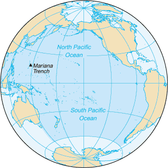
 The Pacific Ocean
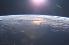
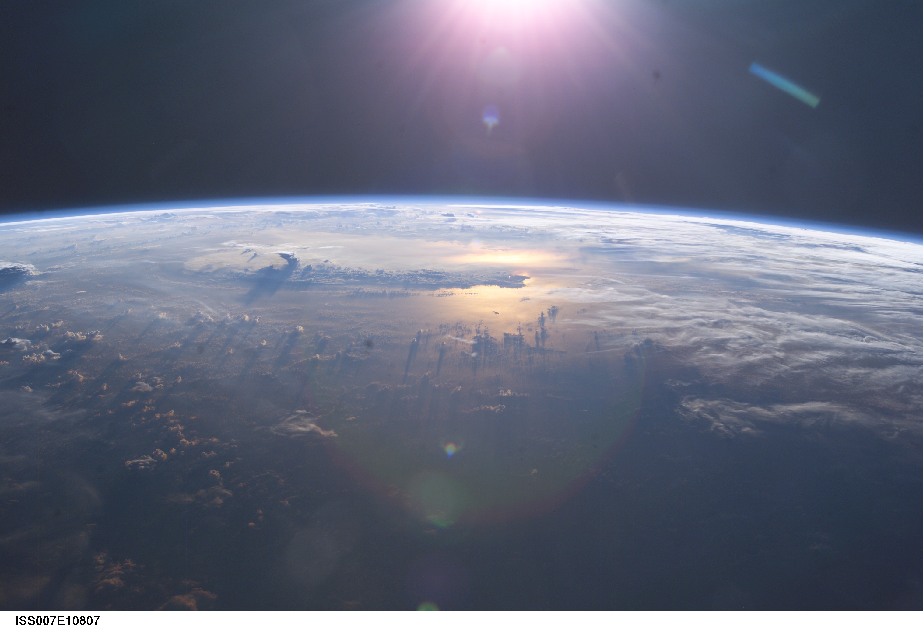
 This video was taken by the crew of Expedition 29 on board the ISS on a pass from the Middle East to the South Pacific Ocean.
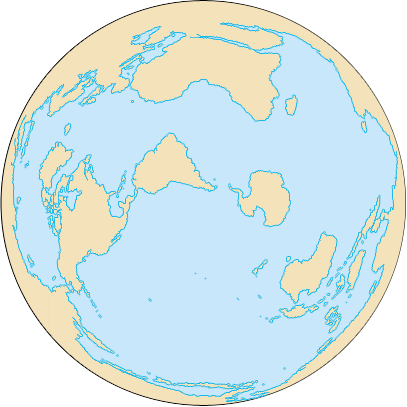
The Pacific Ocean is the largest of the Earth's oceanic divisions. It extends from the Arctic in the north to the Southern Ocean (or, depending on definition, to Antarctica) in the south, bounded by Asia and Australia in the west, and the Americas in the east.
At 165.2 million square kilometres (64.1 million square miles) in area, this largest division of the World Ocean – and, in turn, the hydrosphere – covers about 46% of the Earth's water surface and about one-third of its total surface area, making it larger than all of the Earth's land area combined.[1] The equator subdivides it into the North Pacific Ocean and South Pacific Ocean, with two exceptions: the Galápagos and Gilbert Islands, while straddling the equator, are deemed wholly within the South Pacific.[2] The Mariana Trench in the western North Pacific is the deepest point in the world, reaching a depth of 10,911 metres (35,797 ft).[3]
The Pacific Ocean was sighted by Europeans early in the 16th century, first by the Spanish explorer Vasco Núñez de Balboa, who crossed the Isthmus of Panama in 1513 and named it Mar del Sur (South Sea). Its current name was given by Portuguese explorer Ferdinand Magellan during the Spanish expedition of world circumnavigation in 1521, who encountered favourable winds as he reached the ocean and called it Mar Pacifico in Portuguese, meaning "peaceful sea".[4]
Contents
Overview
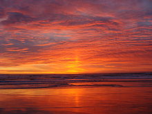
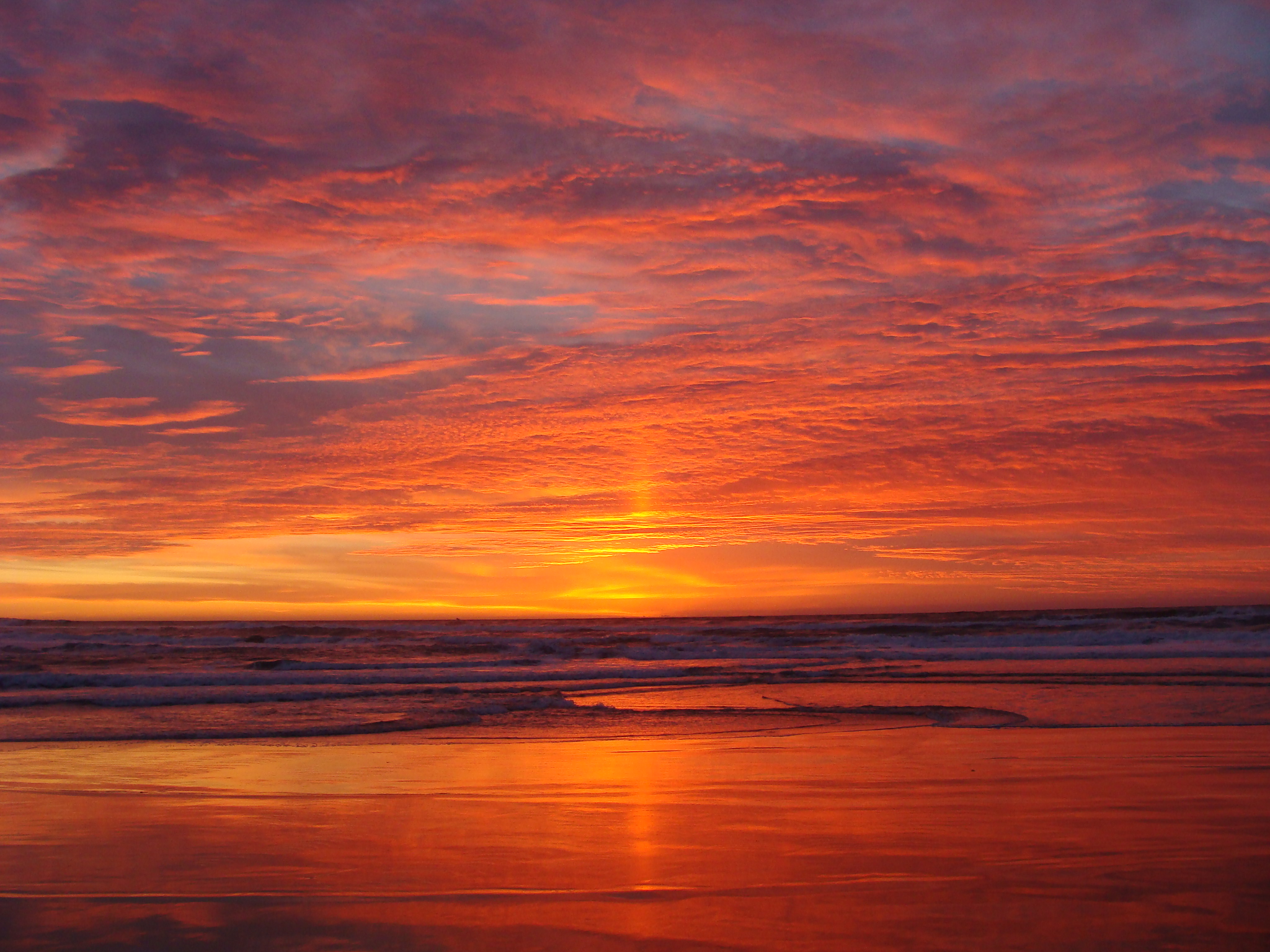
 Sunset over the Pacific Ocean as seen from the International Space Station. Anvil tops of thunderclouds are also visible.
The Pacific Ocean encompasses approximately one-third of the Earth's surface, having an area of 165.2 million square kilometres (64.1 million square miles) —significantly larger than Earth's entire landmass, with room for another Africa to spare.
Extending approximately 15,500 kilometres (9,600 mi) from the Bering Sea in the Arctic to the northern extent of the circumpolar Southern Ocean at 60°S (older definitions extend it to Antarctica's Ross Sea), the Pacific reaches its greatest east-west width at about 5°N latitude, where it stretches approximately 19,800 kilometres (12,300 mi) from Indonesia to the coast of Colombia and Peru – halfway across the world, and more than five times the diameter of the Moon. The lowest known point on earth—the Mariana Trench—lies 10,911 metres (35,797 ft) below sea level. Its average depth is 4028~4188metres (14,000 ft).[1]
The Pacific Ocean is currently shrinking due to plate tectonics, while the Atlantic Ocean is increasing in size, by roughly an inch per year (2–3 cm/yr) on 3 sides, roughly averaging 0.2 square miles (0.52 km2) a year.

Along the Pacific Ocean's irregular western margins lie many seas, the largest of which are the Celebes Sea, Coral Sea, East China Sea, Philippine Sea, Sea of Japan, South China Sea, Sulu Sea, Tasman Sea, and Yellow Sea. The Strait of Malacca joins the Pacific and the Indian Oceans on the west, and Drake Passage and the Straits of Magellan link the Pacific with the Atlantic Ocean on the east. To the north, the Bering Strait connects the Pacific with the Arctic Ocean.
As the Pacific straddles the 180th meridian, the West Pacific (or western Pacific, near Asia) is in the Eastern Hemisphere, while the East Pacific (or eastern Pacific, near the Americas) is in the Western Hemisphere.
For most of Magellan's voyage from the Strait of Magellan to the Philippines, the explorer indeed found the ocean peaceful. However, the Pacific is not always peaceful. Many tropical storms batter the islands of the Pacific. The lands around the Pacific Rim are full of volcanoes and often affected by earthquakes. Tsunamis, caused by underwater earthquakes, have devastated many islands and in some cases destroyed entire towns.
Extent
Main article: Borders of the oceans#Pacific OceanWater characteristics
The volume of the Pacific Ocean is approximately 622 million cubic km. Water temperatures in the Pacific vary from freezing in the poleward areas to about 30 °C (86 °F) near the equator. Salinity also varies latitudinally. The water near the equator is less salty than that found in the mid-latitudes because of abundant equatorial precipitation throughout the year. Poleward of the temperate latitudes salinity is also low, because little evaporation of seawater takes place in these frigid areas.
The motion of Pacific waters is generally clockwise in the Northern Hemisphere (the North Pacific gyre) and counter-clockwise in the Southern Hemisphere. The North Equatorial Current, driven westward along latitude 15°N by the trade winds, turns north near the Philippines to become the warm Japan or Kuroshio Current.
Turning eastward at about 45°N, the Kuroshio forks and some waters move northward as the Aleutian Current, while the rest turn southward to rejoin the North Equatorial Current. The Aleutian Current branches as it approaches North America and forms the base of a counter-clockwise circulation in the Bering Sea. Its southern arm becomes the chilled slow, south-flowing California Current.
The South Equatorial Current, flowing west along the equator, swings southward east of New Guinea, turns east at about 50°S, and joins the main westerly circulation of the Southern Pacific, which includes the Earth-circling Antarctic Circumpolar Current. As it approaches the Chilean coast, the South Equatorial Current divides; one branch flows around Cape Horn and the other turns north to form the Peru or Humboldt Current.
Geology
The Pacific Ocean takes up roughly one third of the Earth's surface, having an area of 179.7 million square kilometers. It contains about 25,000 islands (more than the total number in the rest of the world's oceans combined), the majority of which are found south of the equator, Including partially submerged islands. The ocean was mapped by a man named Abraham Ortelius; he called it Maris Pacifici because of Ferdinand Magellan, who sailed the Pacific during his circumnavigation from 1519 to 1522 and said that it was much more calm than the Atlantic.
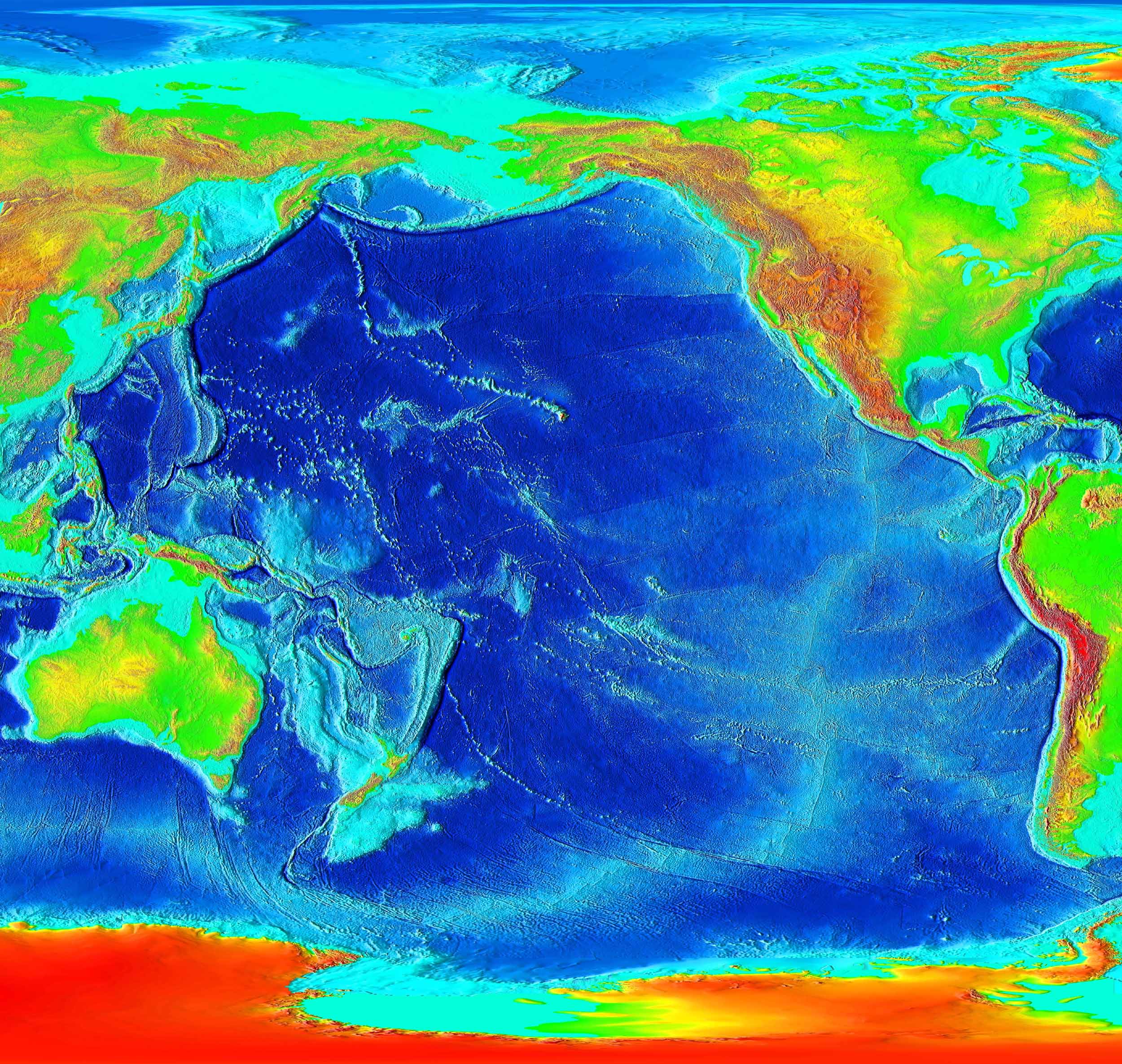
The andesite line is the most significant regional distinction in the Pacific. It separates the deeper, mafic igneous rock of the Central Pacific Basin from the partially submerged continental areas of felsic igneous rock on its margins. The andesite line follows the western edge of the islands off California and passes south of the Aleutian arc, along the eastern edge of the Kamchatka Peninsula, the Kuril Islands, Japan, the Mariana Islands, the Solomon Islands, and New Zealand's North Island.
The dissimilarity continues northeastward along the western edge of the Andes Cordillera along South America to Mexico, returning then to the islands off California. Indonesia, the Philippines, Japan, New Guinea, and New Zealand lie outside the Andesite Line.
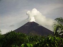
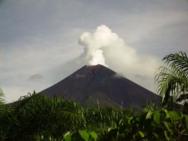
Within the closed loop of the Andesite Line are most of the deep troughs, submerged volcanic mountains, and oceanic volcanic islands that characterize the Pacific basin. Here basaltic lavas gently flow out of rifts to build huge dome-shaped volcanic mountains whose eroded summits form island arcs, chains, and clusters. Outside the Andesite Line, volcanism is of the explosive type, and the Pacific Ring of Fire is the world's foremost belt of explosive volcanism. The Ring of Fire is named after the several hundred active volcanoes that sit above the various subduction zones.
The Pacific Ocean is the only ocean which is almost totally bounded by subduction zones. Only the Antarctic and Australian coasts have no nearby subduction zones.
Geological history
The Pacific Ocean developed from the Panthalassic Ocean following the breakup of Pangaea. There is no firm date for when the changeover occurred, as the replacement of the sea bed is a continuous process, though reconstruction maps often change the name from Panthalassic to Pacific around the time the Atlantic Ocean began to open.[5][6][7] The Panthalassic Ocean first opened 750 million years ago at the breakup of Rodinia,[7] but the oldest Pacific Ocean floor is only around 180 Ma old.[8]
Seamount chains
The Pacific Ocean contains several long seamount chains, formed by hotspot volcanism. These include the Hawaiian – Emperor seamount chain and the Louisville seamount chain.
Landmasses and islands
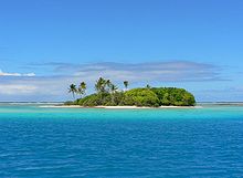
The largest landmass entirely within the Pacific Ocean is the island of New Guinea— the second largest island in the world. Almost all of the smaller islands of the Pacific lie between 30°N and 30°S, extending from Southeast Asia to Easter Island; the rest of the Pacific Basin is almost entirely submerged. During the Last glacial period, New Guinea was part of Australia so the largest landmass would have been Borneo–Palawan.
The great triangle of Polynesia, connecting Hawaii, Easter Island, and New Zealand, encompasses the island arcs and clusters of the Cook Islands, Marquesas Islands, Samoa, Society, Tokelau, Tonga, Tuamotu, Tuvalu and the Wallis and Futuna islands.
North of the equator and west of the International Date Line are the numerous small islands of Micronesia, including the Caroline Islands, the Marshall Islands and the Mariana Islands.
In the southwestern corner of the Pacific lie the islands of Melanesia, dominated by New Guinea. Other important island groups of Melanesia include the Bismarck Archipelago, Fiji, New Caledonia, the Solomon Islands and Vanuatu.
Islands in the Pacific Ocean are of four basic types: continental islands, high islands, coral reefs, and uplifted coral platforms. Continental islands lie outside the Andesite line and include New Guinea, the islands of New Zealand, and the Philippines. Some of these islands are structurally associated with nearby continents. High islands are of volcanic origin, and many contain active volcanoes. Among these are Bougainville, Hawaii, and the Solomon Islands.
The third and fourth types of islands are both the result of coralline island building. Coral reefs are low-lying structures that have built up on basaltic lava flows under the ocean's surface. One of the most dramatic is the Great Barrier Reef off northeastern Australia. A second island type formed of coral is the uplifted coral platform, which is usually slightly larger than the low coral islands. Examples include Banaba (formerly Ocean Island) and Makatea in the Tuamotu group of French Polynesia.
History and economy
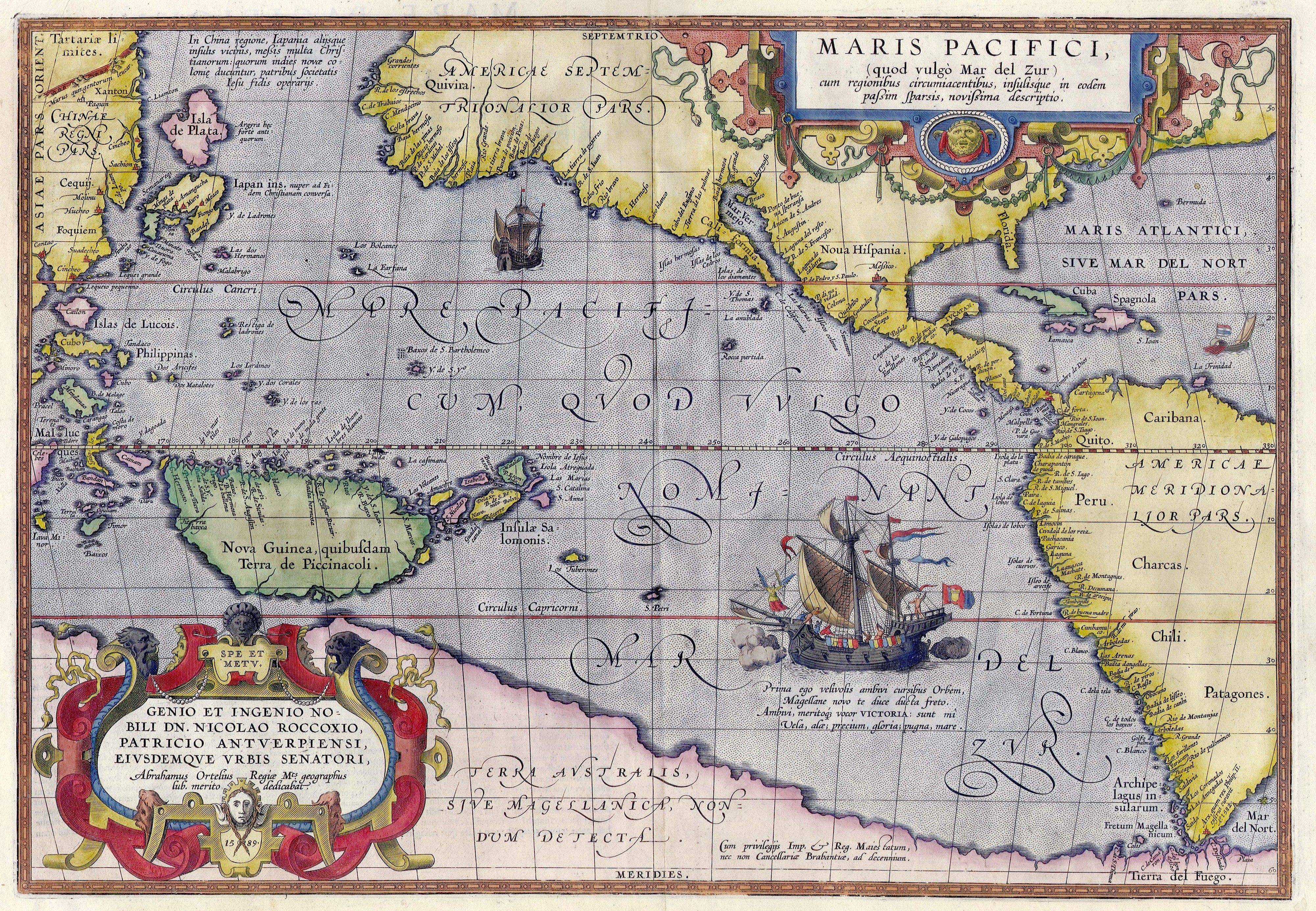
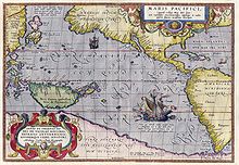 Maris Pacifici by Ortelius (1589). One of the first printed maps to show the Pacific Ocean; see also Waldseemüller map (1507).[9]
Important human migrations occurred in the Pacific in prehistoric times, most notably those of the Polynesians from the Asian edge of the ocean to Tahiti and then to Hawaii, New Zealand, and Easter Island.
The ocean was first sighted by Europeans early in the 16th century. Spanish explorer Vasco Núñez de Balboa crossed the Isthmus of Panama and reached the Pacific Ocean in 1513, naming it Mar del Sur (South Sea). Later, Portuguese explorer Ferdinand Magellan sailed the Pacific on a Spanish expedition of world circumnavigation from 1519 to 1521. Magellan called the ocean Pacífico or "Pacific" because he encountered calm seas throughout his journey. Although Magellan himself died in the Philippines in 1521, Spanish navigator Juan Sebastian Elcano led the expedition back to Spain across the Indian Ocean and round the Cape of Good Hope, completing the first world circumnavigation in 1522.
In 1564, Spanish explorers crossed the ocean from Mexico led by Miguel López de Legazpi who sailed to the Philippines and Mariana Islands. For the remainder of the 16th century, Spanish influence was paramount, with ships sailing from Mexico and Peru across the Pacific Ocean to the Philippines, via Guam, and establishing the Spanish East Indies. The Manila Galleons operated for two and a half centuries linking Manila and Acapulco, in one of the longest trade routes in history. Spanish expeditions also discovered Tuvalu, the Marquesas, the Solomon Islands and New Guinea in the South Pacific.
Later, in the quest for Terra Australis, Spanish explorers in the 17th century also discovered the Pitcairn and Vanuatu archipelagos, and sailed the Torres Strait between Australia and New Guinea, named after navigator Luis Vaz de Torres. Dutch explorers, sailing around southern Africa, also engaged in discovery and trade; Abel Janszoon Tasman discovered Tasmania and New Zealand in 1642. The 18th century marked the beginning of major exploration by the Russians in Alaska and the Aleutian Islands. The Spanish also sent expeditions to the Pacific Northwest reaching Vancouver Island in southern Canada, and Alaska. The French explored and settled Polynesia, and the British made three voyages with James Cook to the South Pacific and Australia, Hawaii, and the North American Pacific Northwest.
 The Bathyscaphe Trieste, before her record dive to the bottom of the Mariana Trench, 23 January 1960.
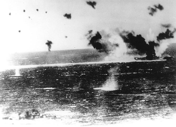
Growing imperialism during the 19th century resulted in the occupation of much of Oceania by European powers, and later, the United States and Japan. Significant contributions to oceanographic knowledge were made by the voyages of HMS Beagle in the 1830s, with Charles Darwin aboard; HMS Challenger during the 1870s; the USS Tuscarora (1873–76); and the German Gazelle (1874–76).
Although the United States gained control of Guam and the Philippines from Spain in 1898, Japan controlled most of the western Pacific by 1914 and occupied many other islands during World War II. However, by the end of that war, Japan was defeated and the U.S. Pacific Fleet was the virtual master of the ocean. Since the end of World War II, many former colonies in the Pacific have become independent states.
The exploitation of the Pacific's mineral wealth is hampered by the ocean's great depths. In shallow waters of the continental shelves off the coasts of Australia and New Zealand, petroleum and natural gas are extracted, and pearls are harvested along the coasts of Australia, Japan, Papua New Guinea, Nicaragua, Panama, and the Philippines, although in sharply declining volume in some cases.
The Pacific's greatest asset is its fish. The shoreline waters of the continents and the more temperate islands yield herring, salmon, sardines, snapper, swordfish, and tuna, as well as shellfish.
Environmental issues

Marine pollution is a generic term for the harmful entry into the ocean of chemicals or particles. The biggest culprits are people who use the rivers for disposing of their waste.[10] The rivers then empty into the Ocean, and with it the many chemicals used as fertilizers in agriculture. The excess of oxygen depleting chemicals in the water leads to hypoxia and the creation of a dead zone.[11]
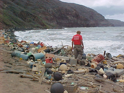
Marine debris, also known as marine litter, is a term used to describe human-created waste that has found itself floating in a lake, sea, ocean or waterway. Oceanic debris tends to accumulate at the centre of gyres and coastlines, frequently washing aground where it is known as beach litter.[10]
Bordering countries and territories
Sovereign nations
1 Taiwan's status as a sovereign nation is disputed.
Territories
 Hong Kong
 Howland Island
- Jarvis Island
- Johnston Island
- Kingman Reef
Major ports and harbors
See also
- Asia-Pacific Economic Cooperation
- Pacific-Antarctic Ridge
- Pacific coast
- Pacific hurricane
- Pacific Islands
- Pacific Time Zone
- Pacific War
- Seven seas
- Typhoon
- War of the Pacific
- See Wallace Stevens's poem Doctor of Geneva for an evocation of the power of the Pacific Ocean.
References
- ^ a b Pacific Ocean". Britannica Concise. 2006. Chicago: Encyclopædia Britannica, Inc.
- ^ International Hydrographic Organization (1953). "Limits of Oceans and Seas, 3rd edition". Monte Carlo, Monaco: International Hydrographic Organization. http://www.iho-ohi.net/iho_pubs/standard/S-23/S23_1953.pdf. Retrieved 12 June 2010.
- ^ "Japan Atlas: Japan Marine Science and Technology Center". http://web-japan.org/atlas/technology/tec03.html. Retrieved 2007-07-04.
- ^ "CATHOLIC ENCYCLOPEDIA: Ferdinand Magellan". Newadvent.org. 1910-10-01. http://www.newadvent.org/cathen/09526b.htm. Retrieved 2010-10-31.
- ^ "Triassic". Scotese.com. http://www.scotese.com/newpage8.htm. Retrieved 2010-10-31.
- ^ "Late Jurassic". Scotese.com. http://www.scotese.com/late1.htm. Retrieved 2010-10-31.
- ^ a b "GEOL 102 The Proterozoic Eon II: Rodinia and Pannotia". Geol.umd.edu. 2010-01-05. http://www.geol.umd.edu/~tholtz/G102/102prot2.htm. Retrieved 2010-10-31.
- ^ "Age of the Ocean Floor". Geology.about.com. 2010-08-05. http://geology.about.com/library/bl/maps/blseafloorage.htm. Retrieved 2010-10-31.
- ^ "LOC.gov". LOC.gov. 2001-07-23. http://www.loc.gov/today/pr/2001/01-093.html. Retrieved 2010-10-31.
- ^ a b "PHOTOS: Giant Ocean-Trash Vortex Documented-A First". News.nationalgeographic.com. http://news.nationalgeographic.com/news/2009/09/photogalleries/pacific-garbage-patch-pictures/. Retrieved 2010-10-31.
- ^ Gerlach: Marine Pollution, Springer, Berlin (1975)
Further reading
- Based on public domain text from US Naval Oceanographer
- Barkley, Richard A. (1968). Oceanographic Atlas of the Pacific Ocean. Honolulu: University of Hawaii Press.
- prepared by the Special Publications Division, National Geographic Society. (1985). Blue Horizons: Paradise Isles of the Pacific. Washington, D.C.: National Geographic Society. ISBN 0-87044-544-8.
- Cameron, Ian (1987). Lost Paradise: The Exploration of the Pacific. Topsfield, Mass.: Salem House. ISBN 0-88162-275-3.
- Couper, A. D. (ed.) (1989). Development and Social Change in the Pacific Islands. London: Routledge. ISBN 0-415-00917-0.
- Gilbert, John (1971). Charting the Vast Pacific. London: Aldus. ISBN 0-490-00226-9.
- Lower, J. Arthur (1978). Ocean of Destiny: A Concise History of the North Pacific, 1500-1978. Vancouver: University of British Columbia Press. ISBN 0-7748-0101-8.
- Napier, W.; Gilbert, J., and Holland, J. (1973). Pacific Voyages. Garden City, N.Y.: Doubleday. ISBN 0-385-04335-X.
- Oliver, Douglas L. (1989). The Pacific Islands (3rd ed.). Honolulu: University of Hawaii Press. ISBN 0-8248-1233-6.
- Ridgell, Reilly (1988). Pacific Nations and Territories: The Islands of Micronesia, Melanesia, and Polynesia (2nd ed.). Honolulu: Bess Press. ISBN 0-935848-50-9.
- Soule, Gardner (1970). The Greatest Depths: Probing the Seas to 20,000 feet (6,100 m) and Below. Philadelphia: Macrae Smith. ISBN 0-8255-8350-0.
- Spate, O. H. K. (1988). Paradise Found and Lost. Minneapolis: University of Minnesota Press. ISBN 0-8166-1715-5.
- Terrell, John (1986). Prehistory in the Pacific Islands: A Study of Variation in Language, Customs, and Human Biology. Cambridge: Cambridge University Press. ISBN 0-521-30604-3.
External links
- EPIC Pacific Ocean Data Collection Viewable on-line collection of observational data
- NOAA In-situ Ocean Data Viewer plot and download ocean observations
- NOAA PMEL Argo profiling floats Realtime Pacific Ocean data
- NOAA TAO El Niño data Realtime Pacific Ocean El Niño buoy data
- NOAA Ocean Surface Current Analyses – Realtime (OSCAR) Near-realtime Pacific Ocean Surface Currents derived from satellite altimeter and scatterometer data
Coordinates: 0°N 160°W / 0°N 160°W
Regions of the world 
Africa Northern · Sub-Saharan (Central · Southern · Western · Eastern) 
Oceania Australasia (Australia) · Melanesia · Micronesia · Polynesia 
America North (Northern • Middle • Central • Caribbean) · South (Southern • Northern • Western) · Anglo · Latin 
Polar Arctic · Antarctic 
Asia Central · Eastern (Northeastern) · Northern · Southeastern · Southern (Indian subcontinent) · Western (Middle East) 
Oceans World · Arctic · Atlantic · Indian · Pacific · Southern 
Europe Central · Eastern · Northern · Southeastern · Southern · Western Seas List of seas Related Continents of the world · List of seas · Physical EarthCategories:

Wikimedia Foundation. 2010.