- Scotia Sea
-
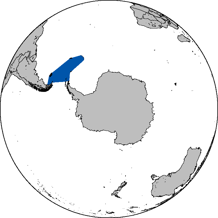
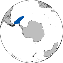 Approximate area of the sea in the Southern Hemisphere
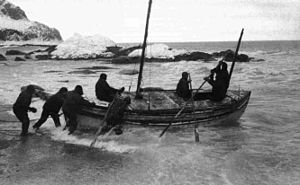 Launching the James Caird from the shore of Elephant Island, 24 April 1916
The Scotia Sea (57°30′S 40°00′W / 57.5°S 40°WCoordinates: 57°30′S 40°00′W / 57.5°S 40°W) is partly in the Southern Ocean and mostly in the South Atlantic Ocean.
Contents
Location and description
Habitually stormy and cold, the Scotia Sea is the area of water between Tierra del Fuego, South Georgia, South Sandwich Islands, South Orkney Islands and the Antarctic Peninsula, and bordered on the west by Drake Passage. These island groups all sit on top of the Scotia Ridge, which frames the Scotia Sea north, east, and south. The Scotia Sea covers an area of about 900,000 km². About half of the sea stands above the continental shelf.
The islands are rocky and partly covered in ice and snow the year round.
History
Named in about 1932 after the Scotia, the expedition ship used in these waters by the Scottish National Antarctic Expedition (1902–04) under William S. Bruce. The most famous traverse of this frigid sea was made in 1916 by Sir Ernest Shackleton and four others in the adapted lifeboat James Caird when they left Elephant Island and reached South Georgia two weeks later.
In Argentina, the Scotia Sea is considered part of the Argentine Sea (Spanish Mar Argentino), and many of the territories claimed by Argentina such as South Georgia and the Falkland Islands, lie within this region.
On 20 August 2006 an earthquake with a magnitude of 7.0 struck at 1:41 a.m. local time (0341 GMT). The exact location was 61.011°S, 34.375°W at a depth of 10 km (6.2 mi) with a USGS event ID of "usrqal".[1]
Flora and fauna
Despite the harsh conditions the islands do support vegetation and have been described as the Scotia Sea Islands tundra ecoregion, which includes South Georgia, the volcanic South Sandwich Islands and the South Orkneys in the Scotia Sea as well as the remote South Shetland Islands near the Antarctic Peninsula and the small isolated volcano Bouvet Island. All these islands lie in the cold seas below the Antarctic convergence. These areas support tundra vegetation consisting of mosses, lichen and algae, while seabirds, penguins and seals feed in the surrounding waters.
Seabirds include four species of albatross: Black-browed Albatross (Diomedea melanophris), Grey-headed Albatross (Thalassarche chrysostoma), Light-mantled Albatross (Phoebetria palpebrata), and Wandering Albatross (Diomedea exulans). There are only five species of bird that remain on land on the islands, and these include two endemic species: a race of the Yellow-billed Pintail duck(Anas georgica) and South Georgia Pipit (Anthus antarcticus).
Penguin species found here include large numbers of King Penguins on South Georgia especially, as well as Chinstrap Penguin, Macaroni Penguin, Gentoo penguin, Adelie Penguin, and Rockhopper Penguin (Eudyptes chrysocome).
Seals include the Antarctic Fur Seal (Arctocephalus gazella) and Sub-Antarctic Fur Seal (Arctocephalus tropicalis) in large numbers, Leopard Seal (Hydrurga leptonyx), Weddell Seal (Leptonychotes weddellii), the huge Southern Elephant Seal (Mirounga leonina), and Crabeater Seal (Lobodon carcinophagus).[2]
Threats and preservation
Although the islands have a harsh climate and have never been permanently occupied they have long been used as a base for fishing and seal-hunting. Wildlife on these remote islands is threatened by introduced species, especially on South Georgia, where even large animals including reindeer have been brought to the islands. Further damage to ecosystems results from overfishing. South Georgia, the South Sandwich Islands and Bouvet Island are protected as nature reserves, with Bird Island, South Georgia being a site of special scientific interest. The seals are further protected by international agreements and Fur Seal populations are recovering.
South Scotia Ridge
South Scotia Ridge (60°0′S 46°30′W / 60°S 46.5°W) is an undersea ridge named in association with the Scotia Sea. Name approved 6/87 (ACUF 225).
 This article incorporates public domain material from the United States Geological Survey document "Scotia Sea" (content from the Geographic Names Information System).
References
- ^ event "usrqal", according to the USGS
- ^ [1]
Further reading
Categories:- Marginal seas of the Atlantic Ocean
- Seas of the Southern Ocean
- Tundra
- Antarctic ecozone
- Antarctic region

Wikimedia Foundation. 2010.