- North Sea
-
For other uses, see North Sea (disambiguation).
North Sea 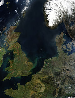
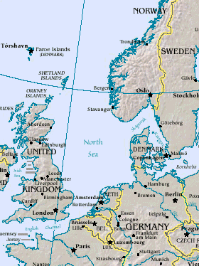
Location Atlantic Ocean Coordinates 56°N 3°E / 56°N 03°ECoordinates: 56°N 3°E / 56°N 03°E Primary sources Forth, Ythan, Elbe, Weser, Ems, Rhine/Waal, Meuse, Scheldt, Spey, Tay, Thames, Humber, Tees, Tyne, Wear, Crouch Basin countries Norway, Denmark, Germany, Netherlands, Belgium, France and the United Kingdom (England, Scotland) Max length 960 km (600 mi) Max width 580 km (360 mi) Surface area 750,000 km2 (290,000 sq mi) Average depth 95 m (312 ft) Max depth 700 m (2,300 ft) Water volume 94,000 km3 (23,000 cu mi) Salinity 3.4 to 3.5% Max temperature 17 °C (63 °F) Min temperature 6 °C (43 °F) References Safety at Sea and Royal Belgian Institute of Natural Sciences The North Sea is a marginal sea of the Atlantic Ocean located between Great Britain, Scandinavia, Germany, the Netherlands, and Belgium. An epeiric (or "shelf") sea on the European continental shelf, it connects to the ocean through the English Channel in the south and the Norwegian Sea in the north. It is more than 970 kilometres (600 mi) long and 580 kilometres (360 mi) wide, with an area of around 750,000 square kilometres (290,000 sq mi).
The North Sea has long been the site of important European shipping lanes as well as a major fishery. The sea is a popular destination for recreation and tourism in bordering countries and more recently has developed into a rich source of energy resources including fossil fuels, wind, and early efforts in wave power.
Historically, the North Sea has featured prominently in geopolitical and military affairs, particularly in Northern Europe but also globally through the power northern European actors projected worldwide during much of the Middle Ages and modern era. The North Sea was the center of the Vikings' rise and subsequently, the Hanseatic League, the Netherlands, and the British each sought to dominate the North Sea and through it to control access to the markets and resources of the world. As Germany's only outlet to the ocean, the North Sea continued to be strategically important through both World Wars.
The coast of the North Sea presents a diversity of geological and geographical features. In the north, deep fjords and sheer cliffs mark the Norwegian and Scottish coastlines, whereas the south consists primarily of sandy beaches and wide mudflats. Due to the dense population, heavy industrialization, and intense use of the sea and area surrounding it, there have been a number of environmental issues affecting the sea's ecosystems. Environmental concerns—commonly including overfishing, industrial and agricultural runoff, dredging, and dumping among others—have led to a number of efforts to prevent degradation of the sea while still making use of its economic potential.
Contents
Geography
Main article: Geography of the North Sea
The North Sea is bounded by the Orkney Islands and east coasts of England and Scotland to the west[1] and the northern and central European mainland to the east and south, including Norway, Denmark, Germany, the Netherlands, Belgium, and France.[2] In the southwest, beyond the Straits of Dover, the North Sea becomes the English Channel connecting to the Atlantic Ocean.[1][2] In the east, it connects to the Baltic Sea via the Skagerrak and Kattegat,[2] narrow straits that separate Denmark from Norway and Sweden respectively.[1] In the north it is bordered by the Shetland Islands, and connects with the Norwegian Sea, which lies in the very north-eastern part of the Atlantic.[1][3]
It is more than 970 kilometres (600 mi) long and 580 kilometres (360 mi) wide, with an area of 750,000 square kilometres (290,000 sq mi) and a volume of 94,000 cubic kilometres (23,000 cu mi).[4] Around the edges of the North Sea are sizeable islands and archipelagos, including Shetland, Orkney, and the Frisian Islands.[2] The North Sea receives freshwater from a number of European continental watersheds, as well as the British Isles. A large part of the European drainage basin empties into the North Sea including water from the Baltic Sea. The largest and most important affecting the North Sea are the Elbe and the Rhine – Meuse watershed.[5] Around 185 million people live in the catchment area of the rivers that flow into the North Sea encompassing some highly industrialized areas.[6]
Major features
For the most part, the sea lies on the European continental shelf with a mean depth of 90 metres (300 ft).[1][7] The only exception is the Norwegian trench, which extends parallel to the Norwegian shoreline from Oslo to an area north of Bergen.[1] It is between 20 and 30 kilometres (12 and 19 mi) wide[1] and has a maximum depth of 725 metres (2,379 ft).[7]
The Dogger Bank, a vast moraine, or accumulation of unconsolidated glacial debris, rises to a mere 15 to 30 metres (50–100 ft) below the surface.[8][9] This feature has produced the finest fishing location of the North Sea.[1] The Long Forties and the Broad Fourteens are large areas with roughly uniform depth in fathoms, (forty fathoms and fourteen fathoms or 73 and 26 m deep respectively). These great banks and others make the North Sea particularly hazardous to navigate,[10] which has been alleviated by the implementation of satellite navigation systems.[11] The Devil's Hole lies 200 miles (320 km) east of Dundee, Scotland. The feature is a series of asymmetrical trenches between 20 and 30 kilometres (12 and 19 mi) long, 1 and 2 kilometres (0.62 and 1.2 mi) wide and up to 230 metres (750 ft) deep.[12]
Extent
The International Hydrographic Organization defines the limits of the North Sea as follows:[13]
On the Southwest. A line joining the Walde Lighthouse (France, 1°55'E) and Leathercoat Point (England, 51°10'N).[14]
On the Northwest. From Dunnet Head (3°22'W) in Scotland to Tor Ness (58°47'N) in the Island of Hoy, thence through this island to the Kame of Hoy (58°55'N) on to Breck Ness on Mainland (58°58'N) through this island to Costa Head (3°14'W) and to Inga Ness (59'17'N) in Westray through Westray, to Bow Head, across to Mull Head (North point of Papa Westray) and on to Seal Skerry (North point of North Ronaldsay) and thence to Horse Island (South point of the Shetland Islands).
On the North. From the North point (Fethaland Point) of the Mainland of the Shetland Islands, across to Graveland Ness (60°39'N) in the Island of Yell, through Yell to Gloup Ness (1°04'W) and across to Spoo Ness (60°45'N) in Unst island, through Unst to Herma Ness (60°51'N), on to the SW point of the Rumblings and to Muckle Flugga (60°51′N 0°53′W / 60.85°N 0.883°W) all these being included in the North Sea area; thence up the meridian of 0°53' West to the parallel of 61°00' North and eastward along this parallel to the coast of Norway, the whole of Viking Bank being thus included in the North Sea.
On the East. The Western limit of the Skagerrak [A line joining Hanstholm (57°07′N 83°6′E / 57.117°N 83.1°E) and the Naze (Lindesnes, 58°N 7°E / 58°N 7°E)].
Hydrology
Temperature and salinity
The average temperature in summer is 17 °C (63 °F) and 6 °C (43 °F) in the winter.[4] The average temperatures have been trending higher since 1988, which has been attributed to climate change.[15][16] Air temperatures in January range on average between 0 to 4 °C (32 to 39 °F) and in July between 13 to 18 °C (55 to 64 °F). The winter months see frequent gales and storms.[1]
The salinity averages between 34 to 35 grams of salt per litre of water.[4] The salinity has the highest variability where there is fresh water inflow, such as at the Rhine and Elbe estuaries, the Baltic Sea exit and along the coast of Norway.[17]
Water circulation and tides
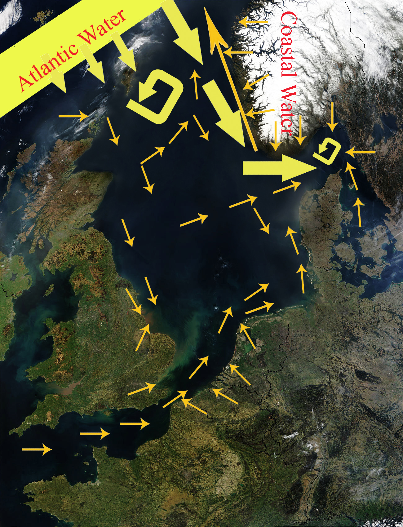
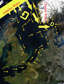 Ocean currents mainly entering via the north entrance exiting along Norwegian coast
The main pattern to the flow of water in the North Sea is an anti-clockwise rotation along the edges.[18]
The North Sea is an arm of the Atlantic Ocean receiving the majority of ocean current from the northwest opening, and a lesser portion of warm current from the smaller opening at the English Channel. These tidal currents leave along the Norwegian coast.[19] Surface and deep water currents may move in different directions. Low salinity surface coastal waters move offshore, and deeper, denser high salinity waters move in shore.[20]
The North Sea located on the continental shelf has different waves than those in deep ocean water. The wave speeds are diminished and the wave amplitudes are increased. In the North Sea there are two amphidromic systems and a third incomplete amphidromic system.[21][22] In the North Sea the average tide difference in wave amplitude is between 0 to 8 metres (0 to 26 ft).[4]
The Kelvin tide of the Atlantic ocean is a semidiurnal wave that travels northward. Some of the energy from this wave travels through the English Channel into the North Sea. The wave still travels northward in the Atlantic Ocean, and once past the northern tip of Great Britain, the Kelvin wave turns east and south and once again enters into the North Sea.[23]
Coasts
Main article: Coastline of the North Sea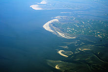 The German North Sea coast
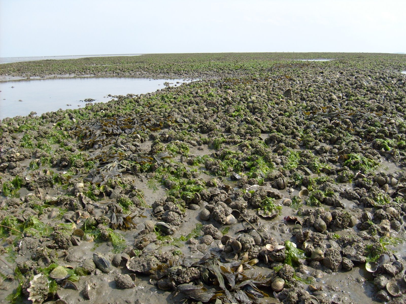
The eastern and western coasts of the North Sea are jagged, formed by glaciers during the ice ages. The coastlines along the southernmost part are covered with the remains of deposited glacial sediment.[1] The Norwegian mountains plunge into the sea creating deep fjords and archipelagos. South of Stavanger, the coast softens, the islands become fewer.[1] The eastern Scottish coast is similar, though less severe than Norway. From north east of England, the cliffs become lower and are composed of less resistant moraine, which erodes more easily, so that the coasts have more rounded contours.[24][25] In Holland, Belgium and in the east of England (East Anglia) the littoral is low and marshy.[1] The east coast and south-east of the North Sea (Wadden Sea) have coastlines that are mainly sandy and straight owing to longshore drift, particularly along Belgium and Denmark.[26]
Coastal management
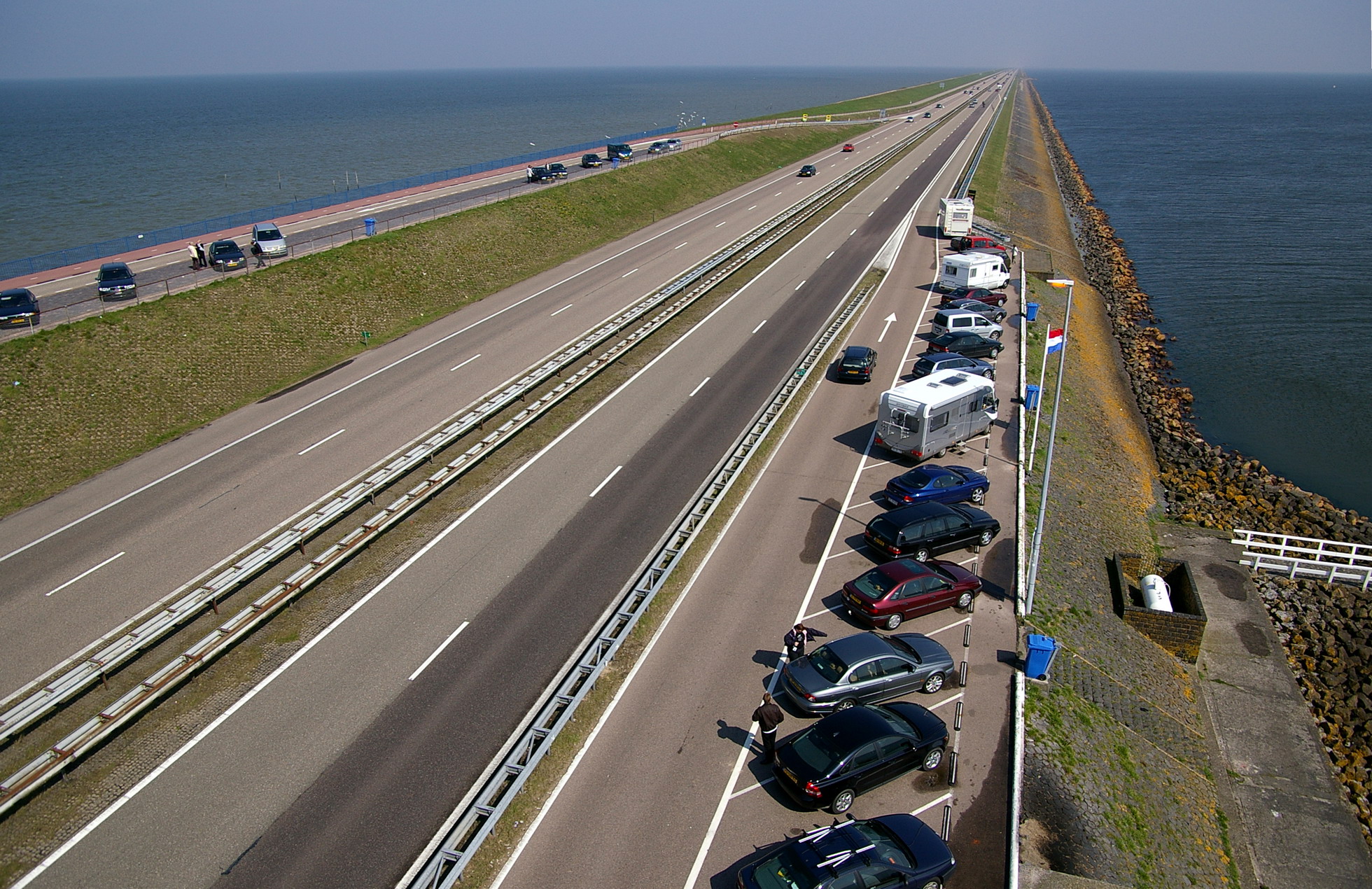
Further information: Afsluitdijk, Delta Works, Flood control in the Netherlands, Thames barrier, and Zuiderzee Works The Afsluitdijk (Closure-dike) is a major dam in the Netherlands
The southern coastal areas were originally amphibious flood plains and swampy land. In areas especially vulnerable to storm tides, people settled behind elevated levees and on natural areas of high ground such as spits and Geestland.[27]:[302,303] As early as 500 BC, people were constructing artificial dwelling hills higher than the prevailing flood levels.[27]:[306,308][28] It was only around the beginning of the High Middle Ages, in 1200 AD, that inhabitants began to connect single ring dikes into a dike line along the entire coast, thereby turning amphibious regions between the land and the sea into permanent solid ground.[27]
The modern form of the dikes supplemented by overflow and lateral diversion channels, began to appear in the 17th and 18th centuries, built in the Netherlands.[29] The North Sea Floods of 1953 and 1962 were impetus for further raising of the dikes as well as the shortening of the coast line so as to present as little surface area as possible to the punishment of the sea and the storms.[30] Currently, 27% of the Netherlands is below sea level protected by dikes, dunes, and beach flats.[31]
Coastal management today consists of several levels.[32] The dike slope reduces the energy of the incoming sea, so that the dike itself does not receive the full impact.[32] Dikes that lie directly on the sea are especially reinforced.[32] The dikes have, over the years, been repeatedly raised, sometimes up to 9 metres (30 ft) and have been made flatter to better reduce wave erosion.[33][34] Where the dunes are sufficient to protect the land behind them from the sea, these dunes are planted with beach grass to protect them from erosion by wind, water, and foot traffic.[35]
Storm tides
Main article: Storm tides of the North SeaStorm tides threaten, in particular, the coasts of the Netherlands, Belgium, Germany, and Denmark and low lying areas of eastern England particularly around The Wash and Fens.[26] Storm surges are caused by changes in barometric pressure combined with strong wind created wave action.[36]
The first recorded storm tide flood was the Julianenflut, on 17 February 1164. In its wake the Jadebusen, (a bay on the coast of Germany), began to form. A storm tide in 1228 is recorded to have killed more than 100,000 people.[37] In 1362, the Second Marcellus Flood, also known as the Grote Manndränke, hit the entire southern coast of the North Sea. Chronicles of the time again record more than 100,000 deaths as large parts of the coast were lost permanently to the sea, including the now legendary lost city of Rungholt.[38] In the 20th century, the North Sea flood of 1953 flooded several nations' coasts and cost more than 2,000 lives.[39] 315 citizens of Hamburg died in the North Sea flood of 1962.[40]:[79,86]
Tsunamis
Though rare, the North Sea has been the site of a number of historically documented tsunamis. The Storegga Slides were a series of underwater landslides, in which a piece of the Norwegian continental shelf slid into the Norwegian Sea. The immense landslips occurred between 8150 BC and 6000 BC, and caused a tsunami up to 20 metres (66 ft) high that swept through the North Sea, having the greatest effect on Scotland and the Faeroe Islands.[41][42] The Dover Straits earthquake of 1580 is among the first recorded earthquakes in the North Sea measuring between 5.6 and 5.9 on the Richter Scale. This event caused extensive damage in Calais both through its tremors and possibly triggered a tsunami, though this has never been confirmed. The theory is a vast underwater landslide in the English Channel was triggered by the earthquake, which in turn caused a tsunami.[43] The tsunami triggered by the 1755 Lisbon Earthquake reached Holland, although the waves had lost their destructive power. The largest earthquake ever recorded in the United Kingdom was the 1931 Dogger Bank earthquake, which measured 6.1 on the Richter Scale and caused a small tsunami that flooded parts of the British coast.[43][44]
Geology
Main article: Geology of the North Sea
Shallow epicontinental seas like the current North Sea have since long existed on the European continental shelf. The rifting that formed the northern part of the Atlantic Ocean during the Jurassic and Cretaceous periods, from about 150 million years ago, caused tectonic uplift in the British Isles.[45] Since then, a shallow sea has almost continuously existed between the highs of the Fennoscandian Shield and the British Isles.[46] This precursor of the current North Sea has grown and shrunk with the rise and fall of the eustatic sea level during geologic time. Sometimes it was connected with other shallow seas, such as the sea above the Paris Basin to the south-west, the Paratethys Sea to the south-east, or the Tethys Ocean to the south.[47]
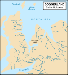 Map showing hypothetical extent of Doggerland (c. 8,000BC), which provided a land bridge between Great Britain and continental Europe
During the Late Cretaceous, about 85 million years ago, all of modern mainland Europe except for Scandinavia was a scattering of islands.[48] By the Early Oligocene, 34 to 28 million years ago, the emergence of Western and Central Europe had almost completely separated the North Sea from the Tethys Ocean, which gradually shrank to become the Mediterranean as Southern Europe and South West Asia became dry land.[49] The North Sea was cut off from the English Channel by a narrow land bridge until that was breached by at least two catastrophic floods between 450,000 and 180,000 years ago.[50][51] Since the start of the Quaternary period about 2.6 million years ago, the eustatic sea level has fallen during each glacial period and then risen again. Every time the ice sheet reached its greatest extent, the North Sea became almost completely dry. The present-day coastline formed after the Last Glacial Maximum when the sea began to flood the European continental shelf.[52]
In 2006 a bone fragment was found while drilling for oil in the north sea. Analysis indicated that it was a Plateosaurus from 199 to 216 million years ago. This was the deepest dinosaur fossil ever found and the first find for Norway.[53]
Natural history
Fish and shellfish
Copepods and other zooplankton are plentiful in the North Sea. These tiny organisms are crucial elements of the food chain supporting many species of fish.[54] Over 230 species of fish live in the North Sea. Cod, haddock, whiting, saithe, plaice, sole, mackerel, herring, pouting, sprat, and sandeel are all very common and are fished commercially.[54][55] Due to the various depths of the North Sea trenches and differences in salinity, temperature, and water movement, some fish such as blue-mouth redfish and rabbitfish reside only in small areas of the North Sea.[56]
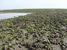
Crustaceans are also commonly found throughout the sea. Norway lobster, deep-water prawns, and brown shrimp are all commercially fished, but other species of lobster, shrimp, oyster, mussels and clams all live in the North Sea.[54] Recently non-indigenous species have become established including the Pacific oyster and Atlantic jackknife clam.[55]
Birds
The coasts of the North Sea are home to nature reserves including the Ythan Estuary, Fowlsheugh Nature Preserve, and Farne Islands in the UK and The Wadden Sea National Parks in Germany.[54] These locations provide breeding habitat for dozens of bird species. Tens of millions of birds make use of the North Sea for breeding, feeding, or migratory stopovers every year. Populations of Black legged Kittiwakes, Atlantic Puffins, Northern fulmars, and species of petrels, gannets, seaducks, loons (divers), cormorants, gulls, auks, and terns, and many other seabirds make these coasts popular for birdwatching.[54][55]
Marine mammals

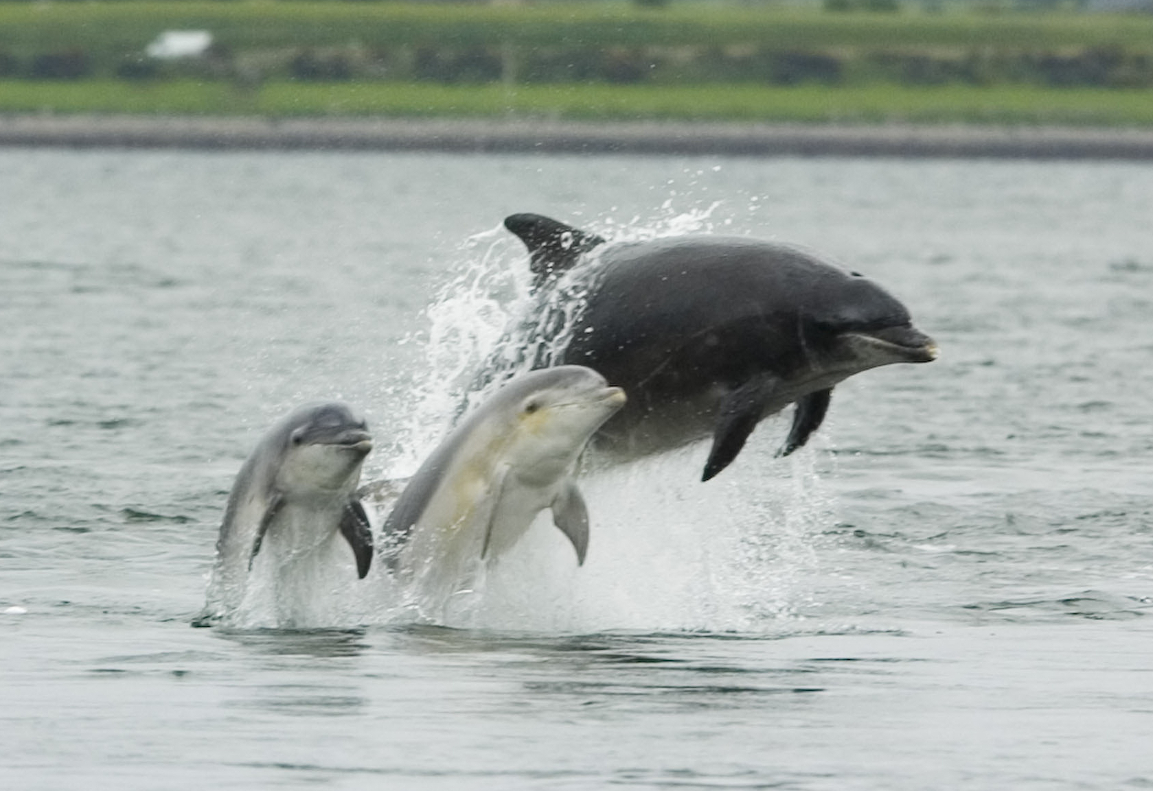
The North Sea is also home to marine mammals. Common seals, and Harbour porpoises can be found along the coasts, at marine installations, and on islands. The very northern North Sea islands such as the Shetland Islands are occasionally home to a larger variety of pinnipeds including bearded, harp, hooded and ringed seals, and even walrus.[57] North Sea cetaceans include various porpoise, dolphin and whale species.[55][58]
Flora
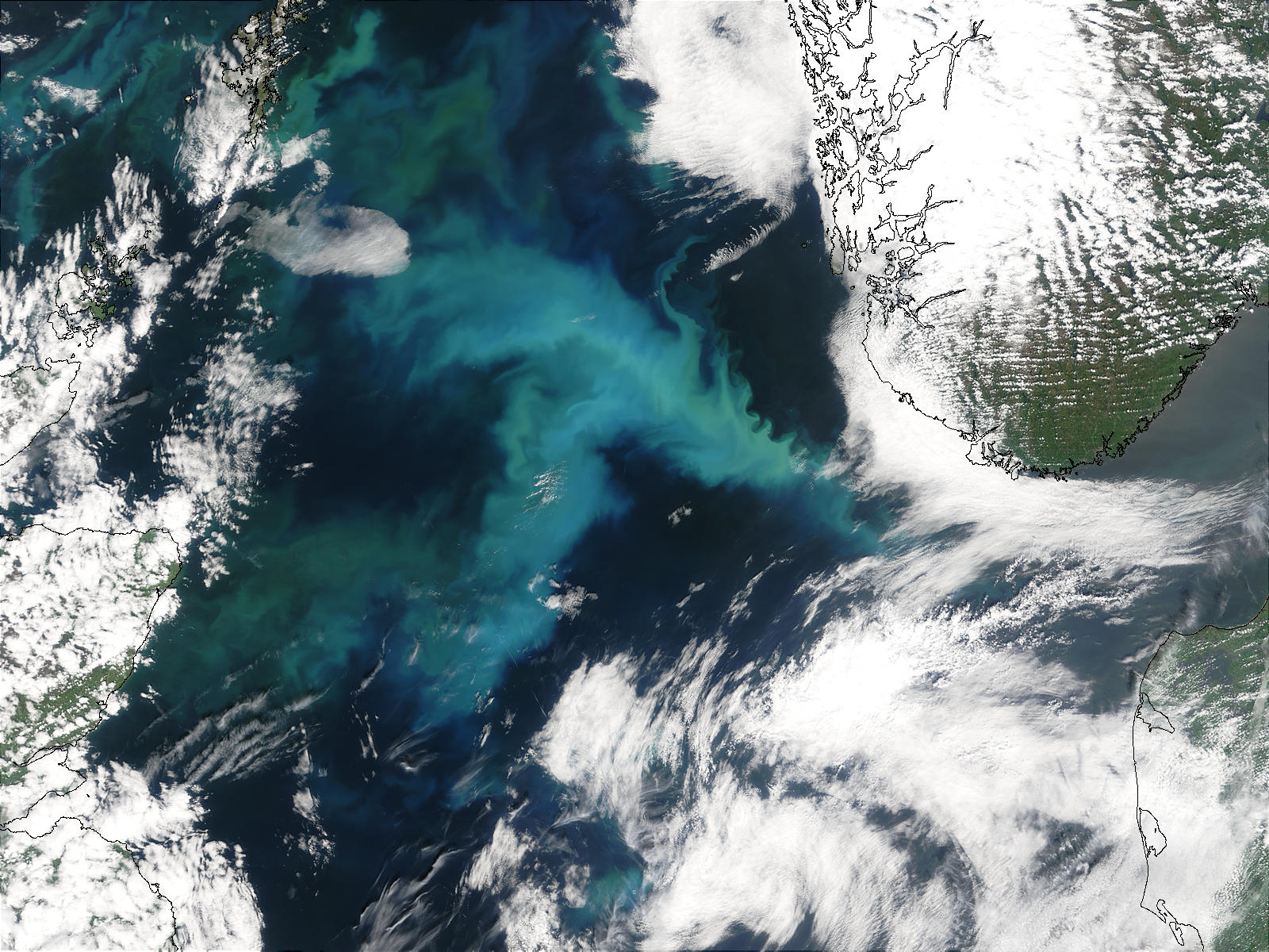
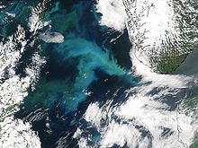 Phytoplankton bloom in the North Sea.
Plant species in the North Sea include species of wrack, among them bladder wrack, knotted wrack, and serrated wrack. Algae, macroalgal, and kelp, such as oarweed and laminaria hyperboria, and species of maerl are found as well.[55] Eelgrass, formerly common in the entirety of the Wadden Sea, was nearly wiped out in the 20th century by a disease.[59] Similarly, sea grass used to coat huge tracts of ocean floor, but have been damaged by trawling and dredging have diminished its habitat and prevented its return.[60] Invasive Japanese seaweed has spread along the shores of the sea clogging harbours and inlets and has become a nuisance.[61]
Biodiversity and conservation
Due to the heavy human populations and high level of industrialization along its shores, the wildlife of the North Sea has suffered from pollution, overhunting, and overfishing. Flamingos, pelicans, and Great Auk were once found along the southern shores of the North Sea, but went extinct over the 2nd millennium.[62] Gray whale also resided in the North Sea but were driven to extinction in the Atlantic in the 17th century[63] Other species have dramatically declined in population, though they are still found. Right whales, sturgeon, shad, rays, skates, salmon, and other species were common in the North Sea until the 20th century, when numbers declined due to overfishing.[64][65] Other factors like the introduction of non-indigenous species, industrial and agricultural pollution, trawling and dredging, human-induced eutrophication, construction on coastal breeding and feeding grounds, sand and gravel extraction, offshore construction, and heavy shipping traffic have also contributed to the decline.[55] The OSPAR commission manages the OSPAR convention to counteract the harmful effects of human activity on wildlife in the North Sea, preserve endangered species, and provide environmental protection.[66] All North Sea border states are signatories of the MARPOL 73/78 Accords, which preserve the marine environment by preventing pollution from ships.[67] Germany, Denmark, and the Netherlands also have a trilateral agreement for the protection of the Wadden Sea, or mudflats, which run along the coasts of the three countries on the southern edge of the North Sea.[68]
History
Main article: History of the North SeaName
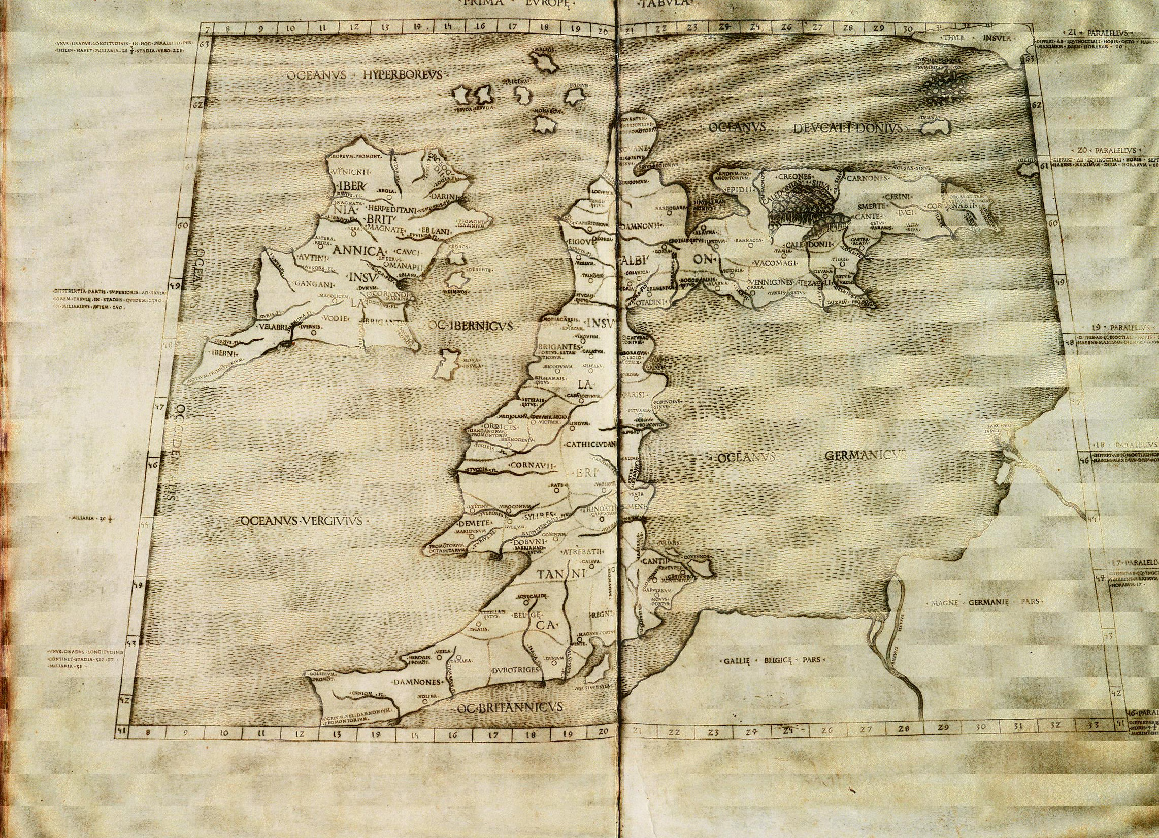
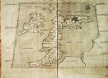 A 1490 recreation of a map from Ptolemy's Geography showing the "Oceanus Germanicus"
Through history various names have been used for the North Sea. One of the earliest recorded names was Septentrionalis Oceanus, or "Northern Ocean," which was cited by Pliny.[69] The name "North Sea" probably came into English, however, via the Dutch "Noordzee", who named it thus either in contrast with the Zuiderzee ("South Sea"), located south of Frisia, or simply because the sea is generally to the north of the Netherlands.[70] Prior to the adoption of "North Sea," "German Sea" or "German Ocean"--from the Latin name "Mare Germanicum" and "Oceanus Germanicus"--were the names in English, and they persisted even into the late 19th Century.[71]
Early history
The North Sea has provided waterway access for commerce and conquest. Many areas have access to the North Sea with its long coastline and European rivers that empty into it.[1] The British Isles had been protected from invasion by the North Sea waters[1] until the Roman conquest of Britain in 43 AD. The Romans established organised ports, shipping increased and sustained trade began.[72] When the Romans abandoned Britain in 410 the Germanic Angles, Saxons, and Jutes began the next great migration across the North Sea during the Migration Period invading England.[73]
The Viking Age began in 793 with the attack on Lindisfarne and for the next quarter-millennium the Vikings ruled the North Sea. In their superior longships, they raided, traded, and established colonies and outposts on the Sea's coasts. From the Middle Ages through the 15th century, the northern European coastal ports exported domestic goods, dyes, linen, salt, metal goods and wine. The Scandinavian and Baltic areas shipped grain, fish, naval necessities, and timber. In turn the North Sea countries imported high grade cloths, spices, and fruits from the Mediterranean region[74] Commerce during this era was mainly undertaken by maritime trade due to underdeveloped roadways.[74]
In the 13th century the Hanseatic League, though centred on the Baltic Sea, started to control most of the trade through important members and outposts on the North Sea.[75] The League lost its dominance in the 16th century, as neighbouring states took control of former Hanseatic cities and outposts and internal conflict prevented effective cooperation and defence.[76] Furthermore, as the League lost control of its maritime cities, new trade routes emerged that provided Europe with Asian, American, and African goods.[77][78]
Age of sail
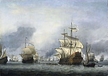
The 17th century Dutch Golden Age during which Dutch herring, cod and whale fisheries reached an all time high[74] saw Dutch power at its zenith.[79][80] Important overseas colonies, a vast merchant marine, powerful navy and large profits made the Dutch the main challengers to an ambitious England. This rivalry led to the first three Anglo-Dutch Wars between 1652 and 1673, which ended with Dutch victories.[80] After the Glorious Revolution the Dutch prince William ascended to the English throne. With both countries united, commercial, military, and political power shifted from Amsterdam to London.[81] The Great Northern War (1700–21) and the War of the Spanish Succession (1701–1714) were fought concurrently.[82] The British did not face a challenge to their dominance of the North Sea until the 20th century.[83]
Modern era

Tensions in the North Sea were again heightened in 1904 by the Dogger Bank incident, in which Russian naval vessels mistook British fishing boats for Japanese ships and fired on them, and then upon each other.
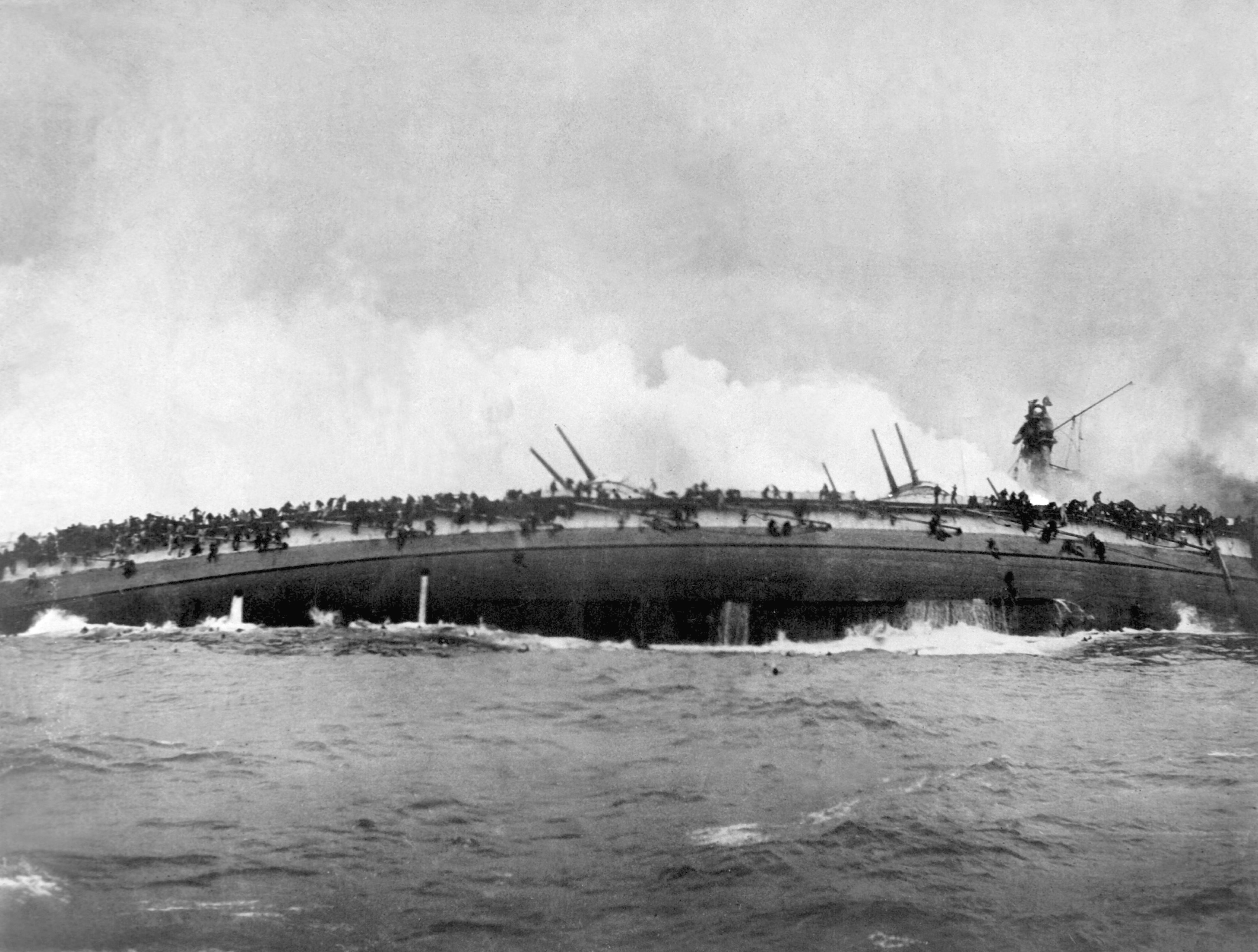
During the First World War, Great Britain's Grand Fleet and Germany's Kaiserliche Marine faced each other on the North Sea,[84] which became the main theatre of the war for surface action.[84] Britain's larger fleet was able to establish an effective blockade for most of the war that restricted the Central Powers' access to many crucial resources.[85] Major battles included the Battle of Heligoland Bight,[86] the Battle of the Dogger Bank,[87] and the Battle of Jutland.[87] World War I also brought the first extensive use of submarine warfare, and a number of submarine actions occurred in the North Sea.[88]
The Second World War also saw action in the North Sea,[89] though it was restricted more to aircraft reconnaissances, aircraft fighter/bombers, submarines and smaller vessels such as minesweepers, and torpedo boats and similar vessels.[90]
In the last years of the war and the first years thereafter, hundreds of thousands of tons of weapons were disposed of by being sunk in the North Sea.[91]
After the war, the North Sea lost much of its military significance because it is bordered only by NATO member-states. However, it gained significant economic importance in the 1960s as the states on the North Sea began full-scale exploitation of its oil and gas resources.[92] The North Sea continues to be an active trade route.[93]
Economy
 The Exclusive Economic Zones in the North Sea
Political status
Countries that border the North Sea all claim the 12 nautical miles (22 km; 14 mi) of territorial waters, within which they have exclusive fishing rights.[94] The Common Fisheries Policy of the European Union (EU) exists to coordinate fishing rights and assist with disputes between EU states and the EU border state of Norway.[95]
After the discovery of mineral resources in the North Sea, the Convention on the Continental Shelf established country rights largely divided along the median line. The median line is defined as the line "every point of which is equidistant from the nearest points of the baselines from which the breadth of the territorial sea of each State is measured."[96] The ocean floor border between Germany, the Netherlands, and Denmark was only reapportioned after protracted negotiations and a judgement of the International Court of Justice.[94][97]
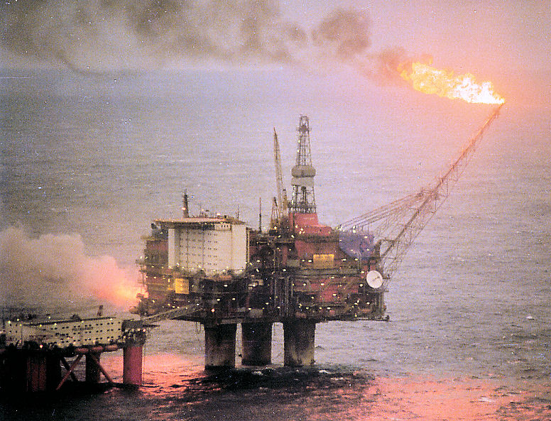
Oil and gas
Further information: North Sea oil and List of oil and gas fields of the North SeaAs early as 1859, oil was discovered in onshore areas around the North Sea and natural gas as early as 1910.[48]
 Oil platform Statfjord A with the flotel Polymarine
Test drilling began in 1966 and then, in 1969, Phillips Petroleum Company discovered the Ekofisk oil field[98] distinguished by valuable, low-sulphur oil.[99] Commercial exploitation began in 1971 with tankers and, after 1975, by a pipeline, first to Teesside, England and then, after 1977, also to Emden, Germany.[100]
The exploitation of the North Sea oil reserves began just before the 1973 oil crisis, and the climb of international oil prices made the large investments needed for extraction much more attractive.[101]
Although the production costs are relatively high, the quality of the oil, the political stability of the region, and the nearness of important markets in western Europe has made the North Sea an important oil producing region.[99] The largest single humanitarian catastrophe in the North Sea oil industry was the destruction of the offshore oil platform Piper Alpha in 1988 in which 167 people lost their lives.[102]
Besides the Ekofisk oil field, the Statfjord oil field is also notable as it was the cause of the first pipeline to span the Norwegian trench.[103] The largest natural gas field in the North Sea, Troll gas field, lies in the Norwegian trench dropping over 300 metres (980 ft) requiring the construction of the enormous Troll A platform to access it.
The price of Brent Crude, one of the first types of oil extracted from the North Sea, is used today as a standard price for comparison for crude oil from the rest of the world.[104] The North Sea contains western Europe's largest oil and natural gas reserves and is one of the world's key non-OPEC producing regions.[105]
Fishing
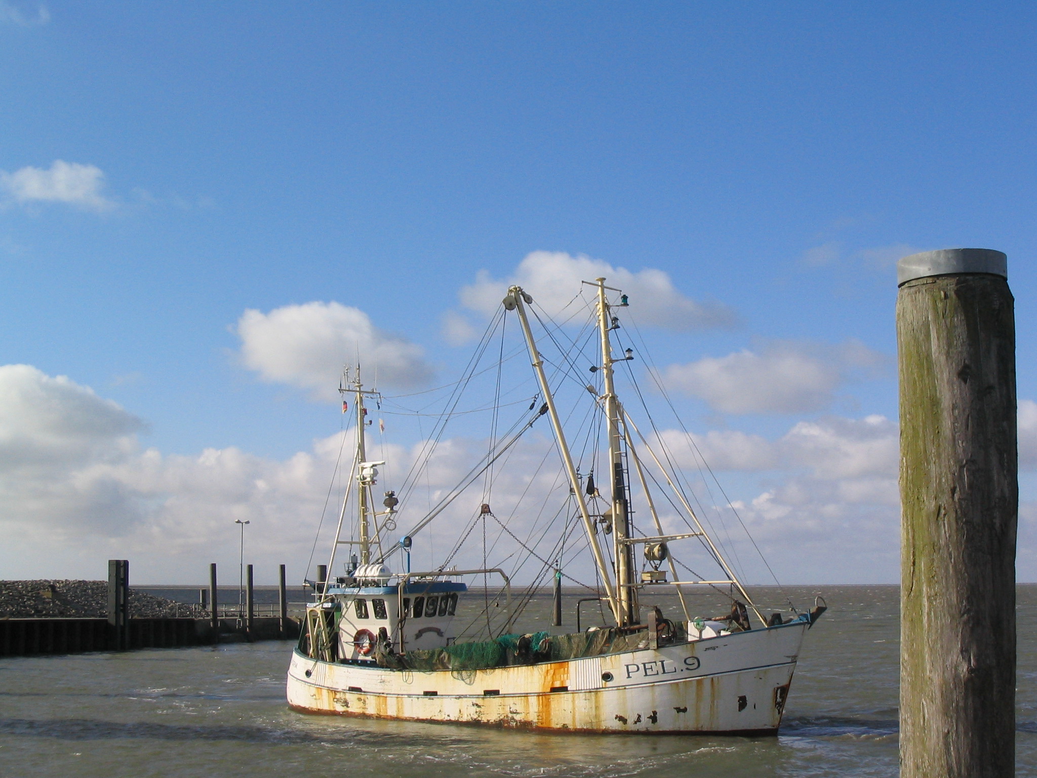
 A trawler in Nordstrand, GermanyMain article: Fishing in the North Sea
The North Sea is Europe's main fishery accounting for over 5% of international commercial fish caught.[1] Fishing in the North Sea is concentrated in the southern part of the coastal waters. The main method of fishing is trawling.[106] In 1995, the total volume of fish and shellfish caught in the North Sea was approximately 3.5 million tonnes.[107] Besides fish, it is estimated that one million tonnes of unmarketable by-catch is caught and discarded each year.[108]
In recent decades, overfishing has left many fisheries unproductive, disturbing marine food chain dynamics and costing jobs in the fishing industry.[109] Herring, cod and plaice fisheries may soon face the same plight as mackerel fishing, which ceased in the 1970s due to overfishing.[110] The objective of the European Union Common Fisheries Policy is to minimize the environmental impact associated with resource use by reducing fish discards, increasing productivity of fisheries, stabilising markets of fisheries and fish processing, and supplying fish at reasonable prices for the consumer.[111]
Mineral resources
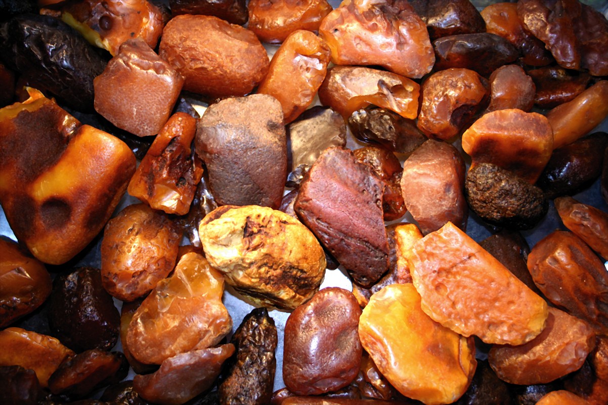
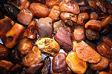 Unpolished amber stones, in varying hues
In addition to oil, gas, and fish, the states along the North Sea also take millions of cubic metres per year of sand and gravel from the ocean floor. These are used for beach nourishment, land reclamation and construction.[112] Rolled pieces of amber, may be picked up on the east coast of England.[113]
Renewable energy
Further information: Renewable energy in the European Union and List of offshore wind farms in the North SeaDue to the strong prevailing winds, countries on the North Sea, particularly Germany and Denmark, have used the shore for wind power since the 1990s.[114] The North Sea is the home of one of the first large-scale offshore wind farms in the world, Horns Rev 1, completed in 2002. Since then many other wind farms have been commissioned in the North Sea (and elsewhere), including the two largest windfarms in the world as of September 2010; Thanet in the UK[115][116] and Horns Rev 2 in Denmark.[117]
The expansion of offshore wind farms has met with some resistance. Concerns have include shipping collisions[118] and environmental effects on ocean ecology and wildlife such as fish and migratory birds,[119][120] however, these concerns were found to be negligible in a long-term study in Denmark released in 2006[121] and again in a UK government study in 2009.[122][123] There are also concerns about reliability,[124] and the rising costs of constructing and maintaining offshore wind farms.[125] Despite these, development of North Sea wind power is continuing, with plans for additional wind farms off the coasts of Germany, the Netherlands, and the UK.[126][127][128] There have also been proposals for a transnational power grid in the North Sea to connect new offshore wind farms.[129][130]
Energy production from tidal power is still in a pre-commercial stage. The European Marine Energy Centre has installed a wave testing system at Billia Croo on the Orkney mainland[131] and a tidal power testing station on the nearby island of Eday.[132] Since 2003, a prototype Wave Dragon energy converter has been in operation at Nissum Bredning fjord of northern Denmark.[133]
Tourism
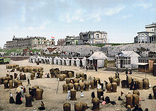 The beach in Scheveningen, Netherlands in c. 1900
The beaches and coastal waters of the North Sea are popular destinations for tourists. The Belgian, Dutch, German and Danish coasts[134][135] are especially developed for tourism. The North Sea Trail is a long-distance trail linking seven countries around the North Sea.[136] Windsurfing and sailing[137] are popular sports because of the strong winds. Mudflat hiking,[138] recreational fishing and birdwatching[135] are among other popular activities.
The climatic conditions on the North Sea coast are often claimed to be especially healthful. As early as the 19th century, travellers used their stays on the North Sea coast as curative and restorative vacations. The sea air, temperature, wind, water, and sunshine are counted among the beneficial conditions that are said to activate the body's defences, improve circulation, strengthen the immune system, and have healing effects on the skin and the respiratory system.[139]
Marine traffic
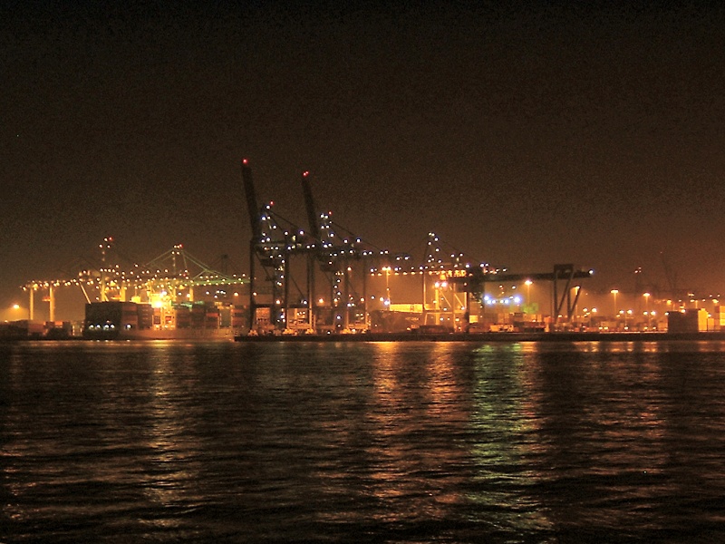
See also: List of North Sea portsThe North Sea is important for marine transportation and its shipping lanes are among the busiest in the world.[94] Major ports are located along its coasts: Rotterdam, The busiest port in Europe and the third busiest port in the world by tonnage as of 2008[update], Antwerp (16th) and Hamburg (27th), Bremen/Bremerhaven and Felixstowe, both in the top 30 busiest container seaports,[140] as well as the Port of Bruges-Zeebrugge, Europe's leading RoRo port.[141]
 Rotterdam, Netherlands
Fishing boats, service boats for offshore industries, sport and pleasure craft, and merchant ships to and from North Sea ports and Baltic ports must share routes on the North Sea. The Dover Strait alone sees more than 400 commercial vessels a day.[142] Because of this volume, navigation in the North Sea can be difficult in high traffic zones, so ports have established elaborate vessel traffic services to monitor and direct ships into and out of port.[143]
The North Sea coasts are home to numerous canals and canal systems to facilitate traffic between and among rivers, artificial harbours, and the sea. The Kiel Canal, connecting the North Sea with the Baltic Sea, is the most heavily used artificial seaway in the world reporting an average of 89 ships per day not including sporting boats and other small watercraft in 2009.[144] It saves an average of 250 nautical miles (460 km; 290 mi), instead of the voyage around the Jutland Peninsula.[145] The North Sea Canal connects Amsterdam with the North Sea.[146]
See also
- List of the largest islands in the North Sea
- Doggerland
- List of languages of the North Sea
- North Sea Commission
- European atlas of the seas
Notes
- ^ a b c d e f g h i j k l m n o L.M.A. (1985). "Europe". In University of Chicago. Encyclopædia Britannica Macropædia. 18 (Fifteenth ed.). U.S.A.: Encyclopadia Britannica Inc.. pp. 832–835. ISBN 0-85229-423-9.
- ^ a b c d Ripley, George; Charles Anderson Dana (1883) (Digitized 2007-10-11 by Google Books online). The American Cyclopaedia: A Popular Dictionary of General Knowledge. D. Appleton and company. p. 499. http://books.google.com/?id=GEpMAAAAMAAJ&pg=PA499&dq=Norway,+Denmark,+Germany,+the+Netherlands,+Belgium,+and+France+%22North+Sea%22. Retrieved 2008-12-26.
- ^ Helland-Hansen, Bjørn; Fridtjof Nansen (1909). "IV. The Basin of the Norwegian Sea.". Report on Norwegian Fishery and Marine-Investigations Vol. 11 No. 2. Geofysisk Institutt. http://web.gfi.uib.no/The%20Norwegian%20Sea/TNS-002.htm. Retrieved 2009-01-09.
- ^ a b c d "About the North Sea: Key facts". Safety at Sea project: Norwegian Coastal Administration. 2008. http://www.safetyatsea.se/index.php?section=northsea. Retrieved 2008-11-02.
- ^ Ray, Alan; G. Carleton, Jerry McCormick-Ray (2004) (Digitized by Google Books online). Coastal-marine Conservation: Science and Policy (illustrated ed.). Blackwell Publishing. p. 262. ISBN 0632055375, 9780632055371. http://books.google.com/?id=E7xLaYVGEF4C&pg=PA262&dq=%22North+Sea%22+watershed. Retrieved 2009-01-21.
- ^ "Chapter 5: North Sea" (PDF). Environmental Guidebook on the Enclosed Coastal Seas of the World. International Center for the Environmental Management of Enclosed Coastal Seas. 2003. http://www.emecs.or.jp/guidebook/eng/pdf/05north.pdf. Retrieved 2008-11-24.
- ^ a b Calow, Peter (1999). Blackwell's Concise Encyclopedia of Environmental Management. Blackwell Publishing. ISBN 0632049510. http://books.google.com/?id=L7V-JtHroGkC&pg=PA100. Retrieved 2008-12-26.
- ^ Ostergren, Robert Clifford; John G. Rice (2004) (Digitized by Google Books online). The Europeans: A Geography of People, Culture, and Environment. Bath, UK: Guilford Press. p. 62. ISBN 0898622727. http://books.google.com/?id=wgPSUQ873scC&pg=PA62. Retrieved 2009-01-10.
- ^ Dogger Bank. Maptech Online MapServer. 1989–2008. http://mapserver.maptech.com/homepage/index.cfm?lat=54.74456315454079&lon=2.3527509224287115&scale=1500000&zoom=50&type=0&icon=0&width=498&height=498&searchscope=dom&CFID=1719760&CFTOKEN=33728793&scriptfile=http://mapserver.maptech.com/homepage/index.cfm&latlontype=DMS. Retrieved 2007-07-20.
- ^ Tuckey, James Hingston (1815) (Digitized May 2, 2007 by Google Books online). Maritime Geography and Statistics .... Black, Parry & Co.. p. 445. ISBN 0521311918, 9780521311915. http://books.google.com/?id=EMMBAAAAYAAJ&pg=PA420&dq=%22north+forties%22++%22broad+fourteens%22++fathoms. Retrieved 2009-01-10.
- ^ Bradford, Thomas Gamaliel (1838) (Digitized October 11, 2007 by Google Books online). Encyclopædia Americana: A Popular Dictionary of Arts, Sciences, Literature, History, Politics, and Biography, Brought Down to the Present Time; Including a Copious Collection of Original Articles in American Biography; on the Basis of the Seventh Edition of the German Conversations-lexicon. Thomas, Cowperthwait, & co.. p. 445. ISBN 0521311918, 9780521311915. http://books.google.com/?id=cxsPAAAAYAAJ&pg=PA445&dq=navigation+%22north+sea%22. Retrieved 2009-01-10.
- ^ Alan Fyfe (Autumn 1983). "The Devil's Hole in the North Sea". The Edinburgh Geologist (14). http://www.edinburghgeolsoc.org/edingeologist/z_14_04.html/. Retrieved 2008-11-02.
- ^ "Limits of Oceans and Seas, 3rd edition". International Hydrographic Organization. 1953. http://www.iho-ohi.net/iho_pubs/standard/S-23/S23_1953.pdf. Retrieved 6 February 2010.
- ^ The Walde Lighthouse is 6 km east of Calais (50°59′06″N 1°55′00″E / 50.985°N 1.9166667°E), and Leathercoat Point is at the north end of St Margaret's Bay, Kent (51°10′00″N 1°24′00″E / 51.1666667°N 1.4°E).
- ^ "North Sea cod 'could disappear' even if fishing outlawed" Telegraph.co.uk
- ^ "Global Warming Triggers North Sea Temperature Rise". Agence France-Presse. SpaceDaily.AFP and UPI Wire Stories. 2006-11-14. http://www.terradaily.com/reports/Global_Warming_Triggers_North_Sea_Temperature_Rise_999.html. Retrieved 2008-12-01.
- ^ Reddy, M. P. M. (2001). "Annual variation in Surface Salinity". Descriptive Physical Oceanography. Taylor & Francis. p. 114. ISBN 9054107065. http://books.google.com/?id=2NC3JmKI7mYC&pg=PA120. Retrieved 2008-12-03.
- ^ "Met Office: Flood alert!". Met office UK government. 2006-11-28. http://web.archive.org/web/20061231073713/http://www.metoffice.gov.uk/education/secondary/students/flood.html. Retrieved 2008-11-02.
- ^ "Safety At Sea". Currents in the North Sea. 2009. http://www.safetyatsea.se/index.php?art=2041&group=400. Retrieved 2009-01-09.
- ^ Freestone, David; Ton Ijlstra (1990). "Physical Properties of Sea Water and their Distribution Annual: Variation in Surface Salinity". The North Sea: Perspectives on Regional Environmental Co-operation. Martinus Nijhoff Publishers. p. 114. ISBN 1853334138. http://books.google.com/?id=sGSMw7gCOLYC&pg=PA67. Retrieved 2008-12-03.
- ^ Dyke, Phil (1974). Modeling Coastal and Offshore Processes. Imperial College Press. pp. 323–365. ISBN 1860946747. http://books.google.com/?id=c3MOQKCru6sC&pg=PA328. Retrieved 2008-12-04. p. 329 tidal map showing amphidromes
- ^ Carter, R. W. G. (1974). Coastal Environments: An Introduction to the Physical, Ecological and Cultural Systems of Coastlines. Academic Press. pp. 155–158. ISBN 0121618560. http://books.google.com/?id=STBKHpqMt6MC&pg=PA157. Retrieved 2008-12-04. p. 157 tidal map showing amphidromes
- ^ Pugh, D. T. (2004) (Digitized by Google Books online). Changing Sea Levels: Effects of Tides, Weather, and Climate. Cambridge University Press. p. 93. ISBN 0521532183. http://books.google.com/?id=Ysa4ymmEotYC&pg=PA93. Retrieved 2008-12-04. p. 94 shows the amphidromic points of the North Sea
- ^ "Development of the East Riding Coastline" (PDF). East Riding of Yorkshire Council. Archived from the original on 2007-08-10. http://web.archive.org/web/20070810055627/http://www.eastriding.gov.uk/aspirelinks/coastal/1development.pdf. Retrieved 2007-07-24.
- ^ "Holderness Coast United Kingdom" (PDF). EUROSION Case Study. http://copranet.projects.eucc-d.de/files/000164_EUROSION_Holderness_coast.pdf. Retrieved 2007-07-24.
- ^ a b (PDF) Overview of geography, hydrography and climate of the North Sea (Chapter II of the Quality Status Report.. Convention for the Protection of the Marine Environment of the North-East Atlantic (OSPAR). 2000. http://www.ospar.org/eng/doc/pdfs/R2C2.pdf. Retrieved 2007-12-04.
- ^ a b c Wefer, Gerold; Wolfgang H. Berger, K. E. Behre, & Eystein Jansen (2002) [2002]. Climate Development and History of the North Atlantic Realm: With 16 Tables. Springer. pp. 308–310. ISBN 3540432019. http://books.google.com/?id=NACgnCN_jaEC&pg=PA308. Retrieved 2008-12-04.
- ^ Khan, Maswood Alam (2005) (PDF). How long to be drowned by floods?. Economic Observer. http://www.economic-observer.com/August07/article5.pdf. Retrieved 2008-11-02.
- ^ Oosthoek, K. Jan (2006–2007). "History of Dutch river flood defences". Environmental History Resources. http://www.eh-resources.org/floods.html. Retrieved 2007-07-24.
- ^ "North Sea Protection Works – Seven Modern Wonders of World". Compare Infobase Limited. 2006–2007. Archived from the original on 2007-05-25. http://web.archive.org/web/20070525134637/http://www.allwondersoftheworld.com/seven-modern-wonders/north-sea-protection-works.html. Retrieved 2007-07-24.
- ^ Rosenberg, Matt (2007-01-30). "Dykes of the Netherlands". About.com – Geography. The New York Times. http://geography.about.com/od/specificplacesofinterest/a/dykes.htm. Retrieved 2007-07-19.
- ^ a b c "Science around us: Flexible covering protects imperiled dikes – BASF – The Chemical Company – Corporate Website". BASF. http://www.basf.com/group/corporate/en/content/news-and-media-relations/science-around-us/imperiled-dikes/index. Retrieved 2009-01-16.
- ^ Peters, Karsten; Magnus Geduhn, Holger Schüttrumpf, Helmut Temmler (31 August to 5 September 2008). "Impounded water in Sea Dikes". ICCE. http://icce2008.hamburg.baw.de/downloads/intern/Paper/BookOfAbstracts/0863_Peters.pdf. Retrieved 2009-01-16.
- ^ "Planungen zum Küstenschutz in Niedersachsen" (in German) (PDF). Niedersächsischer Landesbetrieb für Wasserwirtschaft, Küsten-und Naturschutz. http://www.safecoast.org/editor/databank/File/Towards%20a%20Generalplan%20kustenschutz2.pdf. Retrieved 2008-11-02.
- ^ "Dune Grass Planting". A guide to managing coastal erosion in beach/dune systems – Summary 2. Scottish Natural Heritage. 2000. http://www.snh.org.uk/publications/on-line/heritagemanagement/erosion/appendix_1.2.shtml. Retrieved 2008-11-02.
- ^ Ingham, J. K.; John Christopher Wolverson Cope, P. F. Rawson (1999). "Quaternary". Atlas of Palaeogeography and Lithofacies. Geological Society of London. p. 150. ISBN 186239055X. http://books.google.com/?id=0I6BNSgx3_cC&pg=RA1-PA150. Retrieved 2008-12-15.
- ^ Morin, Rene (2008-10-02). "Social, economical and political impact of Weather" (PDF). EMS annual meeting. http://www.emetsoc.org/annual_meetings/documents/Morin_SilverMedalLecture_2008.pdf. Retrieved 2008-12-04.
- ^ "scinexx | Der Untergang: Die Grote Manndränke – Rungholt Nordsee" (in German). MMCD NEW MEDIA. 06.12.2008 Saturday. http://translate.google.ca/translate?hl=en&sl=de&u=http://www.g-o.de/dossier-detail-395-8.html&sa=X&oi=translate&resnum=5&ct=result&prev=/search%3Fq%3D1362%2BGroote%2BManndr%25C3%25A4nke%26hl%3Den%26client%3Dfirefox-a%26rls%3Dorg.mozilla:en-GB:official%26sa%3DG. Retrieved 2008-12-04.
- ^ Coastal Flooding: The great flood of 1953. Investigating Rivers. http://www.naturegrid.org.uk/rivers/gt%20stour%20case%20study-pages/fld-cstl.html. Retrieved 2007-07-24.
- ^ Lamb, H. H. (1988) (Digitized online by Google books). Weather, Climate & Human Affairs: A Book of Essays and (illustrated ed.). Taylor & Francis. p. 187. ISBN 0415006740, 9780415006743. http://books.google.com/?id=m5IOAAAAQAAJ&pg=PA131&dq=North+Frisian+Flood+of+1981. Retrieved 2009-01-12.
- ^ Bojanowski, Axel (2006-10-11). "Tidal Waves in Europe? Study Sees North Sea Tsunami Risk". Spiegel Online. http://www.spiegel.de/international/0,1518,441819,00.html. Retrieved 2007-07-24.
- ^ Bondevik, Stein; Sue Dawson, Alastair Dawson, & Øystein Lohne (2003-08-05). "Record-breaking Height for 8000-Year-Old Tsunami in the North Atlantic" (PDF). EOS, Transactions of the American Geophysical Union 84 (31): 289, 293. Bibcode 2003EOSTr..84..289B. doi:10.1029/2003EO310001. http://www.ibg.uit.no/~stein/Bondevik-al-03-EOS.pdf. Retrieved 2007-01-15.
- ^ a b A tsunami in Belgium?. Royal Belgian Institute of Natural Sciences. 2005. http://www.naturalsciences.be/active/sciencenews/archive2005/tsunami. Retrieved 2008-11-02.
- ^ Today in Earthquake History June 7. U.S. Geological Survey. 2008. http://earthquake.usgs.gov/learning/today/his_06_07.php. Retrieved 2008-11-02.
- ^ Ziegler, P. A. (1975). "Geologic Evolution of North Sea and Its Tectonic Framework". AAPG Bulletin 59. doi:10.1306/83D91F2E-16C7-11D7-8645000102C1865D.
- ^ See Ziegler (1990) or Glennie (1998) for the development of the paleogeography around the North Sea area from the Jurassic onwards
- ^ Torsvik, Trond H.; Daniel Carlos, Jon L. Mosar, Robin M. Cocks, & Tarjei N. Malme (November 2004). "Global reconstructions and North Atlantic paleogeography 440 Ma to Recen" (PDF). http://www.geodynamics.no/guest/BAT_Torsvik.pdf. Retrieved 2008-11-19.
- ^ a b Glennie, K. W. (1998). Petroleum Geology of the North Sea: Basic Concepts and Recent Advances. Blackwell Publishing. pp. 11–12. ISBN 9780632038459 =. http://books.google.com/?id=BRoJwOzO3NUC&pg=PA11.
- ^ Smith, A. G. (2004) (Digitized by Google Books online). Atlas of Mesozoic and Cenozoic Coastlines. Cambridge University Press. pp. 27–38. ISBN 0521602874. http://books.google.com/?id=ZSuuvlMuQaEC&pg=PA66&dq=%22north+sea%22+paleogeography. Retrieved 2008-11-24.
- ^ Gibbard, P. (2007-07-19). "Palaeogeography: Europe cut adrift". Nature 448 (7151): 259–60. Bibcode 2007Natur.448..259G. doi:10.1038/448259a. PMID 17637645. (Registration is required)
- ^ Gupta, Sanjeev; Collier, Jenny S.; Palmer-Felgate, Andy; Potter, Graeme (2007). "Catastrophic flooding origin of shelf valley systems in the English Channel". Nature 448 (7151): 342–5. Bibcode 2007Natur.448..342G. doi:10.1038/nature06018. PMID 17637667.
- ^ Sola, M. A.; D. Worsley, Muʼassasah al-Waṭanīyah lil-Nafṭ (2000) (Digitized by Google Books online). Geological Exploration in Murzuq Basin. Elsevier Science B.V.. ISBN 0-4444-50611-X. http://books.google.com/?id=WX2iJQmKTvcC&pg=PA18&lpg=PA18&dq=%22intracratonic+basin%22+%22north+sea%22. Retrieved 2008-11-19.
- ^ Discovery Channel :: News – Dinosaurs :: Norway's First Dinosaur Found. Dsc.discovery.com. Retrieved on 2011-11-05.
- ^ a b c d e "MarBEF Educational Pullout: The North Sea" (PDF). Ecoserve. MarBEF Educational Pullout Issue 4. http://www.marbef.org/outreach/downloads/North%20sea%20pullout.pdf. Retrieved 2009-01-12.
- ^ a b c d e f "Quality Status Report for the Greater North Sea" (PDF). Convention for the Protection of the Marine Environment of the North-East Atlantic (OSPAR). 2000. http://www.bmu.de/files/pdfs/allgemein/application/pdf/kapitel5_ospar_report.pdf. Retrieved 2007-12-21.
- ^ (PDF) Factors affecting the distribution of North Sea fish. International Council for the Exploration of the Sea ICES. 2003. http://www.ices.dk/marineworld/fishmap/pdfs/factors.pdf. Retrieved 2007-12-09.
- ^ Marine mammals in the waters of the north sea. The North Sea Bird Club. 2002-12-11. http://www.abdn.ac.uk/nsbc/mar_mammals.hti. Retrieved 2007-12-21.
- ^ Whales and dolphins in the North Sea 'on the increase'. Newcastle University Press Release. 2005-04-02. http://www.ncl.ac.uk/press.office/press.release/item/?ref=1112607082. Retrieved 2007-12-21.
- ^ Nienhuis, P.H. (2008). "Causes of the eelgrass wasting disease: Van der Werff's changing theories". Aquatic Ecology 28 (1): 55. doi:10.1007/BF02334245.
- ^ "Effects of Trawling and Dredging on Seafloor Habitat". Ocean Studies Board (OSB). National Academy of Sciences. 2008. http://www.nap.edu/openbook.php?record_id=10323&page=27. Retrieved 2008-11-02.
- ^ Tait, Ronald Victor; Frances Dipper (1998) (Digitized by Google Books online). Elements of Marine Ecology. Butterworth-Heinemann. p. 432. ISBN 0750620889, 9780750620888. http://books.google.com/?id=gHrXsKJ89rEC&pg=PA432&dq=%22japanese+seaweed%22+%22north+sea%22. Retrieved 2008-12-27.
- ^ "Extinct / extirpated species" (doc). Dr. Ransom A. Myers – Research group website. Future of Marine Animal Populations/Census of Marine Life. 2006-10-27. http://www.fmap.ca/ramweb/media/biodiversity_loss/downloads/Examples_regional_extinctions.doc. Retrieved 2008-11-24.
- ^ "The Extinction Website – Species Info – Atlantic Grey Whale". 2008-01-19. http://www.petermaas.nl/extinct/speciesinfo/atlanticgreywhale.htm. Retrieved 2008-12-03.
- ^ Brown, Paul (2002-03-21). "North Sea in crisis as skate dies out Ban placed on large areas to stave off risk of species being destroyed". London: Guardian Unlimited © Guardian News and Media Limited. http://www.guardian.co.uk/Archive/Article/0,4273,4378387,00.html. Retrieved 2008-12-03.
- ^ Williot, Patrick; Éric Rochard. "Ecosystems and territories" (PDF). Sturgeon, Restoring an endangered species. Cemagref. http://web.archive.org/web/20081217143716/http://www.cemagref.fr/english/seven/News/07/25ans/ETsturgeon.pdf. Retrieved 2008-12-03.
- ^ "OSPAR Convention". European Union. 2000. http://europa.eu/scadplus/leg/en/lvb/l28061.htm. Retrieved 2008-11-30.
- ^ "Official Journal of the European Communities 28.12.2000 L 332/81". DIRECTIVE 2000/59/EC OF THE EUROPEAN PARLIAMENT AND OF THE COUNCIL of 27 November 2000 on port reception facilities for ship-generated waste and cargo residues. http://eur-lex.europa.eu/LexUriServ/LexUriServ.do?uri=OJ:L:2000:332:0081:0089:EN:PDF. Retrieved 2009-01-12. "Member States have ratified Marpol 73/78".
- ^ "Wadden Sea Region" (PDF). Scottish Natural Heritage: A Review of Relevant Experience in Sustainable Tourism in the Coastal and Marine Environment, Case Studies, Level 1, Wadden Sea Region. Stevens & Associates. 2006-06-01. http://www.snh.org.uk/pdfs/strategy/CMNP/Case%20Study/Wadden%20Sea%20Region%20Final.pdf. Retrieved 2008-12-01.
- ^ Roller, Duane W. (2006). "Roman Exploration". Through the Pillars of Herakles: Greco-Roman Exploration of the Atlantic. Taylor and Francis. p. 119. ISBN 0415372879. http://books.google.com/?id=DMPjAyyz1W4C&pg=PA119. Retrieved 2008-12-08. "Footnote 28. Strabo 7.1.3. The name North Sea – more properly "Northern Ocean." Septentrionalis Oceanus – probably came into use at this time; the earliest extant citation is Pliny, Natural History 2.167, 4.109."
- ^ North Sea Online Etymology Dictionary
- ^ German Oxford English Dictionary
- ^ Cuyvers, Luc (1986) (Digitized by Google Books online). The Strait of Dover. BRILL. p. 2. ISBN 9024732522, 9789024732524. http://books.google.com/?id=WBX6rrR20zYC&pg=PA2&dq=%22Great+Britain+%22++%2243+AD%22+%22north+sea%22. Retrieved 2008-12-27.
- ^ Green, Dennis Howard (2003) (Digitized by Google Books online). The Continental Saxons from the Migration Period to the Tenth Century: An Ethnographic Perspective. Frank Siegmund. Boydell Press. pp. 48–50. ISBN 1843830264, 9781843830269. http://books.google.com/?id=MThYNoTutLkC&pg=PA49&vq=jutes&dq=The+Continental+Saxons+from+the+Migration+Period+to+the+Tenth+Century. Retrieved 2008-12-27.
- ^ a b c Smith, H. D. (1992). "The British Isles and the Age of Exploration – A Maritime Perspective". GeoJournal 26 (4): 483–487. doi:10.1007/BF02665747.
- ^ Hansen, Mogens Herman (2000) (Digitized by Google Books online). A Comparative Study of Thirty City-state Cultures: An Investigation. Kgl. Danske Videnskabernes Selskab. p. 305. ISBN 8778761778, 9788778761774. http://books.google.com/?id=8qvY8pxVxcwC&pg=PA305&dq=%22North+Sea%22+++%2216th+century%22+%22Hanseatic+League%22. Retrieved 2008-12-27.
- ^ Køppen, Adolph Ludvig; Karl Spruner von Merz (1854) (Digitized 2006-11-29 by Google Books online). The World in the Middle Ages. New York: D. Appleton and Company. p. 179. OCLC 3621972. http://books.google.com/?id=4bujwAigzEgC&pg=PA179&dq=%22hanseatic+league%22+decline. Retrieved 2008-12-01.
- ^ Ripley, George R; Charles Anderson Dana (1869) (Digitized 2008-06-09 by Google Books online). The New American Cyclopædia: A Popular Dictionary of General Knowledge. New York: D. Appleton. p. 540. http://books.google.com/?id=2AAoAAAAYAAJ&pg=RA1-PA539&dq=decline+african+american+%22hanseatic+league%22. Retrieved 2000-01-09.
- ^ Cook, Harold John (2007) (Digitized by Google Books online). Matters of Exchange: Commerce, Medicine, and Science in the Dutch Golden Age. Yale University Press. p. 7. ISBN 9780300117967. http://books.google.com/?id=haiG4P79gysC&pg=PA7&dq=cod+fisheries+%22Dutch+Golden+Age%22. Retrieved 2008-01-08.
- ^ a b Findlay, Ronald; Kevin H. O'Rourke (2007) (Digitized 2006-11-29 by Google Books online). Power and Plenty: Trade, War, and the World Economy in the Second Millennium. Princeton University Press. p. 187 and 238. ISBN 069111854X, 9780691118543. http://books.google.com/?id=tcZoUGGw3ssC&pg=PA187&dq=fisheries+%22Dutch+Golden+Age%22. Retrieved 2008-12-27.
- ^ MacDonald, Scott (2004). A History of Credit and Power in the Western World. Albert L. Gastmann. Transaction Publishers. pp. 122–127, 134. ISBN 0765808331. http://books.google.com/?id=5wlngm9J29kC&pg=PA134.
- ^ Brand, Hanno (2007). The Dynamics of Economic Culture in the North Sea and Baltic Region: In the Late Middle Ages and Early Modern Period. Leos Müller. Uitgeverij Verloren. p. 46. ISBN 9065508821. http://books.google.com/?id=VY4dcUQ5U3QC&pg=PA46. Retrieved 2000-01-09.
- ^ Sondhaus, Lawrence (2001). Naval Warfare, 1815–1914. New York: Routledge. p. 183. ISBN 0415214785. http://books.google.com/?id=TKXn0IQBKCcC&pg=PA183. Retrieved 2008-12-03.
- ^ a b Halpern, Paul G. (1994). A naval history of World War I. Ontario: Routledge. pp. 29, 180. ISBN 1857284984. http://books.google.com/?id=6hwb6ovvYCcC&printsec=frontcover. Retrieved 2008-12-03.
- ^ Tucker, Spencer (2005-09) [2005]. World War I: Encyclopedia. Priscilla Mary Roberts. New York, USA: ABC-CLIO. pp. 836–838. ISBN 1851094202. http://books.google.com/?id=B1cMtKQP3P8C&pg=RA2-PA836. Retrieved 2008-12-01.
- ^ Osborne, Eric W. (2006). The Battle of Heligoland Bight. London: Indiana University Press. p. Introduction. ISBN 0253347424. http://books.google.com/?id=4IcGeprPmDkC&printsec=frontcover. Retrieved 2008-12-27.
- ^ Tucker, Spencer; Priscilla Mary Roberts (2005-09) [2005] (Digitized by Google Books online). World War I: Encyclopedia. London: ABC-CLIO. pp. 165, 203, 312. ISBN 1851094202, 9781851094202. http://books.google.com/?id=B1cMtKQP3P8C&printsec=frontcover&dq=World+War+I:+Encyclopedia. Retrieved 2009-01-09.
- ^ Frank, Hans (2007-10-15) [2007] (Digitised by Google Books online). German S-Boats in Action in the Second World War: In the Second World War. Naval Institute Press. pp. 12–30. ISBN 1591143098, 9781591143093. http://books.google.com/?id=lGDxkiWKa-IC&pg=PA12&vq=north+sea&dq=Second-World-War+%22North+Sea%22. Retrieved 2009-01-09.
- ^ "Atlantic, WW2, U-boats, convoys, OA, OB, SL, HX, HG, Halifax, RCN ...". Naval-History.net. http://www.naval-history.net/WW2CampaignsStartEurope.htm. Retrieved 2007-07-24.
- ^ Kaffka, Alexander V. (1996). Sea-dumped Chemical Weapons: Aspects, Problems, and Solutions. North Atlantic Treaty Organization Scientific Affairs Division. New York, USA: Springer. p. 49. ISBN 0792340906. http://books.google.com/?id=TGJ5qp7QrgMC&pg=PA49. Retrieved 2009-01-09.
- ^ It was, incidentally, the home of several Pirate Radio stations from 1960 – 1990. Johnston, Douglas M. (1976) [1976]. Marine Policy and the Coastal Community. London: Taylor & Francis,. p. 49. ISBN 0856641588. http://books.google.com/?id=9I8OAAAAQAAJ&pg=RA2-PA195.
- ^ "Forth Ports PLC". 2008. http://www.forthports.co.uk/ports/. Retrieved 2007-11-11.
- ^ a b c Barry, M.,, Michael; Elema, Ina; van der Molen, Paul (2006) (PDF). Governing the North Sea in the Netherlands: Administering marine spaces: international issues. Frederiksberg, Denmark: International Federation of Surveyors (FIG). pp. 5–17, Ch. 5. ISBN 8790907558. http://www.fig.net/pub/figpub/pub36/chapters/chapter_5.pdf. Retrieved 2009-01-12.
- ^ About the Common Fisheries Policy. European Commission. 2008-01-24. http://ec.europa.eu/fisheries/cfp_en.htm. Retrieved 2008-11-02.
- ^ Convention on the Continental Shelf, Geneva.. The Multilaterals Project, The Fletcher School, Tufts University. 1958-04-29. http://fletcher.tufts.edu/multi/texts/BH366.txt. Retrieved 2007-07-24.
- ^ North Sea Continental Shelf Cases. International Court of Justice. 1969-02-20. http://www.icj-cij.org/docket/index.php?p1=3&p2=3&k=cc&case=52&code=cs2&p3=4. Retrieved 2007-07-24.
- ^ Pratt, J. A. (1997). "Ekofisk and Early North Sea Oil". In T. Priest, & Cas James. Offshore Pioneers: Brown & Root and the History of Offshore Oil and Gas. Gulf Professional Publishing. p. 222. ISBN 0884151387. http://books.google.com/?id=TW6yMgPdgbQC&pg=PP1. Retrieved 2008-12-08.
- ^ a b Lohne, Øystein (1980). "The Economic Attraction". The Oil Industry and Government Strategy in the North Sea. Taylor & Francis. p. 74. ISBN 0918714028. http://books.google.com/?id=jZIOAAAAQAAJ&pg=PA73.
- ^ "TOTAL E&P NORGE AS – The history of Fina Exploration 1965 – 2000". About TOTAL E&P NORGE > History > Fina. http://www.total.no/en/About+TOTAL+NORGE/History/Fina/index.aspx. Retrieved 2009-01-15.
- ^ McKetta, John J. (1999). "The Offshore Oil Industry". In Guy E. Weismantel. Encyclopedia of Chemical Processing and Design: Volume 67 – Water and Wastewater Treatment: Protective Coating Systems to Zeolite. CRC Press. p. 102. ISBN 0824726189. http://books.google.com/?id=MfjDlUe8Kc0C&pg=PA102.
- ^ "On This Day 6 July 1988: Piper Alpha oil rig ablaze". BBC. 1988-07-06. http://news.bbc.co.uk/onthisday/hi/dates/stories/july/6/newsid_3017000/3017294.stm. Retrieved 2008-11-03.
- ^ "Statpipe Rich Gas". Gassco. http://www.gassco.no/wps/wcm/connect/Gassco-EN/gassco/home/var-virksomhet/ror-og-plattformer/statpipe_rich_gas/. Retrieved 2008-11-03.
- ^ "North Sea Brent Crude". Investopedia ULC. http://www.investopedia.com/terms/n/northseabrentcrude.asp. Retrieved 2008-11-03.
- ^ "North Sea". Country Analysis Briefs. Energy Information Administration (EIA). January 2007. http://www.auburn.edu/~johnspm/gloss/absolute_advantage. Retrieved 2008 -01-23.
- ^ Sherman, Kenneth; Lewis M. Alexander, Barry D. Gold (1993). Large Marine Ecosystems: Stress, Mitigation, and Sustainability (3, illustrated ed.). Blackwell Publishing. pp. 252–258. ISBN 087168506X. http://books.google.com/?id=mtucgF2qOrIC&pg=RA1-PA252. Retrieved 2009-01-12.
- ^ "MUMM – Fishing". Royal Belgian Institute of Natural Sciences. 2002–2008. http://www.mumm.ac.be/EN/NorthSea/fishing.php. Retrieved 2008-11-29.
- ^ "One Million Tons of North Sea Fish Discarded Every Year". Environment News Service (ENS). 2008.. http://www.ens-newswire.com/ens/nov2008/2008-11-05-03.asp. Retrieved 2007-12-09.
- ^ Clover, Charles (2004). The End of the Line: How overfishing is changing the world and what we eat. London: Ebury Press. ISBN 0-09-189780-7.
- ^ "North Sea Fish Crisis – Our Shrinking Future". Part 1. Greenpeace. 1997. http://archive.greenpeace.org/comms/cbio/crisis1.html. Retrieved 2008-11-02.
- ^ Olivert-Amado, Ana (2008-03-13). The common fisheries policy: origins and development. European Parliament Fact Sheets. http://www.europarl.europa.eu/facts_2004/4_3_1_en.htm. Retrieved 2007-07-19.
- ^ Phua, C.; S. van den Akker, M. Baretta, J. van Dalfsen. "Ecological Effects of Sand Extraction in the North Sea" (PDF). University of Porto. http://www.fc.up.pt/pessoas/ptsantos/azc-docs/phua_et_al_ecological_effects_sand_extraction_north_sea.pdf. Retrieved 2009-01-12.
- ^ Rice, Patty C. (2006). Amber: Golden Gem of the Ages: Fourth Edition (4, illustrated ed.). Patty Rice. pp. 147–154. ISBN 1425938493. http://books.google.com/?id=g6NVVpqhixIC&pg=PA153. Retrieved 2009-01-12.
- ^ LTI-Research Group, LTI-Research Group (1998). Long-term Integration of Renewable Energy Sources Into the European Energy System. Springer. ISBN 3790811041. http://books.google.com/?id=q9r6aYDLwkgC&pg=PA206. Retrieved 2009-01-12.
- ^ Shankleman, Jessica. UK cuts ribbon on world's largest offshore wind farm BusinessGreen, 23 September 2010. Retrieved: 23 September 2010.
- ^ Thanet offshore wind farm starts electricity production BBC, 23 September 2010
- ^ Matthew McDermott. "Denmark Inaugurates World's Largest Offshore Wind Farm – 209 MW Horns Rev 2" Treehugger.
- ^ "New Research Focus for Renewable Energies" (PDF). Federal Environment Ministry of Germany. 2002. p. 4. http://www.bmu.bund.de/files/pdfs/allgemein/application/pdf/new_research.pdf. Retrieved 2008-12-08.
- ^ Ecology Consulting (2005-08-10). "Ecology must be part of research on renewable energy". British Ecological Society. http://draft.britishecologicalsociety.org/articles/publicaffairs/press/pressreleases/Energy/. Retrieved 2009-01-16.[dead link]
- ^ Ecology Consulting (2001). "Assessment of the Effects of Offshore Wind Farms on Birds" (PDF). United Kingdom Department for Business, Enterprise, & Regulatory Reform. http://www.berr.gov.uk/files/file20258.pdf. Retrieved 2009-01-16.
- ^ PDF Danish Offshore Wind: Key Environmental Issues (English version)
- ^ Study finds offshore wind farms can co-exist with marine environment. Businessgreen.com (2009-01-26). Retrieved on 2011-11-05.
- ^ Future Leasing for Offshore Wind Farms and Licensing for Offshore Oil & Gas and Gas Storage. UK Offshore Energy Strategic Environmental Assessment. January 2009 (PDF) . Retrieved on 2011-11-05.
- ^ Kaiser, Simone; Michael Fröhlingsdorf (2007-08-20). "Wuthering Heights: The Dangers of Wind Power". Der Spiegel. http://www.spiegel.de/international/germany/0,1518,500902,00.html. Retrieved 2009-01-16.
- ^ "Centrica warns on wind farm costs". BBC News. 2008-05-08. http://news.bbc.co.uk/2/hi/business/7391056.stm. Retrieved 2009-01-16.
- ^ "RWE Innogy plans to build first open-sea wind farm, Innogy Nordsee 1, off the German coast". RWE Innogy. 2008-12-19. http://www.rwe.com/generator.aspx/presse/language=en/id=604264?pmid=4002828. Retrieved 2009-01-16.
- ^ Associated Press (2009-01-15). "Scottish and Southern Energy gets OK for wind farm". The San Francisco Chronicle. http://www.sfgate.com/cgi-bin/article.cgi?f=/n/a/2009/01/15/international/i093023S58.DTL. Retrieved 2009-01-16.[dead link]
- ^ "Centrica seeks consent for 500MW North Sea wind farm". New Energy Focus. 2008-12-22. http://newenergyfocus.com/do/ecco.py/view_item?listid=1&listcatid=32&listitemid=2068§ion=Wind. Retrieved 2009-01-16.
- ^ Gow, David (2008-09-04). "Greenpeace's grid plan: North Sea grid could bring wind power to 70m homes". London: The Guardian. http://www.guardian.co.uk/environment/2008/sep/04/windpower.renewableenergy. Retrieved 2009-01-16.
- ^ Wynn, Gerard (2009-01-15). "Analysis – New EU power grids in frame due to gas dispute". Reuters. http://uk.reuters.com/article/latestCrisis/idUKLC493972. Retrieved 2009-01-16.
- ^ "Billia Croo Test Site". EMEC. http://www.emec.org.uk/wave_site.asp. Retrieved 2008-11-01.
- ^ "Fall of Warness Test Site". EMEC. http://www.emec.org.uk/tidal_site.asp. Retrieved 2008-11-01.
- ^ "Prototype testing in Denmark". Wave Dragon. 2005. http://www.wavedragon.net/index.php?option=com_content&task=view&id=12&Itemid=14. Retrieved 2008-11-01.
- ^ Wong, P. P. (1993). Tourism Vs. Environment: The Case for Coastal Areas. Springer. p. 139. ISBN 0792324048. http://books.google.com/?id=21ikixG655wC&pg=PA139. Retrieved 2008-12-27.
- ^ a b Hall, C. Michael; Dieter K. Müller, Jarkko Saarinen (2008). Nordic Tourism: Issues and Cases. Channel View Publications. p. 170. ISBN 1845410939. http://books.google.com/?id=mxq97WB2aVQC&pg=PA170. Retrieved 2008-12-27.
- ^ "Welcome North Sea Trail". European Union. The North Sea Trail/NAVE Nortrail project. http://www.northseatrail.org/. Retrieved 2009-01-02.
- ^ Knudsen, Daniel C.; Charles Greet, Michelle Metro-Roland, Anne Soper (2008). Landscape, Tourism, and Meaning. Ashgate Publishing, Ltd.. p. 112. ISBN 0754649431. http://books.google.com/?id=vNnCnURw2O4C&pg=PA112. Retrieved 2008-12-27.
- ^ Schulte-Peevers, Andrea; Sarah Johnstone, Etain O'Carroll, Jeanne Oliver, Tom Parkinson, Nicola Williams (2004). Germany. Lonely Planet. p. 680. ISBN 1740594711. http://books.google.com/?id=38pxvHefrL0C&pg=PA661. Retrieved 2008-12-27.
- ^ Büsum: The natural healing power of the sea. German National Tourist Board. http://www.germany-tourism.de/ENG/destination_germany/master_tlkur-id1252.htm?cc_lang=. Retrieved 2008-11-02.
- ^ "World Port Rankings". American Association of Port Authorities. 2008. http://aapa.files.cms-plus.com/Statistics/WORLD%20PORT%20RANKINGS%2020081.pdf. Retrieved 2010-07-25.
- ^ "Port Authority Bruges-Zeebrugge". MarineTalk a Division of Scientia Technologies Corporation. 1998–2008. http://www.marinetalk.com/articles-marine-companies/com/Port-Authority-Bruges-Zeebrugge-POR069.html. Retrieved 2008-12-28.
- ^ "The Dover Strait". Maritime and Coastguard Agency. 2007. http://www.mcga.gov.uk/c4mca/mcga07-home/emergencyresponse/mcga-searchandrescue/mcga-hmcgsar-sarsystem/channel_navigation_information_service__cnis_/the_dover_strait.htm. Retrieved 2008-10-08.
- ^ Freestone, David (1990). link. ed. The North Sea: Perspectives on Regional Environmental Co-operation. Martinus Nijhoff Publishers. pp. 186–190. ISBN 1853334138. http://books.google.com/?id=sGSMw7gCOLYC&pg=PA167. Retrieved 2009-01-12.
- ^ "Kiel Canal". Kiel Canal official website. http://www.kiel-canal.org/english.htm. Retrieved 2008-11-02.
- ^ "23390-Country Info Booklets Hebridean Spirit The Baltic East". Hebridean Island Cruises. http://www.hebridean.co.uk/_pdf/Hebridean-Spirit-The-Baltic-East.pdf. Retrieved 2009-01-18.[dead link]
- ^ The Journal of Science. John Churchill and Sons. 1877. p. 41. http://books.google.com/?id=h00EAAAAYAAJ&pg=PA41. Retrieved 2008-12-26.
References
- "North Sea". Country Analysis Briefs. Energy Information Administration (EIA). January 2007. http://www.auburn.edu/~johnspm/gloss/absolute_advantage. Retrieved 2008 -01-23.
- "NORTH SEA FACTS". Royal Belgian Institute of Natural Sciences. Management Unit of North Sea Mathematical Models. http://www.mumm.ac.be/EN/NorthSea/facts.php. Retrieved 2009-02-15.
Further reading
- Starkey, David J.; Morten Hahn-Pedersen (2005). Bridging troubled waters: Conflict and co-operation in the North Sea Region since 1550. Esbjerg [Denmark]: Fiskeri-og Søfartsmuseets. ISBN 8790982304.
- Ilyina, Tatjana P (2007). The fate of persistent organic pollutants in the North Sea multiple year model simulations of [gamma]-HCH, [alpha]-HCH and PCB 153Tatjana P Ilyina;. Berlin ; New York: Springer. ISBN 9783540681632.
- Karlsdóttir, Hrefna M. (2005). Fishing on common grounds: the consequences of unregulated fisheries of North Sea Herring in the postwar period. Göteborg: Ekonomisk-Historiska Inst., Göteborg Univ.. ISBN 9185196622.
- Tiedeke, Thorsten; Werner Weiler (2007). North Sea coast: landscape panoramas. Nelson: NZ Visitor; Lancaster: Gazelle Drake Academic. ISBN 9781877339653.
- ed. by Erik Thoen (2007). Rural history in the North Sea area: a state of the art (Middle Ages – beginning 20th century). Turnhout: Brepols. ISBN 9782503510057.
- Waddington, Clive; Kristian Pedersen (2007). Mesolithic studies in the North Sea Basin and beyond: proceedings of a conference held at Newcastle in 2003. Oxford: Oxbow Books. ISBN 1842172247.
- Zeelenberg, Sjoerd (2005). Offshore wind energy in the North Sea Region: the state of affairs of offshore wind energy projects, national policies and economic, environmental and technological conditions in Denmark, Germany, The Netherlands, Belgium and the United Kingdom. Groningen: University of Groningen. OCLC 71640714.
External links
- The North Sea in brief
- See Interactive Map over Oil and Gas Resources in the North Sea
- Etymology and History of Names
- North Sea Commission Environment Group Member Profiles 2006PDF (910 KB)
- Old map: Manuscript chart of the North Sea, VOC, ca.1690 (high resolution zoomable scan)
- Overview of geography, hydrography and climate of the North SeaPDF (2.9 MB)
- Atlas of Palaeogeography and Lithofacies – Hydrodynamic Environment page 150
- Sea temperature and salinity trends
- Silver Pit chart
- The Jurassic-Cretaceous North Sea Rift Dome and associated Basin EvolutionPDF (2.5 MB)
- OSPAR Commission Homepage an international commission designed to protect and conserve the North-East Atlantic and its resources
- The Physical Geography of Western Europe By Eduard A. Koster
- North Sea Region Programme 2007–2013 transnational cooperation programme under the European Regional Development Fund
- North Sea Microorganisms: 60+ images of Foraminifera
Categories:- North Sea
- European seas


Wikimedia Foundation. 2010.