- River Forth
Geobox|River
name = Forth

map_size = 300
map_caption = Course of River Forth
other_name =
other_name1 =
country = Scotland
country_
region_type = Councils
region = Stirling
region1 = Falkirk
region2 =West Lothian
region3 = Edinburgh
region4 = Fife
region5 = East Lothian
city = Stirling
city1 = Edinburgh
city2 =
city3 =
city4 =
length = 94
length_imperial = 60
watershed =
watershed_imperial =
discharge_location =
discharge_average =
discharge_average_imperial =
discharge_max_month =
discharge_max =
discharge_max_imperial =
discharge_min_month =
discharge_min =
discharge_min_imperial =
discharge1_location =
discharge1_average =
discharge1_average_imperial =
discharge2_location =
discharge2_average =
discharge2_average_imperial =
discharge3_location =
discharge3_average =
discharge3_average_imperial =
discharge4_location =
discharge4_average =
discharge4_average_imperial =source_name =
Loch Ard
source_location =
source_region =
source_country =
source_country1 =
source_elevation = 33
source_elevation_imperial = 108
source_lat_d = 56.1833333
source_lat_m = -4.4666667
source_lat_s =
source_lat_NS =
source_long_d =
source_long_m =
source_long_s =
source_long_EW =
mouth_name =Firth of Forth ,North Sea
mouth_location =
mouth_country = UK
mouth_country_
mouth_region =
mouth_country1 =
mouth_elevation = 0
mouth_elevation_imperial = 0
mouth_lat_d =
mouth_lat_m =
mouth_lat_s =
mouth_lat_NS =
mouth_long_d =
mouth_long_m =
mouth_long_s =
mouth_long_EW =
tributary_left =
tributary_left1 =
tributary_right =
tributary_right1 =
image_size = 300
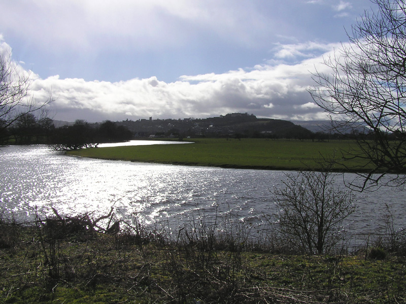
image_caption = The River Forth meanders over fertile farmlands near StirlingThe River Forth ("Uisge For" and "Abhainn Dhubh" (meaning "black river") in Gaelic), 47 km (29 miles) long, is the major
river draining the eastern part of the central belt ofScotland .The Forth rises in
Loch Ard inthe Trossachs , amountain range some 30 km (19 miles) west ofStirling . It flows roughly eastward, throughAberfoyle , joining with theDuchray Water andKelty Water , and out over the flat expanse of theFlanders Moss . It is then joined by theRiver Teith (which itself drainsLoch Venachar ,Loch Lubnaig ,Loch Katrine , andLoch Voil ) and the River Allan, before meandering through the ancient city of Stirling. At Stirling the river widens and becomes tidal, and it is here that the last (seasonal) ford of the river exists. From Stirling, the Forth flows east over theCarse of Stirling and past the towns of Cambus (where it is joined by the river Devon),Alloa andAirth . Upon reaching Kincardine the river begins to widen into anestuary , theFirth of Forth .Settlements on the Forth
There are a number of towns which line the shores, as well as the petrochemical complexes at
Grangemouth , the commercial docks atLeith , oilrig construction yards atMethil , the ship-breaking facility atInverkeithing and the naval dockyard atRosyth , with numerous other industrial areas including the Forth Bridgehead area,Burntisland ,Kirkcaldy ,Bo'ness and Leven.Navigation on the Forth
In
medieval times the Forth was navigable at least as far asStirling , butsilt ing and the increase inship sizes now mean that traffic upstream of Kincardine is rare.Bridges over the Forth
Upstream of Stirling, the river is rather small and is crossed in numerous places (although prior to modern drainage works, the ground was often treacherously marshy near the riverbank). After its confluence with the Teith and Allan, the river is sufficiently wide that a significant bridge is required. A
bridge has existed at Stirling since at least the 13th century, and until the opening of the road crossing at Kincardine in 1936, Stirling remained the easternmost road crossing. Much further downstream at Queensferry the famous rail bridge opened in 1890 and a modern road bridge in 1964. A swinging railway bridge betweenAlloa on the north shore andThrosk on the south opened in 1885 and was closed (and largely demolished) in 1970.Plans to construct a new road bridge slightly to the West of the existing Forth road Bridge have been announced by the Scottish Executive. It is planned to open in 2016.
ee also
*
Rivers of the United Kingdom
*List of rivers of Scotland
*Rivers and Fisheries Trusts of Scotland (RAFTS)
*Association of Rivers Trusts (ART) - England/Wales equivalent of RAFTS
*List of waterway societies in the United Kingdom
*List of navigation authorities in the United Kingdom External links
* [http://www.feta.gov.uk Forth Estuary Transport Authority]
* [http://www.forthports.co.uk Forth Ports plc]
* [http://www.forthestuaryforum.co.uk Forth Estuary Forum]
* [http://www.forthbridges.org.uk Forth Bridges Visitor Centre Trust]
* [http://www.rfyc.org Royal Forth Yacht Club]
* [http://www.forthseabirdgroup.org.uk Forth Sea Bird Group, monitors bird population]


Wikimedia Foundation. 2010.